The Ball Hut Route is a relatively untouched hike close to Mount Cook Village. You can make the hike in a day, but the ~19km return hike is best as an overnight hut.
I say untouched, but that’s by humans. The Ball Hut Route is definitely touched by nature given it passes through avalanche terrain for periods.
The route to Ball Hut is an ~9.5km hike each way making it possible to do as a day hike, but it’s best as an overnight hike.
The distance isn’t super long (though it’s one of the longest Mt Cook hikes), but it’s a technical track given the avalanches that have damaged the track. I’ll explain this in more detail below…and yes, there’ll be plenty of photos.
TABLE OF CONTENTS
1. Details about the Ball Hut Route
2. Ball Hut Route Map
3. How To Get To The Trailhead
4. My Ball Hut Route Experience
BALL HUT ROUTE DETAILS & FAQ
Difficulty1: Medium – hard. It’s not easy, but the distance prevents it from being super tricky.
Hike Distance2: From the carpark to the hut is 19 – 20 km return depending on the exact route you take around the slips.
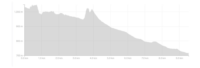
Elevation Gain3: Based on my Strava data there’s between 700 and 750 metres of elevation gain. About 500 metres of this is on the way to Ball Hut.
You can see the elevation profile below. Note: this is the profile from Ball Hut back to the trailhead.
Hike Duration: Given this is a technical trail that goes off route at times, hiking times vary wildly. I’d be very surprised if anyone could hike into the hut in under 2 hours. I’d expect the normal times to be in the 3-4 hour timeframe each way. The return will be a little quicker.
BALL HUT ROUTE MAP
Clicking the map below will open up the map in a new window on topomap.co.nz.
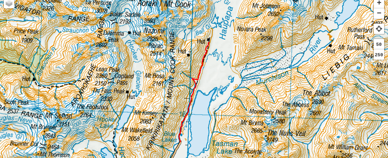
You won’t find this track on Google Maps. While you’ll need to go off track on this hike, you should have a topo app or map available…just in case.
HOW TO GET TO THE TRAILHEAD
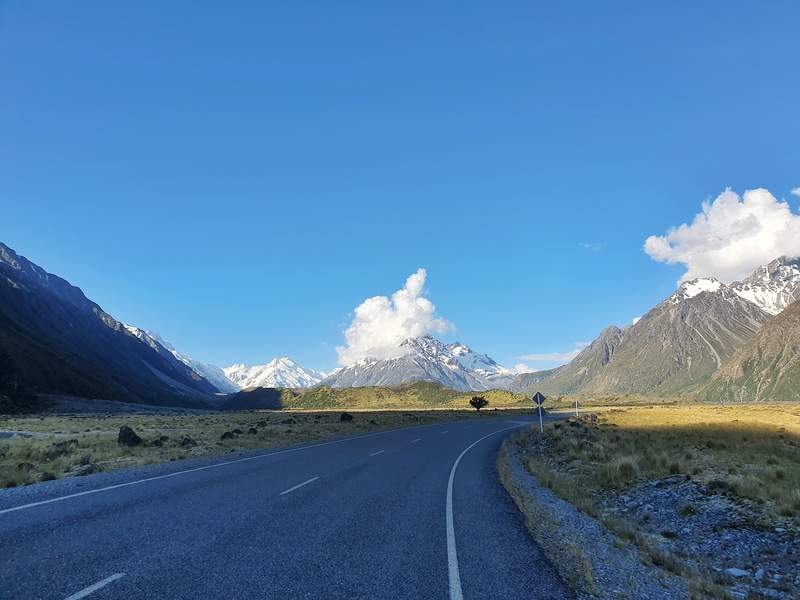
The Ball Hut Route trailhead is at the Tasman Glacier car park.
The easiest way to get there is car which is an 8km (10 minute) drive from Mount Cook Village. You’ll park at the same spot where people walk to Tasman Lake from.
There is the option of driving along the 4WD track to Husky Flat saving you a few km of walking, but life is simpler if you just park at the main car park and walk in from there.
MY EXPERIENCE ON THE BALL HUT ROUTE
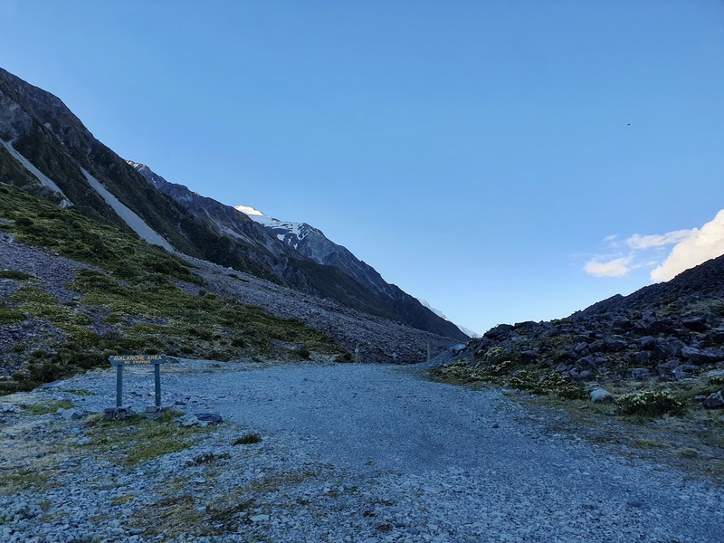
From the Tasman Glacier car park you follow the 4WD road which is a tame start. There’s a sign indicating the avalanche danger levels, but you’ll have checked these before you started the hike…right 😉
Quick tip: Pop your head into the DOC Visitor Centre before heading to Ball Hut. They’ll hopefully have recent news about the condition of the track.
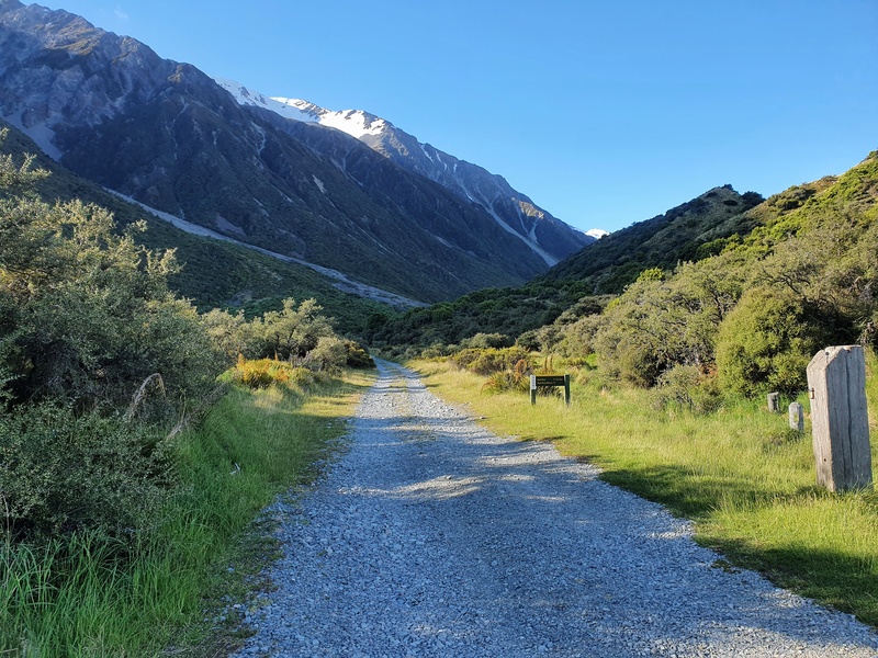
You’ll follow this road for the first 5km or so. Does it make for the best 5km to start a hike? Not really…but this 4WD road is pretty epic. It’s way more interesting than the Roys Peak climb.
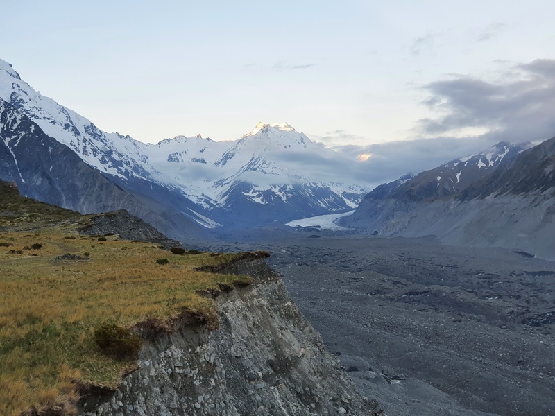
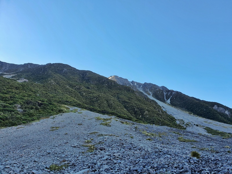
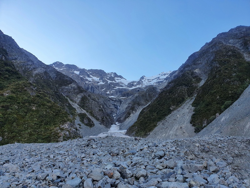
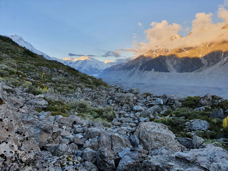
There are no switchbacks, but rather undulations and a couple of sections where you pass through avalanche areas.
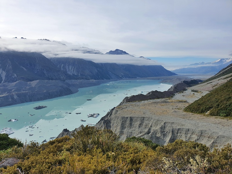
You can see where the terrain has changed as a result of them, it’s enough for you to keep moving…well me at least. The views are nice, but they’re only going to get better.
And then suddenly you’ll get to the slip that everyone’s talking about (well people mentioned that to me). I had heard about this slip and saw some photos, but it’s not until I saw it did I really understand what was going on.
I’ve tried to draw it on a bit of paper here…
Anyhow, on the first half of the slip, you follow the edge of it (but don’t walk on the edge-edge). There’s a vague path you can follow from time to time but there’ll be some hopping over rocks involved.
It’s tempting to drop down into the slip to essentially cut the corner, but do your best to hold on and walk all the way around the slip. Stay safe.
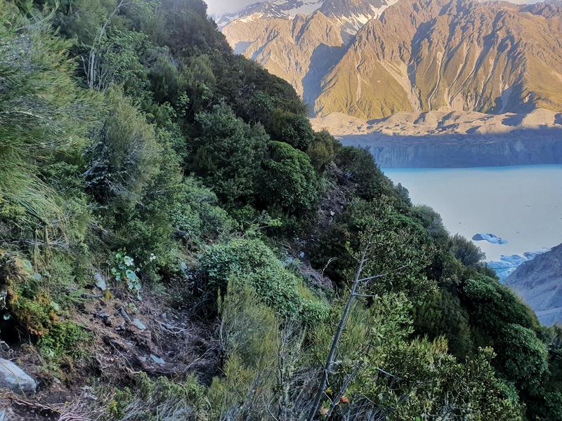
Once you’re on the other side of the slip you’ll see an orange track marker leading into the bush on the side of the hill. This is a trick that has been essentially bashed into the side of the hill post-slip.
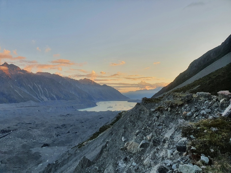
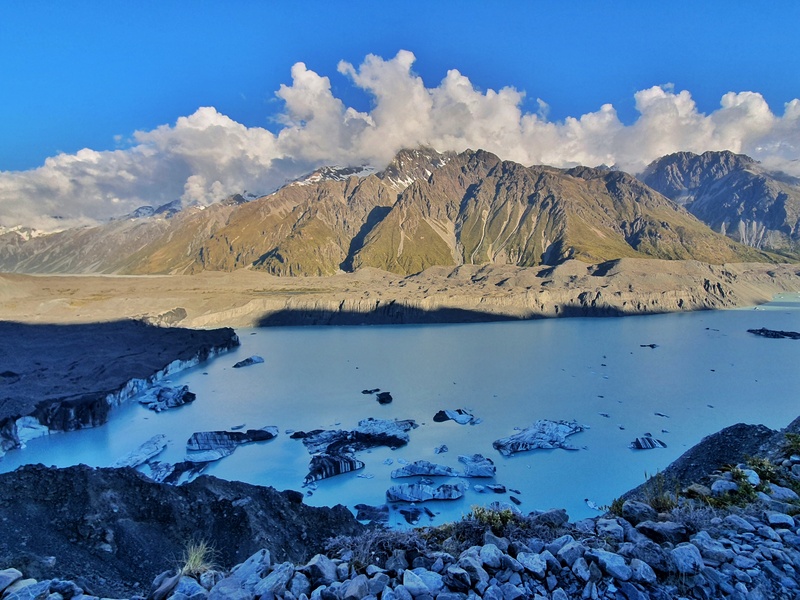
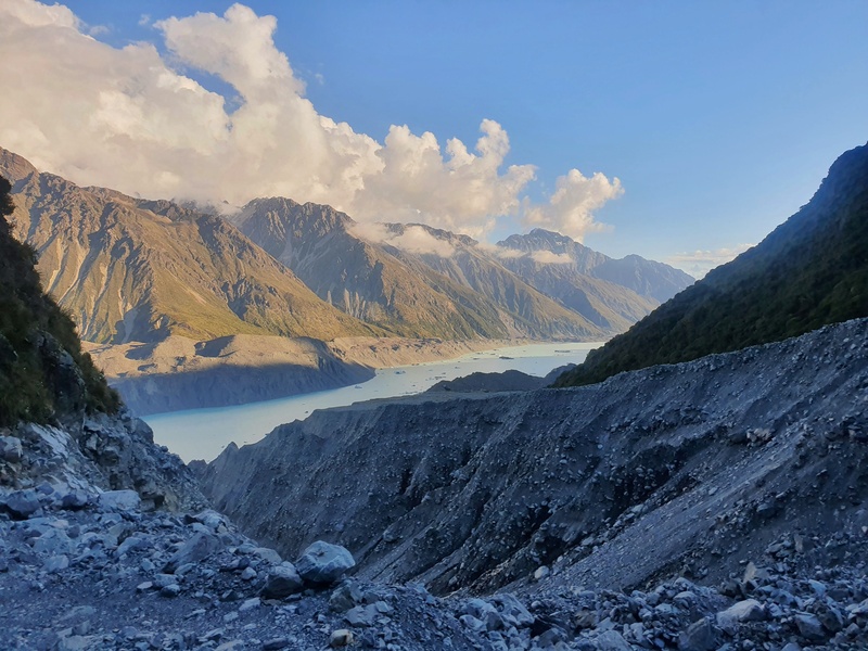
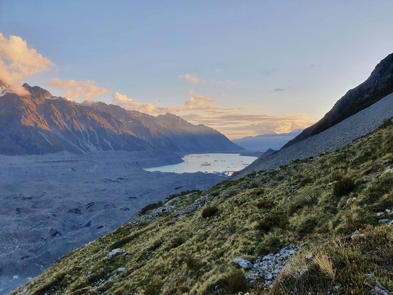
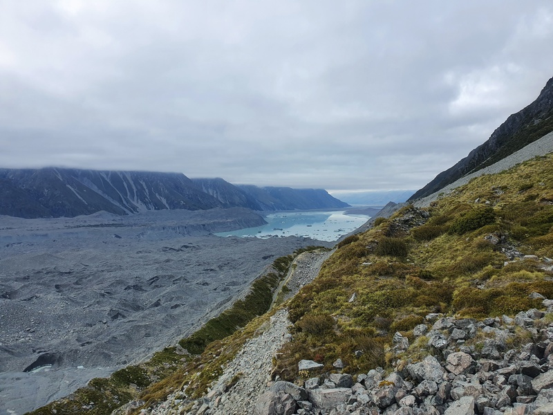
It’s a relatively short section, but it’s technical with some real possibility of slipping. There’s some rope in the steeper parts. There are a few spots where you can get epic views to grasp the size of the slip…and Tasman Lake in the background isn’t too bad 😉
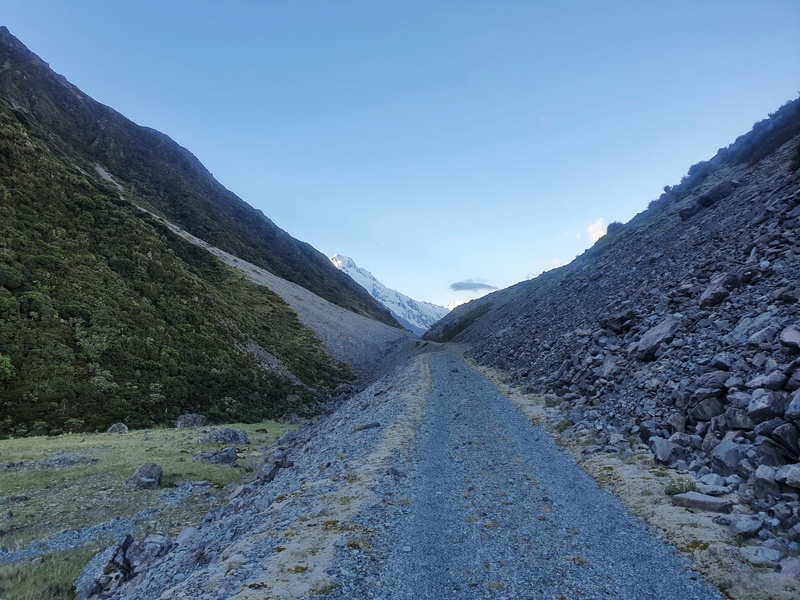
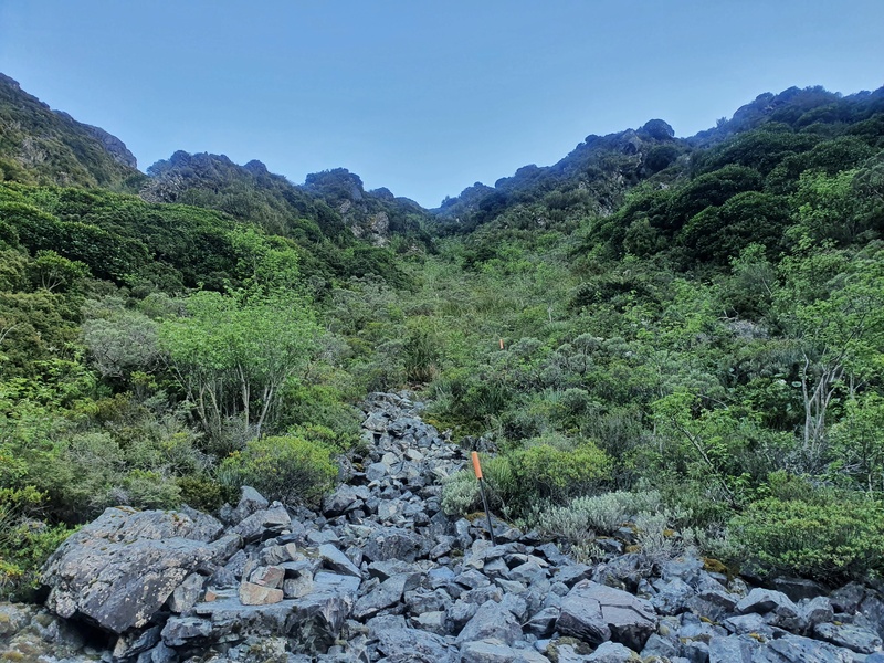
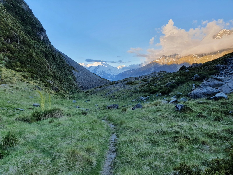
Once you get out of the bush you get a chance to walk along the 4WD track again. It’s super cruisey here…enjoy it while it lasts.
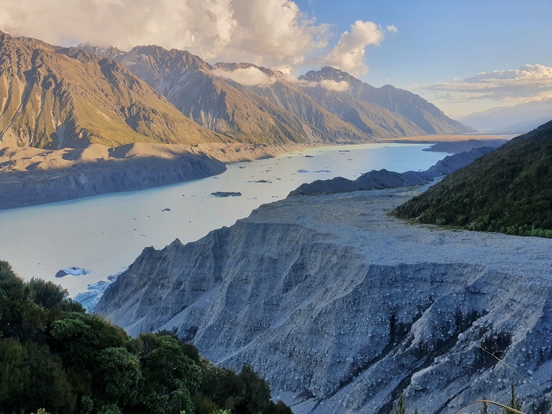
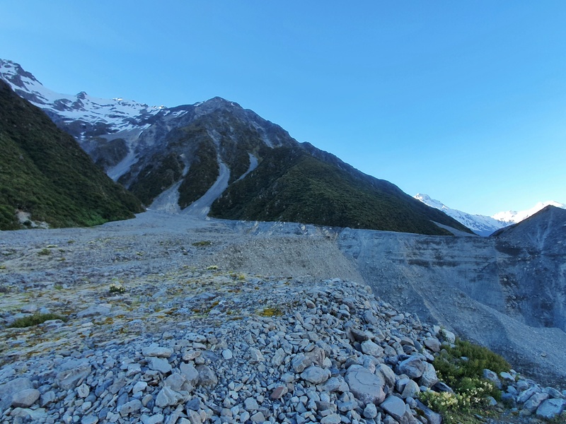
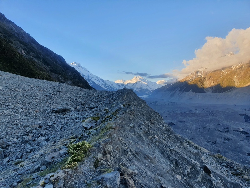
Because you’ll then get to the next slip. This isn’t a slip you’ll need to walk around, but you need to navigate the moraine. This felt like a ridgeline and is super fun to walk along with a little track forming. This goes on for a little bit.
Then you get to follow the track again until you get to the third slip.
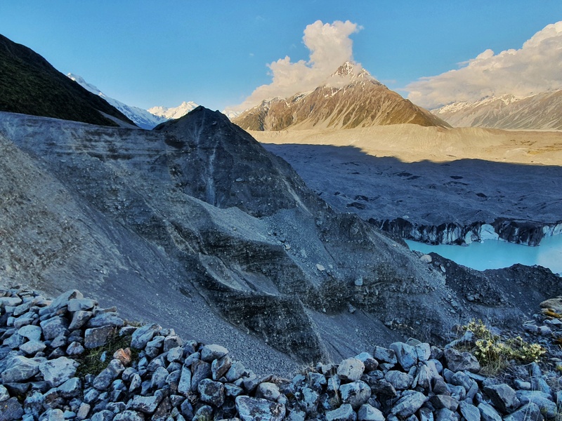
This one was the trickiest one in my mind. Initially, I saw some orange DOC poles in the rubble at the bottom of the slip…I was wondering how on earth it was possible to get down there safely.
It turns out there are some cairns taking you around the slip…they were hard to spot though and you’re kind of walking on a slope here…take your time and you’ll be fine.
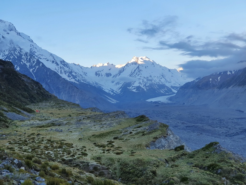
And once you’re off this slip, you’ll soon see the hut on the plateau (can you see it in the photo below?)! And you get a great view of the Tasman Glacier too which is cool.
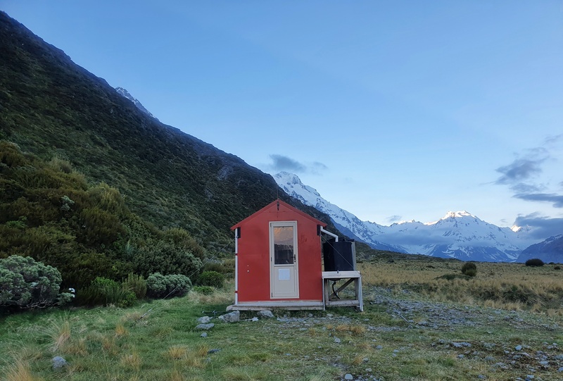
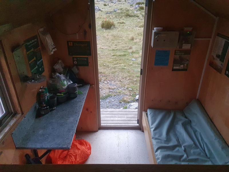
Hopefully, you’ve got the hut to yourself (or maybe you want someone there?) and can spread out 🙂 It’s a super cool little hut that your Backcountry Hut Pass is valid. Minimalist, but works a treat and you can’t argue about the location. It’s an easy spot to relax.
If you want you can head up past the hut and start making your way up the Ball Pass Route. I didn’t do this though and the other people staying in the hut said it was super sketchy and you need to be confident in your skills.
I was happy with the sunset and decided to leave early the next morning.
The following morning I made my way back out. You essentially backtrack your way out. It’s a solid descent overall so you’ll be able to cover some ground pretty quickly on the return.
With the Mount Cook YHA Hostel closing recently, the Ball Hut is going to become more popular over the summer as it’s the cheapest place to stay in Mount Cook (another option is the Whitehorse Hill Campsite).
So make sure you check to see how many people are heading into Ball Hut at the DOC Visitor Centre (as far as they know)…the more info they have the better.
If you have any questions about hiking the Ball Hut Route let me know in the comments below or email jub@churnewzealand.com
OTHER MOUNT COOK WALKS:

Hey, it’s Jub here. I’m the guy behind Chur New Zealand, helping you have the best time hiking, trekking, walking…whatever you want to call it…in NZ. I’m based in Queenstown and am always out and about exploring trails, old & new. If you have any questions, reach out.