The Snout Track is an ~12.6km out and back walk in Victoria Domain, making it another one of the nice walks around Picton.
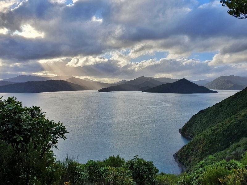
With regular views of the Queen Charlotte Sound, the Snout Track is easy to get to for a great half-day trip.
In this post you’ll get all the details you need to know about walking the Snout Track.
Note: I recommend you combine Snout Track with Upper Bob’s Bay Track. For this post, I’ll be referring to them as one walk.
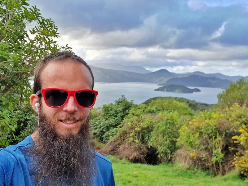
A selfie on the Snout Track as proof I’ve walked the track.
TABLE OF CONTENTS
1. Snout Track Details & FAQ’s
2. Snout Track Map
3. How To Get There
4. My Snout Track Experience
1. SNOUT TRACK DETAILS & FAQ’S
The Snout Track has a lot going for it. It’s located right next to Picton/Waikawa meaning it’s easy to access. The track is well maintained and offers views throughout. And even though it’s usually considered and in and out track, you can add on bits and pieces through Victoria Domain if you want.
The downsides? Snout Head, the turn around point is not what I feel is the best viewpoint on the hike. And mountain bike tracks cross over the walking tracks at times. It’s not a big issue, but always check no ones coming across the tracks.
How long is the Snout Track walk?
According to my Strava data it’s 6.3km one way if you go via Upper Bob’s Bay Track to Snout Head (12.6km return). The map below has it at 3.7 miles one way which is about 6km exactly.
How much time does the Snout Track take?
It took me 1 hour and 27 minutes one way including Upper Bob’s Bay Track. I wasn’t stopping much, but the last section in the mud was tricky. I’d suggest 3 – 4.5 hours will be enough time for most people to complete the full Snout Track and Upper Bob’s Bay Track return which includes time for a snack etc.
How hard is the Snout Track?
Easy – Medium. I include medium as the section from the Queen Charlotte viewpoint to Snout Head can be muddy in the winter.
Is there much elevation gain on the hike?
According to Strava, there’s about 524 metres total elevation (return). As you’re never more than 170 metres above sea level, that gives you an idea of how gentle the incline is over ~12.6km
Is this track okay in winter?
Yes, the Snout Track in winter is good as gold to walk. It might be a little muddy, but still fine to walk.
2. SNOUT TRACK MAP
None of the walking tracks in Victoria Domain are on Google Maps. You can see all the tracks on Maps.me, but I couldn’t get the route tracking properly so I’ve included the map above from Komoot.
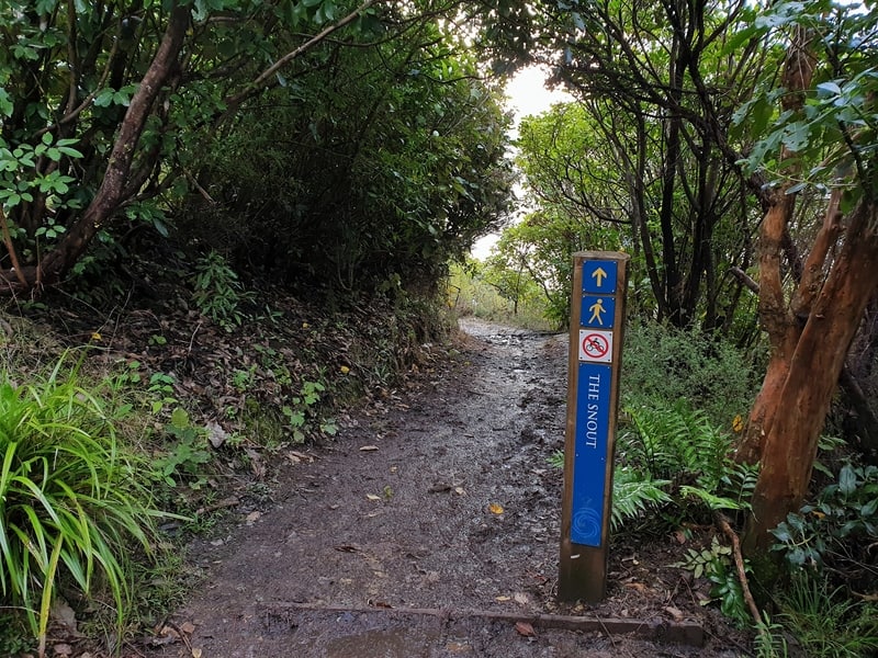
Once you’re on the trail (starting here), you can’t really get lost as the signs are plentiful. And as you can see on the map above, as long as you’re headed to the end of the Peninsula you’re on track.
Just make sure you stay on the walking tracks, and not the mountain bike tracks.
3. HOW TO GET THERE
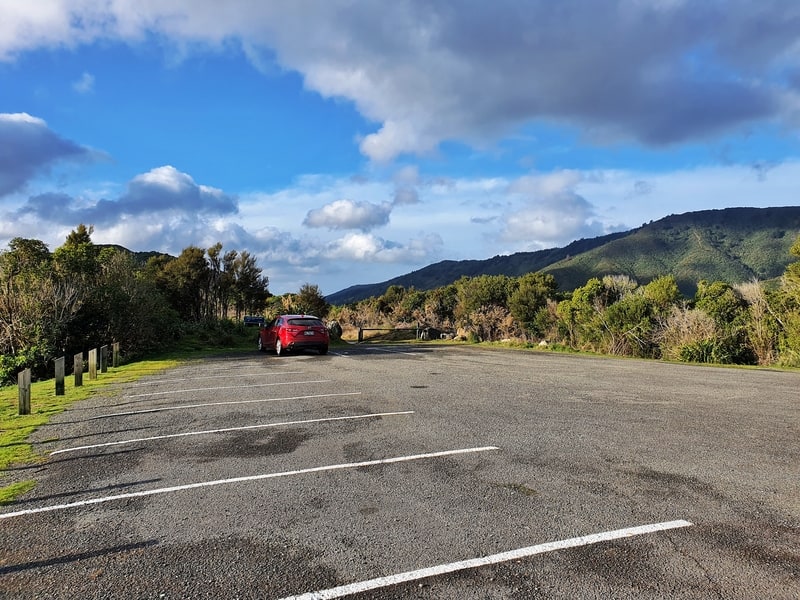
If you’re really short on time and want to complete the Snout Track only, you can drive to the Snout Track Car Park (above) on Victoria Domain Road with free parking.
But, you should incorporate the Upper Bob’s Bay walking track into this adventure. The trailhead for both tracks starts here, which is an ~5 minute walk from the centre of Picton.
4. MY SNOUT TRACK EXPERIENCE
I walked this track on a beautiful day in the middle of winter and it went great.
Having completed the Tirohanga Track, I wanted to complete this walk on the same day so as soon as I hit the trailhead (for Upper Bob’s Bay track) I began walking at a solid pace.
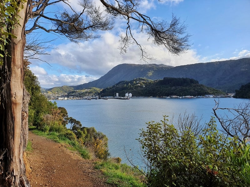
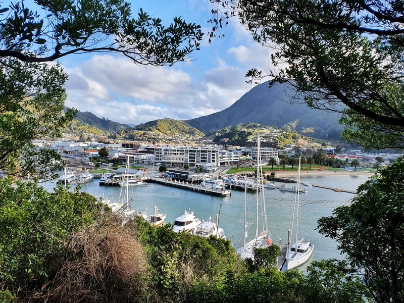
There’s a short sharp rise to start, but don’t let that scare you as the track flattens off 200 metres in and you’ve got your first views back towards Picton already. You’ll be going through trees a lot of the time early on, but there are lots of gaps to give you a sneak peek of the sounds.
After about 1.1km, the Lower Bob’s Bay track will meet up with you again as you continue walking north. The next junction will give you the option of turning left to Bob’s Bay Beach. It’s only 300 metres or so each way, and if it’s summer you might want to spend some time here at the beach.
In the middle of winter though? A bit cold for me.
I kept on walking up a climb which spits you out on the road leading towards the Snout Track car park. Turn left and follow the road to the car park for a couple of hundred metres.
READ NEXT: A LESSER VISITED, YET BEAUTIFUL WALK IN PICTON
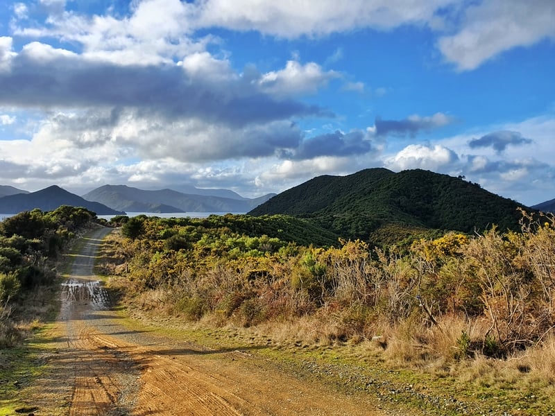
Then you start on the actual Snout Track which begins as a wide 4WD track with low bushes giving you some views. In front of you’ll see the somewhat intimidating green headlands. You don’t go directly over the top of this, the track skirts around the side.
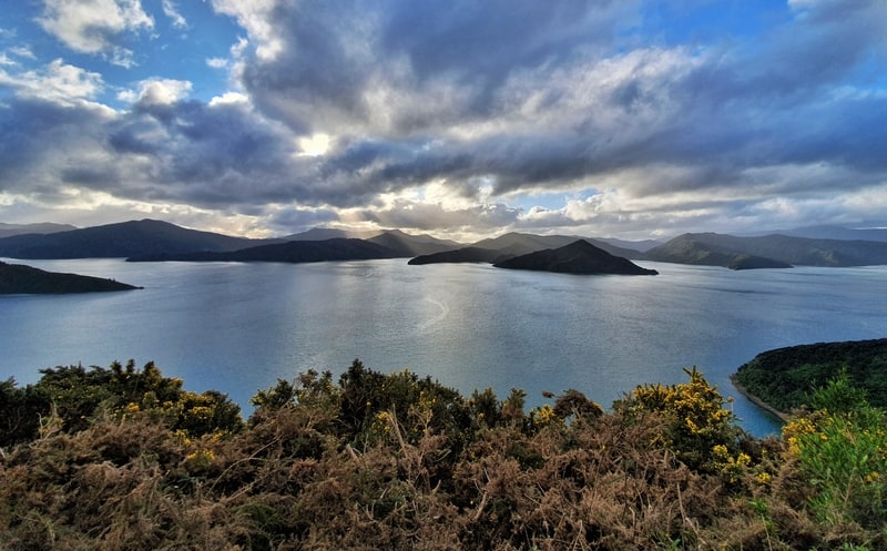
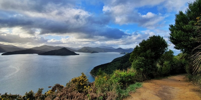
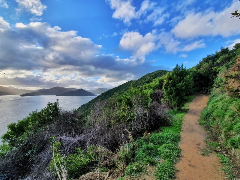
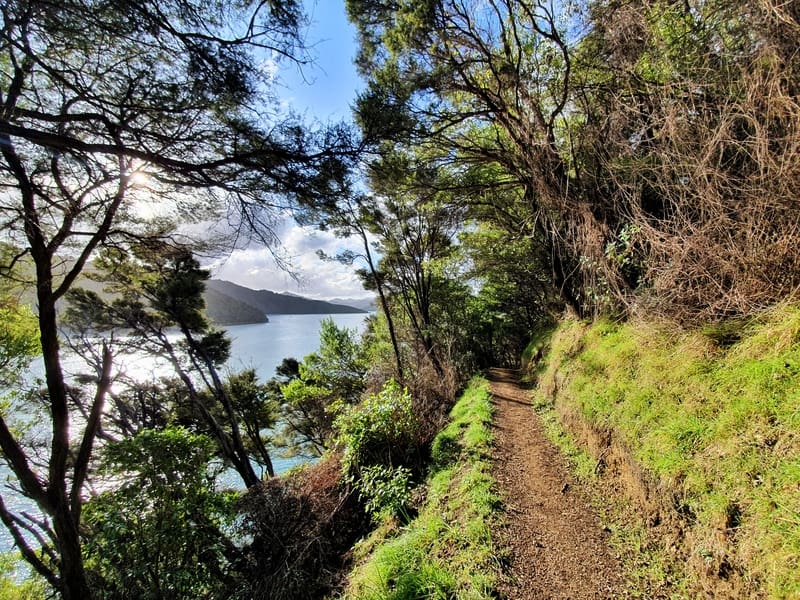
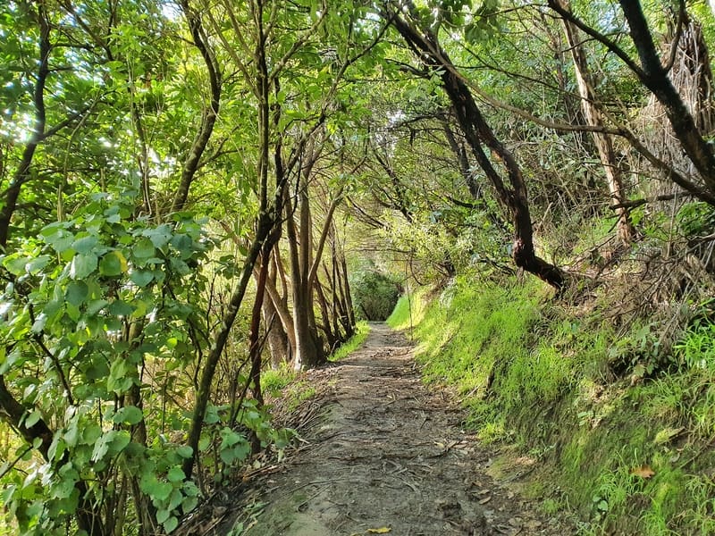
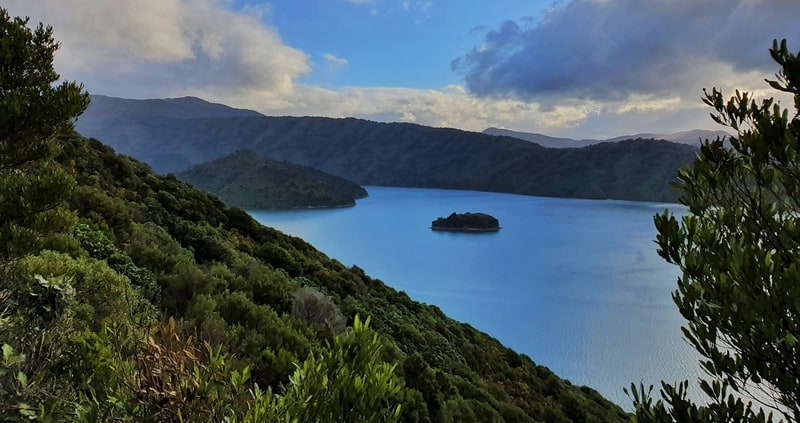
Once you enter the forest again (about 2.8km into the walk), the track can get a bit muddy. And this is where mountain bike tracks occasionally crossover the walking tracks, so stay alert. The trees drop away at points and give you more views of the Queen Charlotte Sound. The views are definitely same-same but different. Not that we should complain about that.
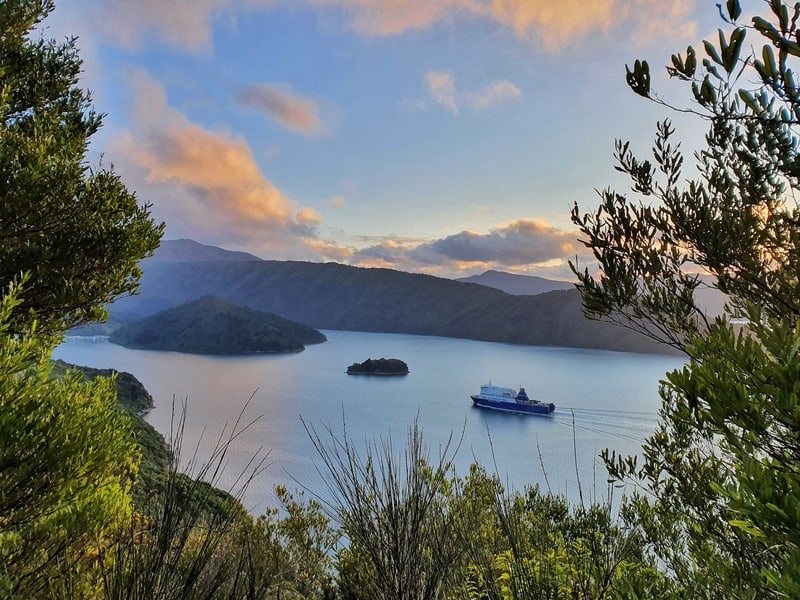
At about 4.3km into the trail you’ll get to the marque Snout Track view. It’s not a 360-degree view, but there’s a small hill to give you a better perspective. There’s a toilet here too 🙂 If it has taken you longer than you expected to get to this point, you can turn around here and not feel bad you didn’t complete the rest of the walk.
The last couple of kilometres to Snout Head is a gradual descent through the forest. And in winter the trail was super muddy. I didn’t fall over, but I walked slowly through some sections to make sure I didn’t fall on my butt.
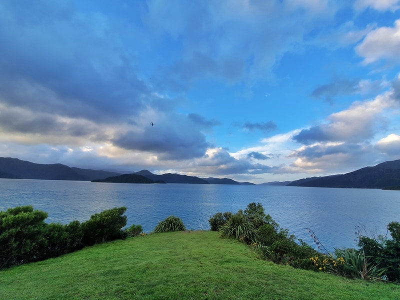
And then you end up at Snout Head where you’ve got a grassy bank, with views north up the sound and some out east too.
Now that you’ve reached the end? Enjoy the walk back. You might want to visit Bob’s Bay Beach on the way back, or you could walk back via the Picton – Waikawa track.
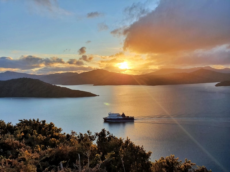
I ran back, as it was getting close to sunset and my phone was getting low on battery (no torch). The sunset made things more beautiful!
The Snout Track is a great way to start or end your Marlborough Sounds Trip. And if you’re planning to walk the Queen Charlotte Track, this is a great way to get a little hiking practice in.
If you have any questions and/or comments about the Snout Track, leave a message below or email jub@churnewzealand.com.
Chur.
p.s. you can find all the hikes I’ve documented in this map (clicking on the icons will provide more info):

Hey, it’s Jub here. I’m the guy behind Chur New Zealand, helping you have the best time hiking, trekking, walking…whatever you want to call it…in NZ. I’m based in Queenstown and am always out and about exploring trails, old & new. If you have any questions, reach out.