If you’re visiting Kingston in Otago, you’re in for a treat.
It’s a tiny town, but there are a few Kingston walks and hikes of various levels of difficulty you can do to fill in some time between other activities in and around Kingston.
This post will get straight into the details of the walks/hikes in Kingston.
KINGSTON WALKS
1. Shirt Tail Track to Lookout
2. Shirt Tail Track to Bushline
3. Lorn Peak
4. Te Kere Haka Track
5. Glen Allen Walking Track
6. Hike to Mount Dick
7. Kingston Waterfront Stroll
8. Kingston Walks Map
9. Other Walks Near Kingston
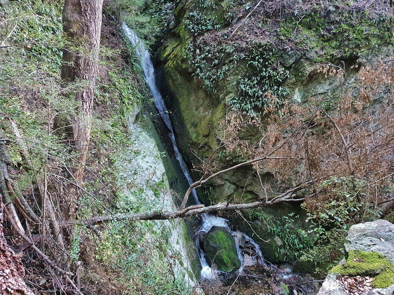
1. SHIRT TAIL TRACK TO LOOKOUT
- Difficulty: Medium
- Distance: 1.6km return
The Shirt Tail Track is a short hike distance-wise, but the end of the track can be a challenge.
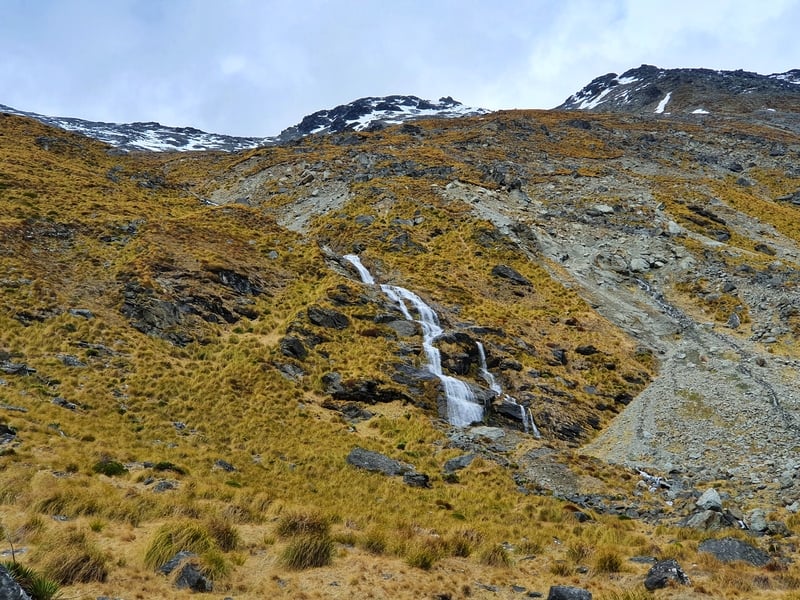
You start walking through a nice track through the bush with a little bit of incline. After 700 metres or so you’ll arrive at a small waterfall you’ll need to cross. You should be able to avoid getting your feet wet!
Then you’ve got a steep ascent to the lookout which might mean you’re on all fours scrambling up at times. The track is less obvious here, but there are enough orange triangles to keep you on track.
The viewpoint is sweet! With epic views over Kingston, the southern end of Lake Wakatipu and mountains on the other side. It’s a great reward.
On the way down, take a wee detour to see the larger waterfall. It’s on the left-hand side as you’re coming back down the hill…it’ll only add another 10 minutes to your walk.
DOC says the track is 2 hours return, but it’s not unreasonable to be all done within an hour.
1. SHIRT TAIL TRACK TO BUSHLINE
- Difficulty: Hard
- Distance: 3 – 4km+
If you Google this track you won’t have much luck finding any information. The track starts on the same trail as the Shirt Tail Track above but veers off halfway up the steep section en route to the lookout.
FYI, I talk in detail about this track at the bottom of the Shirt Tail Track post
You’ll know where to turn off when you see the wooden sign, left for the viewpoint and right to the bush line. From here you’re going to be following the blue ribbons tied to trees and tussocks. They’re really frequent so you should get lost.
The track gets steep, and isn’t maintained so unless you’re an experienced hiker, it’s not going to be an easy climb…or turnaround to come back down.
For me, the blue ribbons disappeared after about 1.5km of hiking at the point of about 860 metres above sea level. There’s some awesome rock formations here to get you some dramatic photos!
You’ve got two options now, you can turn around and head back or continue on up where you’ll eventually join the 4WD track that leads to Mount Dick. The navigation is easy in that you just go up…but it’s still steep and off-trail so the going is tough.
The easier way down is to take the road back down which drops you out on the Glen Allen Track with a cruisey walk into town.
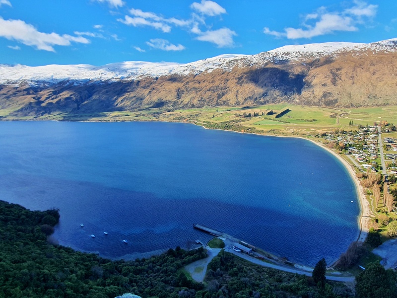
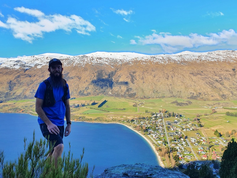
3. LORN PEAK HIKE
- Difficulty: Medium – Hard
- Distance: 11 to 12km return
The Lorn Peak Track is a steady hike to the summit. You cross private land before entering The Remarkables Conservation Area. You’ll then soon be off track and making your way through tussocks next to a fence line.
On the way up you get some cool views over Lake Wakatipu and Kingston which are different. Then at the summit, you can see down into the Nevis Range and along the Hector Mountains too which is fun.
4. TE KERE HAKA TRACK
- Difficulty: Easy
- Distance: 5km return
DETAILS COMING SOON
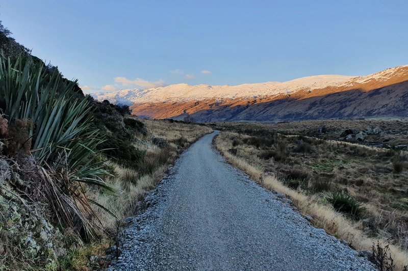
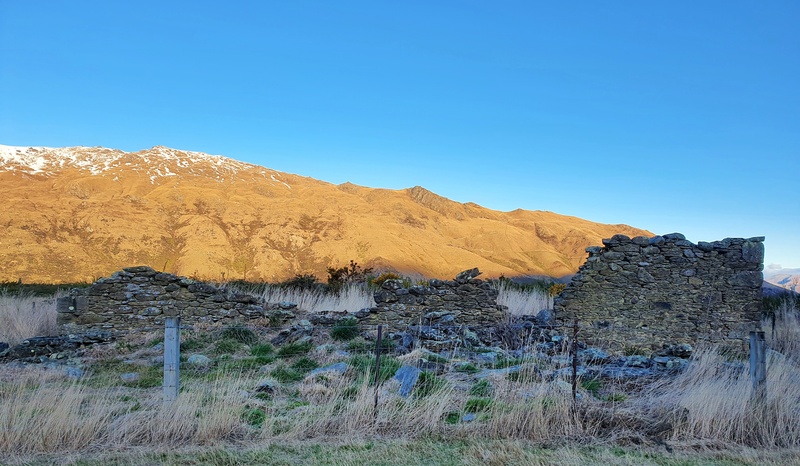
5. GLEN ALLEN WALKING TRACK
- Difficulty: Easy
- Distance: ~6km return from Somerset Street.
The Glen Allen Track follows the first few kilometres of the Around the Mountains cycle track. It’s a really chill track, a nice place if you want to go for a light run in Kingston.
From Kingston, there’s the most gentle incline on the way. So little you won’t notice it. In terms of views, it’s nothing amazing but your goal is to reach the homestead ruins on this track. A slice of history of the area. You can continue on of course, but the homestead is a good turnaround point.
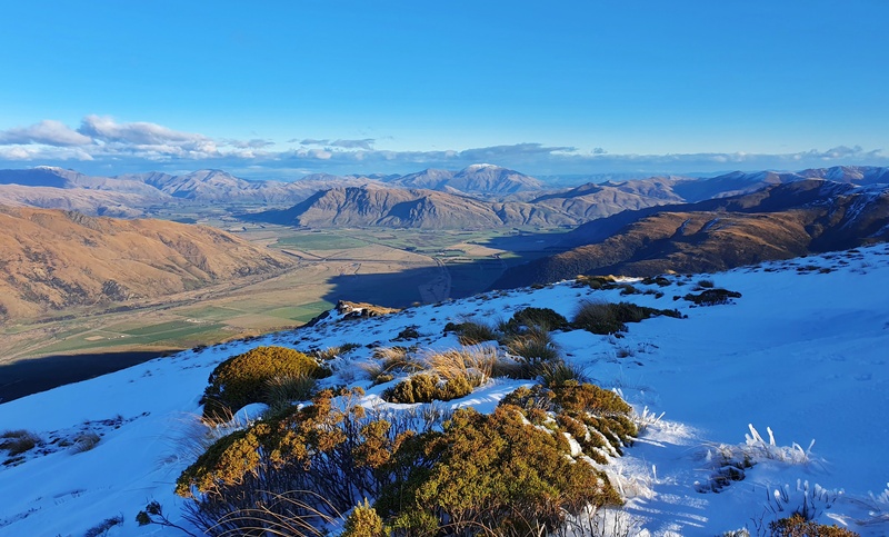
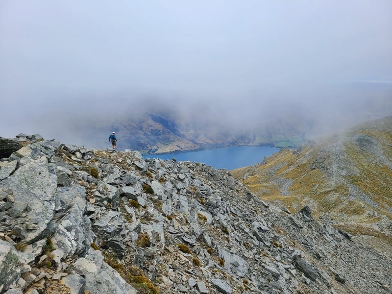
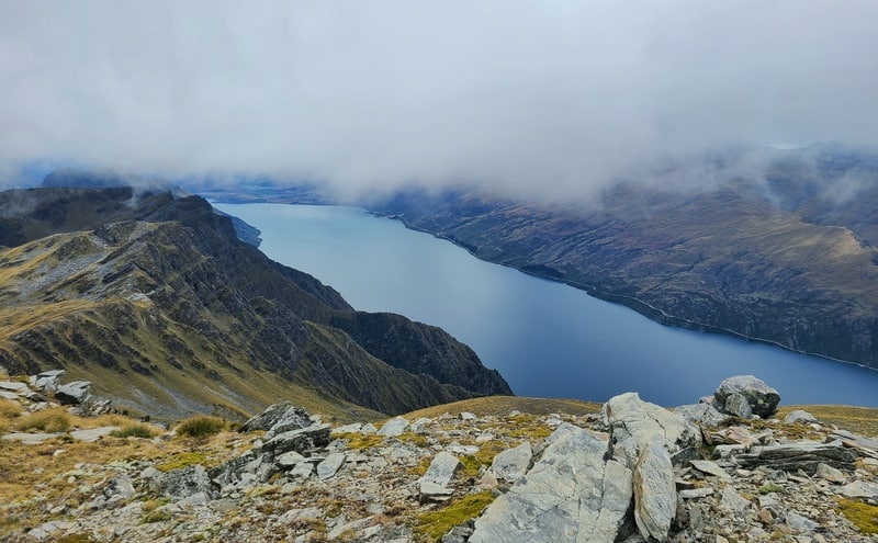
6. HIKE TO MOUNT DICK
- Difficulty: Hard
- Distance: 32+ km
If you’re looking for a gruelling day hike, or a unique overnight hike then consider hiking to Mount Dick. While you’re on a 4WD track for a good chunk of this hike, it’s not bad at all.
The off track section is amazing and you can find yourself in fields of tussocks, spotting tarns, scrambling along ridgelines and more before reaching the top of this incredible summit.
If you camp up here, send me photos of the sunrise/sunset and your set up!
7. KINGSTON WATERFRONT STROLL
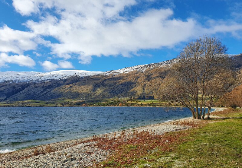
- Difficulty: Easy.
- Distance: 1 to 2 km
The Kingston waterfront is beautiful! There’s a trail that runs on parts of the waterfront, but do walk on the beach. It’s gorgeous, even on a cold wintery day.
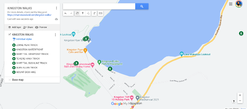
8. KINGSTON WALKS MAP
(clicking on the map will open it up in a new window.)
9. OTHER HIKES NEARBY
And if you’re looking for a whole list of hikes in the Otago region, here you go:
- 20+ Walks in and around Queenstown
- Hikes out the back of Arrowtown
- Walks at the other end of the lake in Glenorchy
If you have any questions about these Kingston walks, leave a comment below or email jub@churnewzealand.com . And tell me about your Kingston hiking experience!
Chur.
p.s. you can find all the hikes I’ve documented in this map (clicking on the icons will provide more info):

Hey, it’s Jub here. I’m the guy behind Chur New Zealand, helping you have the best time hiking, trekking, walking…whatever you want to call it…in NZ. I’m based in Queenstown and am always out and about exploring trails, old & new. If you have any questions, reach out.