If you’re looking for an off-the-beaten-path hike less than an hour from Queenstown and near Kingston, hiking to Lorn Peak, part of the Hector Mountains, might be what you’re looking for.
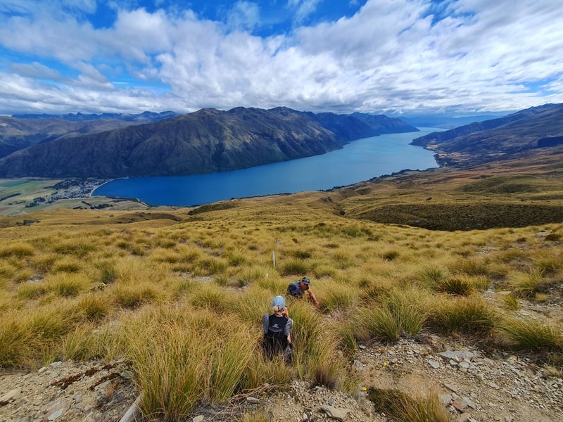
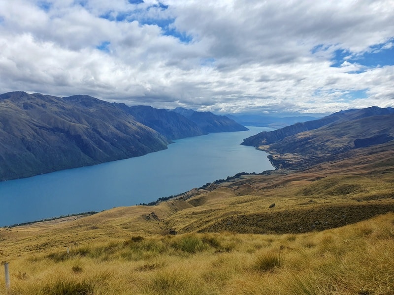
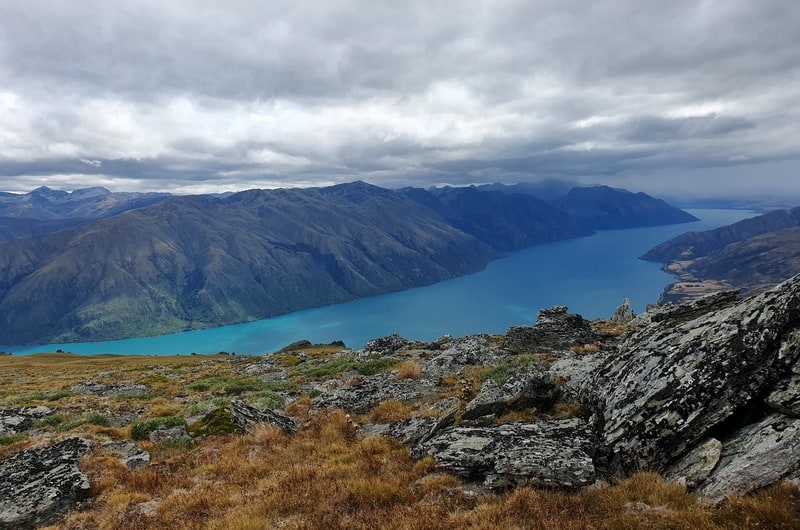
It’s not long at a little under 12km, but it’s a steep hike. And there are some awesome views, might favourite looking down Lake Wakatipu as you make your way to the 1638 metre summit.
Let’s get into the hike.
TABLE OF CONTENTS
1. Lorn Peak Details & FAQ
2. Lorn Peak Map
3. How To Get There
4. My Lorn Peak Experience
1. LORN PEAK DETAILS & FAQ
How hard is it to summit Lorn Peak?
Medium to hard. It’s not a hard hike with most of the terrain easy enough, granted it is steep. And there is some sections where you’ll be off track, so a GPX file is useful.
How long is the Lorn Peak track?
There’s no official distance, but it’s in the 11 to 12km range for the return journey. The variance comes down to how closely you follow the route on the GPX files.
What is the elevation gain like?
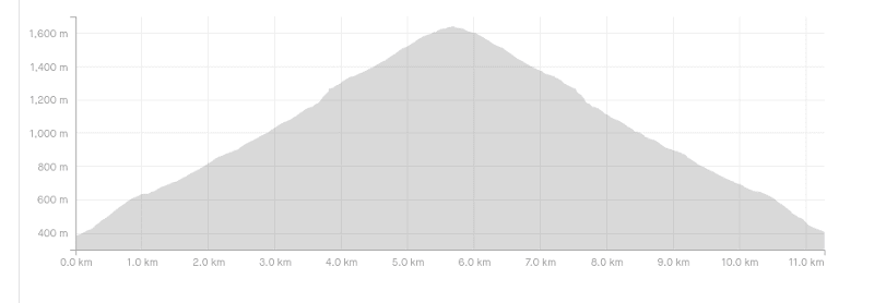
Hiking to Lorn Peak summit is up, up, up, down, down, down as you can see in the elevation profile below.
The total elevation gain is ~1200 metres, which is pretty much all on the way to the summit of Lorn Peak.
How long does the Lorn Peak mission take?
This is tough to gauge as there are no DOC markers to get you started. I’ll say 3 to 5 hours. To hike it up and down in 3 hours is impressive, but you never know.
Is this trail open year-round?
No. The lambing season on the station starts mid-September to late October.
Are dogs allowed on the trail?
No. And just because the track isn’t busy, don’t think you’re being clever. They could easily ban access to this route and no one would be able to enjoy the track.
What’s the track like in winter?
While you can do this track in winter, there is avalanche risk at times. Do your research before you head out if there’s snow on the mountains. And then if the snow is soft, it’d be quite annoying given you’re off trail as we speak.
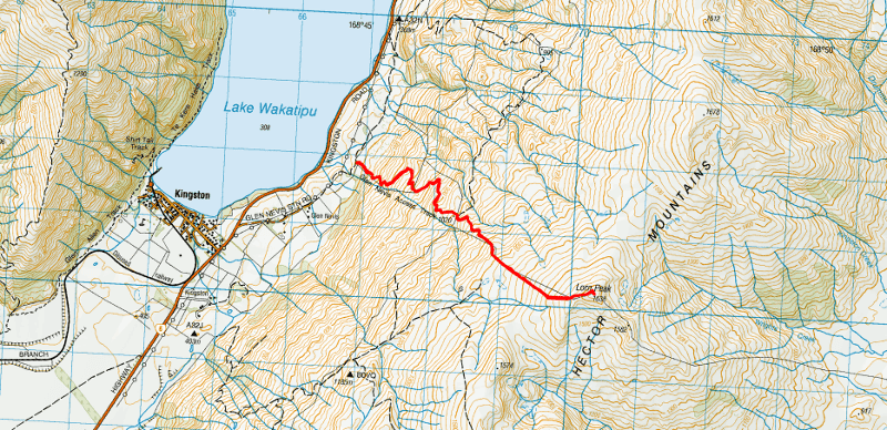
2. LORN PEAK MAP
The map below is my GPX file overlaid on a topo map (if you click on the image it’ll open in a new window).
As there’s no official track, and you cross private land you won’t see the track on any maps. Therefore downloading the GPX file to use on a great topo map app is smart. I’ll explain more about the route in my experience.
3. HOW TO GET THERE
The track isn’t one you’d know exists when you’re driving between Kingston and Queenstown, so make sure to pay attention to the turnoff.
You access the track via the Glen Nevis Station Road which is about 500 metres north of the turnoff into Kingston. The Glen Nevis Station Road quickly turns into a gravel road, something to be aware of. You’ll just need to follow the gravel road (if you’re turning into a house you’ve taken a wrong turn) until you get to the low key carpark next to the green an yellow DOC sign.
The carpark is here on Google Maps, but it’s usually better to follow the map on the topo app to the start of the GPX route.
4. MY LORN PEAK EXPERIENCE
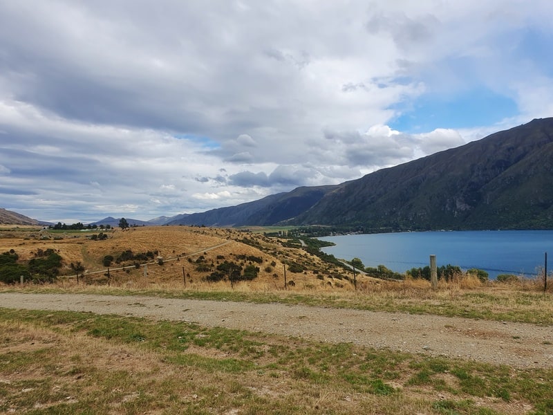
Getting to the trailhead feels like an adventure in itself as you turn onto Glen Nevis Station Road. Heading over the stile, you’re on private land so stick to the track. The track is easy to follow, it’s a 4WD track with just a couple of ruts to avoid getting your feet wet. Note, there’s a lot of poop on the trail.
The trail doesn’t muck around, you’re going up straight away and if it’s a warm day, you’ll be super hot. Make sure you bring enough water as there’s none on the trail.
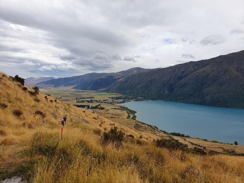
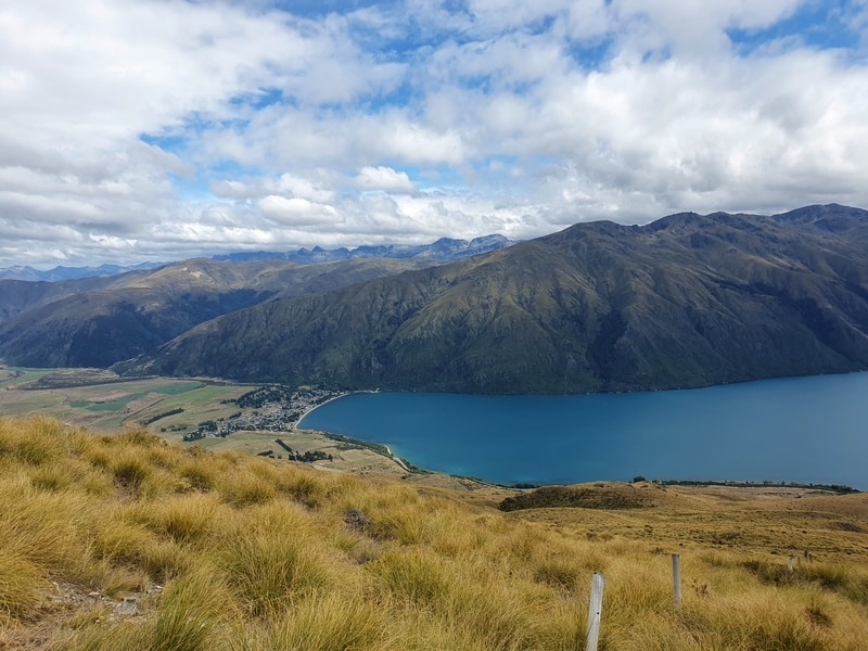
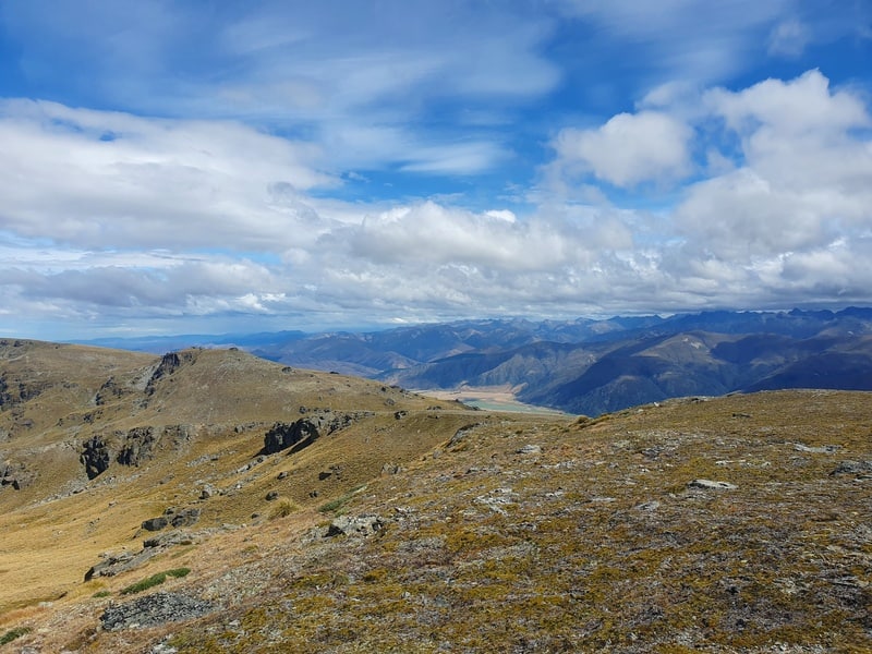
The views you get over Lake Wakatipu, Kingston, and the hills across he lake right away are pretty awesome. If you want the opposite view, you could do the Shirt Tail hike.
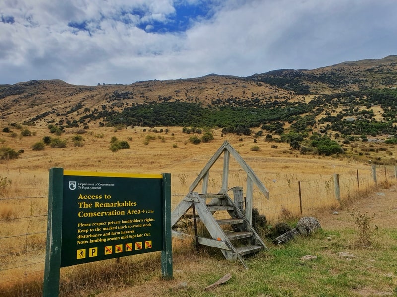
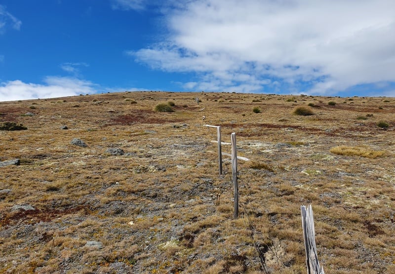
The private land section goes for a couple of kms before you cross a stile into the Remarkables Conservation Area. From here you’ll follow the (rougher) track for a few hundred metres.
Then you’ll come to a fork in the track at point 1020 on the topo map…go right and you need to follow to the fenceline.
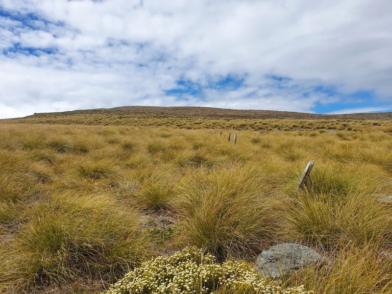
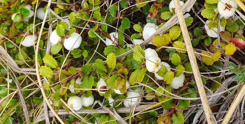
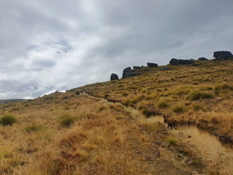
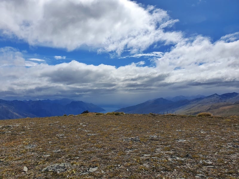
From there it’s up, up, up…that’s no change really but it’s harder as it’s all off trail now. The fenceline is busted in some spots, but it’s easy to follow. I stopped to eat some snowberries which was a delicious snack. The views continue to be great, and some of the rock formations are super cool too.
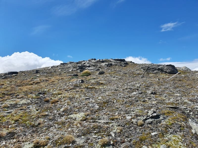
After a while, the tussock gives way to a bare alpine environment with some interesting alpine plants! The incline seems a lot tamer at this point as you’re not wading through tussocks, but you’re still going up that’s for sure.
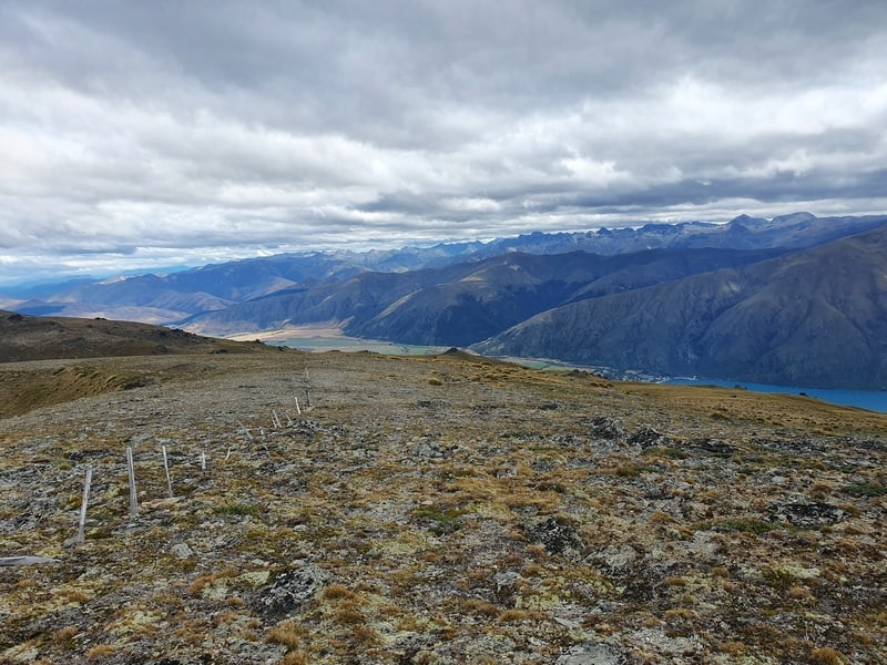
Then you’ll close in on the summit. It’s not an obvious peak, it’s more of a high point. Keep an eye on the topo map to make sure you know when you’re at the summit (there was a small cairn when we were there).
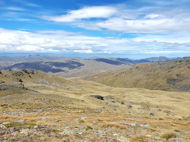
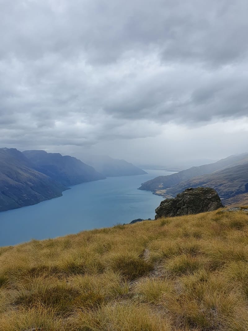
You’ve got great views from the top in all directions. If you’re really feeling adventurous you could camp up here and/or go exploring more of the Hector Mountains.
The way back down is exactly the way you came. The hardest part of the descent is making sure you get back on the track once you’re off the fenceline. We had no trouble but I could image that throws some people off. Pay attention on the way up and you’ll be good as gold.
Heading up to the summit of Lorn Peak is something different that’s for sure. If you like getting off the beaten path, and not following tracks…this might be for you!
There’s some other walks in Kingston you might want to explore as well. It’s a cute wee area that’s a lot quieter than Queenstown!
If you’ve got any questions about Lorn Peak, email jub@churnewzealand.com.

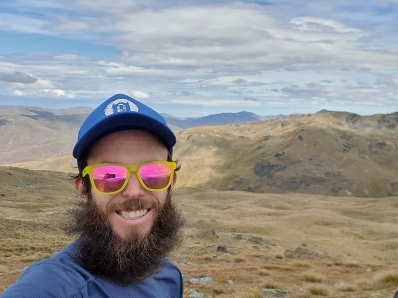
Hey, it’s Jub here. I’m the guy behind Chur New Zealand, helping you have the best time hiking, trekking, walking…whatever you want to call it…in NZ. I’m based in Queenstown and am always out and about exploring trails, old & new. If you have any questions, reach out.