Mount Dick at 1805 metres above sea level is a rarely visited peak near Queenstown. But if you like going off the beaten path and don’t mind hiking off track, put the 32km-ish return hike on your list.
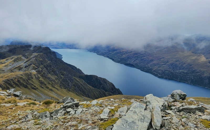
You’ll get unique views of Lake Wakatipu, views of the Eyre mountains, alpine plants galore and a great adventure.
This post will give you all the details about getting to the top of Mount Dick, with photos and yes, there’s a GPX file you can download.
Let’s get into the hardest hike in Kingston.
TABLE OF CONTENTS
1. Mount Dick Details & FAQ’s
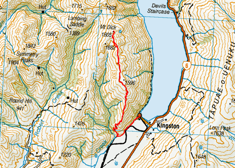
2. Mount Dick Map
3. How To Get There
4. My Mount Dick Experience
1. MOUNT DICK DETAILS & FAQ’S
QUICK DETAILS:
Note: This is a restricted hunting block area. Just as a super precaution, maybe choose your brighter coloured clothing 🙂
How hard is the hike to Mount Dick?
This is a hard hike. While looking at the topo map, you might think it’s a pretty cruisey path once you’re on the ridge, but it’s not straightforward and there’s some route finding involved. In terms of exposure, there isn’t really any.
What distance is the hike to Mount Dick?
As you’re going to be off track for a good proportion of the track which you can attack from various angles, I would say most routes will take you 32 – 33km, which is what my tracking got.
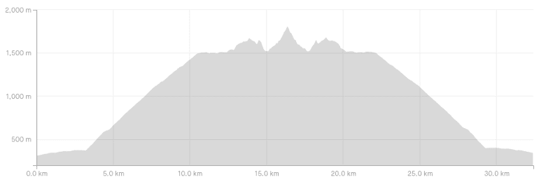
What is the elevation gain of the Mount Dick track?
The elevation gain will again depend on the exact route you take, but we ended up with around 2000 metres total. And it certainly feels like this. Even though you’re only heading to a summit 1805 metres above sea level, you have to drop down a few times on the way and it all adds up.
Here’s the elevation profile:
How long does it take to hike Mt Dick?
This is a tough one as there’s a good amount of elevation, on a variety of terrains and some of it is off track. At least 32km which I would say it’s going to be at least 8 hours of hiking…and for some, a lot longer. So
Can you hike Mt Dick in Winter?
If the conditions have meant lots of snow melt, it could be possible, but if there’s any snow coverage on the off track sections…especially near the summit I would rule out trying to get to the summit unless you have great knowledge of avalanche risks etc.
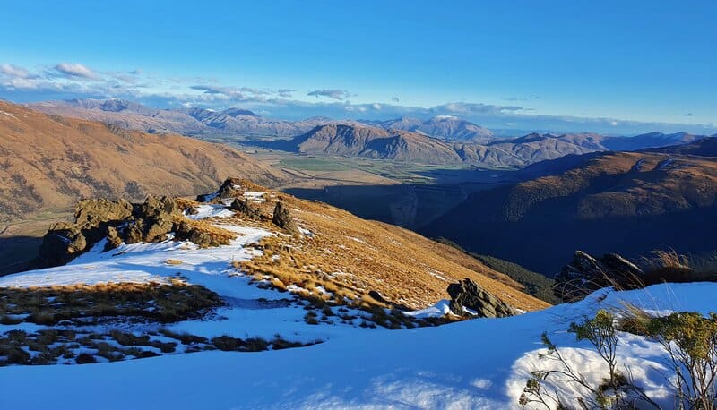
In winter you could hike to the end of the 4WD track which is where the photo above is from at the end of June.
Can you camp on Mount Dick?
From what I can understand, you’re allowed to camp on the route to Mount Dick as it’s public conservation land (and a restricted hunting area). If you’re going to camp, make sure you choose a location beyond the 4WD track that’s ideally not all over the delicate alpine plants.
Can you drink from the tarns near Mount Dick?
There’s a host of tarns and a couple of small creeks you’ll come across after the 4WD track finishes. We found some moving water and decided to drink the water unfiltered. This was a personal choice, but we sighted no animals or animal poop around so figured it was good to go.
2. MOUNT DICK MAP
The map below is my GPX file overlaid on topomap.co.nz. Click on the link below will open the map in a new window where you’ll be able to scroll around and zoom in/out.
I do recommend buying this topo map app, and downloading my GPX file before starting. We had looked on Strava’s heat map prior to going. Once off track you might not follow our route exactly, but it’ll help you no doubt.
3. HOW TO GET THERE
The carpark for the start of this hike is at Kingston Station. You’ll then walk along Somerset Street onto the Round the Mountains cycle trail.
To get here, the easiest option is to drive. From Queenstown Airport it’s about a 40km drive, that might take up to 40 minutes depending on traffic.
There’s a couple of shuttle options you could use, but with such unknown timing it’s hard to arrange a pick up. I’ve hitched between Queenstown and Kingston plenty of times in the past which could be an option for you.
4. MY MOUNT DICK EXPERIENCE
After a smooth drive from Queenstown we set off from the carpark, and made the short journey to the start of the track. Annoyingly we saw a local abusing the rules with a dog on the track…please stick to what the sign says, it makes life easier for everyone.
Anyway, the 3km along the bike track to the turn off are on a gradual incline and a good chance to stretch the legs out. Make sure to take the correct right hand turn off and cross over the gate.
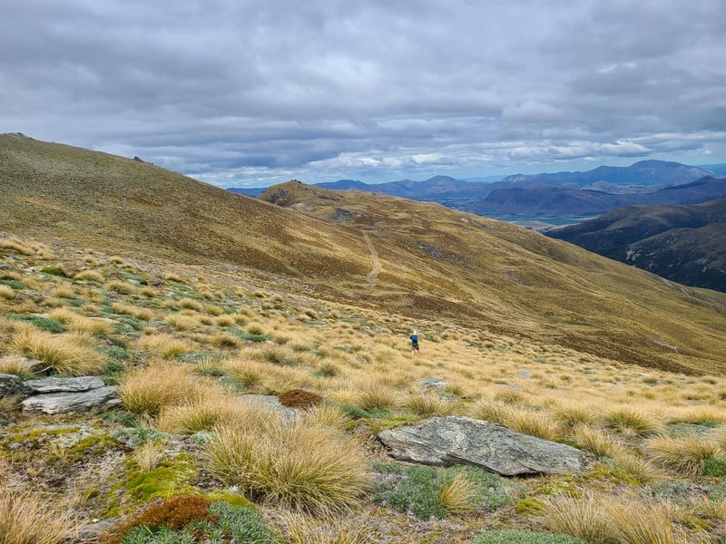
You’ve now got a nice 7.5km or so of incline along a 4WD track which straddles the boundary between Southland and Otago. For a 4WD track, this is pretty cool and you get a variety of views. Looking west towards the Symmetry Peaks is awesome!
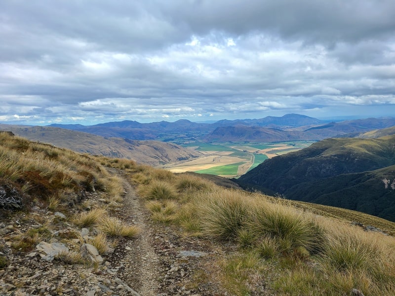
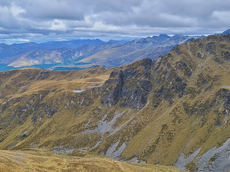
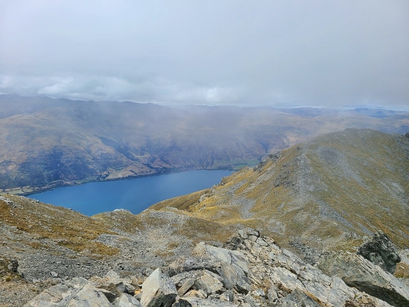
You won’t get too many views of Lake Wakatipu on the 4WD track, but there’s a couple of little spots where you can jump off the track for a quick peek. You can look for Lorne Peak over the other side of the lake too. And if you know where to look you’ll see Mount Dick early on.
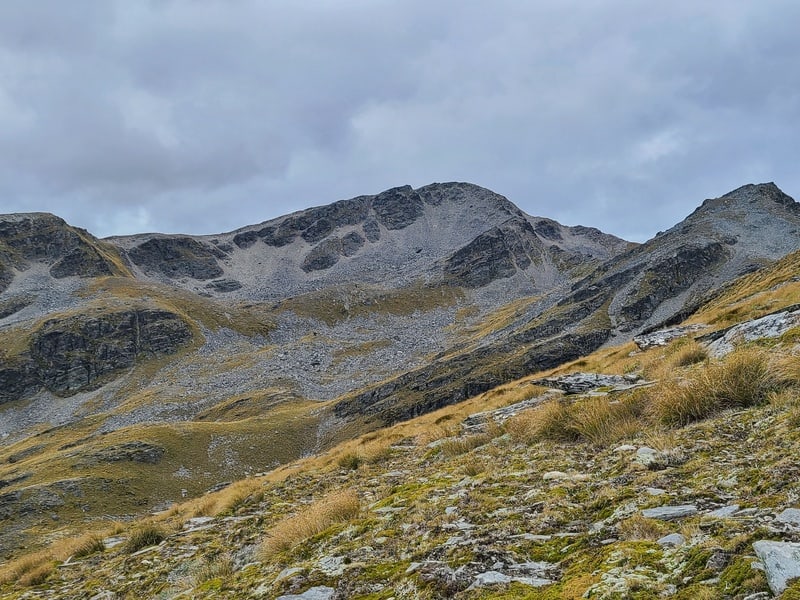
The last 2km of the 4WD track is flatter, and you’ll start to get an idea of where Mount Dick is…but I was still confused with my bearings.
The 4WD section ends abruptly…but if you backtrack a couple of hundred metres, you’ll see a track heading up…we followed this to a false ridge but kept making progress traversing towards the summit.
There were tracks every now and again to follow, but we did our best to avoid standing directly on plants.
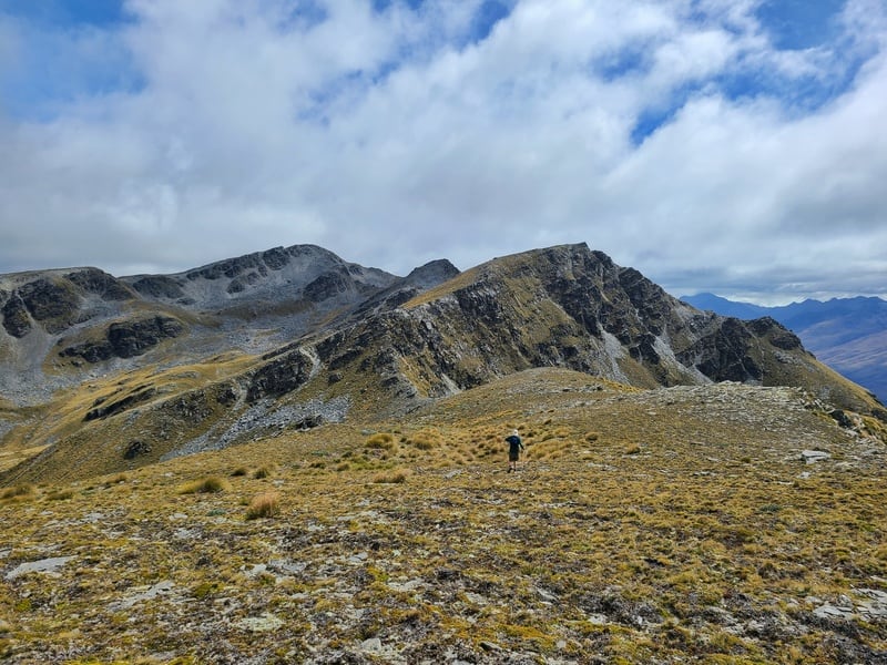
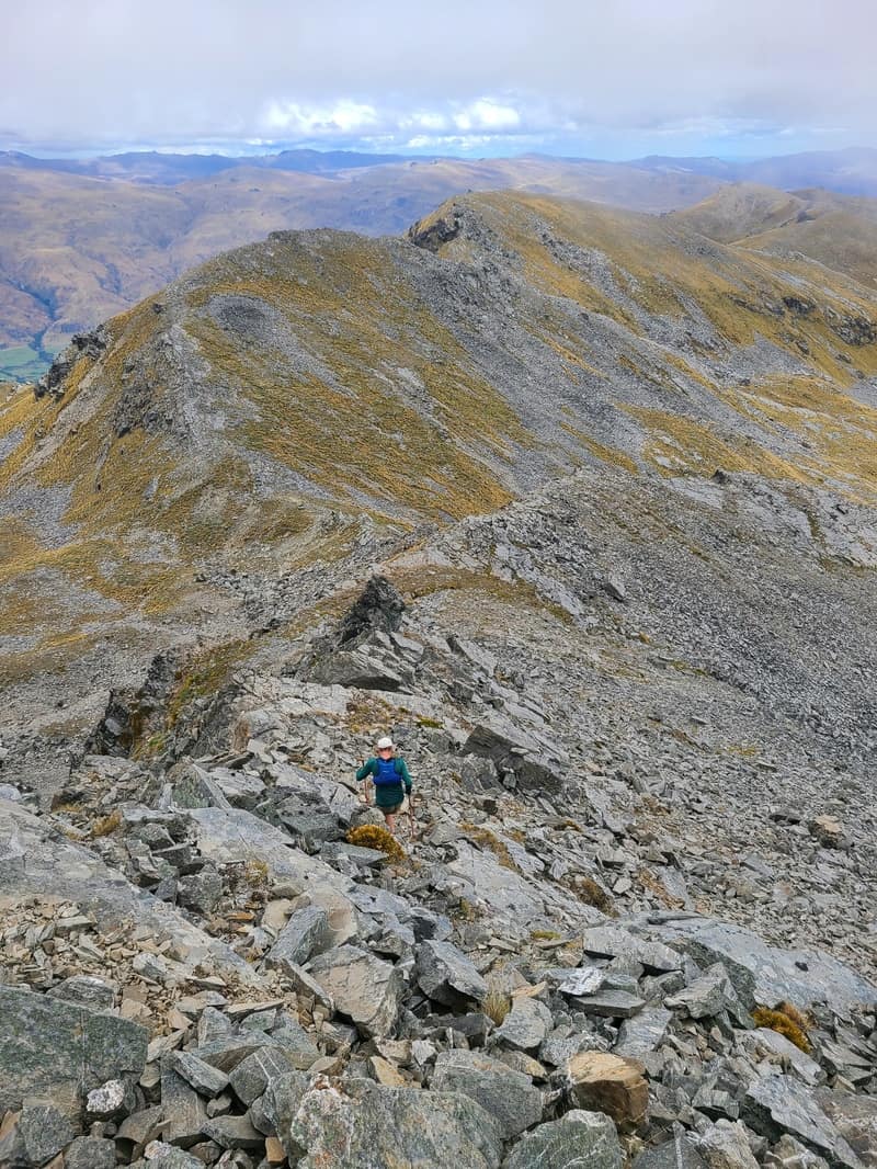
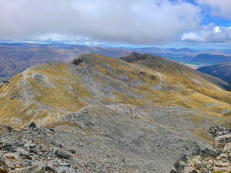
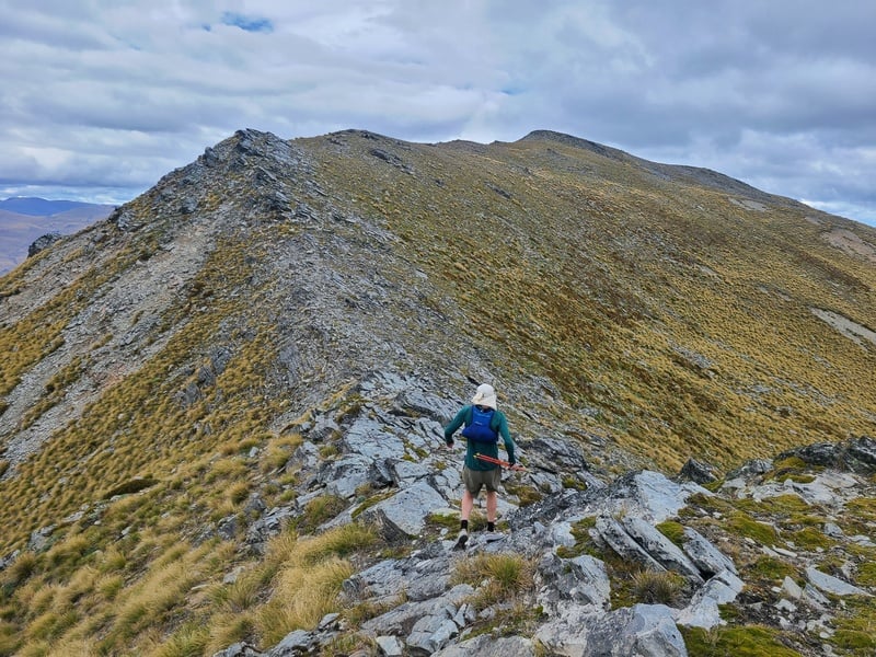
We went over the 1668 metre point on the map, then followed the ridge in front of us which was fun!
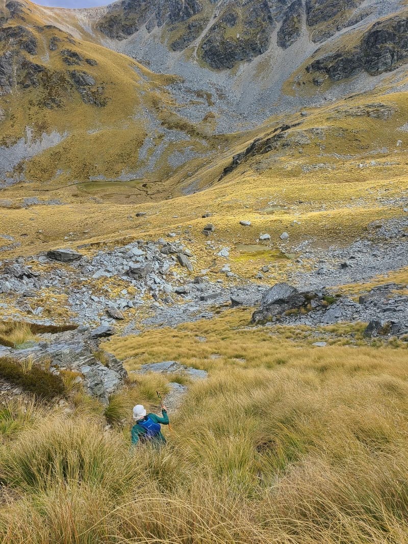
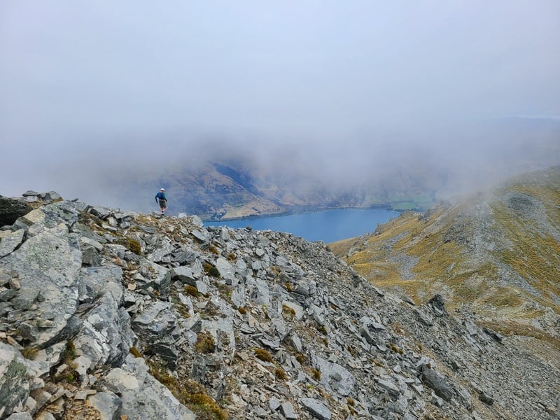
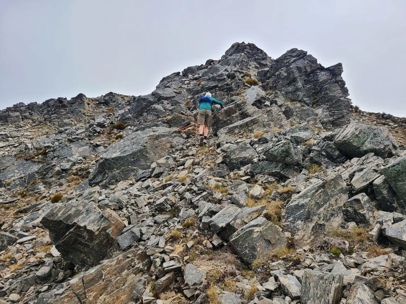
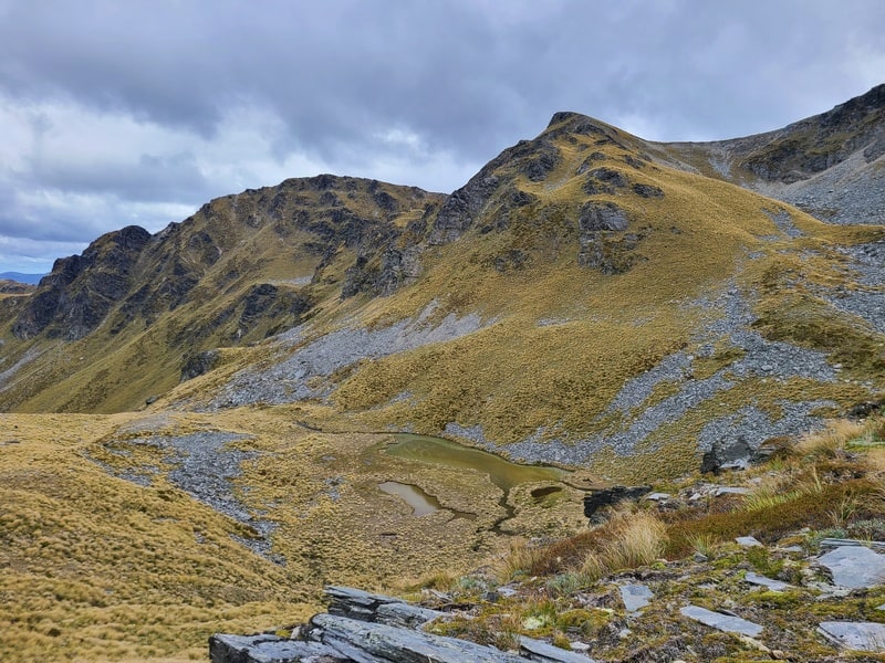
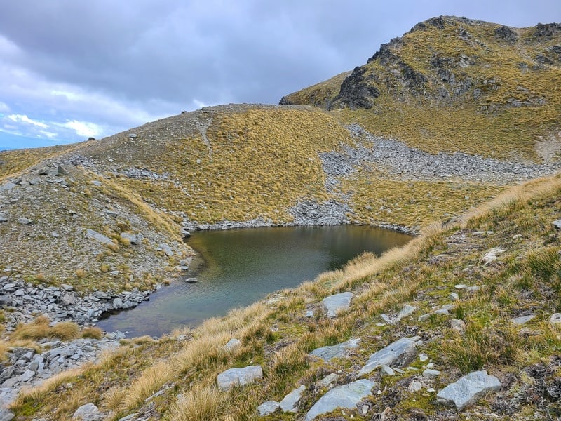
After this next section we decided to commit to the summit, which was getting more imposing by the minute. We decided to drop down a steep tussock section which involved some bum sliding rather than staying on the ridge. Our goal was the tarn between point 1705 and 1753 (we refilled bottles here).
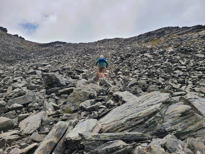
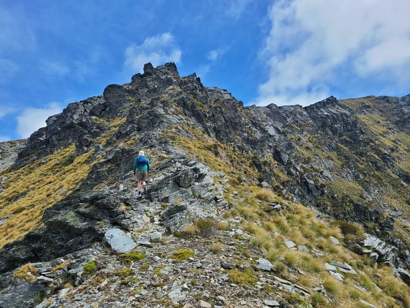
From there we had to decide what way to tackle the ridge. We decided to head right and head up the boulder field. It wasn’t fast going, but the rocks were all pretty stable…once on the ridge, it was a short distance to the summit.
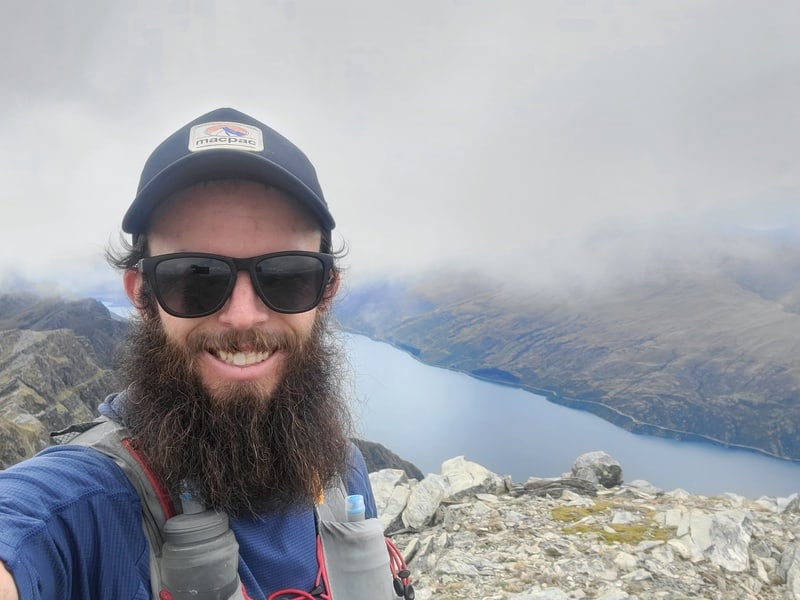
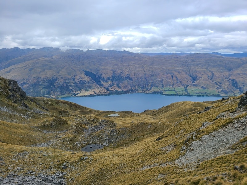
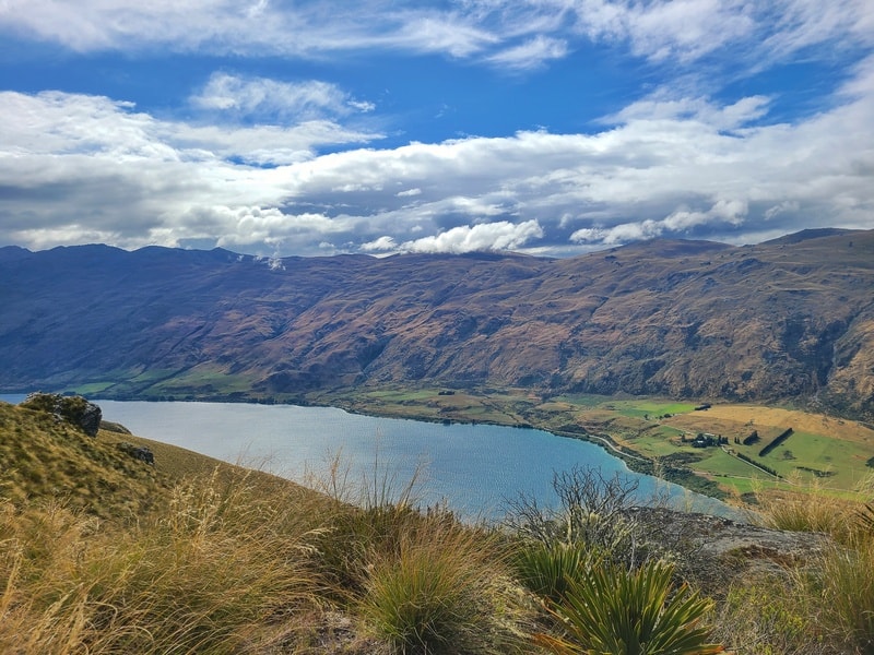
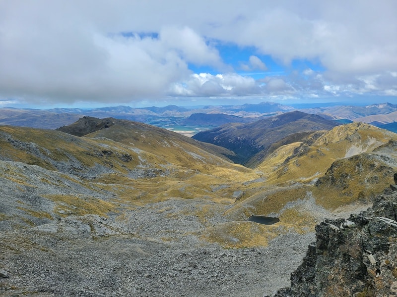
And this is definitely one of those summits where it offers the best views on the whole track. You’re well above all the nearby ridgelines, so you get 360-degree views. Combined with mild temperatures and minimal wind, we were stoked. Mount Dick, tick.
SUMMIT VIEWS!!
But there was rain in the forecast so we made a hasty exit, wanting to get off the boulder slope as soon as possible. This is not a hike to do in wet conditions.
Once back at the tarn, we decided to try a slightly different route back to the 1668 point as you can see on the topo. This still wasn’t easy with a steep ascent, but it felt comfier overall.
Once at point 1668 we were able to more or less follow the same faint trails we saw on the way, eventually dropping down to rejoin the 4WD track.
The 4WD track was a grind, the track doesn’t have much change in gradient and it felt relentless. The views still are awesome though, and we could hear the steam engine in the distance (no sighting).
We were relieved to hit the track again knowing it was about 3km before we got back to the car from here.
What a great day out!
Getting to Mount Dick isn’t an easy hike, but if you’re looking for something different near Queenstown put this on your list. It’s a long day out, or an adventurous overnight hike.
If you have any questions/comments about hiking to Mount Dick, email jub@churnewzealand.com or leave a message below.
And for who stuck around this far, here’s five more photos from the Mount Dick hike.
p.s. you can find all the hikes I’ve documented in this map (clicking on the icons will provide more info):

Hey, it’s Jub here. I’m the guy behind Chur New Zealand, helping you have the best time hiking, trekking, walking…whatever you want to call it…in NZ. I’m based in Queenstown and am always out and about exploring trails, old & new. If you have any questions, reach out.
Loved this and great pics. My family owned Halfway Bay Station just to the north of Mt Dick until the mid-1970’s. Would love to go back and explore the area.
Hey Barrym
Thanks for the kind words! Was a fun day out…would love to explore Halfway Bay Station and Bayonet Peaks! Looks so good.
Chur,
Jub
Thanks so much for the route guide and .gpx Jub! We did an overnight trip there last weekend and camped by the tarn you went to (it was quite hidden…) And the cloud cleared for us to have amazing views from the summit.
Hey mate,
Boom, love that! It’s a very sneaky tarn…would love to camp up there actually.
Cheers,
Jub
Hi and Merry Christmas!
Thank you so much for all the cool trail ideas and awesome pics – love your Website;-)
I can‘t download the GPX for Mount Dick, maybe the link is not correct?
Thanx so much,
Cheers Janine
Hey Janine,
Thanks for the kind words. Hopefully this link works: https://drive.google.com/file/d/1MrWvZbuv7XKGg6Jhg2hduEoNDk5h0i6j/view?usp=sharing
Cheers,
Jub
Yeah, that one works!
Thank you so much 😉