The Tama Lakes Track isn’t over-touristed and makes for a great 16km hike with 500 metres or so of elevation.
I love the Tama Lakes Track and feel like it’s one of the most underrated hikes in Tongariro National Park. It’s also a good Tongariro Alpine Crossing alternative if you’ve done it before and/or can’t get shuttles booked.
The track isn’t a complete in-and-out track as you can add the full Taranaki Falls loop track onto your day.
This post will give you everything you need to know about hiking/walking the Tama Lakes Track.
This could be you.
TABLE OF CONTENTS
1. Details About The Tama Lakes Track
2. Tama Lakes Track Map
3. How To Get There
4. My Tama Lakes Track Review
1. DETAILS ABOUT THE TAMA LAKES TRACK
Um, heck yeah, the Tama Lakes walk is epic!
I’d only recently heard of this track, and have no idea why more people don’t do it. As crowded as the Tongariro Crossing is, this track is about the same length with a little less elevation.
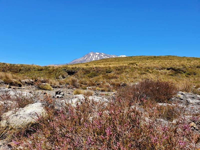
And on the Tama Lakes Track, you get the benefit of views of Mt Ngauruhoe and Mt Ruapehu throughout. And a stunning waterfall. Of course, you don’t get the emerald lakes one of the iconic spots in NZ but the Tama Lakes are stunning.
Other than getting sunburnt, I love love love this hike!
READ NEXT: ABOUT THE NATIONAL PARKS IN NEW ZEALAND
How long is the Tama Lakes Track? 18.2km according to my Strava Data (which includes the Taranaki Falls loop).
The sign at the Tama Lakes trailhead says it’s a 7.3km trip one way to the lower falls which is about 1.8km from the Upper Tama Lake viewpoint which would make for a 9.1km trip one way and 18.2km round trip. So if you’re going to both lookout points you’re looking at an 18-19km roundtrip.
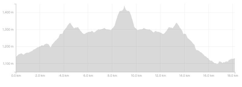
What’s the elevation gain?
Based on my Strava recording, it’s about 560 metres total. You can see the Tama Lakes elevation profile here:
Hike long does the Tama Lakes hike take?
The full track took me 4 hours and 45 minutes to complete which included a 20 minutes lunch break. The DOC signs have the hike taking 3 hours and 5 minutes to reach the upper lake viewpoint, for a 6-hour and 10-minute return trip. You should schedule at least four hours for the hike but should be able to complete everything within seven hours comfortably.
How hard is the Tama Lakes Track?
Overall I’d give this a medium difficulty rating. It’s not crazy hard, but the conditions whether hot or cold can be brutal. And there’s some elevation gain in the route, especially the section from Lower Tama Lake to Upper Tama Lake. That said, if you start early, most people should be fine to finish this.
What’s the Tama Lakes weather like?
Being an alpine terrain, it’s going to vary a lot, and I do recommend stopping in at the visitor centre before starting the hike to get the latest weather updates.
Everyone has their favourite weather app, but I personally like Yr.no so you can see the weather at Lower Tama Lake specifically.
Are dogs allowed on the Tama Lakes Track?
No. The track is in Tongariro National Park, therefore is a 100% no-go zone for dogs.
Can you swim in Tama Lakes?
No. The lakes are pristine alpine water, therefore swimming and/or even touching the water can ruin there quality, introduce weeds etc.
Can you do both the Tama Lakes and Taranaki Falls walk in one go?
Yes, as mentioned, the Tama Lakes Track is an extension of the Taranaki Falls walk. Provided you’ve got time, definitely do both.
TAMA LAKES TRACK MAP
As per usual, downloading and paying for this Topo Map app is a good idea which is where the screenshot below is based on.
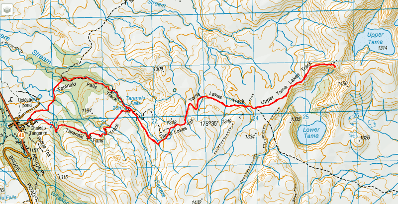
And in what is most definitely a rare instance for Google Maps, you can see the hiking route here. You can also see the track on maps.me.
3. HOW TO GET THERE
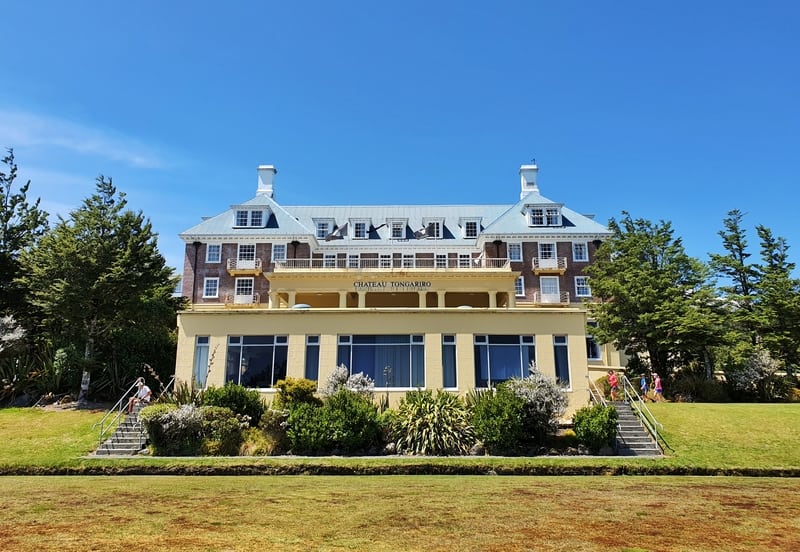
The Whakapapa Chateau is very good looking (but you can’t stay there anymore 🙁 )!
The trailhead is located just behind the Whakapapa Chateau at the end of Ngauruhoe Terrace.
Drive: There’s plenty of parking available in Whakapapa Village (just below the Chateau and on Ngauruhoe Terrace). If there’s an event on, you might take a while to find a park, but you’ll find something eventually.
Walk: If you’re staying in accommodation in Whakapapa Village you’ve got a short walk to the trailhead.
Public Transport: There’s no public transport to Whakapapa Village, but there are shuttles available from National Park. You’ll be able to book these at your accommodation. If you’re in an Airbnb just pop into the nearest hostel to do it.
4. MY UPPER AND LOWER TAMA LAKES REVIEW
Will you go up to the Upper Tama Lake viewpoint? I think you should.
*Note: I hiked on a clear day in the middle of summer. During winter, or on a bad weather day the hike will be tough.
I was lucky enough to have my friends drop me off at the Whakapapa Chateau and after a quick visit to the visitor centre (pop your head in) I walked to the trailhead at the end Ngauruhoe Terrace.
I do recommend reading all the notices at the entrance as some may be relevant for the day you’re making the hike. I started on the Upper Taranaki Falls track and returned via the lower track which is the best way to go.
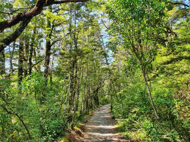
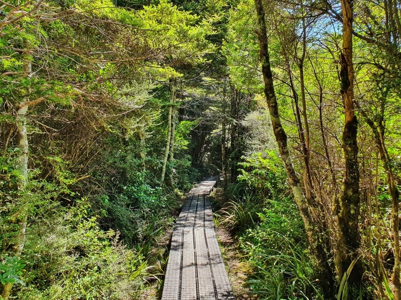
Enjoy this bit of shade early on the walk.
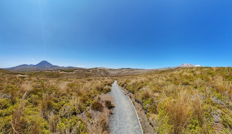
The hike starts off cruisey on the well-worn path and provided you’ve got a nice clear day you’ll have the beautiful volcano views right the way through. After a few minutes, you’ll be under the cover of trees. I enjoyed this respite from the sun. Make the most of this as the rest of the walk is exposed to the elements on the way to the Upper Lake.
After a mild incline, the first milestone on the track for me is the bridge over the Wairere Stream, just above the Taranaki Falls which you won’t see until you come back home via the Lower track. The track until this point is on a slight incline more or less the whole way. But it’s gradual and you’ll be so busy enjoying the views you won’t notice it at all.
Early on and hike has insane views already.
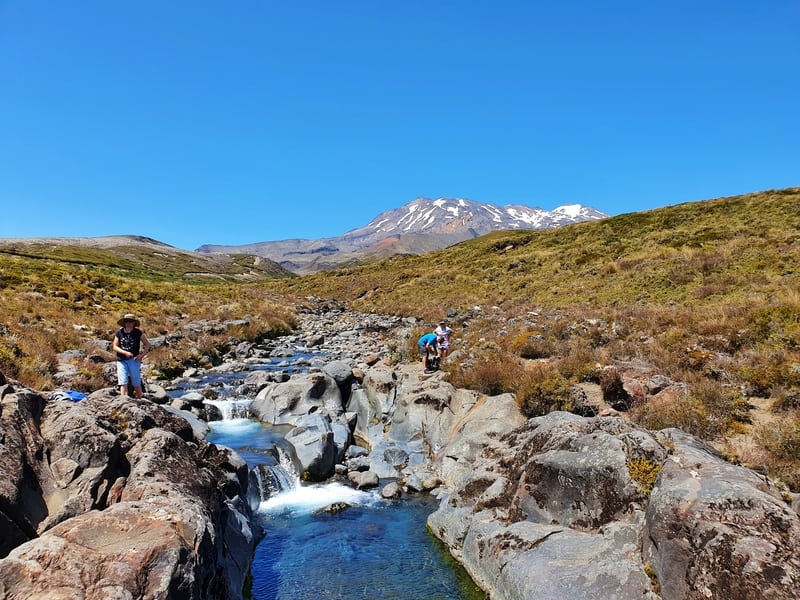
The Wairere Stream the flows into the Taranaki Falls.
Can’t ask for much more than this, eh.
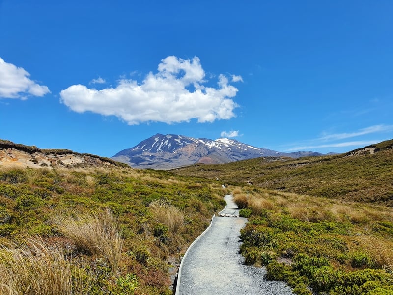
After you cross the bridge, most will be turning left following the Taranaki Falls track, but we’ll go right and the gradient is a little bit steeper for the next 1.6km until you reach what feels like the next level of the plateau. I was loving the constant views of Ruapehu and Ngauruhoe while walking along the well-maintained track. The track is in good condition so the walking is comfortable.
The next three kilometres to the Lower Tama Lake viewpoint are gently undulating, with no crazy elevation changes. I spotted a pair walking their dog off-leash and made sure they knew that dogs were not allowed in Tongariro National Park. Crikey it’s so frustrating to see people trying to ruin good things for the rest of us!
The view from the Lower Tama Lake picnic spot.
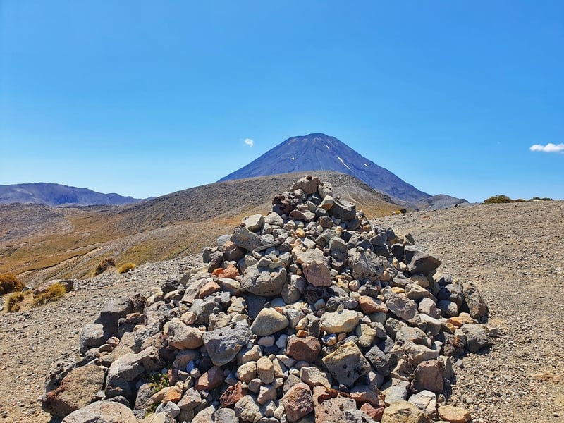
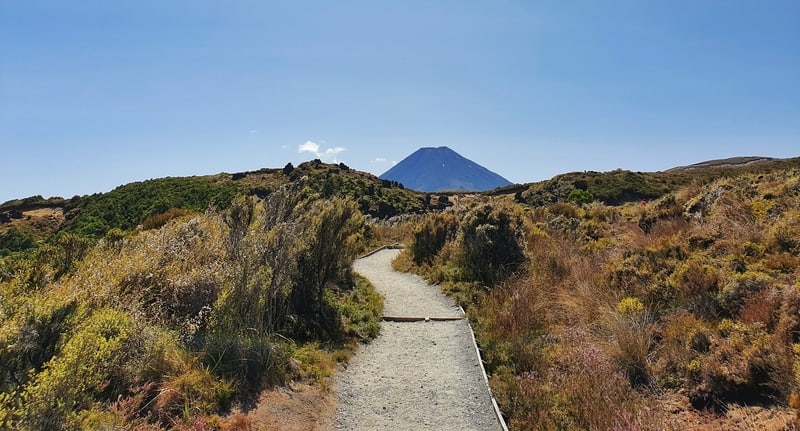
A cairn framed with Mount Doom.
The Lower Tama lake was impressive, but I’d love to come here on a clear spring day as I believe the alpine lake would be bigger from the melted snow. This is another point at which some people will call their turnaround point after having a bite to eat. Why get this far and not go to Upper Tama Lake?
You’ve only got 1.5km to go, but the track is a bit rougher after this point. The first few minutes will take you through a trail that squeezes between tussock plants on the flat before you’re left with a steep 100-metre climb over 500 metres or so. The track was super dry with loose rock so with my worn-out running shoes traction was proving a problem for a while.
With no more tussocks guiding the way, I made it up in good time following the vaguely visible tracks taken by previous hikers. You’ll soon see the high point you need to get to, though I don’t believe there’s any obvious marker to mention you’re at the Tama Lakes other than a couple of large boulders and the fact you can actually see the upper lake on your left-hand side! It’s sneaky and won’t come into view until you get right to the viewpoint, well played, lake.
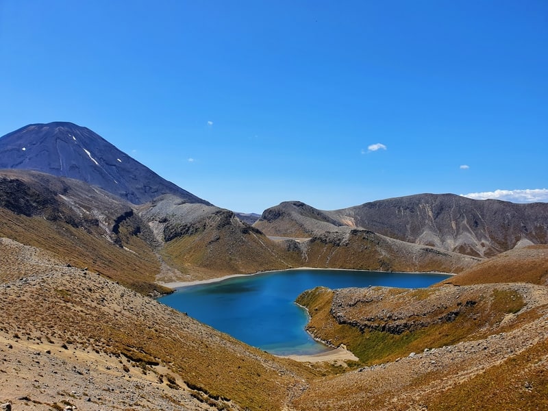
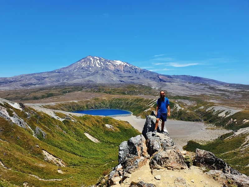
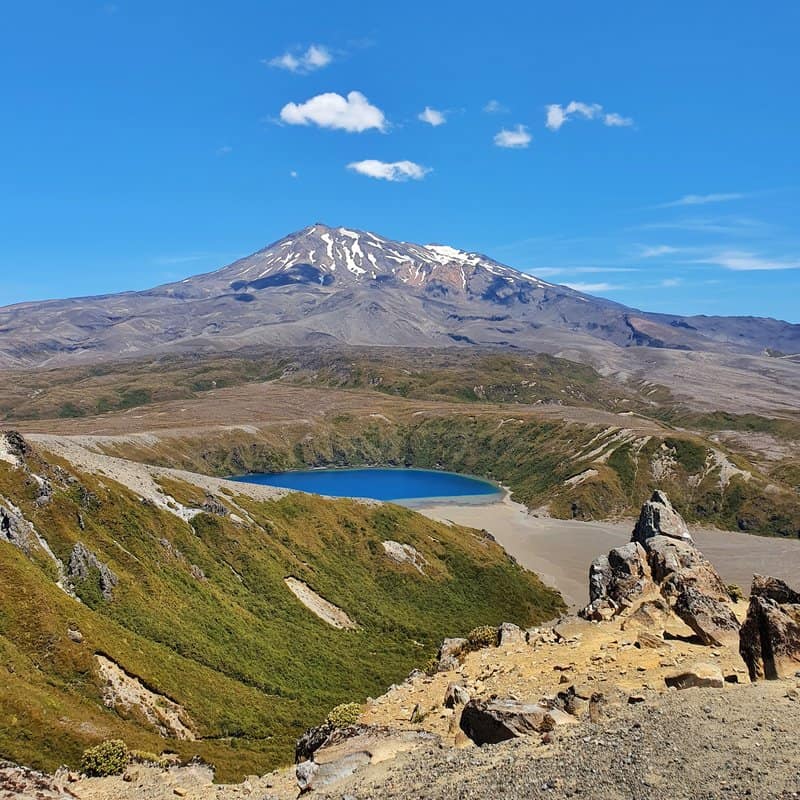
The Upper Tama Lake with Mount Ngauruhoe on the left.
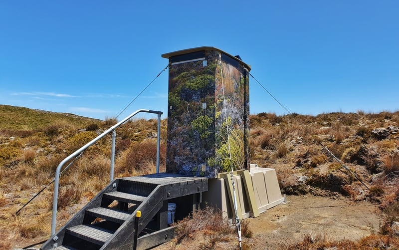
Love these toilets in camoflage. There’s three opportunities for toilet stops on the track.
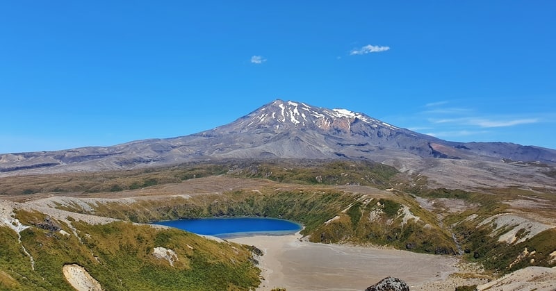
From here you’re seeing the Upper Lake with Mount Ngauruhoe in the background, and on the other side of the peak, you’ve got the epic photo opportunity with the lower lake and Ruapehu perfectly aligned! How cool is that?
Should you go to the Upper Tama Lake viewpoint? For me, it’s a simple yes.
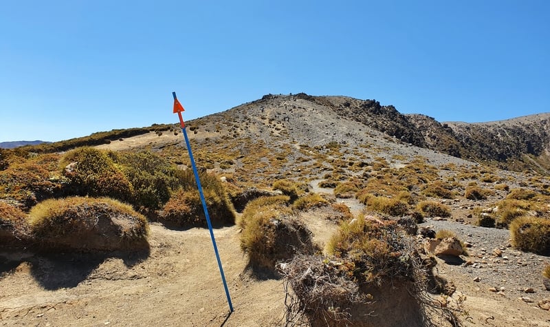
The orange markers on poles are for those hiking when there is still snow on the surface.
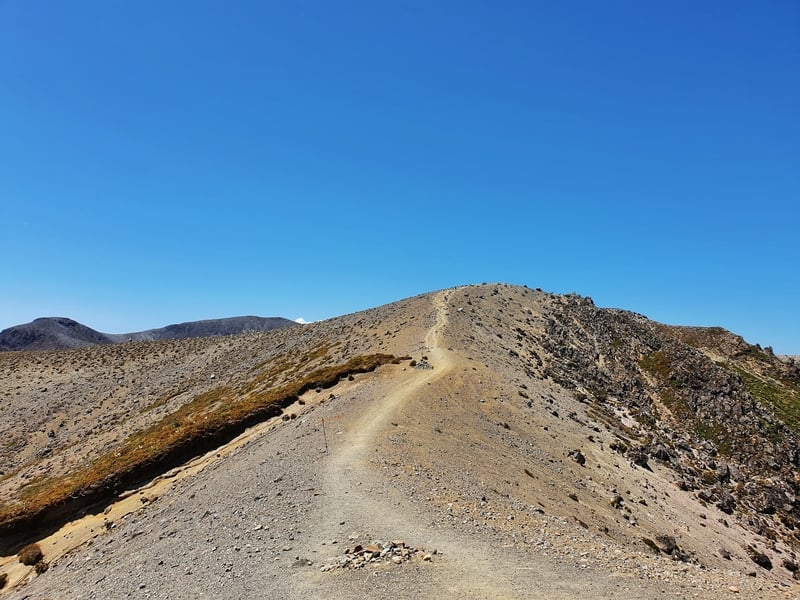
The final countdown to the Upper Tama Lake Viewpoint.
Yes, it’s a niggly 3km return from the lower lake viewpoint, but that’s only because the rest of the hike is rather pleasant all things considered. Being able to say you’ve seen both lakes is cool, and how good is the photo opp for the Lower Tama Lake above!
I spent about 20 minutes up at the summit before starting the trek back down the steep hill. It wasn’t easy, but take your time and you’ll be fine in any decent shoes (I had regular trainers on).
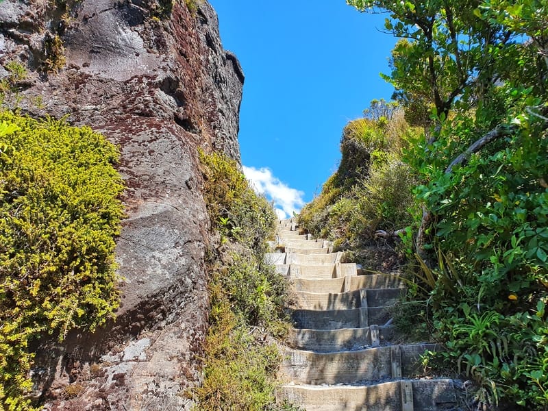
The stairs you’ll come down to reach the Taranaki Falls (provided you go in the same direction I did).
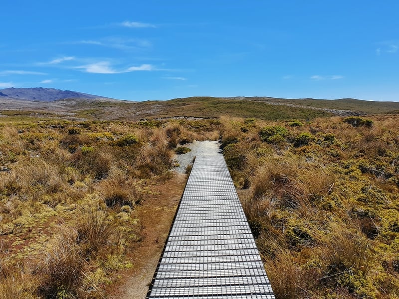
There are a couple of small sections of boardwalk along the way.
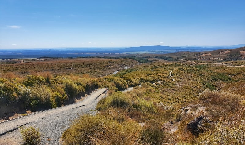
The vistas on the way back make the in and out walk good as gold
On the way back the views aren’t quite as good (but I can’t complain!) until you reach the turnoff to the Taranaki Falls. You’ll turn right just before the bridge, and I was surprised there was the steep set of 50 stairs or so but it makes sense as you’re going to shortly be at the bottom of the waterfall.
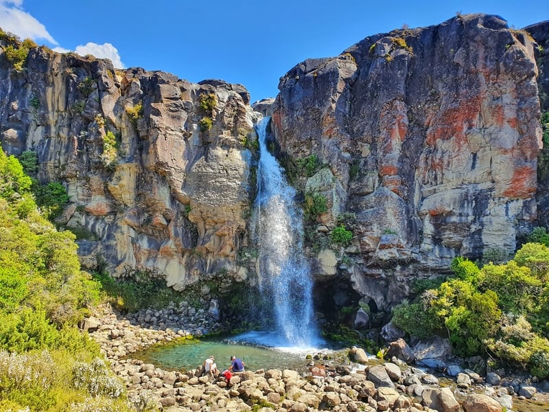
Stunning!
The Taranaki Falls are one of the hundreds of gorgeous waterfalls in New Zealand and in summer this one has more than enough water flowing over it still to give the satisfaction we all look for when chasing waterfalls. There’s plenty of space to chill out if you want to take a break while watching the waterfall too.
Finally, the shade towards the end is a relief in the middle of summer!
From here you’ve got a short walk before you cross the next bridge back to the other side of the Wairere Stream and you then get some respite from the sun. For the next couple of kilometres you’re going to love life as you’re under a canopy of trees following the stream on a path. Once you emerge from the trees you’ll see the Whakapapa Chateau as you begin the final stretch of the Tama Lakes track. And before you know it, you’re all done!
Just out here trying to take artistic photos.
I think of Tama Lakes and the Tongariro Crossing similar to Isthmus Peak and Roy’s Peak in Wanaka.
Roys and the Tongariro Alpine Crossing get all the attention, but if you’d rather have a more relaxed environment, give Tama Lakes and Isthmus Peak a whirl.
They won’t let you down.
If you have any questions about the Tama Lakes Track, leave a comment below or email jub@churnewzealand.com . I’m happy to help!
What to read next:
- The Tupapakurua Falls Track is a gem next to Tongariro National Park
- Heaps of fun things to do in New Zealand
- The Silica Rapids Walk in The National Park

Hey, it’s Jub here. I’m the guy behind Chur New Zealand, helping you have the best time hiking, trekking, walking…whatever you want to call it…in NZ. I’m based in Queenstown and am always out and about exploring trails, old & new. If you have any questions, reach out.
Hi Thanks buddy for this valuable information. We will go there beginning of August 2020, it’s winter time. Depending on the weather and our condition, at least we can reach the Taranaki Fall.
Yea, you should be sweet to get to Taranaki Falls. Let us know how you get on, Hardi.
Chur
Hi Chur
Mission accomplished, well…rather (because we did not go up the Upper Lake). It was really a nice walk apart from strong winds, cloudy and foggy. It’s winter anyway.
The weather turned to be clear in the late afternoon and the mountains clearly visible from down the road.
There’s a river / stream to cross 15 mins before the Lower Lake, can it be flooding when rains? I saw a man walking his dog as well.
Thanks again for your post.
Hey Hardi,
Thanks for your trip report 🙂 Glad to hear the winter mission went well.
I’ll have to look into that river/stream and see what others say. Though it’s not the best place to be when it’s raining anyway haha.
Chur,
Jub