The Taranaki Falls Track is one of the more popular walks in Tongariro National Park (that isn’t the Tongariro Alpine Crossing).
That’s due to the family friendly distance (~6.2km), difficulty, and minimal elevation (+/- 120 metres). The waterfall is cool too.
As you continue to read, you’ll learn everything you need to know about the Taranaki Falls walk before you go (if you still have questions, let me know).
Note: I completed this loop while hiking the incredible Tama Lakes Track. Another good walk similar to the Taranaki Falls Track is the Silica Rapids walk.
TABLE OF CONTENTS
1. Details About The Taranaki Falls Hike
2. Taranaki Falls Walking Track Map
3. How To Get There
4. My Taranaki Falls Experience
1. TARANAKI FALLS TRACK DETAILS
How long is the Taranaki Falls hike?
6.2km based on my Strava data, the same as the DOC track signs.
What does the elevation profile look like?
The 120 metres I had on my Strava seems to be about right compared to other places
How long does the Taranaki Falls hike take?
For me it took 1 hour and 24 minutes, which included a couple of minutes admiring the waterfall. The DOC signs have it at 2 hours, which should be enough for 90% of people. If you’ve only got two hours of time, you’ll be able to complete the hike.
2. TARANAKI FALLS MAP
This is the map on 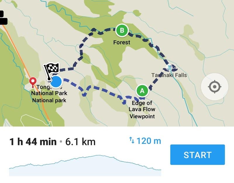
The screenshot above is from Maps.me. It only has the trail at 5.7km but that’s a little short in my opinion based on the details above.
You can also view the trail on Google Maps here or the best topo map app. You don’t really need a map though, it’s well marked and an easy trail to follow.
3. HOW TO GET THERE
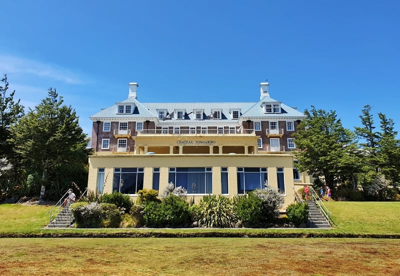
The Whakapapa Chateau is very good looking!
The trailhead is at the end of Ngauruhoe Terrace, a little bit past Whakapapa Chateau
Drive: There’s a carpark available on Ngauruhoe Terrace, but if it’s full you’ll find plenty of free parking around Whakapapa Village.
Walk: From anywhere in Whakapapa Village you’re not far from the trailhead.
Public Transport: Public transport to Whakapapa Village isn’t available from any of the ‘nearby’ towns. You are able to book shuttles though, with hiking shuttles leaving throughout the day from National Park which you’ll be able to book when you get there (most places with accommodation will offer shuttle tickets for purchase which is usually $35 return).
4. TARANAKI FALLS TRACK TRIP REPORT
Stunning!
When researching the Tama Lakes Track I was stoked to learn that I’d be able to complete the Taranaki Falls loop track at the same time! That’s a good thing about the Tongariro National Park hikes, you can link them up often.
So just to be clear, I walked the first 3km of the Upper Taranaki Falls Trail, before splitting off to visit Tama Lakes before returning to complete the rest of the loop via the Lower Taranaki Falls Track.
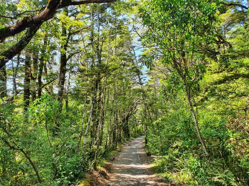
Enjoy this bit of shade early on the walk.
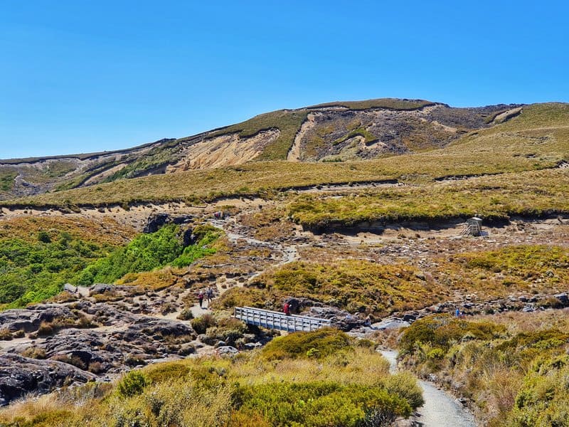
That’s the bridge taking you over Wairere Stream and down to the Taranaki Falls.
It was just seconds before I realised how cool this track is! You get awesome views right away but after a couple of minutes, you’ll enter a light canopy of trees (you’ll be back out before you know it).
The Taranaki Falls walk is well maintained so you’re at no risk of getting lost which is great. Once you exit the canopy you’re under the open skies again but the alpine trees and bushes are low enough that you’ll have 360-degree vistas all the way to Wairere Stream.
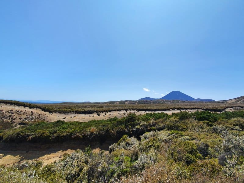
You’ll have clear views of Mt Ngauruhoe with Mount Ruapehu popping up over the ridge throughout.
That gully is an (inactive) lava flow 🙂
You’ll also pass by a gully which is the edge of a lava flow…though if the sign wasn’t there I wouldn’t know it was a lava flow 🙂
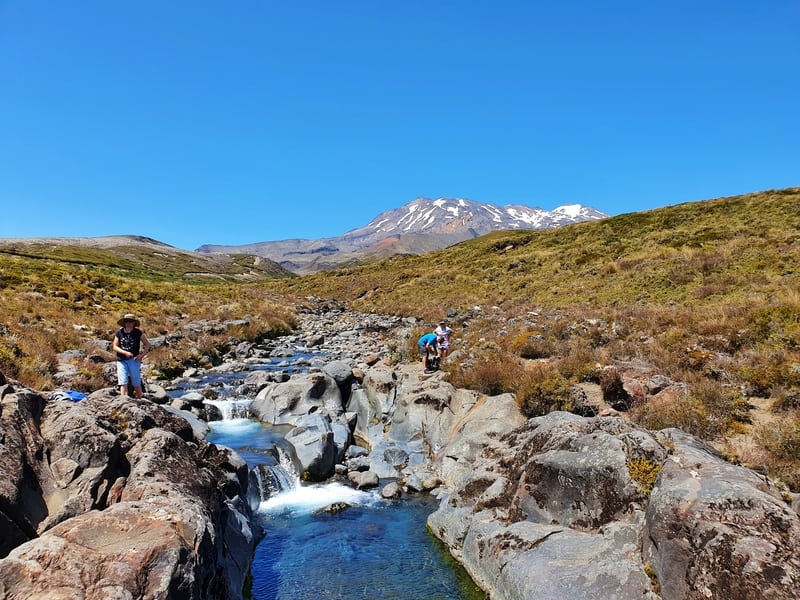
The elevation from the trailhead is less than 100 metres so the altitude won’t give you any difficulties. You’ll know when you’re close to the Taranaki Falls when you see the view above with the bridge over the stream. The stream itself is beautiful and a good source of fresh drinking water.
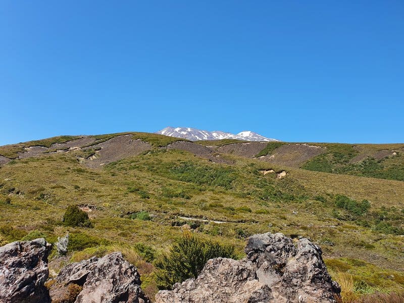
Mount Ruapehu sneaking over a ridge.
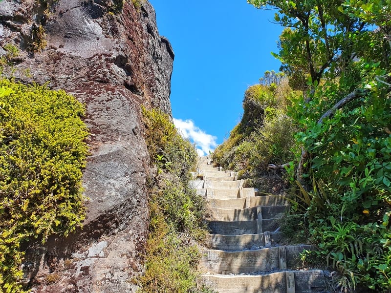
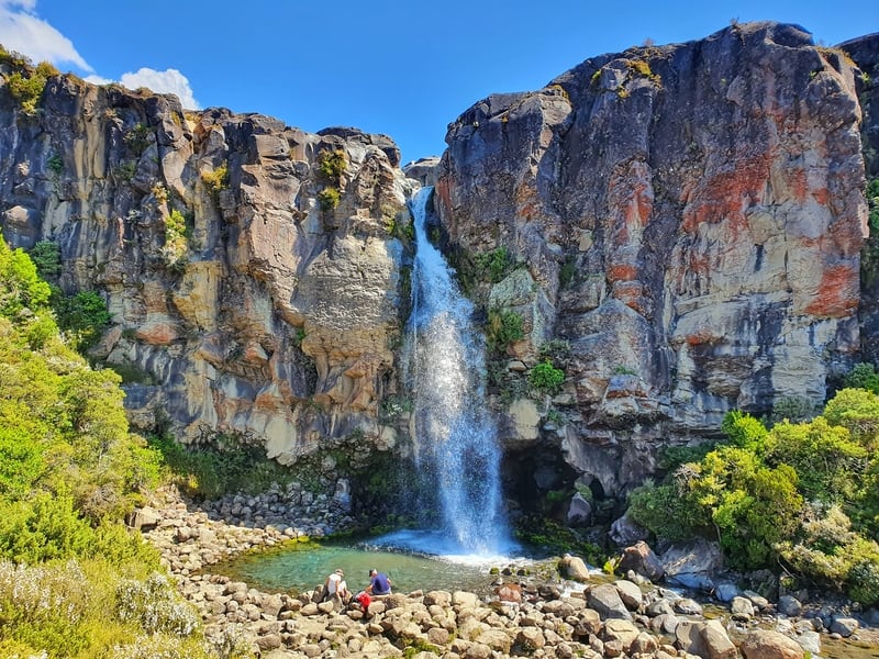
The stairs you’ll come down to reach the Taranaki Falls (provided you go in the same direction I did).
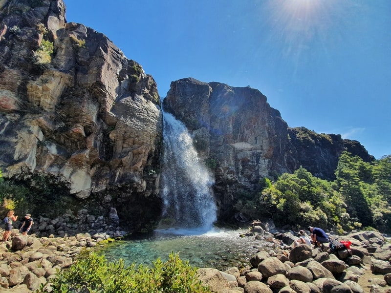
The first glimpse of Taranaki Falls.
Here you can turn right for the Tama Lakes Track, but turn left after the bridge (there’s a toilet here) and make your way down the stairs which are a couple of minutes from the Taranaki Falls. The first viewpoint is about 50 metres from them, but you’ve definitely got to go down to the rocks around the waterfall and enjoy the atmospheric kind of environment they provide.
I didn’t spend long at the falls, but two people were attempting to warm up after jumping in.
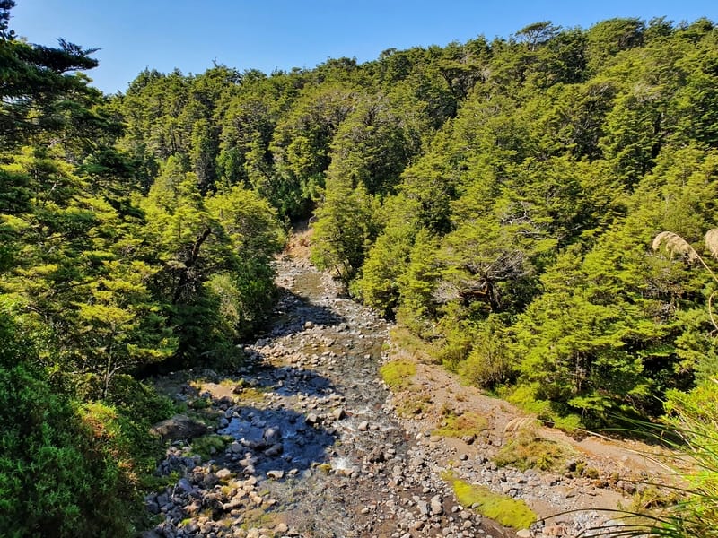
Looking down Wairere Stream.
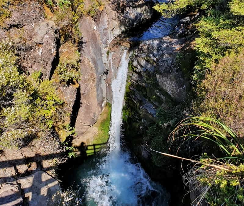
This was a little waterfall when you cross the second bridge over the Wairere Falls.
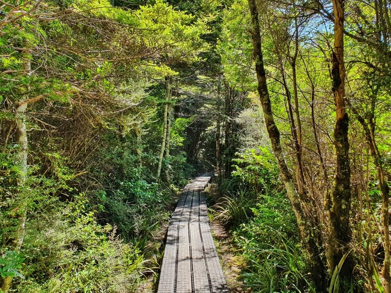
A stretch of boardwalk through the canopy next to the Wairere Stream.
When you cross back over the stream there’s a steady decline (it’s a low gradient so no pressure on your knees) lays ahead as you follow the Wairere Stream via the forest. Once you exit the forest you’re not far from home and you’ll briefly see Whakapapa Chateau in the distance. From here it’s a casual walk back up the hill (it’s hardly a hill) and yay, an epic walk is complete!
This is a great value walk that can be completed in a couple of hours. With minimal elevation it’s amazing you get to have such great views, a variety of environments, and of course, the Taranaki Falls are wicked!
If you got any questions or comments, leave a message below or email me on jub@churnewzealand.com.
Chur,
Jub
p.s. Here’s a map of all the hikes documented on Chur New Zealand. You can click the icon to see brief details, as well as a link to read more about the hike (like this post).

Hey, it’s Jub here. I’m the guy behind Chur New Zealand, helping you have the best time hiking, trekking, walking…whatever you want to call it…in NZ. I’m based in Queenstown and am always out and about exploring trails, old & new. If you have any questions, reach out.