If you’re looking for a way to fill in a few hours before or after hiking the Tongariro Alpine Crossing, this in and out track, close to National Park (the town) is perfect!
This post will give you the details you need before start.
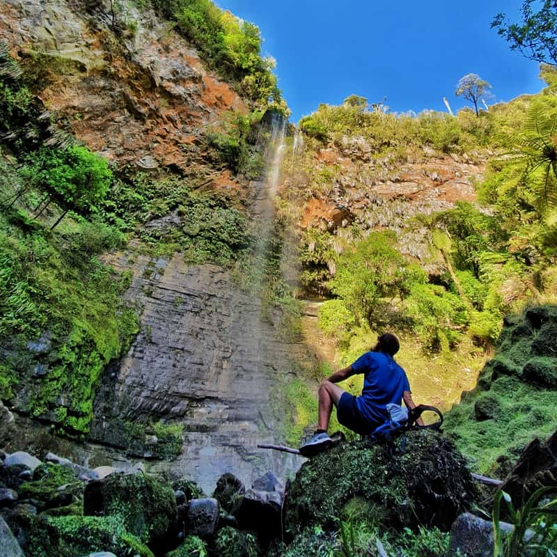
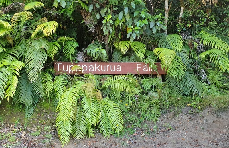
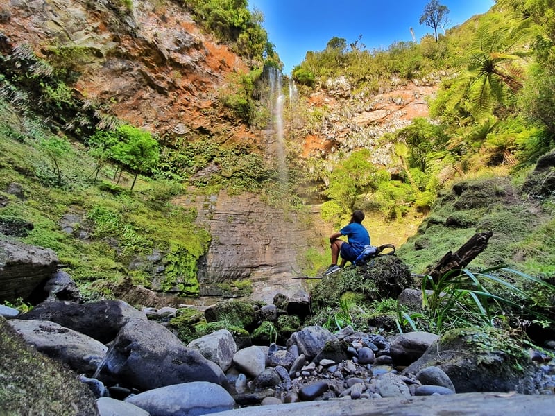
At the bottom of the Tupapakurua Falls
TABLE OF CONTENTS
DETAILS ABOUT THE TUPAPAKURUA FALLS TRACK
Rating?1![]()
I love this track! But that’s because the adventure down to the bottom of the falls was sketchy as the tracks not maintained (there are markers pointing you in the right direction) and I like that kind of thing.
But there’s also the part where you get to pay it forward and carry buckets of gravel further up the track to help those maintain the upper sections of the track too.
In summer the waterfall wasn’t 10/10 amazing, maybe it’s different in winter, but the bush is spectacular and the Mount Taranaki viewpoint is great (I couldn’t spot Mount Taranaki :p ).
When2: January 2020
Hike Distance3: To get there my Strava said 3.78km (means a 7.56km return) from Fisher’s Track to the bottom of Tupapakurua Falls. This seems reasonably accurate as the return route on my run came in at 3.4km.
The sign at the entrance says it’s a 3.1km trip to the Taupapakurua Falls Lookout, and to the bottom of the lookout is at least 300 metres so if you’re going to the bottom of the waterfall it’s going to be about ~7 to 7.5k return. As the track from the Taupapakurua Falls Lookout to the bottom of the falls is not maintained (at the time of writing) you may be happy doing the ~6.2km return walk to the lookout.
Difficulty4: Medium.
Incline5: Based on my Strava Data, I have about 400 metres of incline with about 300 of that occurring on the return.
Hike Duration6: To get from Fishers Track to the bottom of the waterfall it took me 1 hour and 11 minutes. The out route is the descent, so the faster section. I ran back so it’s tough to gauge how long the walk back would be, but I’d say 1 hour 25 minutes for me would be about right. That’s a total time of 2 hours 36 minutes.
The signs say 70 minutes to the lookout, so you can add some time to get to the bottom of the falls. I’d say you’ll take between 2.5 and 3 hours, provided you have short breaks.
TUPAPAKURUA FALLS TRACK MAP
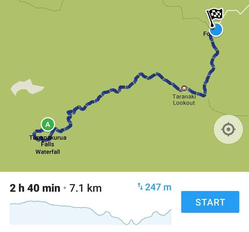
As usual, the track isn’t of Google Maps, but the falls are pinned here.
I’ve taken a screenshot of the track from Maps.me which is what you see above. This seemed to be 100% accurate. Once you’re on the track, you can’t go wrong really.
RELATED: SOME AMAZING HIKES IN TONGARIRO NP
HOW TO GET TO THE TRAILHEAD
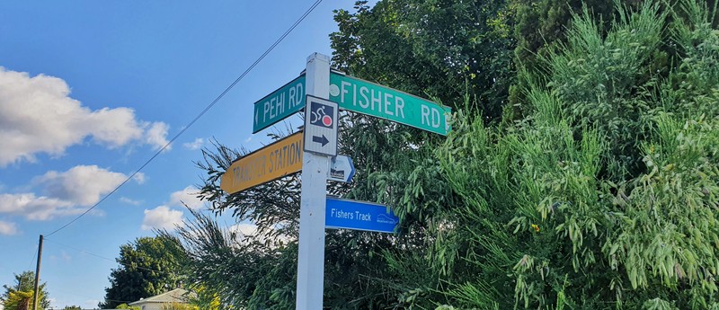
Turn right here onto the gravel road.
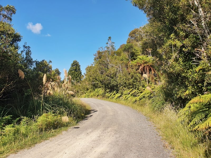
The gravel Fishers Track/Road.
The trail is 3.7km from the National Park Four Square on State Highway 4, on the western side of the railway tracks. The part I find the most confusing is the exact name of the road that the trailhead is on (continue reading).
Drive: You can drive all the way to the trailhead. Shortly after you cross the railway tracks the road turns into gravel where the signposts are for both Fisher Road and Fishers Track (take this road). So it’ll take 8-10 minutes to reach the carpark which is about 50 metres before the trailhead which is marked with signs. This is the route on Google Maps to the trailhead.
Walk: It’s within walking distance of all accommodation in National Park so that is an option. The gravel road isn’t busy so you should be fine. It’s not the greatest walk, but you do get the odd view back towards Ngauruhoe and Ruapehu which is cool!
Public Transport: Not available. Alternatively, you might be able to ask your accommodation to arrange private transport, There did seem to be places that mentioned Fishers Track but I’m not 100% sure on the details.
TRIP REPORT TO TUPAPAKURUA FALLS
Let’s go!
This was my second attempt at getting to this waterfall after making a wrong turn at the end of 2018 and not being able to find the trailhead. It was totally my fault, the key was to turn onto Fisher’s Track, I simply misread Maps.me.
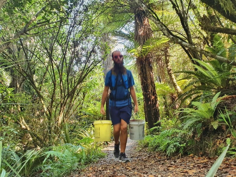
Doing my bit to help out.
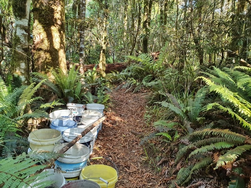
The buckets you’ll see at various points along the track.
After arriving at the trailhead I was surprised to see a nice and tidy sign given the lack of knowledge about the track. After the first few metres there are some signs letting you know what you’re in for, and some buckets of gravel. There was a note asking if people wouldn’t mind helping carry some of the buckets down the trail so the gravel could be spread on the track in the future. There are various depots along the way, and there was something cool about helping make the track a tiny bit better!
The view where you’ll hopefully spot Mount Taranaki on the horizon.
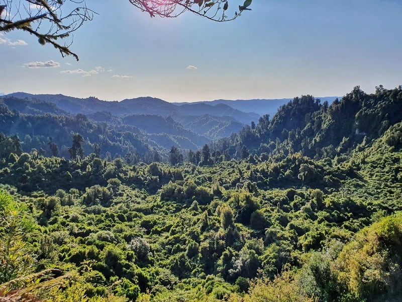
The walk to the Mount Taranaki Lookout is just over a kilometre and is a breeze with gentle undulations and a well-formed track. In a perfect world, you’ll have heaps of bloody (some NZ slang for you) awesome views with Mount Taranaki 120km also visible. As much as I tried squinting and slowly scanning the skyline I had no such luck.
You’ll also come across little information cards in front of some trees. For the tree nerds out there you’ll appreciate this. I’m not exactly a tree nerd, but did appreciate the canopy they formed throughout the walk.
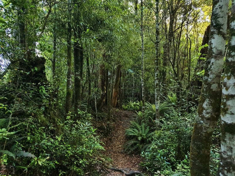
The trail starts to get narrower
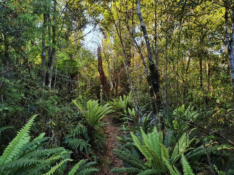
Just love the bush!
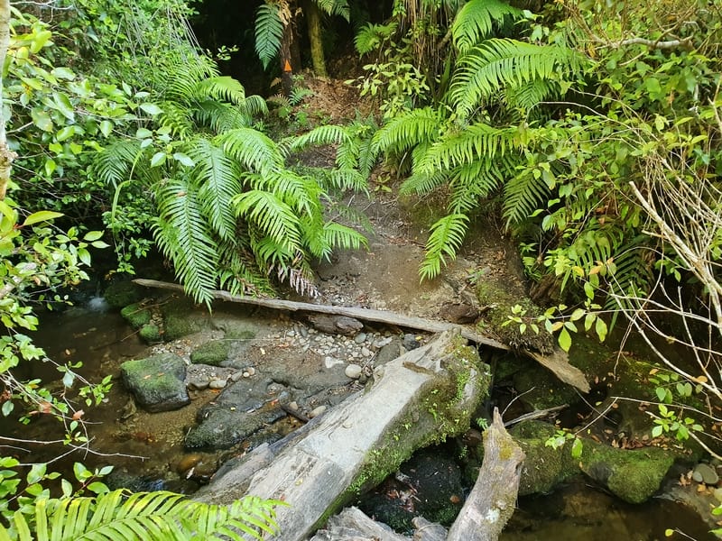
An easy stream crossing.
From here the track is still on gravel to start with, but this will disappear as the track does get more technical the deeper you go. It’s nothing crazy with a slow descent before a small climb, and then a final dip back down to the Tupapakurua waterfall lookout. There’s a couple of little streams with carefully placed items that make it easy to navigate.
Hopefully, there’s plenty of water coming over the falls while you’re there. That definitely wasn’t the case for my mid-summer visit.
Thanks for the headsup!
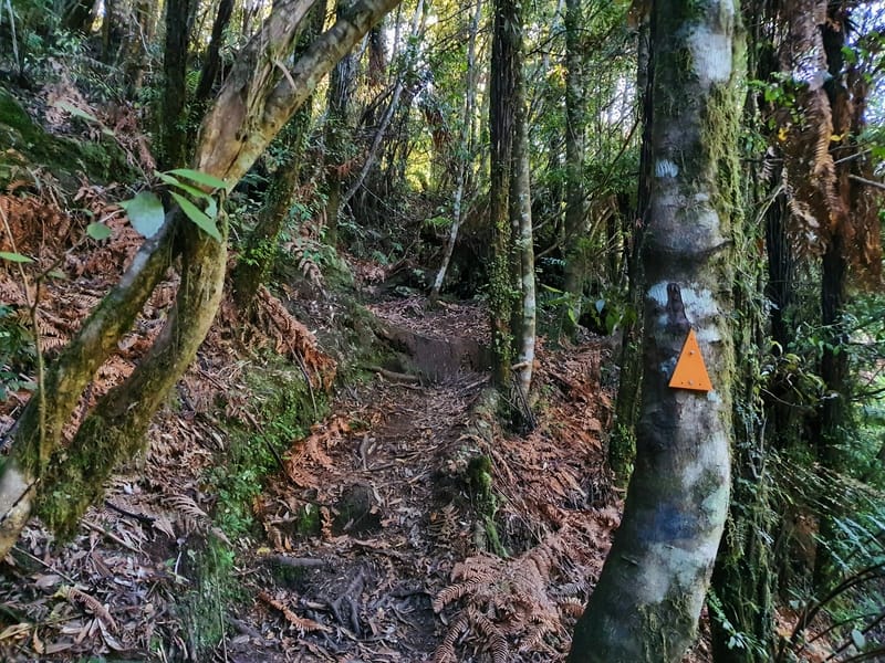
Follow the markers and you can’t go wrong.
Beautiful right!?
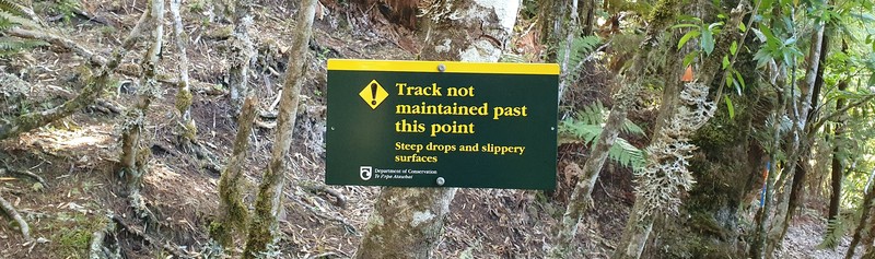
Now, some of you will turn back and head back up the hill to the trailhead, which is totally okay. From here on the trail isn’t maintained so as long as you’re confident and have plenty of daylight, you can continue the 20 minutes or so it takes to get to the bottom of the falls. The orange markers will point you in the right direction. They are helpful as there are times where it looks like the track might go one way but doesn’t.
A couple of minutes after the lookout you’ll see another view of the waterfall, take a quick peek because depending on the light you may prefer this view. From here on out it is a sharp descent to the river almost, with one section where the track has been more or less wiped out but a rope is there to hold.
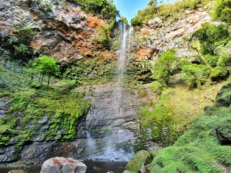
They look better from down the bottom I think!
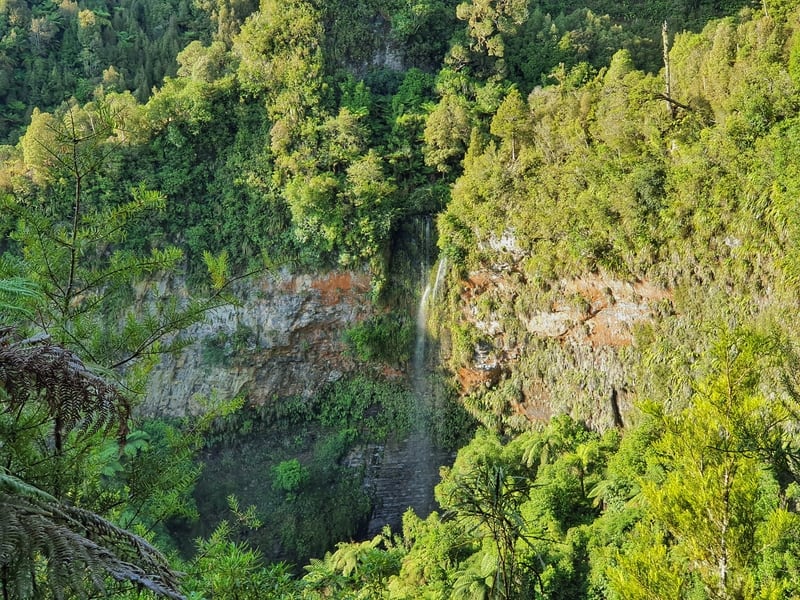
The view of the waterfall (can you see it), from the lookout.
Once you get to the river, you’ll follow it to the base of the waterfall where you can get all the photos you ever need! I didn’t see anyone on the track the entire time so there’s a good chance you’ll have this bit of beautiful nature to yourselves…if you decide to sunbathe nude, remember people can see you from the lookout haha.
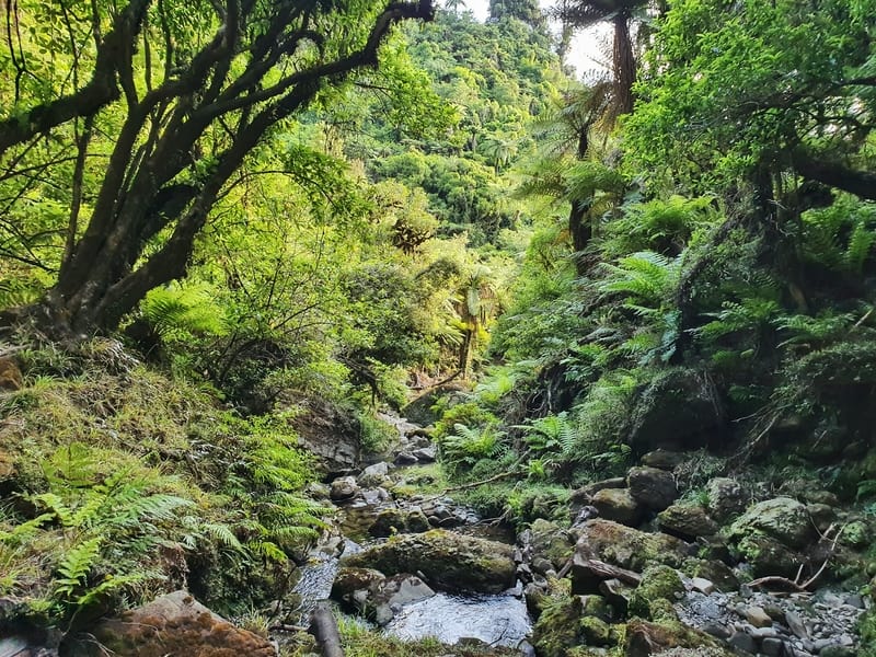
The river flowing away from the waterfall.
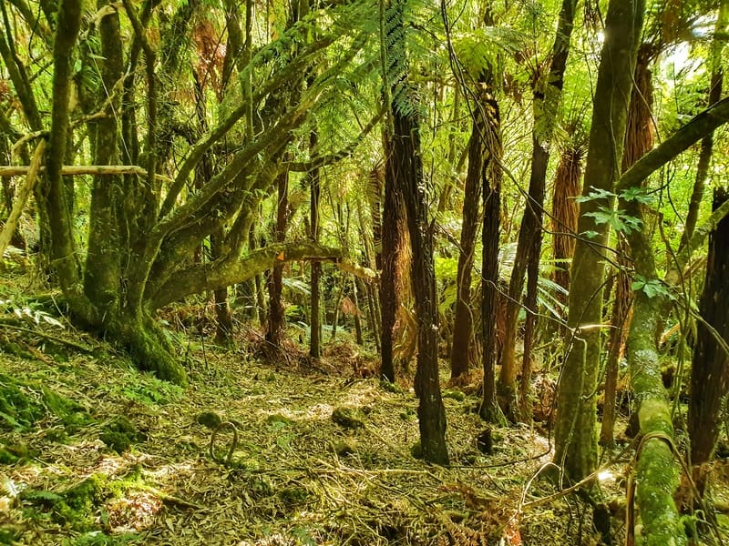
It’s not quite a goblin forest, but it’s still beautiful.
Getting back is simple enough, you’ve just got to go the way you came.
I did find coming back up the unmaintained section tough work, and I almost went off course a couple of times before realising the orange markers were not above me. I liked walking back up the hill for a change as it’s usually the section where your knees get the worst deal.
Plan for the return hike to take a little bit longer for this reason of course. Once you get back onto the maintained graveled section of the track, you’ll feel like you’re flying home where you can head straight to a meal and drink at Schnapps Bar.
The Tongariro Crossing is amazing, there’s no denying that. But if you’ve got reasonable fitness levels you should squeeze this in on the same day (or either side if you’ve a few hours, it’s worth it).
What to read next:

Hey, it’s Jub here. I’m the guy behind Chur New Zealand, helping you have the best time hiking, trekking, walking…whatever you want to call it…in NZ. I’m based in Queenstown and am always out and about exploring trails, old & new. If you have any questions, reach out.