The Silica Rapids Walk is a 7km loop (or you can do an out-and-back) track in Tongariro National Park.
The walk takes you through the forest and open pasture with the main feature being the Silica Rapids just over 3km into the walk.
This is a great walk for those who are:
- in the area for one of the longer walks in the National Park and want a chill warm up
- spending a couple of days around Tongariro National Park but don’t feel up to a big day walk

A selfie at the rapids to prove this is a real account of the track.
This post will give you all the details you need to know about the Silica Rapids Walk.
TABLE OF CONTENTS
1. Details About The Silica Rapids Walk
2. Silica Rapids Walks Map
3. How To Get To The Trailhead
4. My Silica Rapids Walk Experience
DETAILS ABOUT THE SILICA RAPIDS WALK
When1: March 2021
Difficulty2: Easy. There’s a little bit of elevation, but you’re either on gravel, boardwalks, or road the whole way.
Hike Distance3: The DOC website has the loop at 7km, which is more or less what my Strava recording says (6.88km). If you were to walk from the main trailhead to the Silica Rapids return (out-and-back), the walk would be about 6.2km .
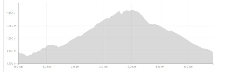
Incline4: Strava record 203 metres of elevation gain. The elevation profile:
Hike Duration5: It took me 1 hour 33 minutes to do the full 7km loop (with a brief stop at the rapids). It shouldn’t take longer than 2 hours unless you’re really mesmerised by the scenery and/or stop for lunch.
SILICA RAPIDS WALK MAP
The map above is the GPX file from the Strava recording overlaid on a topo map. But the track is really well marked (with sign posts and it’s mostly all gravel) so there’s no need for a map.
HOW TO GET TO THE TRAILHEAD
There are two entry points to the Silica Rapids walk. I would recommend using the bottom one as there’s no benefit to using the upper entrance.
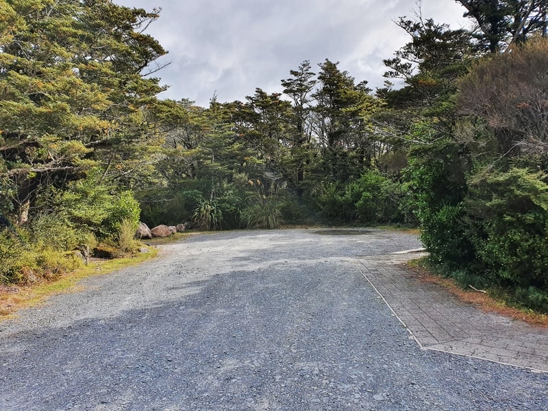
The bottom entry point is on the righthand side of SH48 about 250 metres above the visitor centre. It’s marked on Google Maps as the Whakapapa Nature Walk.
There’s a small car park there. But you can also park near the Chateau and walk up to the trailhead.
MY SILICA RAPIDS WALK EXPERIENCE
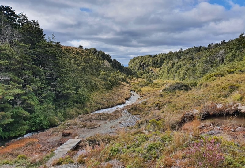
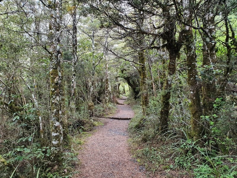
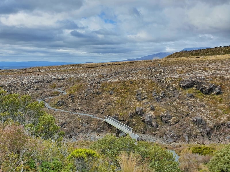
The Silica Rapids Walk begins by crossing a bridge then enters the bush. The bush is super nice as you follow the gravel track.
If it’s a hot day, this is a walk is a good choice as there’s a good chunk of it in the shade. The bush does have a cooling effect which is cool (well I felt cooler anyway).
Note: You’ll have seen at the trailhead lots of different options for walks. The trail is well signposted so you can’t really get lost on the way to the Silica Rapids.
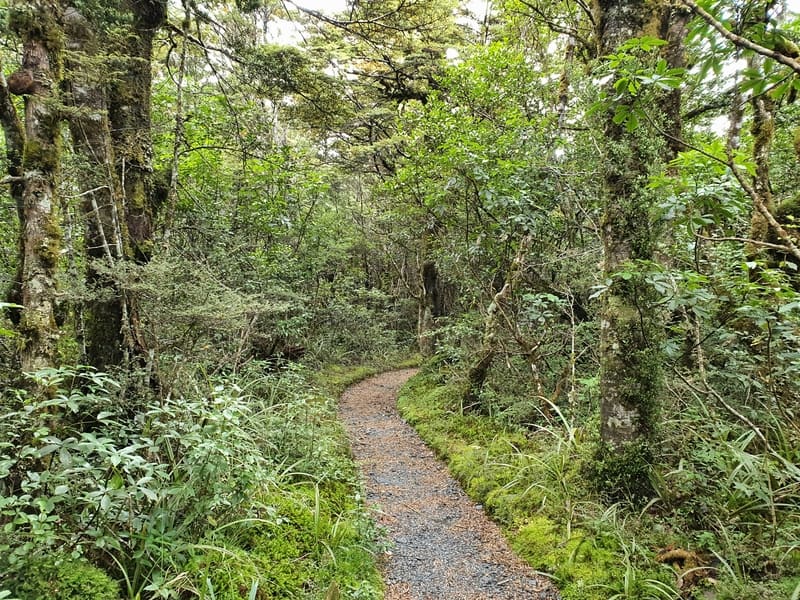
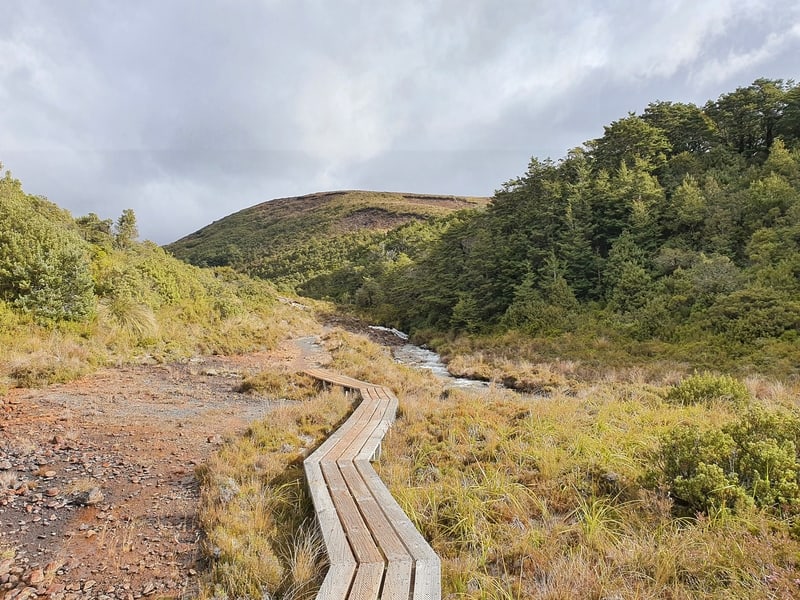
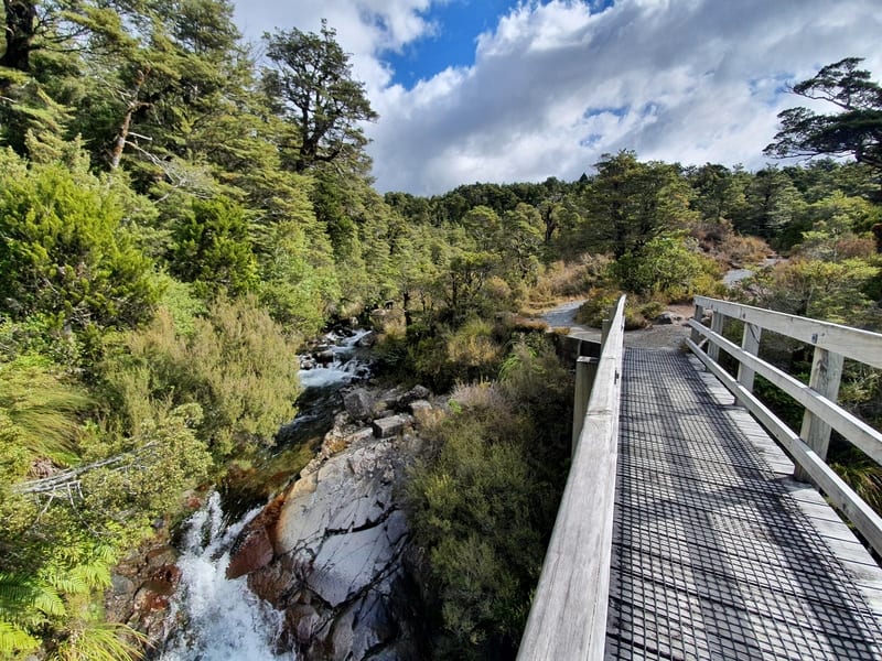
The variety on the walk is awesome as you come out of the bush a few times, crossing some boardwalks and streams on the way. There’s an incline the majority of the way, but it’s at an angle that won’t bother most.
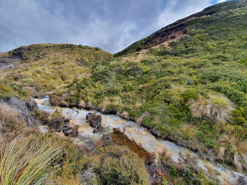
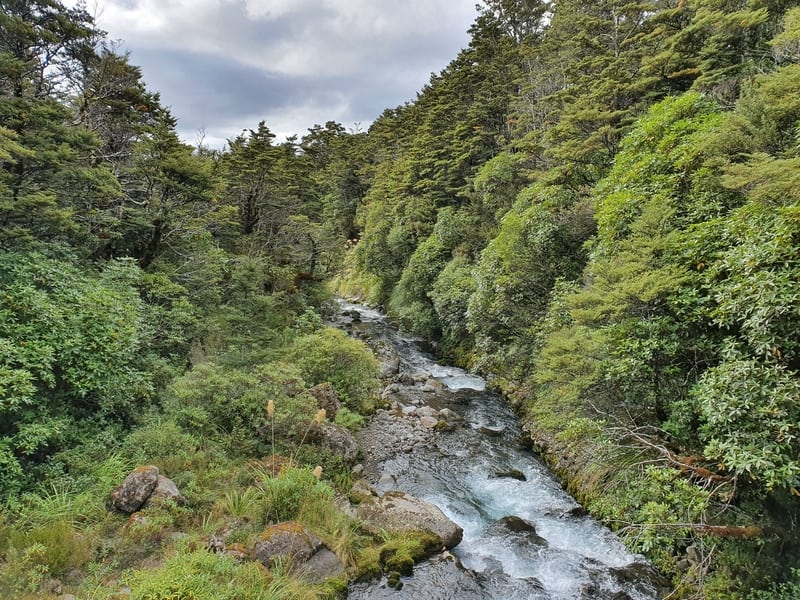
I also really liked the information boards along the route. You’ll see a stream following the track a lot of the time, and its colour looks gold-ish. They go into the reasons for this in detail on the sign. In short, it’s a combination of clay-based soil and iron minerals.
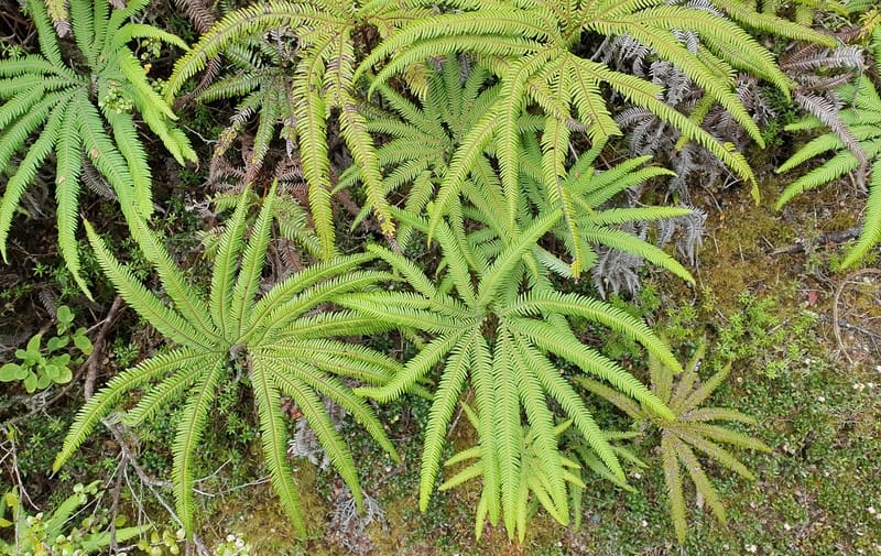
You’ll also learn about some of the birds you might see, the bogs, the plants, the rocks, and more. It’s all interesting and worth a stop to read. This also makes it a great walk for kids (thought you’ll want to keep them close).
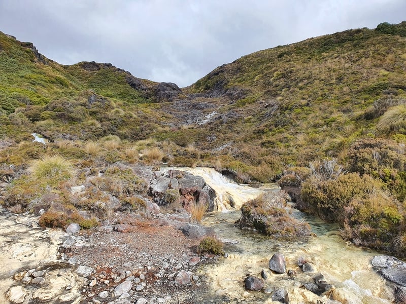
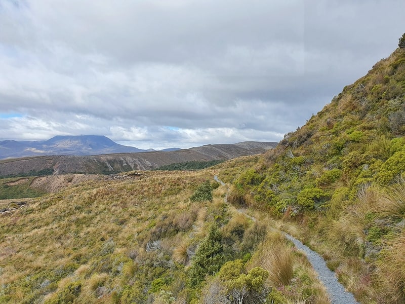
Once above the forest line and you’ll start to see the Silica Rapids which look like a totally different colour to the stream earlier. This is due to aluminum/silica in the rocks (there’s more on an information board).
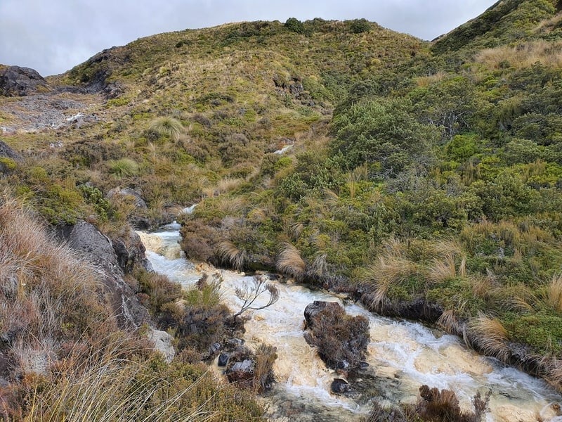
This is as you approach the 3km mark into the walk, and then you’ll get to a viewing platform that gives you a better vantage point. I love how one stream can have the silica effect, but the next doesn’t. Nature doing its thing!
Once you’ve done your thing at the viewing platform you can either return the way you’ve come (a good idea if you’re struggling with the heat) or continue on the loop.
Continuing on there’s a bit more incline but the views over the Tongariro National Park make up for this.
You’ll come to the point where there’s a short descent to a bridge and an ascent on the other side again. Once you get to the top of this section, that’s all the uphill walking completed and it’s time to descend to Bruce Road and follow that back to Whakapapa.
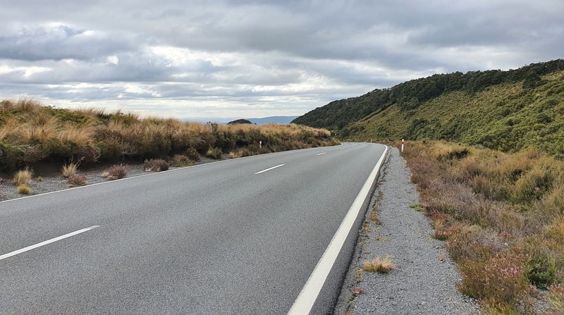
From the Silica Rapids to the road it’s less than 2km, and from there it’s a 2km walk down Bruce Road back to Whakapapa. It’s not a fun walk next to the road (be wary of the traffic) but it is what it is.
You can always do an out-and-back to the rapids as mentioned.
And there ya go, that’s the details of the Silica Rapids walk.
I’d love to hear your thoughts on the walk in the comments below (or email me jub@churnewzealand.com )
RECOMMENDED READING
The Tama Lakes Track
An amazing walk to see some Tama Lakes Track in Tongariro National Park
The Taranaki Falls Track
A similar walk to the Silica Rapids, but this takes you to a waterfall instead
The Tupapakurua Falls Track
A walk to an awesome waterfall you can start from National Park

Hey, it’s Jub here. I’m the guy behind Chur New Zealand, helping you have the best time hiking, trekking, walking…whatever you want to call it…in NZ. I’m based in Queenstown and am always out and about exploring trails, old & new. If you have any questions, reach out.