I like to think of the Mt Kaukau walk as the cool alternative to the Mount Victoria Lookout. With epic views and various tracks, you can definitely fill in a few hours here.
Read on for all the ins and outs of the Mount Kaukau walk.
Why is it the ‘cool’ alternative?

Because Mount Kaukau isn’t in the immediate area around Wellington CBD most tourists won’t go as they prefer to travel on the beaten path. So rather than tourists galore like you see at the Mount Vic lookout, you’ll see locals going about their daily routine up Mount Kaukau. And they don’t bring their oversized cameras.
That said Mount Kuakau is easy to access with a car or public transport.
TABLE OF CONTENTS
1. Details About The Mount Kaukau Walk
2. Mount Kaukau Walk Map
3. How To Get There
4. Mount Kaukau Trip Report
1. DETAILS ABOUT THE MOUNT KAUKAU WALK
How hard is the Mount Kaukau walk?Easy – medium. It’s easy given the short distance, but some of you might struggle with the incline a bit.
How long is the Mount Kaukau hike?
1.4 – 2.5km one-way depending on which entrance you take. If you follow the route I mention below, it’s a 3.2km walk, total, according to Maps.me.
What is the Mount Kaukau elevation gain?
It’s tough to find reliable sources, but from Simla Crescent to the summit is ~240 metres of elevation. And how high is Mount Kaukau? ~430 metres.
How long does it take to walk up Mt Kaukau?:
I haven’t recorded my time going up, but depending on what route you take for most people (I’ll say 90% of people) you’ll be at the summit (one-way) in 20-35 minutes. For the loop I talk about, give yourself 35-60 minutes of walking time.
Is Mount Kaukau worth it?
I don’t give too many hikes 5-stars on Chur New Zealand, but there’s no reason to fault the Mount Kaukau walk. The ease of access is good, the trails are maintained, there are various routes, and it joins up with other trails like the Northern Walkway and the Skyline Trail.
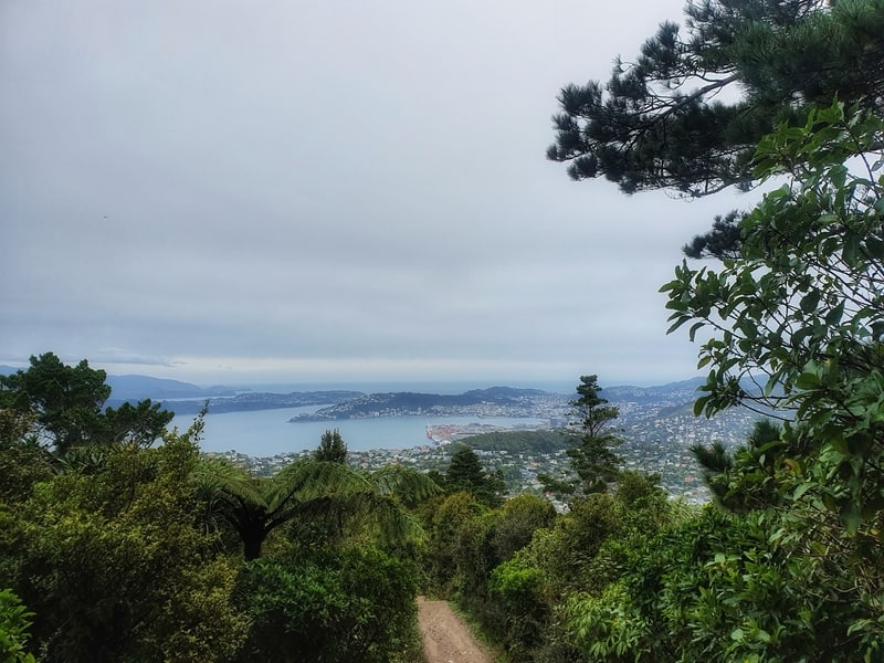
And the views are awesome, making it one of the best walks in Wellington.
2. MOUNT KAUKAU HIKE MAP
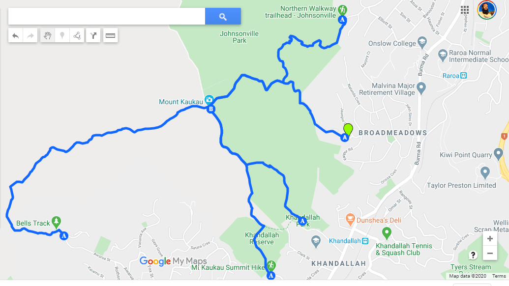
You can open up the different routes on Google Maps (like above) using this link.
But in short, once you’re on the trail, all paths lead to the summit so you don’t really need a map. If you’re clumsy, there are signs along the way. Coming back down, it’s a matter of starting off on the right route.
3. HOW TO GET TO MOUNT KAUKAU
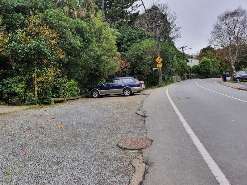
This is the carpark at the Simla Crescent trailhead
This is to get to the recommended entry at Simla Crescent.
DRIVING
Head to the Simla Crescent entrance where you’ll see some parking spots. If you’re going during the middle of the week you shouldn’t have any trouble find a park, but if it’s a nice weekend you might need to drive a bit further down the road. It’s free parking, so that’s ideal.
PUBLIC TRANSPORT
Catching the train from Wellington Station to Box Hill Station is super easy. You take the Johnsonville Line to Box Hill station which takes about 15 minutes (you pay cash onboard). When you get off at Box Hill, you just need to cross the tracks to Simla Crescent which leads you to the trailhead in under 5 minutes.
4. MY MT KAUKAU WALKING EXPERIENCE
The final stretch to the summit (coming from Simla Crescent)
I’ve walked and run up Mount Kaukau maybe a dozen times.
The reason I suggest the loop above (here it is again) is that it takes you up the steep route, which is in the shade and follows a more gradual easier track back down to the bottom in the sunshine.
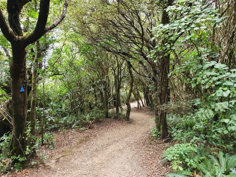
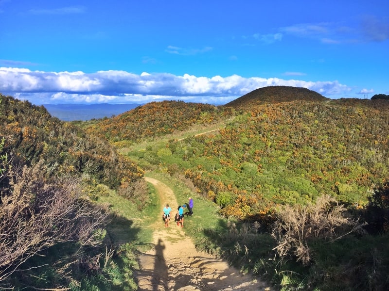
The gorgeous tracks to start with. I saw two kaka munching on some bark in May 2020 along here.
When you enter the forest the track starts its incline right away. It’s a single track trail most of the way, but it’s well-formed and the signs will point you in the right direction at frequent intervals. It’s not crazy steep but you’ll feel your legs burning.
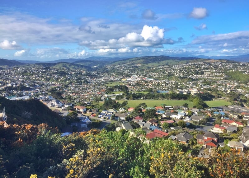
There’s not a whole lot to see on the way up until you emerge from the tree canopy and the summit comes into view. You’ll see the route to the top suddenly gets a whole lot steeper, which is a challenge on a hot sunny day. Slow and steady wins the race, and it’s only a couple of hundred metres.
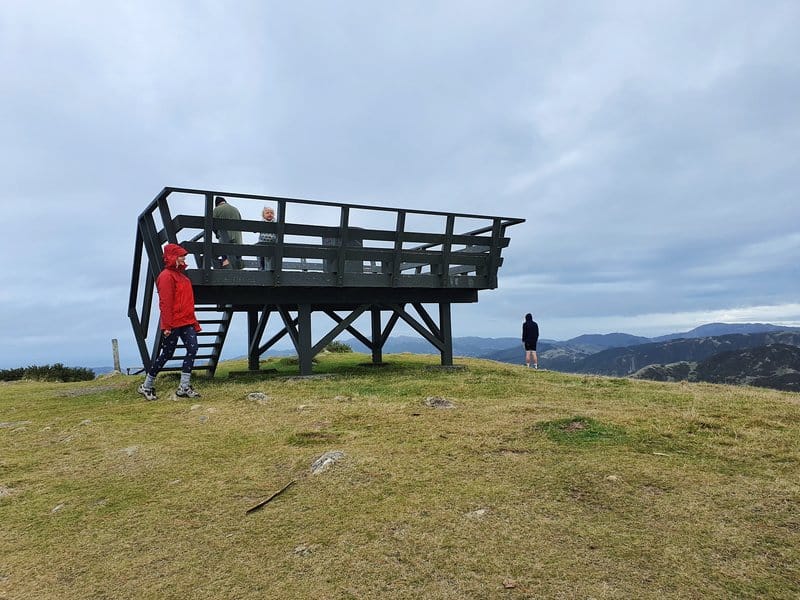
The Lookout
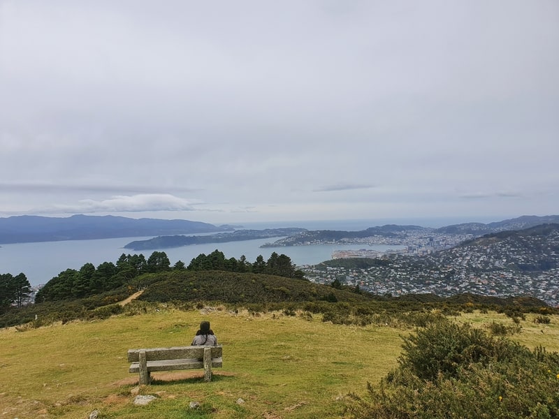
Summit views!
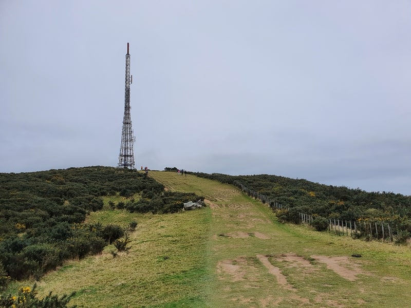
At the summit, there’s plenty of open space to do your thing (e.g. picnic). Of course, there’s the ever-present 122 metre tall TV tower, in addition to the lookout, and a map with a compass element to it which tells you what you’re looking at.
There’s nothing too fancy about the summit as it’s not a massive tourist destination, but that’s what makes it awesome. And you can smile away as you look back towards the city and Mount Victoria knowing you’re off the beaten path 😉
When it’s time to head back down, make sure you don’t go back down the steep section if you’re following the loop I recommend. of course, you can go explore the hills nearby if you like too.
Back down the hill
But for the loop, you want to head north, where you’ll see wide 4WD tracks (there might be a gate to go through) winding through the hills. There’s no canopy of trees on this section which isn’t the worst thing when you’re going downhill.
As you make your way down, the important point is to turn right before you reach the road so you can cut back across the forest to Simla Crescent. If you do reach the road it’s not the end of the world, just make your way back on the road. There’s plenty of signage (I don’t have photos, whoops) so you’ll be fine.
Given its location outside of the CBD, the Mount Kaukau Lookout is definitely not as popular as the Mount Victoria Lookout. But if you like to find the less mainstream viewpoints, this is the one you’re looking for! I haven’t been for sunset, but that’d be awesome I think.
If you’ve got any questions/comments, let me know in the comments below or email jub@churnewzealand.com
Chur,
Jub.
p.s. Here’s a map of all the hikes documented on Chur New Zealand. You can click the icon to see brief details, as well as a link to read more about the hike (like this post).

Hey, it’s Jub here. I’m the guy behind Chur New Zealand, helping you have the best time hiking, trekking, walking…whatever you want to call it…in NZ. I’m based in Queenstown and am always out and about exploring trails, old & new. If you have any questions, reach out.