The views from the top of Mount Victoria Lookout are amazing.
With such easy access from the CBD walking is the best way to get to the summit via the Mount Victoria Lookout walkway (which I’ll detail in this post). But you can drive or catch public transport if you’d prefer.
I’ll detail the drive and public transport options in the how to get there section. But, c’mon, it’s relatively short (yes, rather steep) walk and it’ll make you appreciate the view that little bit more.
And when you’re looking for things to do in Wellington, it won’t hurt the budget.
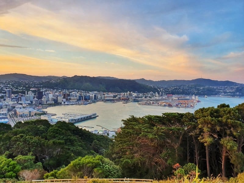
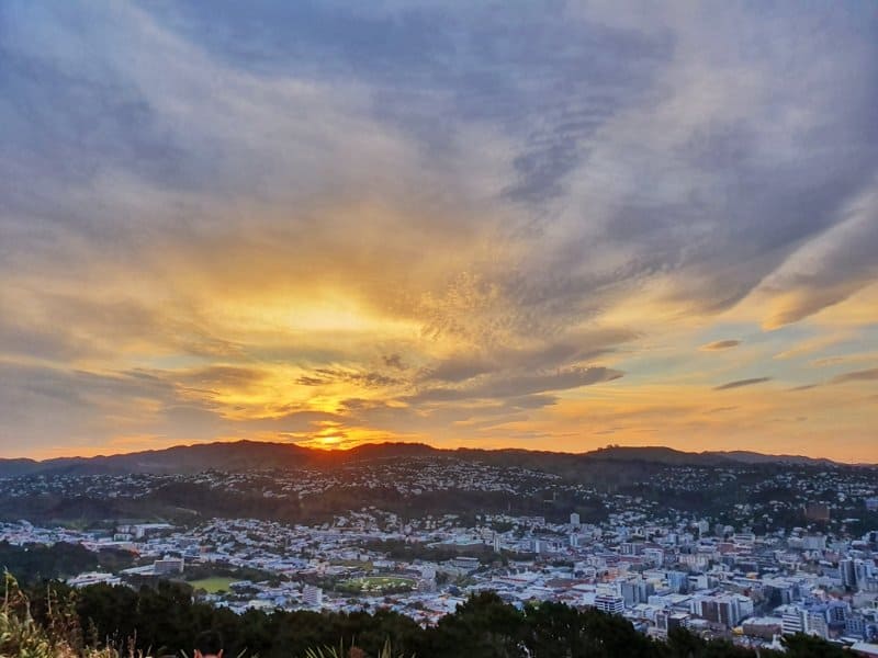
A view just before the sunset kicks in.
TABLE OF CONTENTS
1. Details & FAQ About The Mount Victoria Lookout Loop
2. Mt Victoria Walk Map
3. How To Get To Mount Victoria Lookout Trailhead
4. My Experience Walking Up Mount Victoria
1. DETAILS & FAQ ABOUT THE MOUNT VICTORIA LOOKOUT LOOP
Considering you can be in downtown Wellington having a beer, and then in less than 30 minutes, you’re above the city taking in all of the views (preferably during sunset) the Mt Victoria walk is awesome.
Every city would be jealous of Wellington’s town belt, but Mount Vic takes the spotlight making it one of the best easy access walks in Wellington.
Although I’m sure there’s a legit reason for the road, the car parks are a little bit excessive for me and dampen the purity that the place could be.
How long is the Mount Vic Walk?
The one I’ll discuss below is an ~3.65km loop. There’s lots of trails on Mt Vic so you can make it longer if you like, and even jump onto the Southern Walkway after the summit.
How hard is the walk to the top of Mount Vic?
Easy to medium. It’s not a long walk, but there’s some steeper sections to keep you honest. The terrain is good throughout.
What’s the elevation gain like?
The summit of Mount Victoria is 196 metres above sea level, with the total elevation of the Mount Victoria walkway loop coming in at 183 metres on Strava. This is about right, as you do start slightly above sea level.
How long does it take to walk up and down Mount Victoria?
If you were going up and down with no fluffing about and are fit, you can do it in less than one hour, but you’ll want to spend at least 5-10 minutes at the top (unless you’re there for sunset, in which case you could be there for ages…it’s beautiful).
So for 90% of people, you’ll be able to leave the intersection of Majoribanks Street and Kent Terrace, reach the summit, and be back at your starting point in 75 – 115 minutes.
Can you drive up Mt Victoria?
Yes, there’s a road that takes you to the car park next to the summit. Simply enter Mount Victoria Lookout into Google Maps and you’ll be guided there.
What is Mount Victoria in Maori?
Tangi Te Keo. Sometimes you’ll hear Matairangi being used as well.
Tangi Te Keo is based on a Maori legend involving two taniwha. They tried to get escape Wellington Harbour (which was a lake at the time). One died after stranding and the taniwha’s spirit became a bird, Te Keo. Te Keo flew to the top of the hill to mourn (which is a tangi in the Maori culture).
How high is Mt Victoria Wellington Lookout?
The summit is 196 metres above sea level.
Are dogs along on Mount Victoria Wellington?
Yes, but they must be kept on leads. There are a couple of dog exercise areas (signposted) where dogs can be off leash.
2. MT VICTORIA LOOKOUT WALK MAP
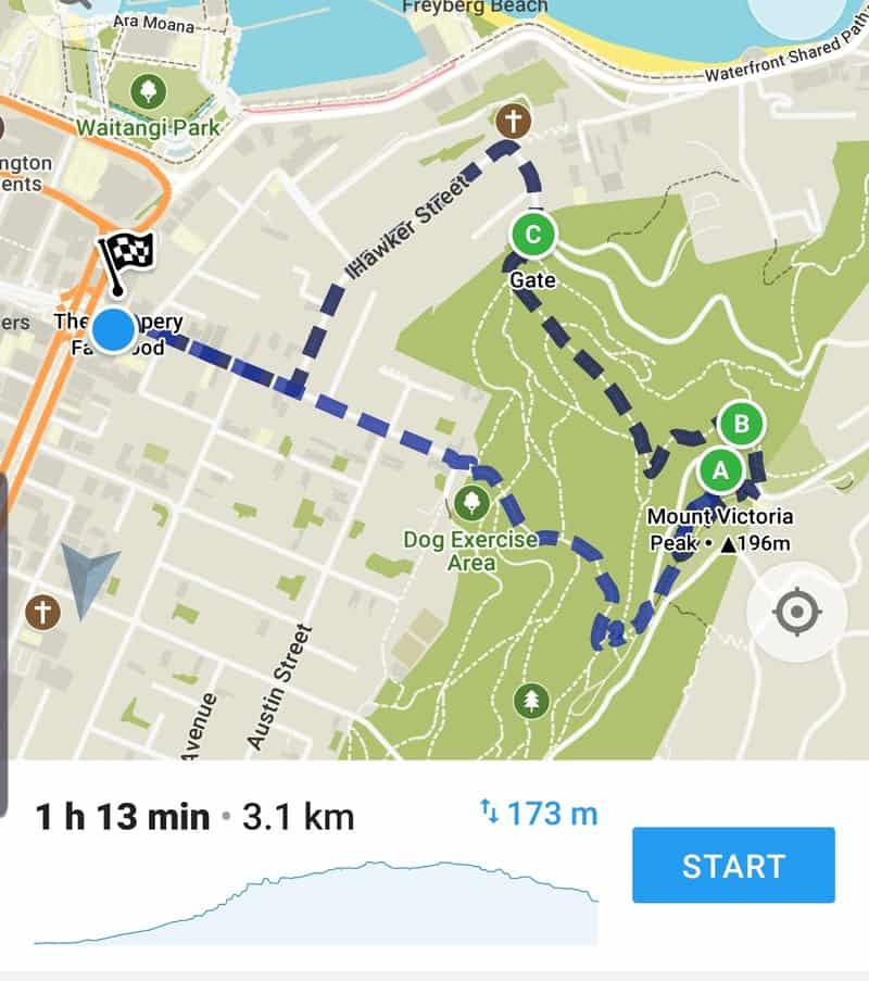
You don’t need a map to get up the hill once you reach the bottom of the hill as there are lots of trails, all clearly marking the way to the summit.
But, the is route above is what I’ll use for the trip report as seen on Maps.me. The signs you need to follow are the purple lookout ones, there are heaps.
3. HOW TO GET TO MOUNT VICTORIA LOOKOUT TRAILHEAD
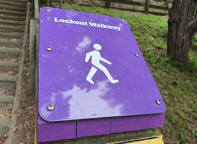
These are what you’re following.
In this post, I’m going to be mentioning ‘there’ as the summit of Mount Victoria because you can get there multiple ways.
Walk: There’s a whole heap of trails that lead to the summit. But the trip report below will be starting and returning from the intersection next to the Embassy Theatre on the corner of Kent Terrace and Majoribanks Street.
Bus: The number 20 bus departs from Courtney Place stop C, and makes its way to the top of Mount Victoria in about 10 minutes (you could walk down).
You can check the timetable here and it’ll cost you $4 for an adult and $2 for a child (you’ll need cash). It’s cheaper if you have a Snapper card.
Car: There are two car parking areas (this is the Google Maps link) at the top of Mount Victoria, but you might strike out with parking spaces if it’s a glorious weather day in the middle of summer and everyone wants the view.
4. MY EXPERIENCE WALKING UP MOUNT VICTORIA
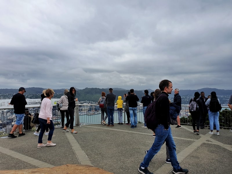
Sometimes you’ll have lots of friends at the lookout…
Every time I walk up to the Mount Vic summit I feel like I’m taking a different route. In reality, I usually take the route I talk about below as it’s the most official route and gets a good bit of everything (views and it’s not crazy steep) without taking you forever to get there.
One thing I’ll mention is that some of the Mount Vic tracks are used for mountain biking (there are designated tracks). So while you shouldn’t have any close calls with bikes flying at you, it’s something to keep in mind.
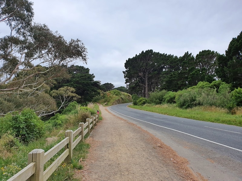
Looking up Majoribanks Street where you start the walk.
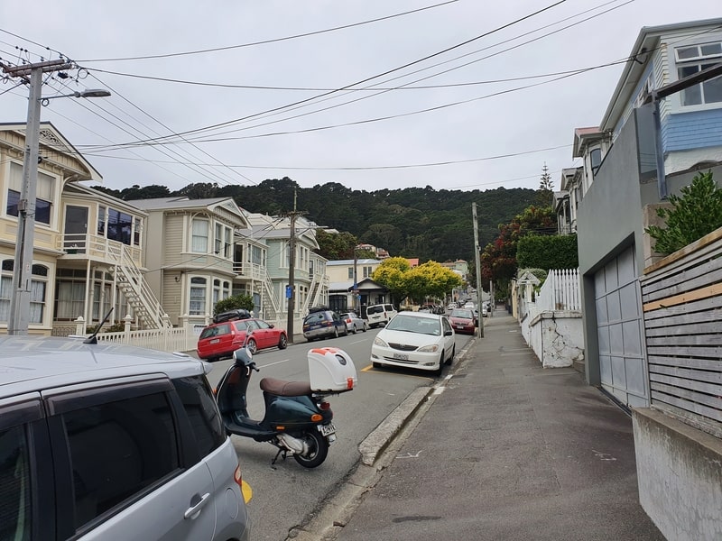
My most recent walk up Mount Victoria was with the purpose of documenting the trip report here. I started from the intersection of Kent Terrace and Majoribanks Street which is at the bottom of Courtney Place, and is where the Embassy Theatre is too.
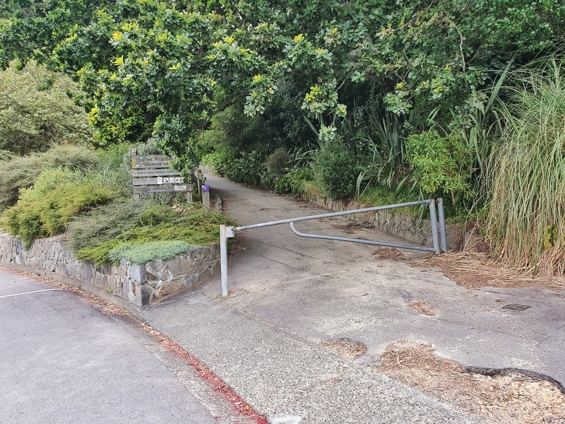
The start is simple, walk up towards Mount Victoria following Majoribanks Street. When you get to the end of the straight, you’ll see a large wooden sign mentioning the Mount Victoria Lookout and the purple walkway signs begin here.
Up the stairs and you’ll see a field where locals like to hang out, often having a picnic or throwing the frisbee around (on a rare not so windy day). You’ll want to look left when you reach the field, and you’ll see the purple markers again leading you up the hill.
A view early on in your walk.
Up, up, up, up.
Up, up, up, up.
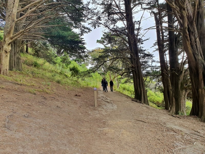
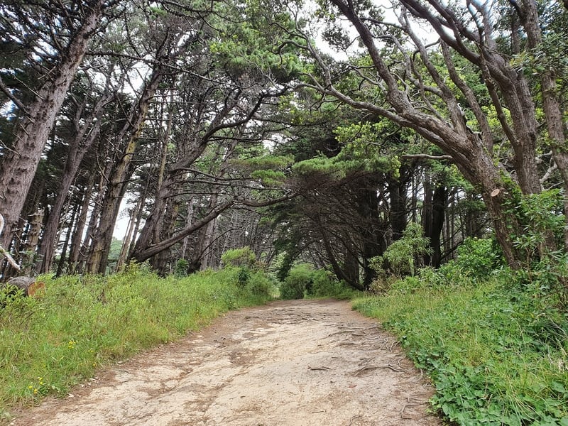
You’ll be under the cover of the trees most of the way until you reach the summit now. The descent isn’t overly crazy, but you’ll soon recognize how fit/unfit you are. The track is mostly just packed dirt (with some gravel) with the track easy to follow given the foot traffic. You get a couple of quick views looking out over the city, but the best is definitely when you reach the summit.
If you’re daydreaming you could well end up following the wrong track, so do just keep an eye on the frequent purple markers!
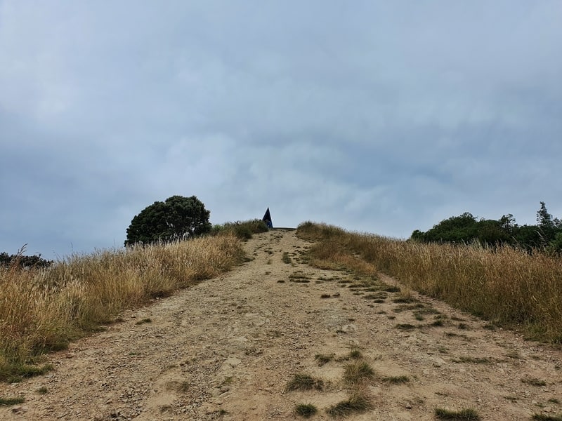
When you reach this point, you’ve conquered the majority of the elevation.
You’ll know when you’re nearly at the top when you pop out close to Alexandra Rd. You’ll be huffing and puffing (well, most of you will be), and the tree cover is no longer.
The second to final push to the summit!
This part is niggly as you can almost see the top, but I always know there’s a couple of climbs left (but at least you’ve got some flat terrain).
When you get close to the top you’ll start to see some information boards letting you know about the area, which you should read as it helps you understand a bit about what you’re looking at.
Winning
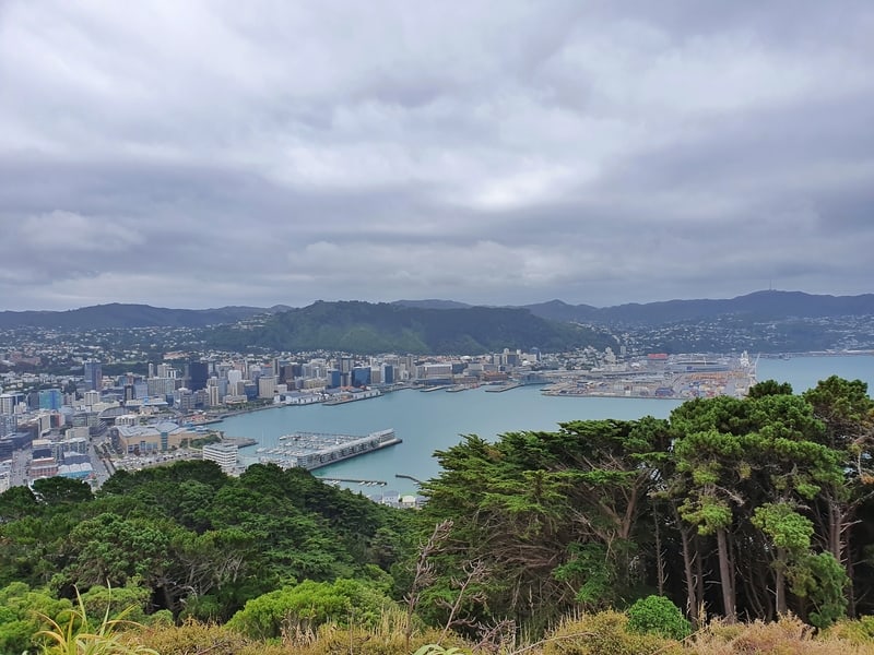
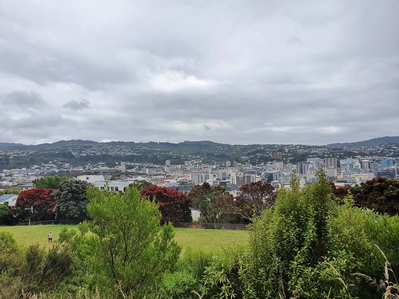
The view looking towards the harbour when you make it!
It doesn’t take a rocket scientist to know when you’re at the summit with the large concrete pad making it obvious. There’s likely to be others at the top with you, but with 360-degree views of the city including the CBD, harbour, airport, Mount Kaukau, Matiu Somes Island, the Basin Reserve, and Tinakori Hill you’ll find some space to take in the views.
As I mentioned earlier, you could spend as little as a few minutes at the summit, or 30 minutes if you’re hanging for the sunset (that’s a tricky walk back in the dark), but whenever you’re ready, it’s time to finish the loop back to Majoribanks Street.
The exit onto Moeller Street.
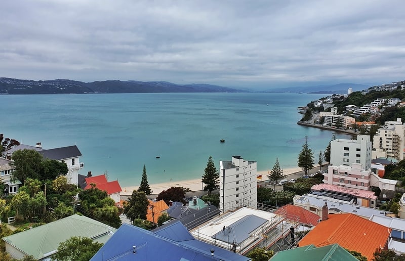
A nice view of Oriental Bay from Moeller Street.
To get back on to the trail, you’ll want to follow the road (in the direction going towards the harbour) for about 100 metres or so until you see the purple signs again. Then it’s a matter of following these back down the hill.
It’s quite steep in a couple of sections coming down, but before you know it you’ll be on Moeller Street which you continue walking down the hill (I always love the view of Oriental Bay along here…one day I’ll own a holiday house here…).
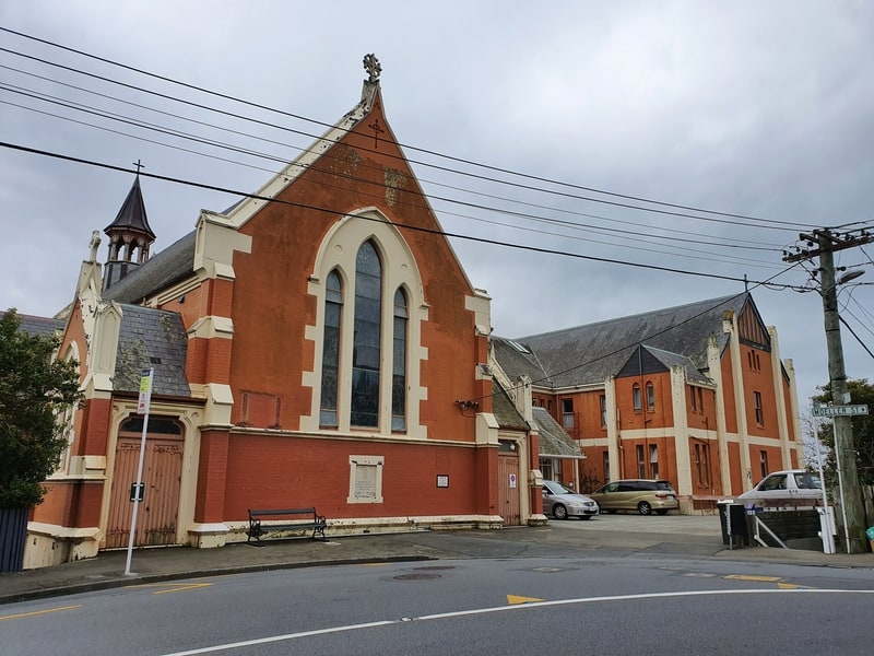
The monastery you’ll see on the way down.
You’ll see Saint Gerard’s Monastery which you might want to look around, before following the road until reach Majoribanks Street again and your Mount Victoria Lookout loop walk is complete!
If you’ve got a can’t beat Wellington on a good day type weather, then you’ve got to walk up Mount Victoria. It’s totally worth it.
The same if it’s a cloudy day and you’re looking for something to do, the views are still pretty sweet over the city. But if it’s wet and windy, well you’ll probably be giving it a miss. Oh, and try and make it for sunset if you can.
The best time to visit the Mount Victoria Lookout is in the morning if you’re after the best lighting (for photos) of the city and the Harbour, but I prefer the sunset which means you’ll be facing towards the sun (more or less) when looking towards the city.
If you have any questions about the Mt Victoria walk, email me jub@churnewzealand.com or leave a comment below.
Chur.
p.s. you can find all the hikes I’ve documented in this map (clicking on the icons will provide more info):

Hey, it’s Jub here. I’m the guy behind Chur New Zealand, helping you have the best time hiking, trekking, walking…whatever you want to call it…in NZ. I’m based in Queenstown and am always out and about exploring trails, old & new. If you have any questions, reach out.