Skyline Walkway Wellington is an end to end track that’s less than 15km long. You’ll get some epic views, including some of the CBD, yet you feel like you’re hours away from the city.
This post will give you everything you need to know about Wellington’s Skyline Walkway.
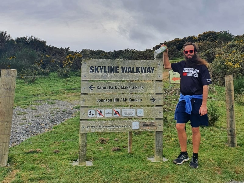
The usual photo with me included so you can trust I’ve actually done the walk.
TABLE OF CONTENTS
1. Skyline Walkway Wellington Details
2. Wellington Skyline Walkway Map
3. How To Get There
4. My Wellington Skyline Walkway Trip Report
1. SKYLINE WALKWAY WELLINGTON DETAILS
The Skyline Walkway is totally different to similar length walks in Wellington like the Northern Walkway and City to Sea Walkway. You’re not going through residential areas that link up the green spaces. Once you’re on the Skyline Walkway tracks, you’re on the dirt tracks for the entire walk.
I always love walking up Mount Kaukau, so this walk was always going to get brownie points from the outset (I started from the Mount Kaukau end). Then heading south, you’re suddenly in a landscape that feels like it should be on a rugged coastline, yet isn’t anywhere near the sea. It’s not until the Karori end of the walk do you start to feel like you’re near civilisation as you skirt around the suburb.
The track is in good condition throughout, and the track markers are regular so you shouldn’t get lost.
It’s a great walk, but I think it’s just missing something. I can’t put my finger on it…but there’s no oomph to it, so I’ll give it a 4/5 star rating.
This is what the markers look like, there’s a lot.
How long is the Wellington Skyline Walkway?
The Wellington Government websites states that it’s 13.4km from end to end. This seems about right based on my Strava data (12.2km from Simla Crescent).
How hard is the Skyline Walkway?
Easy-medium.
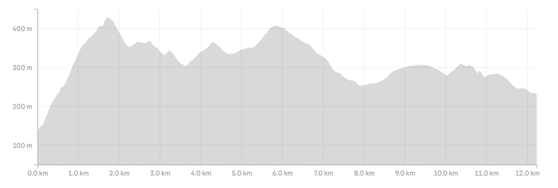
What’s the elevation gain and does the profile look like?
My Strava data has 549 metres of elevation. Given we started at Simla Crescent, I estimate the elevation from the Carmichael Street trailhead to be about 480 metres.
Here’s the elevation profile:
How long does it take to hike the Wellington Skyline Walkway?
We took 2 hours and 46 minutes. The signs say the walk may take up to 6 hours. This is pretty crazy for a 13.4km hike, but if you were to dawdle then you might be able to get that with an inclusion of a picnic and admiring all the viewpoints. I’d allocate 3 to 4 hours for most.
Are there toilets along the way??
There are no toilets along the trail, and minimal good nature spots in the middle portion of the trail. Keep this in mind before you start 🙂
2. SKYLINE WALKWAY WELLINGTON MAP
The Skyline Walkway map is on both Google Maps and Maps.me. Yay!
Annoyingly, when I embed the map it doesn’t show the correct route, so you’ll need to click this link, it’ll open in a new tab. The 13.2km it lists is pretty close to the official 13.4km on the council website.
3. HOW TO GET THERE
As an end-to-end walk, one that you’ll most likely only want to walk in one direction, you’ll need to plan this out a little.
DRIVING
Unless you’re planning to do a key swap (or doing the return walk), you’ll be better off catching public transport. With that said, parking is available close to both trailheads (free).
To reach both trailheads is about a 15-20 minute drive from Cuba Street, Wellington.
PUBLIC TRANSPORT
I think this is a great option, as both trailheads have public transport getting you close to the trailheads. I prefer catching the bus to the Old Coach Road trailhead to start the walk.
To the Old Coach Road trailhead
From Wellington Station you can catch either the JVL train or the #1 bus. The bus will drop you off less than 500 metres from the trailhead, so while it’s slightly less comfortable than the train it gets you to the trailhead faster. This bus also runs straight through the CBD, making it even more convenient.
To the Karori End trailhead
To get to this end, you’ll need to walk a few minutes from the station to this bus stop (here) where you catch the #2 bus to the terminal stop. From here, you’ve got a 1.2km walk uphill to the trailhead. That 1.2km is quite steep so that’s why I recommend the other option.
4. MY SKYLINE WALKWAY EXPERIENCE
When I messaged my buddy to plan our Skyline Walkway meeting point, we decided it was easiest if we met at the Simla Crescent entrance to Mount Kaukau. This meant we wouldn’t be on the trail for the first couple of kilometres, but given we’d both walked that section before we weren’t fussed.
It doesn’t matter which path you take up Mt Kaukau, it’ll get your heart rate going and they’re all enjoyable.
We got off to a steady start, and given it was a long weekend there were plenty of people walking up Kaukau. Once you reach the summit, you get epic 360 views. We didn’t spend more than a minute taking them all in. We’ve been here plenty of times and wanted to keep moving.
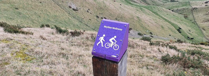
Just behind the lookout you’ll see a large wooden sign with the directions of the various walks and we found our first purple marker with Skyline Walkway written on it.
Hey there good lookin’
These purple markers are seen throughout. If there’s any point where you aren’t 100% sure where you’re going just look for a purple marker in the distance.
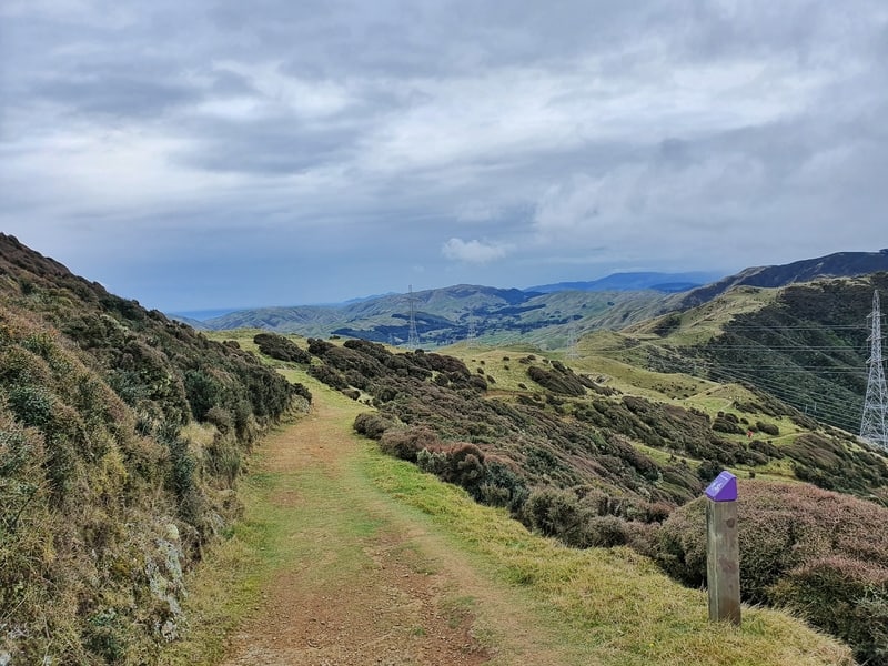
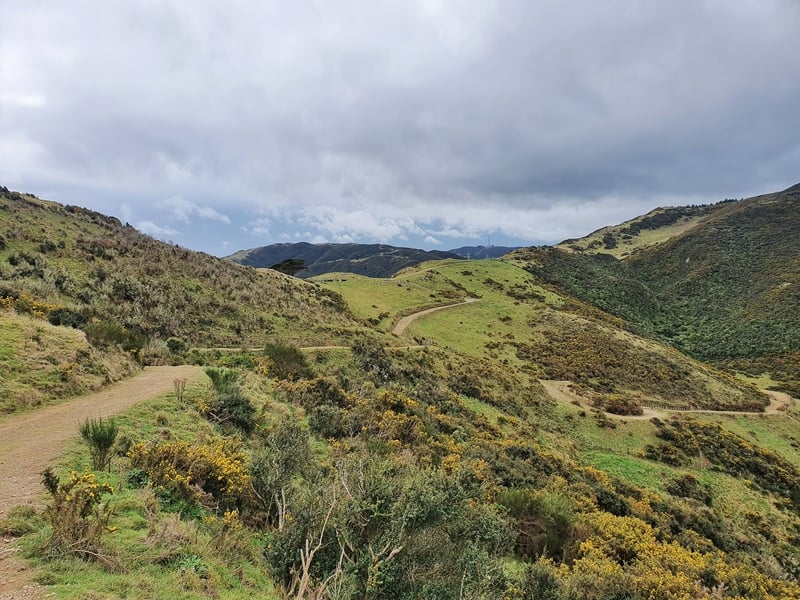
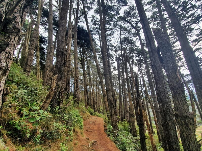
As soon as we were on the other side of the summit, the number of people tailed off. The track is well worn and did find it a little slippery early on the first short descent. The landscape had changed from our climb up the hill through the trees, to an open, farm like terrain with shrubs and gorse smothering some of the hills.
The bonus is that you’ve almost always got a good view on this track:
- Wellington Harbour and the CBD on your left
- Makara Windfarm and the South Island on your right
It’s pretty awesome.
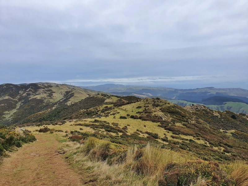
There’s rarely a flat section on this hike, but the good news is that Mount Kaukau is the highpoint of the hike so we’d done the hard part. From here it’s gentle undulations across the farmland…we did veer off the trail when we saw some cows standing on the track (one had a nice set of horns).
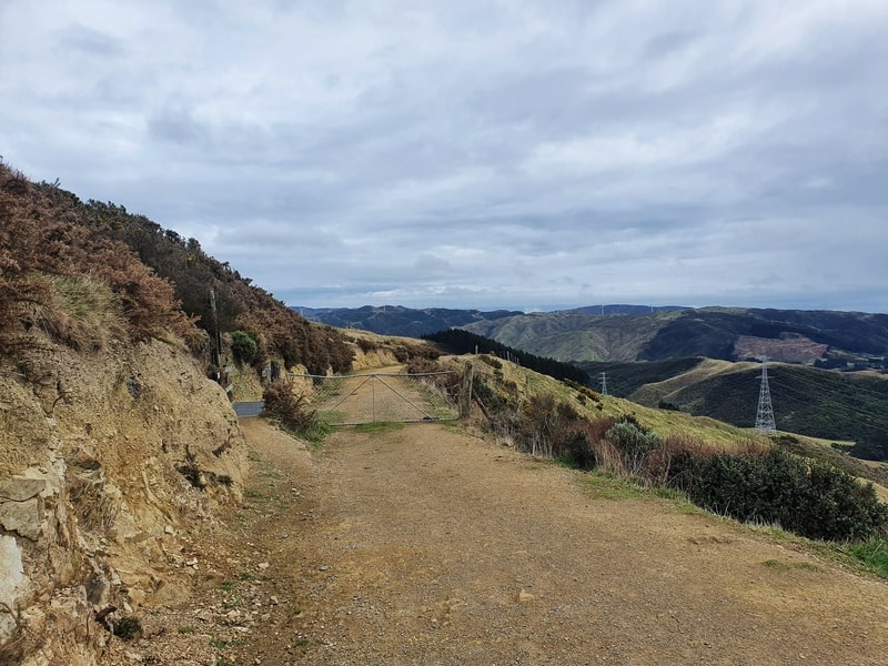
There’s a short section where you go through a cluster of trees before you roll back open farmland like scenery. This walk is a lot tougher when there’s some wind about. If you wanted, you could cut the walk short and turn off down to Crofton Downs at around the halfway point.
While I think you should do the whole trail, it’s nice to know you can jump off the trail and catch public transport from Crofton Downs to wherever you need to go.
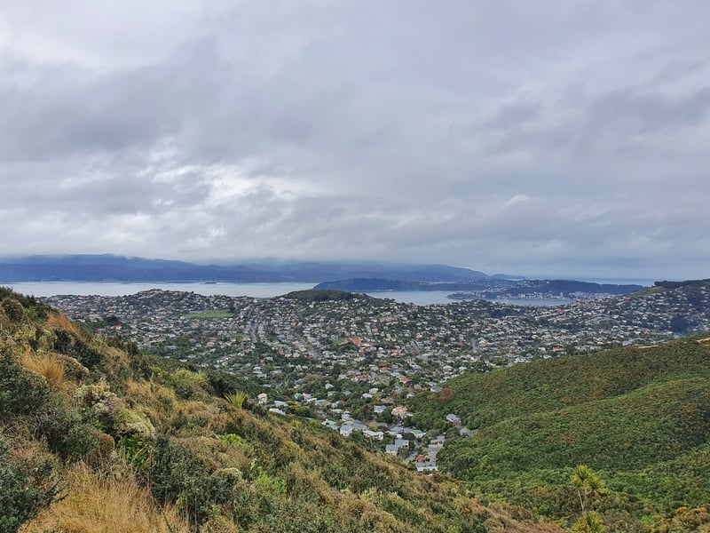
Once the houses of Karori come into view, you’ve still got a few kilometres along the outskirts of the suburb. Again, there’s a couple of points where you could turn off but I do suggest walking the whole way as that’ll mean you can walk through this cool terrain:
After close to three hours, we ended up at the end of the walk. We’d stopped to take plenty of photos but weren’t mucking around. This is definitely on the faster time.
Having experienced the walk down to the buses and Karori Park afterward, that hill to get to the start of the trailhead makes Kaukau the best end to start with.
Like many walks in Wellington, I’d put this in the awesome category, but it’s not something you should feel like you 100% have to put on your list of Wellington activities. Especially if you’re only in town for a few days.
If you’ve got any questions or comments, leave them below or email jub@churnewzealand.com.
p.s. Here’s a map of all the hikes documented on Chur New Zealand. You can click the icon to see brief details, as well as a link to read more about the hike (like this post).

Hey, it’s Jub here. I’m the guy behind Chur New Zealand, helping you have the best time hiking, trekking, walking…whatever you want to call it…in NZ. I’m based in Queenstown and am always out and about exploring trails, old & new. If you have any questions, reach out.
I think that you have got Churton Park mixed up with Chartwell. Churton Park is north of Johnsonville. Chartwell is about the mid point between the start of the Skyline walkway in Johnsonville and the Makrar Saddle in Karori.
Hey Russell,
Nice pick up! I’ve gotten it confused with Crofton Downs. Thanks for that.