The Big Hill Track in Arrowtown is a great ~15.5km day hike with some amazing views.
The best part is you can combine Big Hill with other trails to make the hike longer if you like.
This post will give you all the details you need to have a great day exploring Arrowtown’s Big Hill Track.
TABLE OF CONTENTS
1. Details About The Big Hill Track In Arrowtown
2. Big Hill Track Arrowtown Map
3. How To Get To The Trailhead
4. My Big Hill Experience
1. DETAILS ABOUT THE BIG HILL TRACK IN ARROTOWN
Difficulty1: Medium. There’s a little bit of navigation to take on…i.e. follow the signs. But the trail itself, while narrow at times is well maintained for a ‘route’…most of the time. The elevation will keep you honest but isn’t anything like hiking up the Ben Lomond track, but you’ll want to make sure you take plenty of water on a warm day.
Hike Distance2: If you’re walking from Arrowtown to Big Hill return on the most direct route, it’s about 15.5km in total. But the way the walking trails in Arrowtown are set up, you can create different loops and routes to create a longer hike if you want.
Incline3: On the way up the Big Hill Track, there’s about 750-800 metres of elevation (over 7.7km). On the return there’s only a few short hills, so we’ll go with around 800 metres of total elevation gain.
How long does it take to walk the Big Hill Track Arrowtown?
This can vary a lot. Some people will be able to power up the hill in 2 hours and get back in less than 4 hours total. But the majority of people are going to spend 5 – 7 hours hiking the trail. Of course, you can in detours at various points.
2. BIG HILL TRACK ARROWTOWN MAP
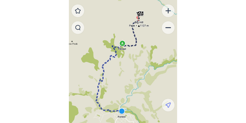
You can’t find the Big Hill Trail map on Google Maps, but you can see the route on Maps.me which is where the screenshot above is taken from.
You can see the tracks on TopoMap.co.nz as well, with Big Hill here. But there’s no need for a topo map on this hike…unless you start combining other trails.
3. HOW TO GET TO THE TRAILHEAD
There’s no specific trailhead for this route as such, but this car park in Arrowtown is the general starting point I reference to friends who want to walk Big Hill.
Once you’re at the car park, walk along the stream (head west/towards Queenstown) and you’ll see the small bridge to cross over the stream to get the hike really underway.
Arrowtown is easy to get to from Queenstown and other areas nearby. You can read about how to get from Queenstown to Arrowtown here.
4. MY BIG HILL EXPERIENCE
I’d explored the vast majority of the Arrowtown Trail Network before taking the journey up to Big Hill.
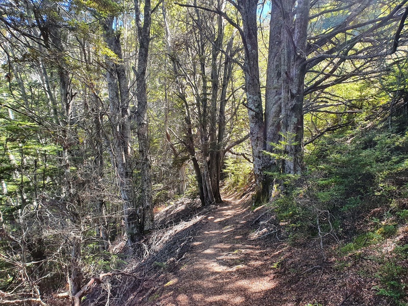
After crossing the stream, follow the 4WD to the left (west) for a few hundred metres before you enter the forest on some lovely single track. The first section of the hike isn’t steep, so enjoy it while it lasts. Once you get to the second bridge (make sure you don’t turn off to Bush Creek) the climbing begins. It doesn’t take long before you emerge above the trees with some steep pinches ready to take your breathe away.
The trail starts to flatten off after 3km or so, this is Eichart’s Flat and where you’ll see the trail split off. THere’s also a big information board with the trail map on it, it’s worth a little read to make sure you don’t end up on the Sawpit Gully Track (a friend may or may not have done this :p ).
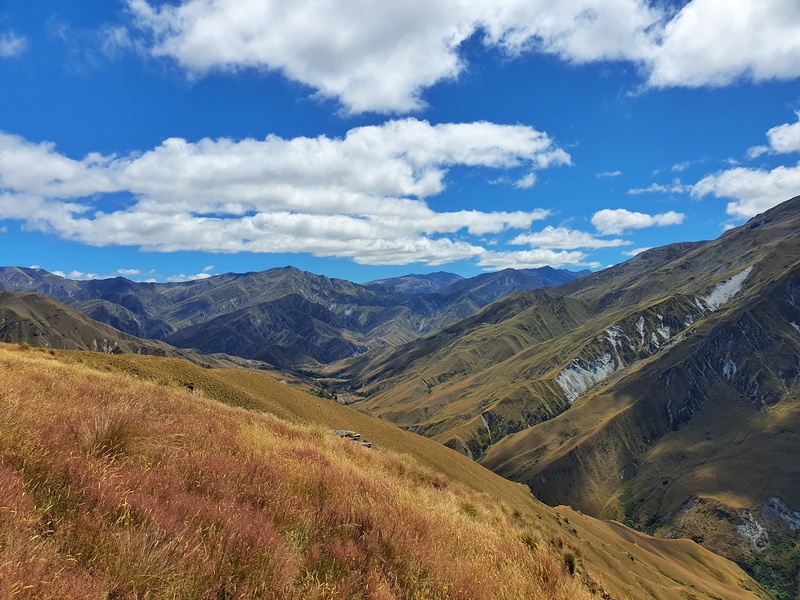
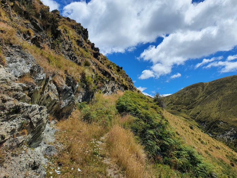
You’ll ee the track you’re taking cut into the hill. This was the primary route taken to reach Macetown up until 1884 when Macetown Road was constructed. Fun fact 🙂
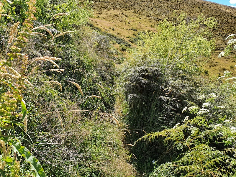
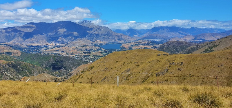
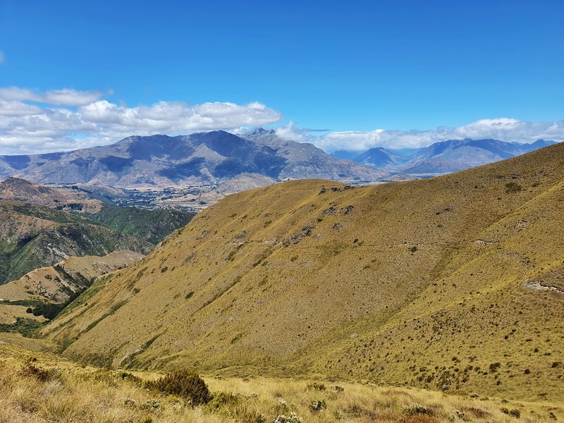
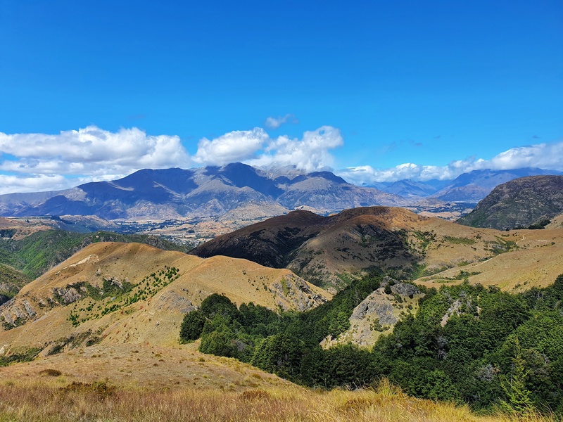
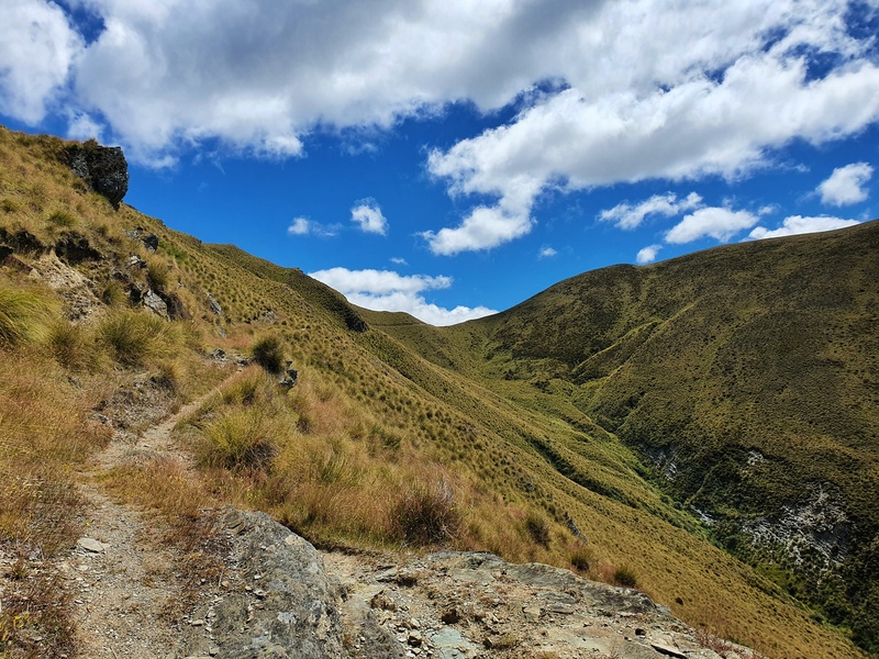
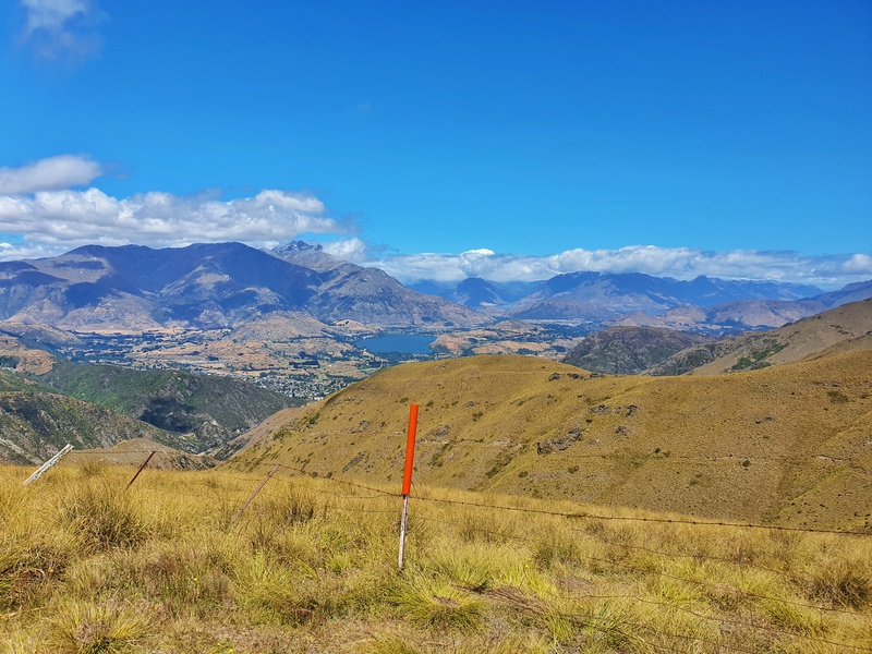
From here you start to get some sweet views over the Basin, Lake Hayes and surrounding mountains. There are a couple of sections where the track is usually overgrown, but it’s nothing complicated.
Aftre 4.5km or so you’ll enter the trees again which can be a nice break from the heat. But the climb does continue! 1.5km later you emerge from the bush for the last 1.7km or so to the summit.
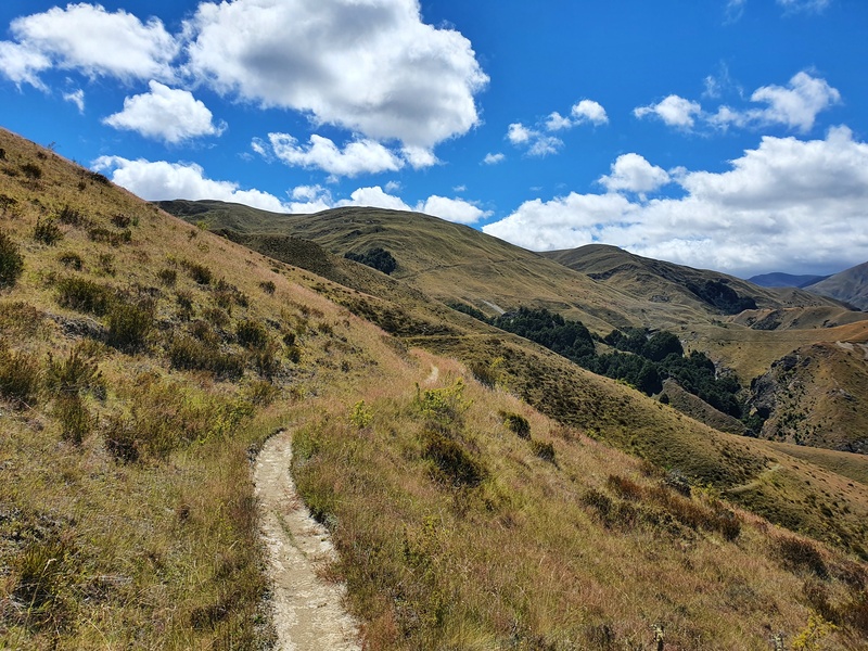
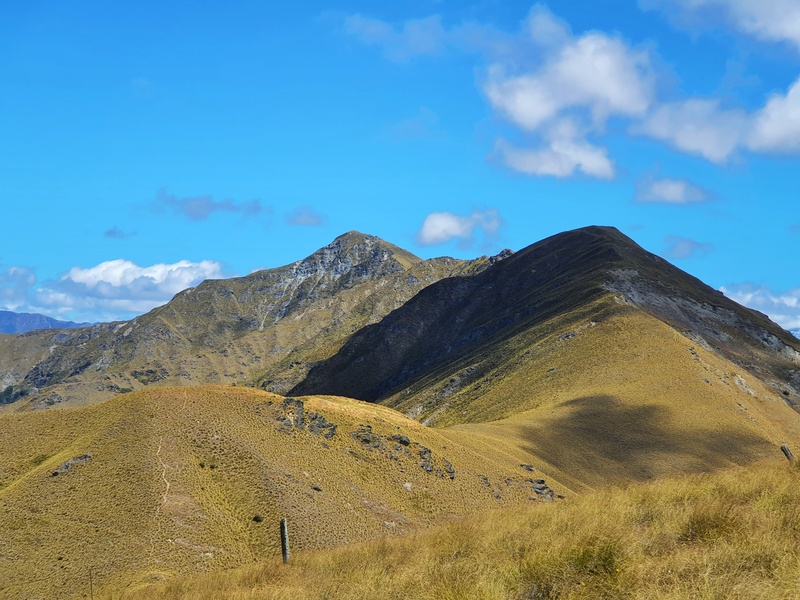
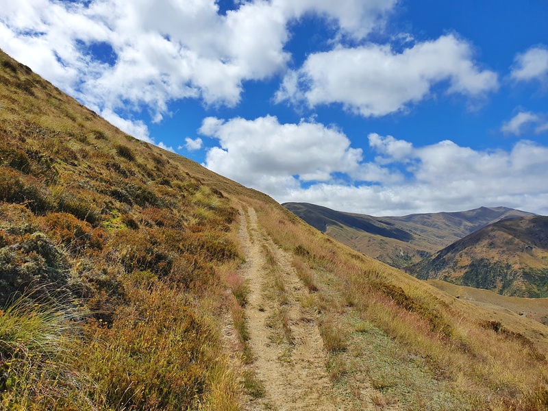
This is a nifty section of trail and you can start to work out which one is Big Hill…it took me a while!
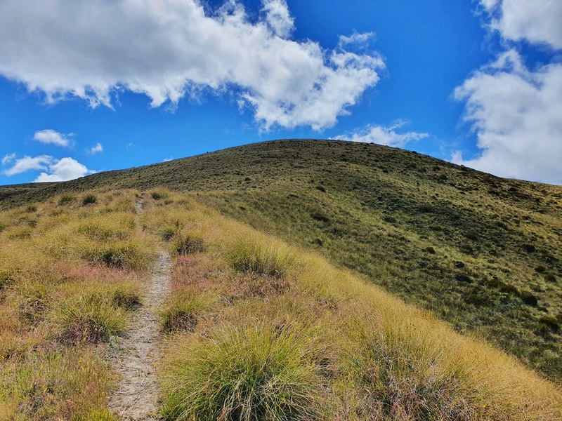
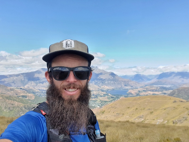
Eventually, you’ll come to another junction. We turn right, following the poled route all the way to the top of Big Hill. It’s a good grunt to finish (photo above)!
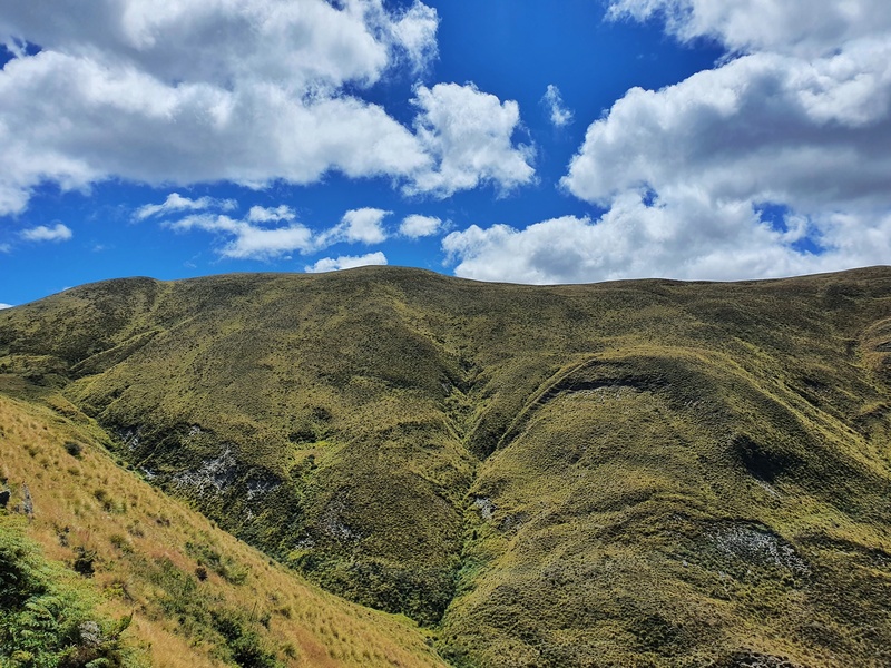
When I’ve been up there, I was always confused exactly where the Big Hill summit is as it’s a rather flat top hill instead of a genuine peak like many of the walks in Otago. Once you cross the fence at the top I feel like you can say you made it to the summit!
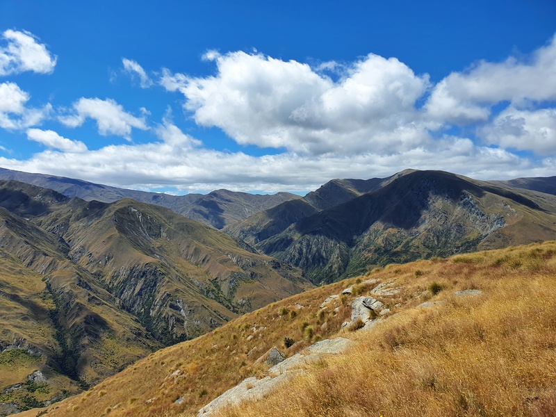
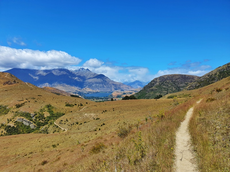
At the summit there are views galore. One benefit of the hill being reasonably flat is you can walk around and get a glimpse of the different drops offs. Although this isn’t great for those who love a dramatic panoramic shot.
Once you’re finished at the summit you can head back the way you came or you could head up the ridgeline towards Brow Peak (photo below) or follow the poled route to Macetown (which continues onto the Motatapu Track). The worlds your oyster from the Big Hill Track :p
I hope that’s given you a bit more of an idea of what to expect when you hike Arrowtowns Big Hill Trail.
If you do have any questions, drop a comment below or email jub@churnewzealand.com. Happy to help!
WHAT TO READ NEXT:
CROWN PEAK TRACK
Another great hike in the area that you can see from the peak of Big Hill.
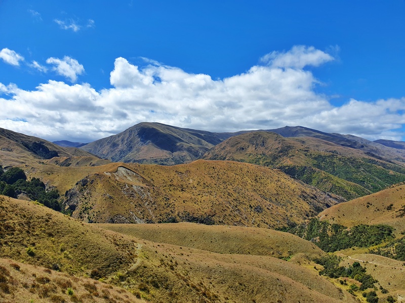
5. SOME EXTRA PHOTOS
If you’ve foudn yourself scrolling like a madman, here’s a handful more photos from the Big Hill Track Arrowtown.

Hey, it’s Jub here. I’m the guy behind Chur New Zealand, helping you have the best time hiking, trekking, walking…whatever you want to call it…in NZ. I’m based in Queenstown and am always out and about exploring trails, old & new. If you have any questions, reach out.