Wellington’s Southern Walkway is an end to end walk between Wellington harbour and the southern coast near Island Bay. Along the way you’ll get various views of Wellington on a variety of terrain that’s primarily linked via the Town Belt.
This post will give you everything you need to know about the Wellington Southern Walkway.
Note: The most common way to walk the route is north to south starting at Oriental Parade and the direction I’ll be talking about.

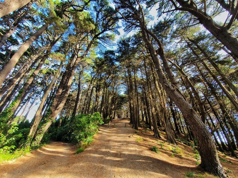
The colour of these turned out really weird in this photo.
TABLE OF CONTENTS
1. Wellington Southern Walkway Details
2. Southern Walkway Map
3. How To Get There
4. My Southern Walkway Trip Report
1. WELLINGTONS SOUTHERN WALKWAY DETAILS
How hard is the trail?
Easy-medium. There are a few steep sections, but they’re broken up enough that everyone with some semblance of fitness shouldn’t have any worries.
How long is the Southern Walkway?
10.6km according to the Wellington City Council brochure. My Strava data has the measurement at 11.04km, which included a couple of wrong turns, so I feel like 10.6km is about right.
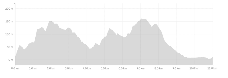
How much elevation gain is on the trail?
The total incline on the walk is 365 metres (it both starts and finishes at sea level). Another blog has the elevation gain at 267 metres, so it’s somewhere in that ballpark.
Here’s the Southern Walkway elevation profile:
How long does it take to walk the Southern Walkway?
I walked the track in 2 hours 33 minutes which is walking at a good pace without any breaks. The council suggests 4-5 hours, which unless you’re really dawdling will be more than enough.
2. WELLINGTON’S SOUTHERN WALKWAY MAP
You’ll be following these pink markers for the Southern Walkway.
Google Maps has the Southern Walkway marked, but there’s no specific search you can find to get an easy route.
It’s easy enough though, as long as you keep an eye out for the pink signs you shouldn’t get lost. Maps.me wasn’t so great for this track given the mix of roads and hiking trails, but I was still using that as a guide in the couple times I got confused when I didn’t see any pink bollards. Also, take a photo of the maps you see of information boards just in case.
It’s not like you’re going into the wilderness so getting lost isn’t a big issue.
3. HOW TO GET THERE
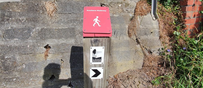
The sign at the northern trail head of the Southern Walkway.
Walk: The exact point of the trailhead is on Oriental Parade here, close to Oriental Bay beach. When you finish, you’ll be right next to a bus stop (this one) with bus #1 departing to the CBD regularly (timetable).
Bus: The closest bus stop to the trailhead is here on Oriental Parade. If you’re coming from the Wellington Railway Station, it’ll take 20-25 minutes for the #24 bus (timetable) to reach the stop mentioned above. If you’re departing from the city, it’s just as easy to walk there via Oriental Bay.
Drive: As it’s an end to end walk, I think you’re better off parking your car in Wellington CBD or Oriental Parade and walking/catching the bus to the trailhead. If you really wanted to drive, you’ll be better off parking at the southern trailhead next to Shorland Park and catching the bus back there afterward (bus #1 from the CBD). You won’t need to pay for parking likely doing it this way.
Alternatively, if you’re super keen you can walk back to the city via the City to Sea Walkway.
4. SOUTHERN WALKWAY WELLINGTON TRIP REPORT
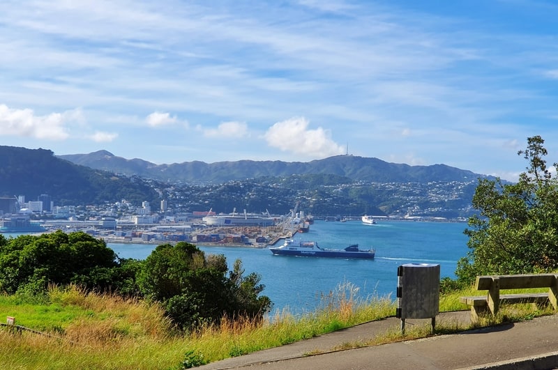
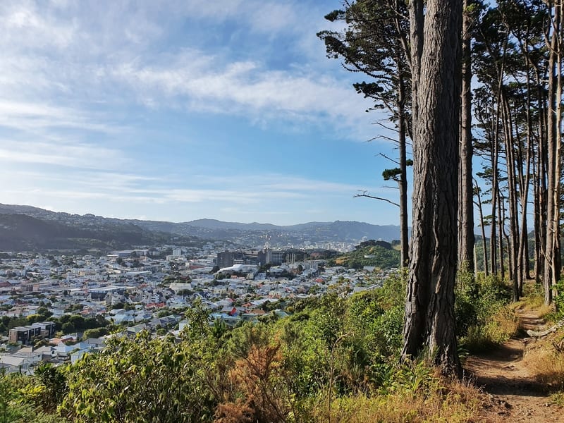
Early on in the walk, you get this epic view of Wellington Harbour. That’s one of the ferries that goes between Inter Islander and Blue Bridge that you can see.
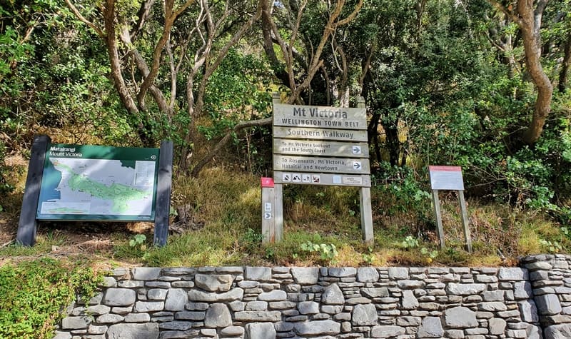
I picked a stunning day to do the walk, with some light cloud cover on a mostly sunny day. Wandering on down to the start of the trailhead on Oriental Parade I easily found the wooden sign, along with the map which included the elevation change. Take a snap of the photos in case you get super confused on the way.
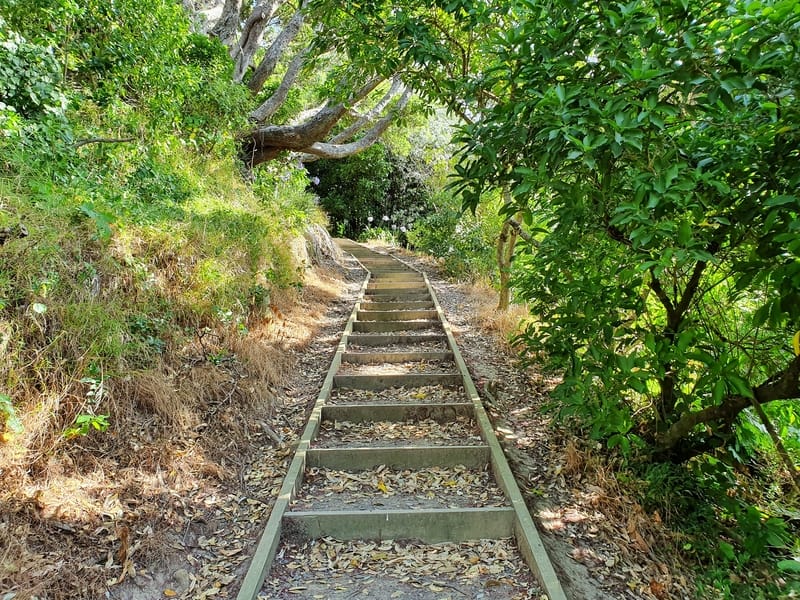
The steps early on the climb up Mount Vic
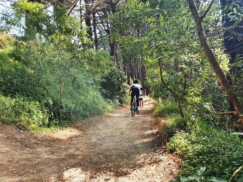
There are a couple of short sections on Mount Vic that are shared with cyclists. Maybe it’s best to keep your headphones out for a little bit.
The start of the walk takes you across the western face of Mount Victoria with a couple of steep climbs in the first 2km. You’ll start on concrete paths, but once you get past the residential houses you’ll end up in the forest where various tracks interwind. There’s plenty of pink bollards too keep you on track.
You might need to take a couple of breaks early on, but don’t let that get you down, once you survive the first two kilometres you’ve done the hardest part of the entire Southern Walkway.
Fortunately to compensate you’ll get a few views along the way.
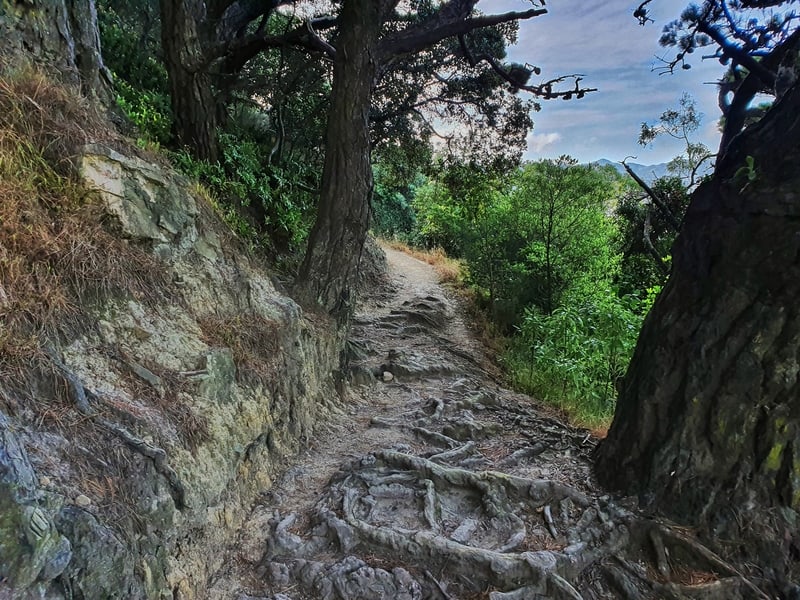
The trail up toward Mount Victoria, it’s a bit rutted in sections.
You’ve reached the top of the first climb when you reach this spot. Congrats.
Looking out over Newtown.
If you want to go to the Mount Victoria lookout, the Southern Walkway doesn’t go to the lookout itself but you can easily take a detour when you reach this point on Lookout Road. It’ll add another 10-20 minutes walking to your journey, but if you haven’t made plans to go see the lookout view, do it!
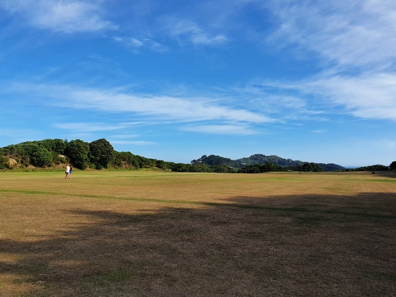
I always love walking across parks…weirdo right.
Once you reach Lookout Road, you’ll be back on walking tracks shortly where you get to enjoy ~2km of trails that slowly wind there way down to Crawford Road. There’s a variety of bush, parks, and small forests in this section, lots of variety. And some views over the Basin Reserve part of town.
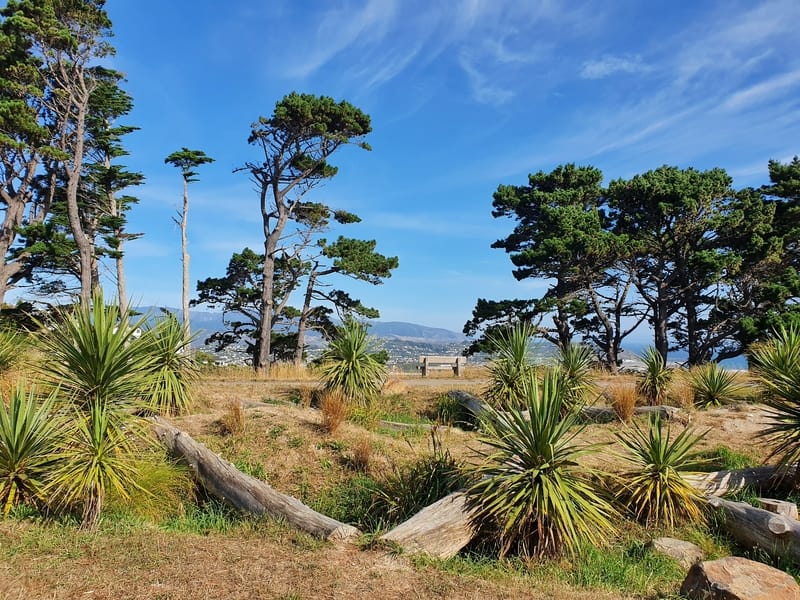
After crossing Crawford Road (I hate crossing this intersection), it’s time to begin the climb up to Mount Albert via Truby King Park which has beautiful pine trees (that’s where the awkward selfie at the top of the post is) but is quite steep for a couple of sections.
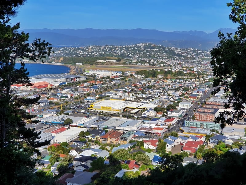
Views over Kilbirnie and beyond.
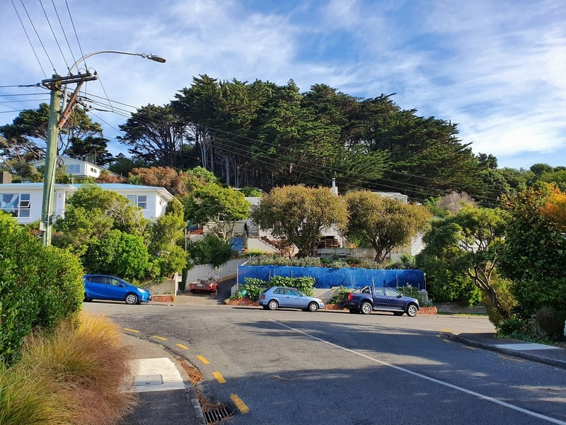
One of the street sections. At least the suburb looks half decent.
As you navigate to the top of Mount Albert there are some awesome views so it’s worth the climb. Halfway between Crawford Road and Mount Albert there’s a descent which breaks up the climb which is good for the morale!
Climbing the track up to Mount Albert.
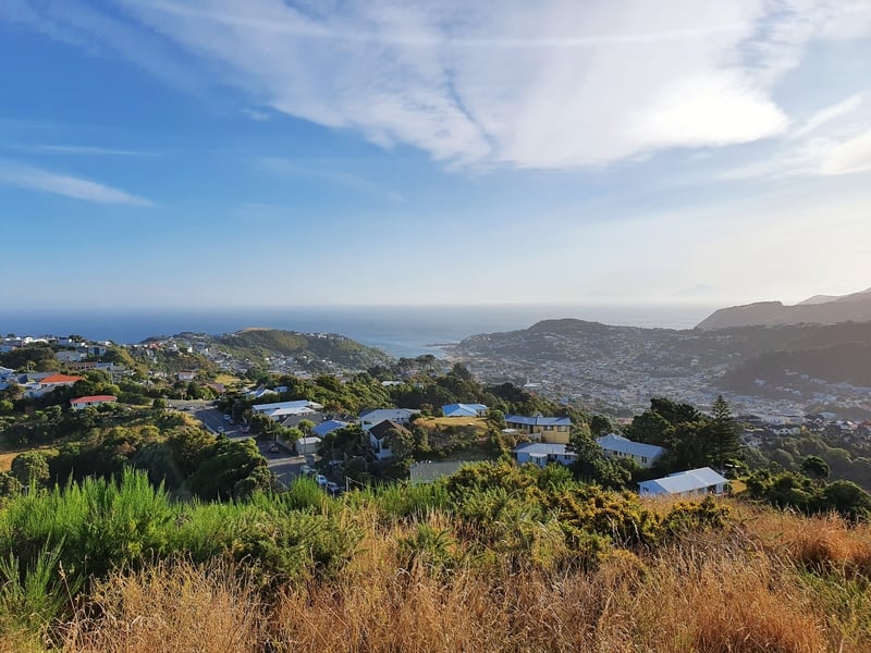
Views from Mount Albert.
Once I got to the top of Mount Albert, I wasn’t sure where I was going but eventually figured out where I went wrong and walked down to Mount Albert Road where I proceeded to walk up a driveway while on a phone call. Fail.
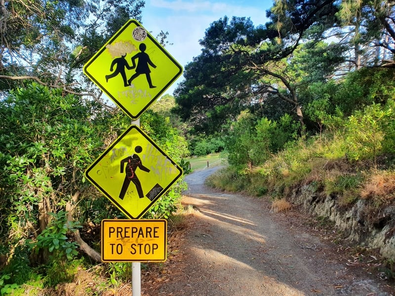
I really enjoyed this sign!
From here on out you’re walking down through more greenery which is always fun, there are a few more cheeky views too. And other than a small ascent you’re cruising down to sea level which you’ll get to Houghton Bay Road. Once you reach the road, you’re heading straight to the coastline. Cross the road, turn right and then you’ve got a beautiful walk following the coast around to Island Bay.
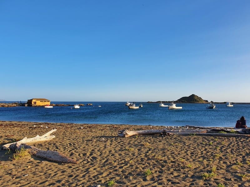
You’ve made it to the southern coast of Wellington, where there’s lots of things to do!
If you want, you could swim at Island Bay or play at Shorland Park which is pretty cool. There are a few shops just up from the bus stop if you’re short on food which is no worries as the buses are regular and you can just catch it further up the road.
Note: If you decide you’re not feeling the walk, Crawford Road is a good place to turn off and walk back into town.
I was glad to finally complete the Southern Walkway, just another one of the awesome Wellington walks. For those who are fascinated by green areas in cities, you’ll love it. It’s a shame that you do need to walk on the road a bit, but it’s not the end of the world.
If you’ve got any comments or questions about this walk, leave them below or email jub@churnewzealand.com.
p.s. Here’s a map of all the hikes and walks you can read about on Chur New Zealand. You can click the icon to see brief details, as well as a link to read more about the hike (like this post).

Hey, it’s Jub here. I’m the guy behind Chur New Zealand, helping you have the best time hiking, trekking, walking…whatever you want to call it…in NZ. I’m based in Queenstown and am always out and about exploring trails, old & new. If you have any questions, reach out.
I enjoyed your description and photos. I love the Southern Walkway and it’s been many years since I did the entire walk. Have done a couple of chunks in the interim. Whet my appetite to do it again this upcoming summer. Many thanks. Great pics. Regards, Lynda
Hey Lynda,
Thanks for the kind words! Hopefully you get a chance to satisfy the appetite over summer 🙂
Cheers,
Jub
We enjoyed this walk on a lovely sunny day. At one point we had to ask instructions. After crossing Crawford Rd and following the trail, we came out into a residential cul de sac where there were no markers. We looked for a while then a kind resident helped us – we had to walk to the exit end of the cul de sac (Paeroa St) and then turn right, left at the next ‘T’ junction at the end of Coleville St and then right to the residential dead end where there is a bench and follow the writing on the path!
Hey Jo,
Glad you managed to enjoy the day….can’t beat Welly on a good day haha. Will look into clarifying the instructions!
Cheers,
Jub