The Brooklyn Wind Turbine is a lone turbine located hills south of Wellington CBD.
You can’t see it from in the CBD, but you can from Mount Victoria Lookout and many people do wonder what all the hills around it have to offer.
Well, you can see for yourself by driving up to the turbine and walking on the surrounding tracks.
This post will cover the Wind Turbine to Red Rocks track. An undulating end to end walk across the top of the hills above Brooklyn down to the rugged and beautiful beaches on the south coast.

A sneaky selfie on a recent visit to the Red Rocks walkway. Note: Many of the photos in this post don’t show the true beauty of the area. The smoke from the Australian bush fires made its way to NZ 😮 I can’t even register how bad the smoke is over there.
This is everything you need to know.
TABLE OF CONTENTS
1. Details About The Wind Turbine To Red Rocks Route
2. Brooklyn Wind Turbine Walk To Red Rocks Map
3. How To Get There
4. My Trip Report
1. DETAILS ABOUT THE WIND TURBINE TO RED ROCKS ROUTE
On a nice day, this is a stunning walk! But as an end to end walk it’s not convenient, and doing the return track back to the starting point isn’t everyone’s cuppa tea given the length.
The weather is pretty volatile up here and if the wind is blowing in the wrong direction, you’ll end up with a nice whiff of interesting smells from the nearby tip (have you walked the Tip Track?).
The tracks are partially shared by mountain bikers too, which isn’t fun!
Nevertheless, don’t let me stop you, as this is one of the walks in Wellington with the best views.
How hard is the walk from the Wind Turbine to Red Rocks?
Easy-medium (provided the weathers not horrendous).
How far is it from point to point?
8.7km according to the Govt brochures, that’s about accurate when I match the data with my Strava record. But depending on your plan with getting to/from the walk, you might need to add a few more kilometres to that.
What’s the elevation profile of the route?
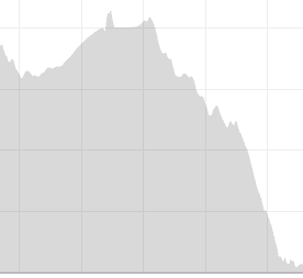
From the wind turbine to the Red Rocks, there’s no more than 200 metres of total ascent on the trail. But keep in mind you start 3000 metres above sea level and you end up at Red Rocks which are at sea level.
How long does the walk take?
For a fast walker with minimal breaks, plan to spend about 2 hours on the walk. If you’re taking your time and have a picnic and the like, you could be upwards of 4 hours.
Are dogs allowed on this trail?
For the most part yes they are provided they are leashed.
There’s a strong southerly blowing…should we avoid this route?
If the forecast does say there’s southerlies blowing, this isn’t going to be the funnest walk. You’ll be exposed a lot, and then when you get to the coast, all the sand in your eyes isn’t going to be fun.
2. BROOKLYN WIND TURBINE WALK TO RED ROCKS MAP
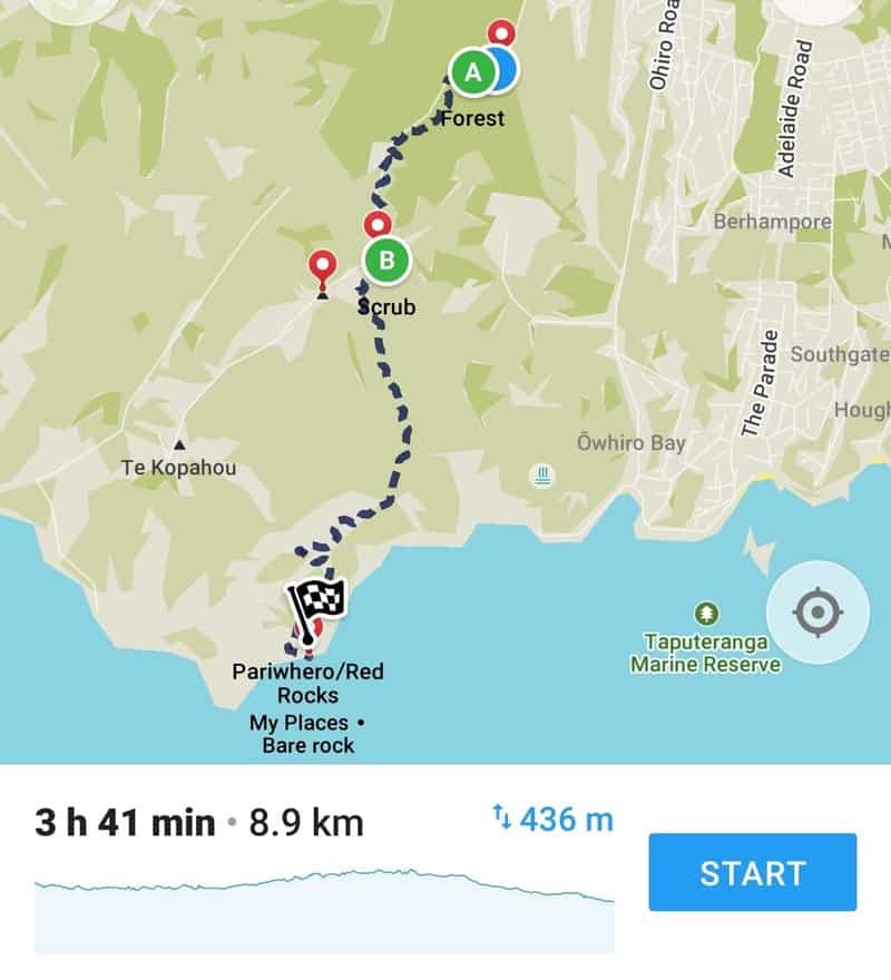
I have to say I was surprised to see the trail from the Wellington Wind Turbine to Red Rocks marked on Google which you can find here.
And of course, it’s on Maps.me which I’ve inserted a screenshot from above.
I would suggest downloading this NZ Topo maps app as it has most of the trails in the are on there.
3. HOW TO GET THERE
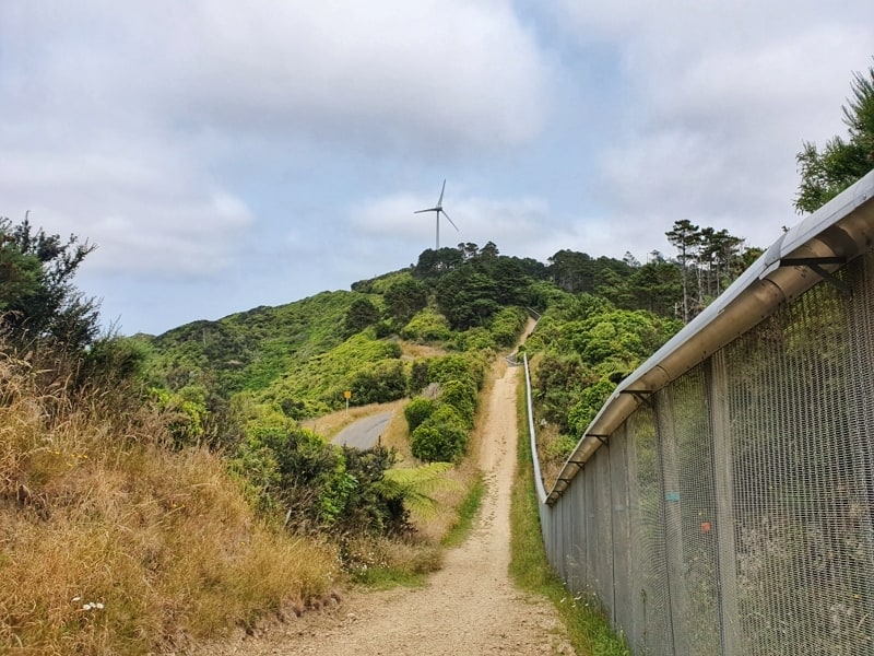
The track running next to Zealandia on the walk up to the Wind Turbine.
Walk: The turbine is about 300 metres above sea level, so while you can walk up to here, you’re in for a calf burner. This is the most formal route from the CBD.
Drive: This is annoying as the Red Rocks carpark is a long way from the Wind Turbine carpark or vice versa. You essentially would have to walk back the way you came as the quickest option, which is cool if you’re up for it.
Alternatively, you might want to consider a key swap, or take two cars and leave one at Red Rocks before all driving to the turbine to start the trip.
Bus: Honestly, you’re probably better just walking up. So while there are options, the best option is to take the #7 bus to Ohiro Road at Cleveland Street and walking the remaining 2.7km up the steep hill. The walk alone will take 45 minutes or so. Take the Brooklyn Wind Turbine walk via the city linked above.
4. BROOKLYN TURBINE TO RED ROCKS WALK TRIP REPORT
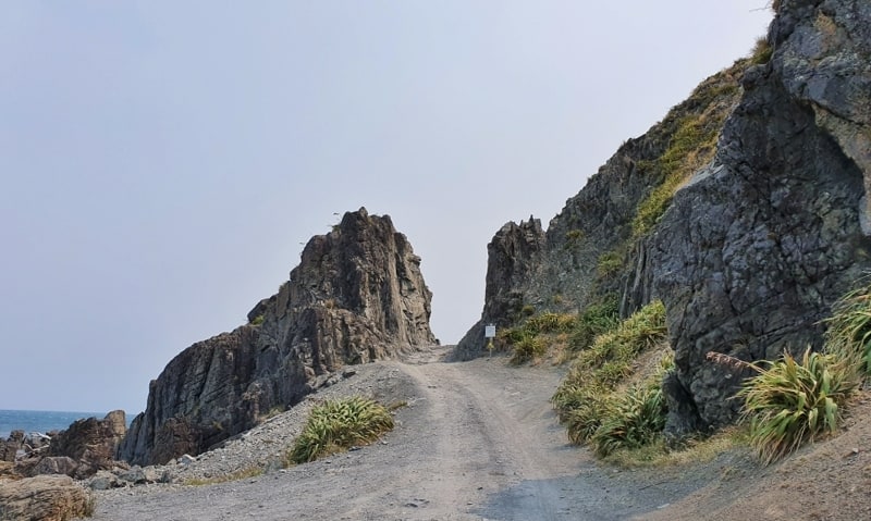
Devil’s Gate. Always impressed that some people can drive through that (this is a short detour when you reach the coast).
Starting off from the CBD on New Year’s Day we had a nice day for this walk. Walking through Central Park on the way to Brooklyn was a chance to reminisce about the drunk late-night walks through the park during University. I never got to realise how beautiful it really is back then!
And then it was a steep mission to the top of the Turbine, where you eventually get off the footpath and follow the boundary fence of Zealandia.
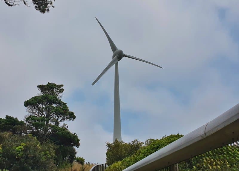
The turbine!
Once you’re at the turbine, you’ll find a large concrete area with an information sign and the first thing I always notice is the road that continues on into the distance towards the Radar Dome. While taking in the views looking east over the city, do take a mental note of where the road goes as the track you’ll be walking on sticks reasonably close to the road to start with.
There is a couple of boards with information about the turbine too (it was first installed in 1993).
There are a few different tracks that go off from here, so make sure you start walking on the one that is closest to the south side of the road if you’re looking away from the CBD. It’ll make sense when you get there and the signs will mention the Car Parts Ext track too, this is the one to follow. It should mention Red Rocks/South Coast on the signs too (I didn’t take a photo of the sign, but I believe it does).
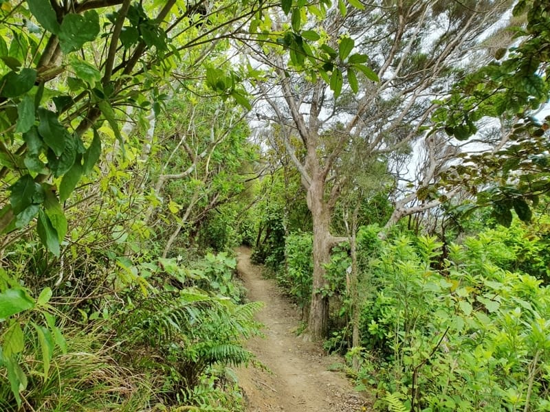
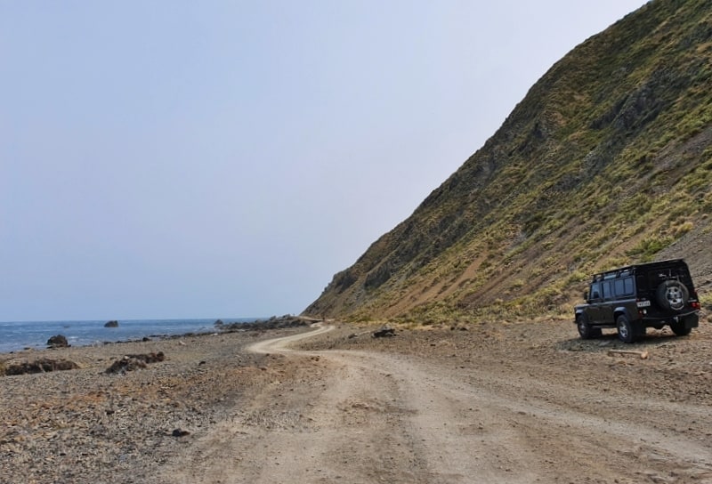
The track starts off gently.
The walk isn’t undulating at all to start but does follow a single trail and I’d recommend not walking with headphones as there may be mountain bikers on the trail. They’ll be courteous but I get a fright if I don’t hear them coming!
You’ll be covered by the light and low bush canopy to start, and while the track isn’t overly technical there are some tight squeezes. Eventually, you emerge from the bush, and when you do, you’re in the open for the rest of the trip.
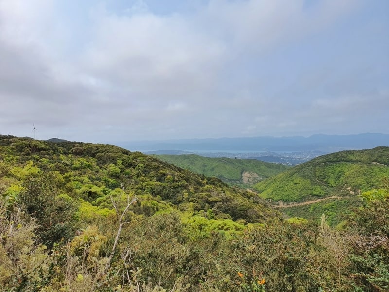
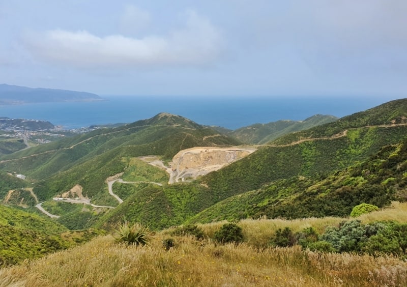
We hadn’t felt the wind too much to start with, but wow, all it took was to walk around a bend and suddenly it was blowing an absolute gale. It was pretty fun, but unfortunately, it also meant there was cloud cover being brought over the city so we didn’t get too many epic views from here on out in that direction.
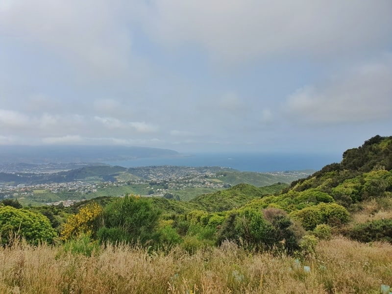
And looking out towards Wellington Airport from the track.
I just love the views!
You could spend a good few days exploring the different tracks in the area.
You’ll see the tip/junkyard below you after a while, and while you could go down the Tip Track, I wouldn’t advise this. Just stick to the Pariwhero/Red Rocks signs that are around whenever there’s a split in the trail.
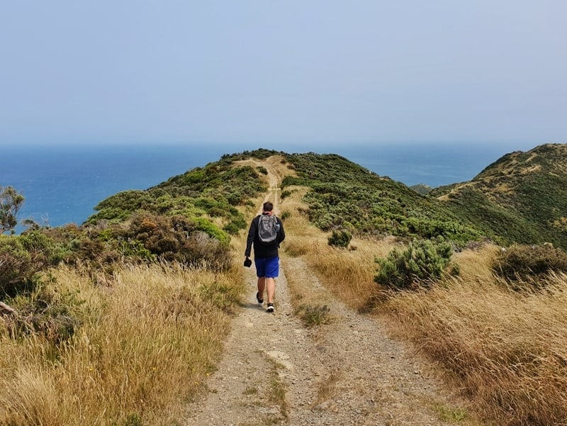
When you’re out in the open, the track is nice and wide and while it’s rocky and not very even, you shouldn’t have too many issues as you navigate up and down the hills. On a clear day, you’ll have a blast with all the views, but as mentioned we didn’t get too many.
The wind was whipping up some cool spray at ocean level.
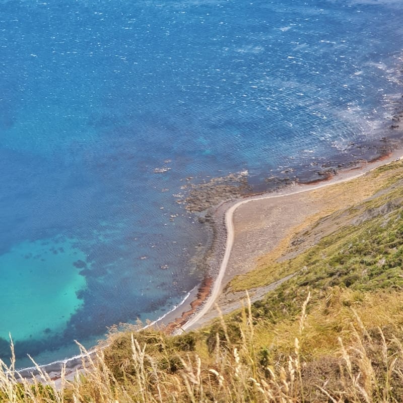
When we reached the ridge that runs above the southern coast we got to see some epic water action though! The wind certainly was putting up a fight. After walking along the ridge, we eventually started the descent down to sea level which goes via a valley. It’s a pretty steep descent with a narrow track, but once again nothing everyone shouldn’t be able to handle with a little care.
To the coast!
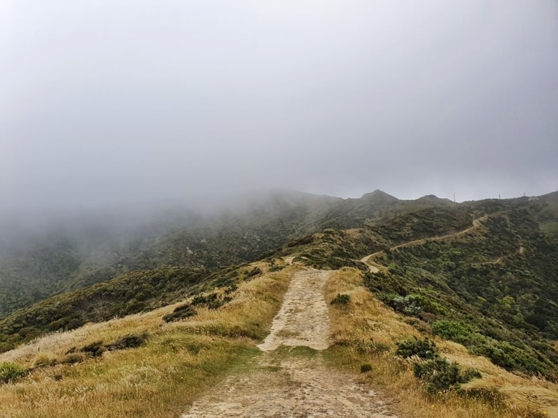
Wind, smoke, and clouds = few views on this walk.
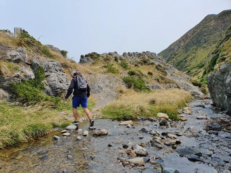
One of the stream crossings as you approach the beach.
Coming out of the valley is cool, and there are two small streams to cross. There are usually well-placed rocks meaning you don’t have to get your feet wet, but if you’re clumsy, you’ll want to take the shoes off.
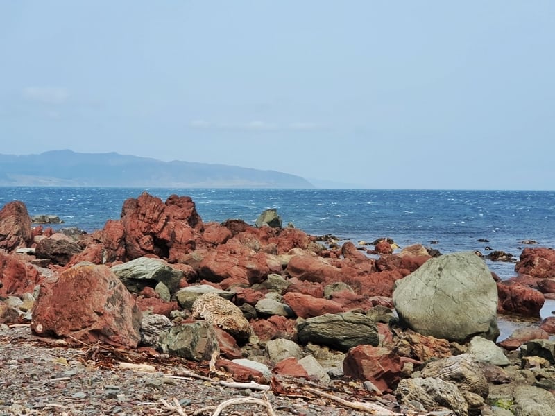
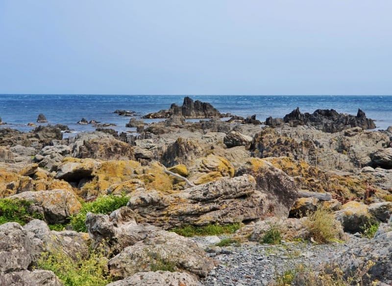
Red rocks, so red right?
And then boom, you’re out on the beach. Now, you might opt to go right if you want to check out the seal colony and Devil’s Gate, but you’ll need to go left to see the Red Rocks (they’re just a short walk from where you reach the beach), and then it’s another ~2km or so until you reach the Red Rocks carpark.
I always enjoy Devil’s Gate and looking for the seals, but if you’re feeling a bit tired, the extra 30-40 minutes or so it adds to the walk might not be for you.
If you’re walking back to the Turbine, have fun! I’ve never walked that way, but at least you’ll get more views of the city on a clear day.
I’ll leave a bunch of photos from on the coastline here:
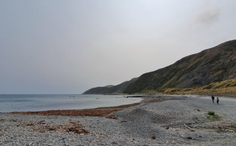
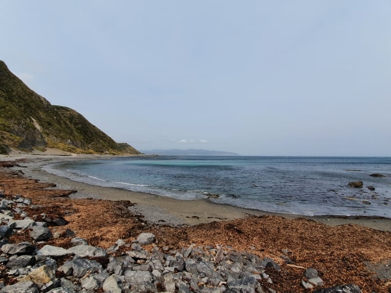
The South Coast of Wellington is so ruggedly beautiful.
More scenery…gee on a non-hazy day it’s so much better. Promise!
Can you spot the seal? I’m shocking with nature photography (phone camera life), so only the keenest of eyes will.
I can’t believe I lived in Brooklyn during University and never explored this part of Wellington! If you’re living in Wellington or staying for at least a week, pop this on your list of things to do. But otherwise, the inconvenience of the walk isn’t ideal and you’re better off doing other walks around Wellington.
If you have any questions/comments about this route, please leave a message below or email jub@churnewzealand.com.
What to read next:

Hey, it’s Jub here. I’m the guy behind Chur New Zealand, helping you have the best time hiking, trekking, walking…whatever you want to call it…in NZ. I’m based in Queenstown and am always out and about exploring trails, old & new. If you have any questions, reach out.