The Makara Walkway is an amazing 7-8km loop walk on the rugged coastline 18km northwest of Wellington.
This post will give you the details about one of the Wellington walks many locals put off, but regret doing so as soon they get around to it.
Why do they take so long to do it? From what I can gather, people think it takes ages to reach the trailhead. In reality, that’s not true.
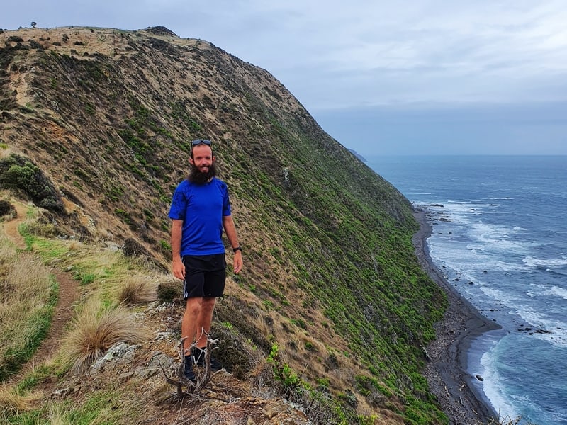
Enjoying the Makara Walkway.
Note: Parts of the track are closed between August 1st and September 30th for lambing.
TABLE OF CONTENTS
1. Details about the Makara Walkway
2. Makara Walkway Map
3. How To Get To The Trailhead
4. My Makara Walkway Experience
DETAILS ABOUT THE MAKARA WALKWAY
When1: April 2021
Difficulty2: Easy – medium.
Hike Distance3: Strava registered 7.86km and DOC has the track at 7km. We did wander around the gun emplacements a little, and went over to the big windmill which would have added to the difference. Plan for a 7-8km walk.
Incline4: Strava registered 214 metres of elevation for the loop. The elevation profile below is when you do the loop in the clockwise direction:
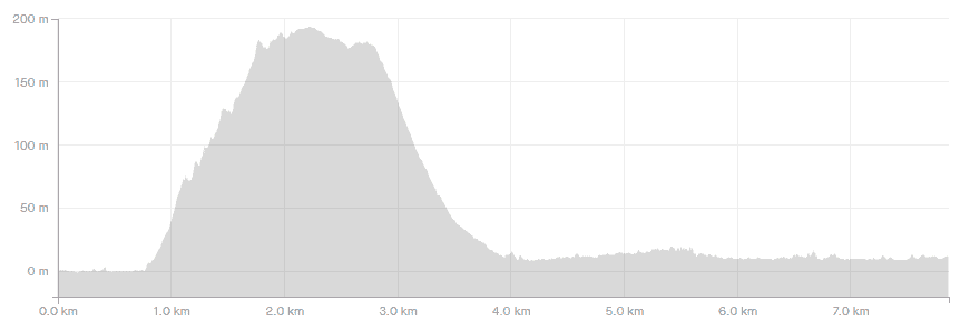
Hike Duration5: The total time was 2 hours and 12 minutes. If you wanted to get it done faster, you could get it done in 1 hour 50 minutes at a push. For most people, it’ll take 2 hours to 2 hours and 45 minutes (give it longer if you’re taking a picnic with you).
MAKARA WALKWAY MAP
The link above is the GPX file from Strava overlaid on a topo map.
That Makara Walkway is on Maps.me which I found useful a couple of times on the walk. There’s plenty of signage, but I did verify we were on the right track.
Google Maps has some of the tracks but not the full Makara loop.
HOW TO GET TO THE TRAILHEAD
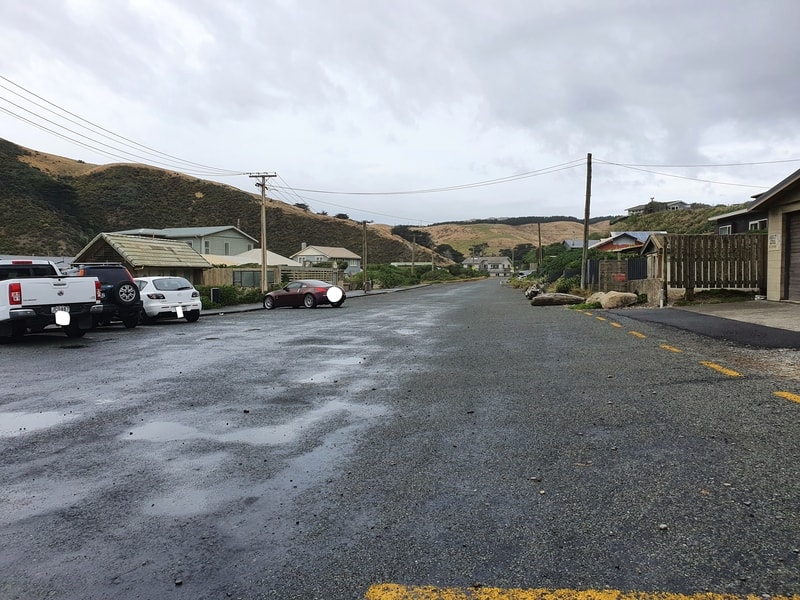
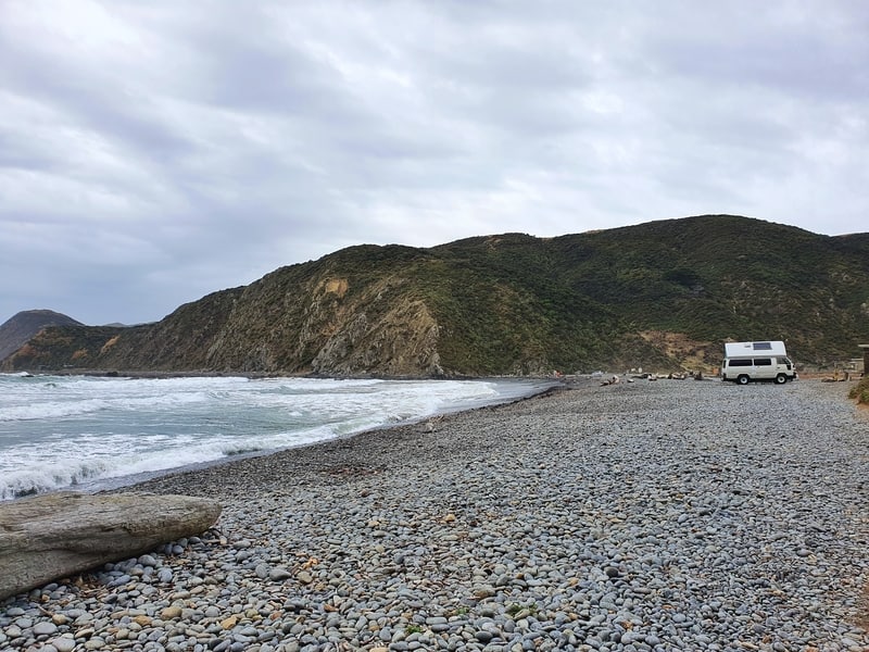
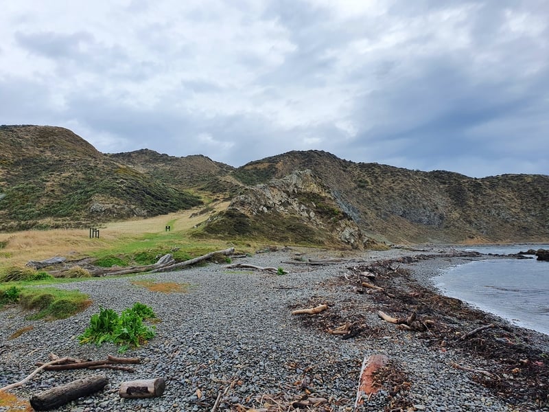
The only realistic way to get out there is by car, for which there are two routes (the photo above is of the Makara Beach car park).
Via Makara Road: If you’re coming from Wellington this will be the way to go which takes you through Karori. From Wellington Station the drive takes ~30 minutes to travel the 18km (it’s a windy road out past Karori).
Via Takarau Gorge Road: If you’re coming from the northern suburbs, say Johnsonville up, the gorge road is the quickest route. From Johnsonville the journey takes 20-25 minutes to travel the 15km.
If you’ve got a campervan, it’s probably worth taking the longer route via Makara Road. The gorge gets a little narrow on spots, but it’s a lightly trafficked route so it’s not a crazy drive.
MY MAKARA WALKWAY EXPERIENCE
We had an iffy weather day as we drove out to Makara Beach via the gorge road, but we had no other day to make the walk work so tested our luck.
As you arrive at the Makara Beach car park, the few houses that make up the town of Makara Beach makes it known you’re in a remote area. That said, the car park is considered safe as the residents have a knack of seeing everything.
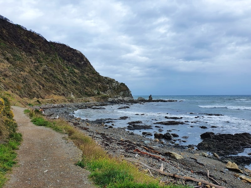
As you’re facing the stone filled Makara Beach, the walkway is on your left (south) following the coast. There’s a clear path.
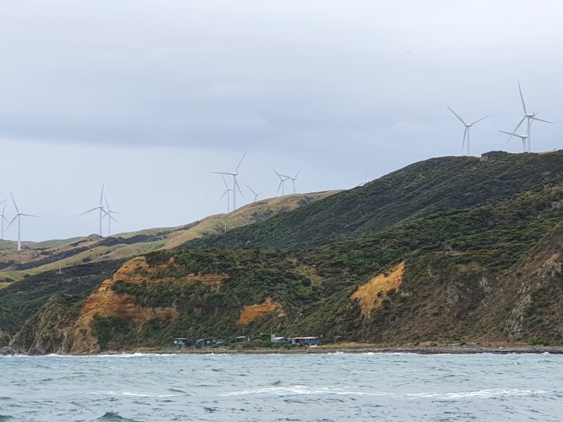
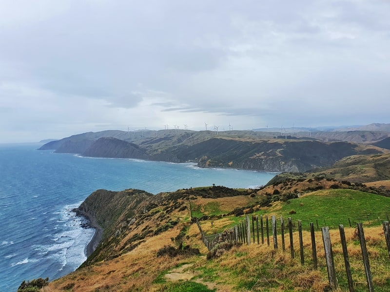
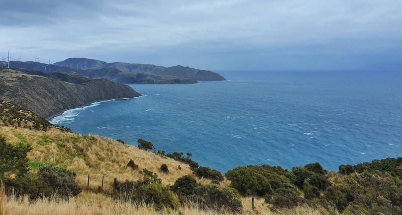
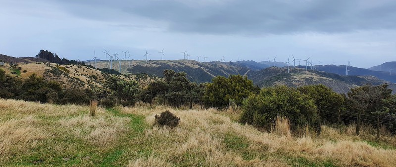
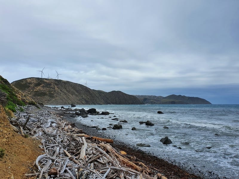
The scenes start right away as you get your bearings. I noticed the wind turbines to the north and the battered baches on the coastline (I’d love to own one of them).
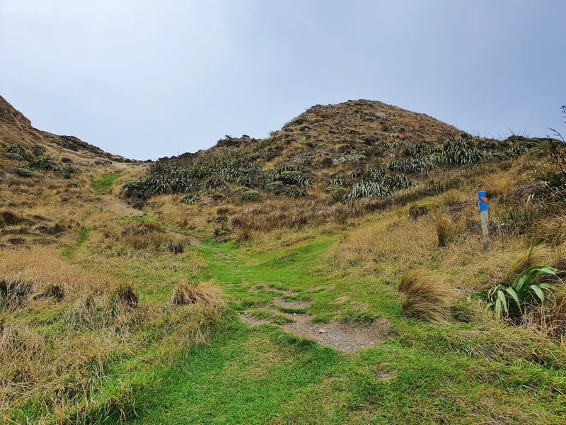
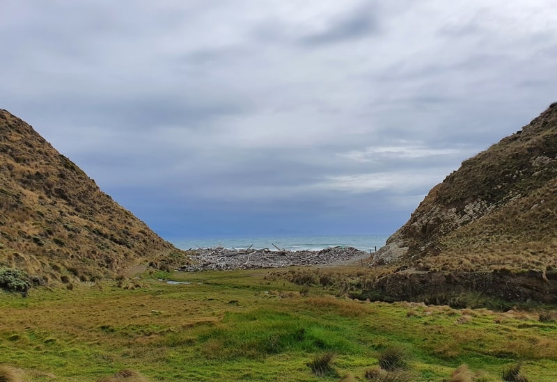
After 700 metres of following the coastline, you’ll get to the junction where the loop begins (in the photo above). I recommend going left up the hill which seems to be the most popular route
The incline is up a single track that’s easy to follow. It’s a steep climb with nearly 200 metres of elevation over the next 1km. But it’s after about 400 metres when you pop out on the ridgeline looking down at the coastline out of nowhere which is amazing.
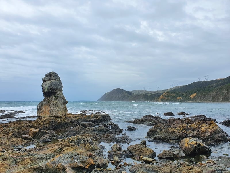
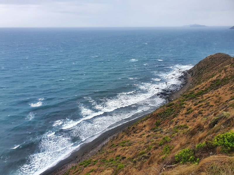
You’ll see the South Island, Mana Island and Kapiti Island. We were grateful for the rain holding off to give us some visibility.
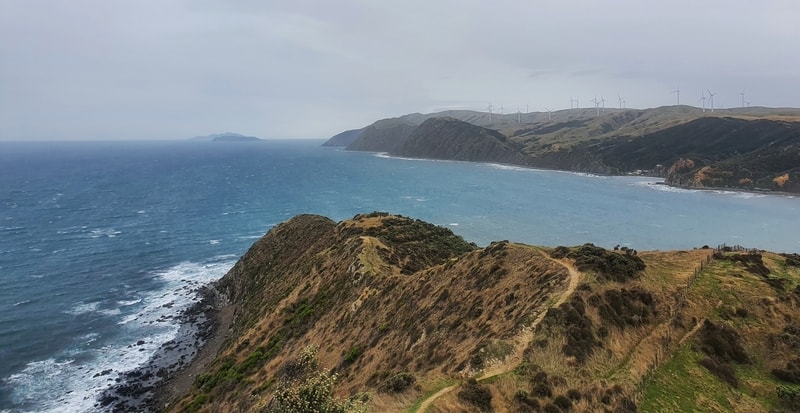
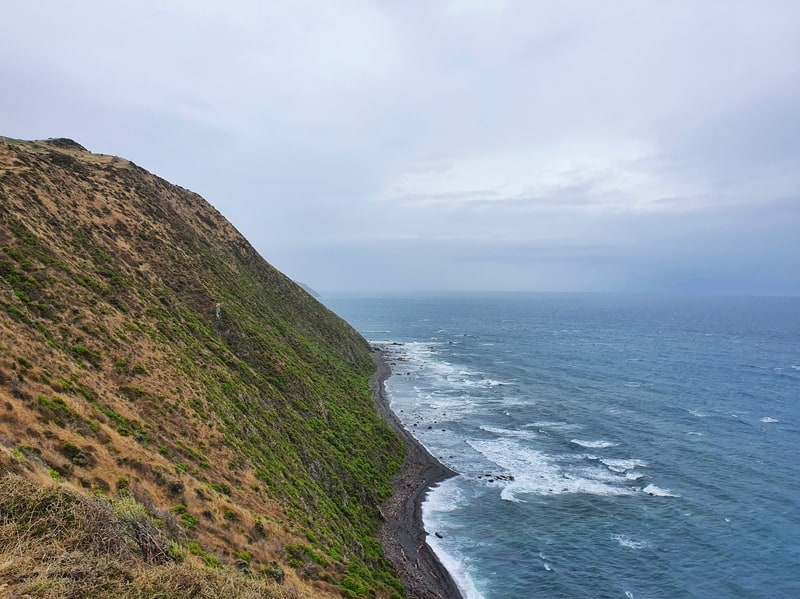
The views are pretty amazing already as you’ll see from the photos.
You can walk around and get all the Instagram photos you want along the ridge as you make your way a long it (the incline continues).
As you get to the top of the climb you’ll come across the gun emplacements. These were built in the early 1940’s after the Pearl Harbour attacks (along with others around the country). The area was known as Fort Ohau.
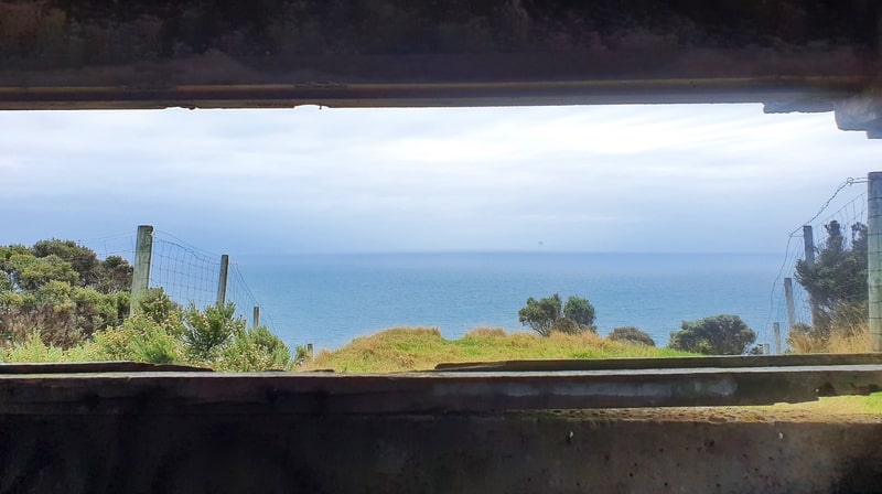
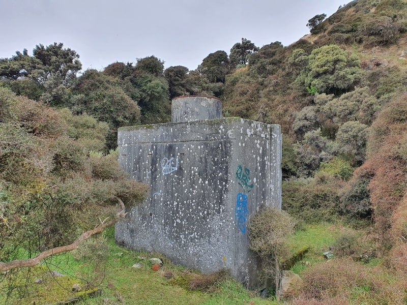
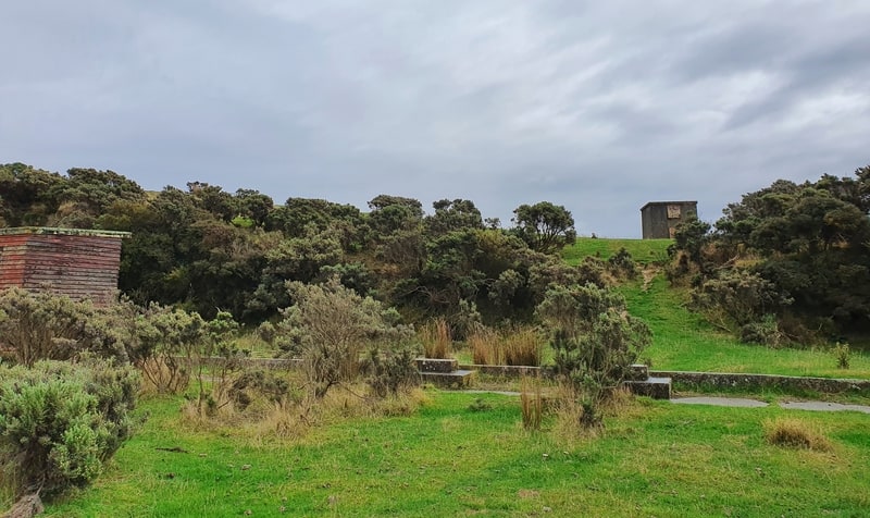
There’s a couple of information boards in the area which give you more details about what was going on at the time, including the daily schedule for the people stationed there. I had never heard of a sick parade before 😮
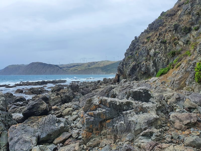
Going beyond the gun emplacements, the track continues along the top of the hills for 500 metres to the next major track junction. We’ll turn right to head back towards the coast, but do make time to wander the 100 metres or so over to the B2 turbine.
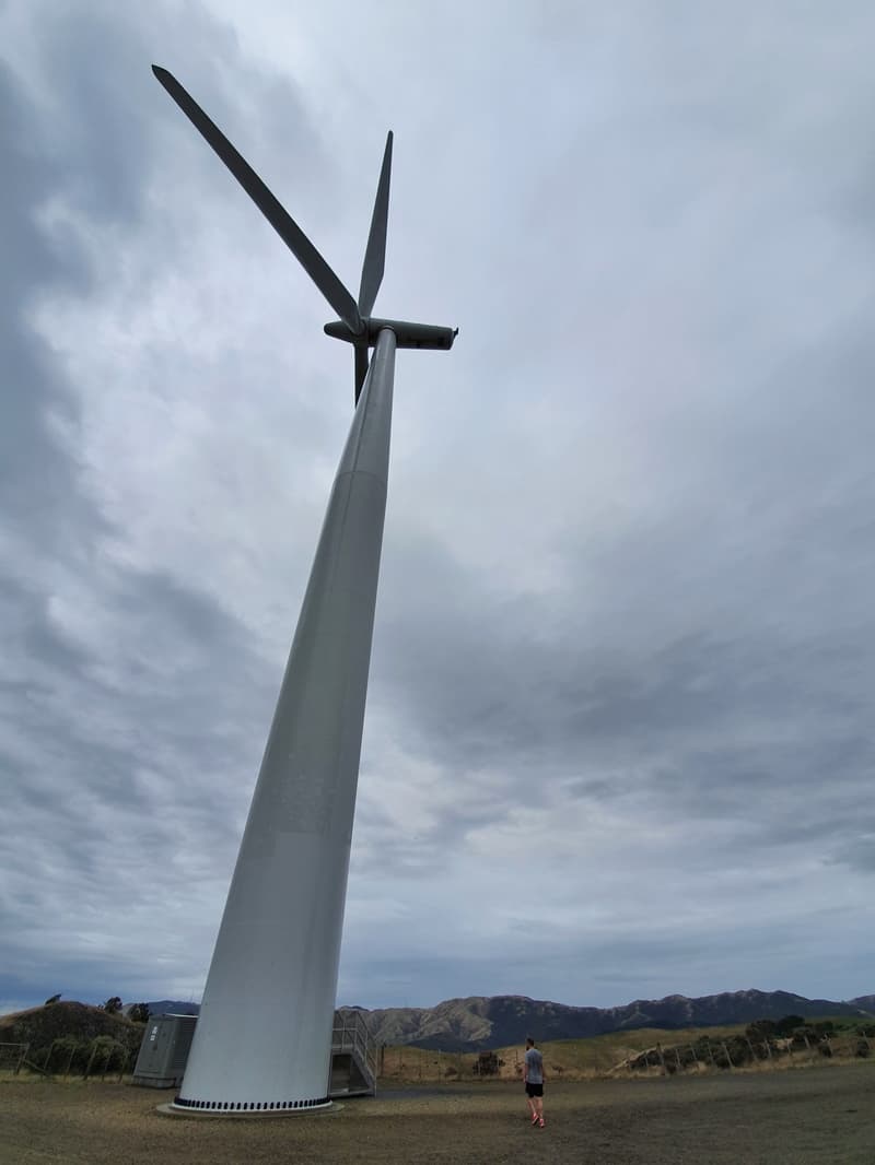
It’s the only turbine of the 62 in the West Wind Recreation Area you can get close to (this is a separate wind farm you see earlier in the hike). They’re massive, standing 67 metres high with 40 metre blades.
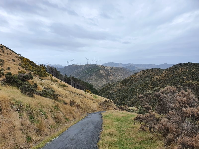
Now as we follow the road down the gully, you might like to know you’re walking along a fault line that last split ~1200 years ago…it’s not going to happen again anytime soon 😉
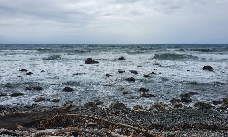
The path drops you back on the coastline at Opau Bay. It was windy on our visit and the rough seas meant there was no chance of us taking a swim, but on a good day? It could be a winner!
The final 3.5 – 4km of the walk follows the coastline back to where you started. The walk is along the stones which can make things frusturatingly slow, but there’s a track where the stones are somewhat less annoying to walk on.
It’s a fun coastline to walk along with the waves crashing down close to you and you can hear the stones getting moved around by the surf in spots.
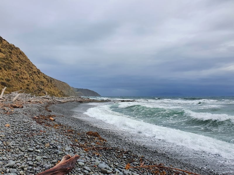
There’s one section of coastline where you’ll need to rock hop. This goes for maybe 100 metres and is easy enough to navigate safely. I enjoyed this section that broke up the monotony.
And then you’re back at the car park, We passed a couple of people surfcasting near Makara Beach, but they were keener than us so we didn’t hang around for an ice cream at the beach.
If you’re looking for other coastal walks in the region, I suggest looking into:
- The Wairaka Walkway between Pukerua Bay and Plimmerton
- The Red Rocks on the Southern Coast
- The Wild Coast Track out Wainui way
The Makara Walkway is something I’ve overlooked for so long. I’d always made excuses not to go. As many do.
While it’s best visited on a beautiful day, if you don’t mind a bit of wind, it can be fun to explore most days.
If you have any questions about the Makara Walkway, drop a message below or email jub@churnewzealand.com .
RECOMMENDED READING
Amazing Things to do in Wellington
There’s more to the city than walks believe it or not 😉
The Paekakariki Escarpment Track
One of the most popular, and loved, day walks in the region.
6 Day trips from Wellington
Because if you came out to Makara, you probably enjoy escaping the city life at times.

Hey, it’s Jub here. I’m the guy behind Chur New Zealand, helping you have the best time hiking, trekking, walking…whatever you want to call it…in NZ. I’m based in Queenstown and am always out and about exploring trails, old & new. If you have any questions, reach out.
Hi
If I walk the trail during lambing season (only time I’m visiting), do we have to turn back or are there alternative routes to complete the loop?
Great info on all your walk reviews!
Thank you.
Hey Mary-Ellen,
Thanks for the kind words! That’s lucky…I’d still go along, from what I recall you’ll need to turn around, but it’s still beautiful the section you get to walk 🙂 There aren’t really any alternatives to doing a full loop.
Cheers,
Jub