The Wild Coast Track is a section of the Remutaka Cycle Trail following the rugged coastline southeast of Wellington.
The official Wild Coast Track is the one-way section between the Coast Road Carpark and Corner Creek Campsite. That’s about a 14.5km trip each way, essentially a 30km day. That said, you can walk as short or as far as you like.
I’ll try to make that clear in the following post.
What I did: It’s primarily a bike track but I went on foot from the car park to the Mukamuka Stream which we then followed upstream for a couple of kilometres rather than continuing to the campsite. We then returned back the way we came.
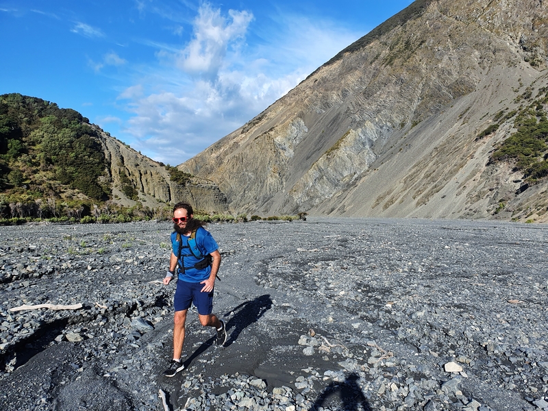
This is heading up the Mukamuka Stream, a little detour I loved.
This post will give you all the details you need to enjoy this epic walk near Wellington.
TABLE OF CONTENTS
1. Wild Coast Track Details
2. Wild Coast Track Map
3. How To Get There
4. My Wild Coast Track Trip Report
1. WILD COAST TRACK DETAILS
It’s not the easiest spot to access with a car the only realistic option, but that’s also part of what makes the walk so epic. There are few visitors, so while the start of the track does cross some private land (you might see horse, goats, and/or horses) you probably won’t see the farmers out and about.
You can’t get lost thanks to the great DOC signs being put in the right spots. The views? Awesome. Weather permitting. You’ve got a few turn around points. There’s no real bad option.
I’d be lying if I don’t get a feeling of ‘ugh can I just finish now’ towards the end while running back…I’m a little brat and should just appreciate the views that are always spectacular.
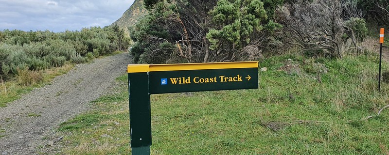
The markers you’ll see along the way look like this: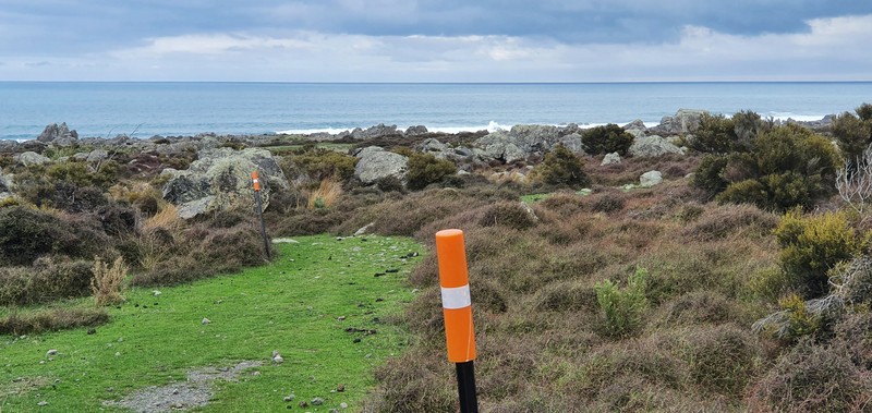
How long is the hike?
25-30km. You can make it as short as you like by turning around back to the start point when you like.
What’s the elevation profile like?
100 metres or so. Not a lot, as you’re following the coast.
How hard is the West Coast Track?
Easy – medium. There’s not much in the way of elevation, but the terrain can be niggly overtime.
How long does the hike take?
The DOC signs say it’s 4.5 hours one way, which would mean 9 hours return. That would be the maximum time. I feel like 7 hours return for the full track is realistic.
2. WILD COAST TRACK MAP
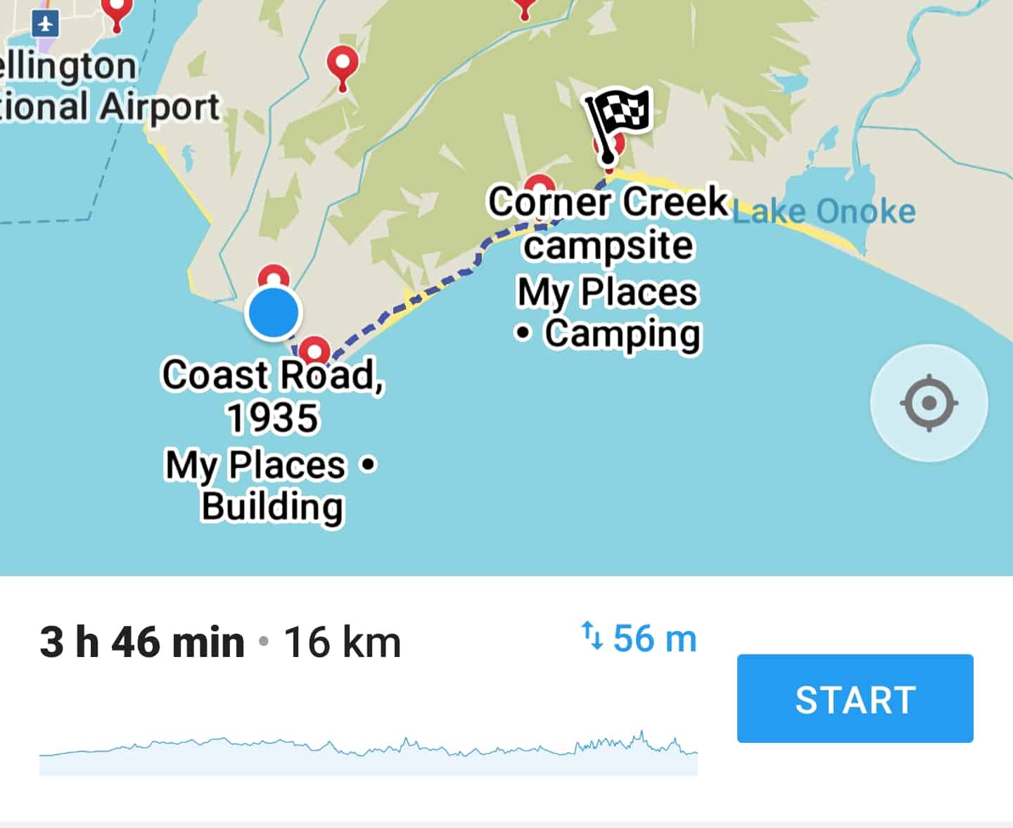
The track is not shown on Google Maps. For the trailheads, they’ll be linked in the how to get there section below.
The screenshot above is the track as marked on Maps.me. This is the track going one way from Coast Road to Corner Creek Campsite. As you can see, the elevation is minimal.
You can see the trail on topomaps labelled as the Remutaka Cycle Trail.
3. HOW TO GET THERE
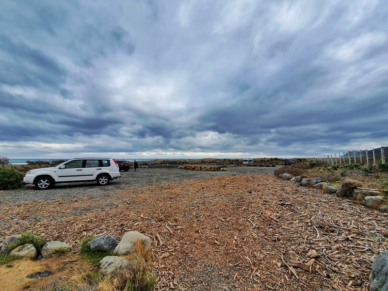
This is the carpark at the end of Coast Road, Wainuiomata. The track starts just across the river next to here. You can’t miss it.
You’ve only got one option…driving (I guess shuttles work too). I don’t recommend hitchhiking as the cars heading to the trailheads are few and far between.
If you’re walking from the Wainuiomata end (where I started), this is where the car park is. It’s about a 45-minute drive from Wellington and a 30-minute drive from Petone.
From the Wairarapa end trailhead (maybe you’re spending time in Martinborough), it’s a 50-minute drive from Martinborough making it about 1 hour 40 minutes from Wellington. The trailhead at the Corner Creek Campsite is here.
I’d recommend keeping as little possessions as possible in the car. They’re not hotspots for theft, but they are remote.
4. MY WILD COAST TRACK EXPERIENCE
We wanted to get an early start on the trail, but after picking up hiking snacks (your last chance is in Wainuiomata) and faffing about we weren’t as early as we’d like arriving at about 9am. There was only one campervan in the car park at this stage. A sign that we were off the beaten path given the good weather for the day.
The car park is massive, and to get started you cross the bridge over the Orongorongo River just past the car park.
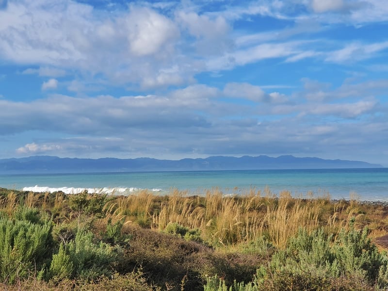
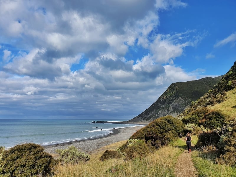
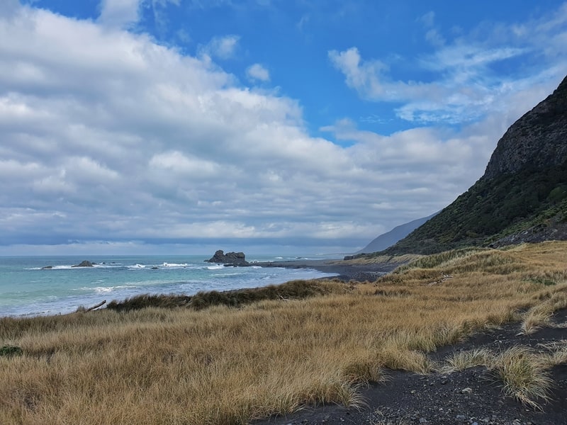
You’ll then see a gate you’ll pass through on the right-hand side which is the start of the trail and then you’re walking along the fence line for the first kilometre or so, heading east following the coast. The waves were barreling but there weren’t any surfers out there. Wow, they would have loved it (I assume).
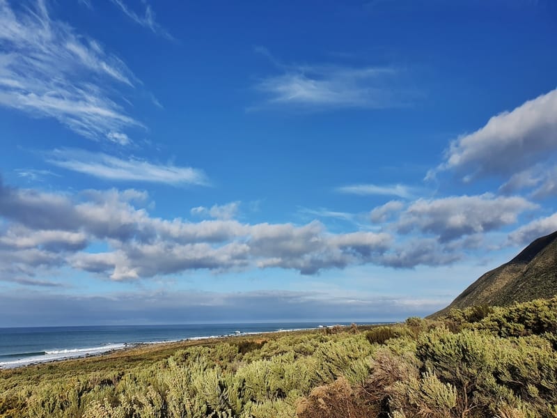
You’ll be following the coastline the whole walk, but there are no real swimming opportunities most of the way from what I could tell.
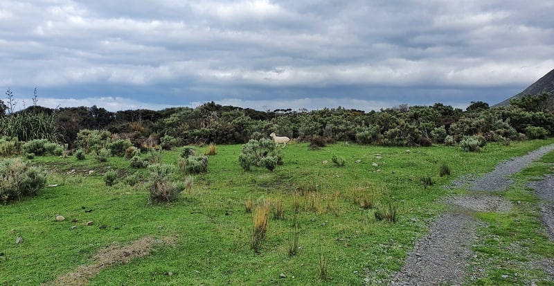
Early on you’re passing through the Orongorongo Station which means you’ll probably have some sheep running away from you, but they’re super cute. We saw a couple of horses and goats as well, but we weren’t sure if they were wild or part of the station?
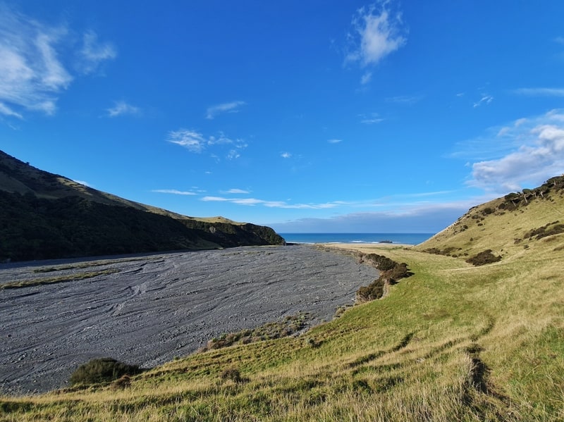
Now, the first decision you’ll need to make is whether you’re going to make the journey to Turakirae Head to see Wellington’s largest seal colony. It’s only another 800 metres extra each way to visit, but we skipped it with the idea we might go on the way back depending on how we were feeling. You’ll see the sign for the turnoff after 20-25 minutes or so of walking
The first few kilometres of the track are for walking and cycling only, and it’s super easy to follow, with some large stones to walk on at times (it’s nothing crazy as it’s a cycling trail after all).
Eventually, you’ll come across the 4WD track. Turn right. This is the track you’ll follow the rest of the way. So yes, the track is suitable for vehicles, but the only cars allowed are Department of Conservation workers and station workers.
As I mentioned above, the elevation isn’t hectic, but you’ll notice small undulations as the walk progresses.
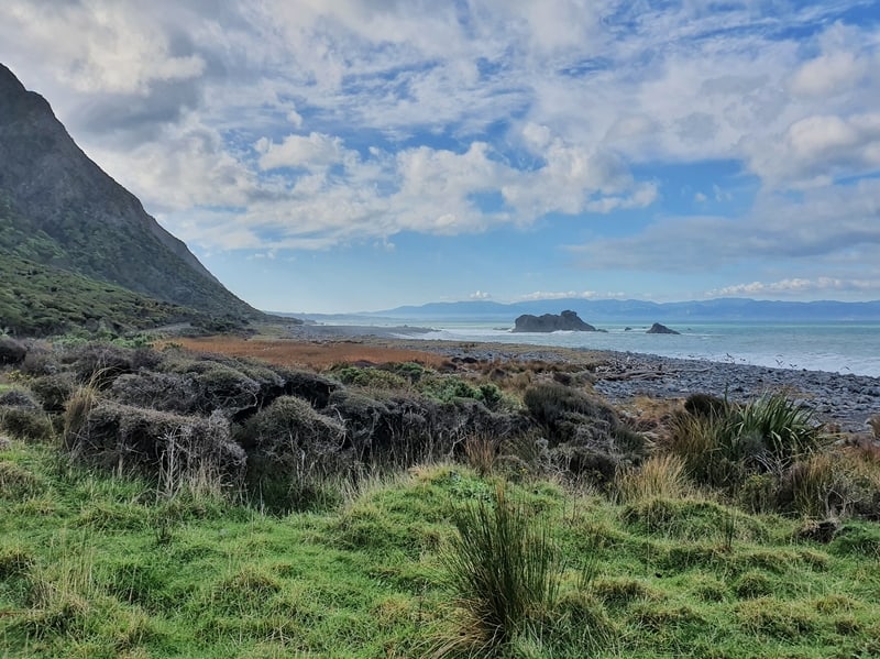
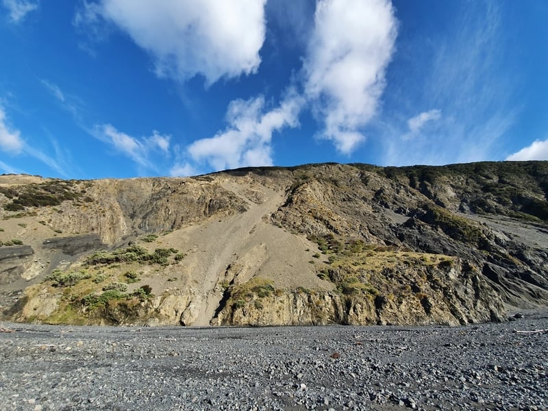
From here you’ll be admiring all the views as you move along the coastline on your right and the rugged hills on your left. There were super cool trees we came across, I’ve got no idea what they are, but they reminded me of Bonzai trees. There’s not much to describe, so I’ll pop a bunch of photos here before continuing on below.
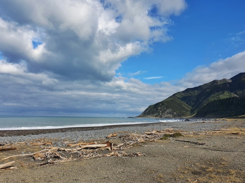
As you close in on the Mukamuka Stream, you’ve got one small stream crossing (don’t cross if it’s flooded) and you do walk through a section of bush which is nice. About 1km before the Mukamuka Stream you’ll come across a toilet and picnic area which was really random. But if you’re planning to bring lots of food, this might be the spot you choose to eat. There are also benches next to Barney’s Whare (photo) which you’ll pass earlier in the walk.
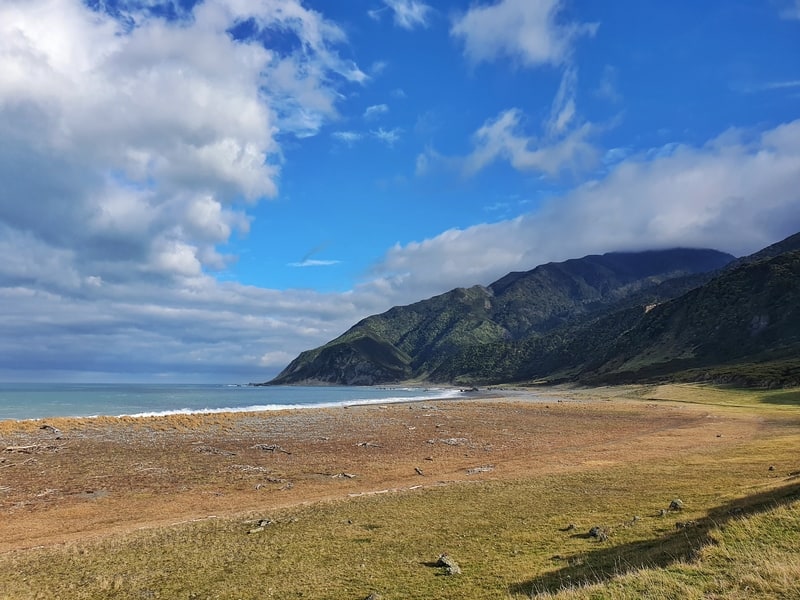
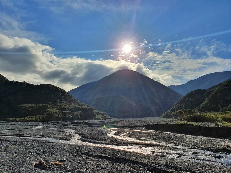
Once you reach the Mukamuka Stream you can cross over and continue on (provided it’s safe to do so), but I can’t tell you what it’s like beyond here. This is another good spot for a picnic, plenty of open green pastures.
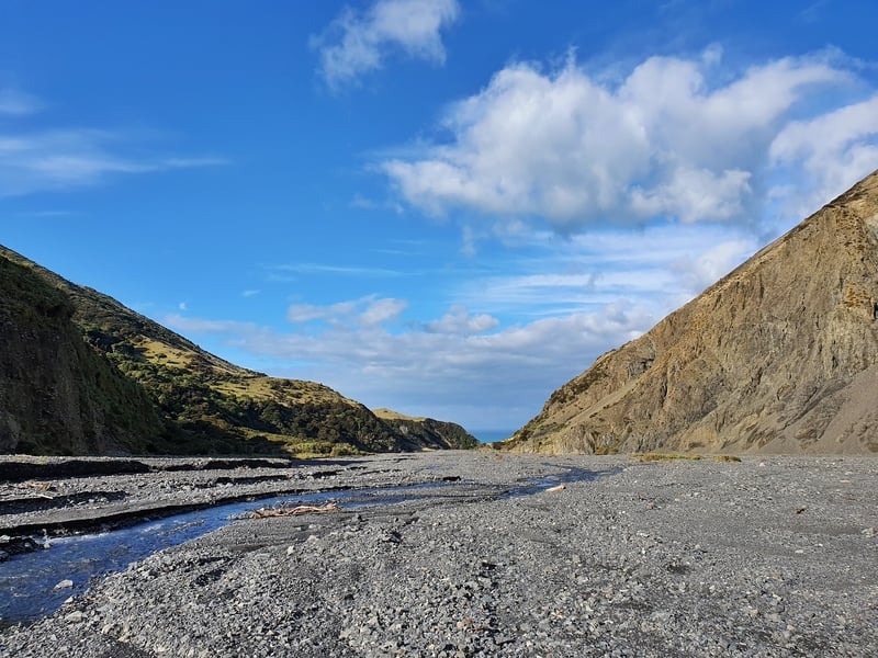
We went up the wide-open riverbed which was really low. It was super cool, even if the feet didn’t love it. We crossed over the stream a few times before turning around about 2.5km upstream to make our return. You can continue on further up the stream if you like towards Mt. Matthews. Once again, the photos tell the story (see below) as we headed back to the trailhead. We decided not to go to the seals as we were pretty knackered and ready for some tomato and avocado on toast for lunch back at the car.
So yea, you can turn back around at any time you like depending on how far you want to go in.
Who did we see? Two DOC workers, two walkers, and a cyclist. Very few for a four-hour adventure.
I’d never heard of the Wild Coast Trail until my mate suggested we go and do this exploration. There was minimal information online, which is almost a guarantee of a good time (if you don’t get lost).
It sure was, and while it would be a different story on a not so great weather day, you’ll want to keep this walk on your to-do list in the future.
If you’ve got any questions about the West Coast Track or a trip report, leave them below or email jub@churnewzealand.com.
p.s. Here’s a map of all the hikes documented on Chur New Zealand. You can click the icon to see brief details, as well as a link to read more about the hike (like this post).

Hey, it’s Jub here. I’m the guy behind Chur New Zealand, helping you have the best time hiking, trekking, walking…whatever you want to call it…in NZ. I’m based in Queenstown and am always out and about exploring trails, old & new. If you have any questions, reach out.