If you’re looking for a peak that’s a solid, but you don’t want it to be too technical…Mount Matthews could be for you. You can do this as either a long day hike, or make it an overnight adventure with several accommodation options.

This post will give you all the details you need to know about hiking Mount Matthews in Remutaka Forest Park near Wainuiomata.
TABLE OF CONTENTS
1. Details About Mount Matthews
2. Mount Matthews Map
3. How To Get There
4. My Mt Matthews Experience
1. DETAILS ABOUT MOUNT MATTHEWS
- QUICK DETAILS:
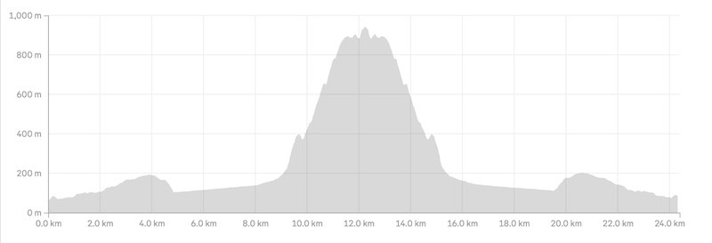
- Distance: 24 – 25km return
- Elevation Gain: ~1262 metres total
- Difficulty: Medium to Hard
- GPX File Coming Soon
How hard is the Mount Matthews track?
It’s overall a tough hike, given the distance. There’s not massive amounts of elevation gain for the distance, but there’s some steep sections approaching the summit, along with the walk along the riverbed which is flat, but exhausting.
What distance is the hike to Mount Matthews?
I recorded 24.4km return. That was going via the Orongorongo Track and the river bed before getting on the Mount Matthews Track .
What is the elevation gain of Mount Matthews?
My watch recorded 1262 metres of elevation gain (return), with 80%+ of that on the way to the summit.
Here’s the elevation profile:
How long does it take to hike Mount Matthews?
You can do Mount Matthews as a day trip, or an overnight…or even make it three days if you want to chill.
If you’re planning to do it in a day, start early (once the carpark is open) and make good progress over the first 5km on the Orongorongo Track
2. MOUNT MATTHEWS MAP
Map will be coming soon. VPN problems :/
3. HOW TO GET THERE
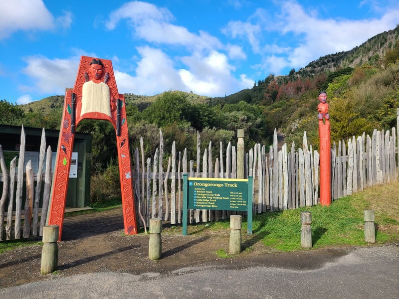
The track to Mount Matthews starts from Catchpool Valley Carpark. The easiest way to get there is by car. It is less than 40km from Wellington Station, and you go via Petone and Wainuiomata. Give yourself an hour to get there…usually it’ll take 50 minutes or so.
Note, the carpark is closed overnight most of the time. Check the carpark closing times before you start the hike.
6 am – 8 pm from 28 September until 7 April
6 am – 6 pm from 8 April until 27 September
You could take a bus from Wellington to Wainuiomata, but you’re still 12km from the carpark from which you could get a taxi, shuttle, or hitchhike the rest of the way.
4. MY MT MATTHEWS EXPERIENCE

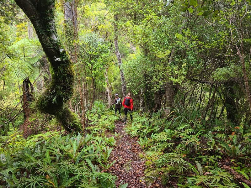
Leaving the carpark, the first 4km along the Orongorongo is on well maintained tracks. There’s a gentle incline throughout these 4km, but it’ll feel more undulating than anything. You won’t have much in the way of views, but it’s nice bush.
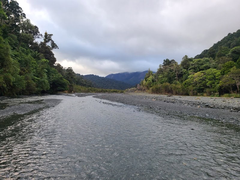
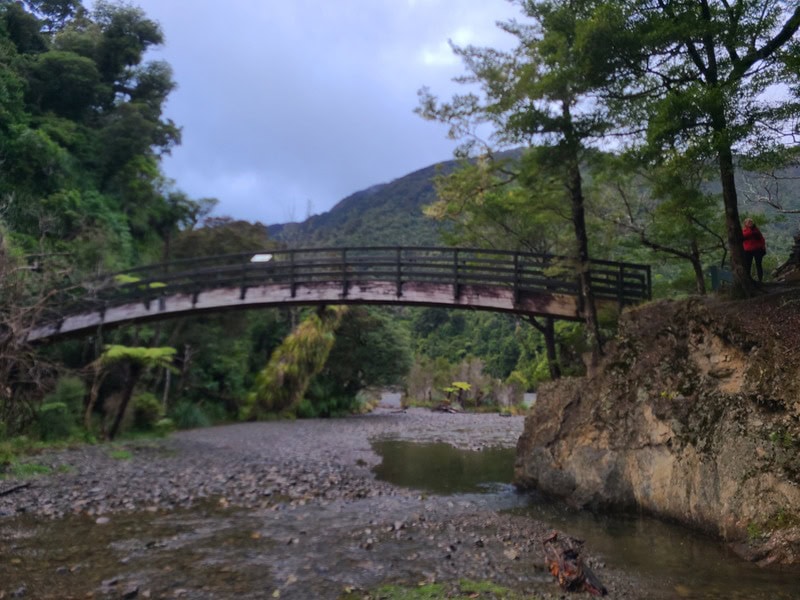
You’ve then got a steady descent for one kilometre that takes you down to Tutere Stream/Orongorongo River…this is also where you’ll cross the Arched Bridge and plonk out down on the river. This is the Orongorongo Track complete.
From here you have two options to reach the start of the Mount Matthews Track (where you actually climb):
- Follow the Big Bend Track
- Follow the river
I was doing this with a friend who has been to Mt Matthews several times who prefers the river route, so that’s what we did.
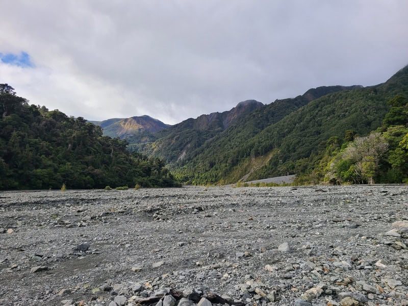
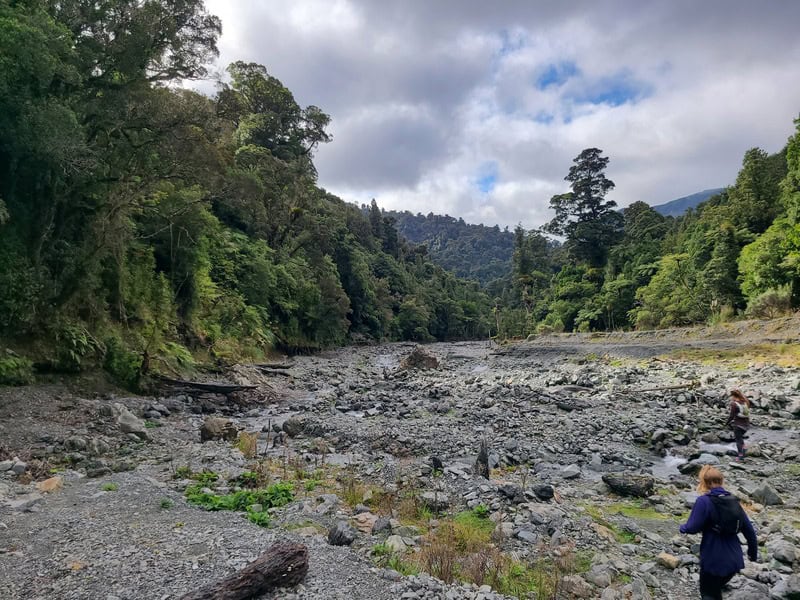
The river was low when we were there, so any time we crossed the river…we still got wet feet but it was a drama. There were some vague tracks from time to time on the riverbed, but we just sort of followed the river as best we could. It’s not my favourite terrain, and likely not yours, but I enjoy walking on river beds. It’s all on an incline you won’t really notice at all.
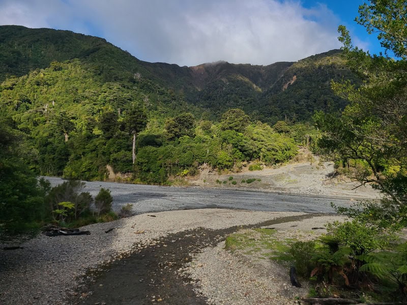
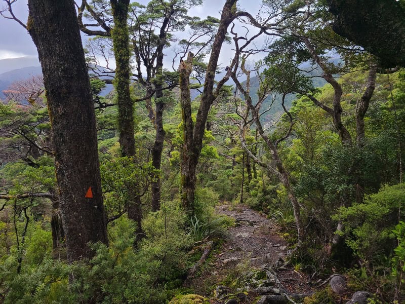
Then we hook a right into Matthews Stream outlet, which is the start of the Mount Matthews Track. You’ll be in for about 700 metres before you get into the forest. The big orange triangles are easy to spot in good weather. In bad conditions, it’ll awlways be handy to have a GPX file when visibility is low.
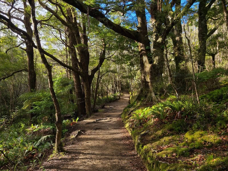
As soon as you hit the bush, you’ll be going up a steep incline with the next ~3.4km having about 750 metres of elevation gain. The route is easy enough to follow through this section, with plenty of orange triangles to assist you on the way.
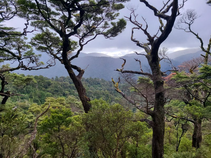
There’s plenty of roots, and about halfway through the climb you’ll reach an offshoot for South Saddle. We didn’t go out as the weather wasn’t great, and we didn’t have any views (it was also super windy).
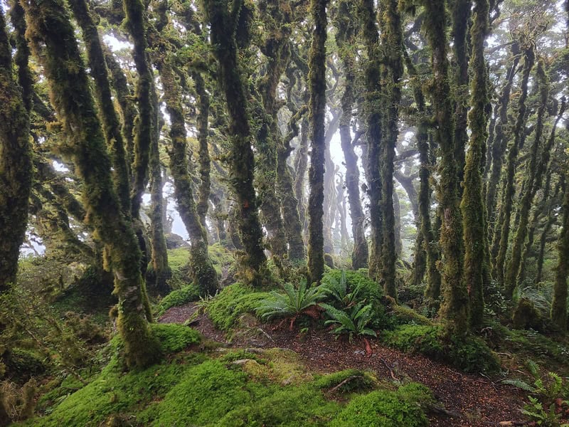
There’s some cool views of the spur as you continue past the South Saddle (we didn’t get many), but the forest is stunning now with its Goblin Magic.
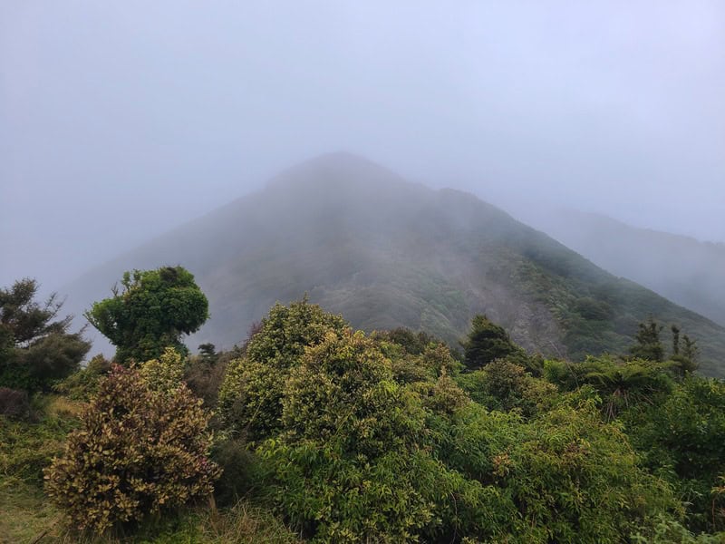
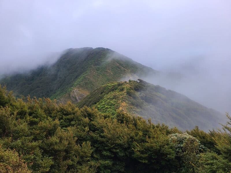
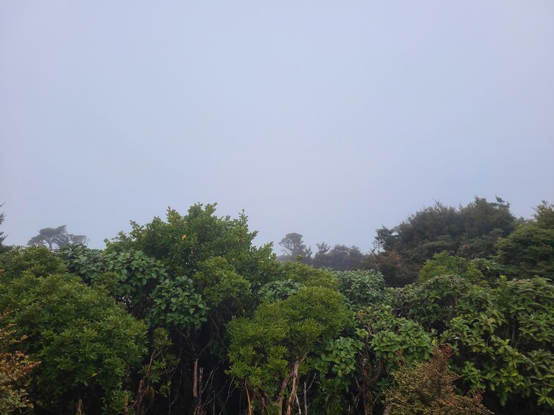
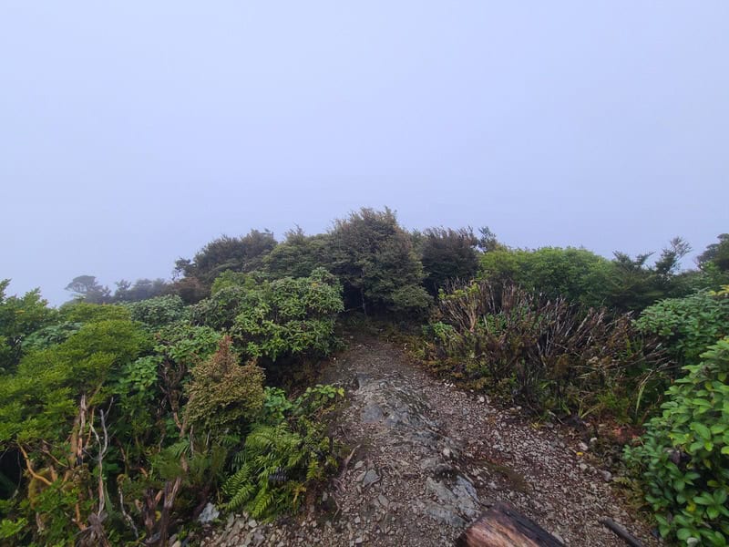
There’s a flatter section close to the summit before a final little pinch. As you’re less than 1000 metres above sea level, you don’t get above the treeline at the summit but you can snatch some views across the region if you make some effort. Unfortunately this was our view…
Coming back down the other way is easy enough as you’re retracing your steps. We briefly thought about returning via the Big Bend Track, but in the end we decided we enjoyed the riverbed enough so went back that way.
And there we go, a great day out at Mount Matthews awaits for you if you’re up for it. If you live in Wellington, make a weekend of it if you can!
Got any questions or comments about a trip to Mount Matthews? Leave a message below or email jub@churnewzealand.com.
Chur.
p.s. Here’s a map of all the hikes documented on Chur New Zealand. You can click the icon to see brief details, as well as a link to read more about the hike (like this post).

Hey, it’s Jub here. I’m the guy behind Chur New Zealand, helping you have the best time hiking, trekking, walking…whatever you want to call it…in NZ. I’m based in Queenstown and am always out and about exploring trails, old & new. If you have any questions, reach out.