The Red Rocks walk is much more of a walk than a hike with minimal elevation change (essentially zero) and the in and out track is suitable for all. The one exception would be on a day with a strong southerly blowing, you’ll be battling to stay upright.
This post is about the Red Rocks costal walk including how long the red rocks walk is, where the red rocks are, and more.
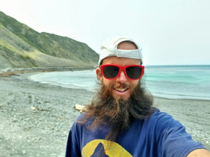
A sneaky selfie on a recent visit to the Red Rocks walkway. Note: Many of the photos in this post don’t show the true beauty of the area. The smoke from the Australian bush fires made its way to NZ 😮 I can’t even register how bad the smoke is over there.
TABLE OF CONTENTS
1. Details About The Red Rocks Walk
2. Red Rocks Walk Map
3. How To Get There
4. My Red Rocks Trip Report
1. DETAILS ABOUT THE WELLINGTON RED ROCKS WALK
Hike Distance: You’ll want to walk all the way past the red rocks to Sinclair Head, which is where the seals are. From the carpark to Sinclair Head, the Wellington official brochure has the walk as 7.6km return. On my Strava, I have it as about 4km one way (8km return). You can walk beyond Sinclair Head following the Southern coast.
Difficulty: Easy.
Incline: Less than 50 metres/negligible…
Hike Duration: At 8km round trip, I would say most people are going to spend at least 1 hour 30 minutes walking to and from the carpark. On a windy day you can add plenty of time for this, along with stopping to see the rocks, seals, baches, and maybe having lunch. If you give yourself 3 hours, that’ll be plenty of time for most.
2. WELLINGTON RED ROCKS WALK MAP
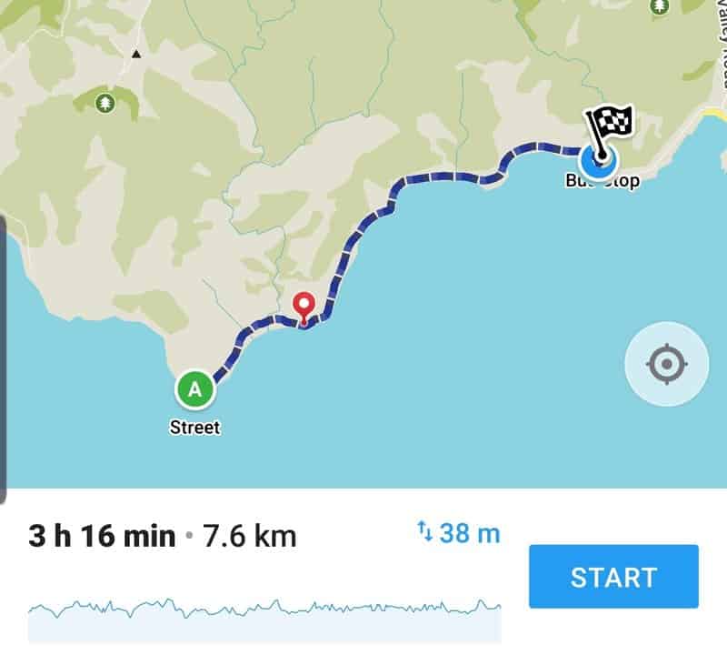
Once you’ve reached the Carpark, you follow the coastline, you can’t get lost.
Nevertheless, I’ve attached a screenshot of the walk on Maps.me. But it’s also useful to check Google Maps (this link will do the trick) and get familiar with where the Red Rocks and Seal Colony are on the coastal walkway. The seals are always further than I think they are.
3. HOW TO GET THERE
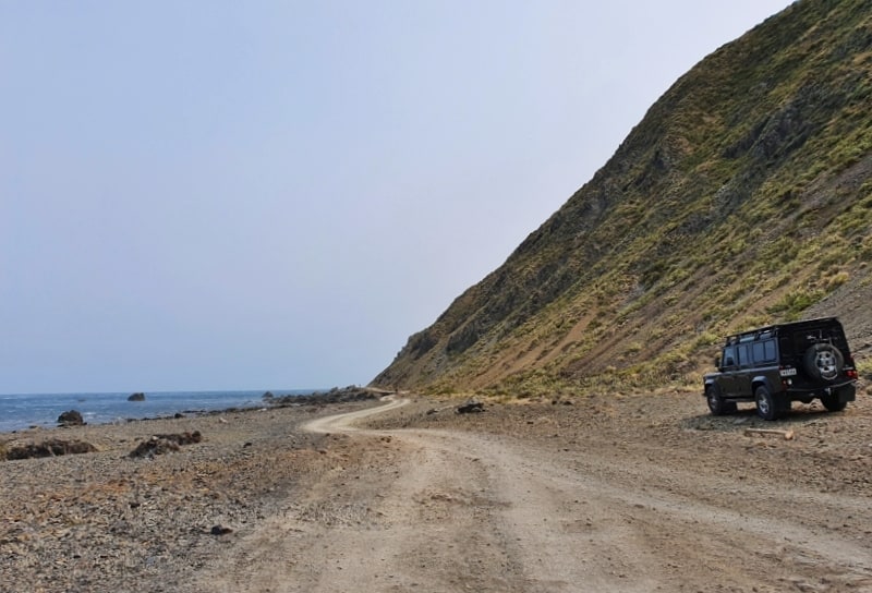
Drive: this is the best option with lots of parking at the Te Kopahou Visitor Centre. The carpark does get pretty full at times, but there’s other parking nearby if needed. No need to pay for parking… there are also a few parking spots for freedom campers if you get there early enough. There’s a coffee cart that’ll often be open in the carpark too Note: If you have a 4WD, you can drive onto the track following the coastal walkway anytime, except for Sundays when the gate is closed off for pedestrians only. In saying that, walk the trail! Don’t be lazy.
Walk: You can walk to Red Rocks from Wellington city via Brooklyn, but that’s not the greatest option. I have walked from the city via the Brooklyn Wind Turbine to Red Rocks track, which is nice!
There’s a bunch of elevation and makes for a minimum of five hours walking (back to the city), but you get awesome views from around the Turbine and surroundings so it’s definitely something I can recommend if you’re up for it.
Bus: This is possible, but as of writing this post the best bus from the city (29e) isn’t running very often so you’ll need to catch the 29 bus from Brooklyn or Newtown. Depending on where you are in Wellington, you may need to get a bus to these places (walking doesn’t take long though). Regardless of whether you catch the 29 or 29e, you’ll need to get off at the intersection of Happy Valley Road and Owhiro Bay. From here you’ve got a 1km walk to the visitor centre.
4. MY RED ROCKS (WELLINGTON) TRIP REPORT
I just love the views!
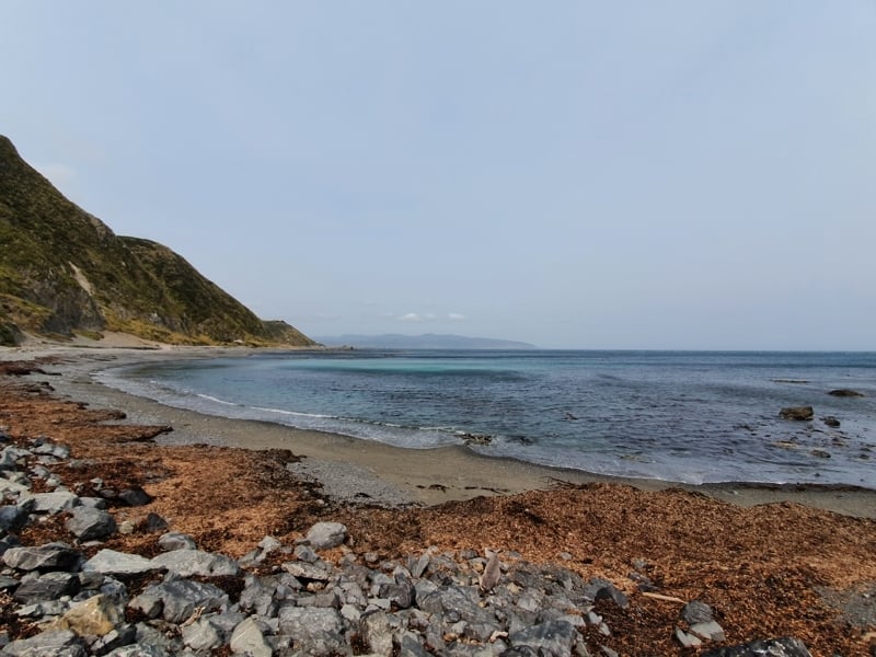
I’m going to document one of my visits which was while bush fires were happening in Australia which left a strong haze in the sky from the smoke drifting over the Tasman. The wind was coming from the north meaning that it was pretty easy to walk most of the time. It was also on New Year’s day, so no shortage of people walking the track.
Nevertheless, the track is long enough, with the 4WD tracks wide enough there weren’t any bottleneck type issues you get on New Zealand’s most popular hikes. I always think the first small stream crossing is going to cause some issues, but thankfully there’s always a couple of well-placed rocks you can easily hop over to the other side (it’s a super small creek).
Then it’s a matter of simply following the tracks, personally I feel like the views are better when you’re coming back, but nevertheless it’s fun to follow the bays around as the scenery changes subtlely throughout. As much as I like making life difficult, you should stick to the 4WDtracks, walking in the sand closer to the water isn’t easy! Though, you could always go for a swim which I haven’t done but would be cool in the summer.
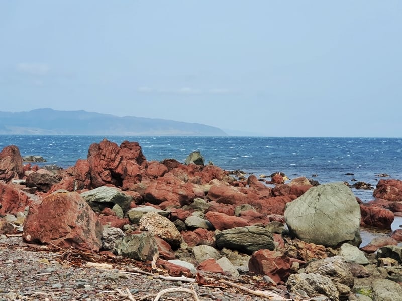
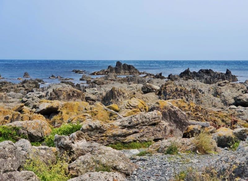
Red rocks, so red right?
The Red Rocks aren’t a massive area, but as long as you’re somewhat conscious of your surroundings you’ll see the large cluster of red rocks between the track and the water. Now that you’re there, you’ll obviously take some photos and get up close to the rocks as you pretend to be a geologist (it’s not just me, right?) for a few minutes. I’m not actually a geologist, but the internet tells me they’re red because of the iron compounds in them. I started Googling more about this but quickly got confused…
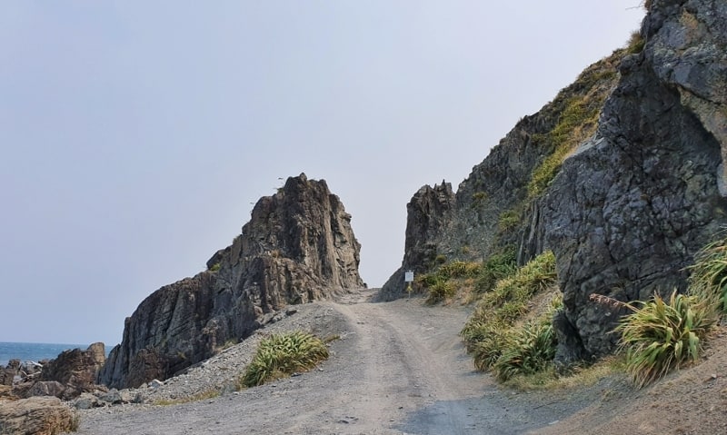
Devil’s Gate. Always impressed that some people can drive through that.
More scenery..gee on a non-hazy day it’s so much better. Promise!
Moving on, it’s now time to keep trucking to Devil’s Gate which you can see from a distance and is basically where Sinclair Head and the seal colony is. I love the small bachs tucked in at the base of the hills too…they’d be great to live in…unless the weather turned bad too often.
It’s about 1km to Devil’s Gate from the red rocks, so while some turnaround, keep going, because of seals! There’s also a trailhead where you can head up some tracks onto the top of the hills which would give you some different views, and you can walk to the Wind Turbine among other items of interest in the hills. This won’t be for most people though…
Can you spot the seal? I’m shocking with nature photography (phone camera life), so only the keenest of eyes will.
I start to keep my eyes scanning the rocks around the ocean as I close in on Devil’s Gate as the seals are pretty skillful at camouflaging themselves on the rocks. According to a tour guide who brings tourists here, the seals can be found on Sinclair Head (let’s just say a few hundred metres either side of Devil’s Gate for ease) year-round, but in various numbers. May to August is when the numbers peak, which makes sense as I only saw two seals on New Years Day. They’re cool though and as long as you respect the guidelines of staying at least 20 metres away, you’ll have a blast watching seals sealing. Unless they’re just sunbathing, then it’s pretty meh.
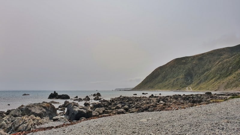
Can you see the smoke? This was a decent weather day and you should be able to easily see the South Island. With the smoke though, no chance.
After you’ve seen the seals, it was time to head back the way I came and this time around the Northerly was harder to walk into, and there were a few sections where the wind picked up some sand and threw sand straight in my face (that’s what it felt like, pesky Sandman). But it wasn’t constant and isn’t nearly as bad as a day with a bad southerly blowing.
Back at the visitor centre there’s plenty of facilities, toilets, lots of information, and a drinking fountain. At the weekends there’s a coffee truck that might be open too…winning!
The Red Rocks walkway is just one of many awesome walks in Wellington. You get to see some funky rocks, seals (most likely), rugged coastline with hills rapidly ascending above, all the while not having to deal with elevation and you’re so close to the city, but it doesn’t feel like it. While I’ve never been to the Red Rocks for sunset, I’ve heard it’s amazing.
If you do go for sunset, send me your photos (I won’t steal them!) of your trip to jub@churnewzealand.com.
Chur.
p.s. Here’s a map of all the hikes documented on Chur New Zealand. You can click the icon to see brief details, as well as a link to read more about the hike (like this post).

Hey, it’s Jub here. I’m the guy behind Chur New Zealand, helping you have the best time hiking, trekking, walking…whatever you want to call it…in NZ. I’m based in Queenstown and am always out and about exploring trails, old & new. If you have any questions, reach out.
Loving your Blog! The info is amazing! Never knew about the Tama Lakes track, so looking forward to doing it next month.
Thanks so much for all the amazing work you have put into Chur NZ. Safe travels, keep having these amazing adventures!
Cheers Sherryl 😊
PS: There’s little known small lake/lagoon on Western side of Taupo – it can be accessed to the west just south of Tihoi Trading Post – maybe called something like Waihoro?? Supposedly, you can drive in but when I went early summer the road in was strictly 4WD. It’s managed by DOC. If you ever venture in there I would love to know please.
Hey Sherryl,
Thanks so much for the kind words! The Tama Lakes Track is definitely one of the lesser-known tracks that should be better know!
Thanks for the tip on Taupo, I’ll be heading up that way next month. If I can figure out how to get there I’ll let you know 🙂
Cheers,
Jub