The Glacier Burn Track is a neat hike that’s starting to gain popularity via word of mouth. The marked route is 8km return to the tree line, but you can continue to get a better view.
It’s never easy to compare hikes, but I’d say it’s a short version of the Earnslaw Burn Track.
After a small water crossing you hit the forest, and then you emerge above the treeline and get great views. In the Dart River, and both the Humboldt Ranges and Richardson Mountains (where you can hike the Mount Judah Track and Mount McIntosh Hut).
This post will give you all the details you need to know about the Glacier Burn Track.
TABLE OF CONTENTS
1. Glacier Burn Track Details
2. Glacier Burn Track Map
3. How To Get There
4. My Glacier Burn Track Experience
1. GLACIER BURN TRACK DETAILS & FAQ’S
QUICK DETAILS:
- Difficulty: Medium
- Distance: 8km return
- Time: 1 to 2 hours to the treeline.
- Download the GPX file here
How hard is the Glacier Burn Track?
It’s a reasonably short trail, and while it might be challenging for some…it’s short enough where you won’t be out there all day, despite the elevation gain.
That’s until you get beyond the tree line. If you go beyond here some route finding skills are required so I’ll make it a medium. Make sure not to go past the treeline in winter and spring!
What distance is the Glacier Burn Track?
From the trailhead to the end of the route which is at the treeline it is 4km, making for an 8km return hike. But I would suggest going up the river a bit further if it’s safe to do so as the views get better and better. Another 1km each way works a treat.
What is the elevation gain of the Glacier Burn Track?
The trailhead is ~330 metres above sea level and the tree line is ~960 metres above sea level. That’s at least 660 metres in the 4km…and there’s a “flat-ish” section two thirds of the way through.
Here’s the elevation profile from the trailhead to the treeline (if you continue it gets steeper):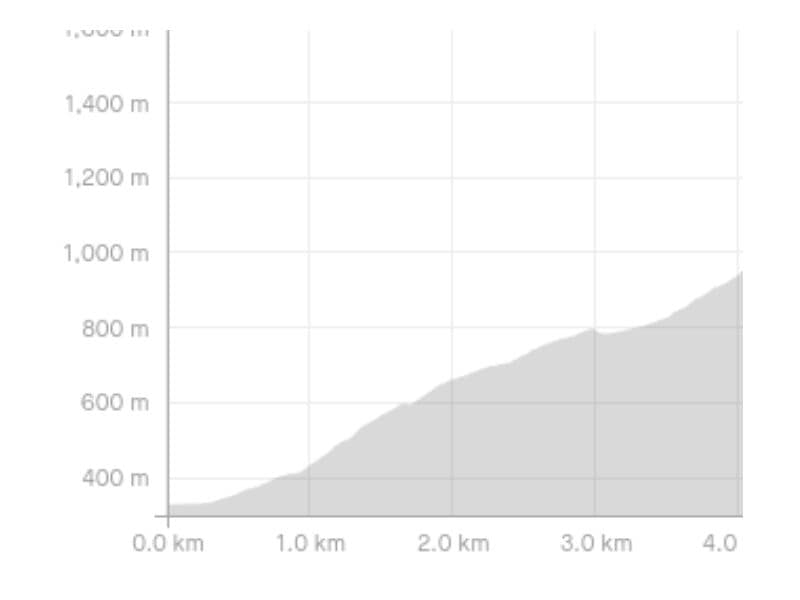
How long does it take to hike the Glacier Burn Track?
This is tricky to judge. But if you can walk it in under an hour you’re doing really well. I would say most will get to the treeline within 90 minutes, then from above the treeline the travel is a lot slower. Getting down will be slightly faster. Give yourself 3 hours or so to experience this hike, minimum. There’s some amazing hikes in Glenorchy, and this is a solid half day option.
Are dogs allowed on the Glacier Burn Track?
No, the track is on Department of Conservation land.
Can you camp on the Glacier Burn Track?
You can camp on DOC land, which is below the treeline. But I would say you’ll have zero issues camping above the treeline…obviously be aware of the risks (see below).
On my way up I met a father and child hiking back down, they’d camped halfway between the treeline and the waterfall. A little bit of searching should reveal flat spots.
Is the Glacier Burn Track suitable year round?
From the trailhead to the treeline, you can safely hike throughout the year. But in winter and spring, it’s not advisable to go above the treeline as the area is suspect to avalanches (from snow you can’t necessarily see). From mid-late summer though, you are generally ok…but take individual circumstances in to play etc.
2. GLACIER BURN TRACK MAP
*Clicking the image below will open the map on topomap.co.nz where you can zoom/scroll around for further details.
This is a GPX file of the track overlaid on a topomap.co.nz map, up until the treeline.
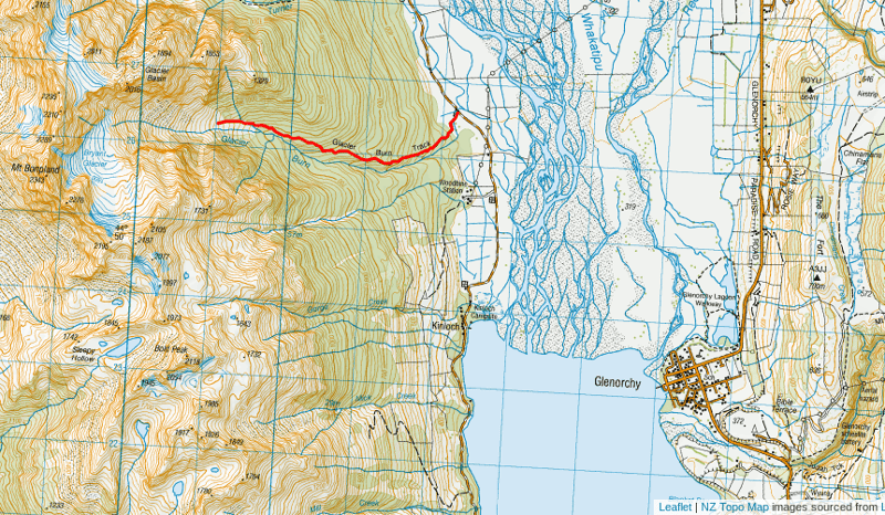
You can download this GPX file if you’d like to go a bit further beyond the treeline.
3. HOW TO GET THERE
You can find the Glacier Burn Track trailhead here on Google Maps (as seen above).
The easiest way to get to the Glacier Burn Track is by car. Located on the route between Glenorchy and Kinloch, you’ll have about 5km of gravel road to drive on before reaching the trailhead. The road quality along this section is fine, it’s like the section getting to the Routeburn Track.
Approximate Drive Times:
- From Glenorcy: 20 to 25 minutes (~22km)
- 1 hour to 1 hour 15 minutes
OTHER OPTIONS
Shuttles: You could shuttle to the trailhead, but it’s tricky as it’s not a long hike and you’d need to contact one of the hiking shuttle companies directly to see if they can make it work. You can try Info track.co.nz or Haula.co.nz.
Biking: If you hire bikes from Glenorchy or Kinloch you could ride to the trailhead and lock your bikes at the tralhead.
Hitchhiking: Hitchhiking from Queenstown to the trails in and around Glenorchy is fairly easy (although I’d recommend an early start as there’s not always a lot of traffic coming from Kinloch/Greenstone-Caples later in the day.
4. MY GLACIER BURN TRACK EXPERIENCE
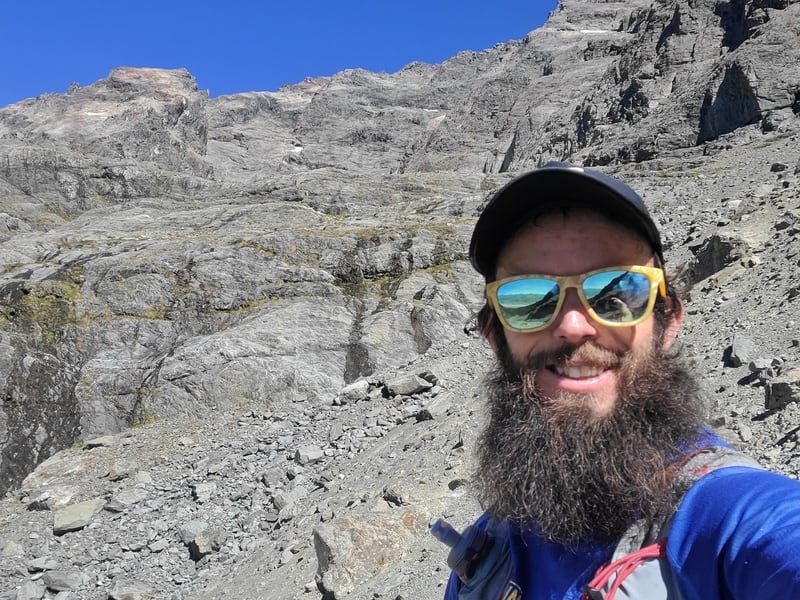
It was finally time to do the Glacier Burn Track! My flatmates were there the day before, and that was the push I needed to go and finally go myself.
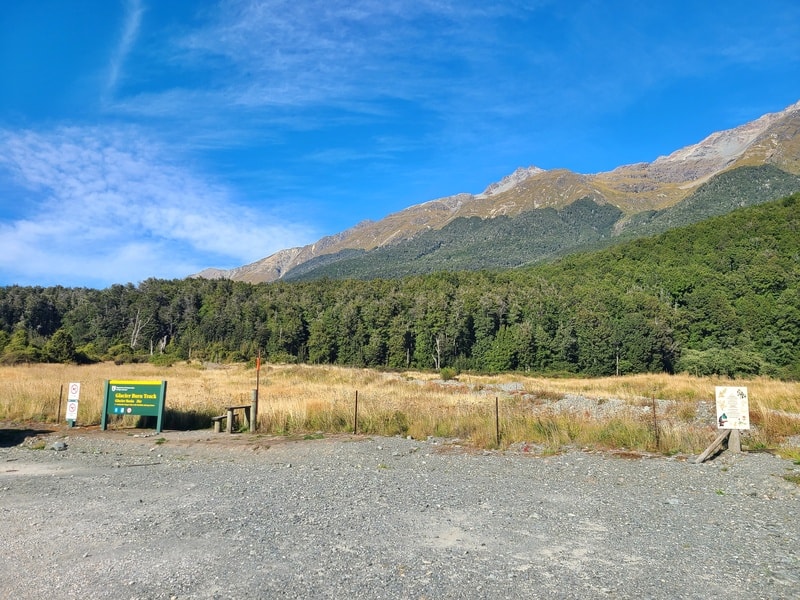
As long as you’re looking for it, the parking area is easy to spot next to the trailhead as you head along the gravel road towards Kinloch…though I kept the map open just in case I didn’t notice it.
The track doesn’t give much away. As you look up, it’s hard to know what to expect beyond the treeline.
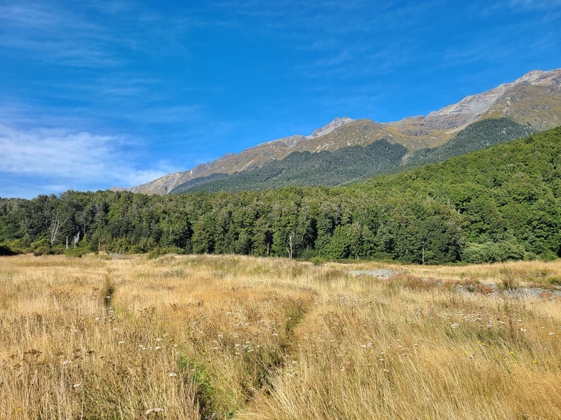
That said, I started and within a couple of hundred metres you’re crossing the Glacier Burn…if there hasn’t been any rain recently, you might be able to get across it without getting your feet wet.
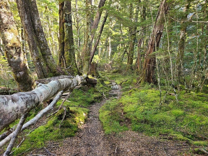
Within a few minutes you enter the treeline. I was confronted with treefall right away, and was thinking I’d been tricked…and the treefall would be a nuisance the whole way. Fortunately that was the only stuff I came across.
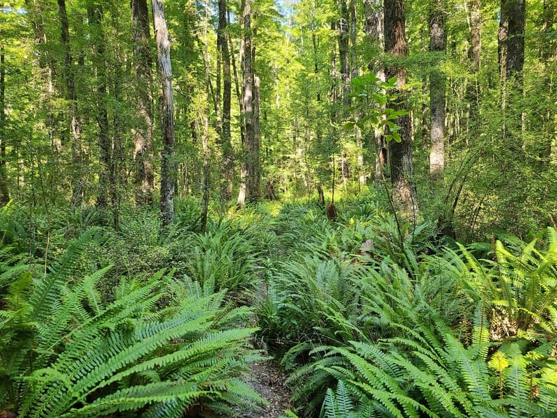
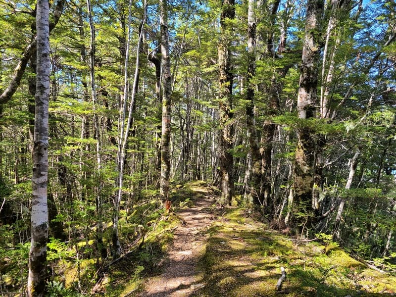
Once you hit the treeline, you’re on the single track but it’s beautiful with ferns lining parts off it early on…just enough to tickle your lower legs.
The ferns fade out and mix with shrubs and moss with the incline never ending. The incline is always steady with few flat sections, but you’ll not be on all fours at any point.
The trail is easy to follow, with the single track well formed and orange triangles always there or thereabouts whenever you’re in doubt.
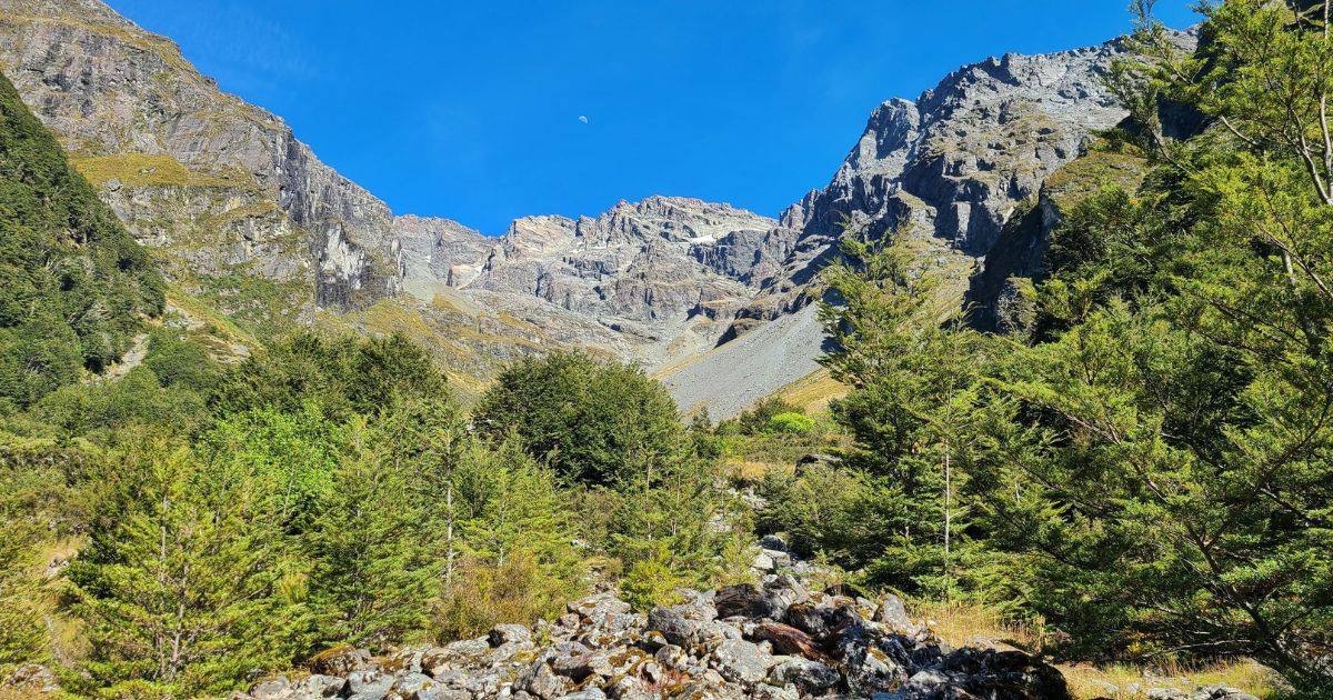
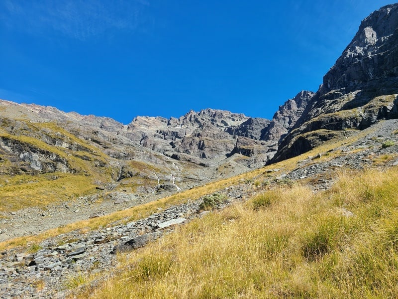
The treeline will start to thin soon enough, and you’ll start to see sections of the Glacier Basin peak through the trees. Emerging through the treeline is magic.
While there’s no obvious spot as to where the DOC track finishes, just remember beyond the treeline is prone to avalanches in winter and spring. It’s not advised to continue beyond the treeline then.
In summer and most of autumn however, the chance to play around beyond the treeline should be taken.
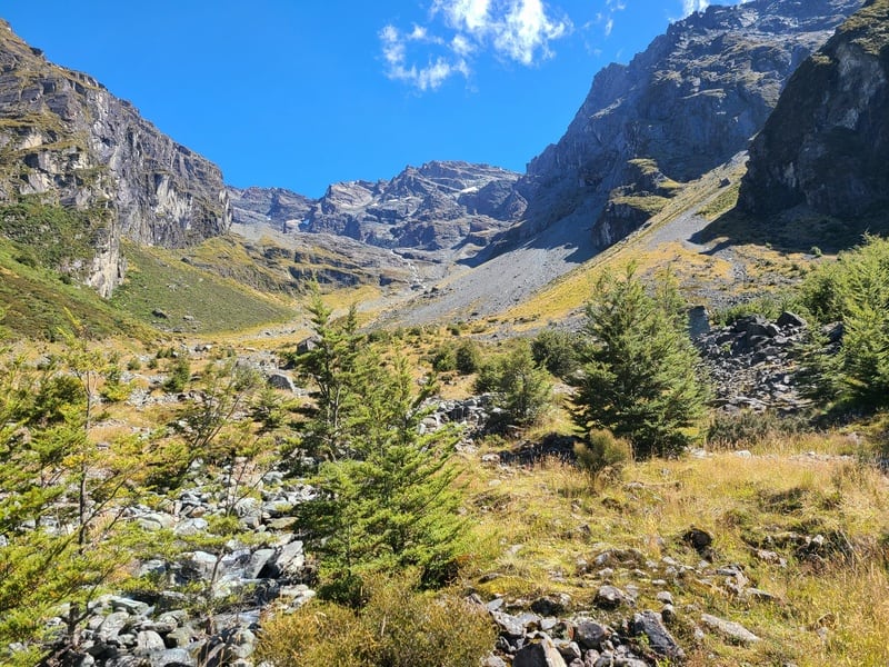
The terrain starts off as a mix of tussock and rocks, with vague trails you can follow. The further you go, the more the terrain becomes all rock.
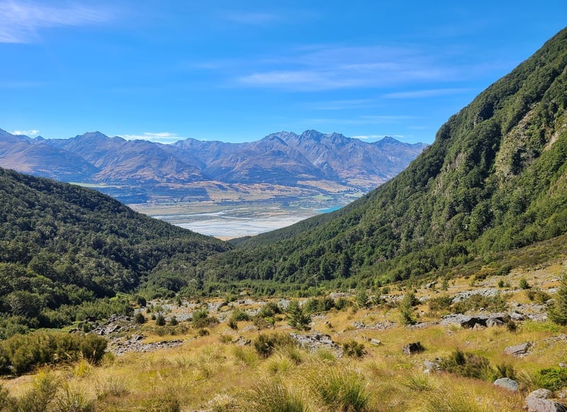
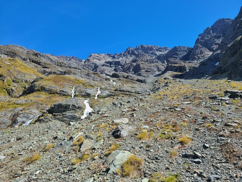
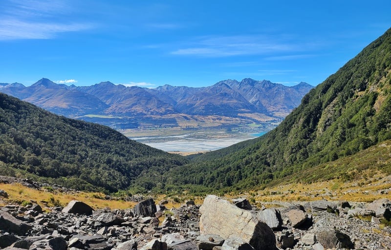
I’d suggest going to the two large rocks you can see after about 5km. From here you’ll get a good view of the waterfall coming down Glacier Burn, a good view all around the Glacier Basin. And looking back the way you came from is amazing views of the Richardson Mountains, the Dart River and the outskirts of Glenorchy.
It’s really beautiful up here! For the adventurous mountaineers, the opportunity to continue up towards Mt Bold and Mount Bonpland must be pretty amazing.
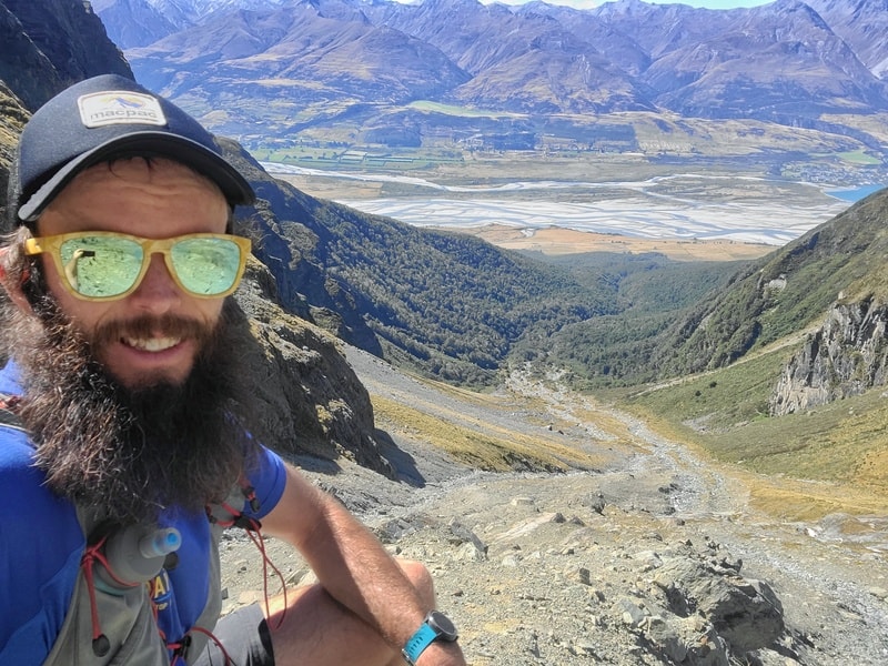
Don’t do what I did and continue up too far, where it gets rather steep, then coming down was a little bit nerve wracking…the spot from above. That’s why I think getting to these rocks are pretty much the perfect spot.
The return back on the out and back is alright, but nothing too spectacular as there’s no views once you get back into the forest. That said it’s nice enough and it’s definitely a faster journey than going up.
The Glacier Burn Track isn’t a track many people will do on a whim, unless they’re staying in Kinloch for a few days.
I like it a lot though, and will be recommending the track to those looking for a day hike that won’t take all day and is off the beaten path. It’s so good!
If you’ve got any questions etc. about the Glacier Burn Track, leave a comment below or email jub@churnewzealand.com. I’d love to hear about your experience too.
Chur.
OTHER TRACKS NEARBY
Or check out all the hikes on this map (clicking on the icons will provide more info):

Hey, it’s Jub here. I’m the guy behind Chur New Zealand, helping you have the best time hiking, trekking, walking…whatever you want to call it…in NZ. I’m based in Queenstown and am always out and about exploring trails, old & new. If you have any questions, reach out.