The Tarawera Trail is an amazing 15km end to end walk that finishes at Hot Water Beach on Lake Tarawera near Rotorua.
You can do the return walk (30 km) in a day, but with a ferry available for transport one way and an overnight campsite, there’s flexibility in terms of how you go about doing the walk.
This post will give you all the details about walking the Tarawera Trail. And there’s plenty of photos from my experience of one of the more unknown attractions in Rotorua.
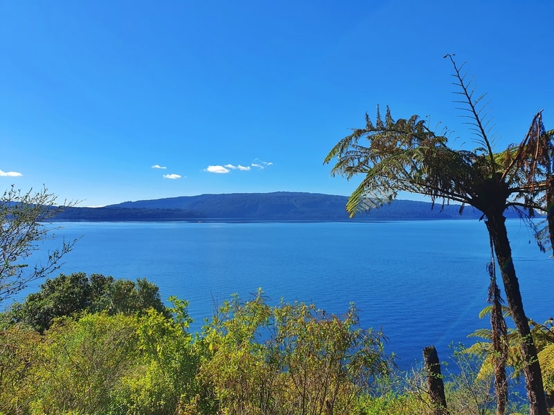
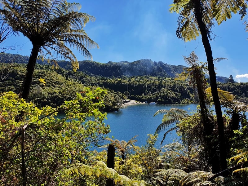
One of the many viewpoints from the trail
TABLE OF CONTENTS
1. Details About The Tarawera Trail To Hot Water Beach
2. Tarawera Trail Map
3. How To Get There
4. My Tarawera Trail Experience
1. DETAILS ABOUT THE TARAWERA TRAIL
QUICK DETAILS:
- Distance: 14-15km each way
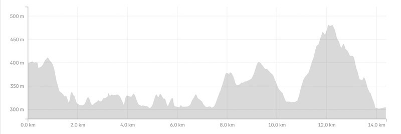
- Elevation Gain: 900 – 1000 metres total return
- Difficulty: Medium to Hard
- Download the GPX File
This is a wicked cool walk. The trail is easy enough to access, but given it’s on the longer side, and there’s a ferry service straight to Hot Water Beach it’s not going to be really busy. Throughout the walk you’ve got views galore and the track is undulating which I like. And you’ve got the treats at the end with Hot Water Beach. Amazing.
How hard is the Tarawera Trail?
Medium one way. Hard return (because of the distance)
How long is the hike from Tarawera Trail to Hot Water Beach?
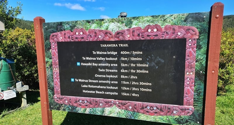
15km one way according to the sign at the trailhead. My Strava data came in at 14.4km. Maps.me comes in at 14km. So it’s in the 14-15km ball park.
What’s the elevation gain of the Tarawera Trail?
My Strava data has 500 metres of elevation gain one way. There are no massive climbs, just regular undulations.
The carpark is 95 metres higher than Hot Water Beach as you can see in the elevation profile below:
How long does the Tarawera Trail take?
It took me 3 hours to walk the trail one way. I’m a fast hiker, so you could do it a little but quicker, but not by too much. The sign at the trailhead says 4.5 hours so I’m comfortable saying 90%+ people will hike the Tarawera Trail to Hot Water Beach in 3-4.5 hours one way.
That’s a 6-9 hour return trip. Plus time spent at Hawaiki Bay and Hot Water Beach.
Can you camp at Hot Water Beach?
You probably know that, but yes you can stay at the Hot Water Beach Campsite. You need to book the campsite online, no spaces are left for people turning up unplanned.
The campsite prices:
- Adults: $18
- Children (5 to 17 years): $9
- Under 5’s: Free
2. TARAWERA TRAIL MAP
The Tarawera Trail is marked on both Google Maps and Maps.me. You can always use my favourite topo map app, NZ Topo50.
I believe the map above only registers at 12.8km as it doesn’t take in the little twists and turns along the track. As I mentioned, be prepared for a 14-15km Tarawera Trail walk that’ll take 3 to 4.5 hours each way.
3. HOW TO GET THERE
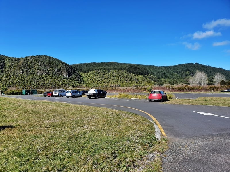
The Tarawera Trail car park
The best option to get to the trailhead is by car. You can bike (take it easy on Tarawera Road), but no public transport is available.
DRIVING
The trailhead is a 15-minute and 15 km drive from the Rotorua i-Site (directions here).
It’s a few kilometres beyond Blue Lake. It’s super easy to spot with signposts 1km away and at the turn-off. You can see the car park above has plenty of space.
THE FERRY TO/FROM HOT WATER BEACH
A 15km walk is going to be at the upper limit for many. 30km is certainly doable but you may not love having to return the way you came. But, there’s a ferry service with Totally Tarawera. You can book a ferry service one way and/or return from/to Hot Water Beach.
At the time of writing, the ferry costs $35 for adults one way and $25 for children one way ($5 for under five’s). You can read about and book the service on TotallyTarawera.com.
You can also have them transport your camping gear for a small fee, contact them regarding this.
The ferry leaves from the end from the end of Tarawera Road which is 2km away from the trailhead. As long as you plan a little bit, this isn’t a major issue and you’ll be ready for your next walk in Rotorua the next day.
Note: The services are available all year expect July and August.
Looking for accommodation close to the trailhead? Here are three options:
Totally Tarawera also offer a glamping set up a 1.5 hour walk from Hot Water Beach.
4. MY TARAWERA TRAIL AND HOT WATER BEACH EXPERIENCE
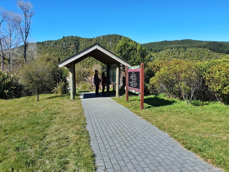
The area around the trail head is presented nicely
After arriving at the trailhead I was relieved to see a few cars in the car park. I wasn’t sure what condition the track would be in during winter, but seeing others there made me feel better.
At the trailhead, there’s a small shelter and a sign letting you know how far to reach the sights along the way. I was going all the way to Hot Water Beach, so I wasn’t too fussed about this.
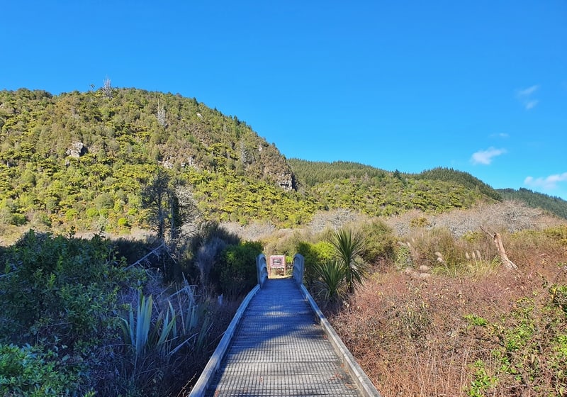
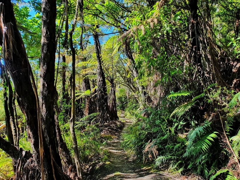
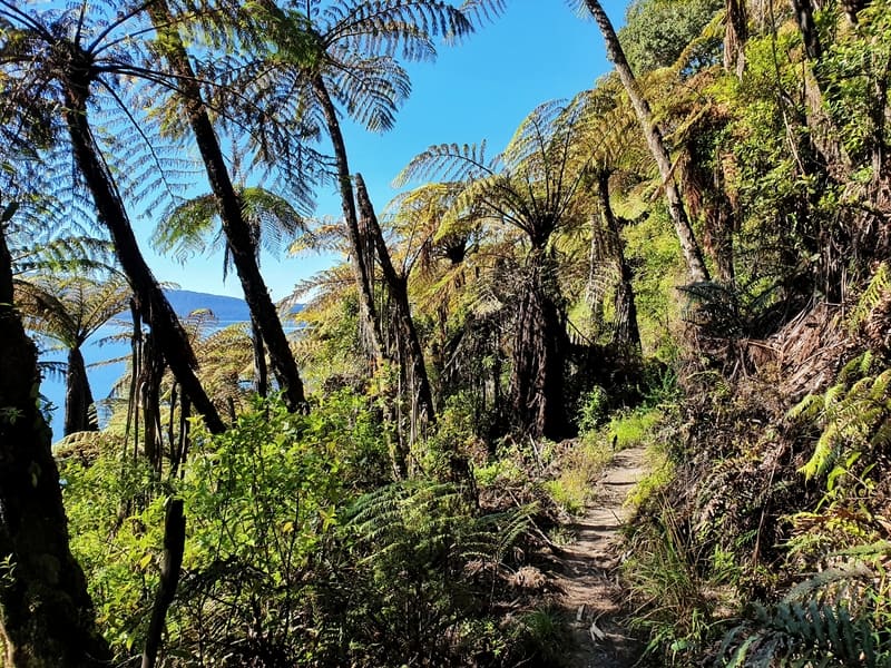
The walk is an easy start. The first kilometre is more or less flat as you walk towards the hill in the distance littered with beautiful ferns. I love ferns!
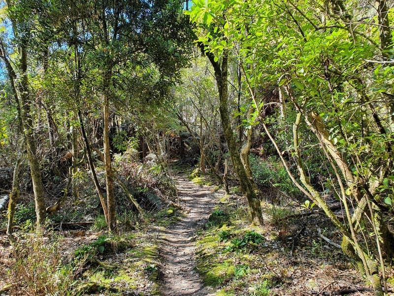
And then you enter the forest.
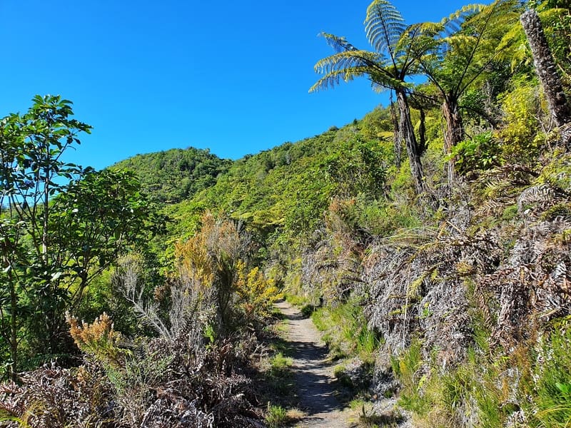
The track is beautiful from the outset and I could tell it’s well used with small ruts in the track, but it also felt raw as it’s not perfectly manicured.
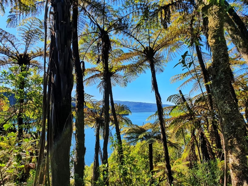
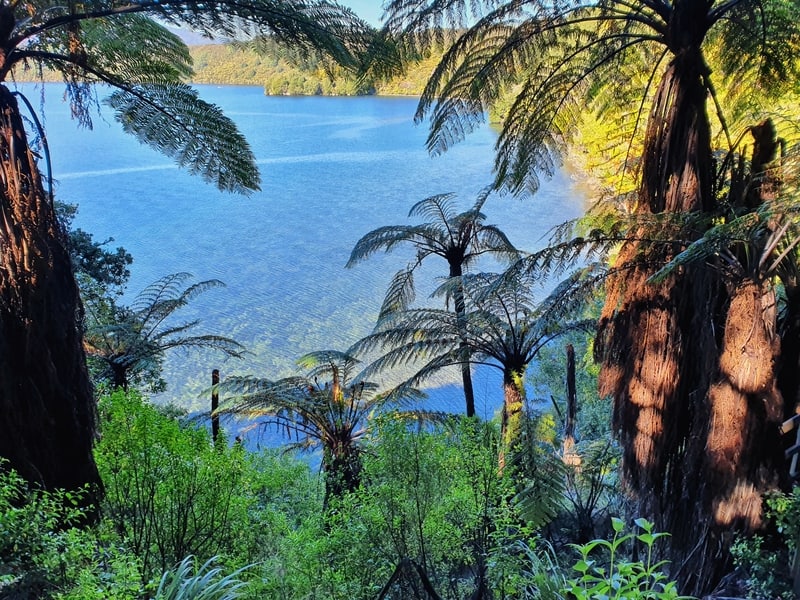
After the first kilometre you make a steady descent towards the lake. It’s not hard going with the occasional views emerging over a forest, and then you get your first glimpses of Lake Tarawera through the trees.
You’ll also hear Wairere Falls pumping. At times it feels like you have to be able to see them they sound that close. But alas, you won’t. To see them, you’ll need to visit the Buried Village (and you need to pay to visit the falls).
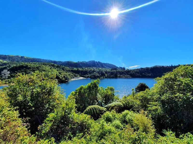
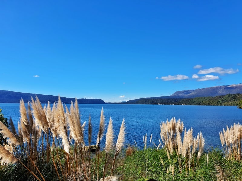
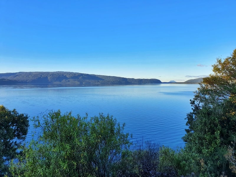
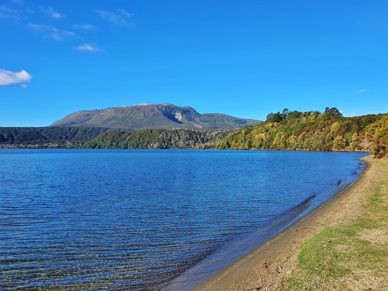
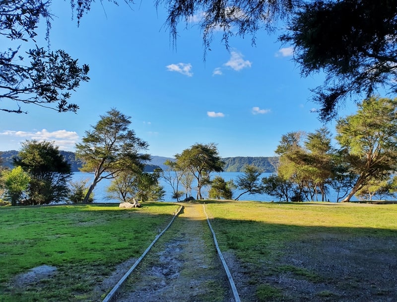
After the descent, you’re close to the level of the lake, and from here the track proceeds to be undulating. A little up, a little down. It’s only minor undulations, but it’s rare you’re in a flat section. It’s all very beautiful and getting frequent glimpses of blue will always keep you moving.
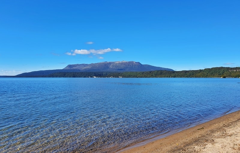
At ~5km in you reach Hawaiki Bay. There’s a sign letting you know that you’ve made it. Turning left for 10 metres will lead you to a beautiful sandy bay. You’ve got amazing views over the lake, and you get to see Mount Tarawera (consider joining a Mount Tarawera guided tours).
I got talking to a local and she said a lot of people will make a day trip to Hawaiki Bay rather than the full Tarawera Trail length. They’ll go for a swim, enjoy the afternoon and then turn back around for the day. That’s a stunning 10km day!
But, I was on a mission. So on we go.
The next 2.5km continues along the same way, with small undulations surrounded by nature with glimpses of the lake.
At the 7.5km mark, you begin the first uphill climb of any note gaining 70 metres of elevation in about a kilometre as you reach the Oneroa Lookout. Another great view of the lake.
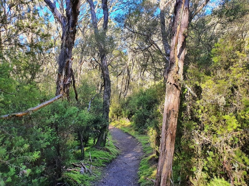
There’s a brief descent before you go back uphill again for a short distance. I felt like the trees and trail were getting wilder by now, I’m guessing that’s due to fewer people making it this far into the walk.
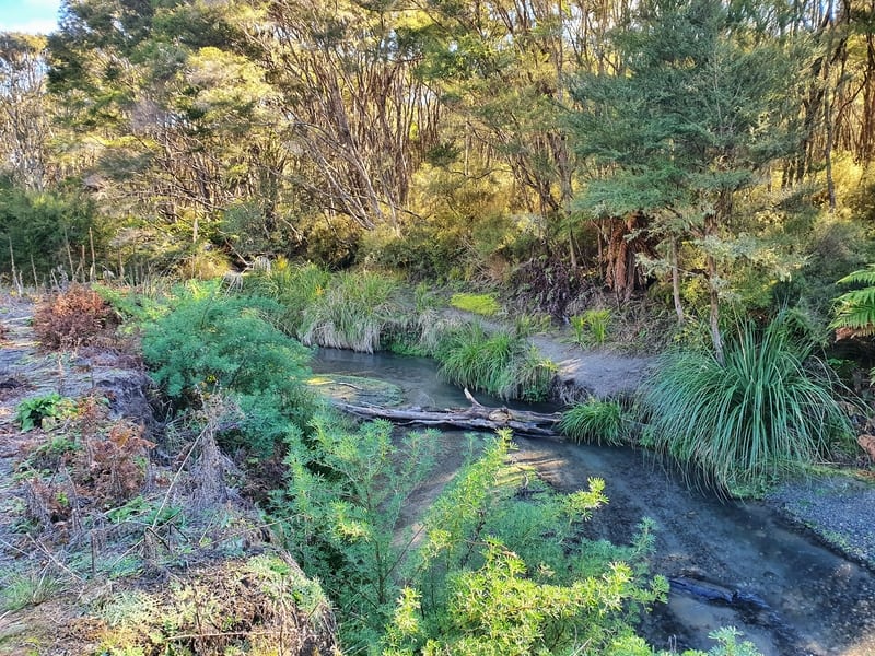
There’s a solid descent just over 9km into the walk now as you go back down to lake level. And then you’ll come across a river crossing. Well, it’s more of a stream. I didn’t see the obvious crossing point at first. The photo above will show you where to cross (over that tree). Take your time and it’ll be no drama.
Once you’re on the other side, I’ve heard you can turn left and follow the track alongside the stream that’ll take you to a ‘secret hot pool’. I wasn’t aware of this before I started the walk 🙁 (my buddy Alex mentioned it).
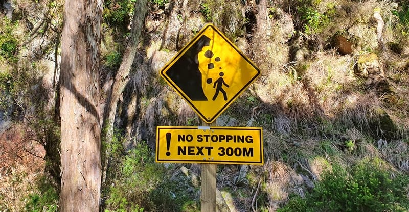
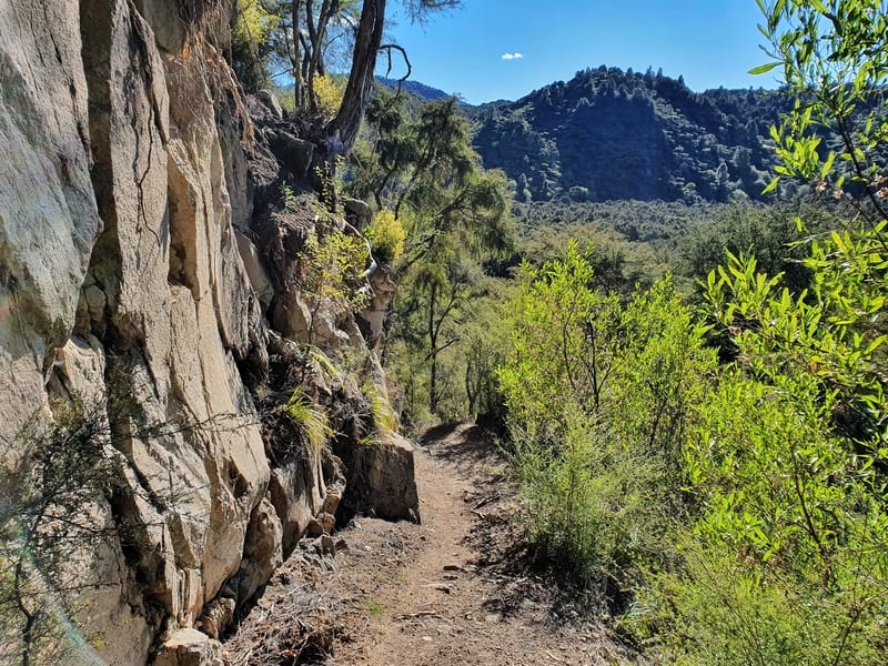
I kept following the track on the other side, dodged the ‘dangerous section’ in front of the rock face and continued on the biggest climb of the walk. You gain about 160 metres on this section, so it’s not massive but you’ll notice it. If you’re not fit, the small undulations will have added up and your legs will surely be starting to tire by now.
And then once you hit the peak, you are going straight back down the other side of the hill towards the lakefront. It’s a steady descent, and again the nature just becomes that extra bit awesome as you get further away from civilisation.
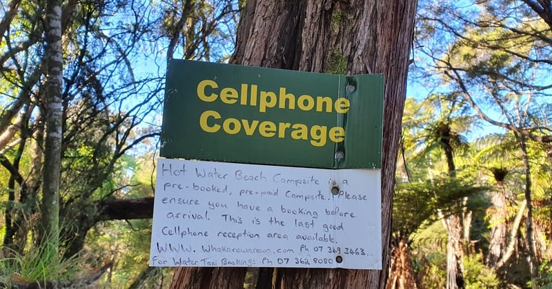
There’s even a sign mentioning when you’re about to lose cell phone service (it’s patchy along the track most of the way).
Arriving at the lakefront was quite the relief. To reach Hot Water Beach (you’re in Te Rata Bay) you turn left and walk a few hundred metres to reach the Hot Water Beach campground. It’s an awesome spot!
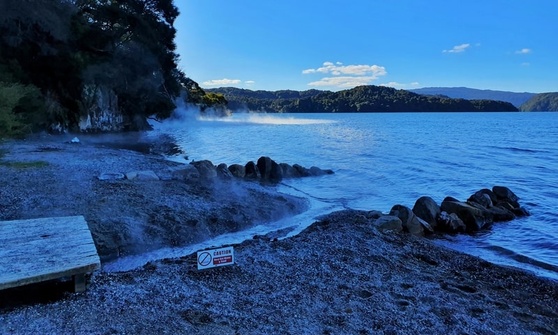
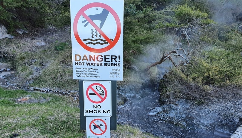
You can see the steam rising off the lake which had me grinning ear to ear. I wasn’t sure how real this Hot Water Beach was going to be compared to its more famous same name twin in the Coromandel.
It didn’t take me long until I took my shoes off. I’m delighted to be able to say that the water was hot! Well maybe not hot, but certainly warm. I mentioned it was an awesome site right?
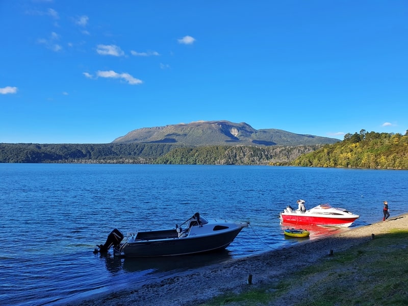
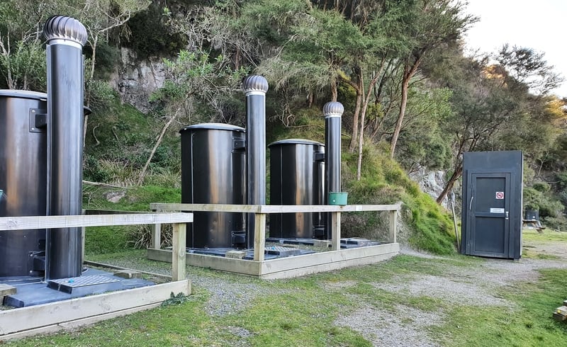
In the summer I can imagine this is an amazing spot to spend a couple of nights camping. There wasn’t anyone camping on my visit just a couple of boaties who had come to visit for a couple of hours.
If I’d left earlier in the day, I would have happily spent a couple of hours chilling out here. But as I didn’t start until after midday I needed to get going to return before sunset.
Now, if you’re not a regular hiker and are planning on a day trip out and back, be sure you know what you’re getting into. The return trip is 30km with about 1000 metres of elevation gain. For comparison, the Tongariro Crossing is 19km with about 760 metre of elevation gain.
For a practice hike, the Rainbow Mountain walk is about 7km return with 350 metres of elevation gain. That’ll give you an idea of how your fitness is. This isn’t to deter you, but I’d rather you know a little bit of what you’re getting into 🙂
I’d love to know how your experience on the Tarawera Trail was. Let me know in the comments below or email jub@churnewzealand.com. If you have any questions, I’m happy to help too.
If you end up short on time, but really want to see a few of the lakes in Rotorua, this this Duck Tour will take you to four lakes, Including Tarawera.
Chur.
p.s. Here’s a map of all the hikes documented on Chur New Zealand. You can click the icon to see brief details, as well as a link to read more about the hike (like this post).

Hey, it’s Jub here. I’m the guy behind Chur New Zealand, helping you have the best time hiking, trekking, walking…whatever you want to call it…in NZ. I’m based in Queenstown and am always out and about exploring trails, old & new. If you have any questions, reach out.