The Okere Falls walk is a short loop track (under 3km) full of action.
Running parallel to Kaituna River you’ll see:
- three waterfalls
- a cave
- relics
- a couple of nice viewpoints
Not bad for a short Rotorua walk 🙂
Notes: I completed the walk as a loop. Most websites only refer to the Okere Falls Track part of the loop. But you can complete a loop by coming back via the Ridge Track.
This is missing from all the maps I could find. It’s well signposted though.
TABLE OF CONTENTS
1. Okere Falls Track Details
2. Okere Falls Walk Map
3. How To Get There
4. My Okere Falls Experience
1. OKERE FALLS TRACK DETAILS
This walk has it all. Interesting history, awesome waterfalls, swimming holes, relics, and more. The track is well manicured and the information provided is useful.
And to top it off, the toilets are solid and there’s plenty of parking. So all in all it’s definitely one of the best things to do in Rotorua.
How hard is the Okere Falls Track?
It’s easy.
How long the the walk?
~3km return based on the signs. I didn’t have my Strava recording the walk.
Is there any hills on the track?
Minimal. The only elevation of note is up to the viewpoint on the Ridge Track which is less than 100 metres.
How many hours will it take?
I spent an hour wandering around the track. If you’re short on time and aren’t fussed about watching the whitewater rafters coming down Tutea Falls you can finish faster.
If you’re taking it really easy you could see yourself here for 1.5 hours or so.
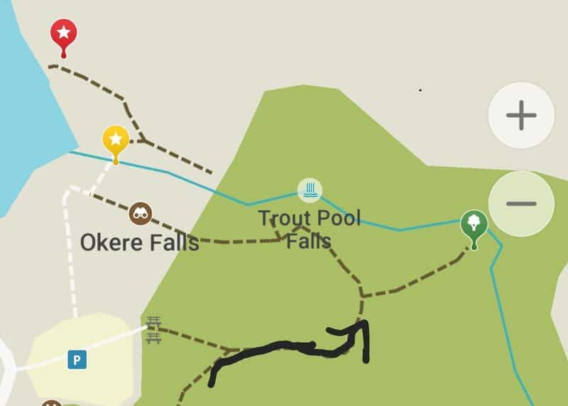
2. OKERE FALLS TRACK MAP
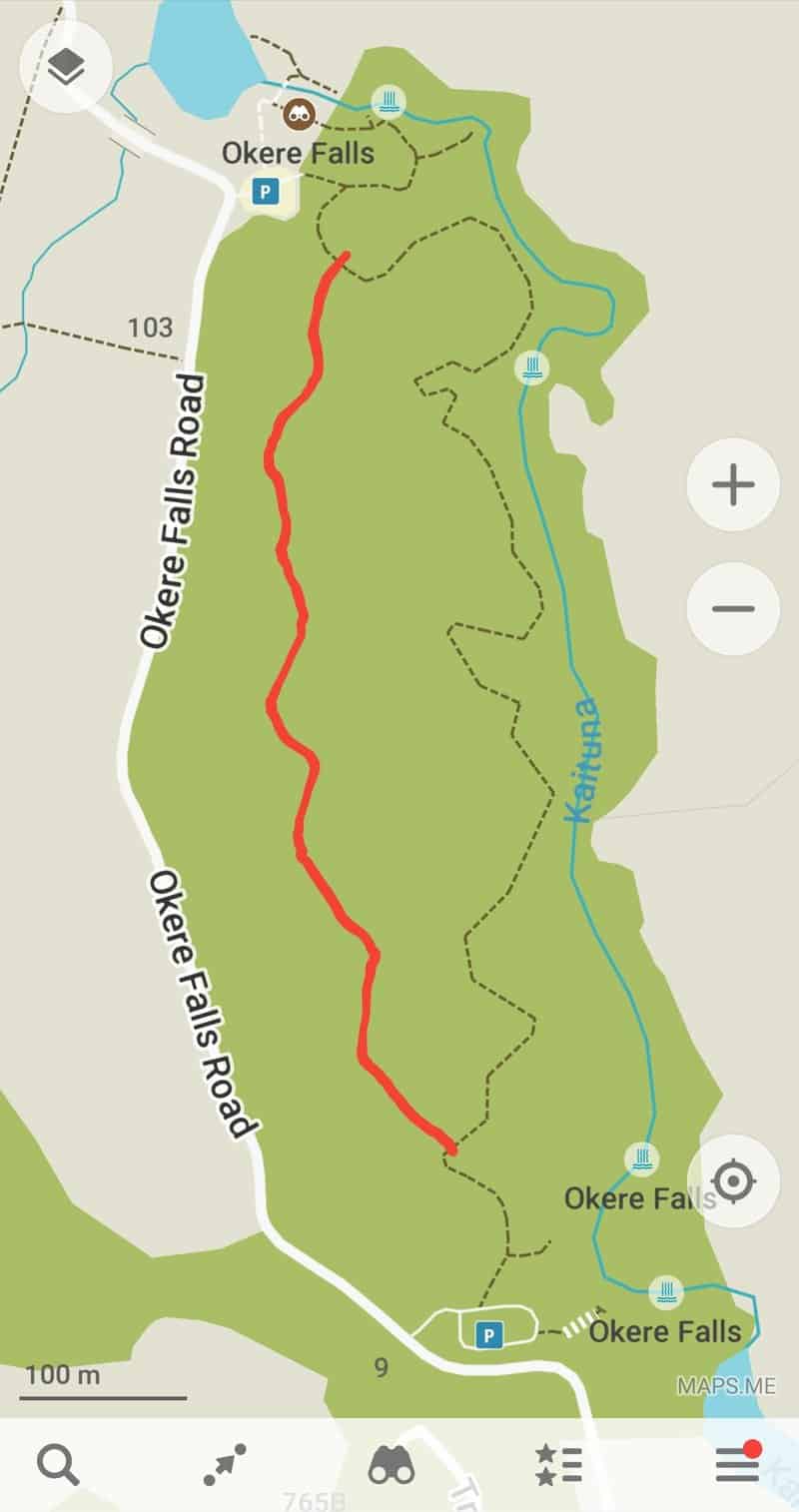
As the Ridge Track was constructed in 2019, the maps online don’t have the track marked (even as of 2025). You can see the Falls Track on Google Maps which is the same as the Maps.me map.
On the screenshot above (from Maps.me) I’ve guestimated where I feel like the Ridge Line goes.
3. HOW TO GET THERE
Note: There are two carparks, but I refer to the starting point as the southern car park closest to the highway.
There’s no public transport that goes to Okere Falls so the best option is by car from Rotorua (or you might be coming from Tauranga direction and want to stop on your way).
From Rotorua, it’s about a 20-minute drive following the highway around the eastern side of Lake Rotorua.
With that said, I did ride my bike from Rotorua to Okere Falls. It took me just over 1 hour to make the 21km journey. It’s not a crazy difficult ride, but you’re on the highway for the majority of it. Remember, you’ll have to ride home too.
4. MY OKERE FALLS WALK EXPERIENCE
Having decided against doing the famous white water rafting over the falls (I’m not great at water activities) I wanted to at least go for a walk to check out the waterfalls at Okere Falls Scenic Reserve.
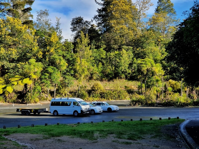
The car park is quite large, but on a nice day in the summer with international tourists around it would get near capacity. There’s some information about the track at the trailhead and a large toilet block.
And we start the walk.
It takes all of 20 seconds to reach the first turn off to a waterfall. The Okere Falls.

Looking down at the Okere Falls
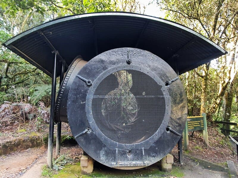
There’s an old turbine at the turn off which was recovered from the era when the Okere Falls was a power station. It arrived at the falls in 1990 and was recovered in 1995, restored and put on display at its current place.
The Okere Falls viewpoint is just a few seconds off the main track and looks down directly on the falls. They’re a cataract waterfall, so they’re not exactly photogenic but it’s impressive to see the power. You can see some of the power station remains at the bottom of the falls too.
Back onto the main track, you’ll walk for a two minutes before you come to the junction. You can:
- turn right to stay on the Falls Track (the main track)
- turn left to go via the Ridge Track
You should turn right. That’s where you get to see the Tutea Falls and the cave. It’s also the flatter route.
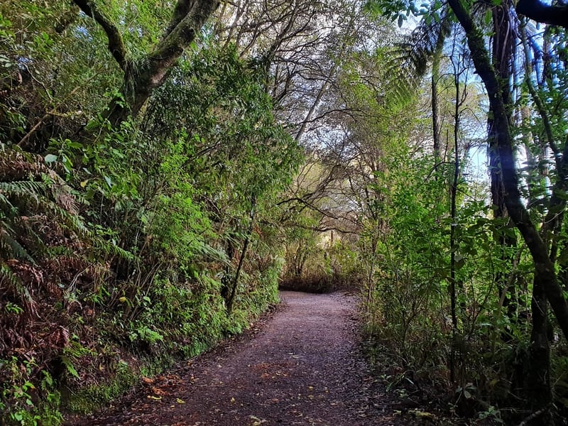
Turning right, you follow a well-formed trail lined with native forest until you reach the next turn off (~500 metres) for Tutea Falls.
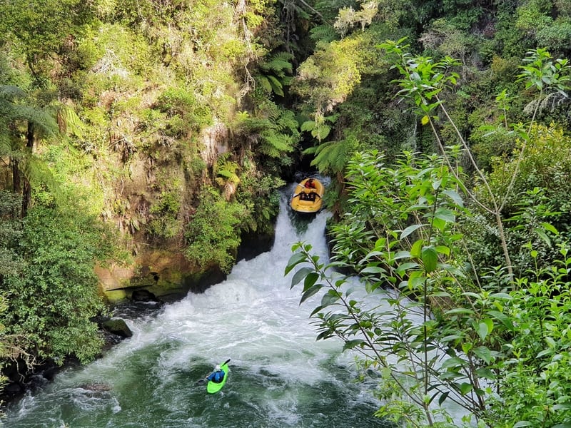
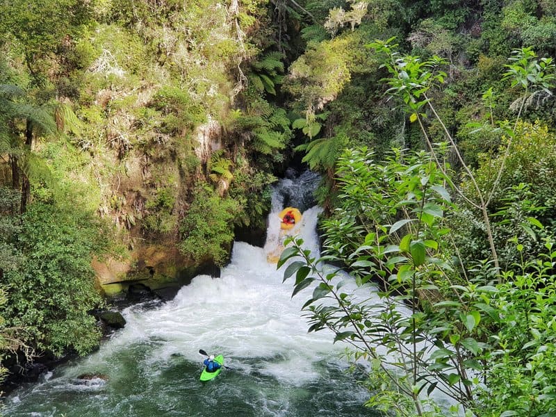
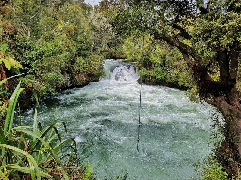
Tutea Falls is THAT waterfall. The highest commercially rafted waterfall worldwide measuring in at 7 metres high. There are a few steps down to the viewing platform where if you’re lucky you can see the white water rafters come tumbling over.
I was lucky to see a group within a couple of minutes after I got there. You’ll know a group is coming over soon as there’ll be a photographer at the viewing point and a kayaker at the bottom of the falls. If you’re wanting to take a photo, you’ll know the raft is about to plunge into the falls when the kayaker blows a whistle.
It’s pretty impressive to watch the raft and adrenaline junkies plunge deep into the water at the bottom of the falls and pop up again. And to hear the screams. The sign mentions 45,000 people go rafting at Okere Falls every year (rafting is available year-round).
Fingers crossed you get to see some rafters go down the fall! If not, waterfalls are always fun to look at.
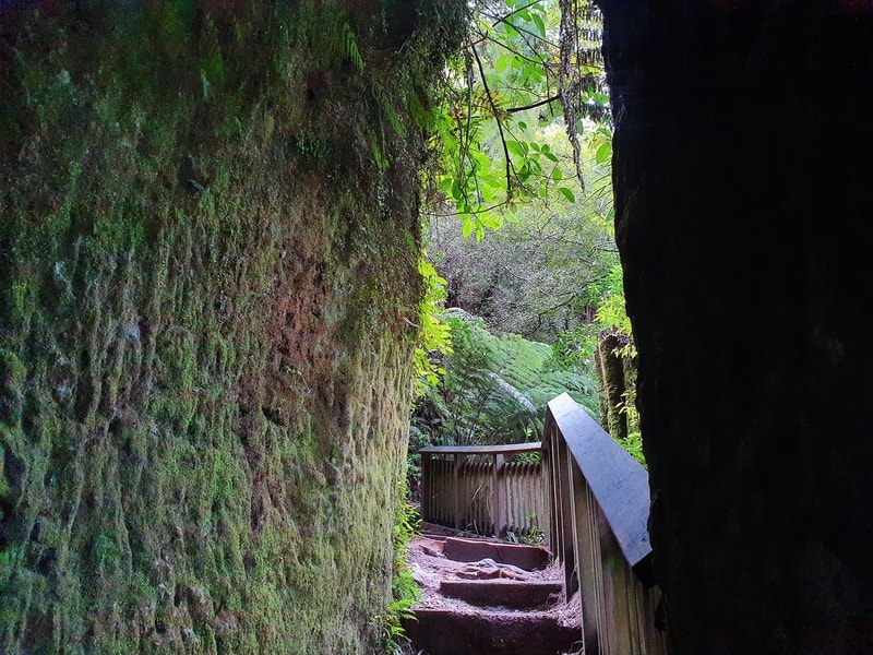
You’ll see the stairs continue on down, and it’s worth a quick visit as this leads to a cave. I totally missed the cave. Somehow? But was impressed with the steps constructed in the early 1900s. There’s some information detailing the history of the caves and steps which I won’t spoil here.
And now to walk back up the staircase to get back on the trail.
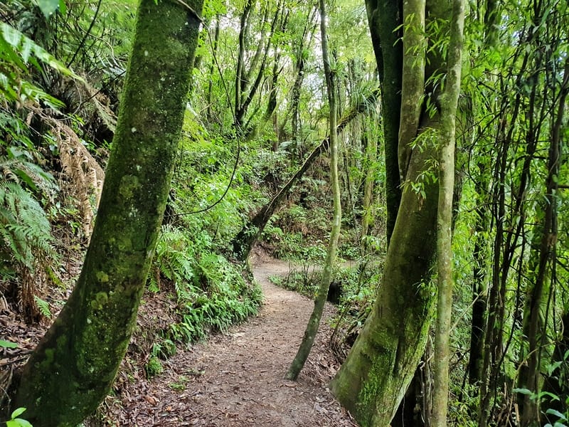
It’s another ~500 metre walk to the last of the three waterfalls we see, but again you’re walking along the trail with very little elevation to speak of as you’re surrounded by native trees.
The Trout Falls
The Trout Falls swimming hole
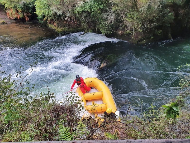
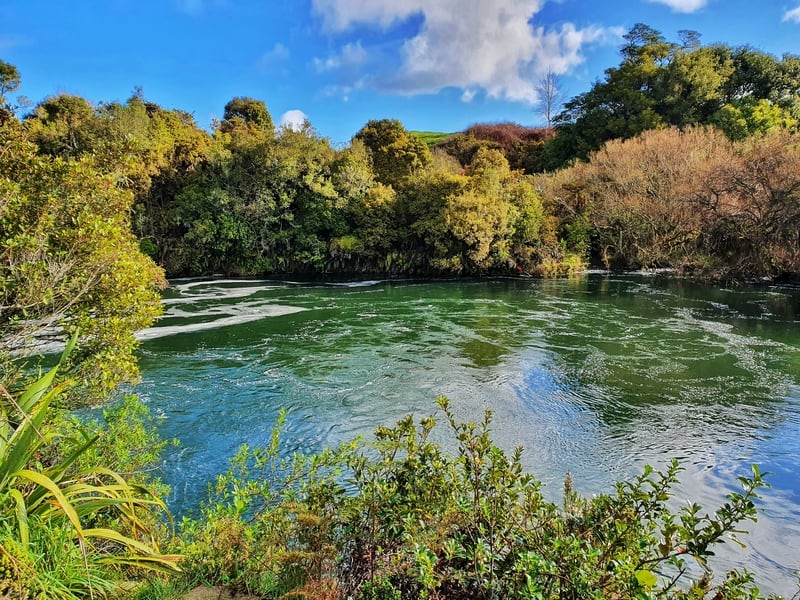
Then you’ll arrive in the area around Trout Falls. It’s a little bit confusing at this end. There are some rapids which I initially thought was the Trout Falls.
To make it easier to understand, I’ve added a map below with some descriptions.
- Green dot: these are rapids which you see. You can go here and you might see some rafters coming on down.
- Yellow dot: The best viewing point for the Trout Falls viewpoint.
- Red dot: Trout Pools. I was certainly not going to go swimming in the winter (and I wouldn’t anyway), but it looks like this is a popular swimming hole with locals as per this article.
Once you’ve finished up with all the activities at this end of the walk, it’s time to make the walk back (if you need to go toilet there’s some in the car park).
On the return, you can go the way you can via the Trout Falls Track or complete the loop and go via the Ridge Track.
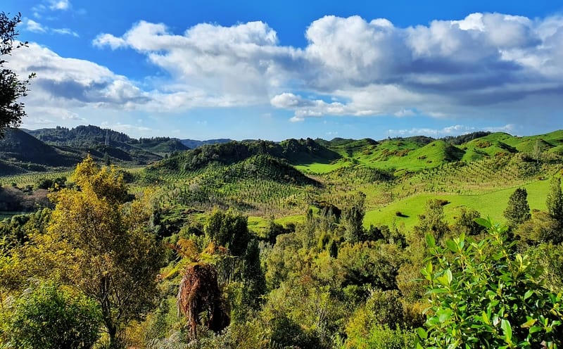
The view from the Ridge Track
As I was lucky enough to see a raft go over the falls, I went back via the Ridge Track. You’ll have seen the turn off on the way to Trout Falls (there’s a signpost).
The Ridge Track climbs quickly for a few minutes where you get to the viewpoint you’ll see above. There are a few other glimpses of views on the first part of the track before you start to slowly make your way back down the hill. The track is well maintained (the Ridge Track opened in 2019) and the total distance is the same regardless of which direction you go (according to the signposts).
I found it confusing how Tutea Falls is the famous waterfall for the rafters here, not Okere Falls. That doesn’t make sense to me given the name of the scenic reserve?
Nevertheless, let me know if you have any questions in the comments below or email me jub@churnewzealand.com
Chur.
p.s. Here’s a map of all the hikes documented on Chur New Zealand. You can click the icon to see brief details, as well as a link to read more about the hike (like this post).

Hey, it’s Jub here. I’m the guy behind Chur New Zealand, helping you have the best time hiking, trekking, walking…whatever you want to call it…in NZ. I’m based in Queenstown and am always out and about exploring trails, old & new. If you have any questions, reach out.