To hike to Rainbow Mountain near Rotorua is a 6-7km out and back adventure to the summit.
Note: It is officially now known as the Maunga Kākaramea Summit Track, but I still hear it usually referred to as Rainbow Mountain Track so will stick with that in this post.
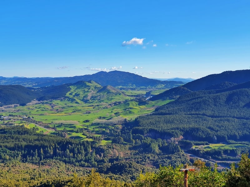
The trailhead is a 20-minute drive outside of the city and rewards you with 360-degree views from the top. Along the way, you get to see a crater lake, various native tree species, and thermal activity.
This post will give you all the details you need to know about the Rainbow Mountain walk, along with plenty of photos.
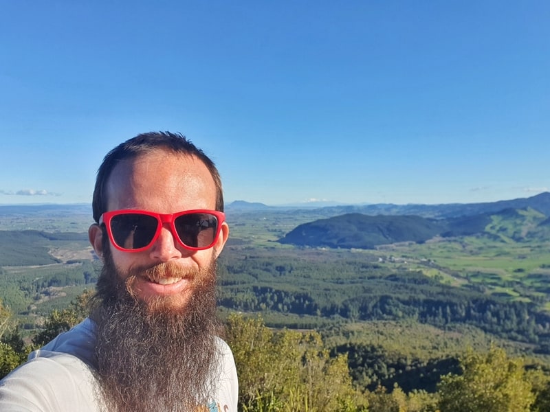
A selfie from the summit of Rainbow Mountain. Proof of having been here.
TABLE OF CONTENTS
1. Rainbow Mountain Hike Details
2. Rainbow Mountain Map
3. How To Get There
4. My Rainbow Mountain Hike
1. RAINBOW MOUNTAIN HIKE DETAILS
QUICK DETAILS:
- Length: 6 to 7km
- Elevation Gain: ~350 metres
- Difficulty: Easy to medium
- Time: 2 to 3 hours, return, for most
Is it because I got an absolutely stunning day to do the walk? I’m not sure, but this walk is a hoot. It’s one of my favourites in Rotorua.
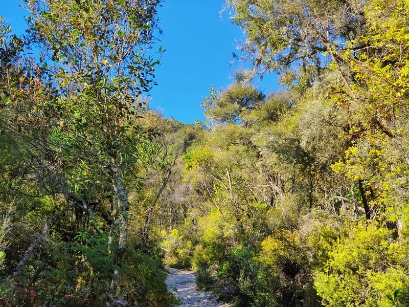
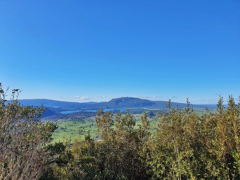
Crater lakes are always gorgeous and the steam from the geothermal activity intrigues. I also liked the variety of native trees on the way. The track is well maintained, yet isn’t overly perfected as to inflict on nature.
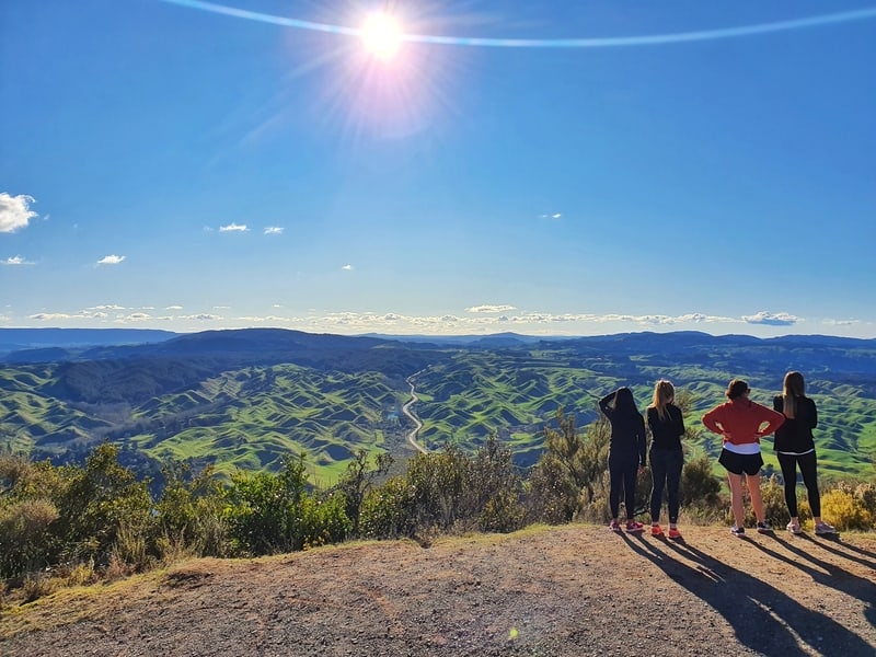
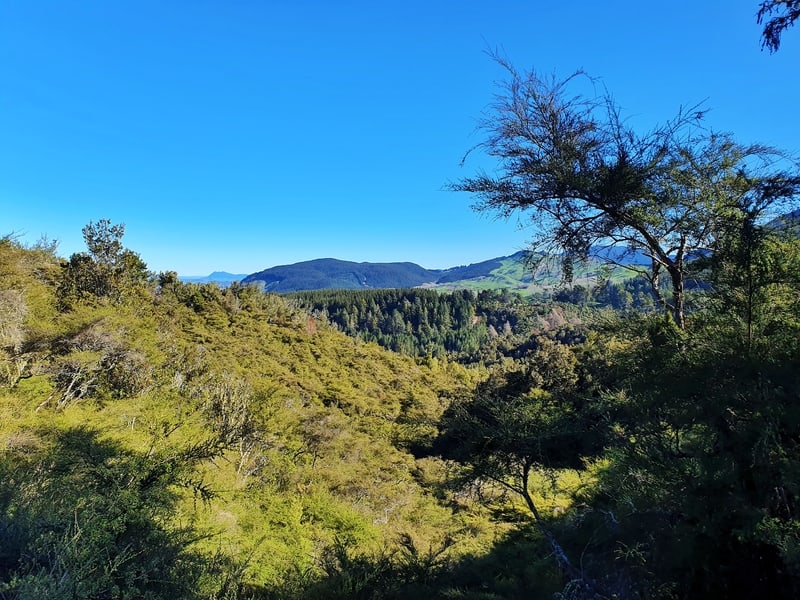
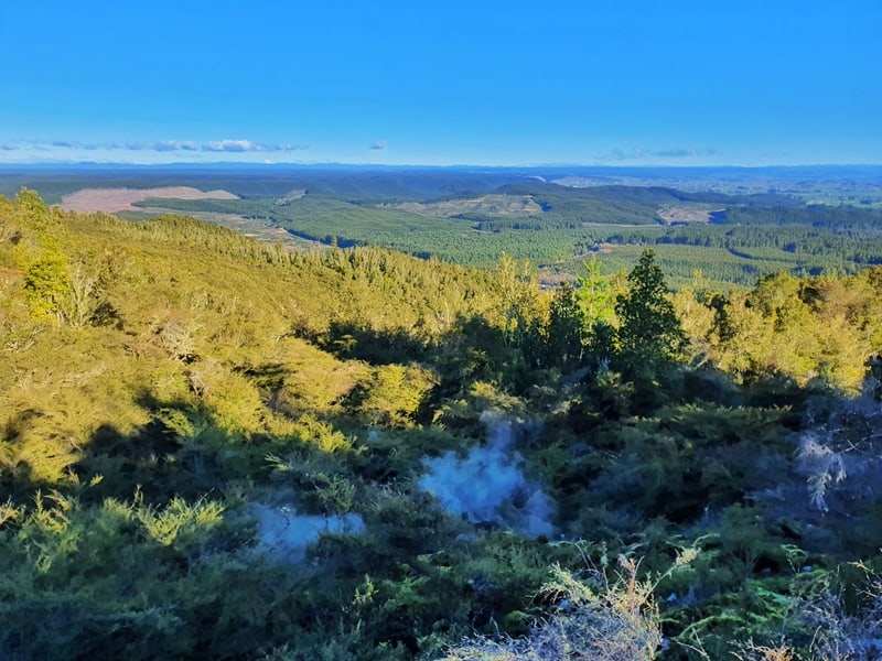
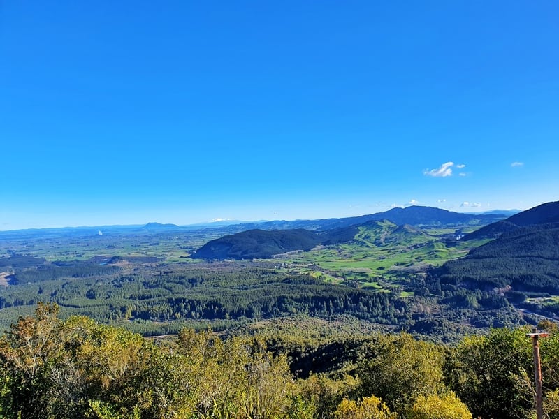
And of course, you’ve got the insane views from the top. Each view was different, which is cool. And there are information boards so you can have some idea of what you’re looking at.
How hard is the hike up Rainbow Mountain Rotorua?
Easy to medium. The track is easy to follow, and pretty well-trodden with no super technical bits. The incline on the way up is steady, but you’re never crawling. And at 7km max, it’s not a long walk.
What is the hikes distance?
My Strava data shows the return trip at 6.8km return, which includes ~200 metres of walking around the summit. On Maps.me the track measures in at 6km return, as does the sign at the trail head.
So plan for a 6 – 7km walk.
What’s the elevation gain on the Rainbow Mountain summit track?
The total incline from my walk on Strava was 350 metres, almost all of it on the way up. This isn’t a small amount, but as long as you are somewhat active you should be okay to make it. The summit is ~743 metres above sea level.
Here’s the elevation profile:

How long does the hike take?
Our total elapsed time from the car park and back was just over 2 hours, which included ~25 minutes at the summit. The DOC website mentions 1.5 hours each way. So I think the majority of people will be finishing in the 2-3 hour timeframe including time at the summit.
2. RAINBOW MOUNTAIN HIKE MAP
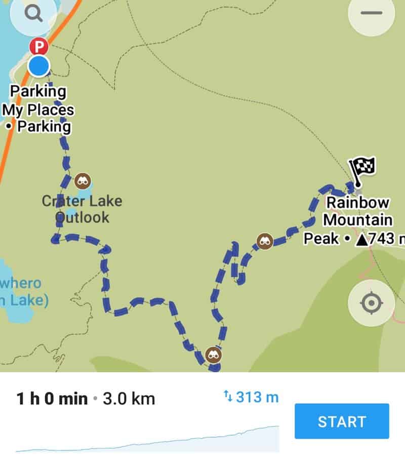
On Google Maps, Rainbow Mountain Scenic Reserve is marked as a location but not the trail itself.
The map above is from maps.me, which shows the trail accurately. You can also see it on the best topo map app you need.
3. HOW TO GET THERE
There’s no public transport that goes near to Rainbow Mountain. So you have two options coming from Rotorua, driving or cycling.
DRIVING
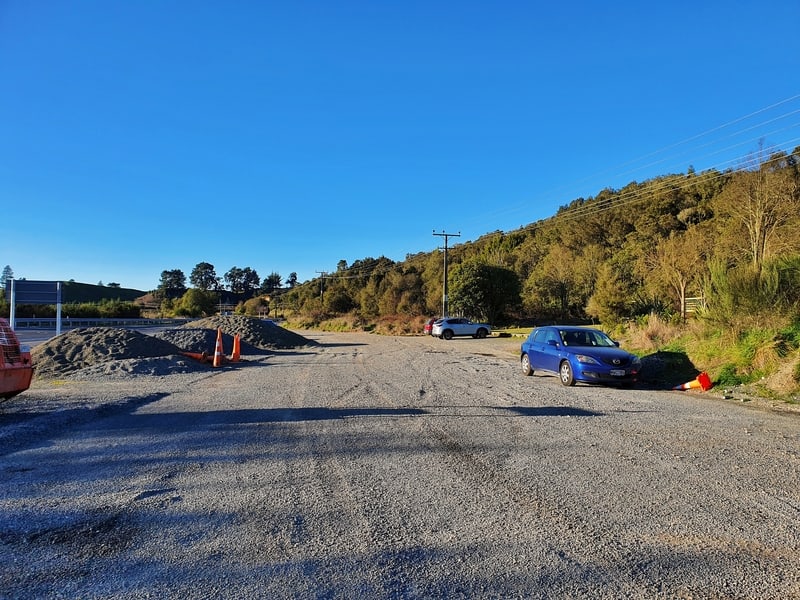
From the centre of Rotorua the Rainbow Mountain car park takes ~20 minutes to reach. You follow State Highway (SH) 5 south of the city, and you’ll see the Rainbow Mountain car park on your left. There’s a sign a couple of hundred metres before it, so you shouldn’t miss it at all 🙂
If you’re driving from Taupo to Rotorua and want to do the walk to break the trip up, head north out of Taupo, and take the route on SH 5 via Reperoa (you need to get off SH 1).
CYCLING
The Te Ara Ahi Trail a.k.a. Thermal by Bike is one of New Zealand’s great rides and goes close to the Rainbow Mountain trailhead. If you’re planning to incorporate the Rainbow Mountain hike with the cycle trail on the same day you’re in for a big day. But it’s certainly possible.
There are plenty of places to rent bikes/e-bikes around Rotorua.
4. MY RAINBOW MOUNTAIN (ROTORUA) HIKE EXPERIENCE
When you Google Rainbow Mountain images, make sure to include Rotorua in your search terms or you’ll be swamped with pictures of the stunning images from the Rainbow Mountain in Peru (I’ll visit one day).
Anyway, my friend and I decided to do the Rainbow Mountain summit track after the Blue Lakes circuit. It’s annoying there’s not a more direct route between the two (you have to go back via the city), but as we arrived at the car park there were maybe six other cars there.
As there’s a mountain bike track, and a walking track to Kerosene Creek not all of those at the car park will be on the way to the Rainbow Mountain Summit.
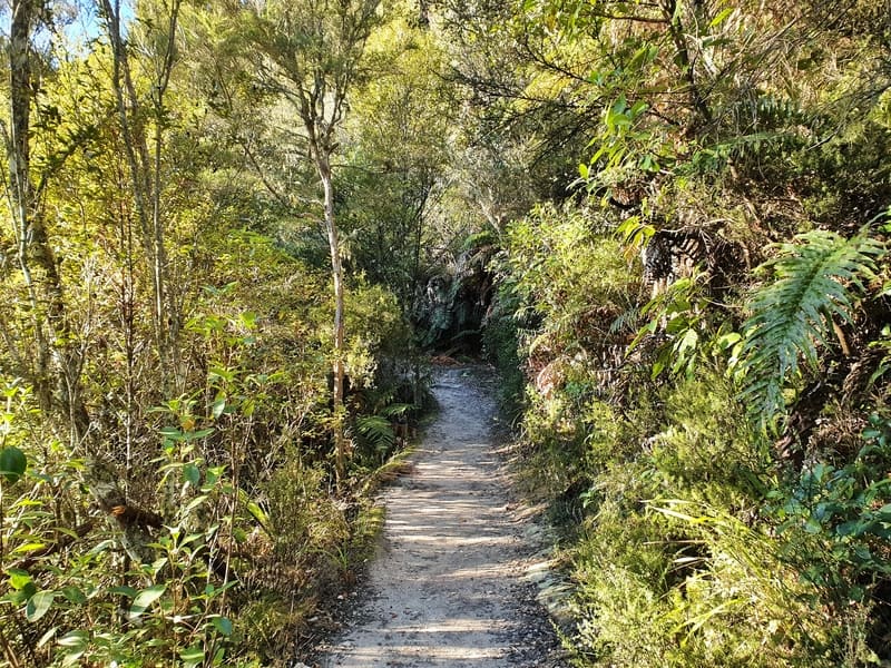
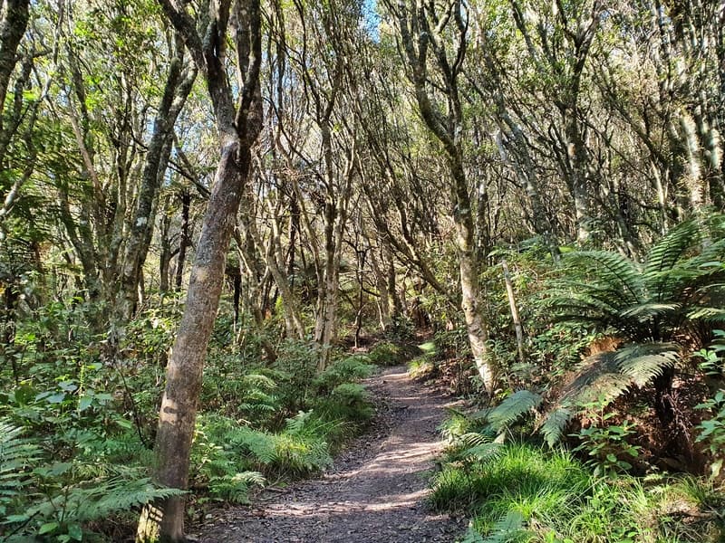
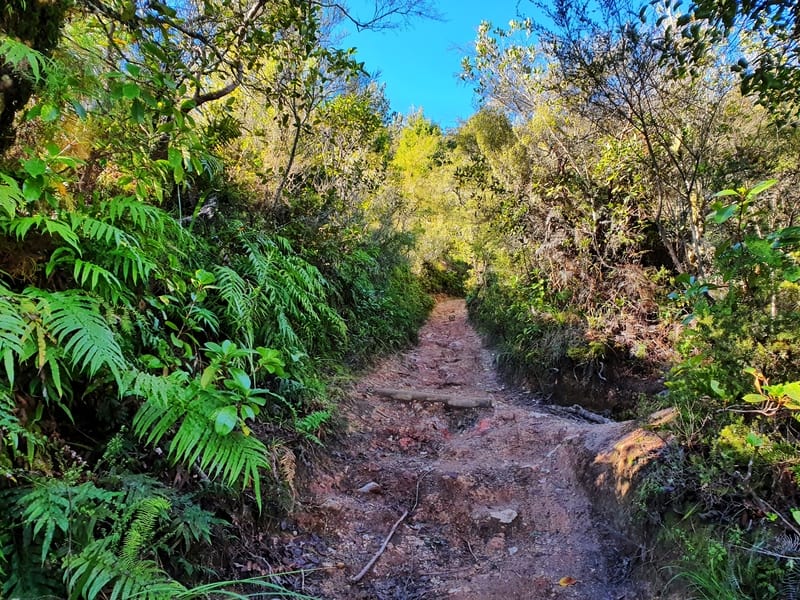
There’s a bit of info about the tracks and the scenic reserve at the trailhead but we skipped that and hit the trail. The first 500 metres of the trail is full of gentle undulations on a single trail, with bush on either side.
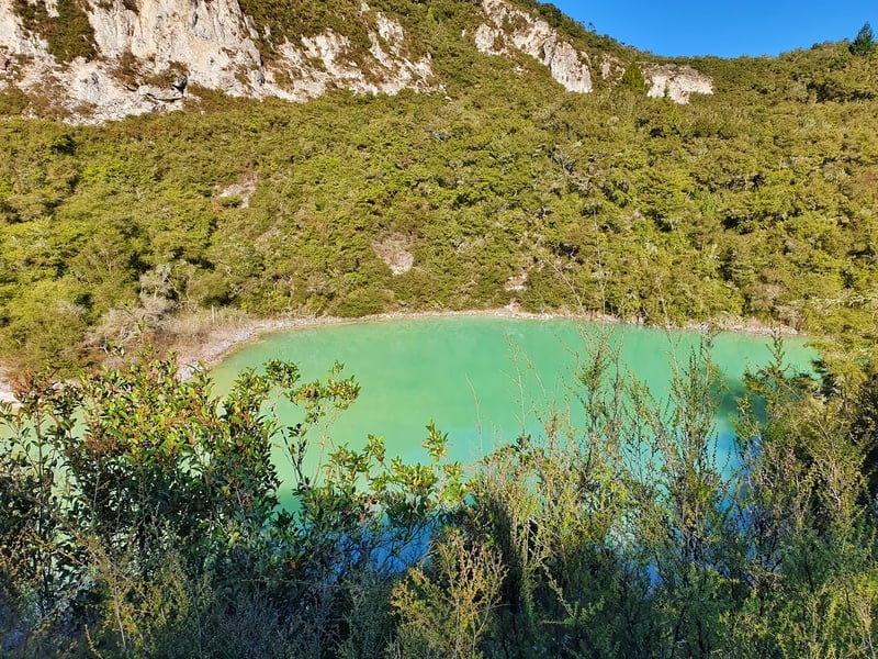
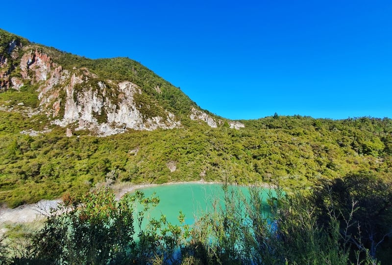
After 500 metres, you’ll reach a junction, make sure to turn left as it’s only 30 metres to reach a viewing platform of the crater lake. And, well the photos will do the talking, but the colours of the water and rock face are awesome. Throughout the walk you’ll see patches of red rocks (they’re not stained, but you know what I mean). I wonder if they’ve got any similarities to the Red Rocks in Wellington.
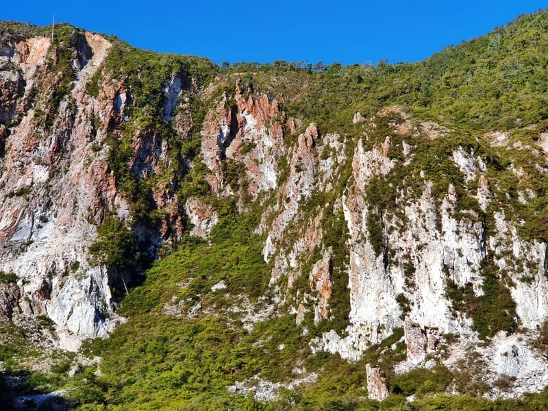
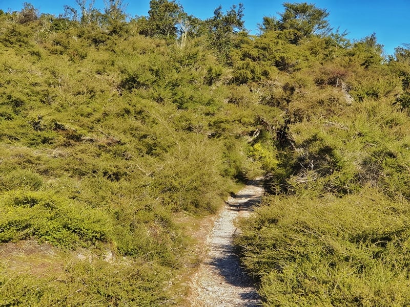
Back on the main trail, and the rest of the walk is on an incline. When I look at the Strava map, the next 600 metres after the crater is on a gentle incline. What I liked about this walk was sometimes you were under a canopy of trees and at other times the shrubs small enough to give you a view of the surrounding landscape. There’s a couple of constructed viewing platforms along the way too.
If you’re pretty fit you might not notice the incline increasing, but it’s always walkable. I did see a couple of people taking a break on the way up.
Ultimately there’s not much to say, with the walk less than 3.5km in length.
When you’re 200 metres from the summit, you’ll reach a road (it’s not busy – I think it’s for work vehicles only) and turn left to reach the summit. And then you’ve made it. There’s a couple of seats at the summit, but definitely take your time to read the signs, enjoy the views and have a bite to eat.
I normally don’t wait around too long at summits, but as I was with a friend he wanted to eat his snacks and I did enjoy the 25 minutes at the top. We had a perfect day with no wind which was quite ideal and must be very rare.
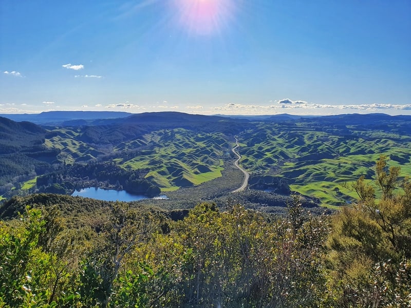
With that said, make sure to walk Rainbow Mountain (ROTORUA!) on a day where there isn’t any low cloud for the best views of the lakes and Mount Ruapehu.
The walk back down was quick as you just come back the way you came. And it’s not steep enough where you’ll be struggling with your knees, as it flattens out the further you go. If only every mountain was like that!
If you keep your expectations in check and realise the colours aren’t going to be like ‘THAT Rainbow Mountain’, you’ll have a blast on this walk.
I’d be stoked to hear if you went on this walk. Drop a comment below, or email jub@churnewzealand.com and tell us all about it.
Chur.
p.s. Here’s a map of all the hikes documented on Chur New Zealand. You can click the icon to see brief details, as well as a link to read more about the hike (like this post).

Hey, it’s Jub here. I’m the guy behind Chur New Zealand, helping you have the best time hiking, trekking, walking…whatever you want to call it…in NZ. I’m based in Queenstown and am always out and about exploring trails, old & new. If you have any questions, reach out.
Hey Jub
Thanks for the day walk tips. We’re just off to walk the Rainbow Mountain trail. Really appreciate you taking the time to put these posts up.
Hey Lorna,
Thanks for the kind words. Hope you had a good time up there!
Cheers,
jub
Just back in Rotorua after walking the track. Exactly as you described and we too enjoyed fabulous weather.
Views are superb.
Recommend ++!
Hey Iain,
Love that! It’s a great trail…when the skies are blue. Thanks for sharing.
Chur,
Jub