The Mt Rosa Track is a steady, but not overly tough hike to a peak (1322 metres) that gives you views over Gibbston Valley, Nevis Range, and other surroundings.
The route I’ll talk about in this post came in at 12.9km. Do note, there are a few different car parks and routes you can take.
- We started walking from the Coal Pit Road car park, &
- Finished here next to State Highway 6 at the entrance to Oxbow Adventure Co.
Keep reading to learn about the elevation gain, distance, what to expect, and a whole lot more. There’ll be lots of photos too 🙂
TABLE OF CONTENTS
1. Details About The Mt Rosa Track
2. Mount Rosa Track Map
3. How To Get To The Trailhead
4. My Mount Rosa Experience
1. DETAILS ABOUT THE MT ROSA TRACK
How hard is the Mt Rosa Track?
I’m going to say it’s medium in terms of difficulty. It’s not overly long, but there’s a solid amount of elevation gain. That said it’s an easy track to follow and it’s not overly technical for the most part.
How long is the Mount Rosa hike?
My Strava recording came in at 12.88km. This felt about spot on…the only issue was we had to navigate the ~7km back to the car. We managed to hitchhike easily to the Gibbston Tavern, then walked the last 1.7km to the car.
What is the elevation gain/profile?
The total elevation gain of the hike was 861 metres. Here’s the elevation profile:
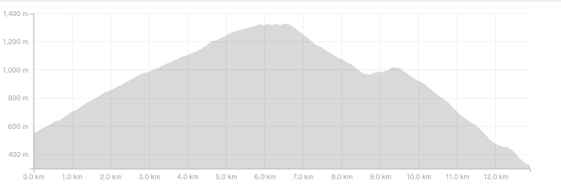
As you can see, over 90% of the elevation gain is on the way up to Mt Rosa.
How long does it take to hike the Mt Rosa Track?
It took us 3 hours and 10 minutes to do the route mentioned in this post which includes a 15-minute break at the summit and a couple of short photo breaks. I’d suggest most people will take between 3 and 4.5 hours to complete this route…that mostly varies depending on many breaks you take 🙂
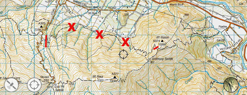
2. MOUNT ROSA TRACK MAP
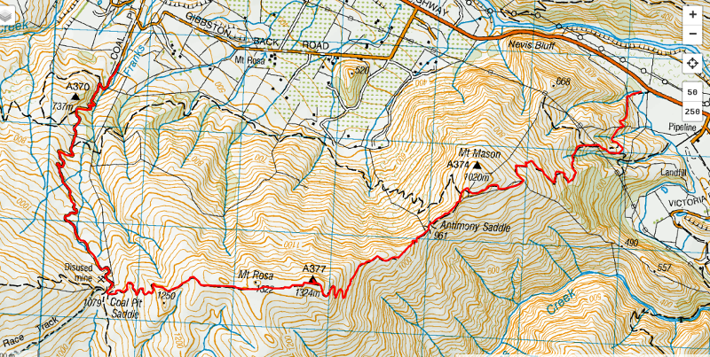
The map above is the GPX file on top of the topo map.
This track is not available on Google Maps, nor on Maps.me (at the time of writing). While you shouldn’t get lost, I do like using the topo map app to make sure we make the right turns etc.
WARNING
We were initially planning to do a loop, but the track with the red X’s below is private and you cannot cross this.
3. HOW TO GET THE TRAILHEAD
With a 25 – 30 minute drive from Queenstown, the easiest way to get to Mt Rosa is by car.
This is the confusing part about the Mount Rosa track. There are a couple of car parks you can start/finish at.
As noted earlier:
- We started walking from the Coal Pit Road car park, &
- Finished here next to State Highway 6 at the entrance to Oxbow Adventure Co.
We drove to Coal Pit Road, and then hitched/walked back to the car from SH6. If you’re not comfortable with hitching, you could do an out and back from one of the car parks. If you’re planning to do this, I’d recommend starting at the Coal Pit Road end as it’s a slightly nicer track in my experience. The distance is about the same from both car parks to the summit.
Gibbston is a popular destination for bikes with trails and wineries. So you could bike to the trail easily too…I’d be comfortable with locking my bike up next to the car park (do so at your own risk!)
RELATED POST: HOW TO GET FROM QUEENSTOWN TO GIBBSTON
4. MY MOUNT ROSA EXPERIENCE
After hiking the Glenroy Water Race Track to Ben Cruachan a week earlier I was interested to see how the Mount Rosa route would play out. It’s not as high or as long but that’s not a bad thing.
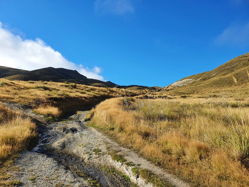
We started off from the Coal Pit Road car park cruising up the 4WD track. Having done it before, I knew what we were in for and soldiered on through it…it’s definitely not the worst 4WD track I’ve hiked up.
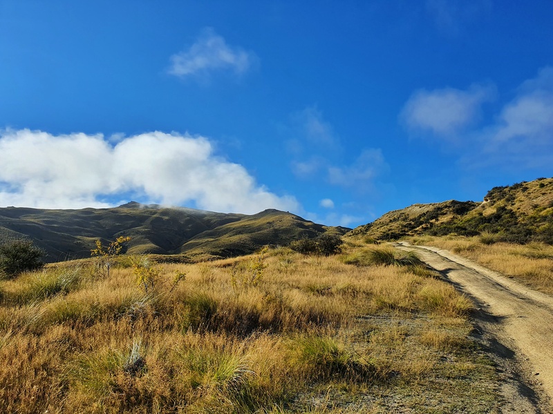
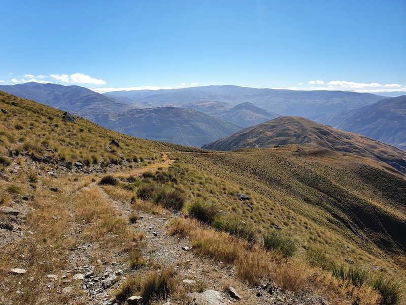
After a few kilometres, you emerge above the bush and you can see Coal Pit Saddle in the distance. Mt Rosa is the peak on the left where you’re heading too.
If you’re starting to feel fatigued, take a moment to look back to get views of the valley and give yourself some credit on how far you’ve come already.
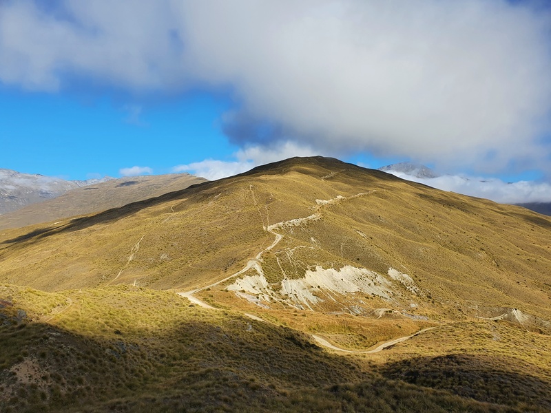
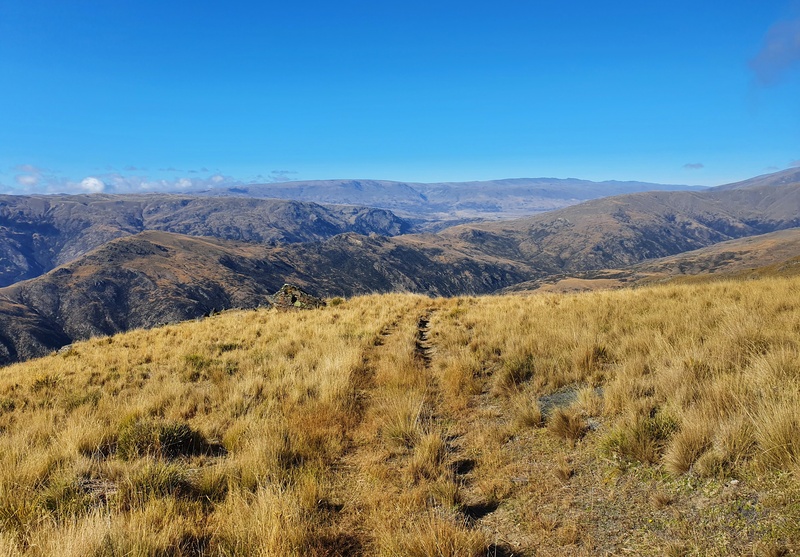
The Coat Pit Saddle arrives a little before the 4km mark into the hike. There’s a green DOC sign pointing you in the direction of the Mt Rosa Track…turning left, the track is overgrown a bit. It’s still easy to follow, but it’s not as perfect as it was early. It twists and turns a little bit, before straightening out as you hone in on the summit.
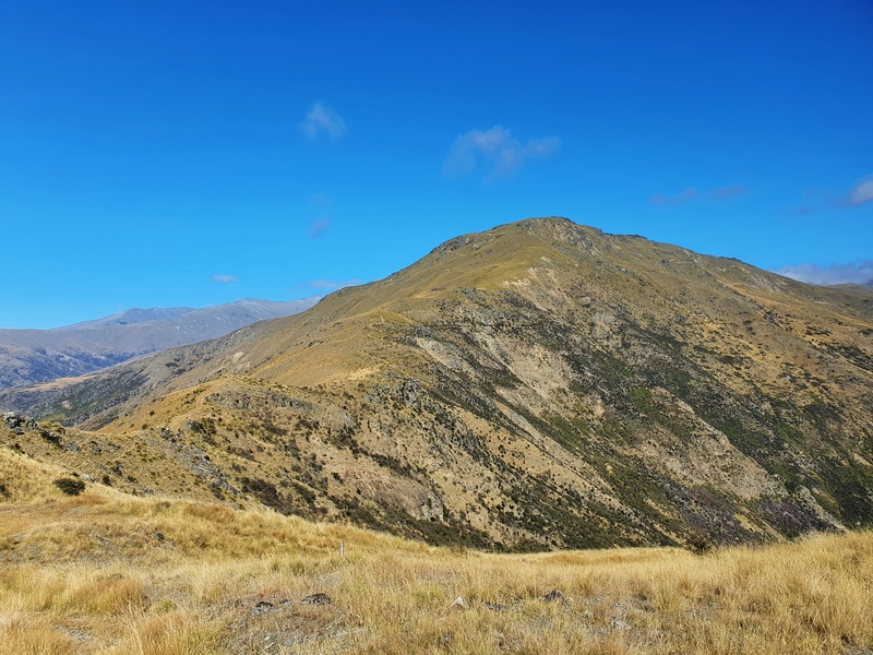
You’ll get some sweet views along this section, and it does start to flatten out as you get closer to the peak which happens at around the 6.5km mark.
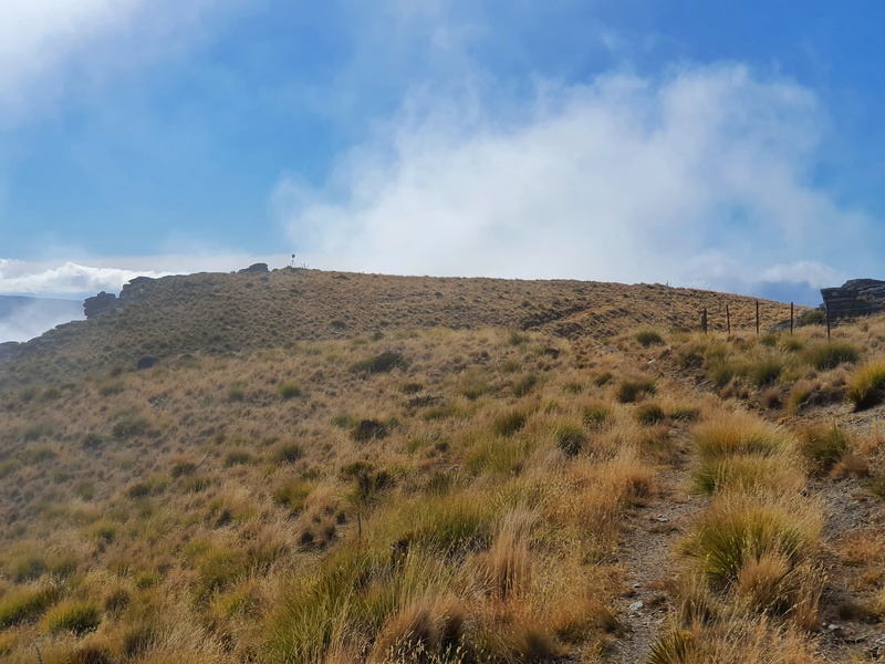
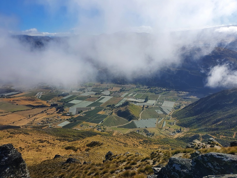
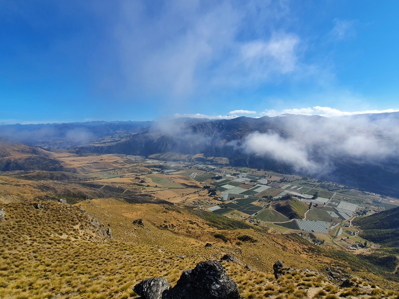
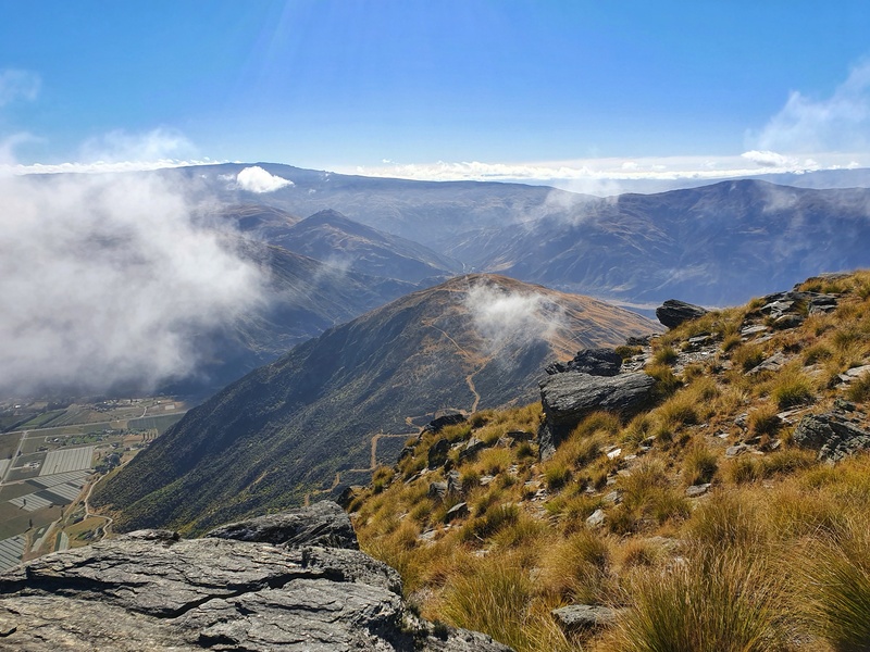
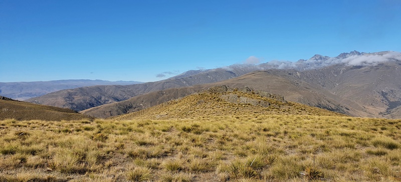
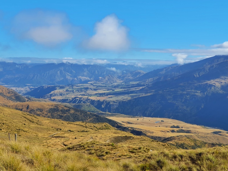
When we reached Mt Rosa trig/summit, there was some low cloud sweeping through the Gibbston Valley which interrupted the views from time to time but there were enough breaks where we got to see all the things.
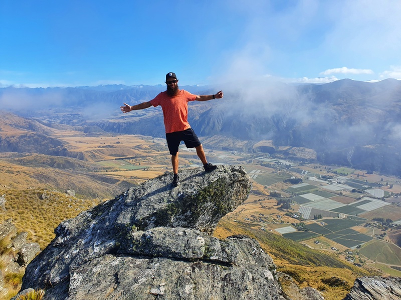
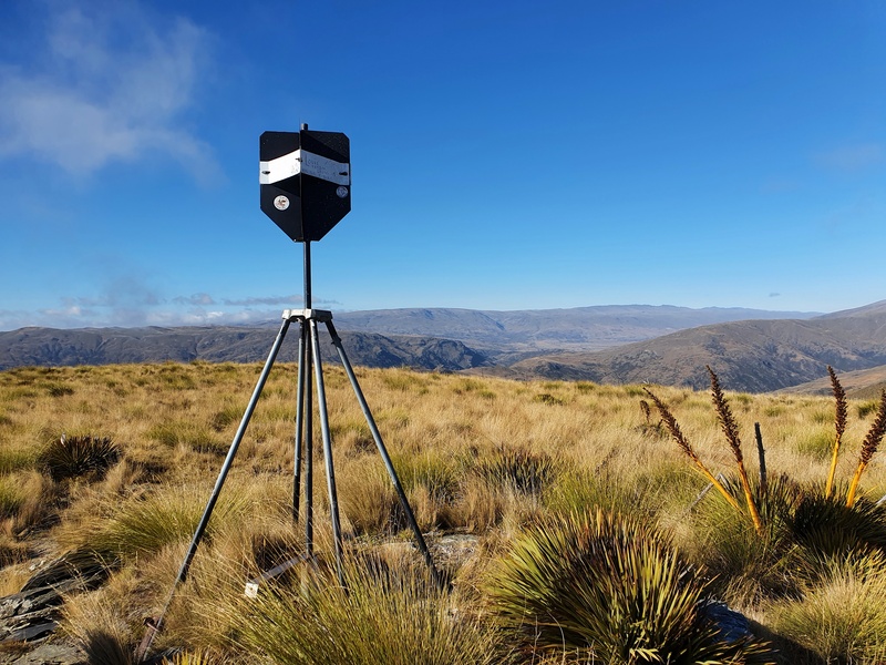
In the other direction towards the Remarkables and the Nevis Range though, she was stunning! Next to the trig, there are a couple of fun rocks perfect for posing (as you saw at the top of the page) and it’s a lovely area for a picnic when there’s little wind.
If you want to make life easier for yourself in terms of getting back to the car, you could return the way you came. This would make for about a 13km total hike, the same distance if you were to continue walking the way we went.
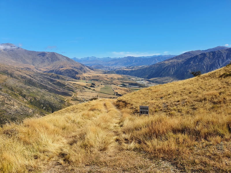
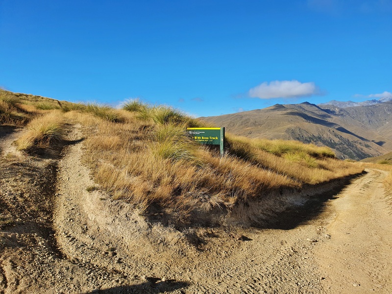
We initially had planned to make a circuit as mentioned on the topo image earlier, but when we got to the turnoff there was a sign saying ‘Mt Rosa Station | Private Property | No Public Access | This Is Not A DOC Track’ as you can see in the photo above.
That was super annoying. We didn’t want to backtrack back up to the summit and down so decided to follow the other track down the hill to State Highway 6 and hitch back to the car.
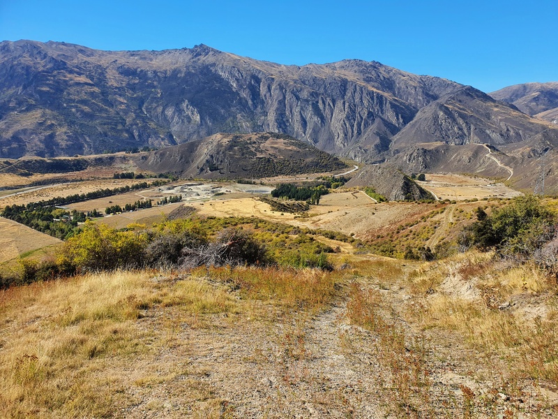
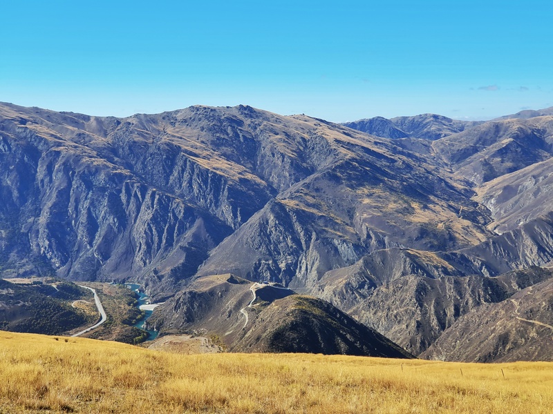
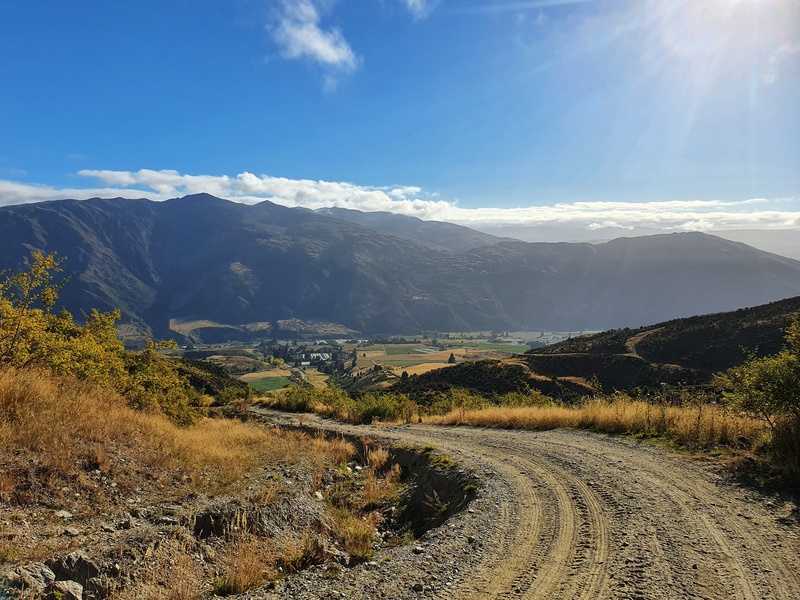
This is a pretty steady descent back down the hill but gives you lots of views of Gibbston Valley, various valleys in the Nevis Range, glimpses of the Kawarau River and even the bungy.
The last couple of kilometres of the track got a little messy, but it was still easy to follow. It wasn’t maintained quite so well but there were a few orange DOC track markers. You can see the highway on the descent so you know it’s just a matter of chipping away and you’ll be finished before long.
After finishing the hike, we stuck our thumb out and were picked up within 5 minutes and dropped off at the Gibbston Tavern where we could walk to the car.
The Mt Rosa Track is a nifty track that’s not too long, and you can easily incorporate into your Gibbston itinerary.
If you have any questions about hiking the Mt Rosa Track, leave a comment below or email jub@churnewzealand.com and I’ll get back to you.
WHAT TO READ NEXT
Best walks in Queenstown
A whole host of the amazing walks in the area.
Awesome walks in Arrowtown
People are often surprised when they discover the great network of trails next to Arrowtown.
Things to do in Cromwell
Often thought of as a transit town, there’s a good amount of awesome things to do here.

Hey, it’s Jub here. I’m the guy behind Chur New Zealand, helping you have the best time hiking, trekking, walking…whatever you want to call it…in NZ. I’m based in Queenstown and am always out and about exploring trails, old & new. If you have any questions, reach out.
Well described guys, I am going to give it a goon Sunday if weather holds. Described way better than by DOC, thanks!
Thanks Margaretha! Looks like it shooooould be okay Sunday. Fingers crossed!
Did the tramp up Mt. Rosa yesterday, starting from the Coal Pit rd end. No sign at the gate at the end of the gravel track though, but luckily I met a guy on an off road bike who said it was correct. Kept on going following the 4 WD track and much higher up there was a DOC sign. The rest was peanuts and the weather kept on getting better still with plenty of sunshine and awesome views. I actually enjoyed myself so much that I took the guess to hopefully catch a ride back to the turn off and walked down past Mt. Mason ending up at Oxbow at Highway 6. Track partly quite overgrown there I have to say. Saw a small mob of wild goats up there too. Didn’t take me long to get picked up, saving me from walking some k’s along the SH6 back to Coal Pit rd. Walked back from there to the van, parked at the gate.
Hey Margaretha,
Thanks for the trip report, interesting to see how the lesser used trail conditions change a bit (like no sign). Stoked you got a hitch back to the car…wouldn’t be the funnest road to walk along!
Cheers,
jub