The Glenroy Water Race Track is a big 28-30km day hike starting in Gibbston Valley.
As an out-and-back hike, there are various points where you can turn around but if you’re going the full distance to the summit of Ben Cruachan, you can expect to walk nearly 30km. For some reason, I thought it was only 18km return. Oops.
I liked how my friend described the hike:
“It’s nice with a great view from the top of Ben Cruachan, but it’s not a must-do hike near Queenstown if you’re a tourist. If you’re living here, then it’s one you should do at some point when you don’t want to drive too far yet want to see somewhere new.”
If you want to hike somewhere near Gibbston, another option starting at the same car park is to hike the Mt Rosa Track. But don;t forget, there’s plenty of things to do in Gibbston besides hiking!
With that said this post has all the details about hiking the Glenroy Water Track to Ben Cruachan. And there’ll be plenty of photos too.
TABLE OF CONTENTS
1. Details About The Glenroy Water Race Track
2. Glenroy Water Race Track Map
3. How To Get To The Trailhead
4. My Experience Glenroy Water Race Track Experiece
5. A few final photos
1. DETAILS ABOUT THE GLENROY WATER RACE TRACK
How hard is the hike?
I’ll go with a medium to hard. As long as you’ve got a little endurance, you’ll be good as gold. The track itself is long, yes, but it’s a 4WD track the majority of the time that’s in decent condition. So the terrain itself isn’t a drama…except for some small sections like a part of the water race (which you can avoid). There aren’t many steep sections, but it’s rarely flat.
Hike far is the Glenroy Water Race Track?
Via Mount Edward
- Car park to Mount Edward: ~6.4km
- Car park to Mt Salmond: ~9km
- Car park to Ben Cruachan: ~14km
Via the water race
- Car park to Mt Salmond: 10.2km
- Car park to Ben Cruachan: 15.2km
What is the elevation profile like?
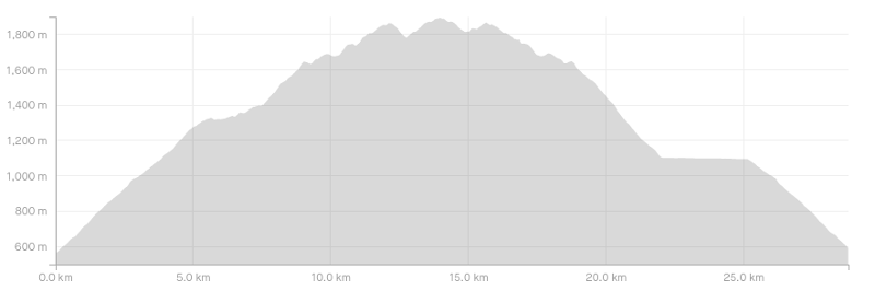
The image above is the elevation profile starting from the car park and going up to via Ben Cruachan via Mount Edward, and returning via the water race as per the Strava route (I took a couple of slight detours on the way back).
How long does the Glenroy Water Race take?
This is a tough one. I hiked with two friends and we made it up to the summit in a little under 3 hours and 20 minutes which included a couple of short breaks. We were going at a good pace, so I suspect that some parties could take upwards of 5 hours to reach the summit.
The return won’t take quite so long as it’s a steady descent on decent terrain. So if you’re taking lots of breaks and photos, expect to be out hiking most of the day.
If you find the hike is taking too long you can turn around at Mt Salmond and still have a great day out.
Want to do this hike in winter?
You’ll likely be able to make it to at least Mount Salmond (above) without hitting the snow. After that, it won’t take long until you hit snow during most of the winter months. As this is a 4WD trail most of the way, you could certainly navigate much of the trail…but do this at your own risk etc.
The toughest part would be when you get up near the summit area.
2. GLENROY WATER RACE TRACK TO BEN CRUACHAN MAP
The map above is the GPX file from my Strava data upload on a topo map. You can’t see this trail on Maps.me at all, and while the route to the end of the water race is on Google Maps, it’s not super useful.
It’s tough to get lost on this route, but I do recommend downloading a topo map so you can see the complete trail.
3. HOW TO GET TO THE TRAILHEAD
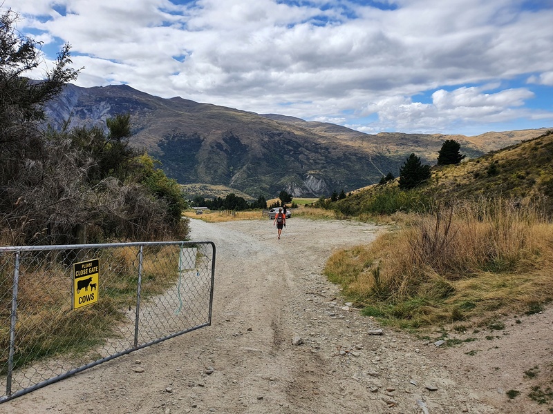
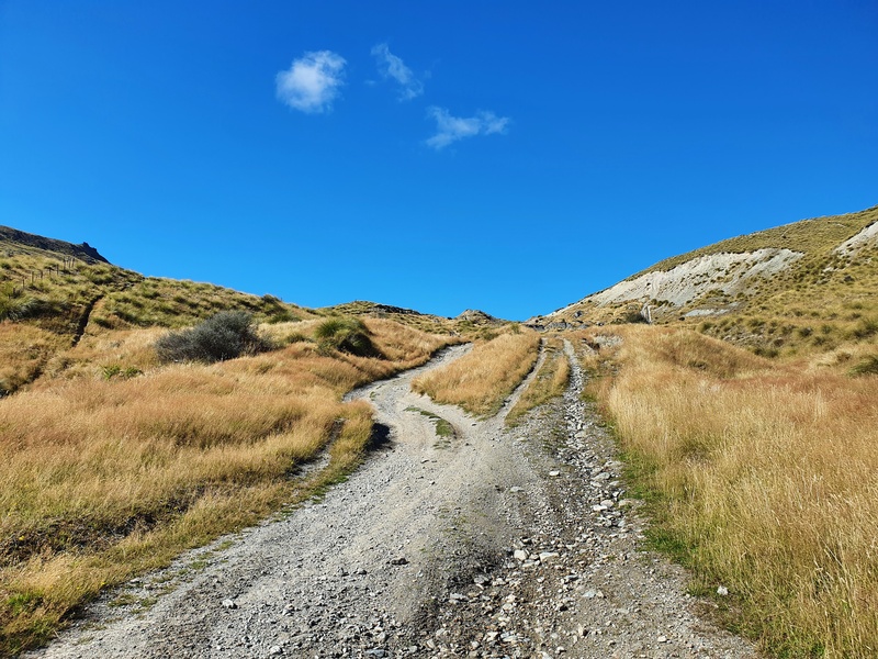
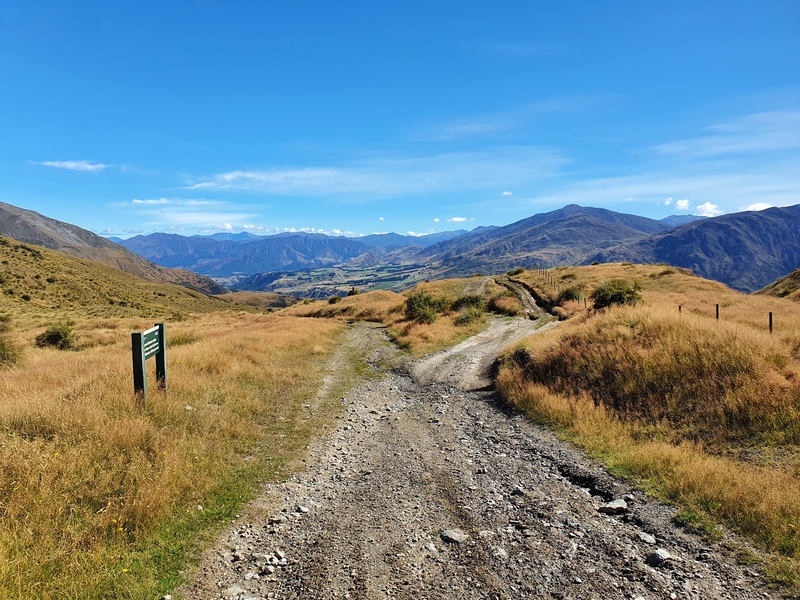
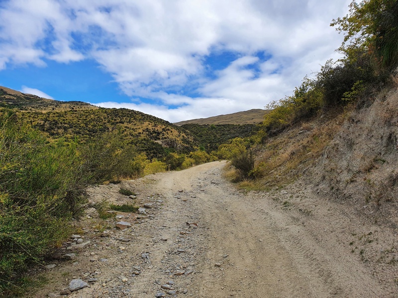
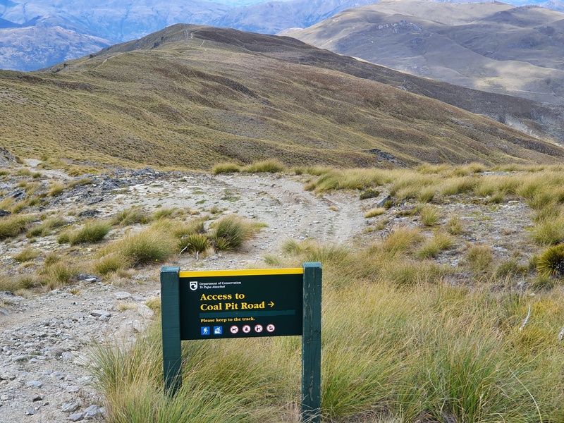
The Glenroy Water Race trailhead is on Coal Pit Road. The DOC website states the track starts at the end of Coal Pit Saddle Road, but this is hard to believe. We along with the few others we saw on the track all parked here (see photo above).
Beyond this point the road gets horrendous and only the craziest of vehicles would make it to the top of Coal Pit Saddle Road.
The easiest way to get to the car park is by car which takes ~30 minutes from Queenstown, depending on traffic.
Or you could bike. There’s the Queenstown Trail network you can use which will get you there from most places in the greater Queenstown area. But this might mean a super big day of activities. You’ll know if you’re up for it 🙂
There’s also a bike rental place in Gibbston which means you could cycle to the trailhead, hike, then hit up the wineries.
Hitchhiking from Queenstown to Gibbston is also reasonably easy, as are all the options to get from Queenstown to Gibbston.
4. MY EXPERIENCE ON THE GLENROY WATER RACE TRACK
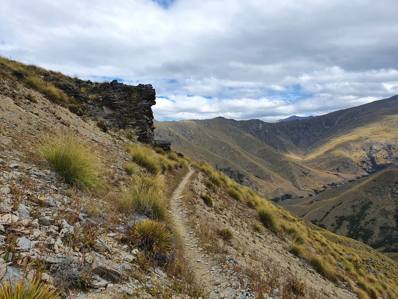
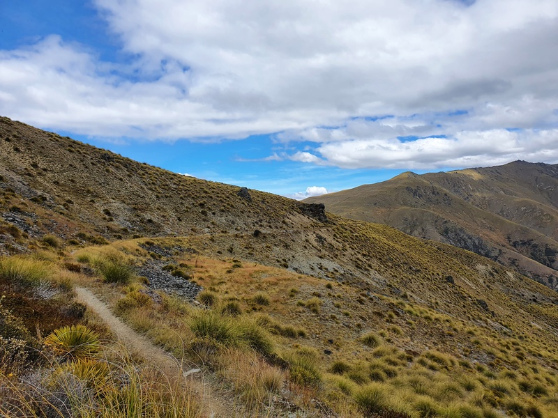
The trail is easy to follow at the start, with a shrub-lined 4WD track weaving you up the hill. Over the first 4km or so the path splits from time to time, but all paths tend to lead to Rome Ben Cruachan.
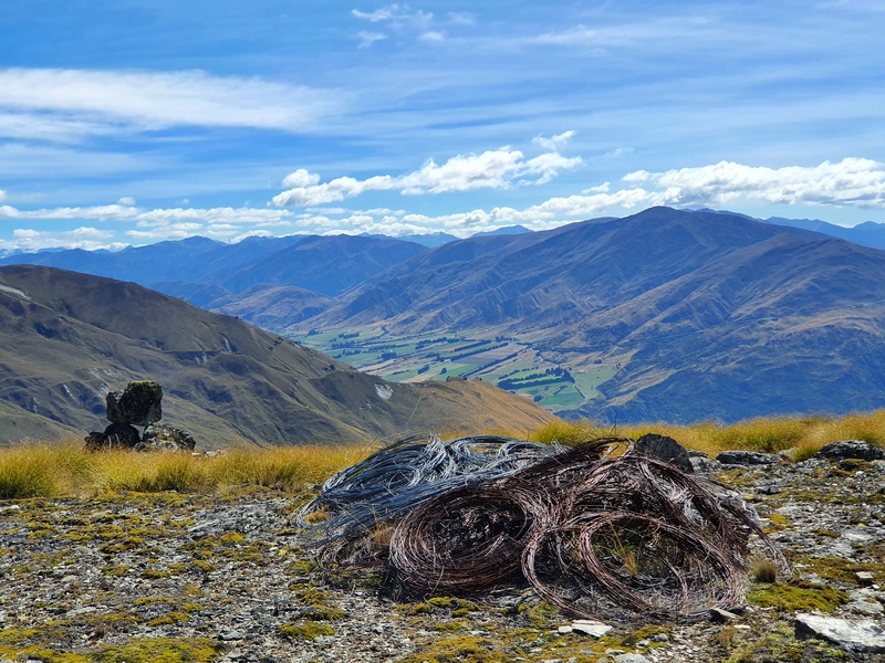
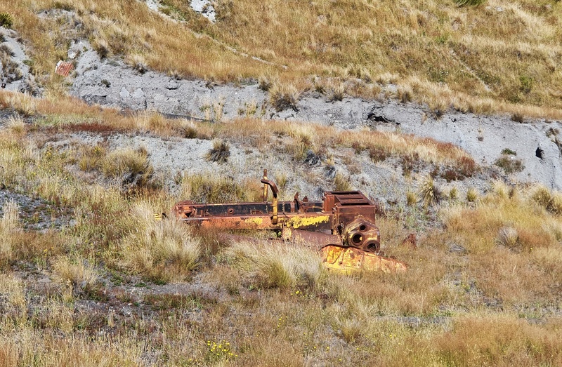
You’ll see the saddle in the distance and perhaps a couple of historic artifacts. Once you’re at the saddle the path splits off in a few different directions as you enter the Remarkables Conservation Area.
To reach Ben Cruachan you’ve got two options:
1. Follow the Water Race Track
2. Follow the 4WD track which goes close to Mount Edward (right of the water race track).
While this track is called the Glenroy Water Race Track we decided to go via Mount Edward to start with as it looked like it had the best views. I’d return via the Water Race Track to experience both sections.
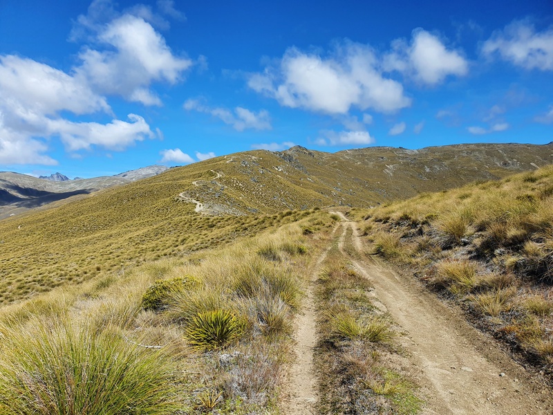
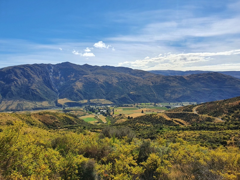
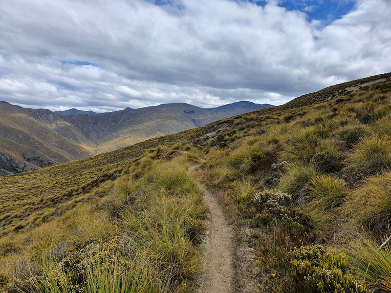
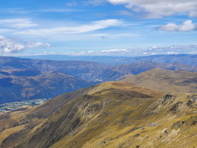
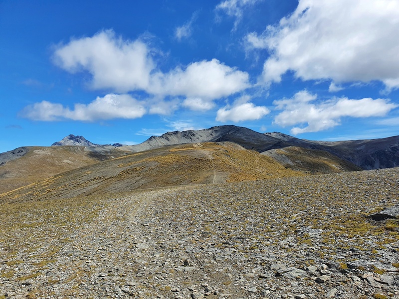
The route via Mount Edward continues climbing before flattening off. You’ll soon start to see where you’ll be walking for the foreseeable future. Ben Cruachan sure does look a long way from where you are. It’s quite cool though as you can see the terrain really starting to change and you get great views of the Nevis.
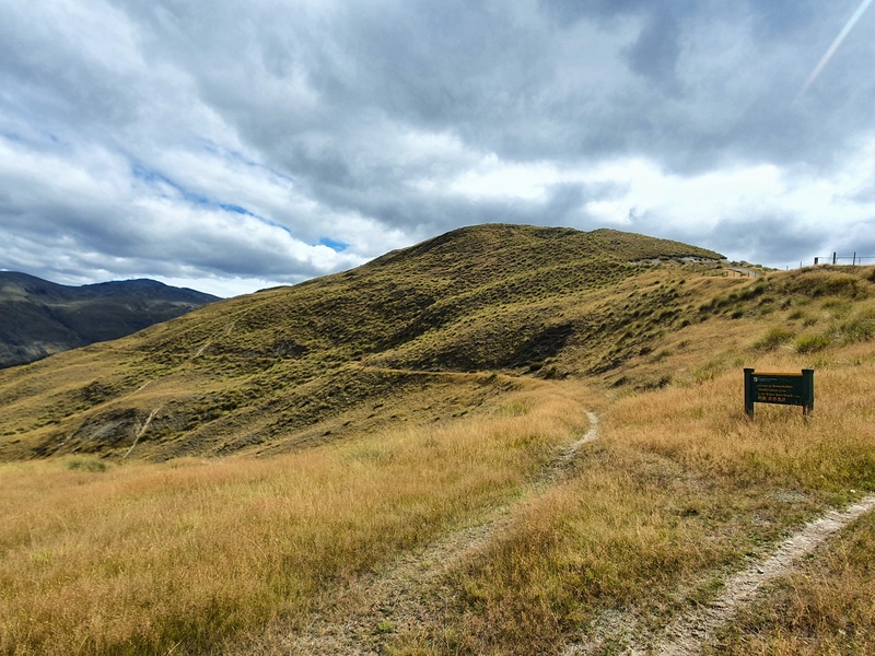
Passing Mount Edward (there’s a trig) the track flattens for a while before climbing up to Mount Salmond.
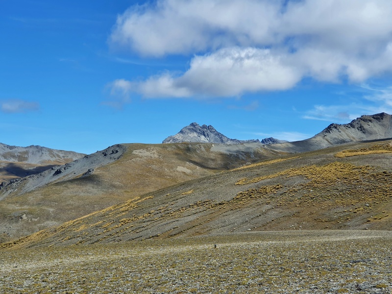
Mount Salmond doesn’t have a marker or anything saying you’ve reached the point, but there’s some big boulders. You’ll need to check the topo map to make sure you’re at the right point. You’ll be able to see Double Cone peaking out from here…if it’s sunny.
Note: the water race track meets back up with the 4WD trail about 1km before Mount Salmond.
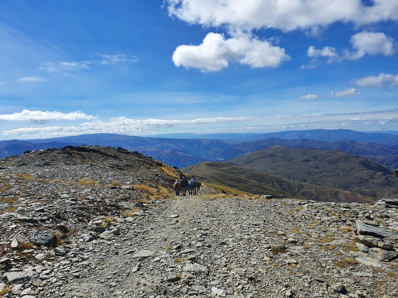
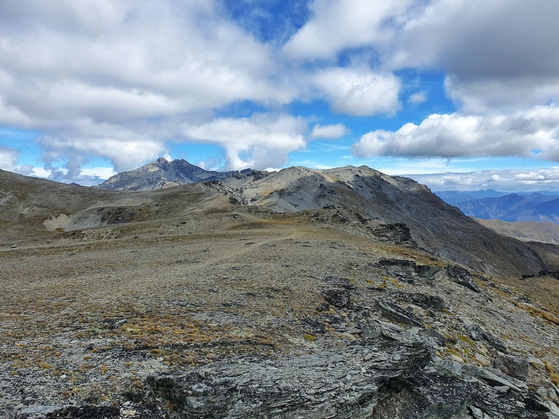
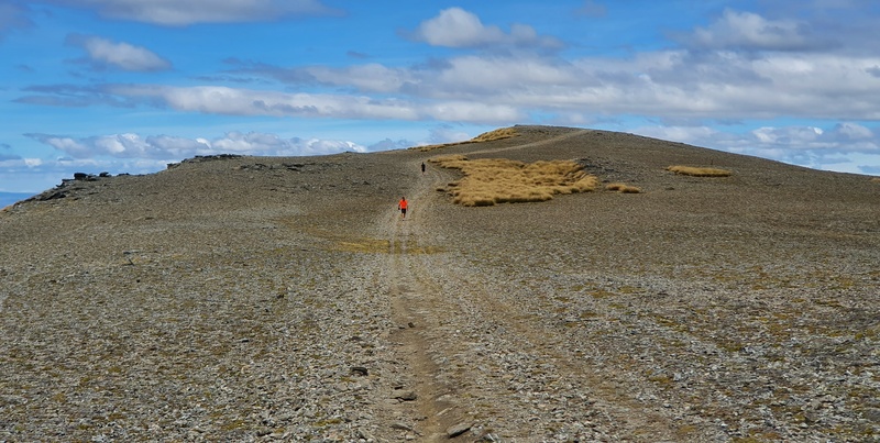
From here you can see where you’re going, but the trail goes a little faint. It’s still followable though. The terrain is super fun from here I think, but some might find it boring given it’s so barren.
Mount Salmond to Ben Cruachan is still a 5km walk, but there’s a couple of descents in this section. Keep chugging along and you’ll close in on the summit.
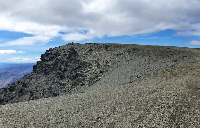
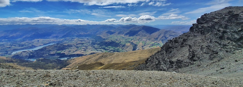
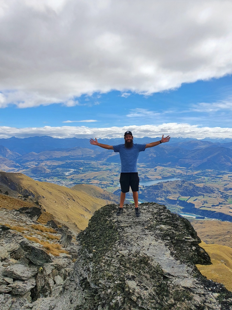
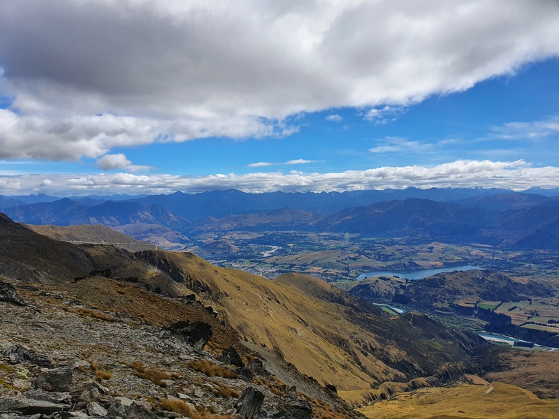
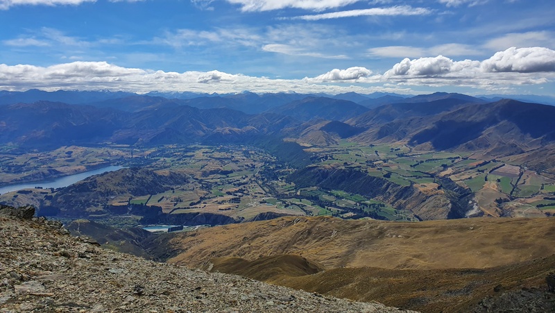
Once you’re at the summit, there’s no sign or anything to say you’ve made it…but that’s okay. You’ll get views over the Wakatipu Basin, Gibbston and beyond. If you’re not familiar with the area, the lake you can see below is Lake Hayes.
There are plenty of good picnic spots near the summit.
Then you’ve got to make you’re way back…in theory, you could navigate the ridges to The Remarkables car park, but I haven’t tried this yet…it was a little sad seeing the Remarkables Road seemingly a little bit away. You consider doing a key swap for this track.
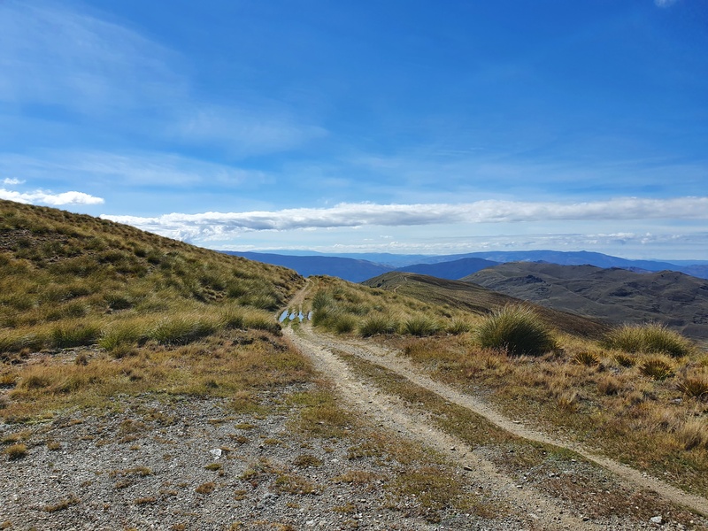
The way down is cruisey…although being able to see where you’ll be walking for the next couple of hours or so can mess with the mind. Once you reach Mount Salmond start thinking about which way you’ll go back down as the DOC sign is about 1km away which tells you the options.
Coming back via the water track is tough to start with as the trail drops down the hill rather quickly with some terrain ready to test your ankles.
I was also getting wet at some points as you never really follow a water race from what I could tell. Once the track flattens out, it’s quite a nice stroll with nice views.
This route is a couple of kilometers longer than going via Mount Edward but I did enjoy the change from the 4WD track.
And once you get back to the junction/saddle, you’ve got around 4km or so to get back down the hill to end a big day of hiking.
If you’re in most places around the world, the Glenroy Water Race hike would be one of the best things you can do. But with so many insane hikes in Otago, I only recommend doing this if:
- if you’ve got a weird craving to do it
- live in the area and want to tick another hike off
If you’ve got any recommendations about the Glenroy Water Race/Ben Cruachan, drop a comment below or email jub@churnewzealand.com .
5. A FEW FINAL PHOTOS
WHAT TO READ NEXT
Fun Things to do in Arrowtown
Arrowtown is a sneaky cool town with lots of walks in the area.
The Isthmus Peak Hike
The Isthmus Peak Hike is an awesome hike and personally I prefer it over Roys Peak.

Hey, it’s Jub here. I’m the guy behind Chur New Zealand, helping you have the best time hiking, trekking, walking…whatever you want to call it…in NZ. I’m based in Queenstown and am always out and about exploring trails, old & new. If you have any questions, reach out.