The Mount Iron Track is a 4.5km loop track close to the heart of Wanaka.
At the top of Mount Iron, you get panoramic views of Lake Wanaka, Southern Alps, the full ridgeline including Roys Peak and more.
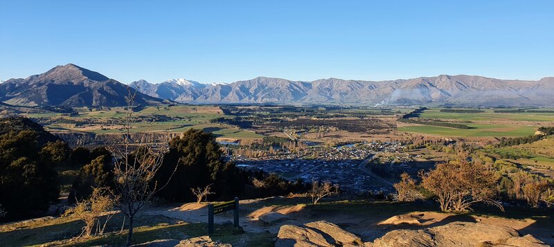
This post will give you the details to know about the Mount Iron Track. Note: I’ll be discussing the most popular Mount Iron loop going in a clockwise direction.
TABLE OF CONTENTS
1. Mount Iron Track Details & FAQ
2. Mount Iron Track Map
3. How To Get To The Trailhead
4. My Mount Iron Experience
1. MOUNT IRON TRACK DETAILS & FAQ
How hard is the Mt Iron walk?
Of all the Wanaka walks that take you to a viewpoint, this is one of, if not the easiest. There’s some elevation gain, but I’m happy to consider this as an easy walk. It’s much easier than Queenstown Hill.
How long is the Mount Iron Track?
Based on my Strava Data, the DOC website, and other sources the Mount Iron loop track is 4.5km.
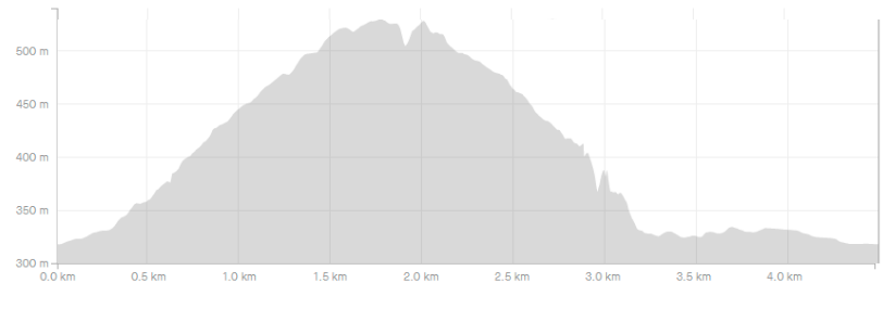
What is the elevation gain on the Mount Iron Track?
The total elevation gain is ~225 metres, with almost all of this on the way to the summit.
Here’s the elevation profile of the walk:
How long does it take to walk up Mount Iron?
DOC suggests the walk takes about 90 minutes which should be on the upper side of the limit. If you’re a fast walker, you can get it done In an hour.
Can you drive up Mount Iron?
No.
Where does the Mount Iron Track start?
There are various starting points to join the Mount Iron Track, including from Albert Town. But the majority of people, including this post, will start at this car park and walk in a clockwise direction.
Are dogs allowed on Mount Iron?
Yes. But must be kept on a leash at all times.
2. MOUNT IRON TRACK MAP
If you click on the map below, it’ll open up in a new window on TopoMap.co.nz.
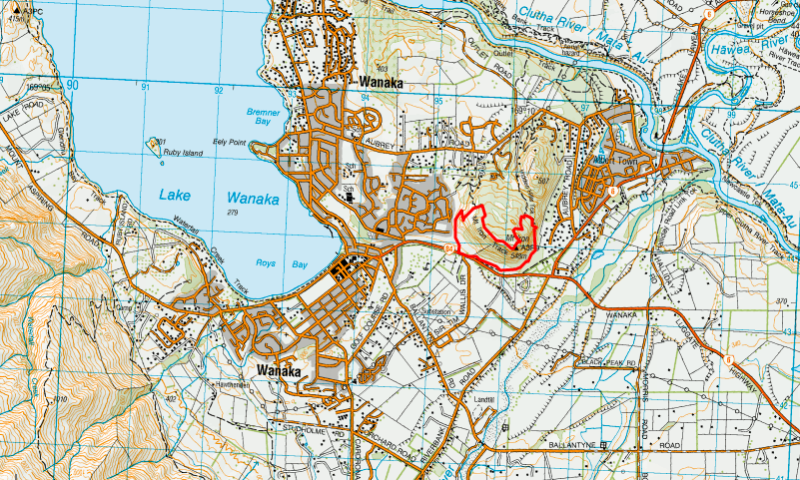
You can see the Mount Iron Track above. In short, it’s a simple loop track to follow. But as there are various trailheads you could potentially get lost…potentially.
You can also see the loop track on Google Maps and maps.me.
3. HOW TO GET TO THE TRAILHEAD
The main trailhead is close to the heart of Wanaka which is great. You can walk to the trailhead which is 2km from the Speights Ale House on the lakefront.
Alternatively, you can drive to the trailhead where there’s plenty of parking.
4. MY MOUNT IRON EXPERIENCE
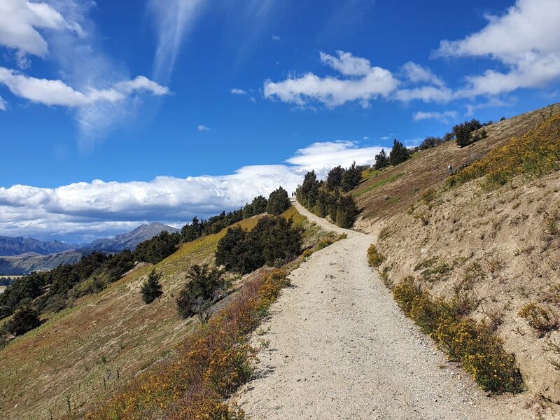
I’ve completed this loop a few times, and it’s fun to see a variety of people going up here. Trail runners, walkers, families, it’s for all 🙂
Leaving the carpark you get straight into a gentle incline for about 250 metres. The incline then increases and then you’ve got a grind for the next 1.5km or so until you reach the top of Mount Iron. There are a few flat sections, but you probably won’t notice them!
There’s a few sections where it looks like the path splits off, but you won’t lose the track as it’s
well maintained on the way up to the trig.
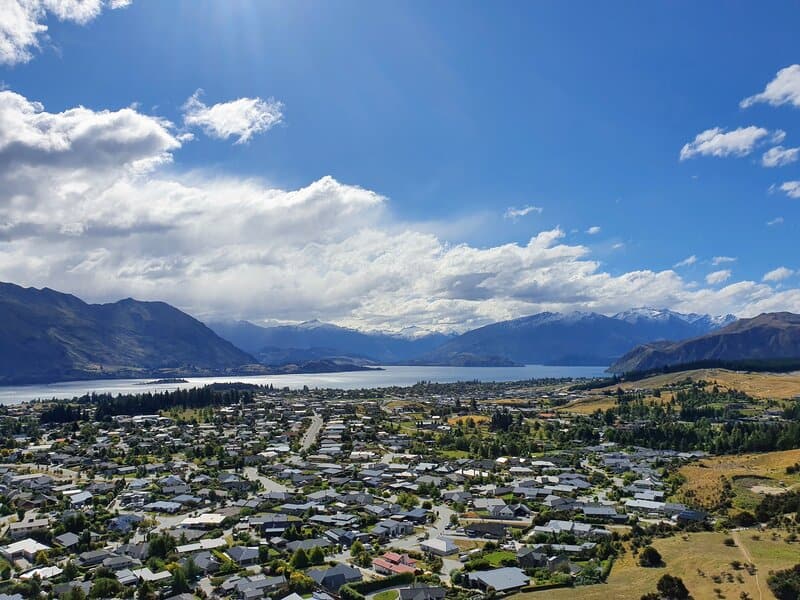
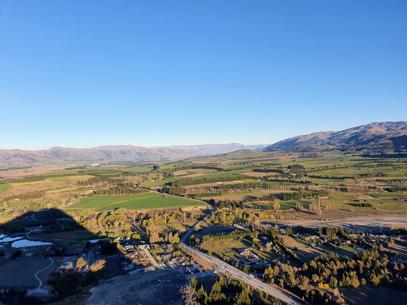
Make sure to take a break from time to time and take in the views over Wanaka as they open up.
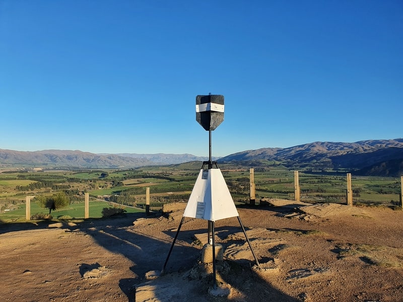
You’ll be able to see the trig from a couple of hundred metres away as you get near the summit. It’s not the fanciest summit you’ll see, but it’s cool. Once you get to the top, enjoy. There’s plenty of space to chill out and have a picnic if you fancy. Do note, there’s not a lot of shade.
To descend you’ll need to put your concentration face on as it’s more technical coming down the hill. It’s not crazy steep (well, it is in a couple of spots) but for just over 1km you won’t want to be daydreaming.
All of a sudden you’ll realise the track has flattened out and the rocks have disappeared. This indicates all the hills
are taken care off as you stroll back around to the start of the track. The last few hundred metres aren’t glamourous next to the road, but after what you’ve just walked, you can’t argue 🙂
Walking the Mount Iron Track is a fun 4.5km loop walk close to the middle of Wanaka.
It’s a great way to warm the legs up for one of the bigger hikes nearby like Isthmus Peak or the Grandview Mountain Track.
If you have any questions about walking the Mount Iron Track, leave a comment below or email jub@churnewzealand.com.
OTHER WALKS NEARBY
Hiking to Meg Hut in the Pisa Range
A great spot for a day or overnight hike.
The Skyline Track in Wanaka
Walking across the ridge above Wanaka.

Hey, it’s Jub here. I’m the guy behind Chur New Zealand, helping you have the best time hiking, trekking, walking…whatever you want to call it…in NZ. I’m based in Queenstown and am always out and about exploring trails, old & new. If you have any questions, reach out.
