Mount Climie is a 12-13km out-and-back hike with ~700 metres of elevation gain. The summit is 862 metres above sea level.
I liked how my mate described the Mt Climie hike the night before.
“Well yea, it’s not gonna be in your top 5 but still worth doing.”
This post will give you all the details about Mt Climie, along with lots of photos and a brief bit about the Tane Track which you can add on.
TABLE OF CONTENTS
1. Mount Climie Track Details
2. Mt Climie Map
3. How To Get To The Mount Climie Car Park
4. My Mt Climie Experience
4. More Photos
MOUNT CLIMIE TRACK DETAILS
When1: March 2021
Difficulty2: Medium. It’s solid amount of elevation gain for the distance, but the 4WD track makes things less hectic.
Hike Distance3: From the upper carpark, my Strava recording came in at just over 12km which is what most people register distance wise (this is too the second summit where the last power station is). The brochure mentions 14km but that seems overboard.
Incline4: Strava registered 702 metres of elevation gain for the hike. ~75% of this is in the first 4.3km as you head to the alpine tops.
Hike Duration5: It took me 2 hours and 52 minutes to complete the hike which includes about 10 minutes at the summit. Ither than that I was only taking short pauses for photos. I would schedule 3-4 hours for most people which includes a little bit of time taking in the views at the top. If you’re not great with hills (it’s pretty steep to start), you might take longer than 4 hours.
Facilities: There are toilets at both the lower and upper carpark. Phone signal is pretty sketchy at the car park, but the reception is decent at the summit. There’s also a nice large picnic area next to the upper car park with lots of picnic benches.
MT CLIMIE MAP
The map above is the GPX file from my journey on top of a topo map. Once you’re on the track you can’t go wrong, no map is required. Simply follow the 4WD all the way to the top (and carry on past the last power station for 100-200 metres or so).
The trail is marked on Maps.me as well.
HOW TO GET TO THE MOUNT CLIMIE CAR PARK
The access to Mount Climie is within the Tunnel Gully Recreation Area of the Pakuratahi Forest.
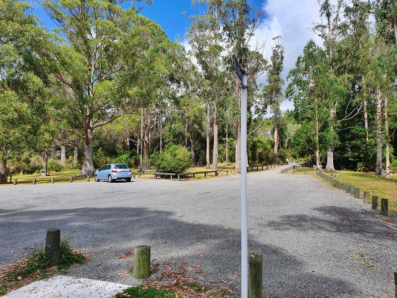
The upper car park is the starting point for the hike to the Mount Climie peak.
Driving
There are two car parking areas. Park at the upper car park which is all the way at the end of the road. There’s plenty of parking space.
From Upper Hutt, it’s just over 10km to the car park following SH2 then turning right onto Plateau Road which you follow all the way to the end.
From Wellington, it’s about 45km and a 45-minute drive.
Public Transport
There’s some surprisingly good public transport access to the trail.
Step 1: From Wellington you’d catch the HVL (Hutt Valley Line) to Upper Hut Station (timetable here). Travel time ~45 minutes.
Step 2: Catch the 112 bus from the bus stop A at Upper Hutt Station and get off at the last bus stop on Plateau Road (timetable here). Travel time ~21 minutes.
From the bus station, keep walking along Plateau Road for about 1.5 km to the trailhead. There’s a little section where the road is narrow with no footpath, but there’s not a lot of traffic.
The Wairarapa Line stops at Maymorn Station, which is only ~2km from the trailhead but the train frequency here isn’t as regular as the HVL.
MY MT CLIMIE EXPERIENCE
As mentioned, my friend said it was a good hike, but not an amazing one given you follow a 4WD track the whole way. That does make navigation easy!
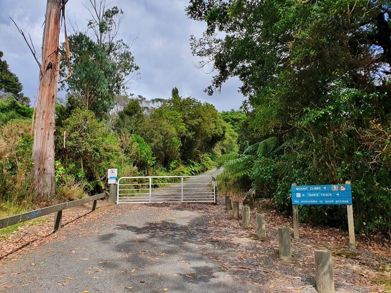
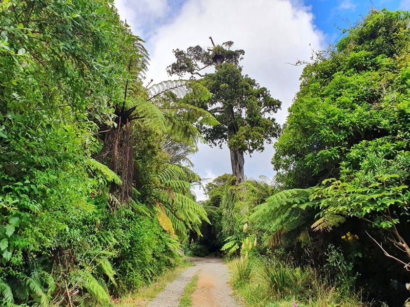
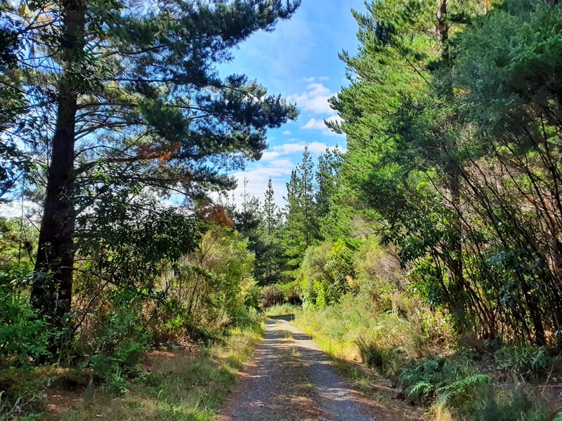
As soon as you leave the car park (you pass the gate in the photo below) the incline begins as you weave your way up the hill. The gradient does vary a decent bit, but it’s more or less steep for the first 4.5km with a couple of short respites where it flattens out.
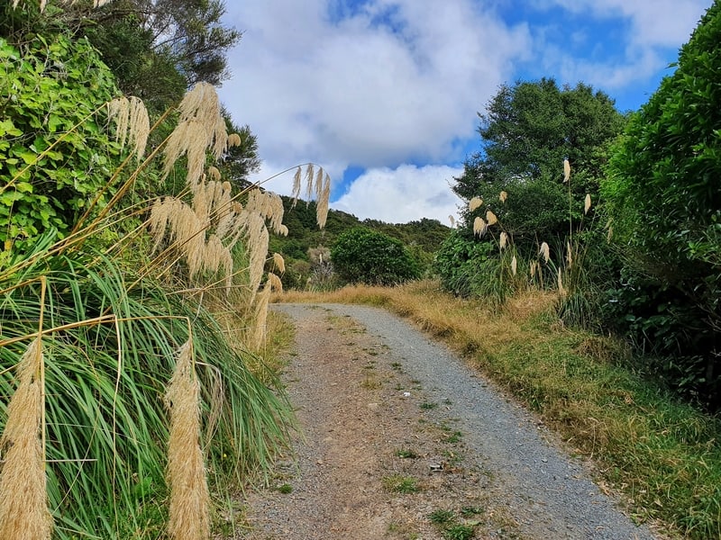
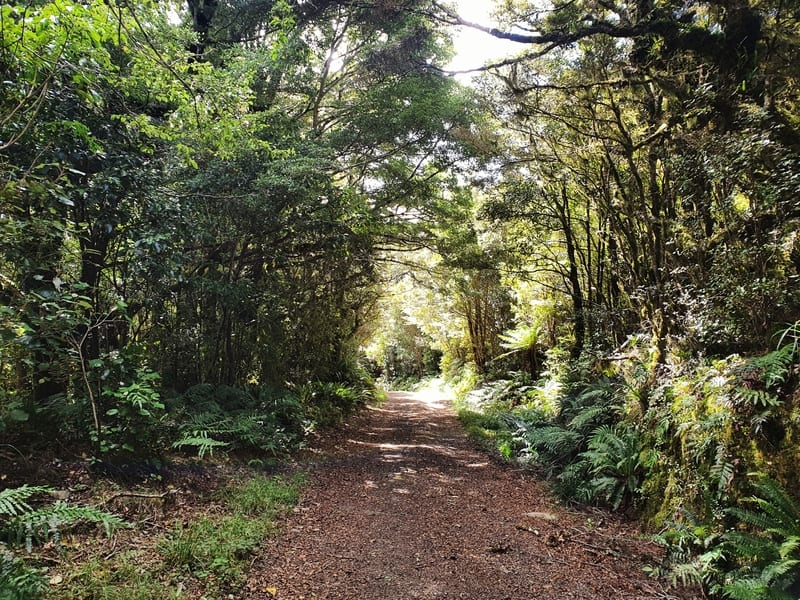
I like how noticeable the change in trees next to the track is (thanks to altitude). Three species I always enjoy seeing are toitoi, kawakawa, and various ferns.
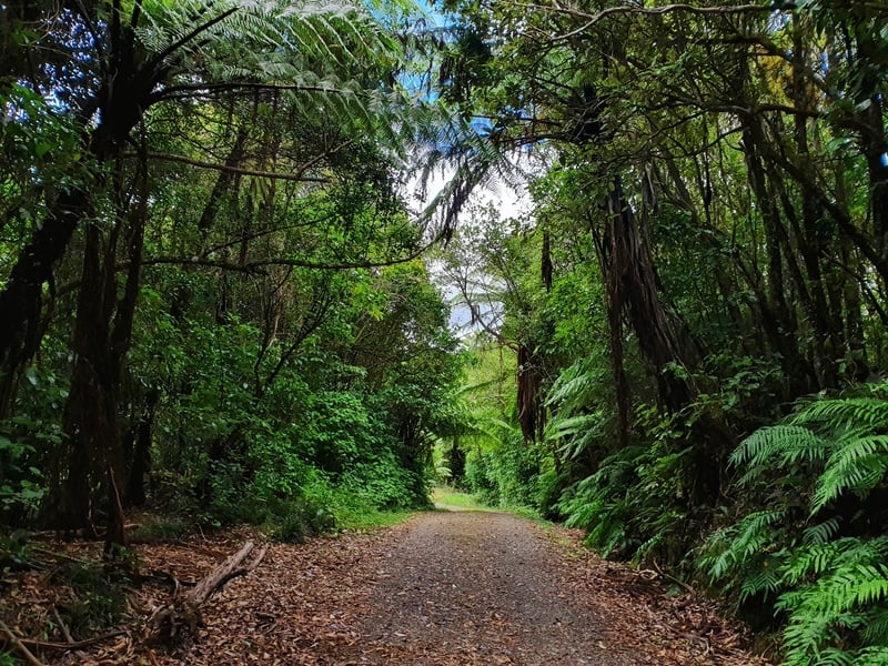
One perk of this track is you’ll be pretty well protected from the sun for most of the incline.
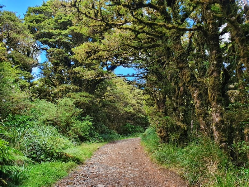
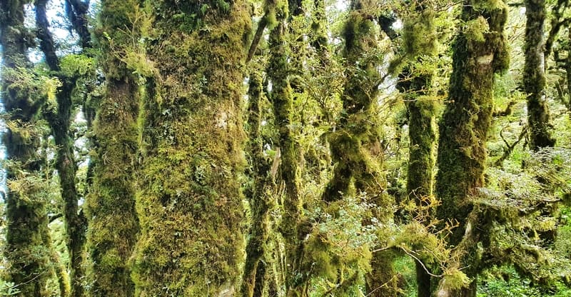
When you start seeing the beech trees covered in moss, you know you aren’t far from the top.
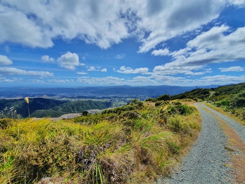
On the way up there are a couple of times where you get views, but I’d delay your admiration until you get up above the tree line.
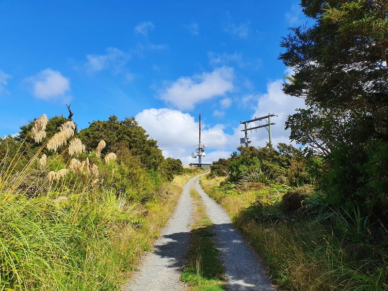
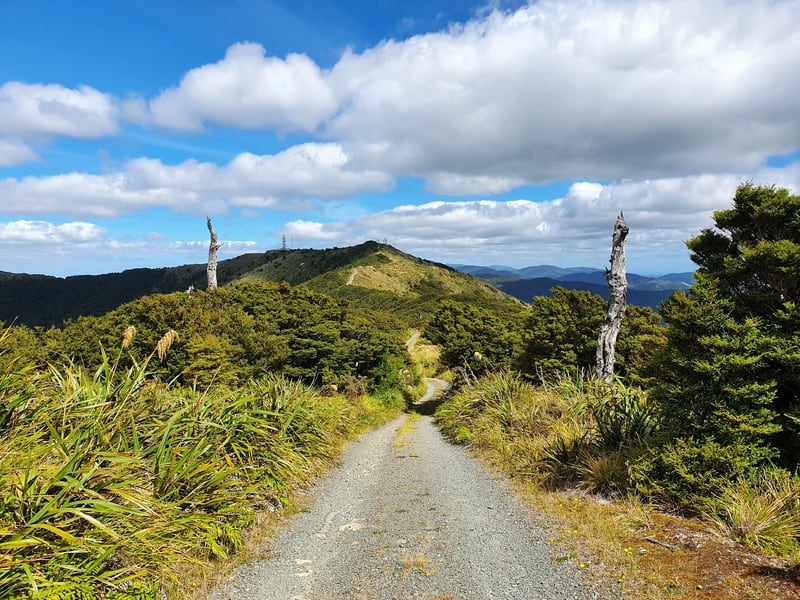
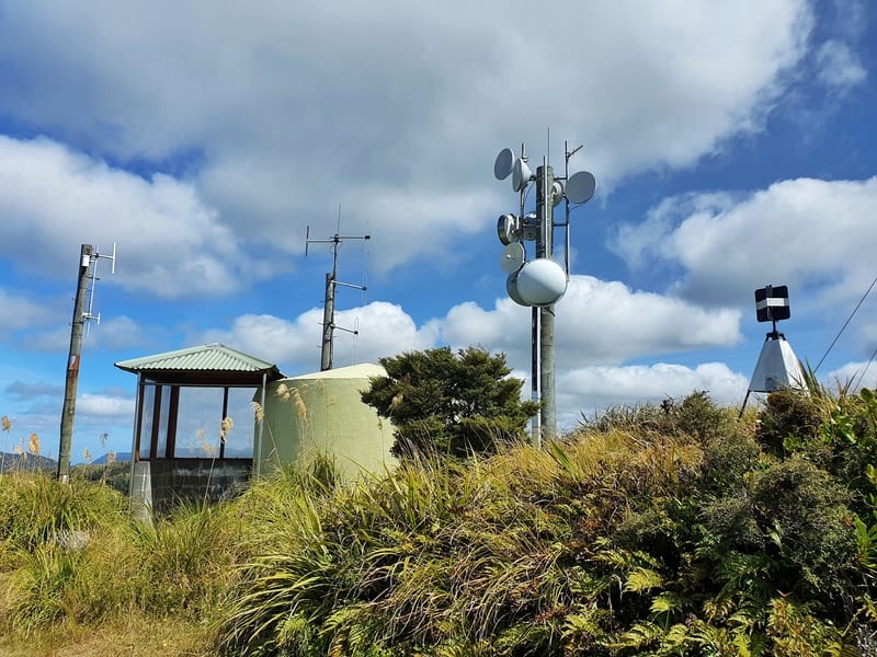
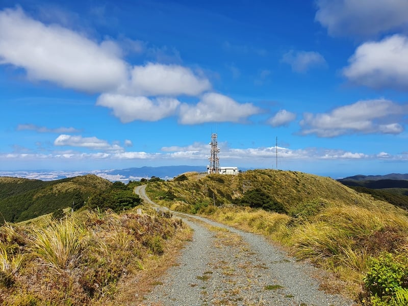
And then the power station will come into view (see above). This is a false summit 😉
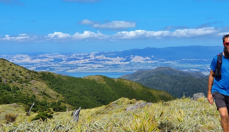
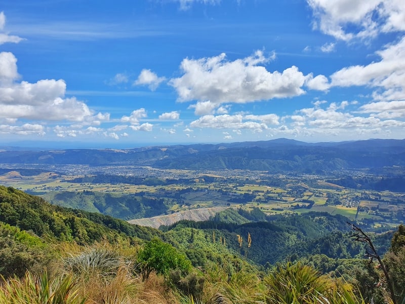
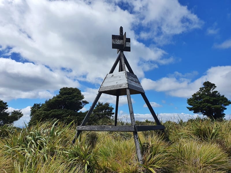
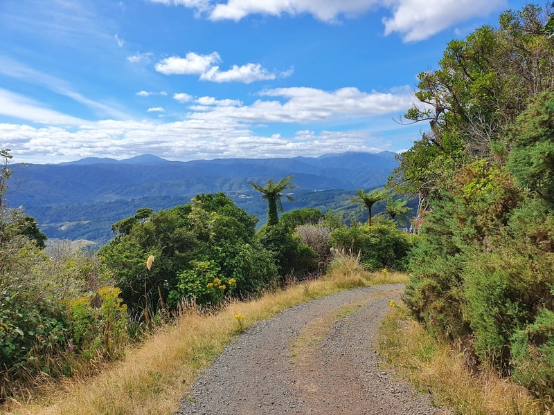
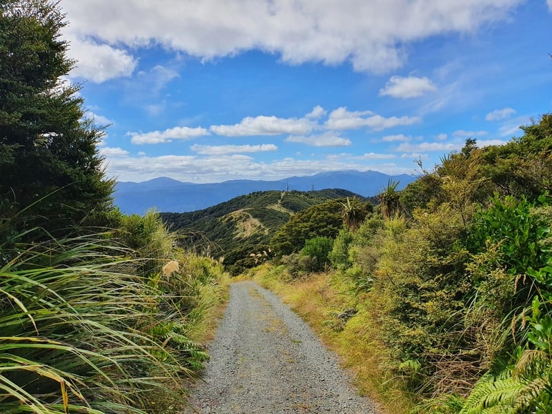
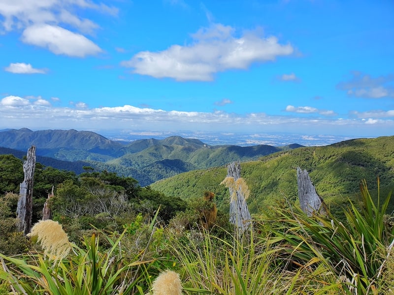
But it does mean you’ve done most of the climbing. You’ll now have great views (cloud permitting) for the next 1.5km as you make your way to the last power station (keep going past the trig).
If you get stuck in a bad weather patch there’s a couple of spots to take shelter along the top.
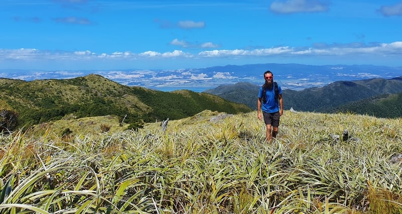
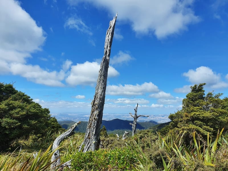
See if you can spot Wellington in the distance on your right-hand-side.
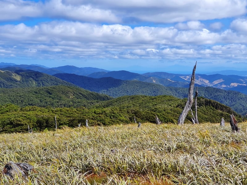
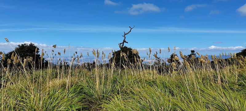
I love the trees that have no branches on them and have stunted in growth…they’ll always remind me of Jurassic Park. It’s the easy access to alpine terrain that makes the Mt Climie walk special.
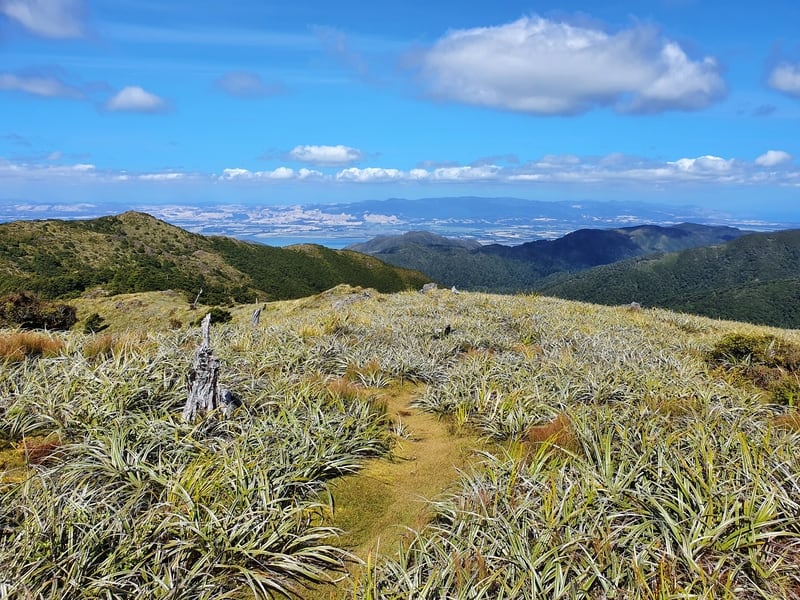
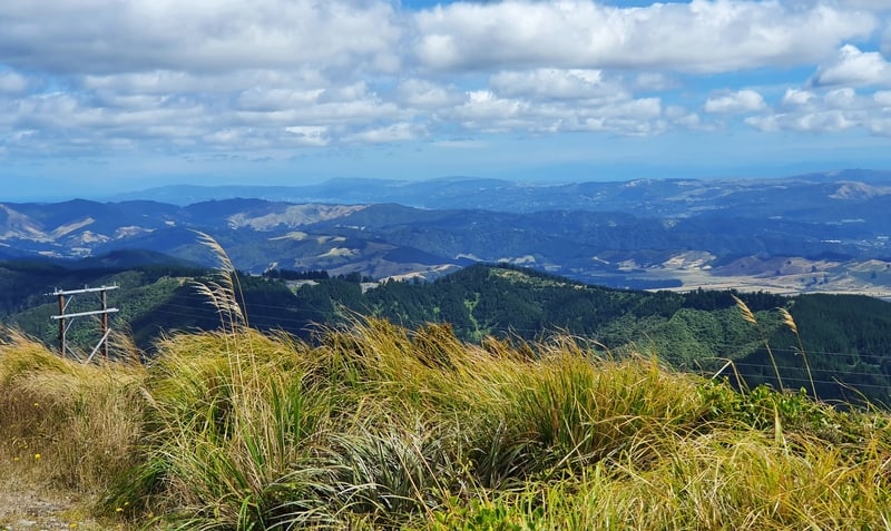
When you get to the last power station, walk around the side of the fence to where there’s a small trail on some carpet-like grass weaving through the snow tussock.
I’ll let the pictures do the talking. Stunning!
There’s no obvious spot where you might want to sit and take a break to eat etc. Keep an eye out while you’re walking along the tops for a spot that takes your fancy.
Then the return is simply coming back down the way you came. The 4WD track might get slippery if it’s wet, but there’s enough traction you can get some good momentum on the way down without worrying about falling on ya bum.
Tane’s Track
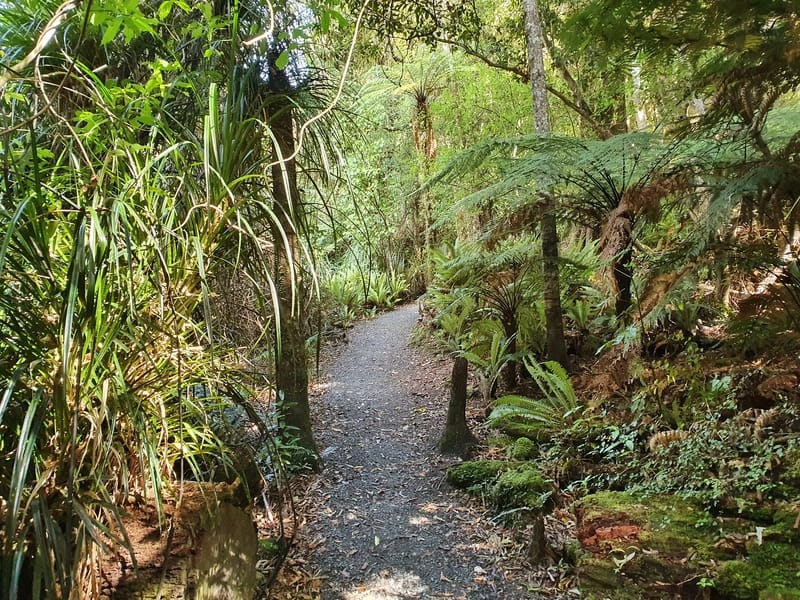
You’ll have seen a sign mentioning Tane’s Track as you started the climb up Mt Climie. This is a 2.4km loop track through some beautiful forest. It’s an undulating terrain, but never super steep so if you’ve got plenty of time and some gas left in your legs you might as well do it.
To get to the start of the trail, turn right once you get back to the car park and you’ll see the signposted trailhead. Give yourself 35-60 minutes to walk this.
You might want to check out Mangaroa Tunnel too.
I genuinely enjoyed the Mt Climie walk, even though a hike along a 4WD track can be a little dull at times. But the forest is dense and varied, before you get to the alpine tops which are always epic…on a good weather day at least.
If you’ve done the Mt Climie hike, or have any questions, leave a comment below or email jub@churnewzealand.com. It’s always fun to hear the experience from others!
I’ll finish the post with a bunch more photos.
MORE PHOTOS
RECOMMENDED READING
What to do in New Zealand
Plenty of ideas all across the country
Walks in the Tararuas
A few options in the nearby mountain range
15+ Wellington Walks
The whole region is full of gems!

Hey, it’s Jub here. I’m the guy behind Chur New Zealand, helping you have the best time hiking, trekking, walking…whatever you want to call it…in NZ. I’m based in Queenstown and am always out and about exploring trails, old & new. If you have any questions, reach out.