There are dozens of amazing multi-day hikes on the South Island. So much so things get tricky trying to prioritise which long hikes you should do.
With that said, you can’t go wrong with any of them…provided you’ve done a little planning, and have a decent weather window.
This post will cover some of the best multiday hikes on the South Island, most of which I have completed. I’ve added a few in thanks to other contributors.
I’m going to address the most common question first though.
What is the best multiday hike in the South Island?
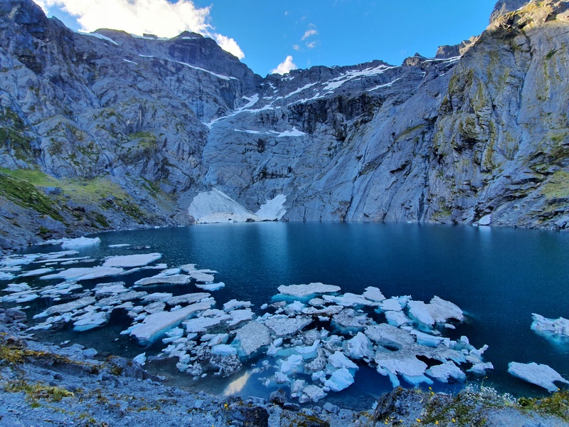
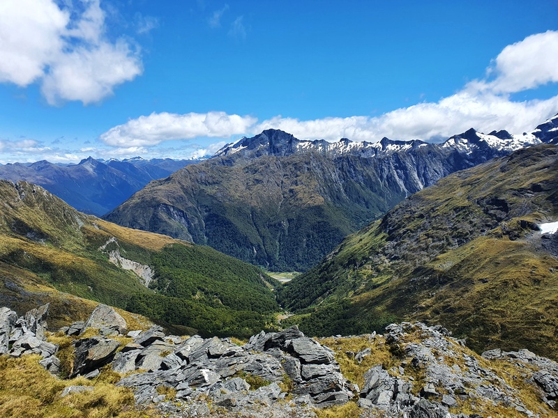
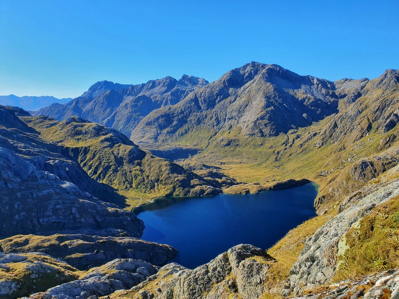
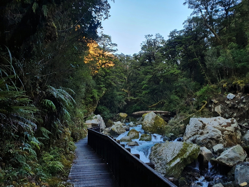
Lake Crucible on the Gillespie Pass Circuit
Of all the South Island multiday hikes I’ve done the best are the Routeburn is still probably the best, despite popularity. I just can’t take it off my best hikes in NZ list.
Note: these are all multi day hikes that are a minimum of 3 days and 2 nights for most people. If you’re looking for overnight hikes in the South Island, two of my favourites are Brewster Hut Track (medium to hard) and Meg Hut (easy).
TABLE OF CONTENTS
1. Queen Charlotte Track
2. Abel Tasman Track
3. Paparoa Track
4. The Gillespie Circuit
5. Motatapu Track
6. Rees Dart Track
7. Routeburn Track
8. Greenstone Caples Track
9. Milford Track
10. Kepler Track
11. Hollyford Track
12. FAQ’s
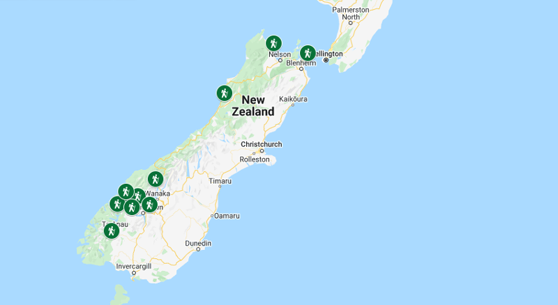
MAP OF THE MULTIDAY HIKES IN THE SOUTH ISLAND
Clicking on the image below will open the map in a new window.
11 OF THE BEST MULTIDAY HIKES IN THE SOUTH ISLAND
1. QUEEN CHARLOTTE TRACK
How many days? 3 days.
How far is the hike? 55km.
What type of hike is it? End-to-end.
What is the total elevation gain? ~2700 meters.
Can you hike this in winter? Yes.
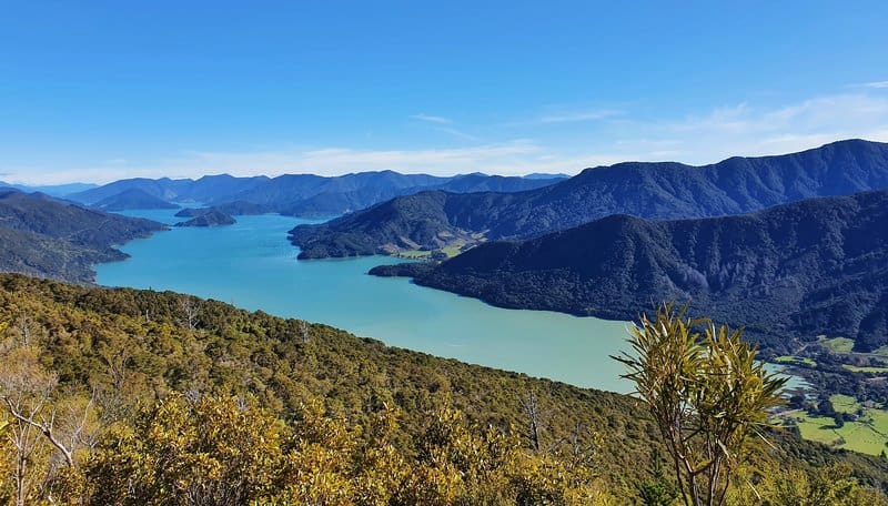
The Queen Charlotte Track is a popular walk starting close to Picton and can be completed by foot or bike. The hike takes you through a lot of native bush, with hills throughout the hike giving you sweeping views of the Marlborough Sounds.
This is a great introduction to hiking in the South Island given you can get to the track from Picton, the gateway to the South Island if you’re catching the ferry from Wellington.
And the accommodation options throughout the hike vary, from campsites to fancy lodges. And you also have the option of having your bags transported for you each day which is handy.
The ferry to the start at Ships Cove is a cool bonus too! I was lucky enough to see dolphins on the way.
2. ABEL TASMAN TRACK
This run down on the Abel Tasman Track is by Laura from Laura The Explorer.
How many days? 3 to 5 days.
How far is the hike? 60km.
What type of hike is it? Point to point.
What is the total elevation gain? ~2000 metres.
Can you hike this in winter? Yes.
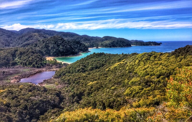
Walked as per the DOC guide, the Abel Tasman Coastal Track takes 5 days and is 60km. However the end-to-end route means sections can be combined, or dropped, and the walk can be completed in either direction. Basically, you can choose how you want to do this Great Walk.
The well-formed track follows the undulating coastline (hence the name!) from one beautiful sandy bay to another. The constant up and down of the track means that despite the ~2000m of elevation gain, the highest point is only 200m above sea level (mostly around the inland Gibbs Hill Track section).
There are two keys to planning an Abel Tasman Coast hike, and the first is the tides!
There are two tidal areas with alternative ‘high-tide’ routes, and then two tidal areas that require coordination. Onetahuti Beach has a stream that should be crossed within 4 hours of low tide, and the Awaroa Inlet must be crossed 1.5hrs before or 2hrs after low tide, in daylight only. There are no alternative routes.
The second is arranging a water taxi! If you’re planning on hiking all (or most) of the walk, a water taxi will be essential to either dropping you at the start or picking you up at the end. These can be arranged in Mārahau.
The Abel Tasman Coast Track makes a great hike for any time of year, particularly during winter when many multiday hikes in the South Island aren’t safe options. We enjoyed hiking over winter when the temperatures were still mild and we had almost all of the huts to ourselves!
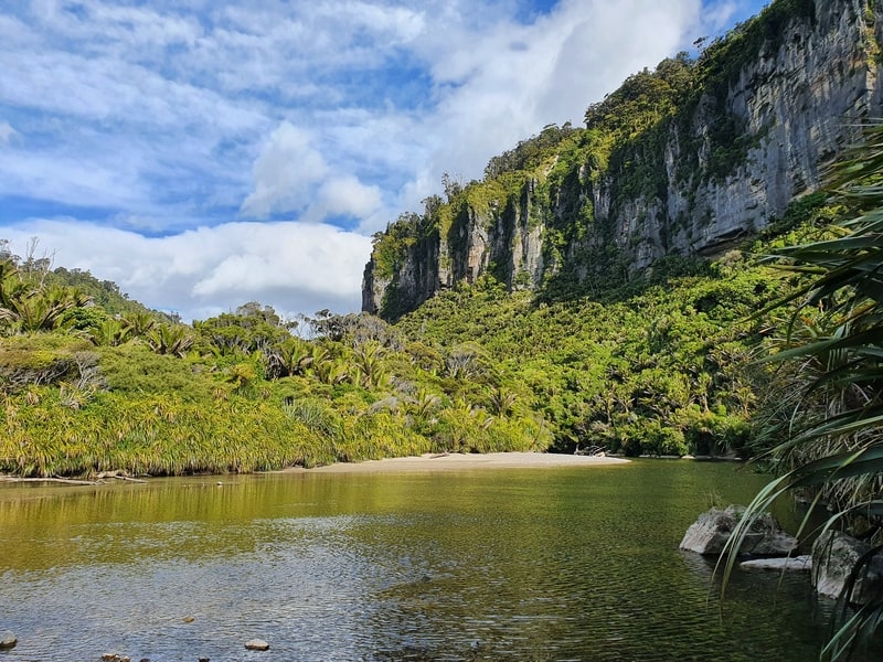
3. PAPAROA TRACK
How many days? 3 days.
How far is the hike? 55km.
What type of hike is it? Point to point.
What is the total elevation gain? 1900 metres.
Can you hike this in winter? Yes.
Since becoming a Great Walk in 2020, the Paparoa Track is the marquee hike in Paparoa National Park and shows you how untouched the West Coast is.
You get to start and finish next to the small towns of Punakaiki and or Blackball, then on the route you get to experience some forest that feels like Jurassic Park (particularly along the Pororari River Track)
Once you get along the top of the ridgelines, wow. The views are awesome…if you’ve got some great weather…I didn’t. This is another track that you can do throughout the year which is handy.
4. THE GILLESPIE PASS CIRCUIT
How many days? 4 to 5 days.
How far is the hike? ~65km.
What type of hike is it? Circuit.
What is the total elevation gain? ~2900 metres.
Can you hike this in winter? Not really.
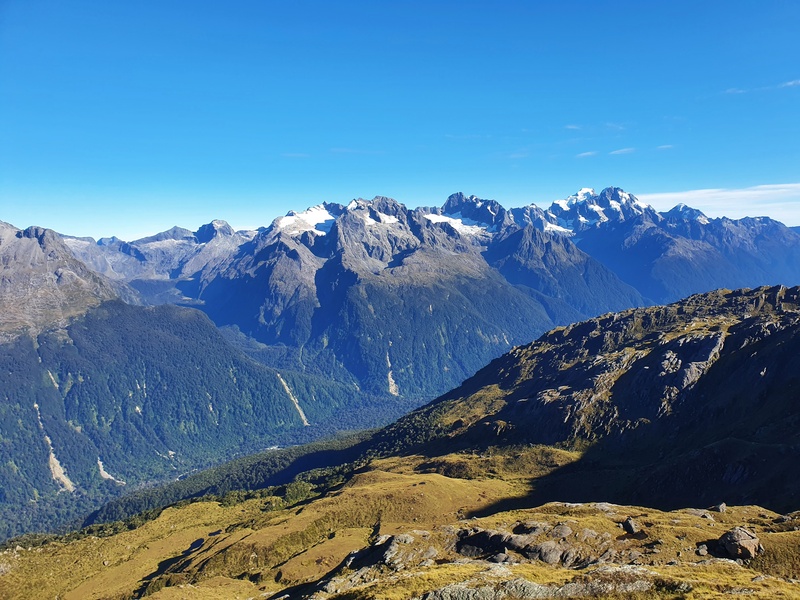
The Gillespie Circuit Track isn’t a track that’s on the top of most visitor’s lists, but definitely consider giving this challenging circuit a go.
There’s a whole host of Gillespie Pass transport options. So if you’re short on time you can get transported into different parts of the track, but if you’ve got 4 days free do the full circuit.
The highlight reel for this track is extensive, but for me, the reward of the hike up to Lake Crucible is incredible. Ideally, you’ll get there early to mid-summer when there are icebergs in the lake.
RELATED POST: WALKS IN MOUNT ASPIRING NATIONAL PARK
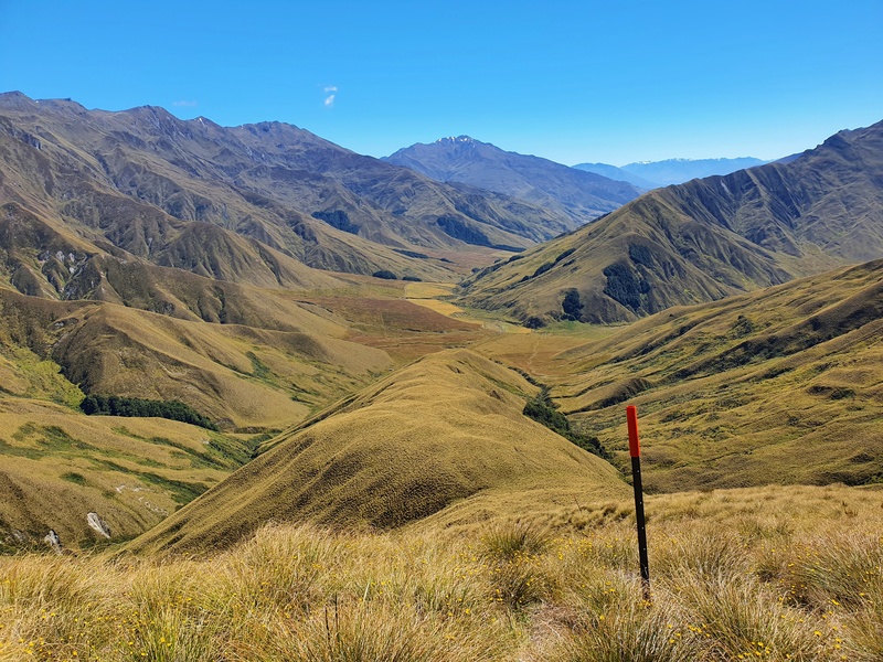
5. MOTATAPU TRACK
How many days? 3 days.
How far is the hike? 50km.
What type of hike is it? Point to point.
What is the total elevation gain? ~3100 metres.
Can you hike this in winter? Sometimes. Depending on the recent snow levels, experienced hikers have done this hike in the middle of winter
If you’re looking for an easily accessible, but tough multiday hike in the South Island, put the Motatapu Track on your list. The route used to be a way for people to get between Wanaka and Queenstown, but crikey, they didn’t take the easy option.
There are three demanding hills spread out across this track. THey’re not the biggest hills you’ll find on the South Island, but they’re steep and will keep you really honest.
This is an awesome hike as you get some epic views, especially toward Lake Wanaka from afar. But you’ll need to work for it! You’ll also bypass Macetown, a historic gold mining town.
RELATED POST: LOTS OF HIKES IN QUEENSTOWN YOU SHOULD DO
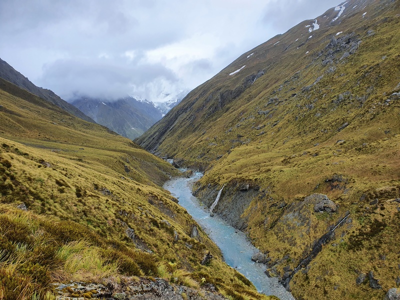
6. REES DART TRACK
How many days? 3 to 4 days.
How far is the hike? 85km.
What type of hike is it? Point to point.
What is the total elevation gain? ~3000 metres.
Can you hike this in winter? Not really. They remove some of the bridges.
The Rees Dart Track seems to be getting more and more popular, but the transport issue does prevent some people from getting the track down on a whim.
The track follows both the Rees and Dart Rivers for a good portion of the hike, but you’ve got the Rees Pass and Cascade Saddle/Dart Glacier to break up the river tracks. Not that the river tracks are boring, you’ve got a whole host of terrains to pass.
This is a multiday tramp in the South Island where I didn’t feel like any of the days were a bit boring (relatively speaking) at all.
7. ROUTEBURN TRACK
How many days? 3 days.
How far is the hike? 33km.
What type of hike is it? Point to point.
What is the total elevation gain? ~1300 metres.
Can you hike this in winter? Not really. You can do parts of the track, but there’s avalanche risk over much of winter.
This Routeburn Track is my favorite Great Walk!
It’s on the shorter length at 33km, but there’s so much variety in that 33km you’ll be amazed on every step. And there’s a host of side trips you can do along the way, which considering there are three huts on the track are mostly doable.
My favourite section on the Routeburn is more or less everything between Routeburn Falls Hut and Lake Mackenzie Hut. Definitely do the trip up to Conical Hill, if weather permits, and if you’ve got long summer days, a trip into the Valley of the Trolls is amazing.
If there’s one downside to the track, it’s the transport issue. While the track is 33km long, by road, the two trailheads are hundreds of kilometres apart.
8. GREENSTONE CAPLES TRACK
How many days? 3 days.
How far is the hike? 56km.
What type of hike is it? Point to point.
What is the total elevation gain? ~1300 metres.
Can you hike this in winter? Yes! Provided the weather has been decent (and will be), you’ll be able to safely cross the river sections.
There’s not too much elevation on the track, and while most people do the hike in three days, there are five huts on the track meaning you can break it up into super small chunks.
As you don’t climb the mountains so much on this hike (you go over one pass), this quickly becomes an alternative to the Routeburn in the winter and if the weather is forecasted to be too bad there.
You get a variety of terrains on the Greenstone Caples, and it’s cool how there are a bunch of swimming holes along the way.
9. MILFORD TRACK
How many days? 4 days.
How far is the hike? 53.5km.
What type of hike is it? Point to point.
What is the total elevation gain? ~2900 metres.
Can you hike this in winter? No. The boats do not service the track over the winter.
This is probably the most famous multi-day hike on the South Island, and perhaps in NZ. I’m not sure exactly what has created the stir, it’s certainly stunning…but I wouldn’t say that it’s head and shoulders above lots of other multiday hikes in NZ.
Maybe it’s the fact you need to get the boat to and from the start of the track that adds to the mystique.
That said, spending lots of time at MacKinnon Pass, and Sutherland Falls is going to make for one of the most memorable days of your life.
Now that I’m typing this, maybe the Milford Track is a bit like Fergburger…there’s so much hype so you have to give it a whirl, but while it’s awesome, it might not be the best? Get me?
With all that said, if you’re keen, 10/10 book it.
10. KEPLER TRACK
How many days? 4 days usually.
How far is the hike? 60km.
What type of hike is it? Circuit.
What is the total elevation gain? ~2000 metres.
Can you hike this in winter? Not really due to avalanche risk.
The Kepler Track doesn’t get too much love in my opinion, but in fairness, the Routeburn and the Milford are right nearby, let alone all of the hikes in Otago.
The middle part of the Kepler, along the top of the mountains, is the best. You get panoramic views or days, and the trail manages to stay relatively flat despite following mountain tops. And if you’re lucky enough, you’ll be able to spend time near kea who tend to hang around Luxmore Hut.
And the track starts so close to Te Anau which makes transport to/from the Kepler Track easy. Make sure you go straight to the Fresh Choice in Te Anau, or to the food trucks across from there.
11. HOLLYFORD TRACK
How many days? 5 days.
How far is the hike? 56km.
What type of hike is it? Point to point.
What is the total elevation gain? ~1300 metres.
Can you hike this in winter? Yes! Provided the weather has been decent (and will be), you’ll be able to safely cross the river sections.
If you’re looking for the best winter multiday hike on the South Island, the Hollyford Track might be what you’re looking for.
Located in Fiordland National Park, a place where so many hikes are a no go in the winter, the Hollyford Track doesn’t get more than a couple of hundred metres above sea level. And there’s no major avalanche risk making this track feasible in winter. If the weather forecast is good.
This is a long point to point track, but again the Hollyford Track transport options are numerous and there are several ways you can tackle the track.
12. FAQ’S
What are New Zealand’s most famous multiday walks called?
They are the Great Walks, and there are currently 10 of them. The next hike to be added to the list is the Humpridhe Track which should happen in the next few years.
In the South Island, the Great Walks are the:
- Abel Tasman Track
- Heaphy Track
- Paparpa Track
- Milford Track
- Routeburn Track
- Kepler Track
- Rakiura Track
Where can I buy gear for hiking?
You can find places to buy hiking gear throughout the country. Here’s a selection of the stores you’ll be needing to keep an eye out for. Each shop has a different kind of person they’re targeting, but these shops you’ll find across the country.
- Macpac
- Kathmandu
- Mountain Warehouse
- Rebel Sports
- Bivouac
Then you’ve lots of smaller chains, and independently-run stores in places throughout the country. Two of the most popular ones I am aware of are Further Faster in Christchurch, Small Planet in Queenstown, and Gordon’s in Wellington.
Add in other options like Facebook Marketplace and op shops and you’ll have more than enough options to find the right hiking gear for you.
You should also invest in a couple of hiking apps, like what I think is the best TopoMap app in NZ.
Is multiday hiking hard?
If you’ve never completed a multiday hike before, yes. That’s often because people underestimate how long you spend on your feet each day and pack way too much. You’ll start to figure things out soon enough, and while they’re never easy, you’ll be impressed by how well your body can handle multiple days of long hikes.
Do I have to finish the hikes in the recommended number of days?
For the most part no. Most of the options will give you the chance to skip a day or spend an extra day at the hike. The exception is the Great Walks during high season which you need to book in advance. You need to stay at the huts on the nights you booked them.
Do I need to bring all my water on multiday hikes?
In the majority of cases, no. There should be enough water in the tanks at the huts for you. And on most of the hikes, the best water is the stuff coming straight from the rivers and streams!
As a general guideline, take enough to carry at least 1, ideally 2 litres of water at all times.
What kind of food should I eat on a multiday hike?
This is highly subjective. You’ll have some people who eat dehydrated meals all the time for the convenience factor and to cut down weight. And you’ll have people who are boujee, bring wine, cheese, crackers, and all sorts of bulky foods. Most people are somewhere in between…it’s something that you’ll figure out yourself, and tinker with on each hike.
RELATED POST: THE BEST TRAMPING SNACKS
Can you get a good night’s sleep in huts?
Yes! Most of the time I sleep really well in huts and fall asleep much earlier than I do at home. That said there’ll occasionally be some impressive snorers or people who toss and turn all night which when in sleeping bags can be really annoying. If you’re a light sleeper, put some earplugs on your gear list.
One thing that isn’t an issue 99% of the time is dealing with people getting drunk and rowdy in the huts till the early morning.
p.s. if you’re doing lots of the hikes, definitely get the DOC Back Country Hut Pass.
RELATED READ:HIKING ETIQUETTE
And there we go. I’m sure you’ve got some inspiration for your next multiday hike in the South Island now. If you have any questions about these adventures, send me an email at jord.bryant@gmail.com or leave a comment below.
Happy hiking.

Hey, it’s Jub here. I’m the guy behind Chur New Zealand, helping you have the best time hiking, trekking, walking…whatever you want to call it…in NZ. I’m based in Queenstown and am always out and about exploring trails, old & new. If you have any questions, reach out.