The Wentworth Valley Falls walk leads to a two-tiered waterfall with each tier about 20 metres high. If you’re looking for an easy walk, the gentle incline on a gravel path to the waterfall viewing platform makes this a great walk to consider.
This post based on my experience will help you decide if you want to visit one of the more popular Coromandel walks to Wentworth Valley Falls.
The photos of the waterfall get better, I promise :p
p.s. If you’re staying overnight at the campsite, definitely give the Wentworth Valley Falls a visit.
TABLE OF CONTENTS
1. Wentworth Valley Walk Details & FAQ
2. Wentworth Valley Falls Walk Map
3. How To Get There
4. Wentworth Valley Hike Trip Report
1. WENTWORTH VALLEY WALK DETAILS & FAQ
- QUICK DETAILS:
- 6 – 7km
- 160 – 180 metres
- 100 to 150 minutes
- Easy
- GPX file available here
It’s not the most exciting walk (but it’s NZ, so it’s still awesome) as you follow the gravel path up the gentle incline towards the Wentworth falls lookout. Along the way you’re following one of the Wentworth Valley rivers which means there are lots of chances for a swim.
Beyond the viewing platform, most people will be able to get down to the bottom of the falls for a swim too. And then there’s the mineshaft from the gold mining era. I wish there was more information about the area.
How far is the hike?
The DOC website lists the walk at 3km (each way) but on my Strava entry I have a 6.74km return trip. This includes a couple of brief detours so I’d say you’ll walk b6 to 7km depending on detours you take for swimming etc.
How hard is the Wentworth Valley Falls walk?
Easy. It’s not a technical track, and while it’s uphill, it’s not a significant amount.
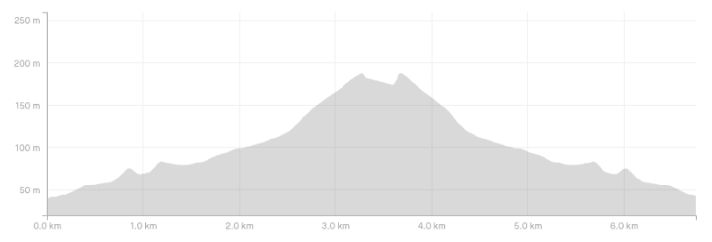
What’s the elevation profile of the Wentworth Valley Falls hike like?
My strava has the elevation at 179 metres, and another site, Freewalks.nz has it at 168 metres, so somewhere in that range. Here’s the elevation profile on a chart:
How long does the Wentworth Falls hike take?
The DOC signs say that the walk takes 1 hour 15 minutes to reach the falls, which is super conservative. It took me just under 50 minutes to reach them, and after spending a while at the base of the waterfall, I made it back in a faster time for a total trip time of 1 hour 53 minutes. It’ll depend on how long you swim (if you do), but you won’t take more than 2 hours 30 minutes and could be as little as 1 hour 40 minutes.
What about the Mines Walk that starts at the Wentworth Valley Falls trailhead?
Meh, you can skip it. You’ll see two mine shafts like the one on the main Wentworth Valley waterfall walk but you can’t enter them. And there’s a river crossing at the end which you can jump over the rocks if the water level is low. It’s nothing special, and I’d skip it unless you’re camping in the valley and have endless time.
Are dogs allowed on the Wentworth Valley walks?
Yes, they are allowed but must be on a leash at all times.
2. WENTWORTH VALLEY FALLS WALKING MAP
*Clicking the link below will open the map on topomap.co.nz in a new window where you can zoom in/out etc.
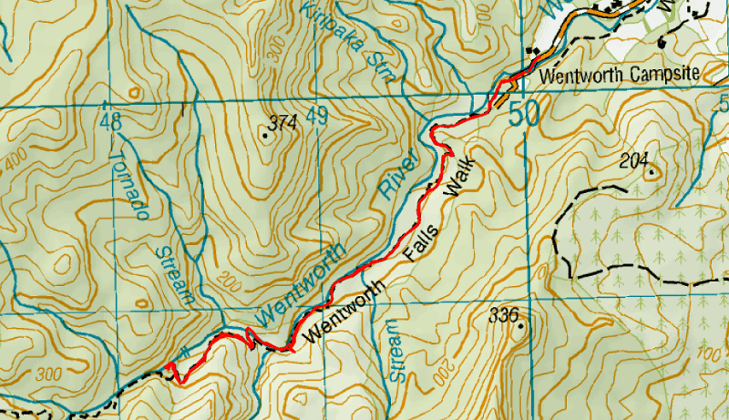
As usual you can’t find the trail on Google Maps, but they have a pin here for it. The maps.me app has the trail, as does the topo maps. I review my favourite NZ topo map app here.
3. HOW TO GET THERE
Public Transport: None available.
Car: The trailhead is at the very end of the Wentworth Valley Road which is nearly 5km long. Wentworth Valley Road is mostly gravel but you’ll be fine in any vehicle, making sure to cross the small ford towards the end safely. There’s ample parking space near the trailhead.
From Whangamata, you turn left onto the main highway and turn right onto Wentworth Valley Road. You’ll be there in about 10 minutes max.
From the Wentworth Valley Campground: No rocket science involved, you’ll see the signs to the trailhead.
4. WENTWORTH VALLEY WATERFALL WALK TRIP REPORT
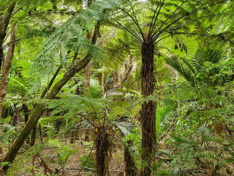
Loving the fern action!
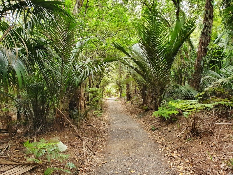
This is what the majority of the walk is looking like for the first 2.5km.
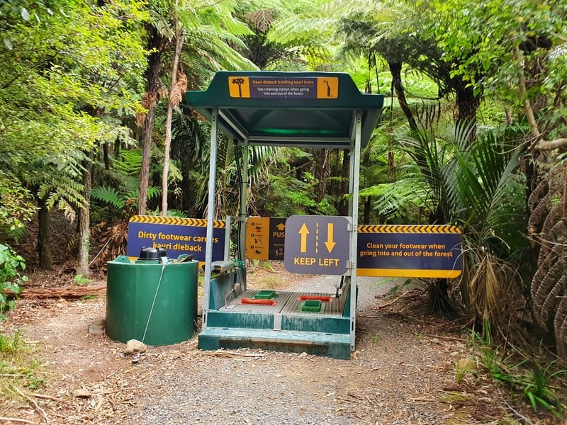
This is what the Kauri dieback disease cleaning stations look like.
The Wentworth Valley Falls Walk starts off in an open-top section from the carpark for about 200 metres. Once you’re under the canopy of trees you pass through a Kauri dieback disease station which you should use to clean your shoes (instructions are provided). The walk is pretty consistent with a low gradient incline interrupted by short declines. The incline isn’t crazy and given the firm gravel on the track, it doesn’t provide any difficulties so much so that there’s pretty much no orange triangles usually seen on tracks to indicate the way in New Zealand.
One of the views crossing the bridges in the Wentworth Valley.
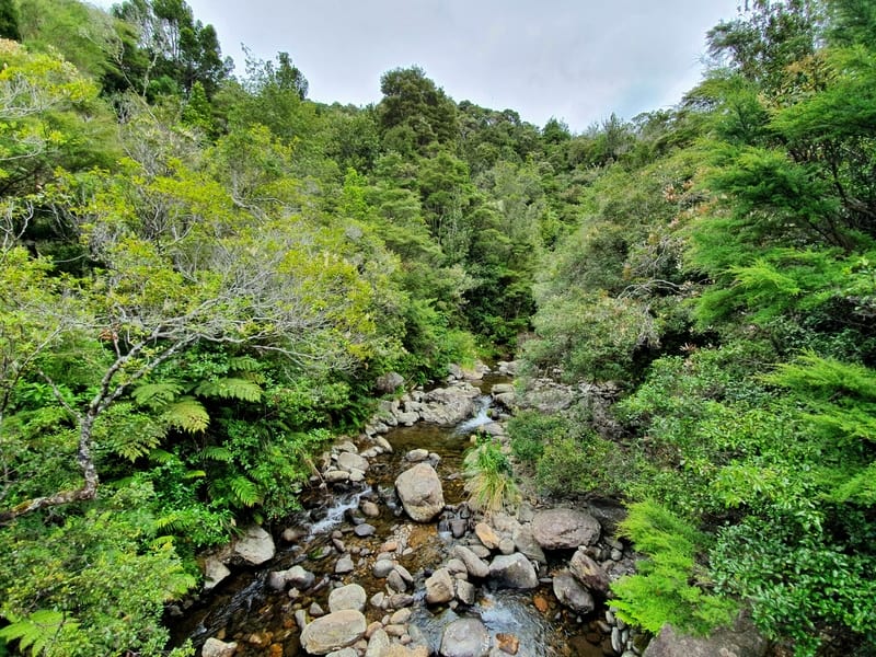
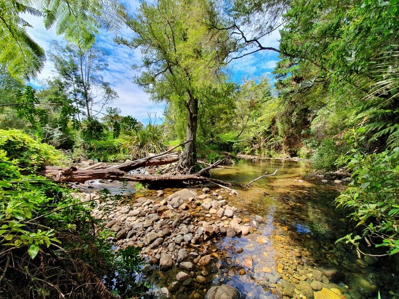
You’ll pass over two bridges which are close to some good swimming holes I spotted but like the nearby Wharekirauponga Track, you’re better off waiting to swim at the bottom of the waterfall.
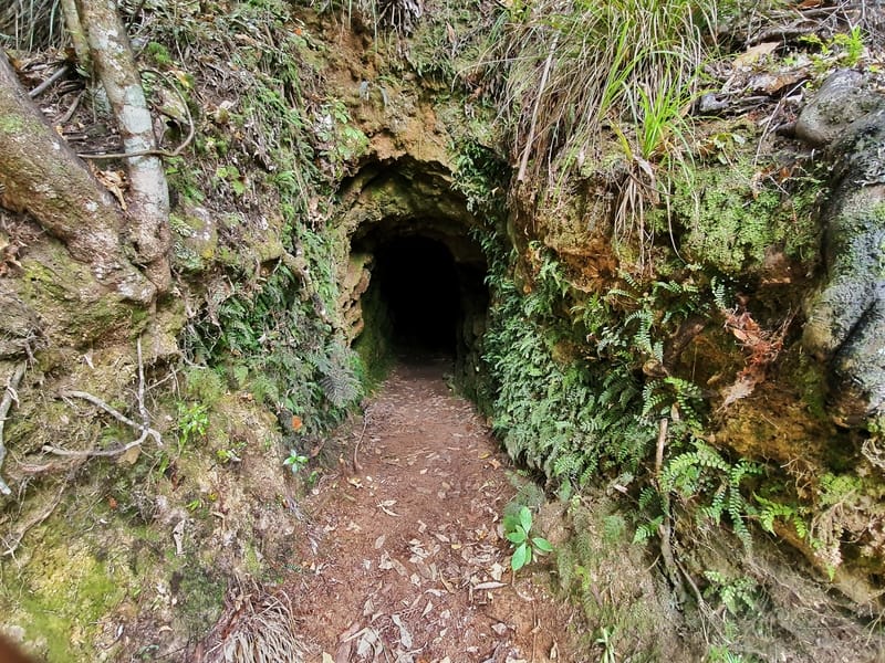
A mine shaft you’ll see on the Wentworth Valley track, you’re allowed to walk inside this.
What I loved on the Wentworth Valley Waterfall walk was the density of the ferns, including silver ferns, an iconic emblem in New Zealand. I did think there’d be more stuff related to the mining era on the track, but other than a mining shaft which you can enter there wasn’t anything major (nor any information about it).
Anyhow, after ~2.5km, there’s a noticeable difference in the incline in the track, but it’s nothing crazy and from here it’s less than 1km to the viewing platform. I was surprised how easy it was and saw people of all ages walking the trail.
When you get close to the platform, keep an eye out for the sign directing you to the right. If you were to keep walking you’d be walking for hours on a one-way track which would exit on the other side of the Coromandel. So, when coming back make sure to turn right to get back to the carpark.
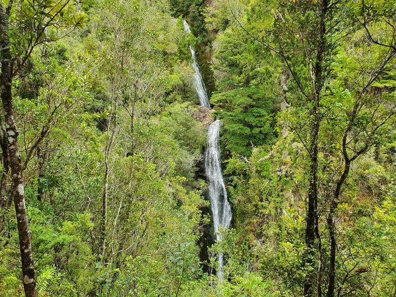
The view from the viewing platform. I liked it! It reminded me of the Wairere Falls view.
The viewing platform is sturdy and the view of the falls is cool in that it’s framed by the trees and you get to see the two tiers clearly. They were flowing pretty strongly in the summer during my visit, though later in the summer the flow might not be so strong. In winter I can imagine they’d be even more awesome.
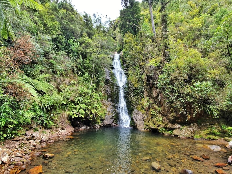
The Wentworth Valley Falls from the bottom, you can’t see the top tier.
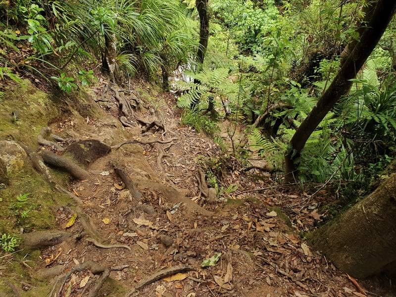
This is what the track looks like after the viewing platform to get down to the bottom of the falls.
Now, the official track ends at the viewing platform, but it is possible to make your way down to the bottom of the waterfalls by following the track around the front of the platform. It’s steep, and on a wet day, it would be super sketchy as you’re walking on dirt with roots sticking out. But as long as you understand the risk and aren’t too clumsy you can make it down no problem.
Once you’re down the water is deep enough at the bottom of the falls for a good swim and there’s plenty of places to sit for a picnic etc. I wouldn’t have noticed the track down unless I heard people talking from down below and made a conscious effort to see the way down.
On the way back, well it’s pretty simple, you head back the way you came. The decline is gentle and won’t hurt your knees 🙂
This is the river you cross to end the Mine’s Walk if you decide to do that (not recommended).
My buddy Alex from Discover Aotearoa said about the Wentworth Falls: “They’re nice if you stay on the campsite, otherwise not sure if it’s worth it.”
I can see what she means by this, but given the short distance from Whangamata (less than 8km from the centre) if you have a car, go for gold! They do make a nice way to fill in a day, especially if the Whangamata beaches are windy.
If you’ve got any questions or comments, leave a message below or email jub@churnewzealand.com.
What to read next:
- Katikati: New Zealand’s mural town
- Mount Maunganui summit walk: done this yet?
- Brainstorm your ideas for things to do in NZ
- Coromandel’s Success Track

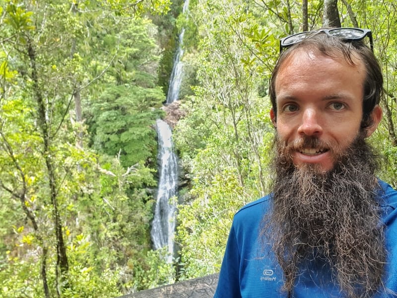
Hey, it’s Jub here. I’m the guy behind Chur New Zealand, helping you have the best time hiking, trekking, walking…whatever you want to call it…in NZ. I’m based in Queenstown and am always out and about exploring trails, old & new. If you have any questions, reach out.