You might be thinking Picton is a port town, but if you find yourself here for a few days, there are some amazing walks in Picton you can go on.
Often seen as a stopover destination, take a moment to consider adding a couple of days in Picton to do these tracks (or more if you’re thinking the Queen Charlotte Track. And yes, there are cool things to do in Picton beyond the trails.
A little below is a map of where the walks are, then I’ll follow up with info about each of the walks along with a few pics. You can also click on the track names below to go straight to the walk that intrigues you.
1. Tirohanga Track (Easy – Medium | 1 hour 15 mins – 2 hours)
2. The Snout Track (Easy – Medium | 3 – 4 hours)
3. The Humphries & Barnes Dam Tracks (Easy | 1 hour 45 mins – 2 hours 30 mins)
4. The Link Pathway (Medium | 1-5 hours)
5. Queen Charlotte Track (Medium | 1 – 5 days)
A MAP OF THE WALKS IN PICTON
Here’s a map so you can get an idea of where the walks are from the centre of Picton.
THE 5 PICTON WALKS
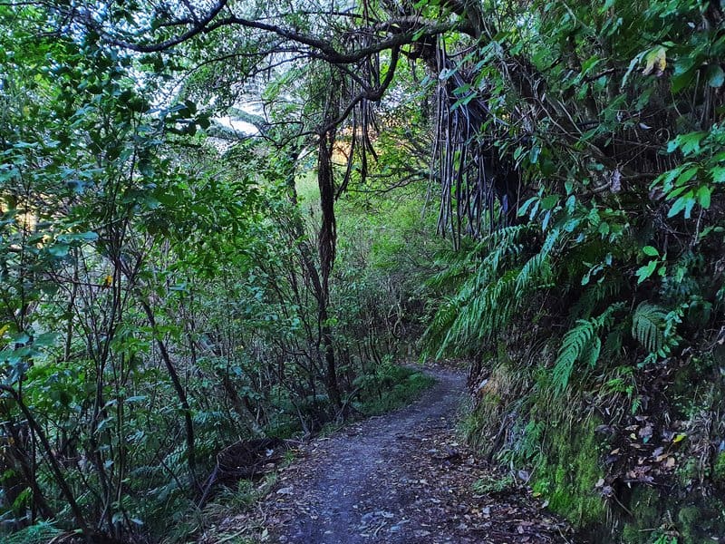
1. TIROHANGA TRACK
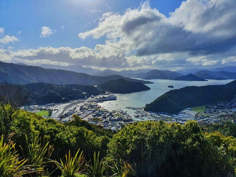
The Tirohanga Track gets a lot of love at hostels when you mention you want to go for a short bushwalk in Picton.
It’s an end to end walk with views over Picton on the way up is gorgeous before you get to the best vantage point at the summit.
The track is made up of clay which does get slippery in the wet. But the track is in good condition and easy to follow. If you’ve got some time to kill before catching the ferry, this is the walk for you.
In terms of photography, you’ll want to be here earlier in the day, but the sunset would no doubt be amazing here too (I haven’t seen it here yet).
GET THE FULL DETAILS: THE TIROHANGA TRACK
2. THE SNOUT TRACK
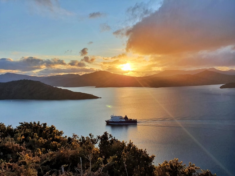
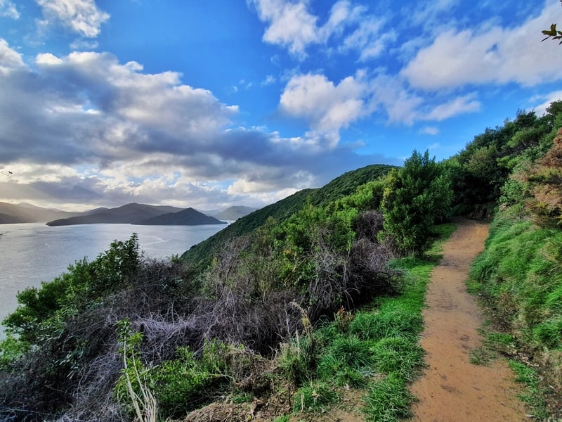
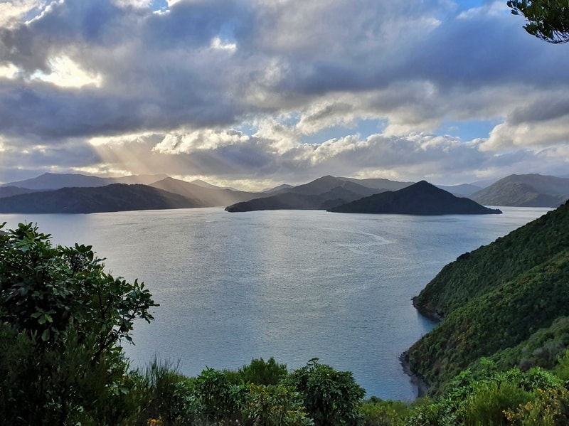
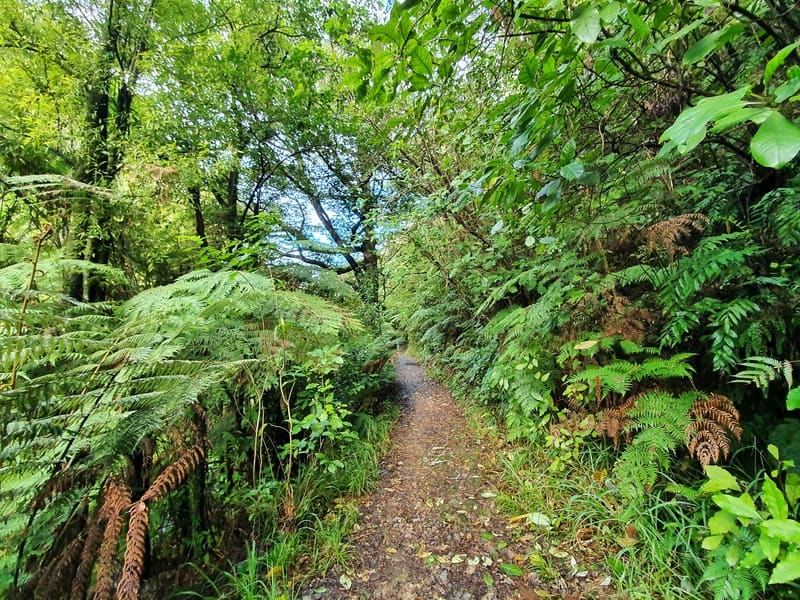
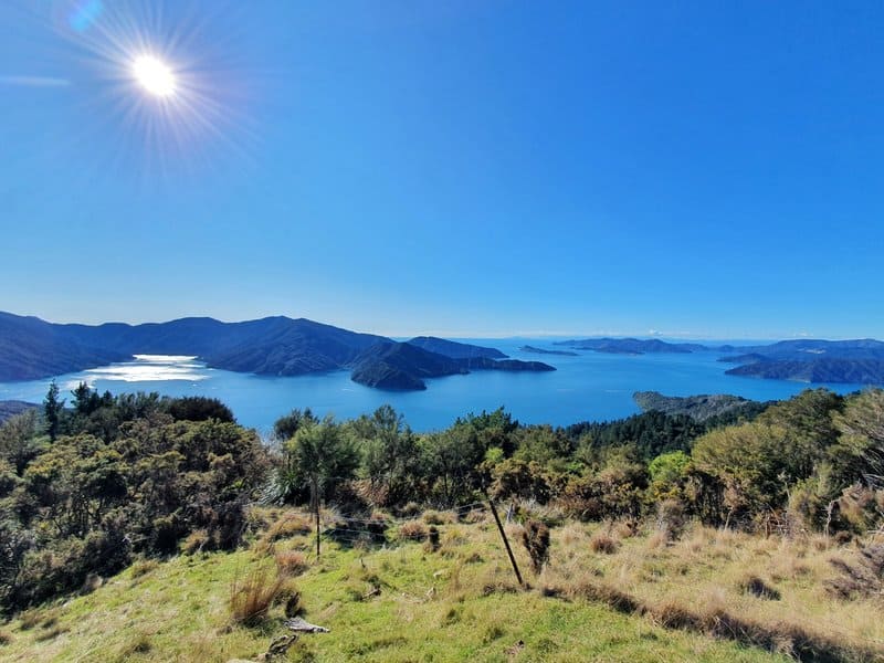
The Snout Track is a longer track in Victoria Domain. As the domain starts right by Picton Marina I suggest adding Upper Bob’s Bay track to your walk which connects to Snout Track. Along the way, you’ll get a bunch of different views of Queen Charlotte Sound and it’s a good way to get a grasp of how large the sounds are if you haven’t been on the ferry yet.
These tracks are friendly to walk, with lots of undulations rather than any big climbs. And if you are happy with the views at the Queen Charlotte viewpoint (it’s marked on the map in the link below) you can turn around at this point as the last section is all in the bush until you get to Snout Head.
GET THE FULL DETAILS: THE SNOUT TRACK
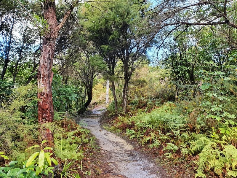
3. HUMPHRIES &/OR BARNES DAM TRACKS
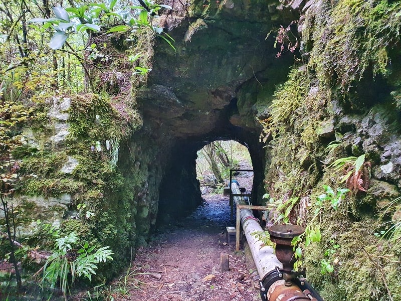
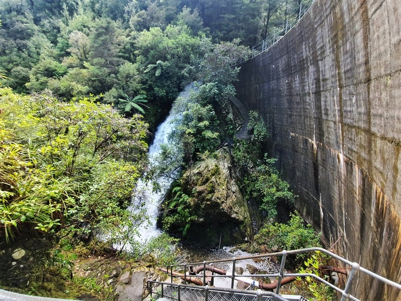
If you’ve got your dog with you, this is the best Picton walk as they can be let off their leash on these tracks. The tracks to both dams aren’t strenuous at all, and there are some information boards along the way in addition to being able to see a couple of waterfalls.
After the first couple of hundred metres you enter the native canopy and it’s actually really beautiful and the air feels crisper. Perhaps that’s because it’s in a valley away from town? If I was a local, I’d be walking this track often.
The dams themselves aren’t so impressive in terms of size, but they’ve got historical significance. If there are water shortages over the summer, the Barnes Dam can still provide safe water to the city. There are a few picnic benches along the way too.
If you’re planning to walk to one dam only (doing both takes an extra 30 minutes) I suggest walking to Barnes Dam.
GET THE FULL DETAILS: ESSON VALLEY HUMPHRIES BARNES DAM TRACK
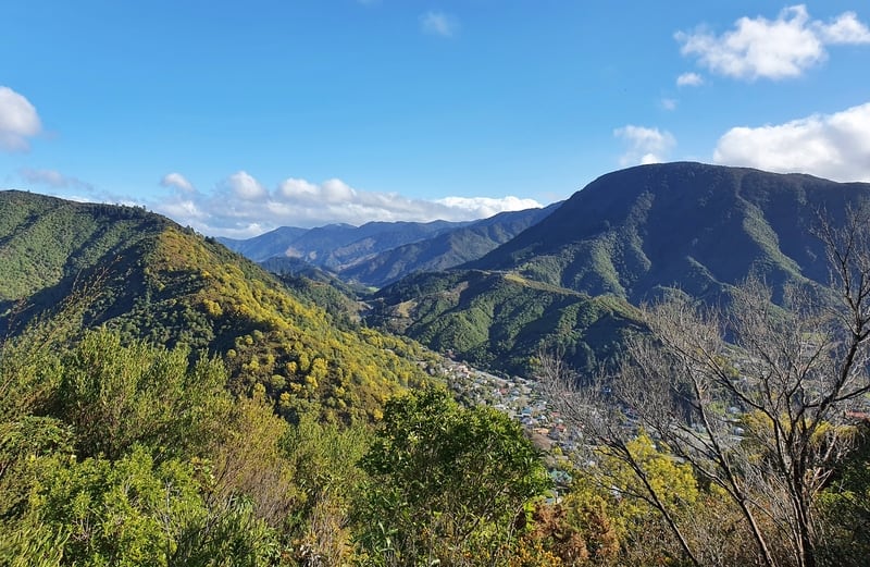
4. THE LINK PATHWAY
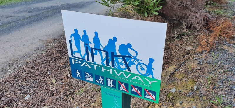
This is the newest of the walking tracks and is a 36km pathway that connects the communities between Picton and Havelock. At a cost of $1,000,000 and over 10 years of work, thousands of volunteers contributed their time and skills to the project.
I’ve only been from the section between Anikiwa and Picton (23km) and if I was to suggest what section you should walk, it would be the area from Picton to Grove Arm Jetty. That’s about 15km of the track, so that would make for a long 30km return trip. But you can break this into smaller sections.
For those who don’t like hills, the section between Grove Arm Jetty and Ngakuta Bay is great. For those who don’t mind some hills, you’ll be reward with some nice viewpoints between Picton to Ngakuta Bay. This is about 11km one way, which may be too long again, so you can always shorten it by turning around about here on the western side of Shakespeare Bay.
The track is well maintained, and while there are a few short sections near the road, you’re normally well away from it. It’s also worth mentioning that bikes can you this path too.
5. THE QUEEN CHARLOTTE TRACK
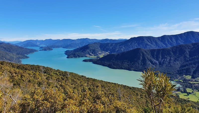
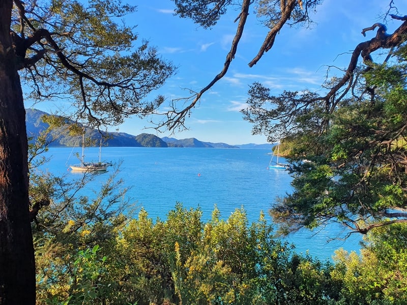
The Queen Charlotte Track is the most well-known of the tracks in the region, and one of the more popular multiday hikes on the South Island. While technically not in Picton, it’s the gateway to the trail with most people who plan to do the 72km trip over 3-5 days (you can do it in shorter or longer days if you want) catching the ferry from Picton to Ship Cove.
The walk takes you right along the crazy piece of land following Queen Charlotte Sound. The track is super easy to follow and only a few sections are technical if you could call them that. There are lots of undulations, but as they’re spread out over the 72km there are no long long stretches of climb for thousands of feet.
The accommodation spots are beautiful in their own right, but the views are amazing. The photos above give you a sense of what you can look forward to. It’s not like that the whole way of course 🙂 You do need to walk through the forest to get the great views…it’s one of the best hikes in New Zealand.
If you’re looking to do a 1-day walk on the Queen Charlotte Track, many like to drive/catch the ferry to Anikiwa and start from there. But you can also walk from Ship Cove over to Endeavour Inlet and be picked up again from there. There are a lot of options including this one available on BookMe 🙂
Note: The walking track is shared with bikes most of the year, so don’t be surprised if you come across some.
The Queen Charlotte Track is one of the best walks on the South Island and is often thought to be worthy of Great Walk status.
Well, there you go. I hope these Picton walks have given you something to think about.
If you have any suggestions or questiozns about these Picton walking tracks, let me know in the comments or email jub@churnewzealand.com
Chur.
p.s. If you’re after more hikes in New Zealand (these are my favourites), you can click through to all the ones I’ve detailed on Chur New Zealand on the map below.

Hey, it’s Jub here. I’m the guy behind Chur New Zealand, helping you have the best time hiking, trekking, walking…whatever you want to call it…in NZ. I’m based in Queenstown and am always out and about exploring trails, old & new. If you have any questions, reach out.
Nice work on the track info and much appreciated for the easy to follow content and navigation!
yay! awesome, thanks for the kind words Joh.
Enjoy the adventures 🙂
Jub