Note (December 2023): There’s a massive slip on the road to Otaki Forks meaning cars cannot access the regular car park. You can still hike in, but it adds another 5km extra each way. This means, it’s probably best done as an overnight hike to Mount Hector.
Hiking to Mount Hector in Tararua Forest Park near Wellington, New Zealand is a grueling day trip, or you’ve got the option of making it an overnight trip too. That’s the great thing about hiking in NZ, not everything has to be a big day hike. There’s often a hut nearby.
Mount Hector is best known as the highest peak on the Tararua’s Southern Crossing, a hiking trip that usually takes 2-3 days.
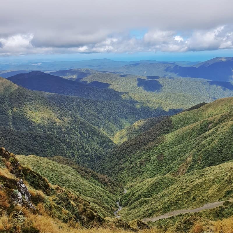
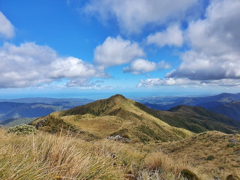
Whether it’s a one, two, or three day trip to Mount Hector, if the skies are clear the effort is worth it, with epic views of Kapiti Island, Wellington, the South Island, and across the Tararuas!
This post will let you know how to get ready for the big trip to Mount Hector, and what you can expect. There’ll be plenty of photos at the bottom.
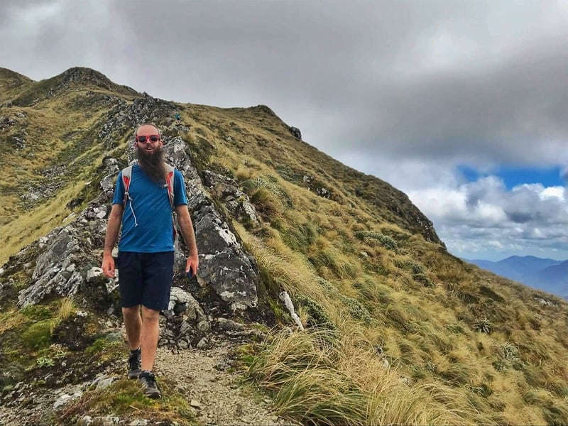
Shorts and t-shirt weather! A rare day in the Tararua’s
Note: When I completed this trip the goal was to power hike/run the whole way, so we completed it faster than if it was just hiking (obviously). This was also during the summer when there was lots of daylight, a good weather day, and no snow. In winter, the snow gets deep and the trip should only be considered by those who know what they’re doing in the backcountry. And yes, people have died close to Kime Hut which you’ll pass on the way to the Mount Hector summit.
An alternative hike in the Tararua’s closer to Waikanae is the Kapakapanui Track.
TABLE OF CONTENTS
1. Details
2. Mount Hector Hiking Map
3. How To Get To The Trailhead
4. Trip Report
5. More Photos
DETAILS ABOUT THE ADVENTURE FROM OTAKI FORKS TO MT HECTOR
Having grown up in Waikanae, I’ve not spent enough time in the Tararua Forest Park. That’ll be changing going forward because this was an awesome day (the company helps) and I want more!
On the trip to Mount Hector you get a chance to experience the NZ bush and the crazy tree roots before you pop out above the bushline giving you panoramic views (on a nice day). There’s no reason to dock any points for this hike in my experience! On a bad weather day, well then who knows…
How far is the Otaki Forks to Mount Hector hike?
Somewhere between 24-28km. On Maps.me it is 26km, and my Strava data says 28km, but I think that’s exaggerated because of tracking issues.
How hard is the hike to Mount Hector?
Medium-hard. It’s long and steep, but not overly technical.
What’s the elevation gain and profile of the hike?
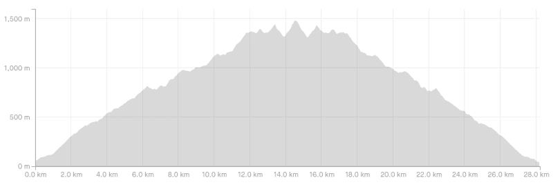
With Mount Hector at 1,529 metres above sea level my Strava data says just over 2100 metres of total elevation which seems about right. WildThings.club has 2300 metres of elevation but I think that’s a bit too much. For reference, Otaki Forks is at ~130 metres altitude.
How long does the hike to Mt Hector take?
We completed the run/hike in just over 6.5 hours. If you’re hiking, it’s going to be about 5-6 hours in each direction for most people. What’s awesome is that if you find you’re behind time, you’ll still get awesome views from the Table Top just beyond the Field Hut which makes the journey still worth it.
MOUNT HECTOR TRACK MAP
You’ll find the track from Otaki Forks carpark to Mount Hector IS on Google Maps which surprised me. There’s the entire Southern Crossing marked, as well as Field Hut, Kime Hut, and Table Top.
It has the Mount Hector summit at 1310 metres which is incorrect as multiple sources say it’s 1529 metres so while it’s useful for a guide, it’s not great on the elevation profile.
If you’ve got this topo maps app, that’s brilliant to ensure you’re going the right way.
The track is also on Maps.me and has the huts and Table Top on there. This is what I used to gauge how far we were from the huts along the way. It’s the ballpark figure distance-wise that helped us predict how far we were from the huts.
How much does it cost to stay at the huts?
For both Field and Kime Huts:
Adult (18+): $10/night
Youth (5–17): $5/night
Child/Infant (under 5’s): free
Make sure to buy your DOC hut tickets in advance, or your Backcountry Hut Pass is valid here.
Are dogs allowed on the track to Mt Hector?
Yes, but they must be kept under control at all times.
HOW TO GET TO THE TRAILHEAD
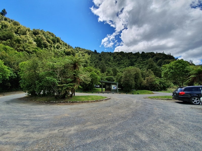
The carpark at Otaki Forks has heaps of room
Walking: Not practical.
Public transport: Not an option.
Driving:
From Otaki: It is about ~18km to get to Otaki Forks carpark. Heading south on SH1, about 2km south of Otaki turn left on to Otaki Forks Road. From here it’s a matter of following the signs all the way. The road turns into gravel with a few kilometres left, but cars of all sizes get there ok…just be careful on the blind corners.
From Kapiti Coast/Wellington: Following SH1 north, turn right onto School Road in Te Horo and follow the signs to the Otaki Forks from there where you’ll join Otaki Forks Road after a short while before having to deal with the gravel road too.
The carpark is massive, so you won’t have any issues with parking, and there’s a toilet block there too.
MOUNT HECTOR NEW ZEALAND TRIP REPORT
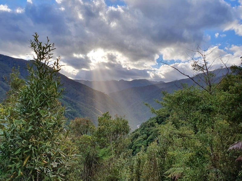
Early morning sunrays at Otaki Forks
Note: Before hiking in New Zealand, it’s always wise to fill out an intentions form. At least tell friends your plans and that you’ll check in with them when you return. Just in case. But I was able to get reception when we were above the bush line for most of this hike so make sure you travel with a sim card and a phone with a full battery. For reference I use Skinny when travelling NZ.
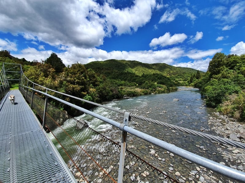
The suspension bridge at the start of the walk (this was taken when we returned).
On a perfect Saturday morning, the three of us were one of the first cars in the Otaki Forks carpark at 7 am. After a quick gear check, and look at the maps on the information board to confirm where we were going we set out across the bridge to begin.
There’s plenty of signs on the early sections of the track to make sure you don’t take any wrong turns. The first few kilometres on Fields Track is along a well-pathed gravel path with no canopy of trees, just lots of bush either side of you with occasional views back towards the carpark and forking rivers. The incline doesn’t give you a chance to warm up, it starts right away.
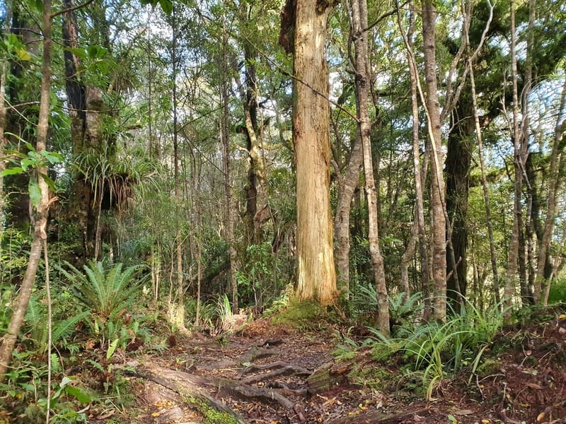
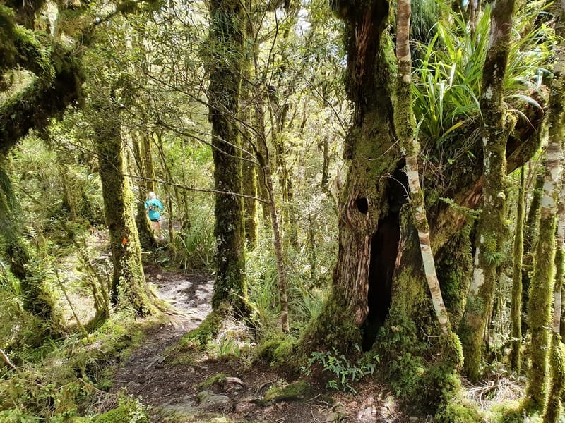
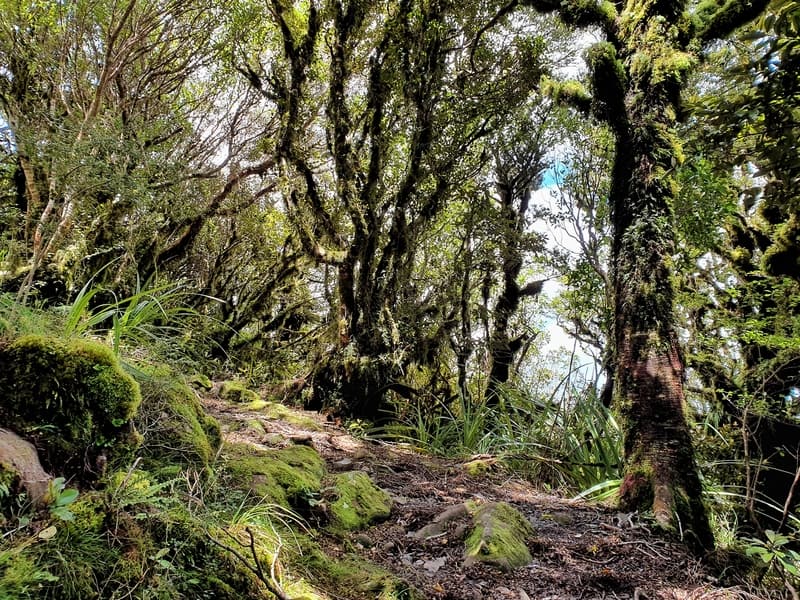
The oh so beautiful bush.
When you hit the bush you’re immersed in the forest and it’s beautiful. The gravel path gives way to an easy to follow track (there are orange triangles) navigating in, around, and over the tree roots and branches that are attempting to reclaim the track.
There’s a bunch of muddy patches, but those who are careful can avoid them with nimble maneuvering. It’s pretty slow going through this section with just a few short flat sections. The moss on the trees is what impressed me the most, and it felt more and more goblin-like as we got higher.
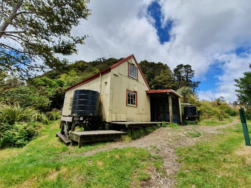
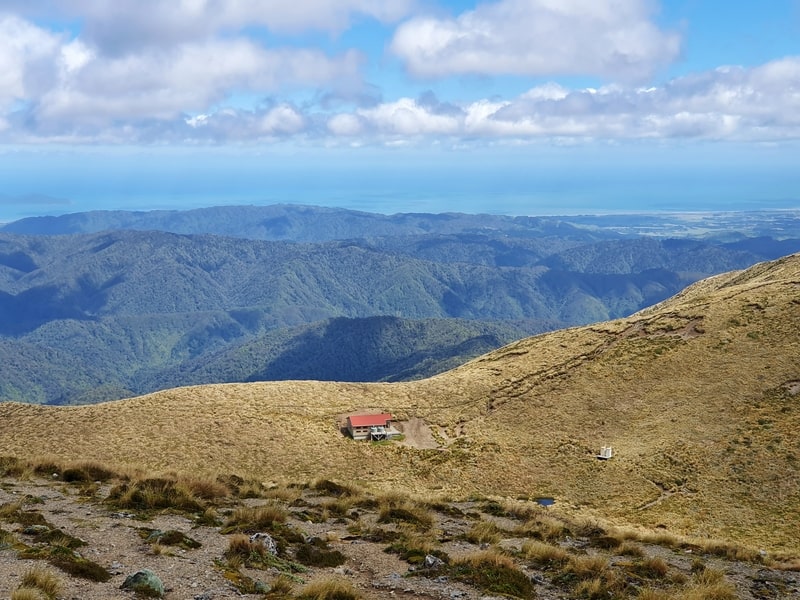
Field Hut was one of the first huts built in the country for people to stay in on overnight hikes.
Field Hut pops up out of nowhere and is a little bit under seven kilometres into the track. It’s placed a little bit below the bush line but it is plenty big enough if you’re staying overnight there. Take a quick break here, especially if it’s warm as you’ve only got another 10 minutes or so until you’re on the Table Top above the bush line and exposed to all the elements.
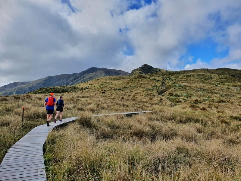
The boardwalk is a nice break from the track.
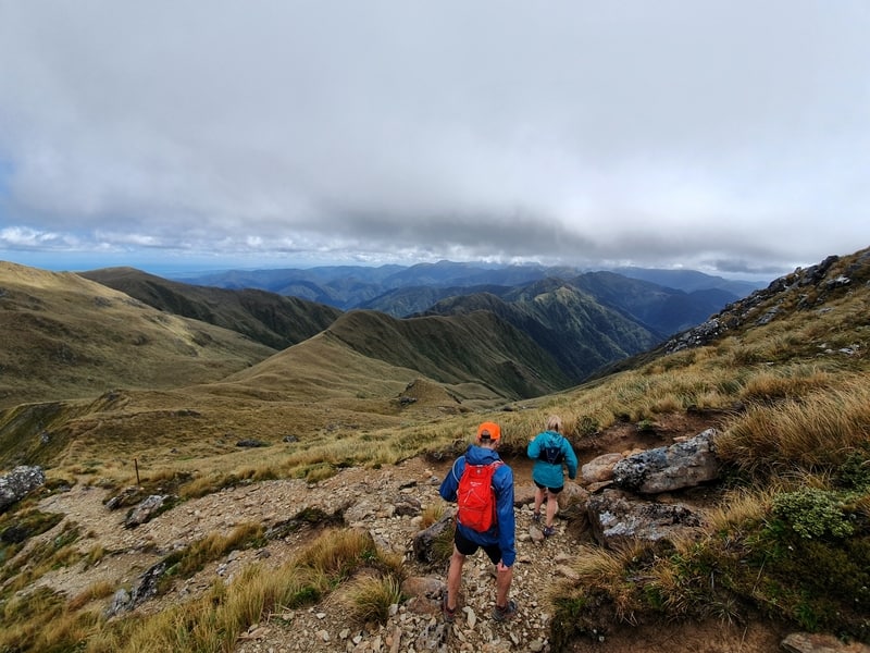
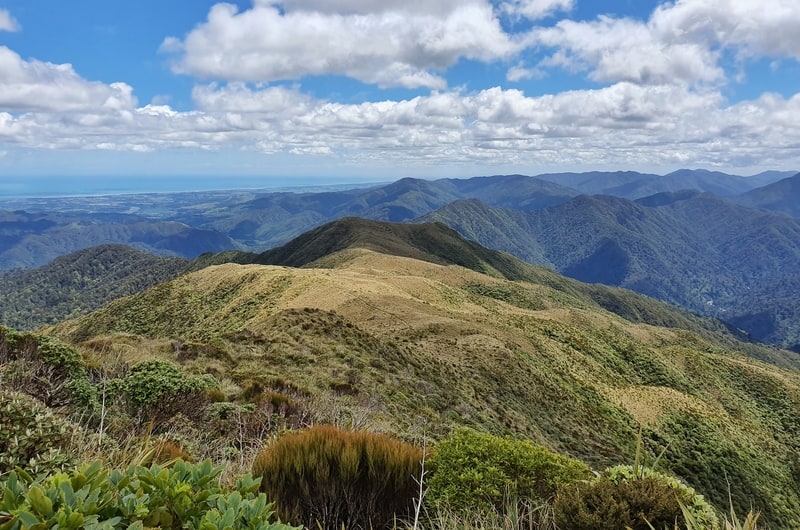
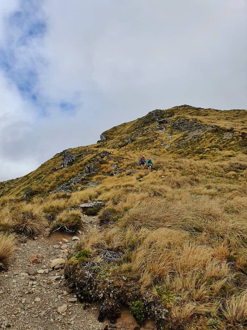
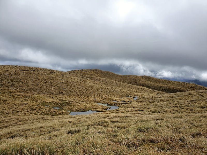
It’s crazy how quickly the forest ends, and it suddenly feels like you’re in a totally new world with the trees so much shorter and the canopy of the forest replaced with ankle tickling tussock. You’ll see the section where the boardwalk is before you get there as you follow a mountain peak around its sides and this is the kind of stuff you’re here for.
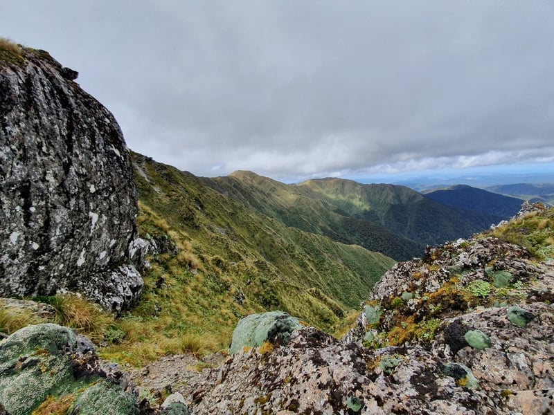
Panoramic views in every direction. This is if it’s sunny of course, and you’ll be able to see the track where you’re going on the peaks in the distance, with the orange markers now replaced by large poles.
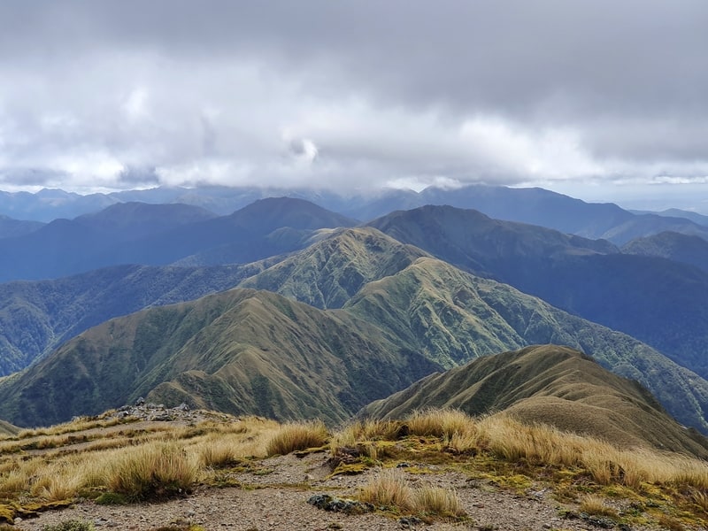
Views, views, views!
If it’s cloudy/claggy, you won’t be able to see anything as you’ll be swamped in by the cloud.
After you’ve crossed the boardwalk, you’ve got a couple of ascents left until you reach Kime Hut at the bottom of a saddle. Before you reach Kime Hut, you’ll come across signs mentioning Maungahuka Hut, make sure you go in the direction of Kime Hut! This is where the people I mentioned earlier in the article got lost and died, it’s easily done when visibility is low.
Note: You can use your DOC Backcountry Hut Pass to stay in both Field and Kime Huts.
Can you see Kime Hut?
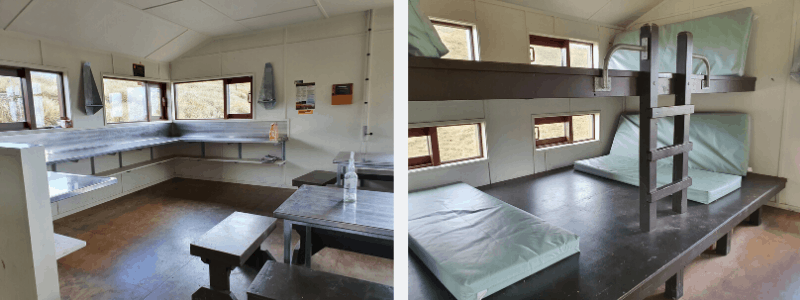
A couple of photos from inside Kime Hut.
Once you’re at Kime Hut, you’ve got an hour or so until you reach the summit of Mount Hector which involves some fun peak traverses with the steepest and trickiest one at the end. The track condition doesn’t change much from Table Top to Mount Henderson, there’ll be middy patches, and rocks on the tracks, and DO be careful of waratahs that stick out no more than 10 cm from the ground on the Table Top section of the trail. They’ll hurt if you kick them just right!
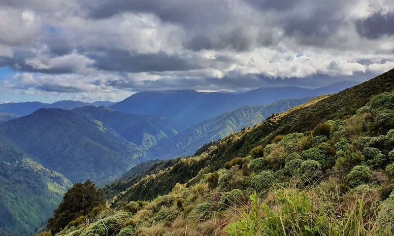
And while it wasn’t windy on Mount Hector itself, it certainly got colder from about Kime Hut onwards with a strong breeze on one of the peaks shortly after Kime. Even on a great day the weather changes were noticeable.
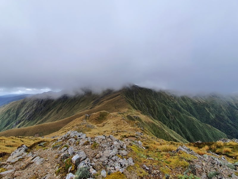
Looking toward Mount Hector shrouded in cloud.
What’s niggly is you can’t see the cross on top of Mount Hector until you’re less than 50 metres away! But, you can’t miss it once you’re there. There are some nicely positioned rocks for a bite to eat, and hopefully, you still have a view! We finally got into the clouds when we reached Mount Hector, but as you’ve seen (and will below) we got lots of insanely cool views along the way.
Now, it’s time to go back down. Perhaps you’ve taken some extra gear in case you decided to stay at Field Hut, or Kime Hut overnight. But if not, like us, it’s a simple matter of coming back the way we came. I didn’t get bored of the return route as the scenery is stunning.
Keep in mind the DOC signs say it’ll take about 6 hours to get from Mount Hector to Otaki Forks carpark (and these predictions are as conservative as many timings you’ll see on hiking tracks in New Zealand) so you won’t want to be hanging out taking photos all day. So while we got back to the start in 6 hours and 30 minutes, there was plenty of running involved in that.
MORE PHOTOS
Mount Hector isn’t a walk in the park that’s for sure. But, if you’re looking for an awesome adventure close to Wellington that’s got a badass element too it, this is for you. I really had a great time, especially with all the views above the bush line.
What to read next:
- A closer, yet just as awesome view of Kapiti Island on this hike
- A trip to a legitmate bird paradise, Kapiti Island
- You’ll never run out of fun things to do in New Zealand

Hey, it’s Jub here. I’m the guy behind Chur New Zealand, helping you have the best time hiking, trekking, walking…whatever you want to call it…in NZ. I’m based in Queenstown and am always out and about exploring trails, old & new. If you have any questions, reach out.
cool
Thank you – a great journal of the walk. Did this day walk with two friends back in 1990 starting about 6:30am and returned to car park around 7:30pm. Was certainly clouded in on the tops of Mt Hector but got to the cross. A great trip and one I’m considering attempting again.