The Kapakapanui Track is a tough 12-13km track with some of the best views the Tararua Ranges have to offer. With Kapakapanui Hut on the route, this makes for a nice day or overnight hike.
This post will contain all the details you need to know about the Kapakapanui Track, including my experience (doing the full loop in a clockwise direction).
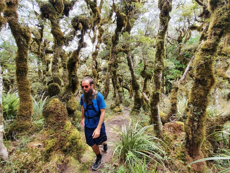
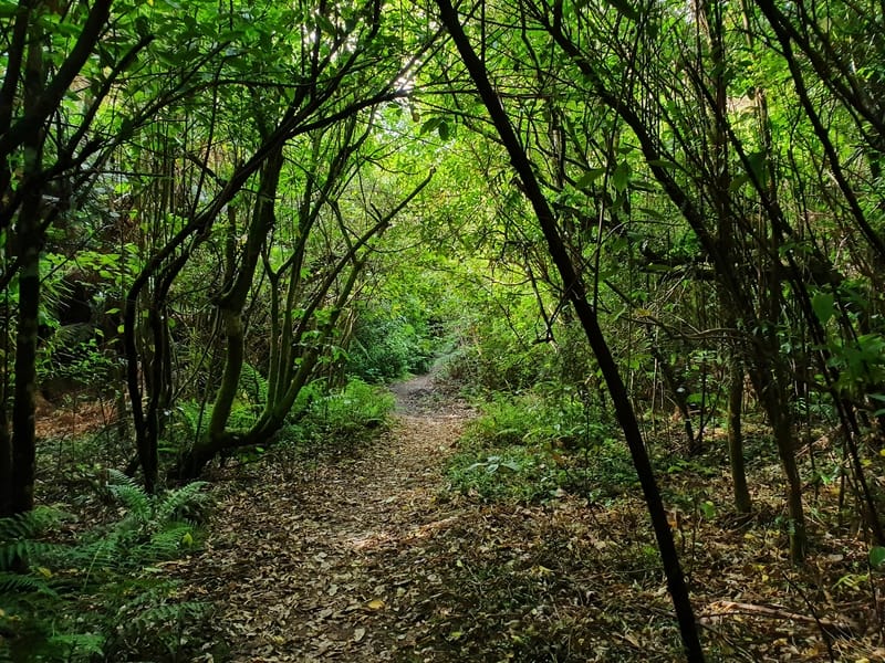
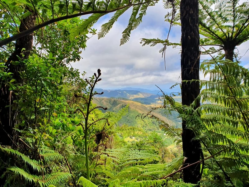
Hiking through the Goblin Forest on the Kapakapanui Track!
There’ll be (hopefully) plenty of helpful tips along the way too.
I think of the Kapakapanui Trail as the big brother of the Hemi Matenga loop walk. The Kapakapanui summit is about twice the height, a bit over twice the distance and has views of Kapiti Island at the top.
TABLE OF CONTENTS
1. Kapakapanui Track Details
2. Kapakapanui Loop Map
3. How To Get To The Trailhead
4. Kapakapanui Track Trip Report
1. KAPAKAPANUI TRACK DETAILS
QUICK STATS
- Distance: 12-13km loop
- Elevation gain: ~1058 metres
- Difficulty: Meidum to Difficult
- Time: Anywhere from 4 to 8 hours
Wow! This track is amazing and given it’s accessibility (via car), makes for an awesome day hike.
The river crossings at the start, followed by the incline that takes you up into the goblin forest, before the canopy of trees dissolves and you’re left with views of the Tararua Ranges, including Mount Hector (another epic day hike), out to Kapiti Island (if the clouds cooperate).
Then it’s back down through the forest trying to not fall on your bum before getting your shoes wet once again to finish.
This is definitely an off the beaten, yet epic trail on the edge of the Tararua’s.
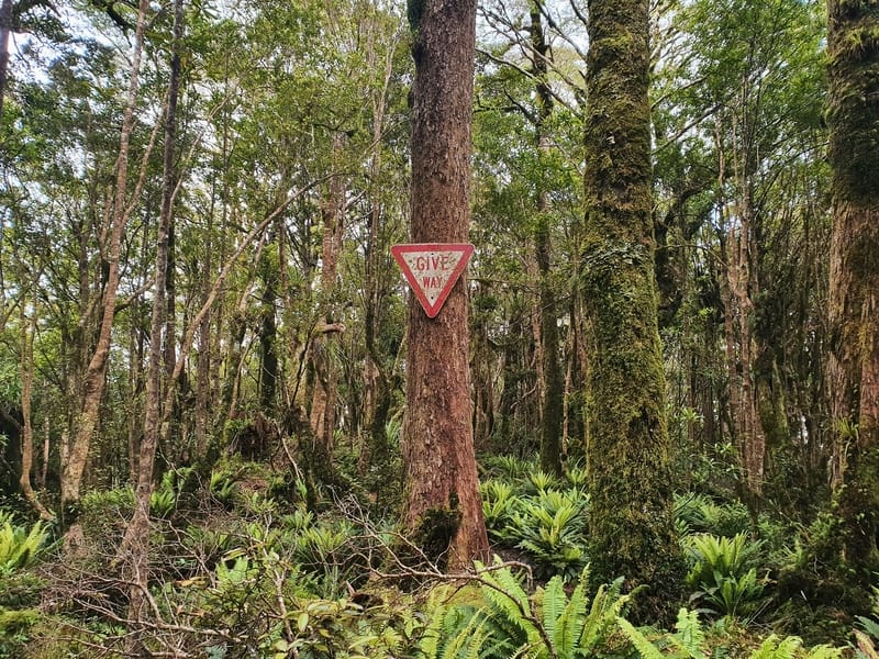
p.s. I have no idea why that Give Way sign is hanging on that tree in the middle of the track. Send me a photo if you spot it to jub@churnewzealand.com!
How long is the Kapakapanui Track?
The DOC signs have the walk measured at 13.5km but my Strava data came in at 12.3km. I didn’t take any shortcuts that I’m aware of and the trail on my maps doesn’t have any sections missing or anything so, 13.5km is the absolute max you’ll walk, but it’s likely a bit less as Maps.me has it at 12km.
How hard is the Kapakapanui Circuit?
Medium-hard. Note: My friends Jacob and Loreli are experienced hikers and took their two children who are both under five up the track. Loreli said ‘They do not recommend the tramp for small children even though I am secretly chipper-as. Tramping is good for my soul.”
What is the elevation profile of the Kapakapanui Track?
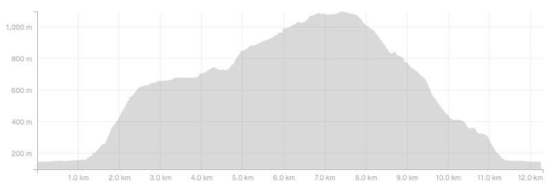
The Kapakapanui Summit is at 1102 metres above sea level with the carpark (details below) at 145 metres. This means there are at least 957 metres of elevation one way. The Kapakapanui elevation profile on my Strava has 1058 metres of elevation total which makes sense, there’s a couple of small descents on the way up the hill, and a couple of small ascents coming back down. The Wild Things has 1046 metres of elevation listed..
How long does it take to hike the loop?
The DOC signs say it’ll take 6-8 hours to complete the loop. I completed the loop in 4 hours and 15 minutes which was at a decent pace with no breaks. I know a friend mentioned it took her 7 hours which included a picnic break so 4-5 hours if you’re on a mission, or the full 6-8 hours if you’re making a full day of it.
How much does it cost to stay at Kapakapanui Hut?
Adult (18+ years): $10/night
Youth (5–17 years): $5/night
Child/Infant (under 5’s): free
Kapakapanui Hut makes for a great overnight hike near Wellington.
2. KAPAKAPANUI LOOP MAP
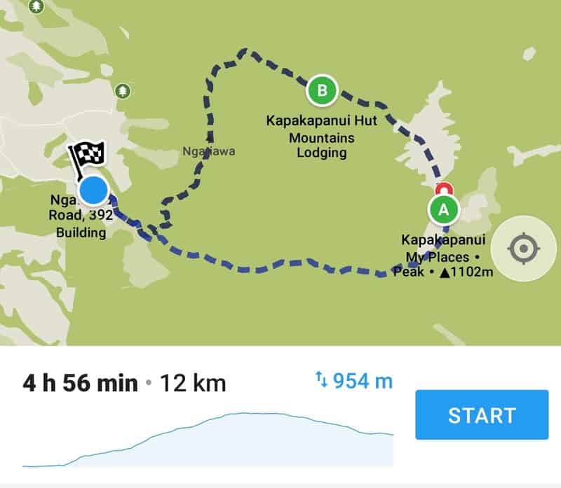
The screenshot above is from Maps.me which is my goto app for hiking in NZ. On Google Maps there’s no trail marked at all.
Personally I like using the NZ Topo Map app which does cost, but it’s brilliant!
At the trailhead, there’s a picture of the trail along with surrounding tracks in the Tararua’s. Take a photo of it before you begin 🙂
3. HOW TO GET TO THE TRAILHEAD
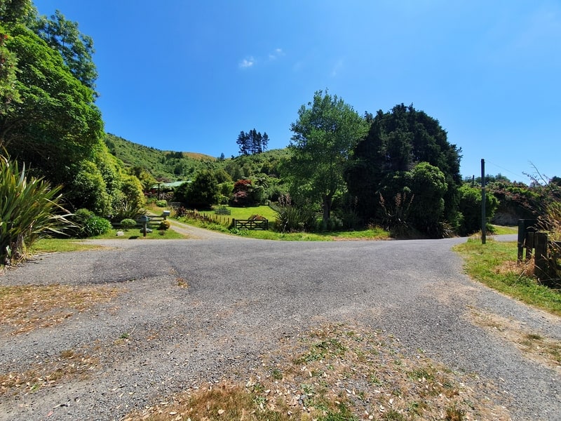
Here’s the carpark. It’ll often be empty as it’s a bit of a hidden gem!
Care: You’ll reach the trailhead in less than 10 minutes from Waikanae Village following this route.
All the roads are sealed, but you’ll want to be careful driving the last few kilometres as the road gets quite narrow with no centerline. There’s ample parking space (see photo above) at the trailhead given the Kapakapanui Track isn’t super popular. Make sure to avoid parking in front of the driveways 🙂
Walk: The trailhead is ~8.5km from Waikanae train station which does make the walking distance doable, but most of the route has no footpath and tight corners so you’d need to be super keen to do the hike and keep your wits about you to avoid cars.
Public Transport: No option.
Ride-Sharing: None of the ride sharing apps work in Waikanae, but you can usually find a taxi near the village. Make sure the meter is turned on and they know where they’re going!
RELATED POST: 5 WAIKANAE WALKS
4. KAPAKAPANUI HIKE TRIP REPORT
I just love the nature on this walk.
There’s not a massive amount of content and images on the Kapakapanui Track, so after Dad dropped me off at the trailhead I didn’t know really what to expect beyond friends telling me it’s steep in sections and you get some nice views.
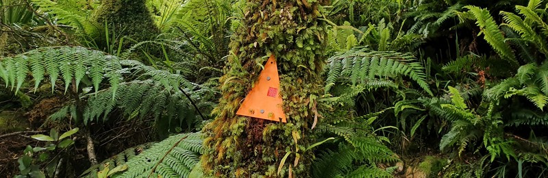
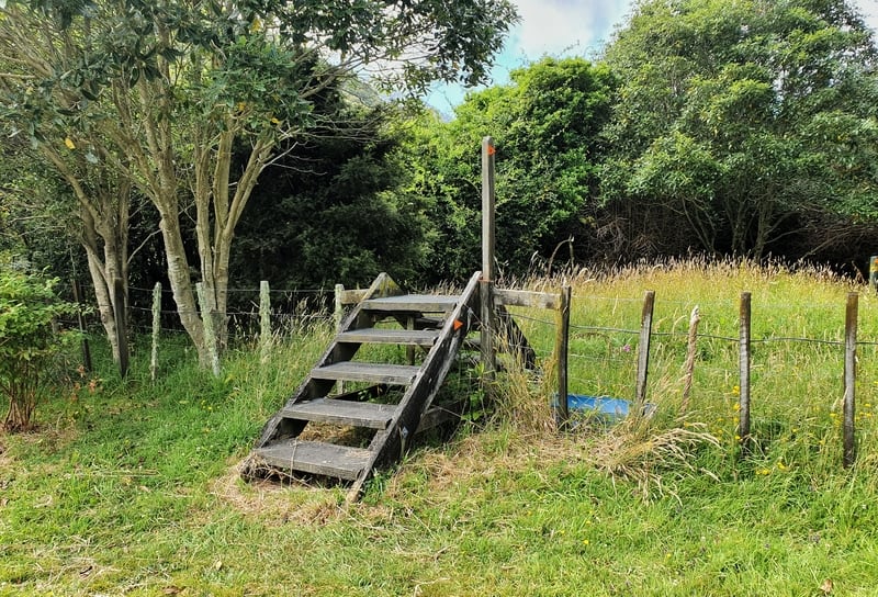
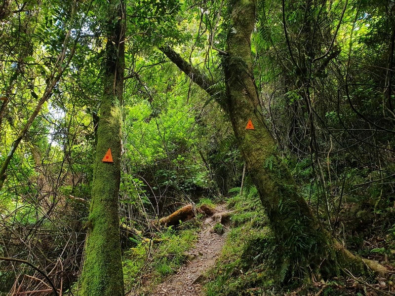
You’ll be following the orange DOC track markers throughout, and you’ll see the first ones on the fence leading down the driveway of house number 395.
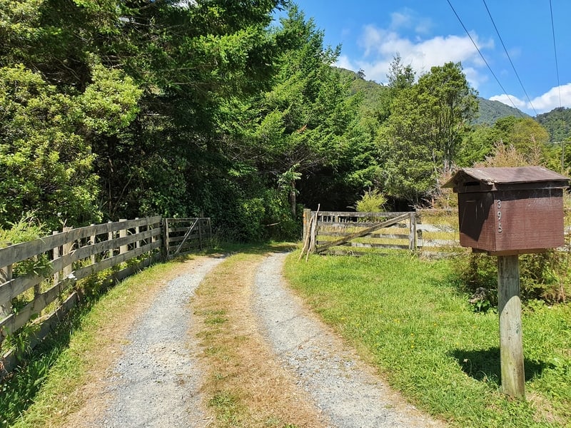
This is the driveway you walk down to start the hike.
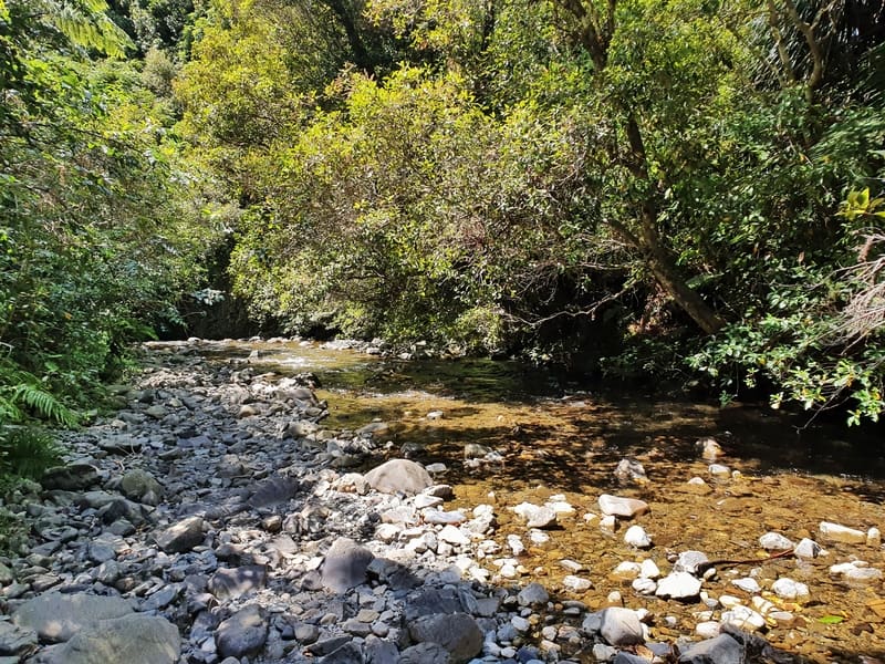
The river you cross back and forth.
After climbing the first few stiles at the end of the driveway, I suddenly remembered a friend had also mentioned the numerous river crossings at the beginning. There’s no way around it. There was one section where I had to follow the river for about 50 metres, but there’s always orange markers on the other side of the river so you can’t get lost.
If you go the clockwise route you’ll cross the river nine times before the incline! On the way back you cross five-ish times.
WARNING
The river was no more than shin deep when I was there. If there has been heavy rainfall recently, this river can get deep and become too dangerous to cross safely. If you’re having any hesitation about crossing, play it safe.
Phew, now you’ve been warned, don’t sue me. Please.
After about the fifth crossing (about 1km into the track), you’ll come across the point where the loop goes in two directions. The signs say:
Clockwise (left):
- Kapakapanui Hut 2 hours 45 minutes
- Kapakapanui Trig 3 hours 30 minutes
Anti-Clockwise (right):
- Kapanui Trig 4 hours
- Kapakapanui Hut 5 hours
The ascent begins….
As you know I went left. After I finished I asked my buddies and they both went right as it’s the steeper route going up and people generally prefer to go down the less steep route to ease the load on the knees. You can see the elevation profile on Strava for my route and I definitely went the steeper way coming back down but didn’t find it painful.
Up, up, up, up.
Turning left, the forest quickly envelopes you as the climb begins. You’ve got about 1.5km of a relentless ascent that goes up about 500 metres in elevation. It’s pretty brutal in sections, but the path is easy to follow and the path is developed enough that as long as you keep putting one foot in front of the other (cliche as), you’ll make it. Eventually.
I was hoping to hear and see lots of bird action on the walk, but I didn’t hear much of anything. But the stunning forest more than makes up for it.
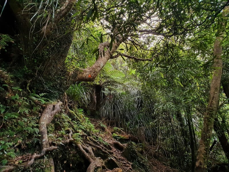
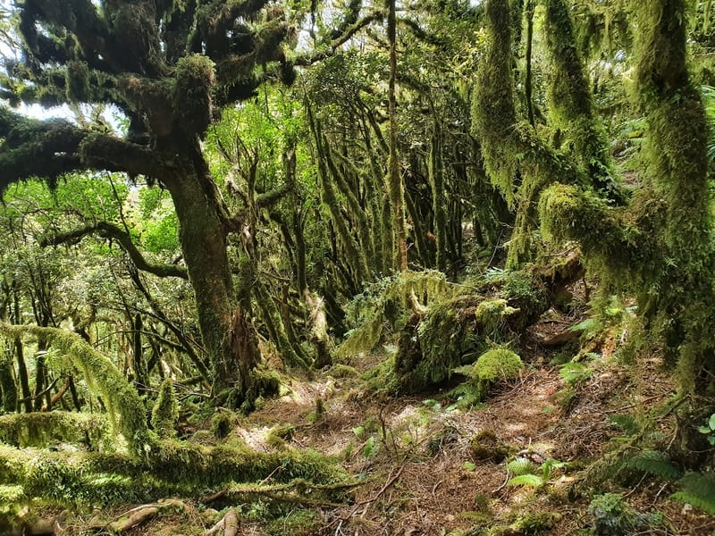
Once the trail flattens out I was relieved. It was a grind going up. The trees do change as your elevation increases, and after a couple of kilometres of relatively flat walking, you’ll feel the elevation kick in again as the trees have more and more moss on them.
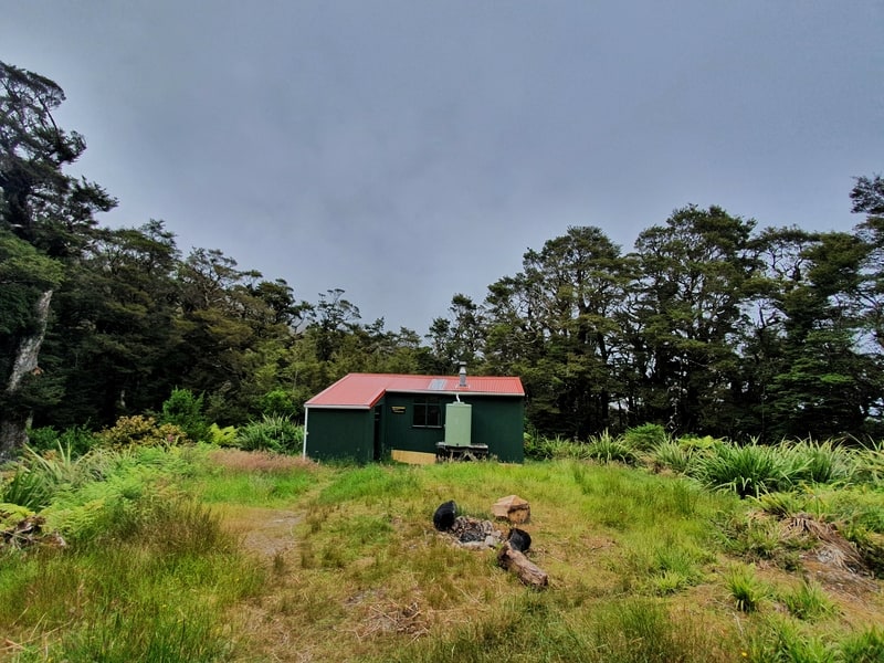
Kapakapanui Hut.
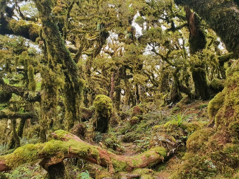
GOBLIN FOREST!
You’ll then spot Kapakapanui Hut and the outhouse (no one was there when I walked past), and continued on the climb through what has definitely become a goblin forest by now. It’s stunning and is totally what I’d imagine Jurassic Park was like!
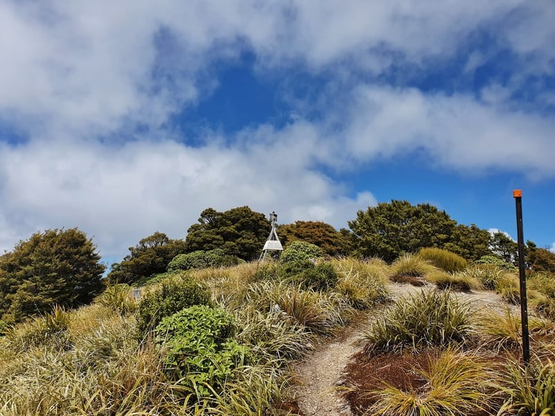
About 1km from the summit it almost felt like I was emerging from a cave when the canopy left me, exposing me to the wind.
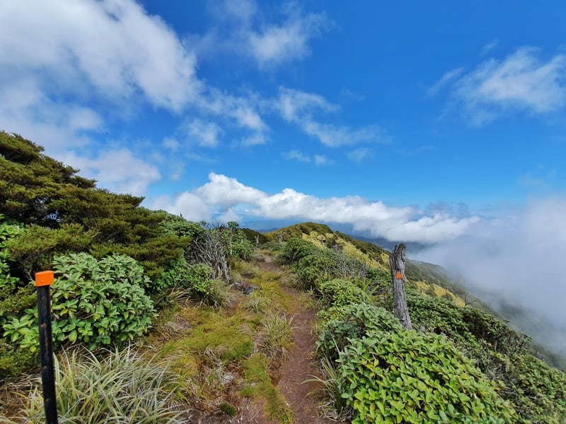
Emerging from the forest close to the summit.
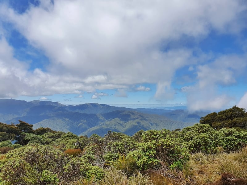
A view looking southeast over the Tararua Ranges.
There’s the trig! A.k.a. the Kapakapanui Summit.
You don’t get much in the way of views until the summit so I was gutted to realise I wouldn’t see Kapiti Island, pesky clouds. But looking left, the ridgelines of the Tararua’s were visible and wow they’re stunning!
Other than the occasional naked tree, most of the bush and shrub close to the summit is knee-high and it almost feels like a catwalk as I closed in on the trig I could see in the distance.
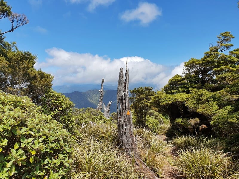
A couple of naked trees at the top of the hike.
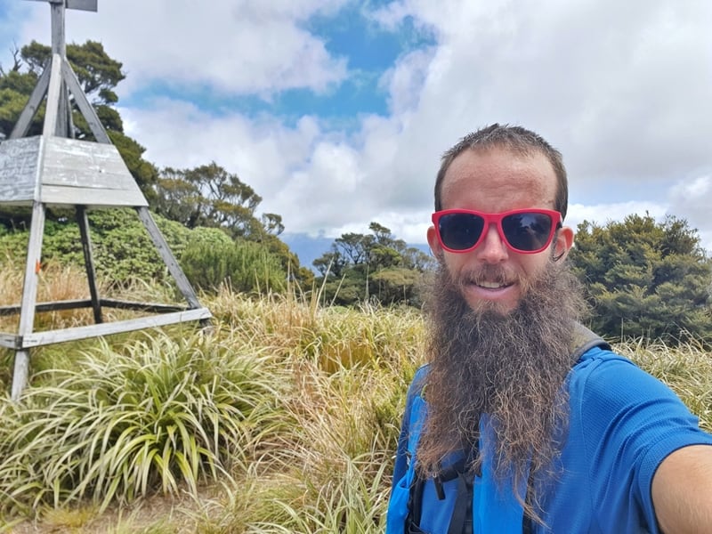
Classic summit selfie?
Made it! It took me 2 hours and 30 minutes to reach the trig. The sign said 3 hours and 30 minutes so I was happy with my pace, granted there was no breaks (I stop to take way too many photos though). After taking a few snaps it was time to continue the Kapakapanui loop and head back down. On a nice day, a picnic at the top would be in a winner.
Going in this direction, I was about 60% of the way (distance-wise) through the track. Once I started walking down to the Ngatiawa Road entrance, there were not many flat sections. But again, the track is well marked with lots of orange markers on the trees.
While the track is pretty easy to follow I found myself wandering off trail a couple of times thinking I was following the right path, but then had to correct myself. Easy enough.
More beauty.
A rare view half way down the Kapakapanui Track.
There were two occasions where I lost my footing come down but just fell on my bum. I’ll blame the running shoes on. If your knees hate walking down hills go in the anti-clockwise direction I guess. Every bit helps right?
The descent was pretty quick and all of a sudden I was back where the loop turnoff was. Knowing I had just a few more river crossing back to the carpark was a nice relief. Although getting wet shoes again wasn’t exactly fun! Getting down from the summit took 1 hour and 45 minutes, again with no real break other than pausing for photos.
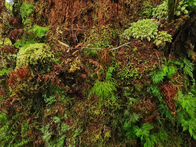
I love the texture of the trees on this track.
If you’re looking for an off the beaten track that’s easy to reach via car, the Kapakapanui Track is for you. It is a challenge, and you do need to be fit to scale the 1000 metres plus of incline, but it’s so worth it. The forest is amazing, and I’m looking forward to going up on a super nice day again when the view of Kapiti Island is available.
If you have any questions and/or comments, feel free to leave a message below or email jub@churnewzealand.com.

Hey, it’s Jub here. I’m the guy behind Chur New Zealand, helping you have the best time hiking, trekking, walking…whatever you want to call it…in NZ. I’m based in Queenstown and am always out and about exploring trails, old & new. If you have any questions, reach out.
Thanks so much for the reminiscence of this trail. To this day its still in my top 5 favorite trails I have ever hiked (and not going to lie it might take the cake for sheer variety and beauty), and I have seen done some sweet ones!
I used to run this every Monday morning when I lived nearby over 20 years ago. It was breathtaking to see so many different layers and varieties of nature scenery.
I always said it was the one trail where you could see nearly every type of forest, bush and ocean coastline available in the world in one shot. Only thing it was missing is a desert and some palms and a little snowcap and it would have it ALL!
The summit took me by total surprise the first time I saw it. Walking out of the forest to a stark contrast bald grassy knob was breathtaking to go from dense forest to wide open coastline vistas! Looks like the trees have grown in alot at the summit since I was last there. It used to open up a bit more wide open though it looks like you can still see quite the impressive sprawl of coastline and mountain ranges.
I sure hope to be able to bring my teenagers here in the next few years if I can manage to get back down there. Been back in the states for 21 years now without coming back to that little piece of heaven. But of all the scenery and places in NZ I need to see this is the number 1.
Thanks for the nice photos to help jog some great memories!
Hey Wesley,
Thanks for the wicked comment. That is one massive run every Monday haha, at least you’re getting in your vert early in the week.
I agree with you with the scenery all along the track too. Especially the contrast when you get out onto the tops. It’s simply awesome!
Fingers crossed your teens will enjoy the track as much as you do.
Cheers,
Jub