If you’re looking for a hike that’s known but most people still don’t go to, the Green Lake Track to Green Lake Hut might be what you’re looking for. The minimum distance is 7km one way, though it can be longer with side trips or you start from Lake Monowai.
You can walk to the Green Lake Hut as a day trip, or stay overnight in the 12-bed hut in a beautiful location next to the hut.
This post will give you all the information you need to know before starting out.
Note: There are two different tracks to Green Lake Hut. Having done both of them, I’m going to be writing this post starting from the Borland Road trailhead. It’s better, shorter, and you can do Mt Burns Tarns Track as well (see FAQ below) as well.
TABLE OF CONTENTS
1. Details About Hiking To Green Lake Hut
2. Green Lake Track Map
3. How To Get To The Trailhead
4. My Green Lake Hut Track Experience
1. DETAILS ABOUT HIKING TO GREEN LAKE HUT
QUICK DETAILS:
- Distance: 7.1km one way (minimum)
- Elevation gain: 350 metres one way (minimum)
- Difficulty: Easy to moderate.
- Time: It’s not a fast hike! Expect 2 to 3 hours, unless it’s super dry.
- GPX File
How hard is the Green Lake Hut walk?
From Borland Biv it’s a reasonably easy walk. But if it has been raining recently, you’ll have wet feet!
What distance is the track?
Without the detour, my Strava file came in at a tad over 7km. If you add the detour to Island Lake it was 8.9km on my Strava recording. Still a reasonbly short hike for an overnighter. DOC says it’s 6.8km, but I’m not convinced it’s that short.
The hike in from Lake Monowai is closer to 11km.
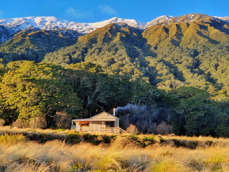
What’s Green Hut like?
Beautiful! While some say it’s one of the best huts to hike to in New Zealand, I’m not sure I’d go that far. It’s nice though.
Known as a standard hut, there’s 12 bed spaces available and it’s first come first served. Adults are required to get hut tickets. The prices are:
- Adult (18+ years): $10 per night (blue ticket)
- Youth (5–17 years): $5 per night (yellow ticket)
- Child/Infant (0–4 years): free
If you have a Backcountry Hut Pass, this hut is free to stay in.
If you’re looking for huts that are like Green Lake Hut, you could check out:
What is the elevation gain?
There’s not a tonne of elevation gain with lots of little undulations adding up. The one big climb gains 180 metres in about 500 metres which is steep. But it’s not for a long time thankufully.
Here’s the elevation profile*:
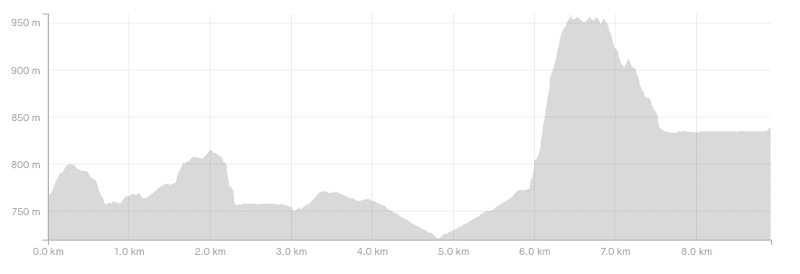
*From kilometre 4 to ~5.8km is the side trip to Clark Hut.
How long does it take to hike to Green Lake Hut?
For a short track, it takes sneaky long even if I’d like to think I’m fit. DOC recommends 3 hours and dont be surprised if it relly is this long, particularly if the track is water logged. If you’re fit you could do it in 2 hours, but it took us about 3 hours with a couple of breaks (and if you removed the detour).
Should I do the Mt Burns Tarns Track as well?
Yes, if you’re starting the Green Lake Track from Borland Road.
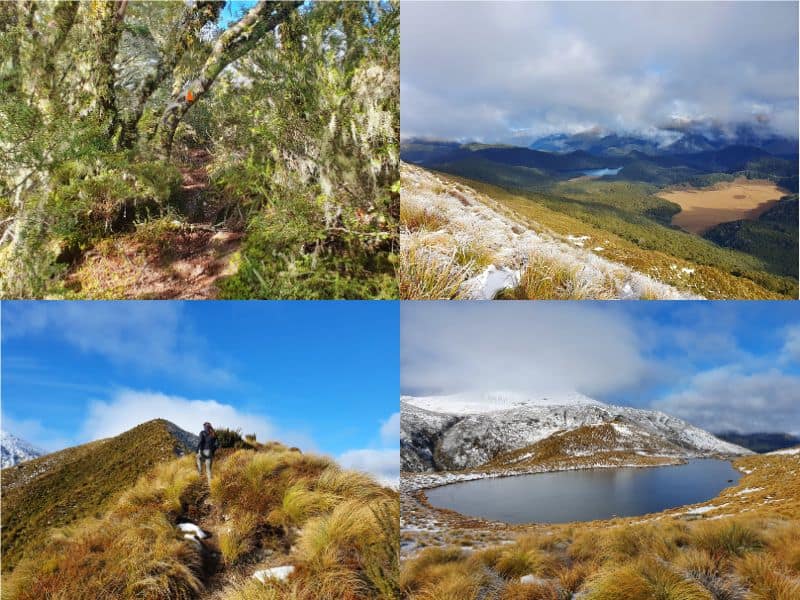
The Mt Burns Tarns Track is an awesome short track starting at Borland Saddle.
It’s a short track, less than 2km return with a steep ascent but gives you epic views as you can see in the photos above.
Why do you prefer starting from Borland Road?
- It’s a shorter distance to Green Lake Hut
- The hike is more interesting
- It’s less popular than the other route (from what I can gather)
- You can do the Mt Burns Tarn Track
Can you hike this point-to-point, Borland Road to Lake Monowai?
You can, and we did, though it wasn’t the plan.
When we got to the hut we were talking to the one other group who were there. The next morning, we asked if they were up for a key swap as they’d hiked in from Lake Monowai. We trusted them, and it worked a dream with them bringing our car to Lake Monowai…they left the key where we told them and we didn’t have to hike out the same way.
The other option which friends have done is to drop bikes at Borland Biv, and drive to Lake Monowai to start the hike (or vice-versa). You then bike back to the car. Easy? You’ll need to be okay with leaving your bike in public etc, but I’m usually fine with such things as long as I lock up the bike.
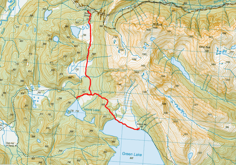
2. GREEN LAKE TRACK MAP
Clicking on the map below will open in a new window on topomap.co.nz.
3. HOW TO GET TO THE TRAILHEAD
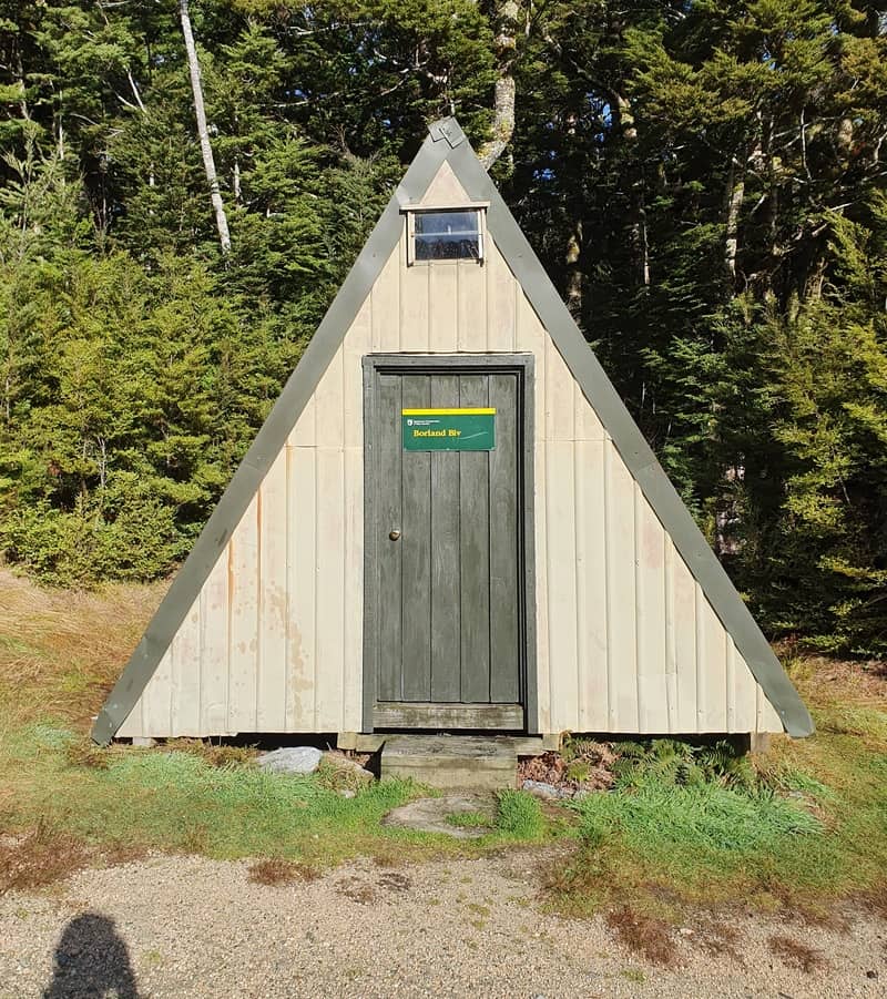
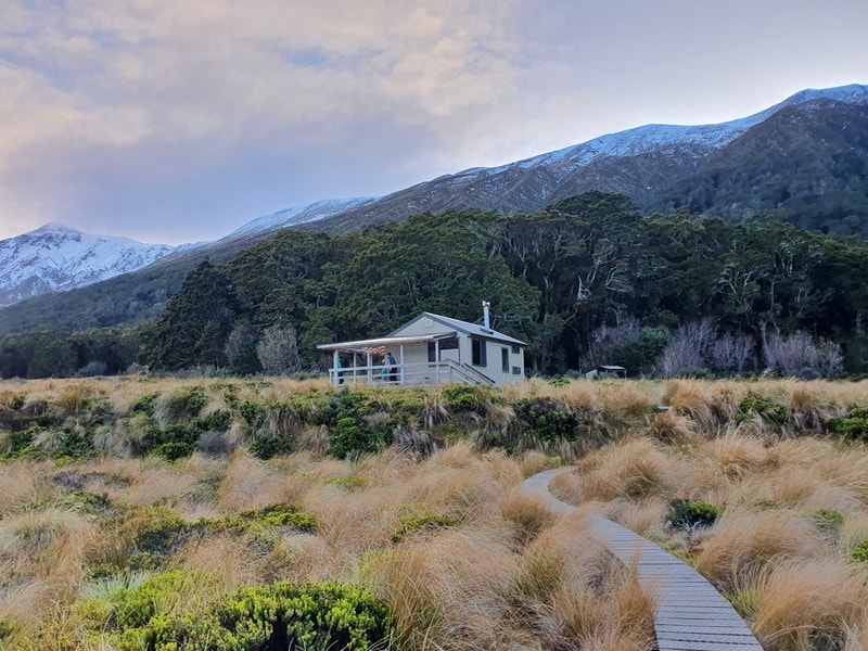
We parked here near the powerlines, about 50 metres before Borland Biv (seen above).
*As mentioned earlier, the Borland Road access is usually closed over winter and may be closed in the days following storms in other months. Check the DOC website if you’re unsure. You can still hike in from the Lake Monowai entrance if Borland Road is closed.
Located in Grebe Valley, you wouldn’t accidentally stumble across Borland Road on a regular road trip. The Borland Road isn’t the easiest gravel road to drive on, but ultimately we got there with no issues.
From Manapouri, it’s less than 70km to the trailhead but it could be closer to 2 hours by the time you get there. From Queenstown? Expect 3 to 4 hours. It’s a track where it’s better to leave earlier rather than later.
You’ll see a track information sign near Borland Lodge which is worth reading.
Driving here is the only realistic way to get to the trailhead.
4. MY GREEN LAKE HUT TRACK EXPERIENCE
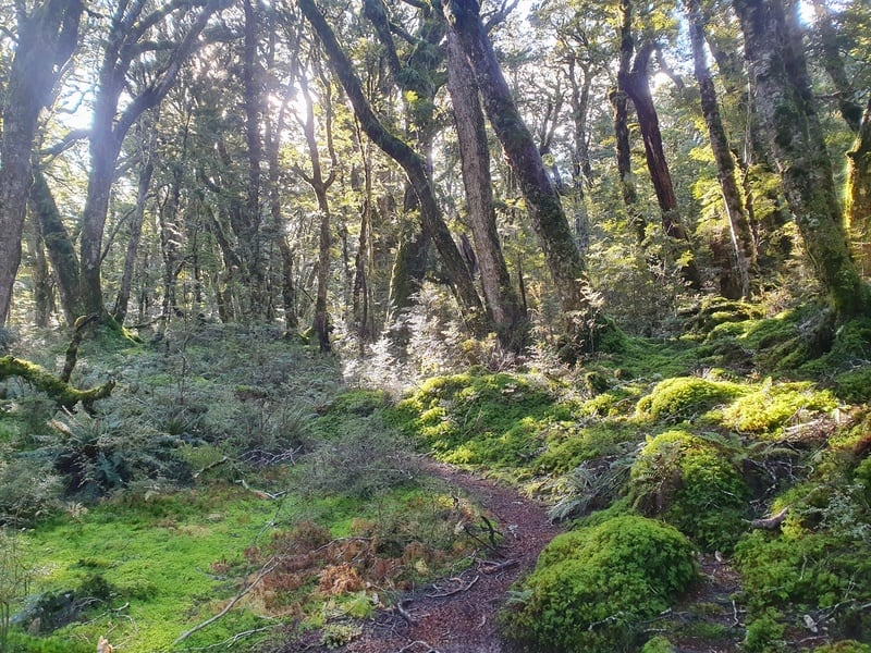
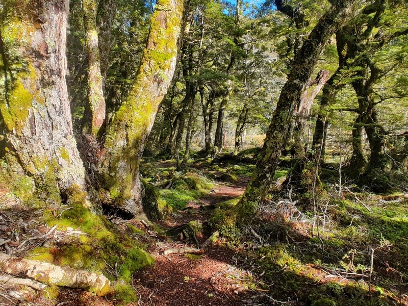
After spending an hour or so hiking up and down the Mt Burns Tarns Track, we parked up at Borland Biv and entered the beautiful forest you’ll see on most hikes in Fiordland National Park.
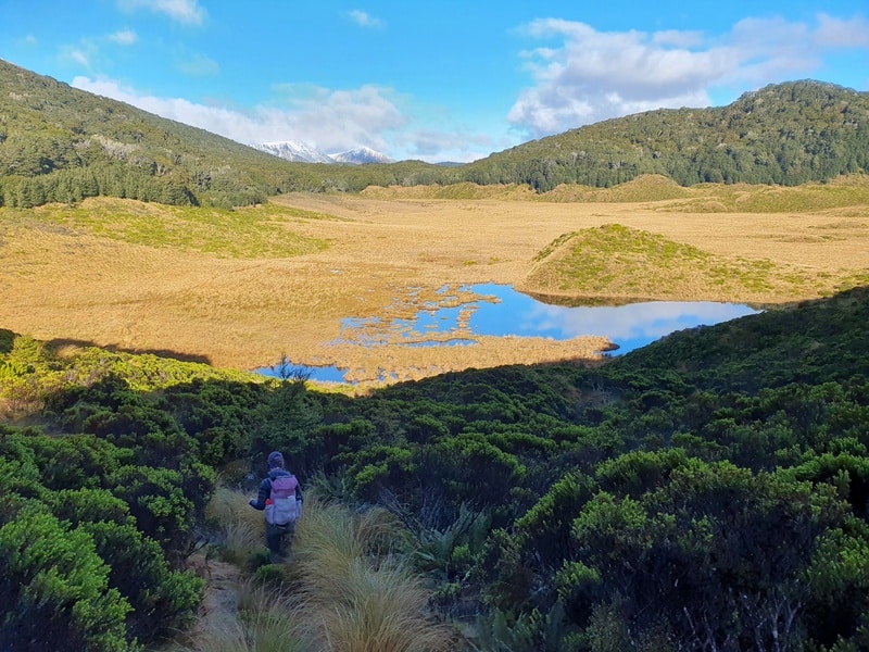
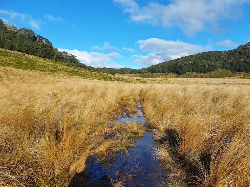
This was just a short section before you’ll be looking out over a tussock filled flat area. It’s good looking, but meant we’d soon have very wet feet (mid May). The track was water logged as we trudged through aiming for the next orange triangle in the distance. Falling into little holes wasn’t fun but I managed to keep the pack dry.
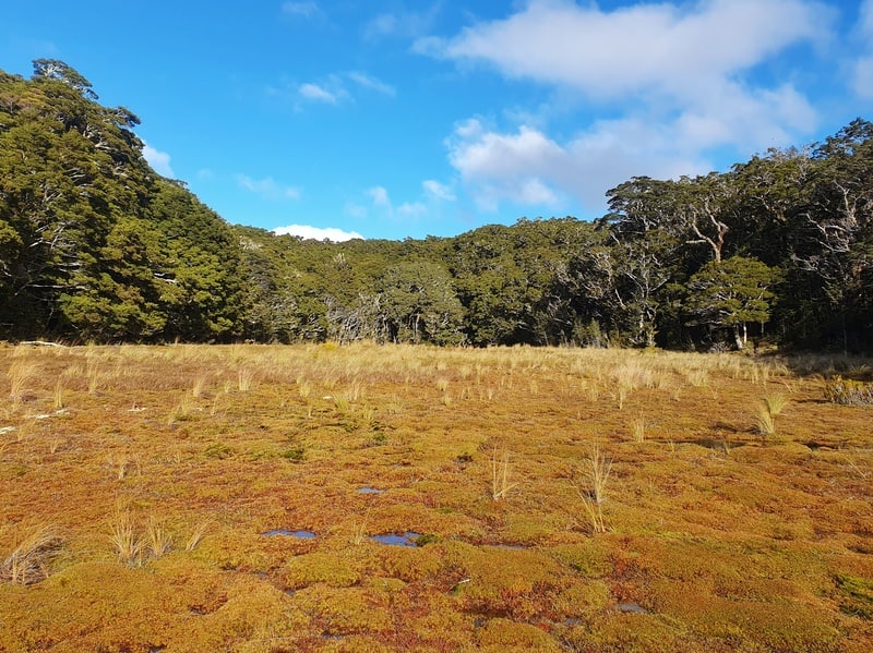
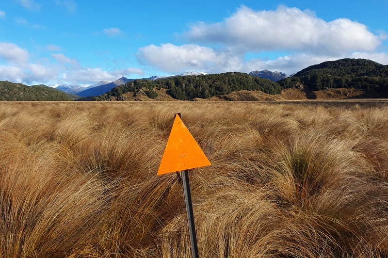
After the tussock, you’ll enter the bush again for a little climb before a quick descent back into the tussocks. Again. The tussocks are super long here, making it hard to see the orange triangles sometimes. I pulled up this topo map app (worth it) a few times to verify we were on track.
Again, expect to get your feet wet.
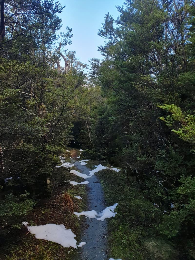
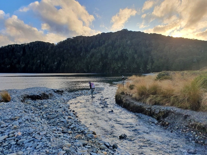
The next section of track was stunning, with some (dry) single track with a little bit of snow left over a week or so prior. At about the 4km mark we decided to take a detour towards Clark Hut and see Island Lake. We got about 800 metres before we came across a small river crossing which we weren’t feeling upto so decided to head back to Green Lake.
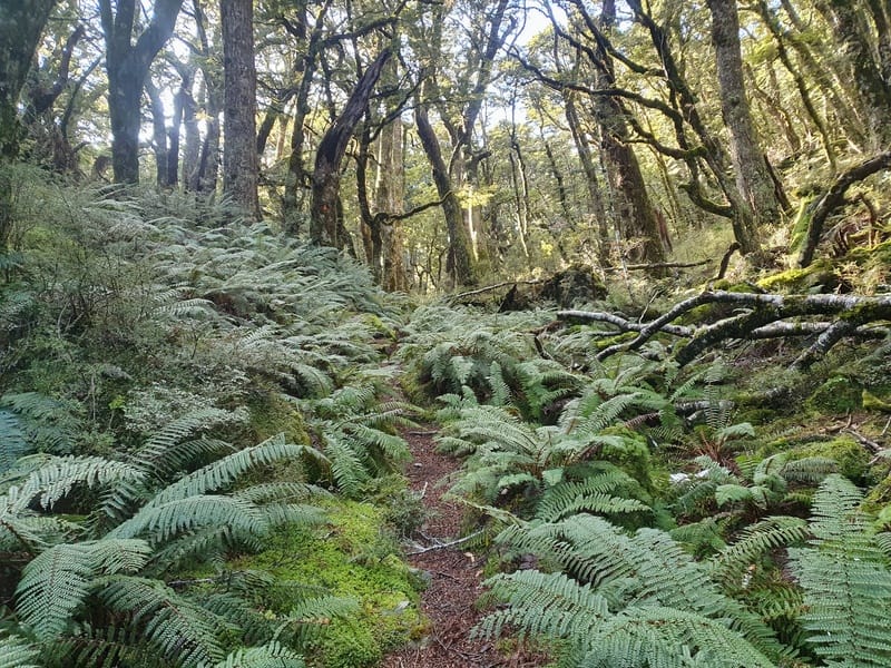
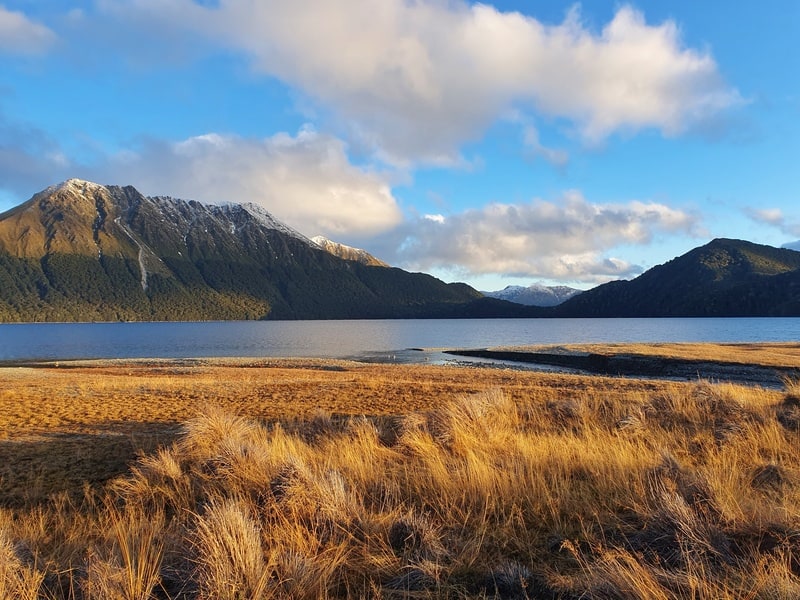
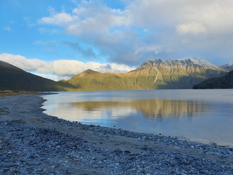
Back on track we were soon going up the steepest climb of the day, covering 180 metres of vertical gain in 500 metres. You’ve then got some undulating track before the descent down towards the lake. The lake caught me by surprise as we got to it’s shores without seeing it approaching. You won’t see Green Lake Hut just yet, but head left and follow the shoreline.
We decided to get to the hut first to drop our bags off before exploring the lake a bit more. Once we saw the smoke coming out of the hut we were stoked we weren’t going to have to do it ourselves.
The Green Lake sunset is a relaxing time. And the huts good. After a good nights sleep we then headed on towards the Rodger Inlet Track and the Bushline Route. Both are great additions to a night at Green Lake.
The Green Hut Track is great if there’s been a dry spell, and you’re looking for a hike that doesn’t have too much elevation change.
If you have any questions/comments about hiking to Green Lake Hut, leave a message below and/or email jub@churnewzealand.com.

Hey, it’s Jub here. I’m the guy behind Chur New Zealand, helping you have the best time hiking, trekking, walking…whatever you want to call it…in NZ. I’m based in Queenstown and am always out and about exploring trails, old & new. If you have any questions, reach out.