The Rodger Inlet Bushline Route is a sneaky good (7km+ return) route! If you’re staying at the Rodger Inlet hut, make the effort to get at least above the bush line.
You’ll be rewarded with epic views, and it’s a totally different trail compared to others in the area.
This post will give you all the information you need to know about hiking the Rodger Inlet Bushline Track.
TABLE OF CONTENTS
1. Rodger Inlet Bushline Route Details
2. Rodger Inlet Bushline Route Map
3. How To Get There
4. My Rodger Inlet Bushline Route Experience
1. RODGER INLET BUSHLINE ROUTE DETAILS
- QUICK DETAILS:
- 7 to 10km (and possibly more)
- ~1000 metres (to the end of the topo route)
- Difficult
- At least 3 hours, possibly a lot more
- GPX File Here
How hard is the Rodger Inlet Bushline Route?
Having done the hikes to Green Lake Hut and the Rodger Inlet Hut Track beforehand, we were expecting a tough track given what we knew. We were fully prepared to turn around if we were struggling given this is a track not many people seem to do.
But the track was in much better condition than expected (May), nor was the route too tricky to follow. That said, it’s still a tough hike…it’s not one I’d recommend to people early in their hiking career.
What distance is the Rodger Inlet Bushline track?
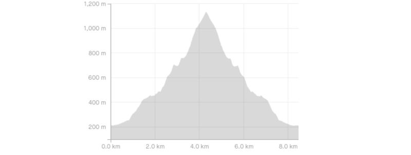
The distance from the hut to the bushline is about 3.5km each way. But you’ll want to continue further up to get the best views. We continued on until we got to the end of the route marked on the NZ topo map which gave made for an 8.3km return trip (based on Strava).
What is the elevation gain of Rodger Inlet Bushline Track?
To get to the bushline (and back), there’s about 860 metres of elevation gain. We got about 1000 metres on the dot up to our turnaround point.
Here’s the elevation profile:
How long does it take to hike to bushline?
This is a super hard thing to gauge, as it’s a steep track and the tree fall could make things complicated. We took 1 hour and 20 minutes to get up, and 1 hour and 10 minutes coming down. We spent about 15 minutes above the bushline taking in the views.
DOC says 4 to 5 hours to the bushline. This seems extreme. I’d be surprised if it took more than 3 hours for pretty much anyone.
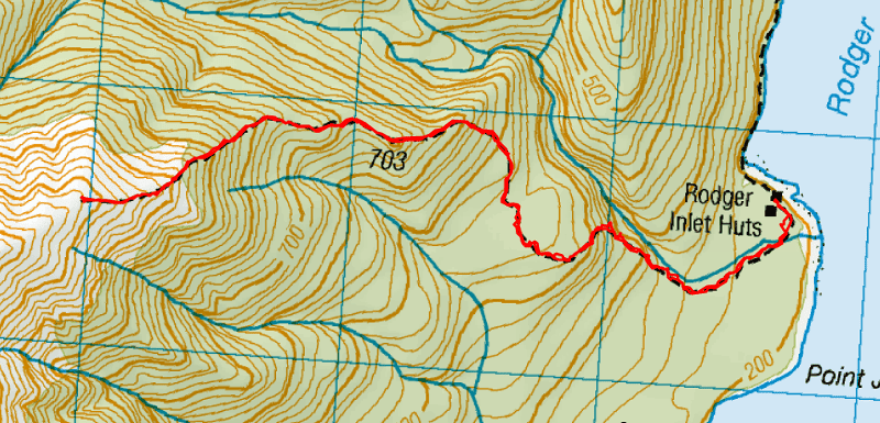
2. RODGER INLET BUSHLINE ROUTE MAP
*Clicking on the map below will open it up in a new window on topomap.co.nz where you’ll be able to scroll around etc.
3. HOW TO GET THERE
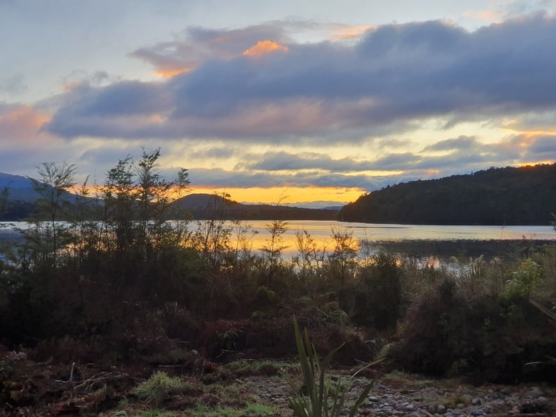
The route starts at the Rodger Inlet Hut, which is a fun hut to stay at. It’s right by the lake, and if need be, get the fire cranking and you’ll be roasty toasty.
To get to the hut, you have two options. You can hike via the Rodger Inlet Track (click that link for more information). Or if you’ve got access to a boat and or kayak (even this cheap inflatable kayak would do the job for most), then travelling via Lake Monowai to the hut would be super fun.
4. MY RODGER INLET BUSHLINE HIKE EXPERIENCE
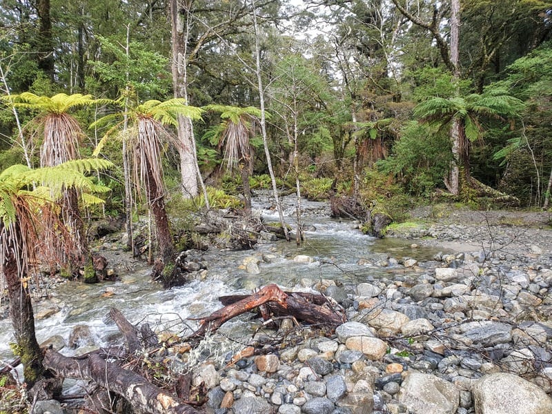
After a stunning sleep at Rodger Inlet Hut (calm skies and no wind), we set off on the hike. We didn’t worry about taking our shoes off as we crossed the river behind the hut to start the hike (photo above). But if you really hate getting wet shoes/boots, then it’s the only time you’ll need to for the hike.
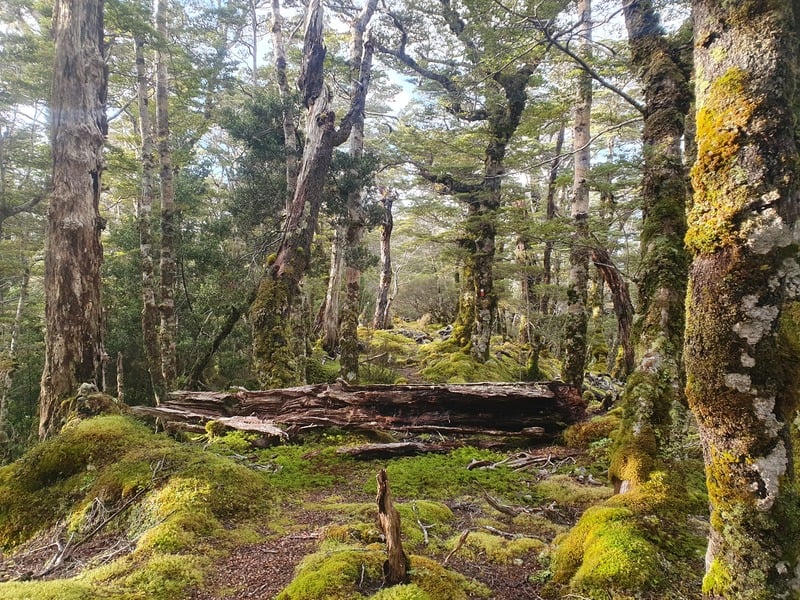
The track starts off flat-ish, keep an eye on the orange triangles. We missed a turn early and bush bashed our way back on track.
I say flat-ish, but you’re definitely going up hill. But after about 800 metres, the incline really begins and you’ll be glad it wasn’t this step from the get go. The track is pretty easy to follow with orange triangles regular enough. But pending tree fall, you might find yourself veering off track from time to time. You’ll quickly realise though.
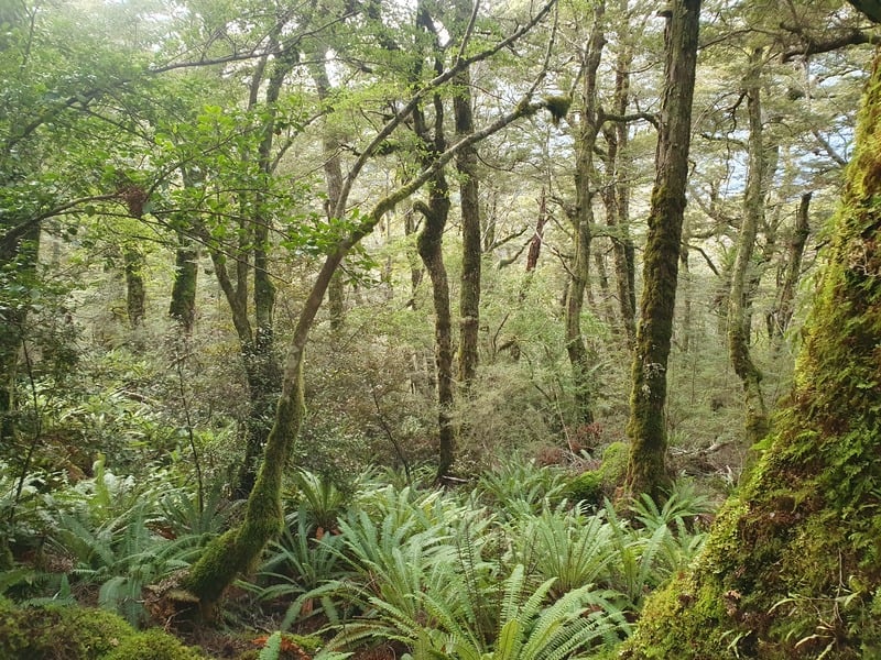
The route is almost like a staircase with massive stairs as every now and again the track flattens out to give your calves a brief respite.
There aren’t any views on the way up really (minor ones), so keep those legs turning over as the fantails flicker around you.
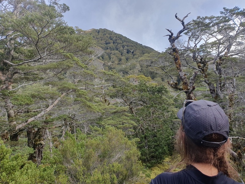
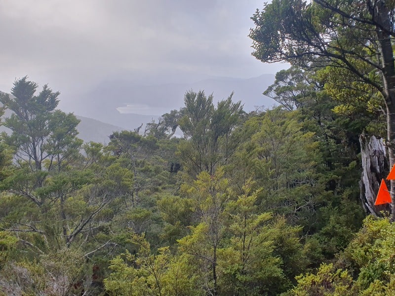
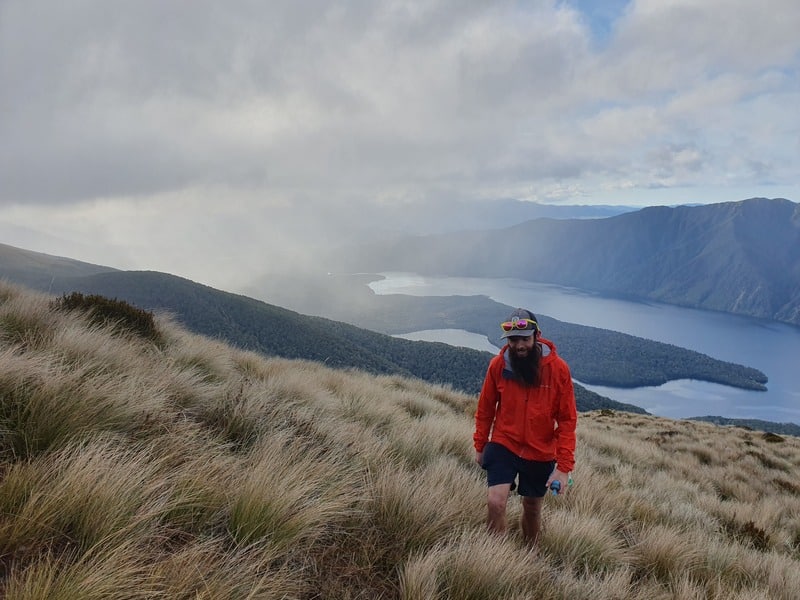
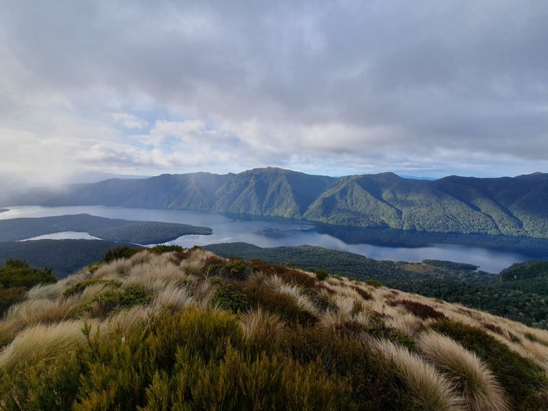
Just as you’re about to emerge from the treeline the track gets really steep in a couple of spots. But once you get above the bushline, you’ll be stoked.
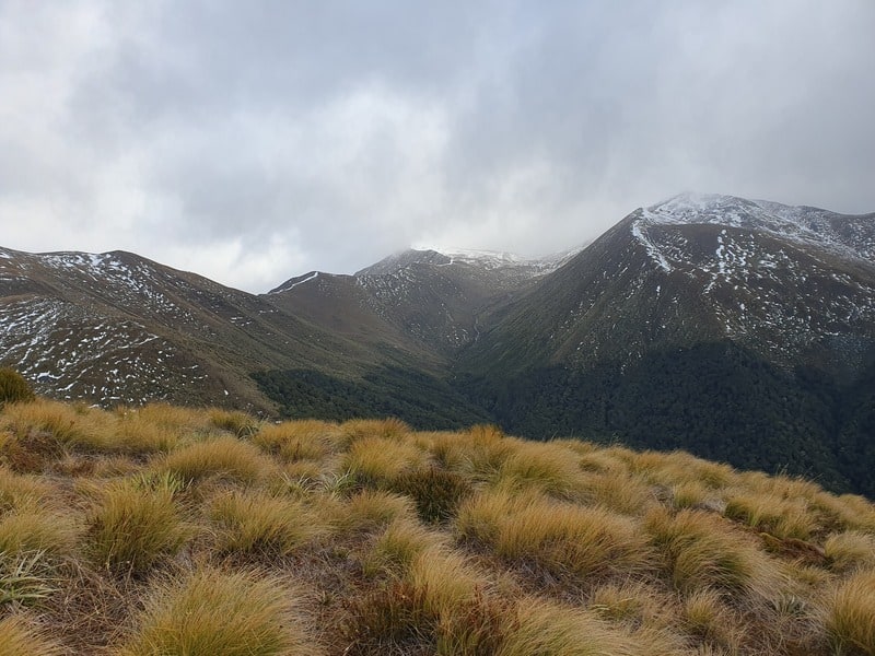
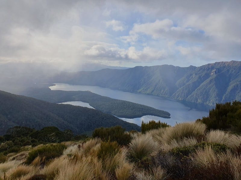
The views are good, but keep better so plug away through the tussocks. There are some semblance of tracks above the treeline, but it was harder to follow. We just kept an eye out for markers in the distance and headed towards them.
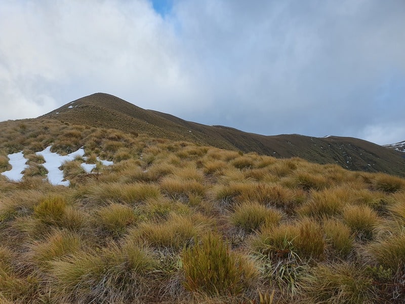
Enjoy your hard work! We would have loved to have kept exploring above, but knew the hike out could take a while and didn’t want to be hiking in the dark. If you’ve got two nights at Rodger Inlet Hut (or arrived by boat/kayak), you could spend a long time exploring the ridge line on the tops.
Coming back down will be faster for most people, but take care on the super steep sections. If it’s dry or wet, it can be easy to slip. You shouldn’t have any issues with directions coming back down either.
Have the best time!
If you’re planning to stay a night at the Rodger Inlet Hut, then make sure to put time aside to get up above the bush line!
If you have any questions/comments about hiking this track, leave a message below or email jub@churnewzealand.com.

Hey, it’s Jub here. I’m the guy behind Chur New Zealand, helping you have the best time hiking, trekking, walking…whatever you want to call it…in NZ. I’m based in Queenstown and am always out and about exploring trails, old & new. If you have any questions, reach out.