The 11.3km Rodger Inlet Track to the hut isn’t as frequented as other tracks nearby such as the Green Lake Hut Track.
So if you’re heading to this region and would prefer a hut to yourself, you’ll prefer the Rodger Inlet Track.
This post will give you all the details about the Rodger Inlet Track.
p.s. I wouldn’t do this as an out and back track in one day. I’d stay at Rodger Inlet Hut, and do the Ridgeline Track either that evening or the following morning depending on daylight you have.
TABLE OF CONTENTS
1. Rodger Inlet Hut Track Details
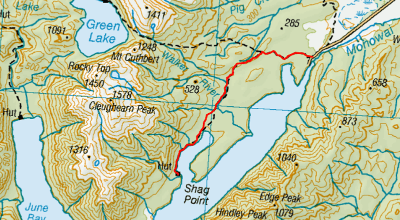
2. Rodger Inlet Track Map
3. How To Get There
4. My Rodger Inlet Track Experience
1. RODGER INLET HUT TRACK DETAILS
- QUICK DETAILS:
- ~11.3km one way
- ~280 metres of elevation gain one way
- Medium difficulty
- 3 to 5 hours each way
How hard is the Rodger Inlet Hut hike?
Given the minimal elevation gain/loss and not a crazy distance, this is not a hike to be underestimated. The track is a gorgeous single track most of the way. But it gets tricky in spots due to the bogs on the track, even in late summer. And the section along the lake as you get close to the hut needs to be navigated with care (minor exposure).
What distance is the Rodger Inlet Track?
DOC says it’s 10km, but my Strava came in at about 11.3km from Lake Monowai carpark to the Rodger Inlet Hut. I can’t recall doing any detours. So plan for closer to that distance if you’re tracking things and don’t be heart broken when you pass 10km and are still hiking.
What is the elevation gain of the Rodger Inlet hike?
From the Lake Monowai carpark to Rodger Inlet Hut there is 280 meters of elevation gain. You start and finish at ~200 metres above sea level, and are never more than ~325 metres above sea level, so there’s no long climb.
How long does it take to hike to Rodger Inlet Hut?
According to DOC, it’s about 6 hours, but this is the longest it should take if you’re pottering along. We took just over 3 hours which included a short break or two. I would give yourself 4 hours for most people. For the distance that may seem long, but the bogs and (potential) tree fall can make for slow going.
Are there other hikes beyond the hut?
Yes, there is! There’s the Rodger Inlet Bushline Route which I wrote about. This is a steep track that takes you above the bushline for awesome views of Lake Monowai and the surroundings.
2. RODGER INLET TRACK MAP
*clicking on the map below will open the map in a new window on topomap.co.nz
3. HOW TO GET THERE
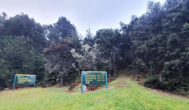
The Roger Inlet Hut Track starts a little before the Lake Monowai carpark, we parked right by the trailhead here.
The easiest and only real way is going to be via car. You could rent one of the Otago shuttles on this list if there’s a large group of you, but that’ll be on the pricey side.
From Manapouri, it’s about 50km and 45 minutes away. Te Anau is slightly further, while Queenstown is a good 2 to 2.5 hour drive.
4. MY RODGER INLET TRACK EXPERIENCE
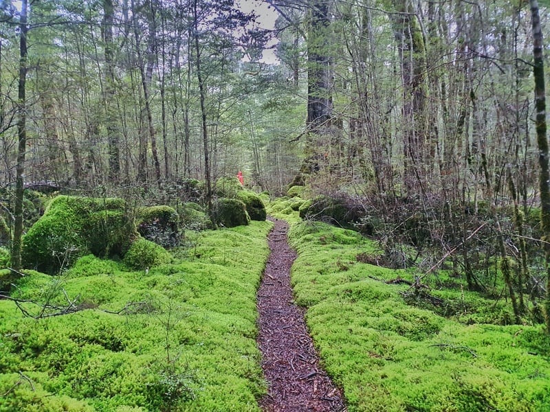
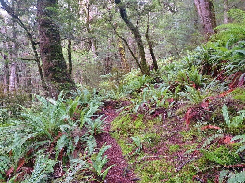
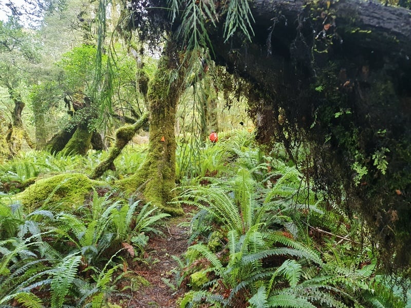
Having visited the Green Lake Hut earlier, it was fun to see how the hike to Rodger Inlet Track would differ. The track starts off gently with most of the track being wide (in between some beautiful moss lined single track).
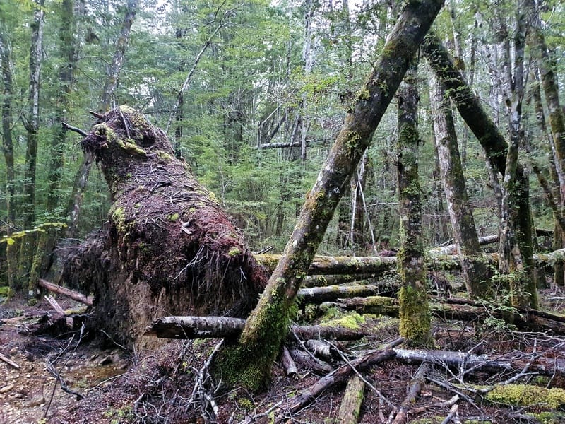
You can see what the bad weather does here with some massive trees being toppled over.
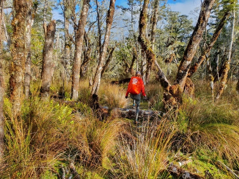
Turning left after 2.9km, you’ll start the ‘hill’ section of the Rodger Inlet Hut Track. The undulations are minor, but they’re nothing crazy whatsoever. The trees are fun as the trail picks its way through them.
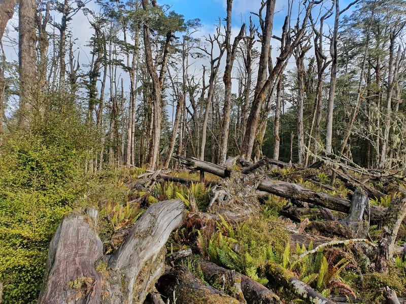
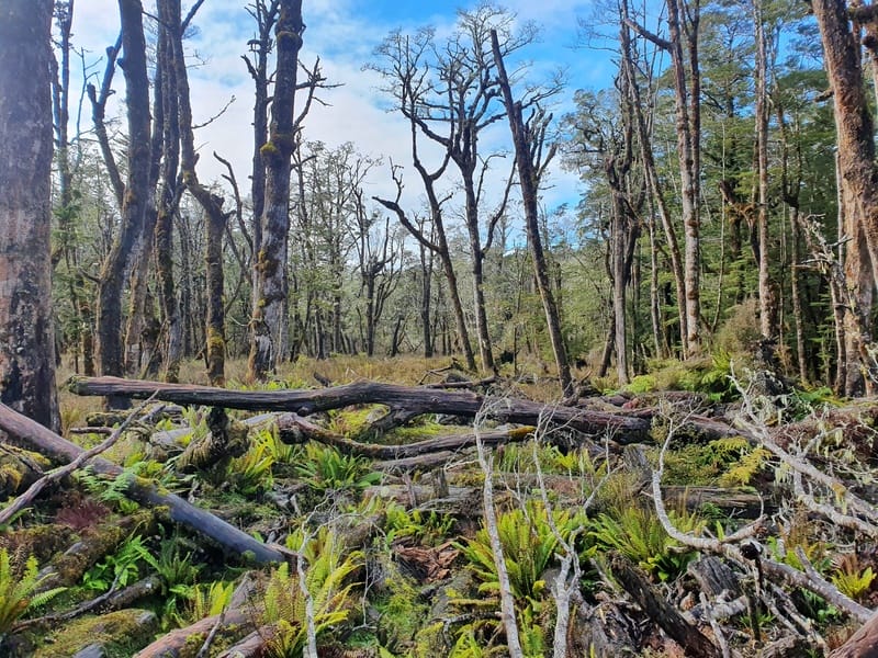
Once you start heading back down the hill (nearly 5km in), you’ll be dropped out into an awesome area. It reminds me of Jurassic Park with all the dead trees. It’s quite the contrast!
We struggled to work out where to go exactly here as one of the trees with the orange triangles had fallen over. We soon figured it out though (keep your eyes peeled for the triangles in the distance). Don’t rush this section, there’s some narrow streams to cross and lots of tree fall that can be slippery.
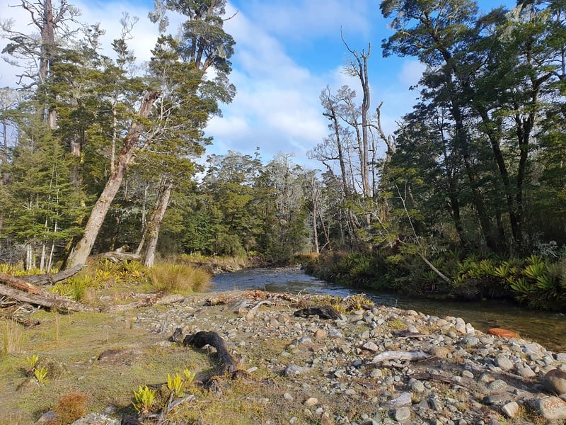
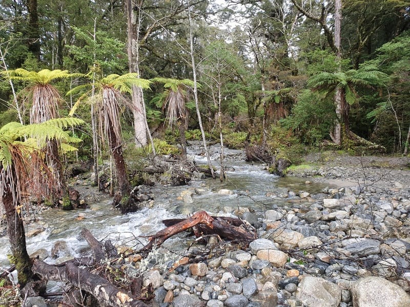
You’ll then follow the river for a while which is nice. And a good picnic spot! You will need to cross the river at one point, but provided there’s been no heavy rain it’s not deep. Take it easy!
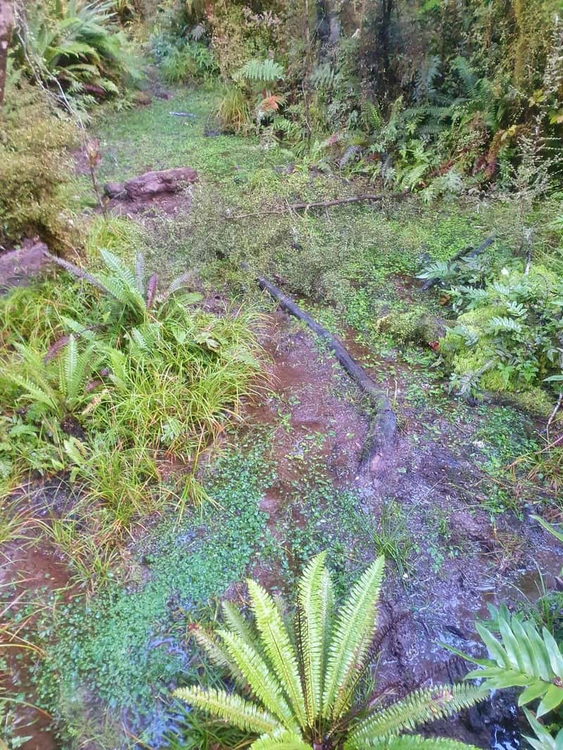
Once you leave the river, it’s time to get ready for the bogs (more than you’ve experienced thus far). There’s lots of wet muddy sections of track, even at the end of summer. Be prepared, then do your best to follow the leave no trace principles while not destroying yourself. It’s all flat terrain here, so stay patient and keep the forward momentum going.
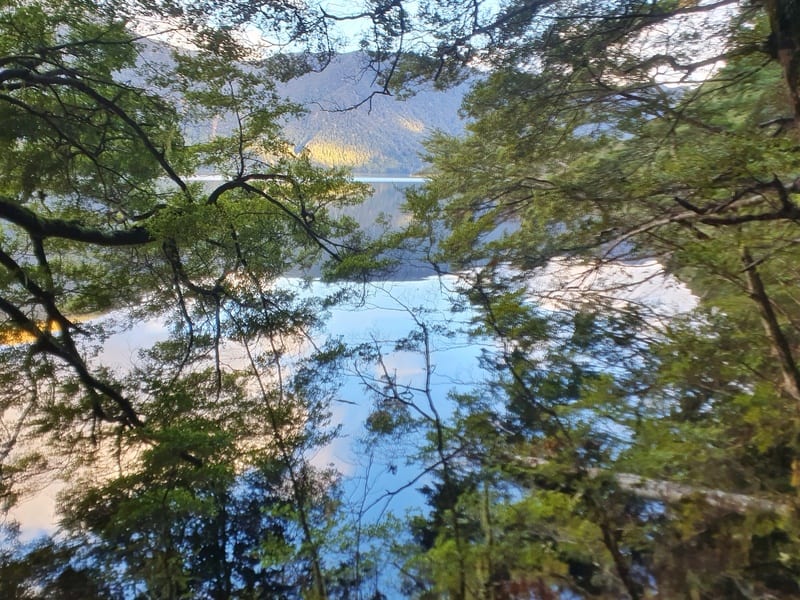
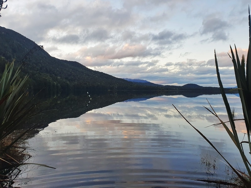
Once you get back next to the lake again, you’re less than 3km from the finish and it’s better terrain through here overall. There’s a couple of fun sidle sections that you’ll take slowly, but you’re more or less there! There’s also some weird mirage kind of effect going on if the lake is flat.
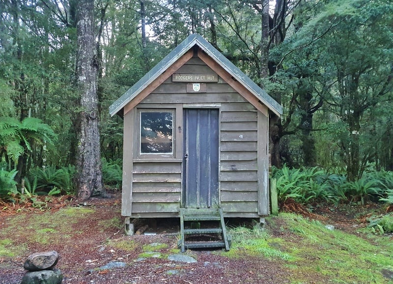
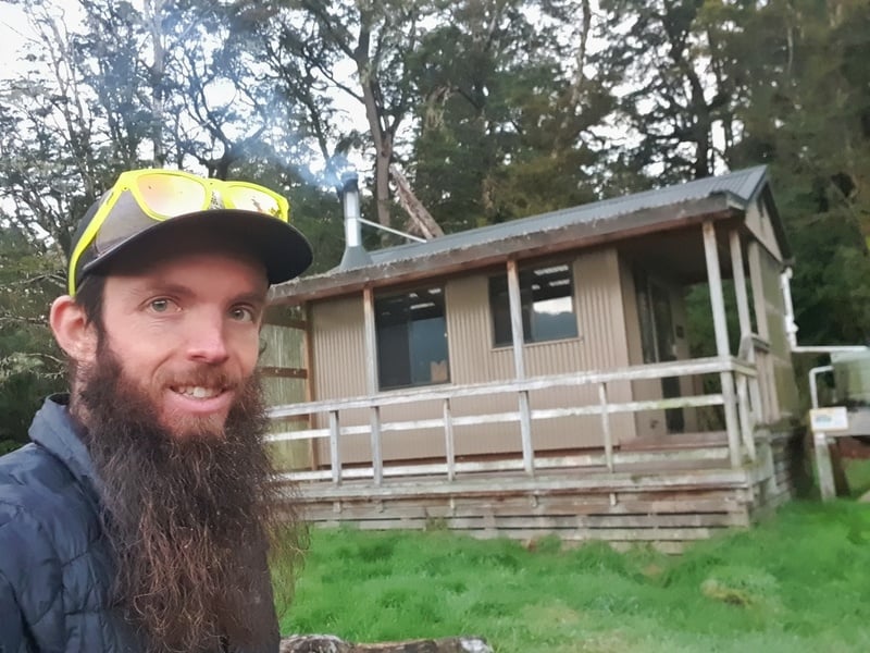
And enjoy the hut. If you’re brave you could stay in the original Rodgers Inlet Hut, but opt for the newer one 50 metres past it.
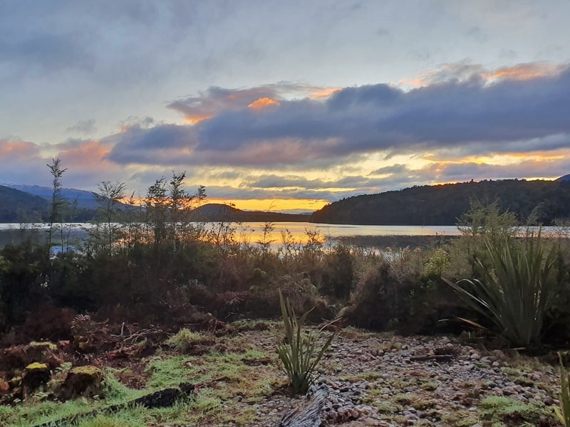
Hopefully you get some amazing sunsets and are brave enough for a quick dip.
If you’re looking for an off the beaten path hike, this is a great track. And if you’ve got friends who aren’t hikers, but enjoy kayaking/boating, you can do this hike with them. They can paddle to the hut, while you hike and then you can enjoy each others company at the end of the day. How good!
Have you got any questions about the Rodger Inlet Hut Track? Drop a comment below or email jub@churnewzealand.com.

Hey, it’s Jub here. I’m the guy behind Chur New Zealand, helping you have the best time hiking, trekking, walking…whatever you want to call it…in NZ. I’m based in Queenstown and am always out and about exploring trails, old & new. If you have any questions, reach out.