The Tokorangi Pa Track is an 11.5km loop starting at the i-SITE visitor center in the Whakarewarewa Forest, a.k.a. The Redwoods, in Rotorua.
It’s a reasonably easy walk with the biggest climb happening in the first third of the journey. From there you wander through a variety of terrains with a couple of good views along the way.
This post will give you all the details you need to know about the Tokorangi Pa Track in Rotorua, another one of the cities nice walks.
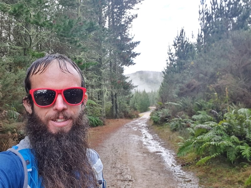
TABLE OF CONTENTS
1. Tokorangi Pa Track Details
2. Tokorangi Pa Track Map
3. How To Get There
4. Tokorangi Pa Track Trip Report
1. DETAILS ABOUT THE TOKORANGI PA TRACK
I’m giving this a 3.5-star rating. The same as the yellow marked Pohaturoa Track starting from the same spot. The first two-thirds of the Tokorangi Pa walk is awesome as you navigate the Redwoods, then climb up through the bush to some viewpoints before plunging down into a valley.
The last few kilometres get a bit boring as you’re walking on access ways which aren’t anything special.
With that said, it’s a great way to spend a few more hours in the Whakarewarewa Forest.
How long is the Tokorangi Pa Track?
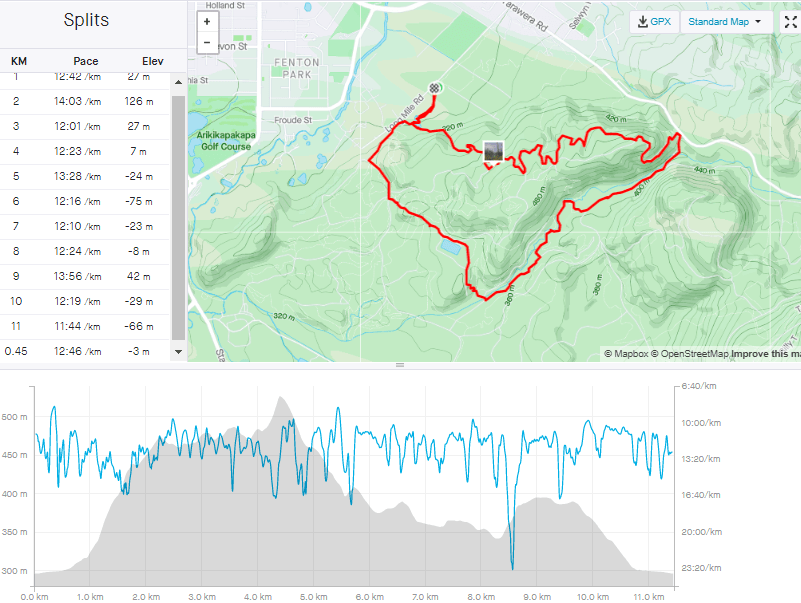
11.5km (my Strava had 11.45km, so pretty much spot on).
How hard is the trail?
Easy-medium.
Does the Tokorangi Pa Track have much elevation gain?
My Strava data had 361 metres of elevation gain, the majority of which is in the first 5km.
You’ll be able to see the Tokorangi Pa Track elevation profile below.
How long does the Tokorangi Pa loop take?
It took me 2 hours 30 minutes on the dot which was at a good speed. The Redwoods website has the track at 3 hours 30 minutes, most (I’m going to say 95%) will finish the walk in this time.
Will I get lost?
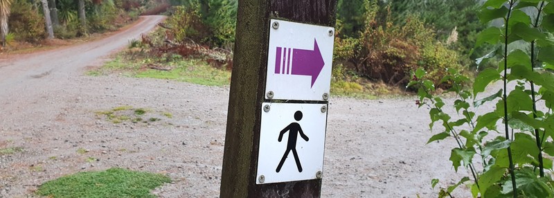
You shouldn’t, the purple track markers are frequent.
2. TOKORANGI PA TRACK MAP
While you can see Tokorangi Pa Road on Google Maps, the majority of the track isn’t marked on here. On the usually reliable Maps.me, it’s not obvious what track you’re supposed to follow.
But you won’t get lost as the purple arrow markers (above) are really frequent.
3. HOW TO GET THERE
The Redwoods i-SITE is a 4.7km walk from the Rotorua i-SITE. This will take you no more than an hour, so it’s not off the cards for the super keen.
PUBLIC TRANSPORT
There’s a bus that’ll get you the majority of the way. You’ll need to the #3 bus stop across the road from Pak’n’Save here and get off
If you’re planning to spend a good portion of the day there though, that little energy you’ll save is helpful.
DRIVING
There’s a tonne of free parking on Long Mile Road. From downtown Rotorua, it’s less than a 10-minute drive to reach the i-SITE. If it’s busy at the Redwoods (weekends/public holidays/summer), you might need to park a 5-10 minute walk to get to the info centre itself.
RIDE SHARING APPS
At the time of writing, Uber, YourRide, and Ola are not available in Rotorua.
4. MY TOKORANGI PA TRACK EXPERIENCE
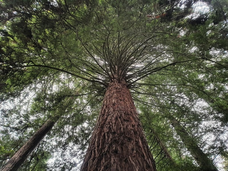
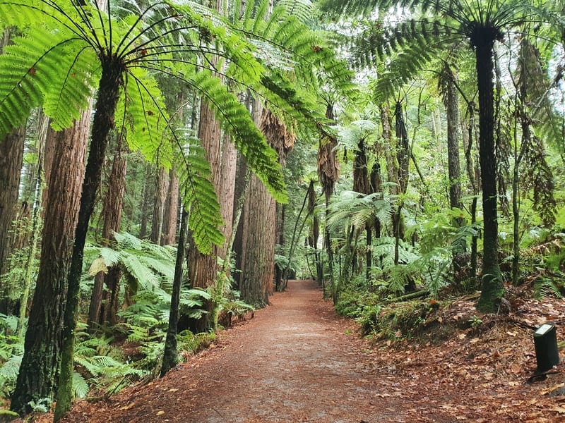
I arrived at the i-SITE just after 1 pm on a reasonably bad day weather-wise. Anyhow, I decided to go ahead with the walk, being sheltered early on by the huuuuuge Redwoods.
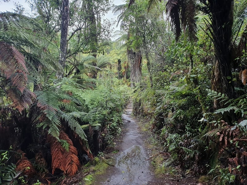
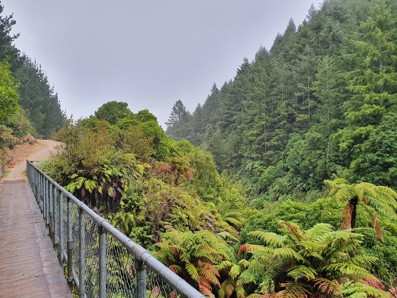
Skipping across a boardwalk, the Redwoods disappear but the greenery doesn’t. The first incline is after you make a right turn, where you’ll face a few sets of stairs. For the next 1km or so it’s a steady climb.
When the track starts to flatten, peak behind as you’ll get a few views here. It’d been raining the previous couple of days, and while there was certainly some mud I was able to get up with slipping in my running shoes.
It was starting to get misty at the summit, making for a cool feel.
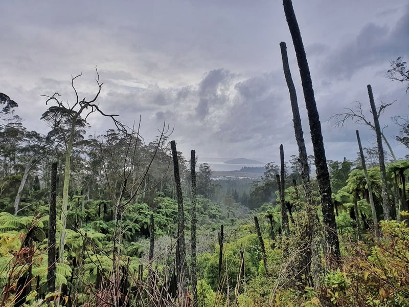
Views back out over Rotorua.
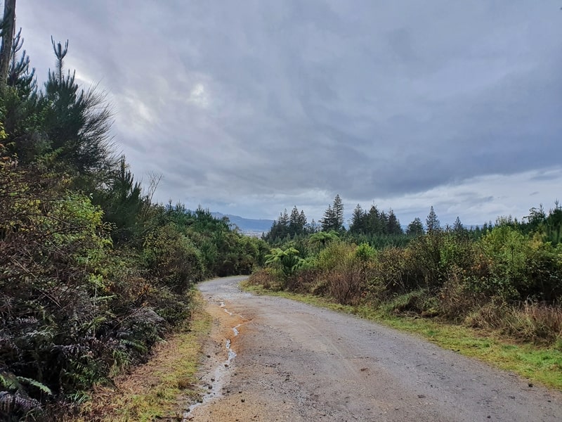
Once you hit the summit about 4.4km (~1 hour) in, the next few kilometres are a steady descent. At times I found them slippery in the rain. The terrain changes as you hit some 4WD tracks providing more footing into the valley. There’s a variety of trees again, but the pines are prominent.
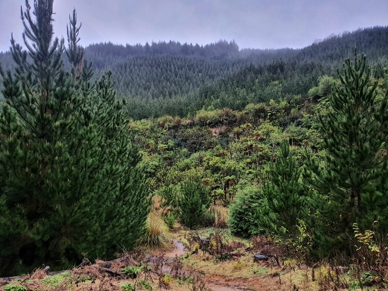
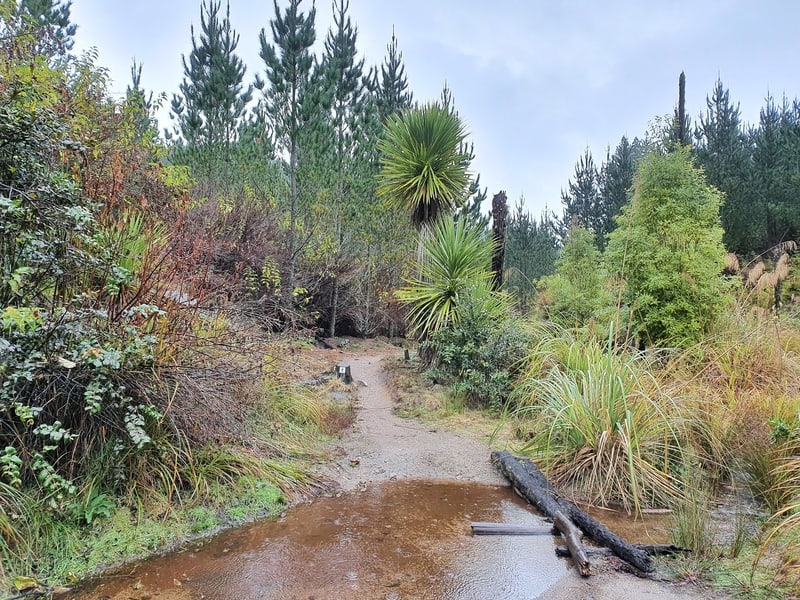
There’s a small stream you’ll need to cross, but like most of the hikes in NZ, there’s some perfectly placed punga and rocks. As you start to emerge from the valley, the scenery gets a bit boring as you walk along the 4WD track, past a reservoir of some description. Once you begin the final descent at the 9.5km mark, it’s all downhill until you return through the Redwoods for the last few hundred metres of the walk.
And there you go, in a destination like Rotorua that can easily see you spend all your money…the Tokorangi Pa Track is a great free activity.
If you’ve got any comments or questions, leave them below or email jub@churnewzealand.com.
Chur.
p.s. Here’s a map of all the hikes documented on Chur New Zealand. You can click the icon to see brief details, as well as a link to read more about the hike (like this post).

Hey, it’s Jub here. I’m the guy behind Chur New Zealand, helping you have the best time hiking, trekking, walking…whatever you want to call it…in NZ. I’m based in Queenstown and am always out and about exploring trails, old & new. If you have any questions, reach out.