The Pohaturoa track is a great walk to do in Rotorua.
This post will give you everything you need to know about hiking the Pohaturoa Track, a.k.a. the yellow track in the Redwoods (there’s a table of contents below).
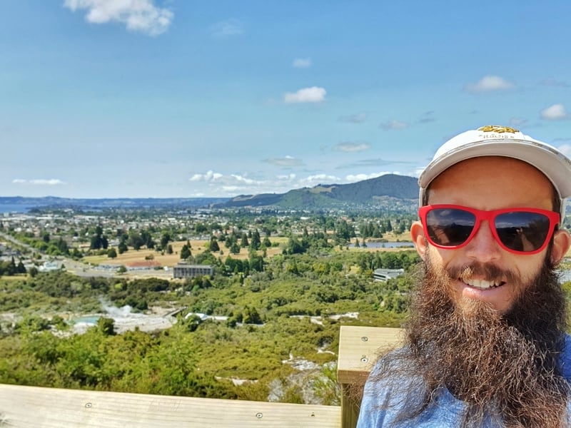
At the best viewpoint on the track. There’s a photo of the view without my mug in it later in the post.
TABLE OF CONTENTS
1. 1. Pohaturoa Track Details
2. 2. Pohaturoa Track Map
3. 3. How To Get There
4. 4. My Pohaturoa Track Trip Report
1. POHATUROA TRACK DETAILS
Hike Distance: All of the signs say it’s a 7.5km loop. You can see an error in my Strava data, but when I remove that straight line my total walking distance is about 8.65km. So let’s go with somewhere between 7.5km and 8.65km.
Visitor Hours: The gates open at 5:30 am and close at 8:30 pm. They shouldn’t give you any problems if you’re outside those times.
Difficulty: Medium.
What is the Pohaturoa Track elevation gain?
According to Strava I logged about 220 metres of elevation. On the WildThings website it has 160 metres of elevation. I think 220 feels about spot on!
How long does the track take?
It took me 1 hour and 48 minutes to complete. That was going at a decent clip and without too much time spent taking photos. The signs says two hours, but I think that’s on the quicker side, which is different to the conservative times usually seen on DOC signs. If you’re just after a cruisey walk with a picnic, budget three hours.
2. POHATUROA TRACK MAP
Map coming soon, but you can see it on Maps.me, or download the NZTopo50 map, the best topo map app.
You can check the Strava details which will give you an idea of the directions you’ll be walking.
3. HOW TO GET THERE
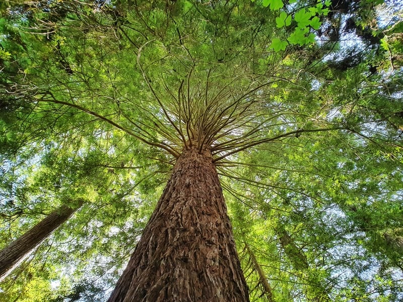
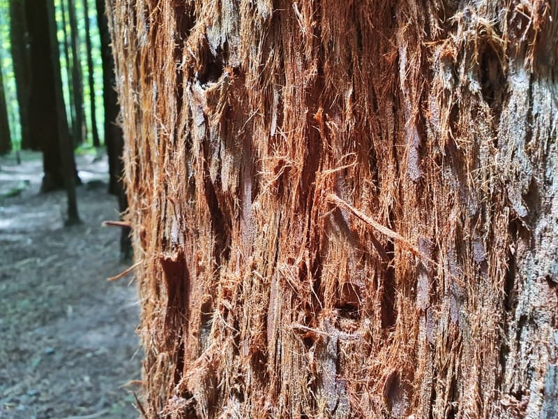
Looking straight up the trunk of a tower Redwood.
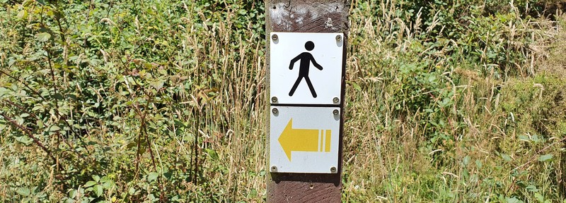
You’ll see endless yellow arrows guiding you in the right direction.
The five main colour-coded Redwoods walks (this is the yellow track) begin in front of the i-SITE visitor centre. This is where I’ll give you directions too below.
Drive: From the city centre it’s less than 5km to the Redwoods. For parking, there’s lots of free parking on Long Mile Road, but there’s also A LOT of cars, particularly in summer. So you’ll just need to drive along Mile Long Road and park wherever there’s a free space which may mean you park a 10-minute walk from the i-Site, but there’s nothing else that can be done (go early).
Walk: This is how I got there, and after taking the long route the first time, I discovered the quicker route on my return. The walking route isn’t available on Google but basically, as you’re following highway 30 out of Rotorua (there’s a footpath), when you cross the stream you turn right onto the Cedar Trail here. Follow the fenceline and you’ll see the entrance to the Redwoods after 10 minutes or so. This cuts about a kilometre off the walk compared to the Tarawera Road route. The distance is just over 3km from the CBD and takes about 40 minutes at a steady pace.
Bus: The buses are efficient in Rotorua, with a standard one-way fare of $2.80 for adults and $1.40 for kids (at the time of writing – cheaper with a Bee Card. From Rotorua you can catch the #3 bus from Arawa Street near the i-Site. Just let the driver know you want to goto the Redwoods and they’ll let you know when to get off. You can view the timetable here.
Rideshare Apps: Ridesharing is available in Rotorua, and the trip from the CBD to the Redwoods will cost you $12-$17 usually (that’s when I was searching while writing this post).
RELATED POST: WALKING THROUGH THE REDWOOD FOREST VIA THE SWINGBRIDGES
4. POHATUROA TRACK TRIP REPORT
Upon arriving at the Redwoods i-Site I was somewhat dreading the walk ahead, there were so many people. Everywhere! Granted, it was a stunning Saturday in the middle of summer, essentially peak season.
With so many people around, and the beginning of the canopy walk right next to the I-Site building it took me a couple of minutes to figure out where the trails were. Turns out the five color-coded tracks all start right in front of the i-Site and all follow the same path (you go right if you’re facing the iSite) through the Redwoods for the first few hundred metres before splitting off.
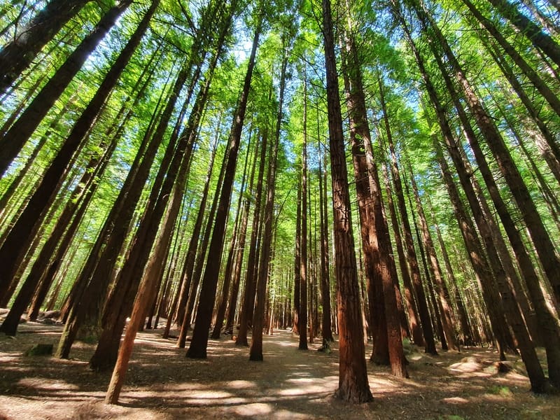
The walk through the Redwoods is genuinely stunning, and it didn’t take me long to notice that as usual, everyone was crowded around the one spot (in this case, the canopy walk) and I soon found myself in the peace and quiet surrounded by living giants (trees).
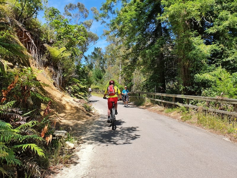
A biker on the shared path up Nursery Road. There were about 20 bikers on this stretch.
After about five minutes I was a little bemused to find myself exiting the forest and walking in front of the cars parked on Mile Long Road, but this was for 100 metres or so before what’s one of the two climbs of note up Nursery Road. It’s a sealed road section that lasts about 300 metres, and is a path shared with mountain bikers.
You’ll likely be in the heat of the sun, so just cruise up the path in your own pace, though I didn’t like it when I saw a girls dog poop on the path and she didn’t get off her bike to clean it up…seems very non-kiwi like. When you get towards the top of the climb, you’ll see a sign pointing to the right. This is when we get back on the trails!
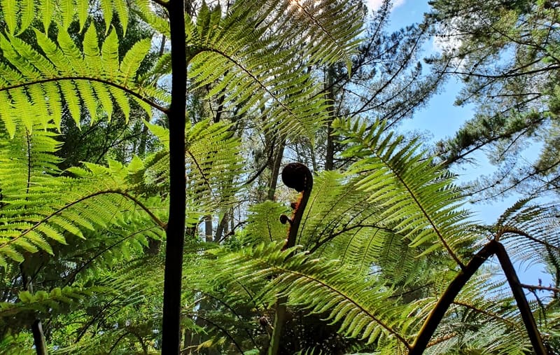
Awesome fern action on the trail.
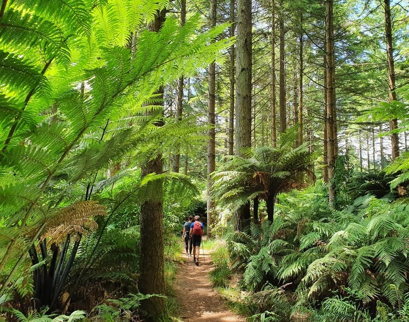
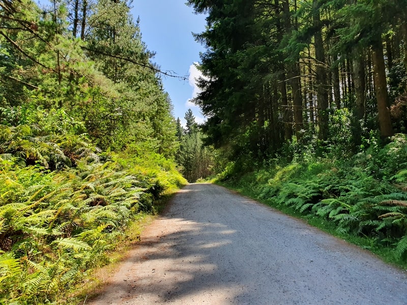
The trails are well-formed, and with so many yellow trail markers it’s impossible to get lost. Unfortunately, there’s no more Redwoods but there’s still plenty of lush trees and ferns trailside, sometimes providing a nice canopy from the sun.
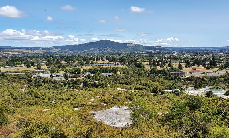
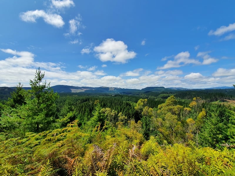
The view from the Whaka Lookout, the best viewpoint on the track.
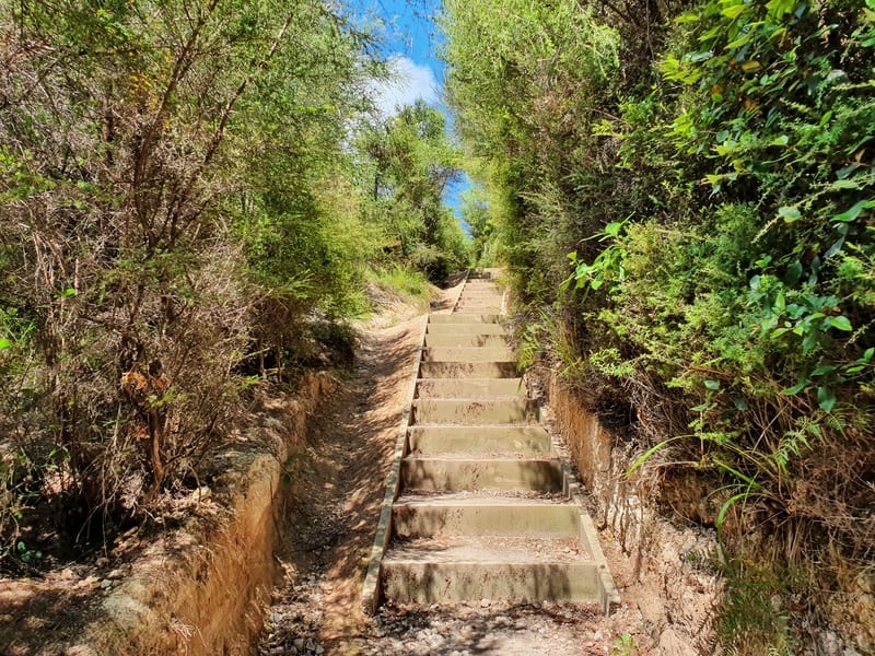
Stairs between the Whaka Lookout and the Trig
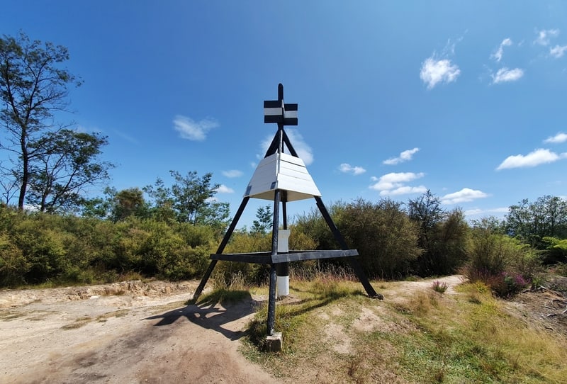
The trig which comes with a viewpoint and is close to the highest point on the track.
The first viewpoint you’ll get to is the Whaka lookout (definitely go via this route rather than the shortcut that skips it). It’s a genuinely nice viewpoint that looks directly over Te Puia, the CBD, and out to Mount Ngongotaha in the distance. There are some stairs both before and after the viewpoint as the incline kicks in but it’s nothing too crazy (this is the last climb of note on the track).
It’s just a matter of plugging away and putting one foot in front of the other until you reach the trig which has views back over the super green Whakarewarewa forest.
A view from the Waipa Lookout, it’s very similar to that of the Trig.
From here it’s a short walk out to the Waipa Lookout, you can skip the first turnoff to it, the second one will leave a much shorter walk to the viewpoint, saving you a few minutes and you won’t miss out on anything.
Walking through nature, yeow!
The Pohaturoa Road section, you’ll likely have mountain bikers passing you along here.
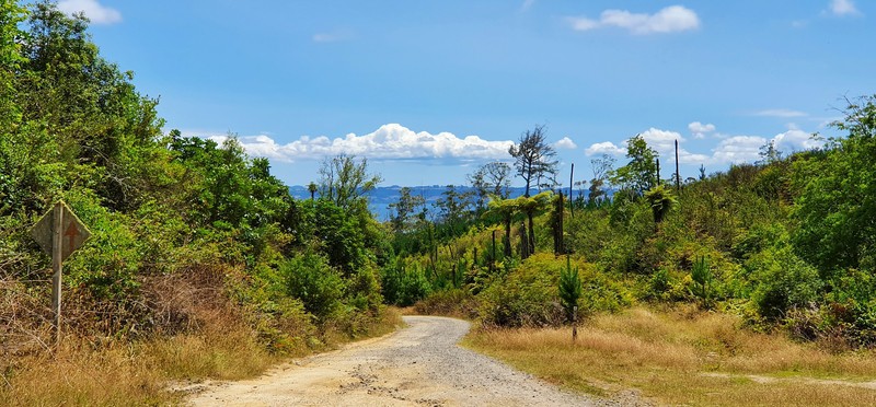
You catch a glimpse of Lake Rotorua.
This is about where you begin the descent down into the forest having skirted around the outside for much of the trail thus far. You won’t have much in the way of views for the rest of the walk, but the forest is awesome except the section where you’re on gravel Pohaturoa Road. But it’s not a long section, you just might have some mountain bikers hooning past you.
After a bit of a climb, you’ll have completed the loop at the top of Nursery Road. From here on out it’s just about retracing your footsteps back to the start (of course they still have heaps of signs guiding you back).
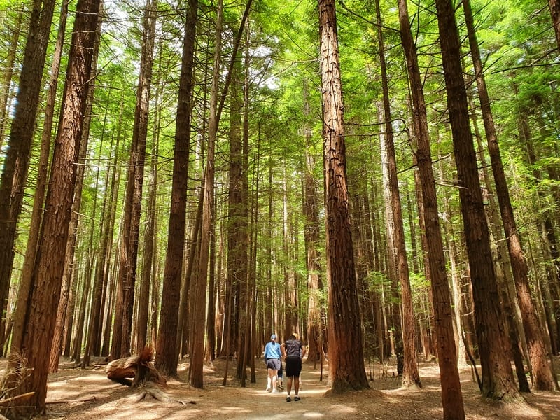
This gives you a grasp of just how big these California Redwoods are (they were planted in 1901).
The Redwoods is a super awesome area with hundreds, if not thousands of people opting to experience the epic trees via the canopy walk. But if you’re looking for a free Redwoods experience, the Pohaturoa Track is perfect for you.
If you have any questions, or comments about this hike, let us know in the comments below or email jub@churnewzealand.com.
Chur.
p.s. Here’s a map of all the hikes documented on Chur New Zealand. You can click the icon to see brief details, as well as a link to read more about the hike (like this post).

Hey, it’s Jub here. I’m the guy behind Chur New Zealand, helping you have the best time hiking, trekking, walking…whatever you want to call it…in NZ. I’m based in Queenstown and am always out and about exploring trails, old & new. If you have any questions, reach out.
Closer to 3 hours with photos and nearer to 10km walked according to a health app
Hey Chris and Jennie, thanks for the headsup on ya experience. Hope the long weekend is treating you well 🙂
Cheers, Jub