The Paekakariki Escarpment Track is one of, if not, my favourite day walks in New Zealand.
At ~10km one-way there are a few ways you can do the hike, but it doesn’t really matter what route you choose. On a sunny day, there’s no bad choice.
That said, I do think there’s a better way to walk the track as part of a day trip from Wellington.

Proof I’ve experienced the Paekakariki Escarpment Track. How good is that view!?
The Paekakariki Escarpment Track gets the nickname Stairway to Heaven Wellington thanks to the hundreds of stairs involved.
On a nice day, you’re going to love this trail but on a not-so-good day, the track isn’t so enjoyable. Why?
The views are a big reason I love this walk. With clouds around, the epicness of the view is diminished. Add in some wind and walking along the side of the hill with a steep drop off isn’t everyone’s idea of fun.
So while the Paekakariki Escarpment Track is open year-round it’s best walked on a good weather day.
TABLE OF CONTENTS
1. Details About The Paekakariki Escarpment Track
2. Paekakariki Escarpment Track Map
3. How To Get To The Stairway to Heaven walk
4. My Paekakariki Escarpment Walk Experience
1. PAEKAKARIKI ESCARPMENT TRACK DETAILS
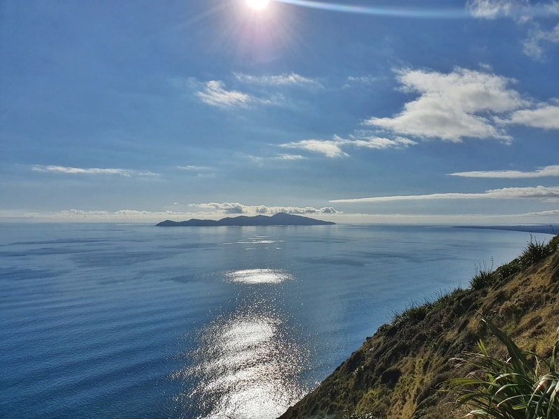
Why I love it? You get incredible views and there’s enough variety in the trail to keep things interesting. I didn’t get to hike this trail until 2017 but it was worth the wait and I’ve both walked and ran it plenty of times since.
And you might see one of my favourite birds, the Tui, on the way.
When1: March 2021 (the most recent trip).
Difficulty2: Medium to hard.
Walk Distance3: ~9.8km. This is from Maps.me which I also have when I used Strava (that’s from train station to station).
HWalk Duration4: ~2 hours one way walking. For most people, it’ll take 2-3.5 hours each way.
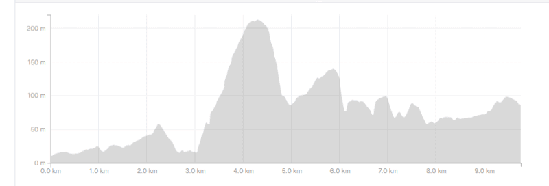
Elevation Gain5: According to my Strava data the total elevation is about 420 metres (one way) of elevation gain.
Here’s the Paekakariki Escarpment Track elevation profile from north to south:
RELATED READ: 5 MORE EPIC ATTRACTIONS ON THE KAPITI COAST
2. PAEKAKARIKI ESCARPMENT TRACK MAP
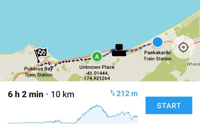
Above is the trail as seen on Maps.me.
Weirdly, Google Maps has some of the trail marked, but not the whole route. But that’s okay as you shouldn’t get lost.
If you do somehow get confused, any local will point you in the right direction. And there are plenty of trail markers once you’re on the trail (you’re on the road for the first little bit).
Afterward walking the Paekakariki Escarpment Track you might want to consider flying the unique Fly by Wire nearby.
3. HOW TO GET TO THE STAIRWAY TO HEAVEN WALK
Driving: If you’re driving, the best end to start from is the Paekakariki end so you can park at the train station which is accessed from Tilley Road (avoid parking on Ames Street).
If you’ve decided you only want to walk one way, catch the train from Pukerua Bay Station back to Paekakariki (don’t forget to bring cash for the train).
Alternatively, you can park at Pukerua Bay Station and complete the route from south to north.
Public Transport: This is super easy given the trail starts and finishes at train stations (why can’t every hike be like this). The Paekakariki and Pukerua Bay train stations are located on the Kapiti Line which services stops between Wellington and Waikanae seven days a week.
If you’re coming from Wellington, the journey takes 36 minutes to reach the Pukerua Bay Station and 46 minutes to Paekakariki Stations.
What I recommend: I recommend getting off at the Paekakariki Station and walking south towards Pukerua Bay. After you’ve finished, all you need to do is wait for the train back to Wellington. Or you can be ambitious and continue walking south along the Wairaka Walkway to Plimmerton which is another ~12km.
You can plan your train trip (and see the train fares) using the Metlink Planner.
4. MY PAEKAKARIKI ESCARPMENT WALK EXPERIENCE
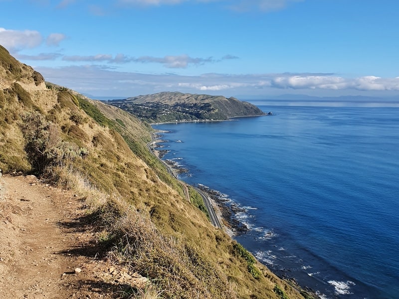
The most popular route is to start from the Paekakariki and walk south which is what I’ve mentioned above. This is the direction for this trip report.
Arriving in Paekakariki, there are lots of activities to do in this small beachside village. The main street is right by the station and has a few nice cafes and shops.
When you get out of the train, walk south until you reach the railway crossing. Cross the tracks and continue walking south through the forested area until you connect with the footpath again. Shortly after this, you’ll see stairs leading you under the highway to the trail (photo below).
Alternatively, you can turn right to walk past the town shops (pick up some hiking snacks?) and turn left onto Ames Street. Once you reach the end of Ames Street turn left and you’ll see the stairs going under the highway.
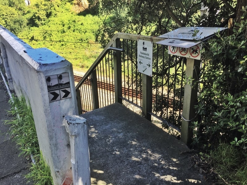
This is the set of stairs that takes you under the highway.
Once you’re on the other side of the highway the trail begins with some easy undulations. You’ll get some nice views early on. It’s the perfect warm-up, as the calves are going to be burning shortly.
If you haven’t warmed up, you’ll start to wonder how on earth you’re going to reach the summit…but don’t worry, you will.
Moving on, if you’re afraid of heights, the lack of any guardrails tests your nerves as you trudge uphill to the lookout. As you’re on private land, please stay on the track so it stays open in the future.
Note: there aren’t many stairs going up this way, you’ll get them on the descent.
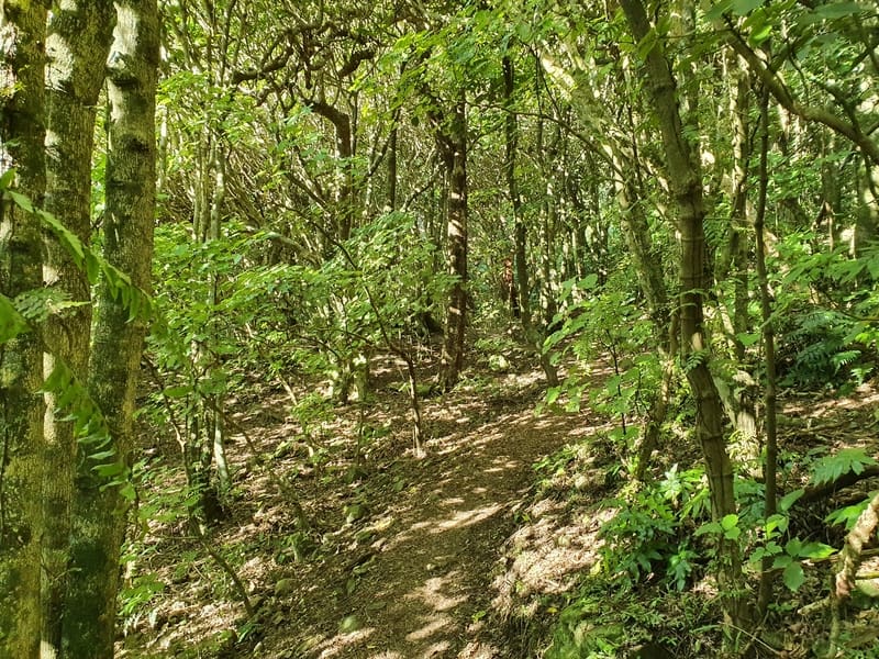
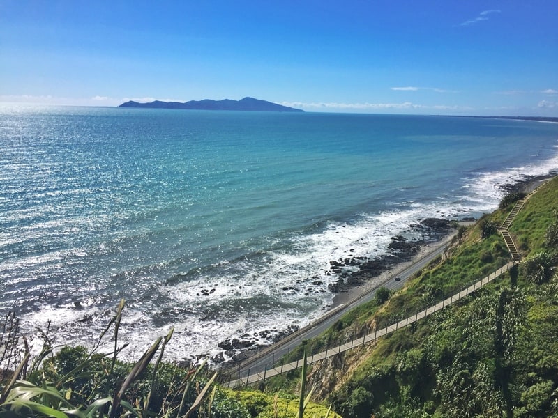
As you continue to climb you’ll be looking toward the stunning Pukerua Bay. Don’t forget to glance behind at Kapiti Island (yes, you can visit Kapiti Island on a day trip).
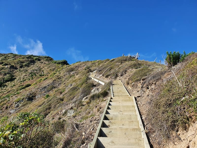
Once you reach the top there are some benches if you need a break before the steep flights of stairs await your descent. The stairs are in good condition, but you do need to concentrate as they aren’t all even.
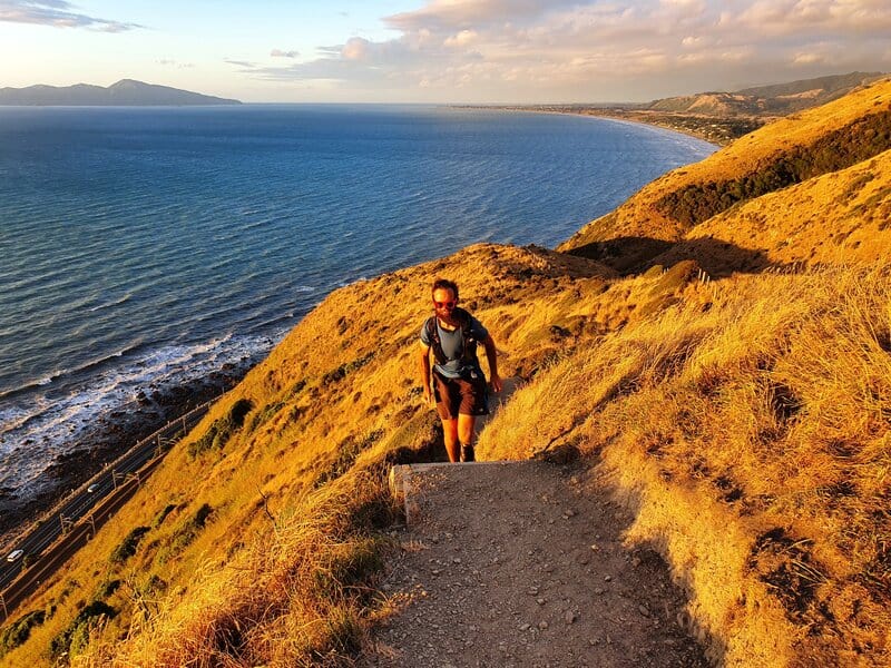
p.s. The sunset is amazing from the top of the walk on a good day. There’s a lot fewer people too! Just bring a headtorch of some description 🙂
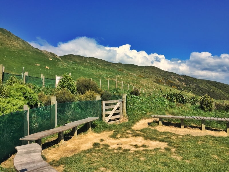
At the summit, about 200 metres above sea level.
As you make you’re way back down through the second half of the track you’ll walk through some short sections of forest which are a welcome break on a sunny day. The two swing bridges that assist you over the valley are photogenic.
One of the two swing bridges you’ll cross along the way.
The last kilometre of the walk is a bit boring once you reach the old Muri train station and walk through the residential section of Pukerua Bay.
But you’ll be buzzing (and/or puffing) from the walk, so you could say it’s a nice way to cool down before jumping on the train to your next destination.
If you’re feeling good, you now turn around and do it all in reverse!
Alternatively, there’s a footpath next to the highway that you can take back to Paekakariki if you want to walk back without the elevation.
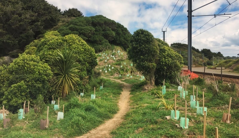
You’re on the home stretch here.
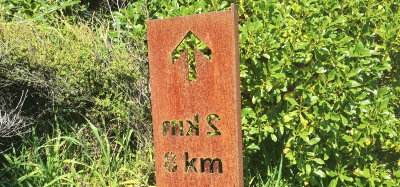
You’ll see these signs along the way letting you know how far you’ve been, and how far you’ve got to go.
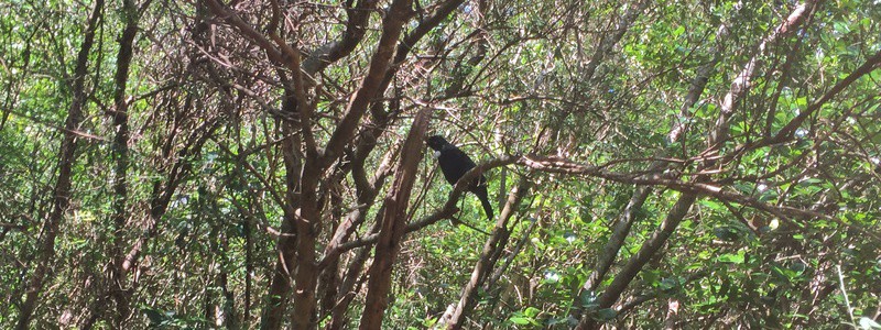
Keep a look out for these birds with the white fluffy collar. They’re awesome.
The Paekakariki Escarpment Track is a great adventure that’s not too far from Wellington for a day of walking.
If you need help with anything about the Paekakariki Escarpment Track, email me at jub@churnewzealand.com or comment below about your experience on the trail.
RECOMMENDED READING
Answering what to do in New Zealand
Now go get it!
5 nice walks in Waikanae
If you’re looking for more nice walks in the area, Waikanae has some beauties.

Hey, it’s Jub here. I’m the guy behind Chur New Zealand, helping you have the best time hiking, trekking, walking…whatever you want to call it…in NZ. I’m based in Queenstown and am always out and about exploring trails, old & new. If you have any questions, reach out.

I did walk yesterday. Was doing good walk up all the stairs. I saw the 7 k marker read the Pukerua board .But end up going back to Paekakariki. Dispolnt in my self miss the swing bridge s .If I when how come I did go down the .Please tell what did wrong. Kindrehard Alan Carter
Hey Alan, good stuff on making it up the stairs. Not quite sure what you’re asking there when the typos came into play 🙂
Cheers
Jub
Hello,
I’m planning on walking the Escarpment Track on November 29th. What time would you recommend leaving Wellington if we wanted to be there for sunset? Assuming it takes us 3.5-4 hours one way. For sunset, would you recommend walking in a certain direction? Is one direction easier than the other?
Kind regards,
Casey
Hey Casey,
I would definitely walk from Pukerua Bay to Paekakariki. Departing Wellington, I’d aim for 4 departing from Wellington…but it depends on where you want to be for sunset.
Have the best trip!
Cheers,
Jub