The Manawatu Gorge Track, a.k.a. ‘the Gorge’ to locals, is a ~10km end-to-end walk following the Manawatu Gorge close to Palmerston North. You’re in the forest for most of the trail but there are enough viewpoints and things to see to keep it interesting.
There’s the inconvenience of getting to and from the trailheads (unless you do an out and back), but if you’ve got a plan for that, this is a great value walk in an area international tourists overlook.
This post will give you the details you need to know about the Manawatu Gorge walk, one of the most popular things to do in Palmerston North.
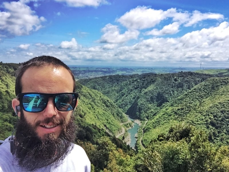
TABLE OF CONTENTS
1. Manawatu Gorge Track Details
2. Manawatu Gorge Walk Map
3. How To Get There
4. My Manawatu Gorge Trip Report
1. DETAILS ABOUT THE MANAWATU GORGE WALK
The walk itself is awesome. I was super lucky my Aunty dropped me off at the trailhead, and managed to hitchhike (easy in NZ) back to Palmerston North easy enough. But, it’s definitely an inconvenience.
The track is well maintained and there are lots of little sites along the way to check out. It would be nice to see more of the river, but there’s only so much that can be done about that. 10km is a good distance, and with minimal elevation, it’s doable for most. As long as you can get to/from the track okay, pop it on your list of possible things to do in New Zealand.
So while it’s cool, I wouldn’t go as far as making it a WOW worthy walk. That said, the hiking standards are high in NZ!
How long is the hike?
It’s ~10km end to end according to the DOC signs, but then it says 11.2km on their brochure? Maps.me has it at about 10km too, if you take the little side trips.
How hard is the Manawatu Gorge Track?
Easy-medium. There’s the ascent to begin with, and then the track gets rugged for a couple of brief moments but anyone with reasonable fitness will be able to finish this without too much whinging.
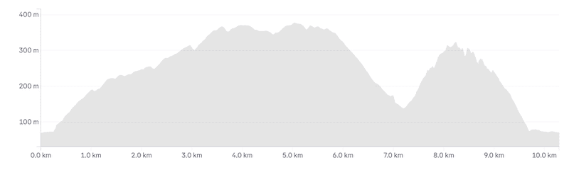
What’s the elevation profile look like?
The elevation gain is about 320 metres for the track. Here’s what the elevation profile starting from the Ashhurst end:
How long does it take to hike the Manawatu Gorge Track?
The walk took me just over 3.5 hours. I was surprised it took me this long as I normally walk a lot faster than recommended times. The DOC brochure suggests 3.5-5.5 hours, which I think will be accurate for many of you. But you can certainly do it in under 3 hours if you’re short on time.
2. MANAWATU GORGE WALK MAP
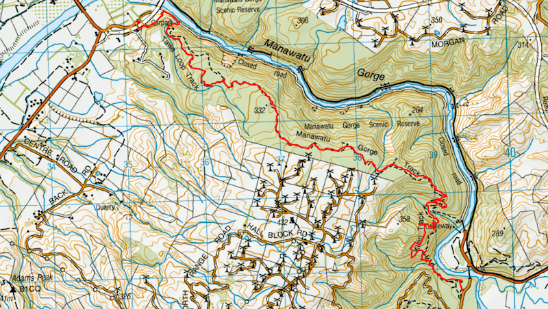
The map above is a GOX file of the walk on top of topomap.co.nz. You can click the image above to open it in a new window/tab.
Unfortunately, the track isn’t on Google at all, but it’s on Maps.me and on NZTopo50 of course. The track is well sign posted.
You can download the Manawatu Gorge Track GPX file here.
3. HOW TO GET TO THERE
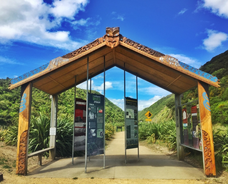
This is next to the Ashurst trailhead.
There are two traileads. One at the Ashhurst Road end here and the Woodville end about here.
You can start from either end of the track. In terms of walking, with either route, there’s an incline to start as you make your way to the top of the gorge before walking along the top of the mountain range and descending at the end.
My experience is starting from the Woodville End, but I believe most start from the Ashhurst End.
Driving: As it’s an end to end walk, you could drive to one end (Ashhurst has the nicer car park) and walk there and back. Otherwise, you’ll need to do a key swap or some other kind of arrangement if you aren’t lucky enough to have someone drop you off. I like how this post displays the options for this.
Public Transport: Public buses go between Palmy and Ashhurst on weekdays with a very limited schedule that are $4 each way for adults. This is a good option to get there, but as they only run a couple of times a day, you’ll need to be careful with your timing to get back, otherwise, you’ll be hitchhiking. You can check the timetable here (bus #114). Also, consider there’s a walk to get to the trailhead from where the bus drops you off.
Shuttles: If there’s a group of you, call Palmerston North City i-SITE and they should be able to arrange a shuttle for you. Phone: +64 6 350 1922.
4. MY EXPERIENCE ON THE MANAWATU GORGE TRACK
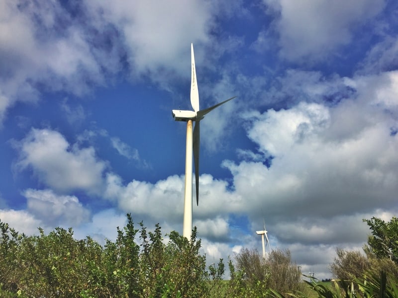
The Te Apiti Wind Farm is just across the river from where you’ll be walking.
My Aunty dropped me off at the Woodville end trailhead at about 10.20 am and I was surprised there was just the one other car in the car park. I’ve always thought of this as a popular hike.
Ugh.
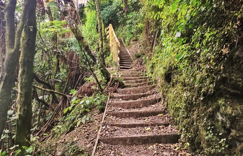
It’s easy to get started with big signs on the trailhead leading you into the bush. It was a flat start to the walk which soon got intense going up the stairs. I made it okay, but they were unexpected which caught me off guard. Just plod along, and know once you’re up the top of the stairs you’re basically there. All that’s left is a few switchbacks to the top of the range. From then on you’ve got gentle undulations and flat track walking the rest of the way.
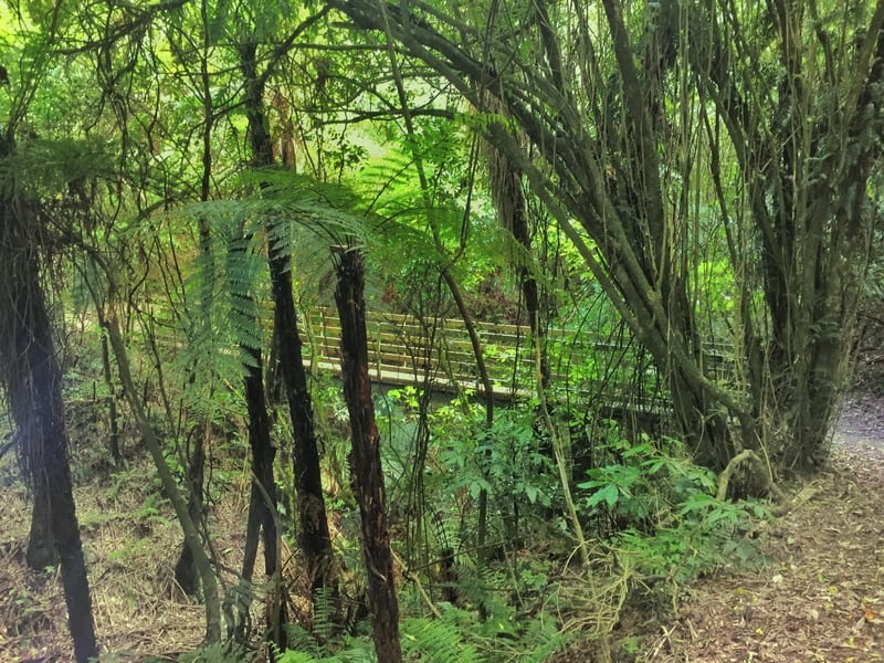
Rugged, and beautiful.
I made the decision early on to visit all of the little lookouts that running off the main gorge trail. It only a few minutes to see each oneach one, so unless you’re short on time I recommend them. The viewpoints are:
- Windmill Lookout
- Sentinel Lookout
- Windy Lookout
- Te Apiti Lookout
- Tom’s Lookout
- White Horse Rapids Lookout
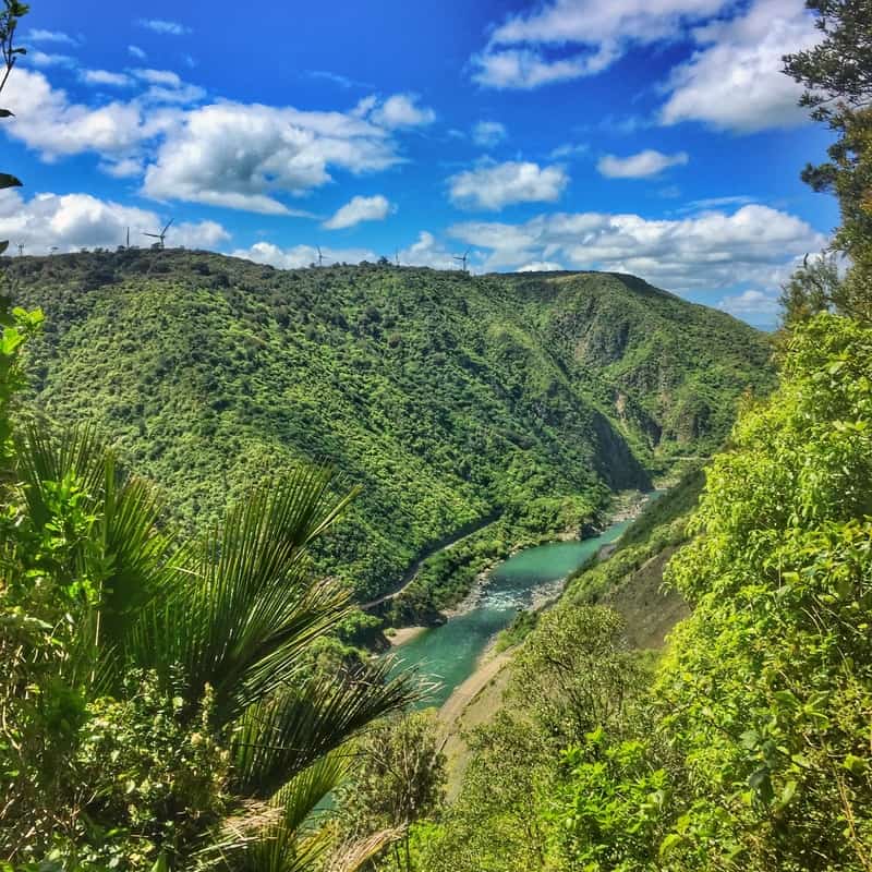
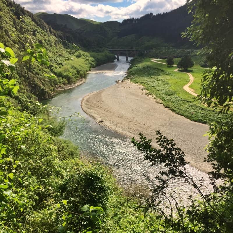
The best viewpoint is definitely White Horse Rapids.
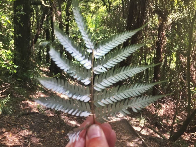
Keep an eye out for some silver ferns!
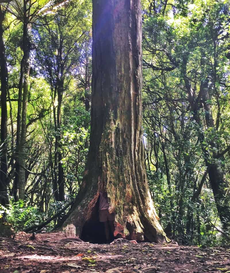
Can you see me?
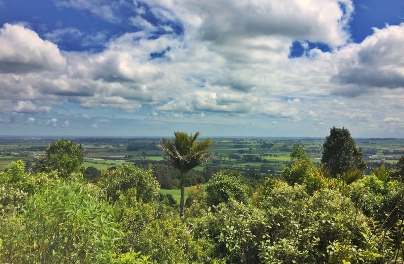
Does this feel tropical to you?
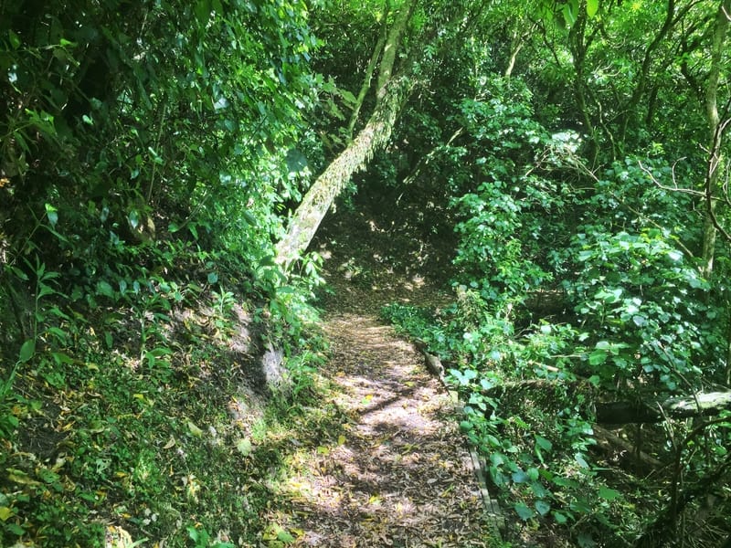
As I said earlier, once you’re at the top of the gorge it’s a smooth walk from here. The trail is well maintained, and there’s nothing too crazy about it. The forest feels different from the Tararua Ranges and in reading about the hike on other sites, it must be the Nikau Palms and the tropical feel they portray. The greens were a lot brighter!
The view from Tom’s Lookout
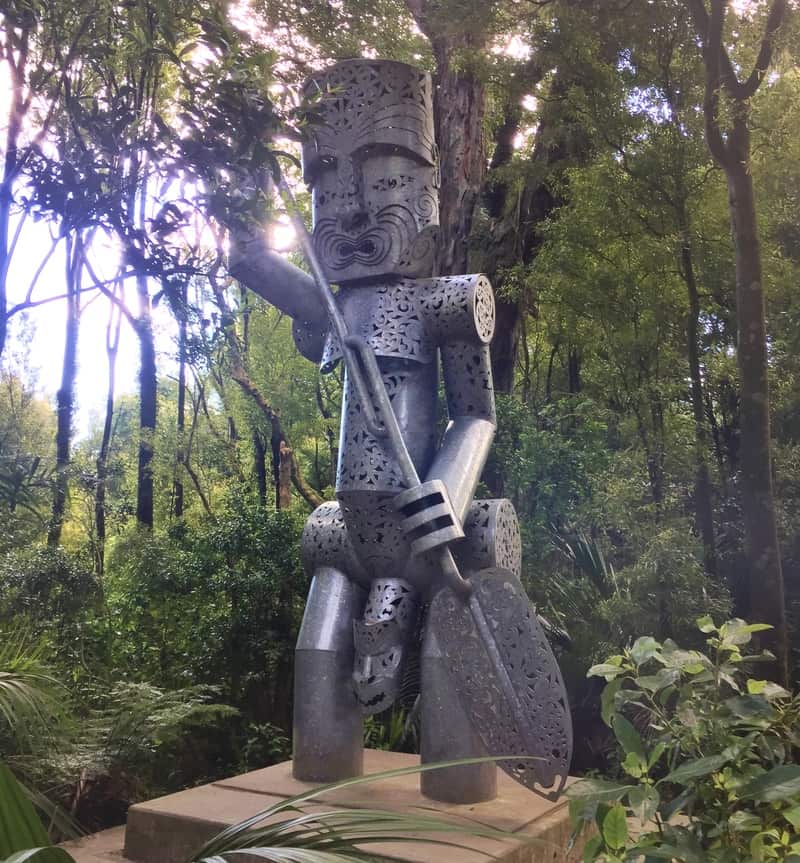
The Whatonga Monument
Stunning.
Once you reach the Te Whatonga monument you’ve got a decision to make. This is the halfway point of the Tawa Loop Track that starts at the Ashurst trailhead. If you veer left, you’ll go past Tom’s Lookout, but you’ll need to turn around when you reach Tom’s Lookout so you can take the other route and pass the White Horse Rapids Lookout (the best one).
I suggest doing this unless you’re short on time, because why not? It’ll add a bit of distance to the walk so if you don’t really like the viewpoint above just turn right 🙂
After the White Horse Rapids, you start the descent down the mountain. It’s gradual enough so your knees won’t hate you. The last section along the river is stunning, and there’s plenty of information to read about the area in the shelter too.
From here, I’ll leave you to figure out your transport!
Damned if you do, damned if you don’t. I wish it was easier to access this hike, but that would probably make it too popular and I’d complain anyway. Nevertheless, if you’re looking for a nice hike between Tongariro National Park (do the Tama lakes Track!) and Wellington.
If you have any questions or suggestions about the Manawatu Gorge Track, leave them below or email jub@churnewzealand.com.
Chur.
p.s. Here’s a map of all the hikes documented on Chur New Zealand. You can click the icon to see brief details, as well as a link to read more about the hike (like this post).

Hey, it’s Jub here. I’m the guy behind Chur New Zealand, helping you have the best time hiking, trekking, walking…whatever you want to call it…in NZ. I’m based in Queenstown and am always out and about exploring trails, old & new. If you have any questions, reach out.
Is it possible to walk the old road through the gorge?? That is what Id be more interested in doing – seeing all the familiar bends and bridges etc.
Hey Frances, from what I understand it’s not. Legally at least 😉