There are two Cameron Hut’s in New Zealand. This post will be about the Cameron Hut in Mount Aspiring National Park, Otago. NOT the Cameron Hut in Canterbury with the purple door.
This isn’t a popular hike in the area. This hike is for you if you’re looking for something off the beaten path, that’s challenging and just want to check out another hike in Mount Aspiring National Park.
TABLE OF CONTENTS
1. Details About Cameron Hut
2. Cameron Hut Map
3. How To Get There
4. My Cameron Hut Experience
1. DETAILS ABOUT CAMERON HUT
QUICK DETAILS:
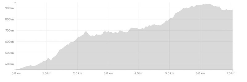
- Distance: ~7km each way
- Elevation Gain: ~1126 metres total return
- Best for: Experienced hikers
- Download the GPX File
How hard is the hike to Cameron Hut?
It’s tough! Much tougher than I expected. It’s a hike that I think a few people will turn around on based on how much slower going it is than planned.
It’s slower going than Earnslaw Burn‘s first 8km, but similar to nearby track to Makarora Hut.
What is the distance to Cameron Hut?
~7km. That was based on my watch, but given the route is through a narrow river valley for a while, I wouldn’t be surprised if the data isn’t totally accurate. Plan for it to be a little longer, then be surprised when it’s short 😀
What is the elevation gain of the route to Cameron Hut?
My watch recorded:
- 816m there
- 310m back
For a total of 1126 metres gain. You’re watch could be 150 metres higher or lower I reckon…it’s a tricky track with subtle ups and downs that some watches catch, some don’t, and the narrow valley.
Here’s the elevation profile from the trailhead to the hut:
How long does it take to hike to Cameron Hut?
DOC says 4-5 hours one way, which is a pretty slow route for 7km! But plan on that, as it took us about 3.5 hours to get in, and I’d like to think we weren’t slouching. The first 500 metres is the quickest of the trip. From there, it’s a slog.
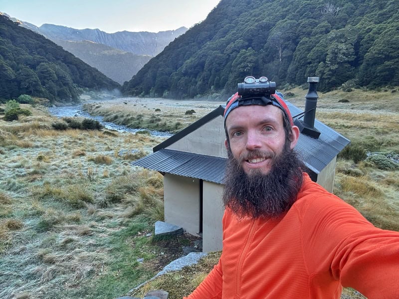
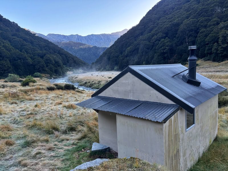
About Cameron Hut
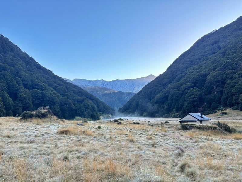
I really liked out short stay at Cameron Hut. We were ther stay in mid-March on a Friday night, with no one else at the hut. There was a light frost in the morning, but I’d love to have stayed a bit longer to enjoy the areas around the hut…like the waterfall!
The fees for the hut are (as of May 2026):
- Adults (18+): $10/night
- Children (5 to 17 years): $5/night
- Kids under 5 years: free
Booking are not required, so make sure to buy your DOC hut tickets in advance. Backcountry Hut Passes are valid here.
Here’s a couple of photos of the hut interior: 1, 2.
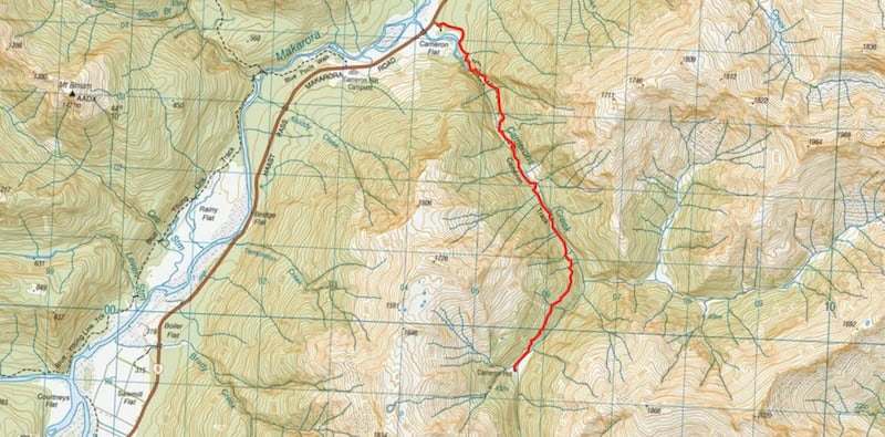
CAMERON HUT MAP
The map below is this
Clicking the image below will open the map in a new window.
3. HOW TO GET THERE
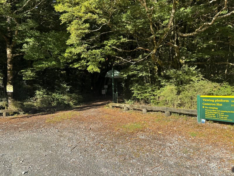
The trailhead/carpark is located here (photo of carpark above).
It’s 60km/50-minutes north of Hawea township, 73km north of Wanaka. It’s a short drive from the famous Blue Pools. It’s 67km/1 hour from Haast.
The easiest way to get there is by driving yourself. You could get a shuttle but that’s likely to be very expensive. If you’re confident, you can hitchhike there fairly easy.
4. MY CAMERON HUT (OTAGO) EXPERIENCE
The trip to Cameron Hut had been postponed several times over the summer as we didn’t want to go during mediocre weather knowing there was a river crossing to be done.
We finally had a window that worked so it was all on, but it was going to be a quick trip as we were meeting friends to camp at Brewster Hut the following night.
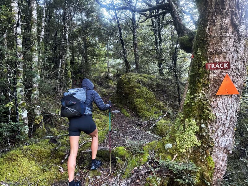
After arriving to an empty carpark, later in the afternoon than we’d planned, we set off. The first few hundred metres is easy with a gentle incline on a well maintained track as you work towards a viewpoint that’s detailed at the trailhead.
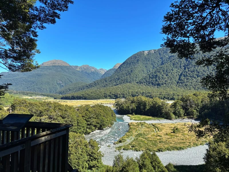
When we were there, the viewing platform was closed but you still get a solid view. The way the lighting is, it’s better seen earlier in the day (or on your way out).
There’s a small climb, but enjoy this section as it’s likely to be the fastest you’ll move on the whole journey to the hut.
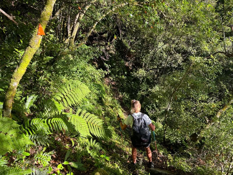
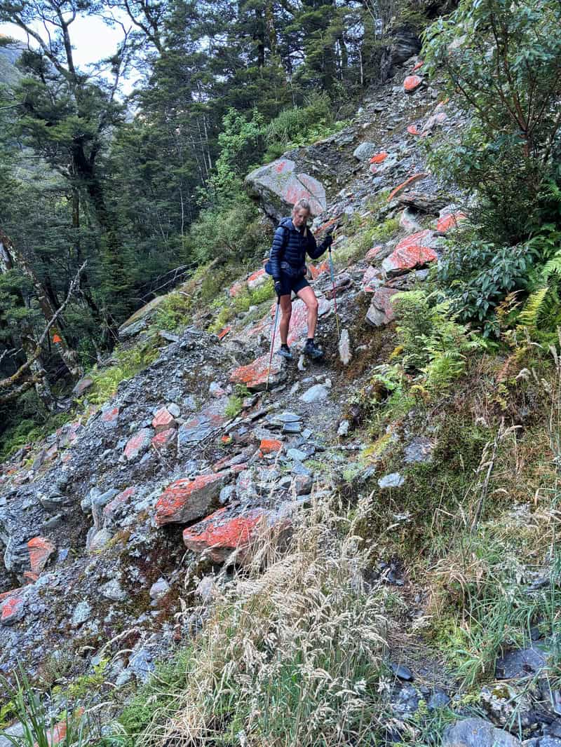
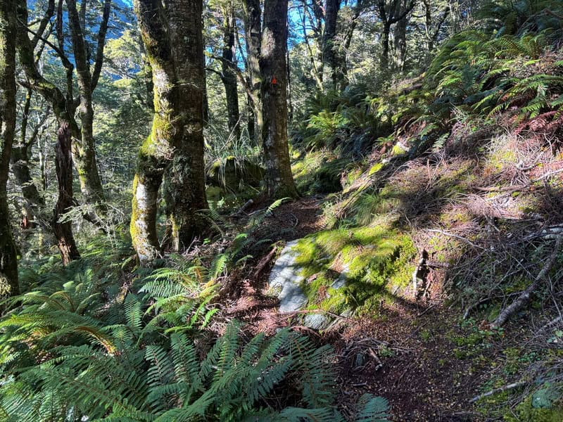
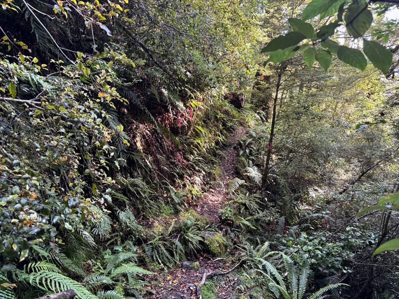
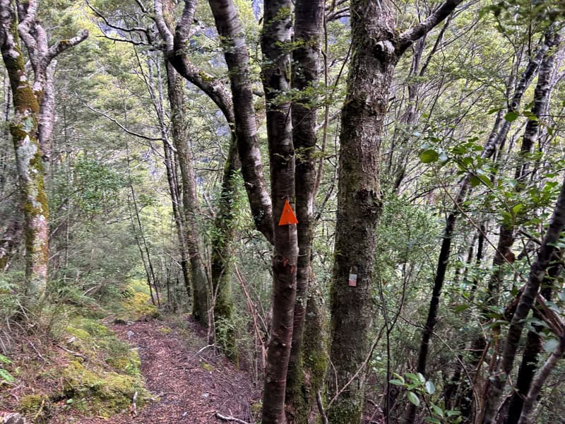
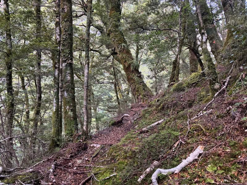
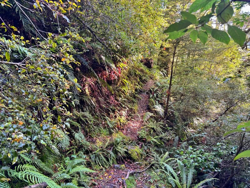
After you pass the viewpoint, the trail gets narrower, and a lot more rocky, slippy, and rooty. Looking at the elevation profile, the first climb makes sense. It’s pretty relentless and the techy terrain makes it feel steeper. If it was wet, this wouldn’t be fun.
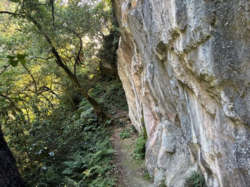
There’s a couple of spots where you do need to be careful with your footing as the track is narrow and slipping wouldn’t be fun. I wouldn’t call it exposure but it wouldn’t be a fun fall.
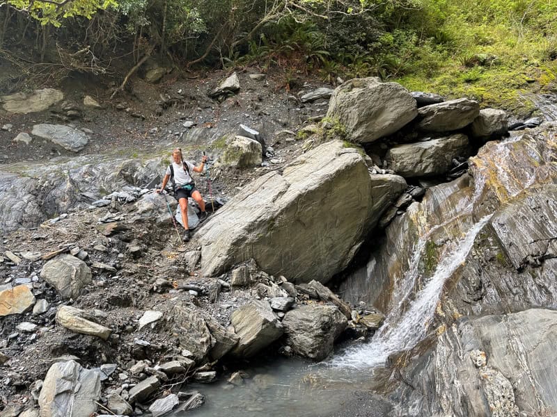
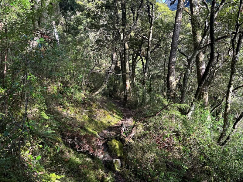
The small stream in the third photo below is a simple one to cross (in good conditions).
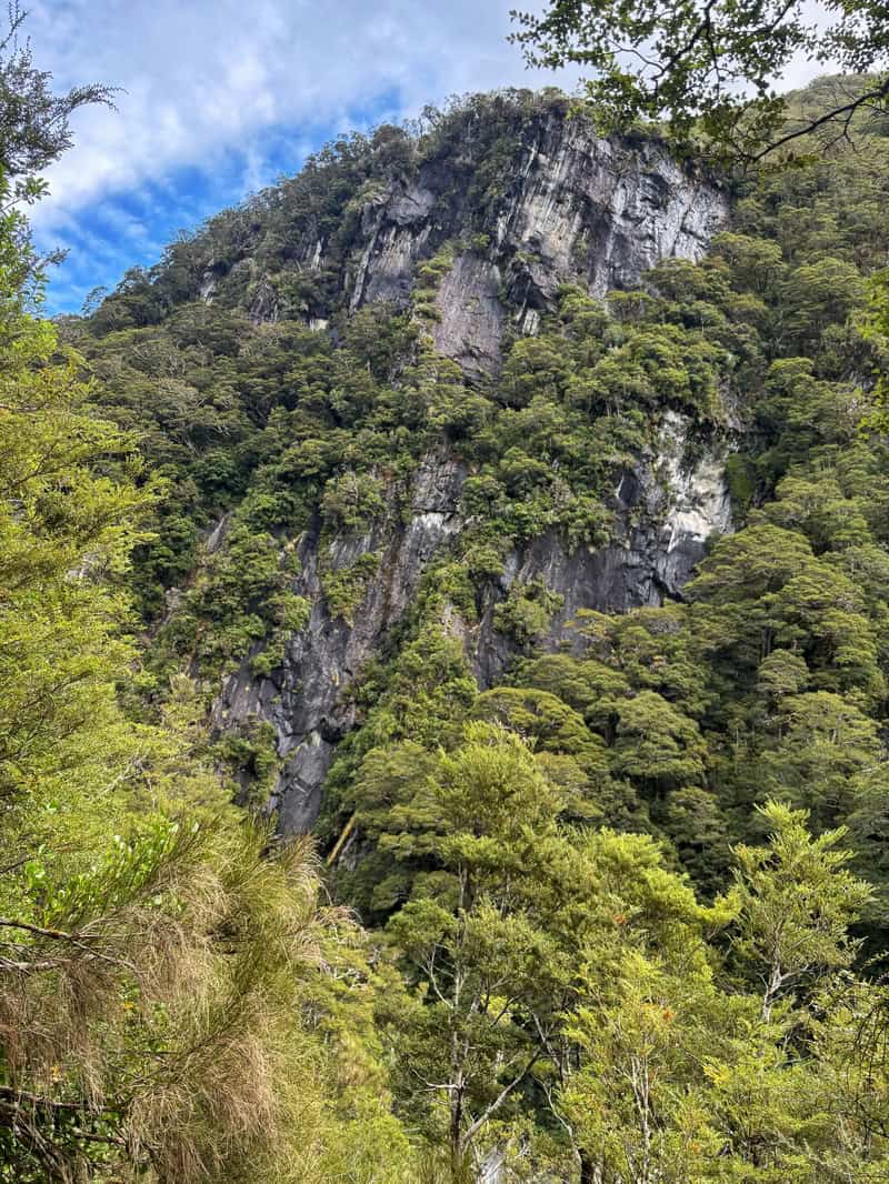
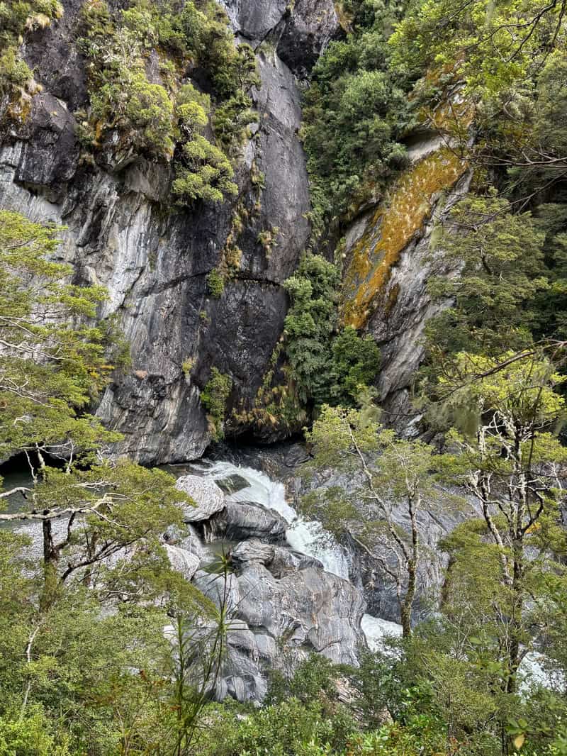
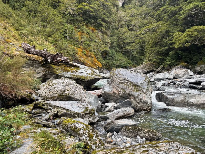
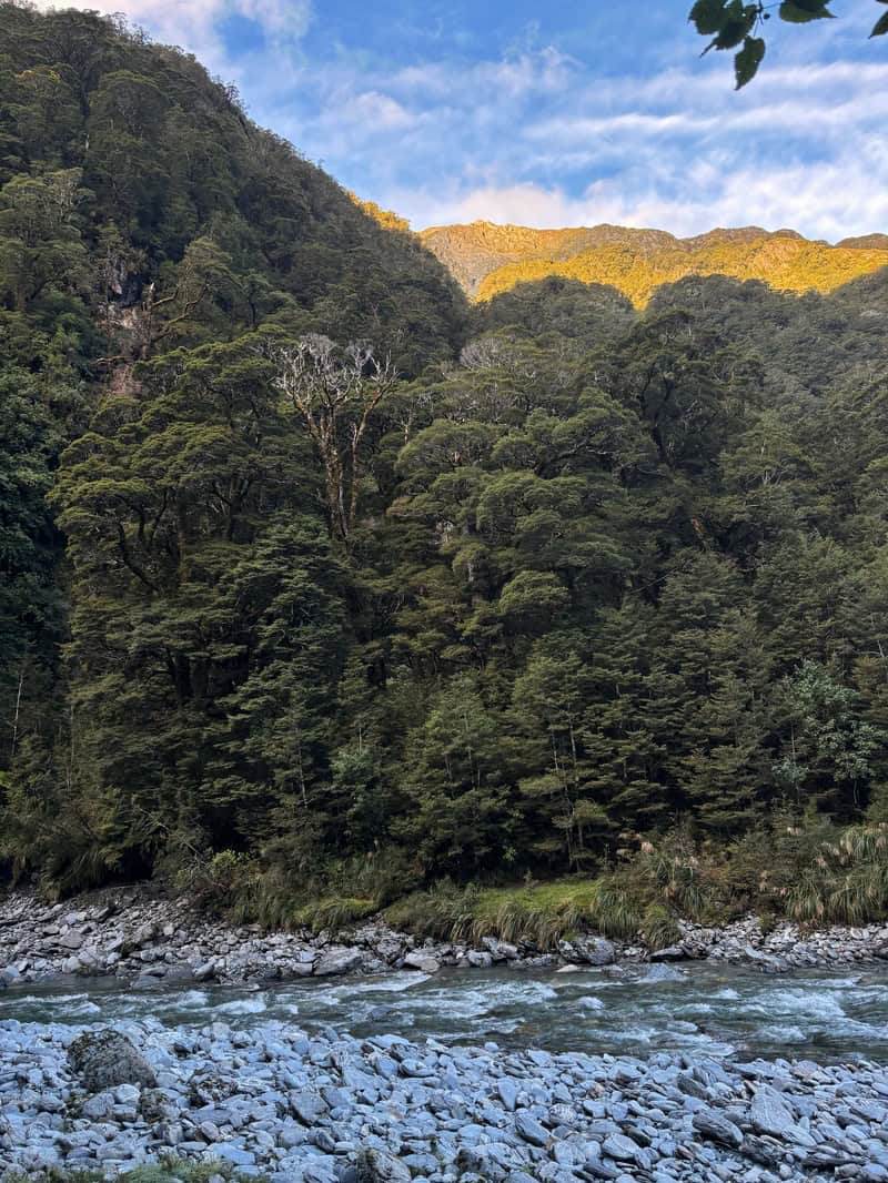
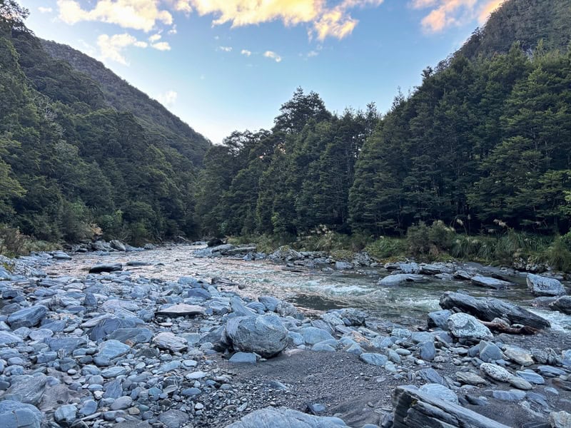
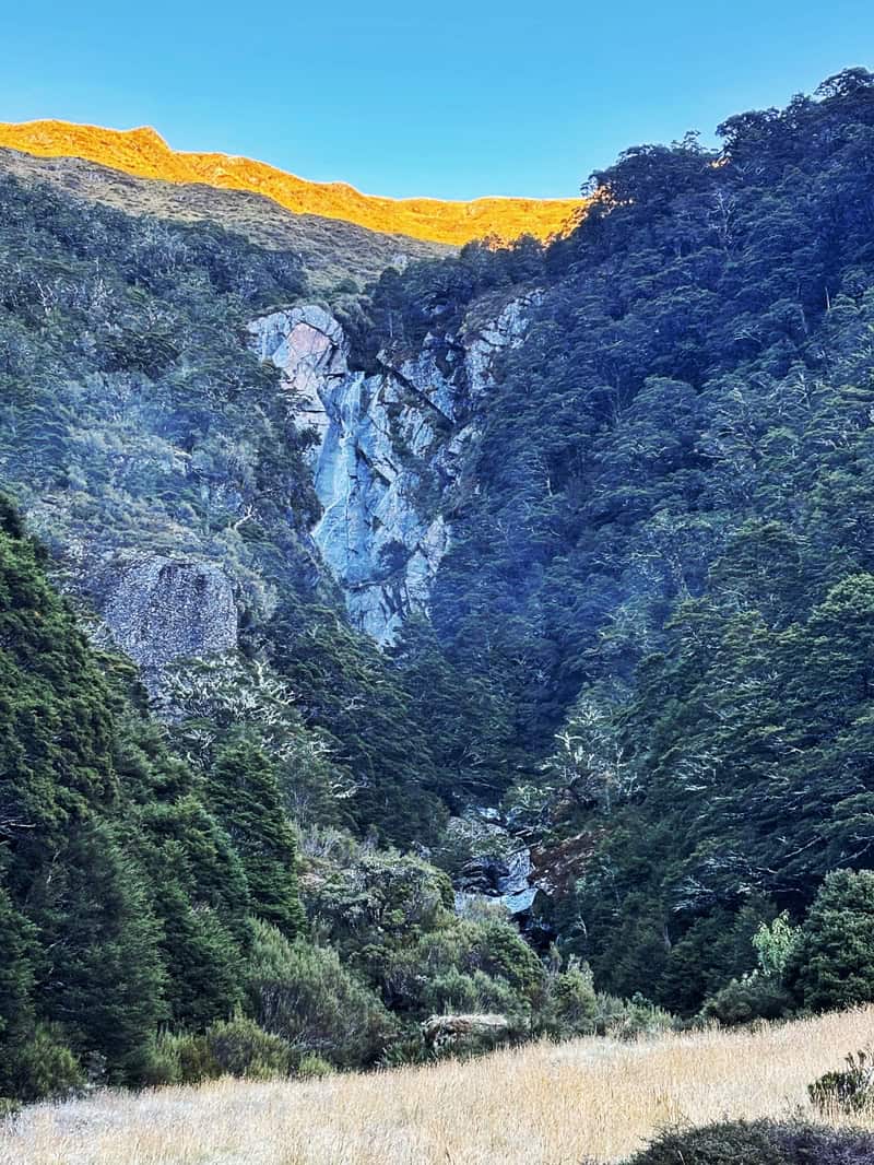
It’s hard to know where the top of this climb is. But eventually you’ll be making your way down towards the river. If you see any openings, enjoy the view…it’s a cool canyon through the river (which is weirdly called Camerons Creek…it’s not a creek).
Note, it can be slippery on the descent in spots, even if it’s been dry.
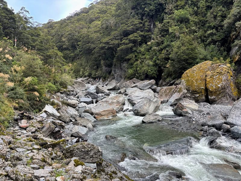
You’ll hit the riverbed once, before back onto diddling back into the forest.
The next time you get down onto the river I found confusing. On the topo map it looked like you cross the river straight away, but that looked like it wouldn’t be the safest crossing. Eventually I decided to go up stream an spotted an orange triangle pointing further up the river. Like 150 metres or so?
Keep hopping along and you’ll see the orange triangle on the opposite side of the river (third photo below). The crossing on the day we wer there got to about knee depth, it was fine. But you can see with any rain how it could get sketchy fast.
On the other side, it’s back into the forest for a bit. It’s much of the same, rocky, rooty and just slow going. I personally enjoyed it, my partner wasn’t a big fan.
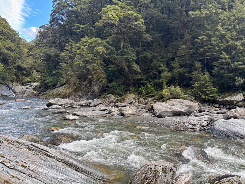
You’ll drop back to the river a bit more here. It’s pretty sweet.
Eventually we spot a sign for the high river route…and while the river was low…we decided to take the high route as we didn’t want to have to turn around with fading light.
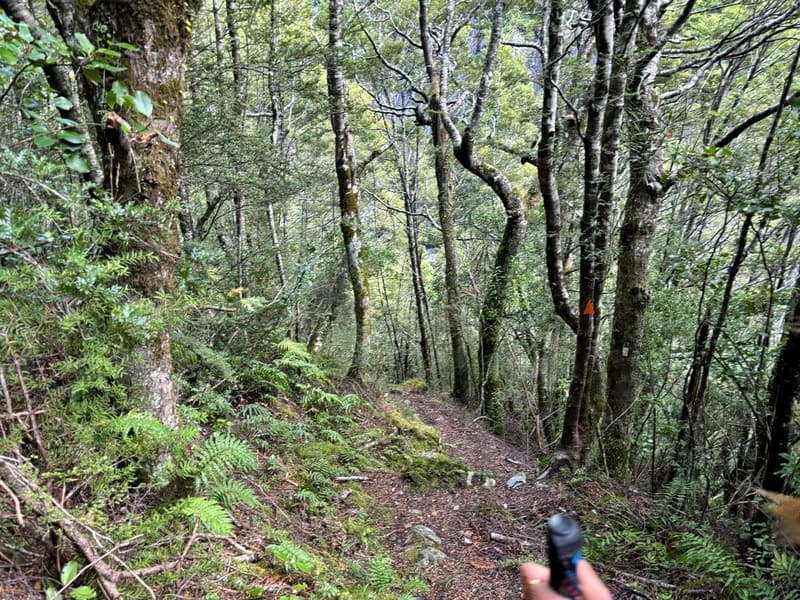
The trail here is relatively easy to follow as it cruises up and down the side of the valley (you’ll touch the riverbed briefly a couple of times. There was some treefall, but it’s just one of those trails that is hard to get any real momentum on. I wouldn’t say there’s exposure, but it’s not a place you’d want to slip at times.
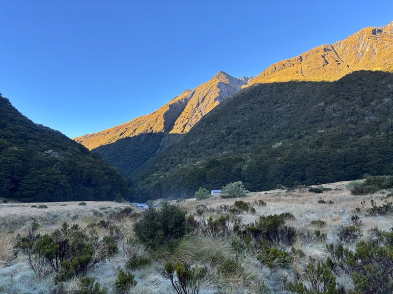
Darkness then set, and I was worried if we’d have to set up camp in the bush if the trail got harder. But despite a bit of treefall, we managed to find the way alright and eventually came out into the flats of the valley. Phew! Waht a time.
We soldiered on, and with a couple of short stream crossings came across the hut (this was longer then we thought).
That amazing feeling where there’s noone in the hut! So good.
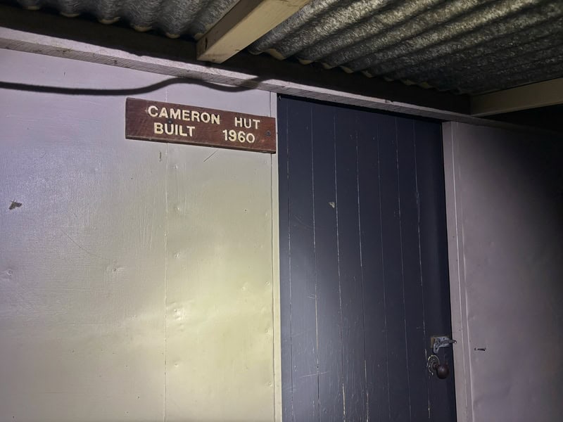
The hut is nice. It’s just a wee 4 bed hut, but there’s always going to be a reasonable chance you’ll have it to yourself as it’s really not a super popular hut. I would take a tent though, just in case.
In the morning, we didn’t have a lot of time to explore as we had to get the work done for the Love Our Huts campaign and then meet friends at the trailhead.
But it was nice in the valley, and the nearby waterfall looks great to explore. You can take a dip in it according to friends that have…brrrr…I’ll pass.
The hike out is only marginally faster as it’s the kind of terrain that’s just slow. It helps knowing where you’re going, that’s where you benefit from the time saving I find.
Back at the carpark, remember to have your post hike snacks and beverages ready! Hopefully something is open in Makarora, but just in case, be ready.
A trip to Cameron Hut is awesome, if you’ve got the right expectations. You’re in for a tough hike, but it’s a good challenge and with a good chance of getting the hut to yourself, worth it!
Got any questions or comments about a trip to Mount Aspiring National Parks Cameron Hut? Leave a message below or email jub@churnewzealand.com.
Chur.
p.s. Here’s a map of all the hikes documented on Chur New Zealand. You can click the icon to see brief details, as well as a link to read more about the hike (like this post).
p.p.s. here are some more photos of the track that weren’t used in the post.

Hey, it’s Jub here. I’m the guy behind Chur New Zealand, helping you have the best time hiking, trekking, walking…whatever you want to call it…in NZ. I’m based in Queenstown and am always out and about exploring trails, old & new. If you have any questions, reach out.