Note: I need to add more Ben More Peak photos after I get my phone fixed 🙂
If you’re looking for an off the beaten path peak to summit, then put Ben More (Otago) on your list.
The 15.5km hike will make you work hard, but you’ll get plenty of elevation, beautiful ridgelines, views, and a trail to yourself (98% of the time).
It’s a stunning hike for those with a good amount of off trail experience.
Make no mistake, it’s a challenging hike compared to the lovely, but easy Moke Lake Loop.
Note: This is about the Ben More peak in Otago, not the one in Canterbury.
TABLE OF CONTENTS
1. Ben More Summit Details
2. Map of the Ben More Track
3. How To Get There
4. My Ben More Peak (Otago) Experience
1. DETAILS ABOUT HIKING BEN MORE PEAK
QUICK DETAILS:
- Distance: ~15.5km return
- Difficulty: Hard
- Time: 6 to 8 hours
- Download the GPX File here
How hard is the Ben More Peak track?
Hard. The majority of the track is off route. Add in the elevation gain, and terrain overall it’s a good push for most people.
What is the distance to the summit of Ben More, return?
From the Moke Lake carpark to the summit return, my GPX file came in at 15.5km-ish. There’s going to be some slight variations on each adventure depending on the exact route you take.
What is the elevation gain of the hike?
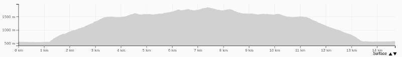
Again, this will vary a little bit on each adventure, but expect about 1600 metres based on my GPX file.
Here’s the Ben More elevation profile:
How long does it take to hike to Otago’s Ben More?
This is tough to gauge, but I would bank on at least 6 hours for most people, but upwards of 8 wouldn’t be a surprise. It’s a similar elevation gain and distance as the Ben Lomond Track, but being off track for most of the route and there’s some steep climbs…it’s going to take a long time.
Especially factoring in meal breaks and taking in all the views. This is a hike you’ll want to start early in the day.
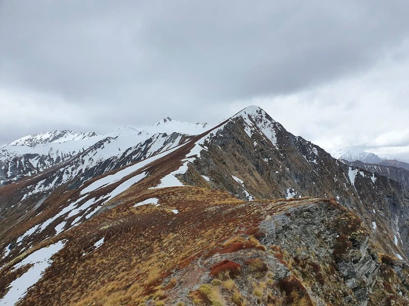
Can you hike Ben More in winter?
I attempted this once in winter, but hit the snow line after about 4km and it looked waaaay to sketchy to continue with my minimal experience. I’d say keep this one as a summer/autumn adventure unless you’re a mountaineer with all the gear and skills.
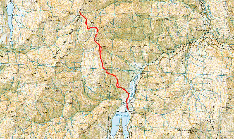
2. BEN MORE MAP
Clicking on the image below will open the map in a new window.
The map below is a GPX file of the route overlaid on a map from topomap.co.nz.
3. HOW TO GET THERE
The best route to Ben More starts from the Moke Lake carpark. From Queenstown, the Moke Lake carpark is a 20 to 25 minute drive.
The easiest way to get there is by car, just note the last 6km is on a gravel road. You can also hitchhike there rather easily, or you could arrange a shuttle for dropoff and pickup.
There are two accommodation options next to Moke Lake (for both ends of the budget) that might make your logistics easier:
4. MY BEN MORE SUMMIT EXPERIENCE
After a few failed attempts (one for snow, two for short on time), I was off on a solo mission to reach Ben More peak.
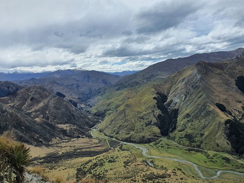
Starting from Moke Lake, you head off towards the Moonlight Track before veering off after a few hundred metres (download the GPX file for sure). There’s a 4WD track for a while with orange poles to follow (some of them are faded – non existent), but you’ll want to veer left and cross the creek.
This first 1km or so is mostly flat but you’ll need to weave through some matagouri as you approach the start of the gruntiest of climbs. It’s almost too steep to be able to see the next pole.
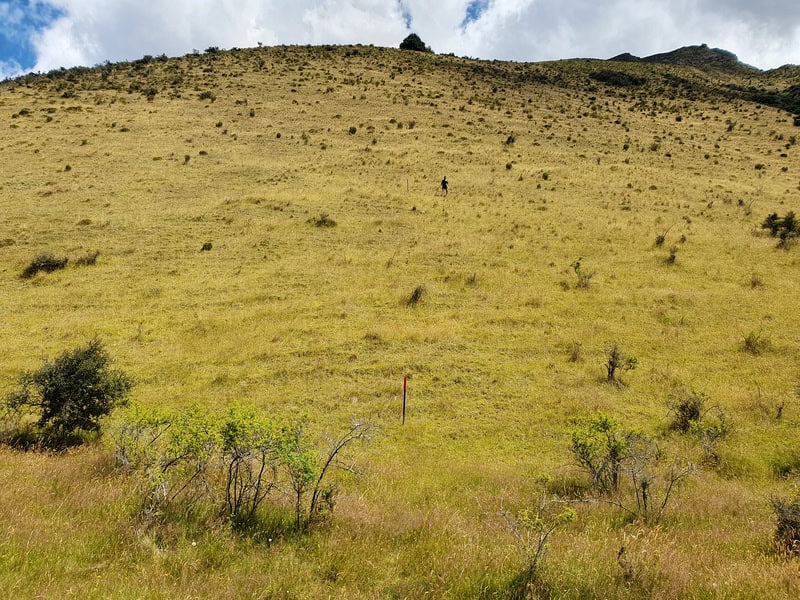
The next 2.5km are steep. Don’t burn all your matches too early.
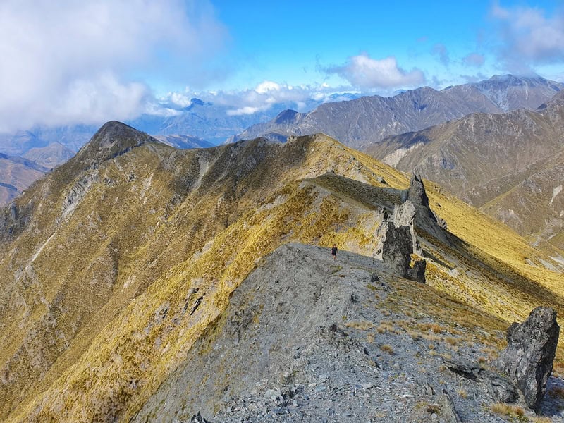
After the first 500 metres, you’ll see the sign exiting the marked route and you’re then entering the conversation area. It’s easy to see the ridge you’ll be following for the next couple of kilometres still…as it’s still up, up, up.
There’s a host of ways you can follow here with vague resemblance of paths. My goal was just to stay on the ride as much as possible as that’s where the animal tracks seem to be the clearest.
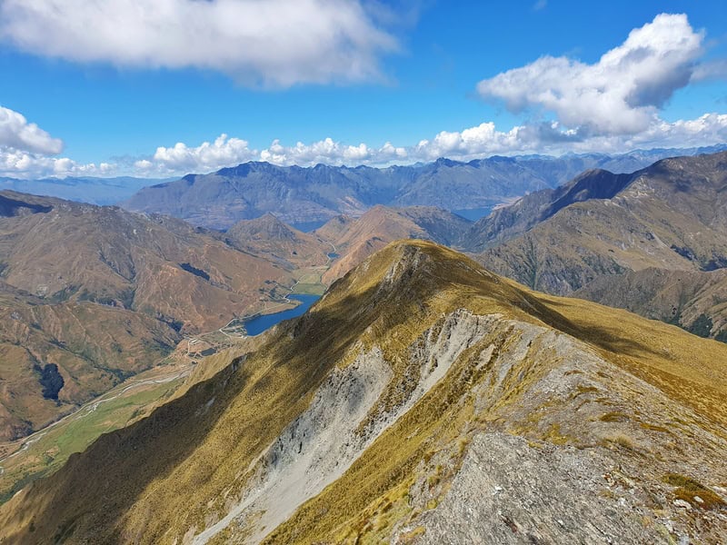
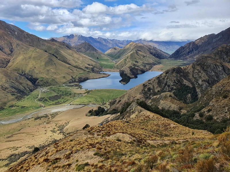
The steep ascent feels like it never ends, but it does! If you need the motivation, remember to look behind you as the views of Moke Lake and towards the Moonlight track are pretty awesome. You can see Ben Lomond too of course.
While I say stay on the ridge, don’t be silly along here as there are some vertical dropoffs.
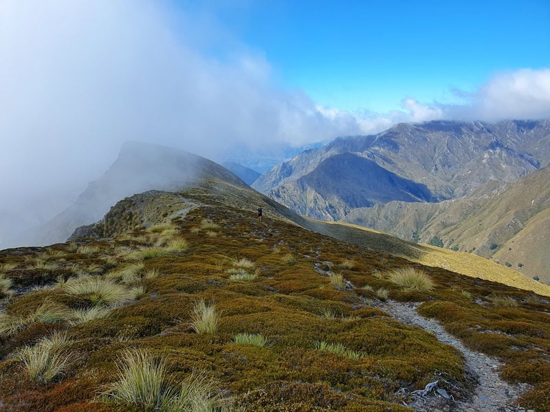
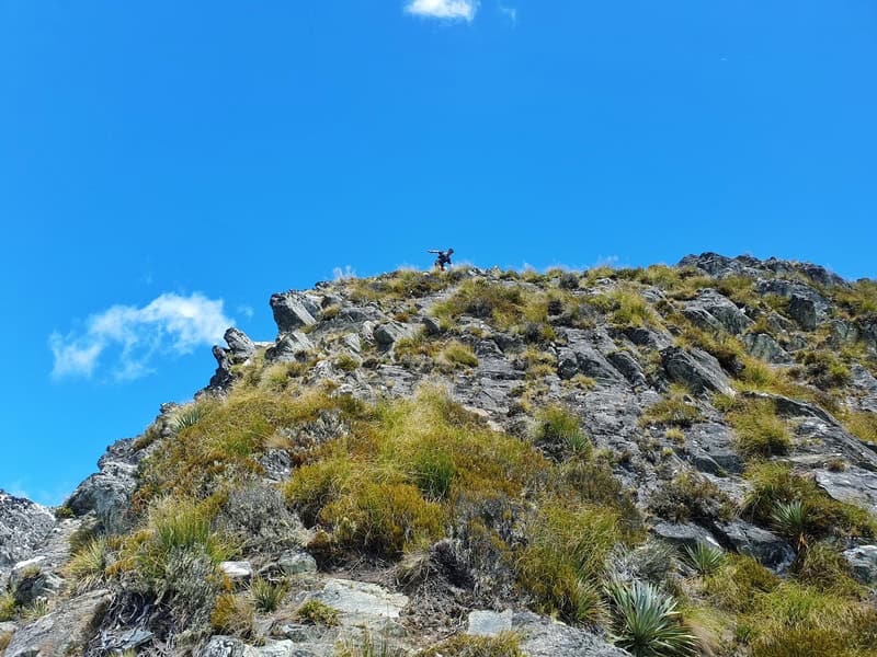
Once you get above the strrp section you’ll start to see what the rest of the track entails. The next little mission is to get to point 1621 on the topo map. You can sidle along the left hand side to cut the corner, but I do that on the way back.
After here, although the terrain isn’t steep there are some slow sections as you navigate around some rocks. You’ll also see what I always had thought was the Ben More summit on my previous tracks were, but are in fact not! I was looking at point 1799 the whole time.
The best decision to make is after passing point 1611 on the map. You’ll want to traverse across below point 1799 rather than going up the scree slopes to the (even more) technical ridgeline. The goal here is to stay at around 1650 meters altitude…if you go to high you’ll need to drop down later.
It’s not until you get around the next spur the Ben More finally reveals itself to you. It looks quite far away still, but it’s less than a kilometre and you can start edging up towards the Ridgeline which has chilled out again which is nice.
When I made it to the summit there was a handful of rocks indicating I’d made it! The versions are pretty incredible. It might be one time I was hopeful a kea would come and hangout, as I hadn’t seen anyone since leaving Moke Lake. But that’s part of what makes this peak awesome.
The descent is all about retracing your steps as best you can. It’s definitely faster coming down, but there’s some slippery descents in a couple of spots so don’t clock off yet!
You can also cut off a couple of corners you might not have on the way up as you’ve seen the views.
Ben More is an Otago peak you won’t hear about too often, as there’s no DOC track leading to the peak.
But I wouldn’t be surprised to see this peak start to get a little bit more recognition in the future, a bit like how the Mount Crichton summit has (in my circles at least).
But give it a go, reach out to me in the comments below or email jub@churnewzealand.com with any questions. And once you’ve reached the summit, leave your thoughts below to help other hikers!
Chur.
p.s. you can find all the hikes I’ve documented in this map (clicking on the icons will provide more info):

Hey, it’s Jub here. I’m the guy behind Chur New Zealand, helping you have the best time hiking, trekking, walking…whatever you want to call it…in NZ. I’m based in Queenstown and am always out and about exploring trails, old & new. If you have any questions, reach out.