NOTE (MAY 2026): As per the DOC website, the Wairere Falls Track is closed until further notice. Please respect the closure for the safety of yourself, and people working to get the track reopened. Chur.
—-
The Wairere Falls walk leads you to the highest waterfall on the North Island. The 153 metres high Wairere Falls.
The out and back walking tracks are well maintained with two viewing platforms letting you see the Wairere Falls from below and above. You’ll see awesome scenery along the way with my only gripe being you don’t get close to the base of the falls.
If you’re looking to visit a waterfall near Matamata, this post will help you plan your visit to the Wairere Falls track.
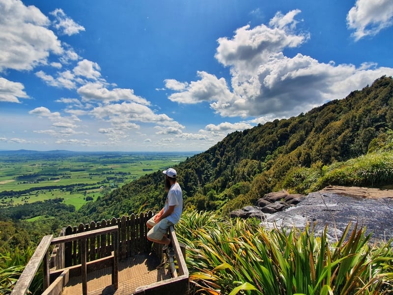
Proof I’ve been to the falls!
TABLE OF CONTENTS
1. Details About The Wairere Falls Walk
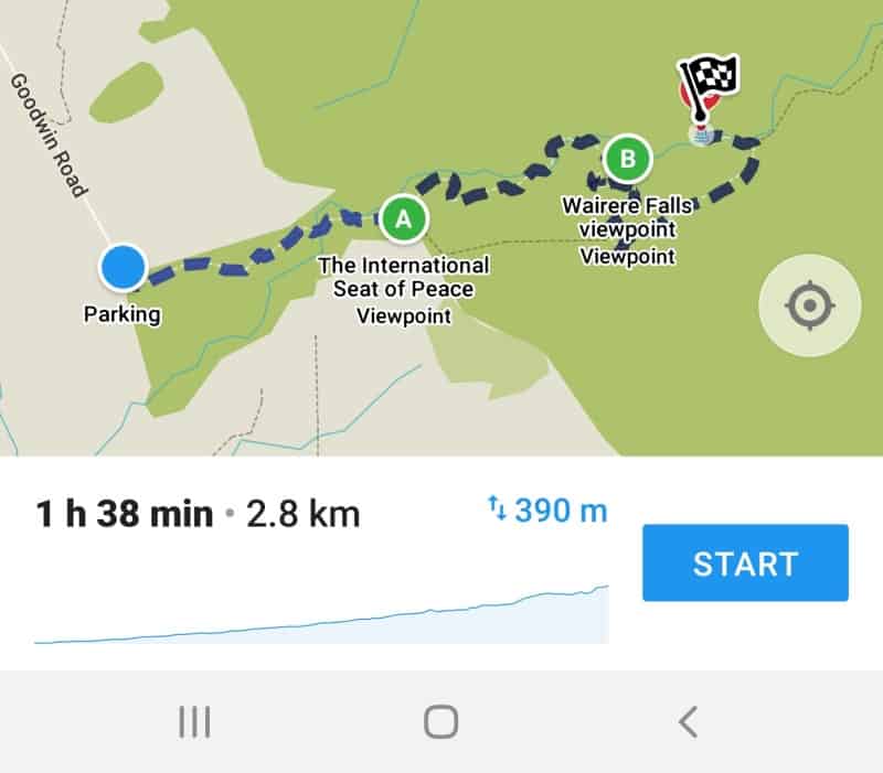
2. Wairere Falls Walk Map
3. How To Get To The Wairere Falls
4. My Wairere Falls Walk Experience
1. DETAILS ABOUT THE WAIRERE FALLS WALK NEAR MATAMATA
As the tallest waterfall in the North Island, the Wairere Falls is pretty cool to look at!
It’s a solid walk to the first platform (lower) so it’s a bit frustrating that you can’t get closer to them. You’re limited to viewing them from a platform where there’s a sneaky opening in the trees.
Getting closer would be awesome! But you definitely should hike to the top of the Wairere Falls. You can’t see the entire falls after they begin to plunge, but you can swim at the top (not near the edge of the waterfall of course) and get awesome views over the countryside.
If you’re in Matamata, I would say this is a must-do hike to help fill in the day after visiting Hobbiton.
When1: November 2019
Walk Distance2: Based on my Strava data, the distance from the trail head to the Upper Wairere Falls platform is ~3.2km each way. If you decide to take the Ancient Maori Trail (details below) it’s ~2.4km each way (based on my Strava info). According to Maps.me it is 2.8km to the upper viewing platform.
In short, prepare for a 7km return walk.
Difficulty3: Medium. The track is well formed, but the elevation will keep your fitness in check.
Elevation Gain4: Based on my Strava results the total elevations is about 425 metre to the upper platform (I didn’t track Strava perfectly so have had to manipulate the numbers).
Wairere Falls Walk Time 5: To get to the upper viewing platform took ~47 minutes, and down via the Maori Ancient trail was about 48 minutes (1 hour 25 up and down which doesn’t count time spent at the top). I did continue walking further up past the platform but as it’s not exactly worth it I have removed this time from the totals. On the sign it says it’ll take 90 minutes to get up so I think 95% of people will be between 45 and 90 minutes one way.
2. WAIRERE FALLS MAP
On Maps.me the trail is marked (see below) and while it’s only 2.8km, I feel like the Strava measurement of 3.2km is more accurate.
3. HOW TO GET TO THE WAIRERE FALLS FROM MATAMATA
Public Transport: There are no options.
Drive: There’s a large car park next to the trailhead. As it’s a large car park with nothing much around there could be a chance of theft, but there is a sign that says security cameras are running in the area so it should be fine (take all the usual precautions).
Hitchhike: This was how I got there and it went pretty smoothly, though it might not be that way all the time. I waited in front of this church for about 10 minutes before getting picked up and taken all the way to the Wairere Falls trailhead.
Coming back I waited near the entrance to Fantails Cafe and waited about 40 minutes before a French couple took me back to Matamata.
I think getting there a sign could be useful. Especially if you get dropped off at the turn-off where traffic decreases. But as usual hitchhiking in NZ wasn’t too hard.
Bike: This was an option mentioned at the Matamata i-Site who said there are bikes for rent at Matamata Backpackers for $20.
It’s about a 15km ride from Matamata Backpackers to the Wairere Falls car park. There are nice views on the way but some of the roads don’t have lots of space for bikes so I recommend only those comfortable riding bikes do this.
There are enough objects around the car park you can lock the bike too.
4. MY WAIRERE FALLS WALK EXPERIENCE
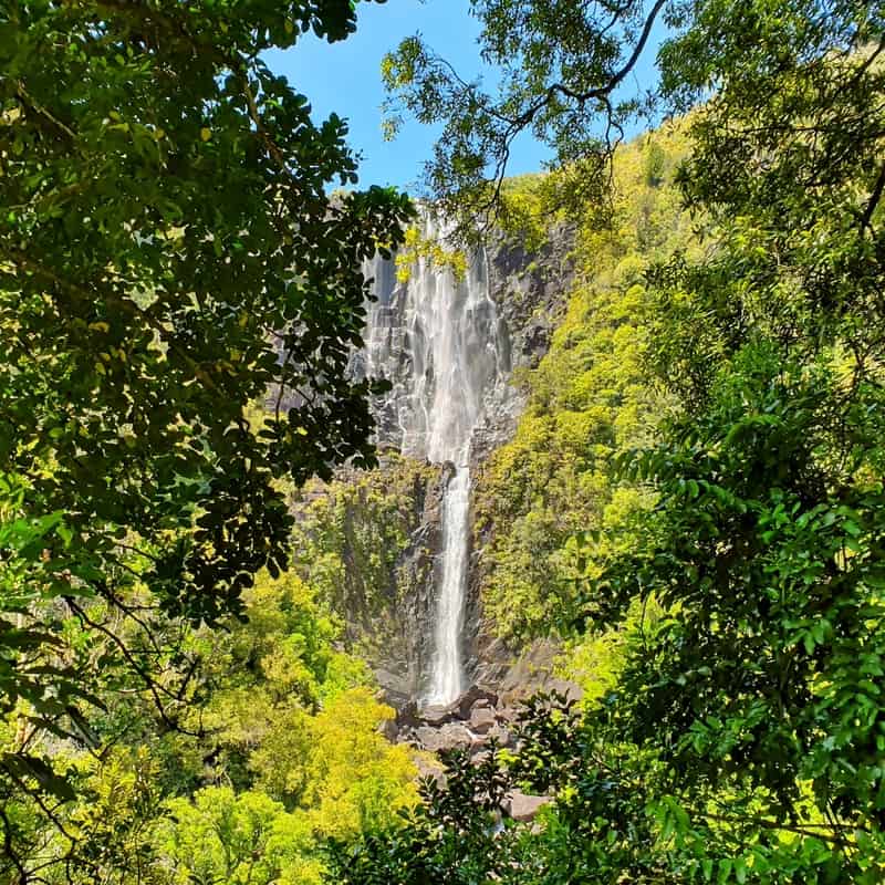
The Wairere Falls from the Lower Platform.
The trailhead is right by the car park so there’s no fluffing about which is nice.
The first 100 metres or so is flat (you’ll see the toilet on your right) but then the incline begins and until you get to the last few hundred metres before the summit, it never really lets you off.
You’re under the canopy of the Kaimai Ranges for most of the hike, so if you’re an idiot like me and don’t put on sunscreen you shouldn’t get too burnt (touchwood).
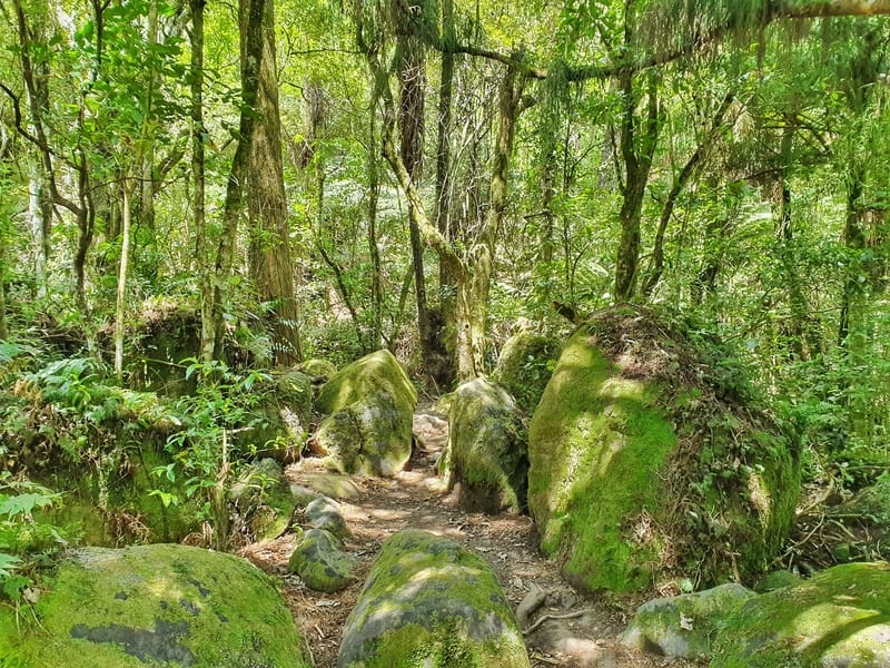
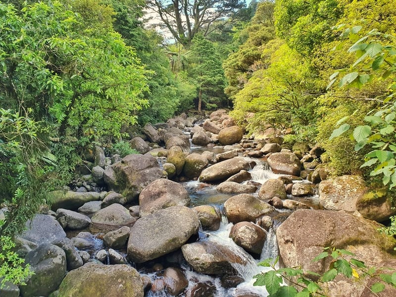
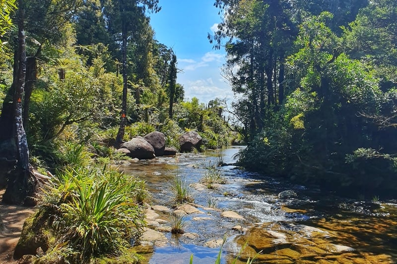
Love these mossy boulders!
How gorgeous does this look! This is while crossing the first bridge.
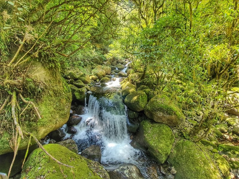
Another bridge, another awesome little waterfall (this one doesn’t have a name)
The incline is gentle to start off with and you’ll see some cool mossy boulders which I liked (photo above).
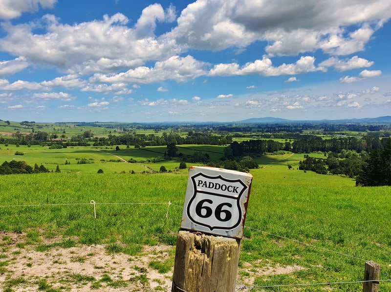
Route 66…pffft…Paddock 66 is where it’s at…?
After 1km you’ll come across the International Seat of Peace. I couldn’t figure out what the history of the seat was, but I did walk up the embankment to check out the view from Paddock 66!
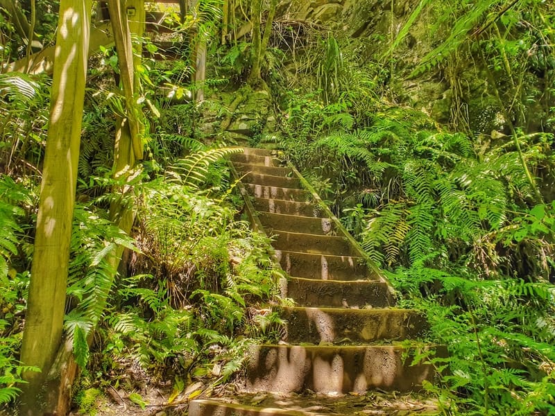
The first flight of stairs…
Before long you’ll come across the stairs that make this hike tough for some. There’s not heaps of them but they’ll keep you honest.
Once you’re up the stairs you’re just a few minutes from the signpost pointing you left for the lower waterfalls (1 minute) or right to the upper platform (45 minutes)
Head to the lower platform (about 2km total from the trailhead) to get your obligatory photos before heading to the top.
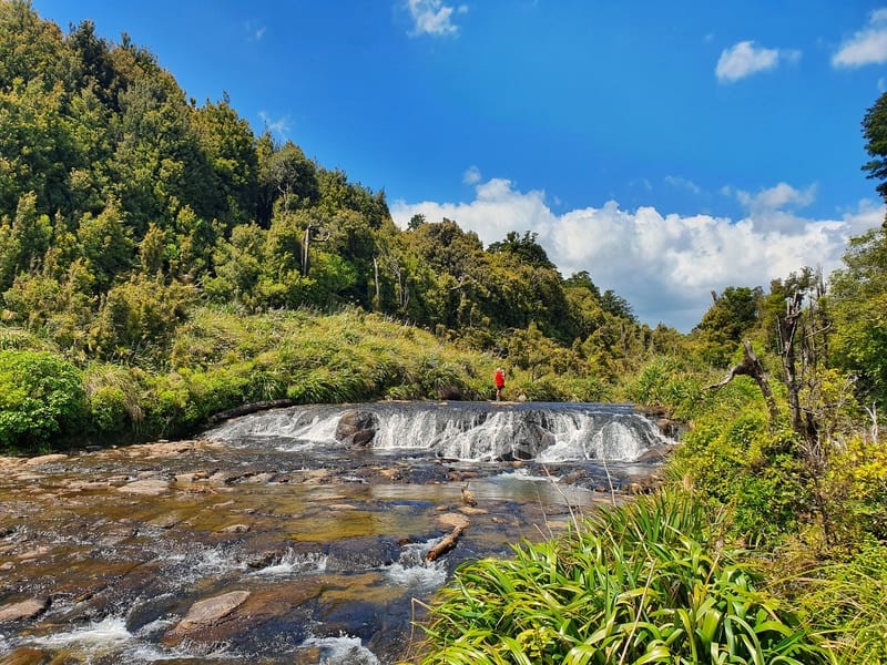
This is a little waterfall at the top of the falls which you can swim in/walk around (at your own risk).
From here the track to the top is on a reasonably steep incline. After about 800 metres there’s a small descent for the last 400 metres to the upper viewing platform.
Once you’re at the top, enjoy the views, and if you’ve bought your togs (NZ slang for swimming suit) feel free to take a dip. Obviously don’t go silly getting close to the edge, but the smaller of these Matamata waterfalls is neat in its own way.
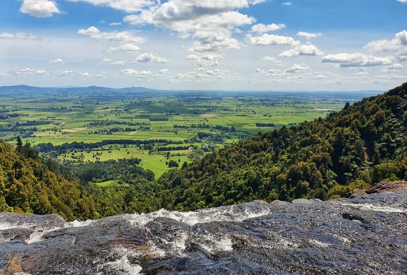
How good is the view!
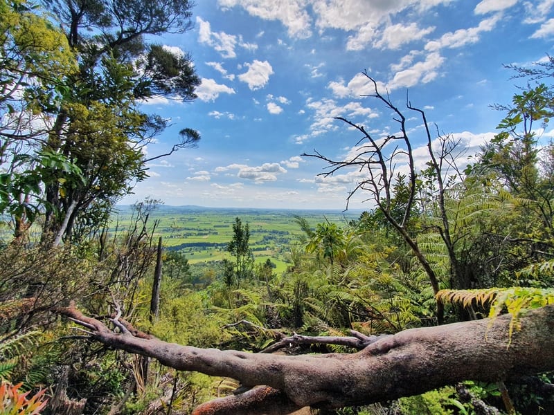
This is a bit further away from the waterfall edge and therefore safer for kids.
For most of you, you’ll simply retrace your steps back the way you came. I did walk up to the North-South track junction beyond the upper platform and can tell you it’s nothing special.
On the way back I decided to walk down the Ancient Maori Trail. On the sign, it is marked as very steep and not maintained. This is accurate and it’d be easier to walk up than down, but unless you know where you’re looking you’ll miss the turnoff to go up as there’s no sign at the bottom.
If you want to try to look for it, it’s just after the International Seat of Peace.
A view from the Maori Ancient Trail
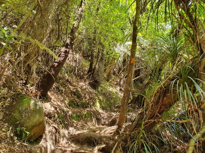
The Ancient Maori Falls isn’t 100% easy to follow but there’s just enough orange markers to follow
I was a bit nervous about coming down, but it was easier to follow than I expected. It was steep and if there’s any recent rain it’d be VERY slippery. It’s a fun adventure, but other than a sneaky couple of views and saving time there’s no harm in following the normal trail back. No FOMO is required.
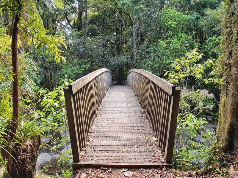
The bridges are totally fine to walk on.
Having started at the trailhead at 1:30 pm, I got back to the car park at 3:35 pm for a total time of two hours and five minutes. This includes 20 minutes of walking to and from the North-South junction.
So if you’re short on time, you can still squeeze this in over a couple of hours if you’re decently fit.
The Wairere Falls walk is a good solid walk with stunning views. Add in boulders, viewpoints, bridges, and the chance to take a dip at the top of the falls you can’t argue
Any questions? Let me know below. Or if you’ve walked the Wairere Falls Track please let me know about your experience in the comments!
What to read next:

Hey, it’s Jub here. I’m the guy behind Chur New Zealand, helping you have the best time hiking, trekking, walking…whatever you want to call it…in NZ. I’m based in Queenstown and am always out and about exploring trails, old & new. If you have any questions, reach out.
Thank you for all the relevant information; very useful tonus since we’re heading out there soin
Cheers Marc, enjoy NZ!