Looking for good hikes in Taupo? Make the Mount Tauhara hike a priority.
With 360-degree panoramic views of Lake Taupo and the surrounding landscape, this hike offers great value and won’t take up more than a few hours of your day.
It’s a great way to fill in a day with other activities like the Maori rock carvings tour.
This post will give you all the details you need to know about the hike (it’s a bit more than a walk).
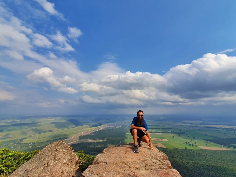
At the top of Mount Tauhara. Views!!!
TABLE OF CONTENTS
1. Details About The Mt Tauhara Walk
2. Map Of The Mount Tauhara Hike
3. How To Get To The Mt Tauhara Car Park
4. My Mount Tauhara Experience
1. DETAILS ABOUT MT TAUHARA WALK
My initial thoughts/recap: By crikey I’m glad I made time to hike Mount Tauhara.
Given its proximity to Taupo, the lake, and the views from the top you can’t go wrong. There are views along the way which keep you motivated as you navigate the gnarly Mt Tauhara track full of roots, rocks, and other obstacles (nothing overly difficult).
The track is only accessible by car which is a bit niggly but that does make it a bit more off the beaten path. This is one of those hikes locals love but tourists haven’t overrun. Yet. Keyword: yet.
When1: December 2019
Hike Distance2: According to most websites it is a 2.8km trip each way (5.6km total). But my Strava data has the return hike at 6.42km and Maps.me measures it as 6.4km. Plan for a 6-7km hike/walk..
Difficulty3: I would rate the Mount Tauhara walking track as easy-medium in difficulty. It’s not long, but can be a little technical in some spots.
Incline4: Strava has the Mount Tauhara hike as 529 metre elevation gain which makes sense. The summit is 1,088 metres above sea level.
Mt Tauhara Walk Time5: The round trip took me 1 hour 54 minutes which includes a 10-minute pitstop at the top. Given most websites say it’s a 3 hour return hike, you can assume it’ll take between 2-3 hours for most of you.
2. MAP OF THE MOUNT TAUHARA HIKE
The Mt. Tauhara trail isn’t marked on Google Maps but you can reach the trailhead on Mountain Road by searching for Mount Tauhara car park (or click here).
It’s marked on Maps.me (see below), and while the trail isn’t marked with orange trail markers you shouldn’t have any issues with getting lost when you reach the bush line. I’ll leave more details in the trip report about how to reach the bush line.
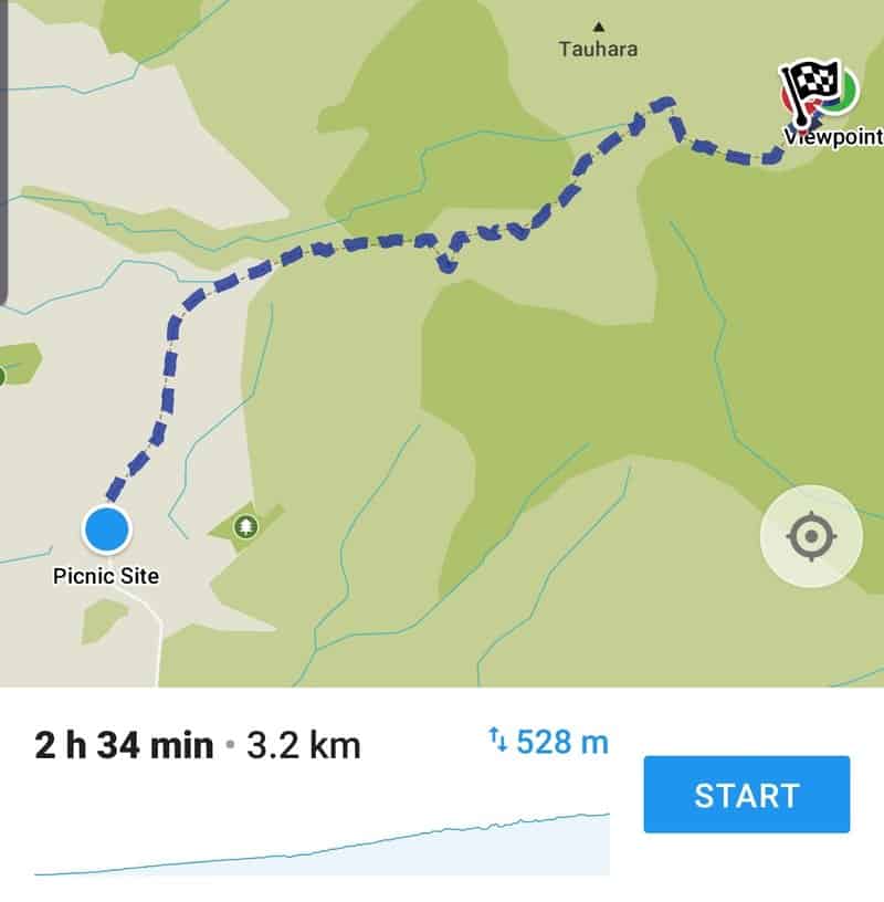
And if you’re like to see the Mount Tauhara map on a topo map, here you go.
3. HOW TO GET TO THE MT TAUHARA CAR PARK
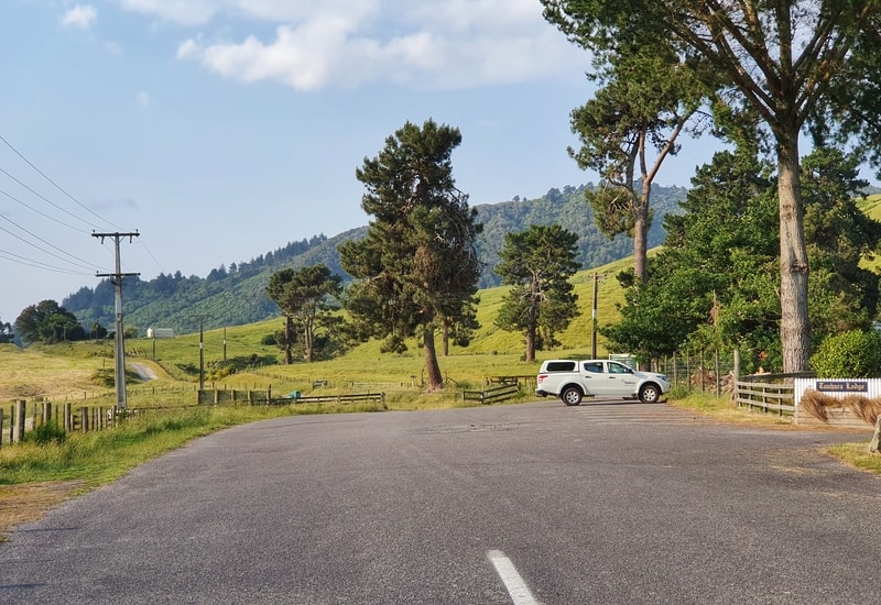
This is the carpark at the trail head.
Public transport: There are no options that go anywhere close to the car park.
Drive: This is the most practical option to get to the Mt Tauhara walk. It’s only a short drive (less than 10km) from the centre of Taupo via the Napier-Taupo highway. There’s ample car parking space at the trailhead on what is an otherwise quiet road.
Ridesharing: This is an option if there’s a few of you going. To get from Taupo city centre to the Mount Tauhara car park you can expect to pay NZ$20-25 each way (there’s cellphone reception at the trailhead to get back). Ridesharing apps in NZ are Uber, OlaCabs, and YourRide.
On foot: This is how I got to and from the Mt Tauhara car park (running), but I wouldn’t recommend it.
It isn’t the most scenic of routes to the trailhead, and you are walking for a few kilometres on the side of the highway with no footpath. There’s enough room to make sure you’re well off the road, but it’s not exactly comfortable.
You could hitchhike, but it’d likely take several rides and you’ve got to walk to get to the Taupo hitchhiking spots.
4. MY EXPERIENCE WALKING MOUNT TAUHARA
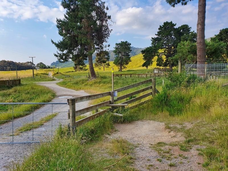
The start of the trail take you over the fence.
Having run to the trailhead, I was glad to see a couple of people in the car park as I still wasn’t sure if I was going all this effort for a waste of time or not.
Much to my relief, they (American tourists) loved their Mt Tauhara walk. That was just the message I needed, ready to begin.
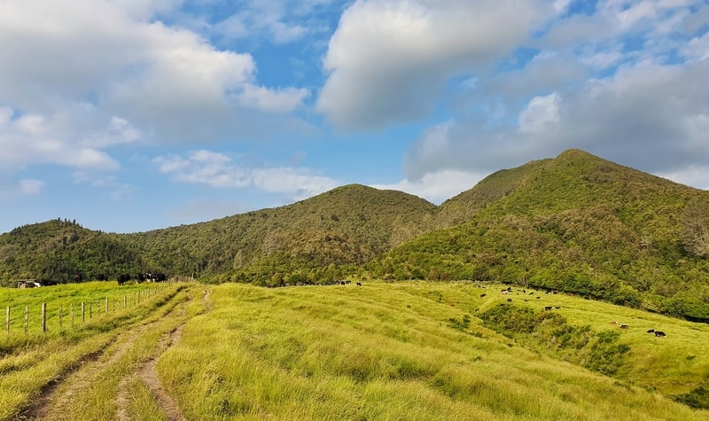
Looking up toward the summit near the start of the hike.
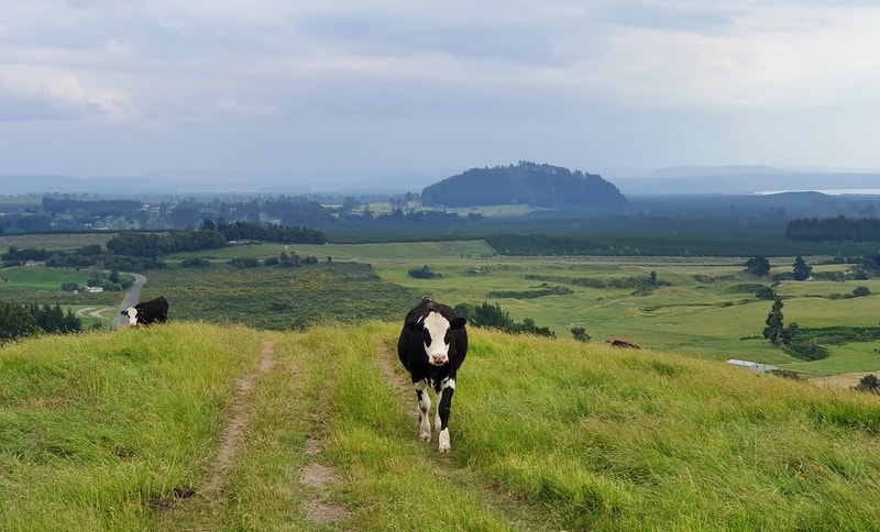
Moo.
The start of the hike takes you through private farmland which may mean you need to walk next to a herd of cows.
Cows can be intimidating if you’re not used to being so close to them as they won’t run away from you well in advance.
As you can see from a couple of photos in this post I had lots of cow friends on the way up but they moved away as I got closer (none charged at me etc.). Don’t let them scare you off. Follow the bright yellow highlighted posts that indicate the walking route through the farm.
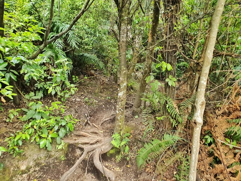
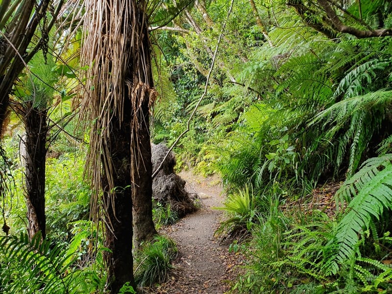
A section of some of the gnarly roots.
You’ll then hope over one more fence (there’s a stile) which takes you up to the Tauhara’s treeline. The canopy of the treeline isn’t thick so put your sunscreen on in summer.
Once you get under the canopy of the forest, you’ll see that while the track is obvious to follow the roots are gnarly at times. It’s not a straight forward hike where you can daydream without tripping over.
There are no orange markers once you reach the forest, but the path is obvious and at points where the paths split off, they’ll join up again shortly after. Take the route that looks the most inviting to you.
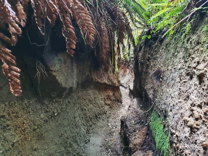
The feeling of walking through these sections is awesome, with the walls of dirt above your head!
A nicer foot-free section of the trail
This was a viewpoint on the way up…self-timer fail 🙂
The incline is pretty steady the whole way, and if you’re getting tired there are some places you can sit down with a view (not of the lake).
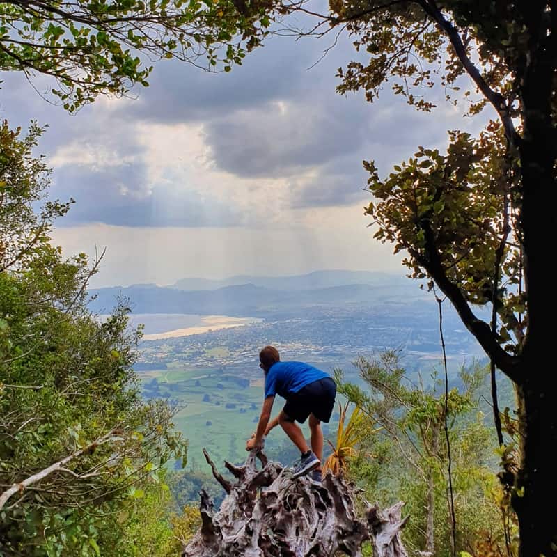
The other part I liked about the trail is there are sections where you are almost hiking in a canyon, and on either side of you the edge is higher than your knees and in one section the walls are taller than you. This is hard to explain, but the picture above paints 1000 words.
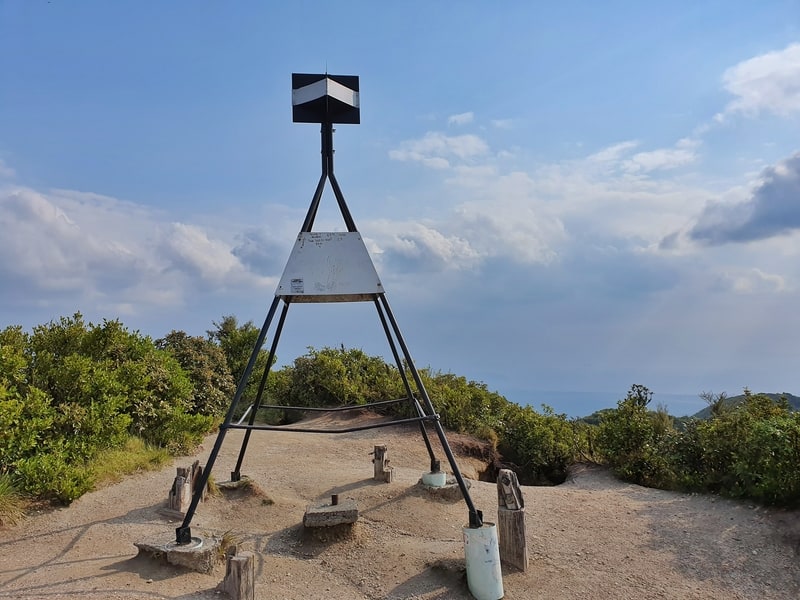
You made it to the summit, yay!
Another photo I liked from the summit.
There are no markers along the way telling you how far you are from the top, but you definitely know you’re at the summit thanks to the Mt Tauhara trig.
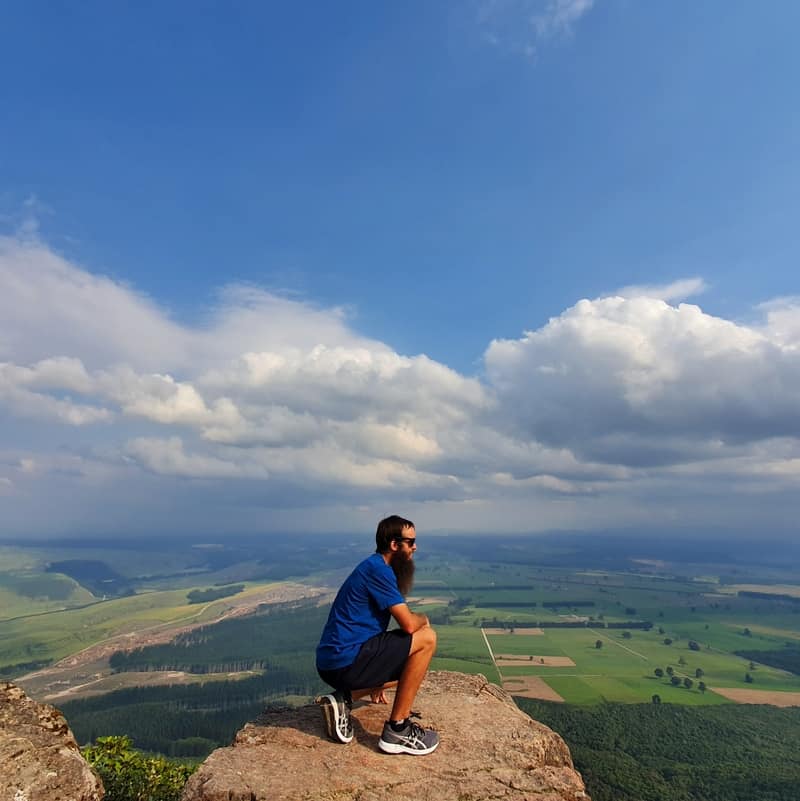
Important: From here the views are nice but you need to follow the trail another 200 metres or so south towards the rocks which are where epic viewpoints and photo spots are.
I’d be lying if I didn’t have some level of expectations (thanks, Instagram) but I’m stoked to say I wasn’t let down. I hope you won’t be!
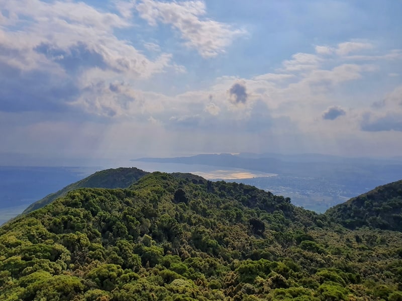
As mentioned below, the haze from the Aussie bush fires weren’t making for the best lake views.
There was a haze in the sky, so I couldn’t get the best views of Lake Taupo but that’s okay.
The sunset was happening about 8.30pm on the day I went and I was at the summit at about 5:30 pm which I think is a fine time to go if you want the photos of the green plateau you see in these photos.
If you want better photos of Lake Taupo, go earlier in the day.

This was the scene I had on the way back down the hill.
The hike down Mount Tauhara was pretty quick, just be careful about tripping on any roots. In the rain, this track would be slippery!
When I got back down the fencing the cows were congregating even more which was a little bit intimidating. Once again they moved so all was well.
Great hike!
You know by now I want you to do this hike. At a maximum three hour time commitment (plus transit time), the Mount Tauhara walk won’t take up a large chunk of your day.
But gives you an epic appreciation of Lake Taupo’s size.
Let me know if you’ve got any questions in the comments below, or email jub@churnewzealand.com
What to read next:
- A list of things to do in New Zealand
- Exploring Taupo’s Moari rock carvings
- What souvenirs to buy in NZ

Hey, it’s Jub here. I’m the guy behind Chur New Zealand, helping you have the best time hiking, trekking, walking…whatever you want to call it…in NZ. I’m based in Queenstown and am always out and about exploring trails, old & new. If you have any questions, reach out.
Dog friendly?
Hey Rebecca,
Unfortunately no dogs allowed on Mount Tauhara.
Cheers,
Jub
Would you reccomend a sunrise bike for a couple who aren’t familiar with the track? (We have torches)
Hey Daisy,
If you’re experienced hikers, yes, most definitely!
Cheers
Jub