The Canyon Creek Track is amazing. Make sure you put it on your bucket list right now, before you continue reading this post that’ll give you all the details you need to know…to get to the end of the DOC route, and beyond to the rock bivvy.

I’m loving the Ahuriri Valley more and more every visit.
You can do this as a long day trip, or overnight at the rock bivvy.
And yes, as I’d been told, the Canyon Creek Track does have Earnslaw Burn Track vibes.
Note: There’s a rock bivvy you can camp next to, but I turned around before that. I’m confident this post doesn’t detract from that.
Alright, let’s get into it.
TABLE OF CONTENTS
1. Canyon Creek Track Details
2. Canyon Creek Track Map
3. How To Get There
4. My Canyon Creek Experience
1. CANYON CREEK TRACK DETAILS
- QUICK DETAILS:
- Distance: 19-21km
- Elevation Gain: 850-1000 metres
- For who: Experienced hikers only
- Download the GPX File here
- Here’s the location of the rock bivvy on TopoMap.co.nz
How hard is the Canyon Creek Track?
It’s hard, but not as hard as I expected. If you look at the marked trail on a topo map/DOC ends you’ll actually find orange poles beyond that…but you do need to have some kind of route finding ability throughout the hike. Download the GPX file!
What distance is the Canyon Creek Track?
Based on my Strava it was 19.2km return…you’ll need to add another 2km or so if you are staying at the bivvy. Interestingly, the DOC has it at 8.5km, which is a lot less than I found.
What is the elevation gain of the Canyon Creek Track?
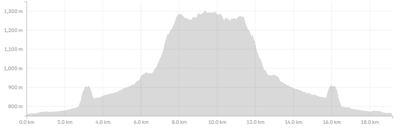
My watch gave me 872 metres of elevation gain, with 700 metres of that on the way in. My partner had about the same. To get all the way to the bivvy you could add another 50 – 100 metres total.
Here’s my elevation profile:
How long does it take to hike Canyon Creek?
I won’t answer this one as it’s going to vary a lot based on the people we met out there. And I might annoy people with any estimates I give haha. The DOC website has it at 3.5 hours from the carpark to the rock bivvy. For 8.5km, that gives you an idea on how much of a battle it is! That’s possible generous as well if you’re not used to rough terrain.
2. CANYON CREEK TRACK MAP
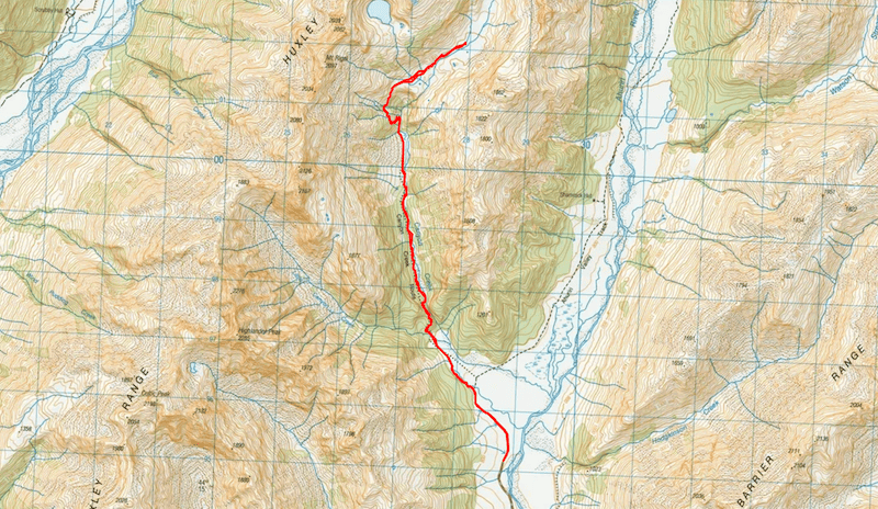
The map below is the GPX file overlaid on topomap.co.nz. If you click on the image below, it’ll open in a new tab where you can scroll around, zoom in/out etc.
If you missed it earlier, download the GPX file here, and if you’re overnighting, here’s the rock bivvy location.
3. HOW TO GET THERE
The carpark is here on Google Maps.
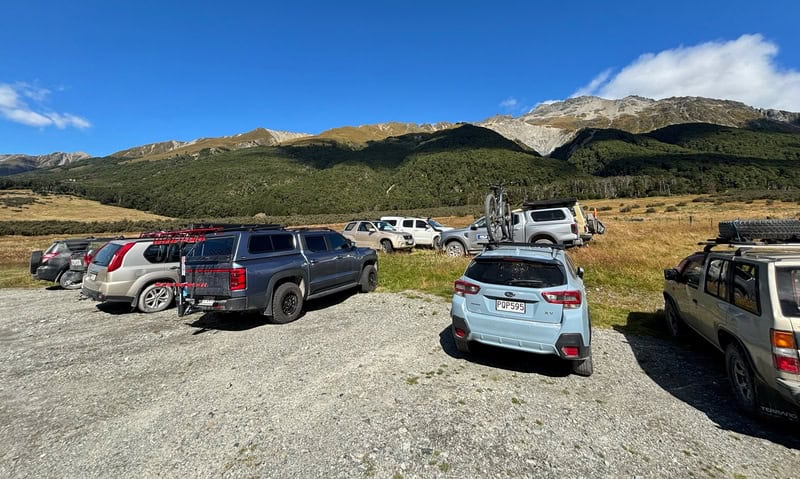
This is going to be the biggest barrier for many people, as you’ll want a decent car to get along Birchwood Road. We were prepared to turn around if the road got to rough, but got there in the end in the Toyota Rav4. The photo above will give you an idea of what kind of cars are going the full route. If you decide to abort the drive partway through, give the East Ahuriri Track a whirl.
The Ahuriri River Lodge website has a good description of the road for the first 24.3km. The road continues for another 10 km or so and is full of potholes, and there are points where alternative routes have formed when ditches have become too steep.
If you can ask people about this road, I’m not the best person to consult.
4. MY CANYON CREEK TRACK EXPERIENCE
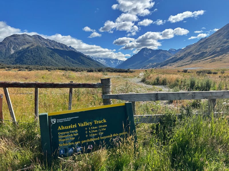
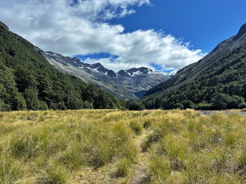
The start of the trail is also the trail to a couple of nearby huts (Shamrock and Hagens), and you’ll be on the Ahuriri Valley Track for about 1.5km until you see a sign for Canyon Creek pointing you left. Soon enough the track becomes a single trail weaving through the grass, skirting around the small creek.
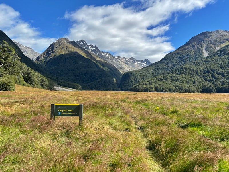
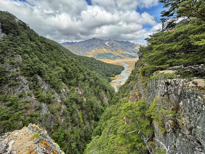
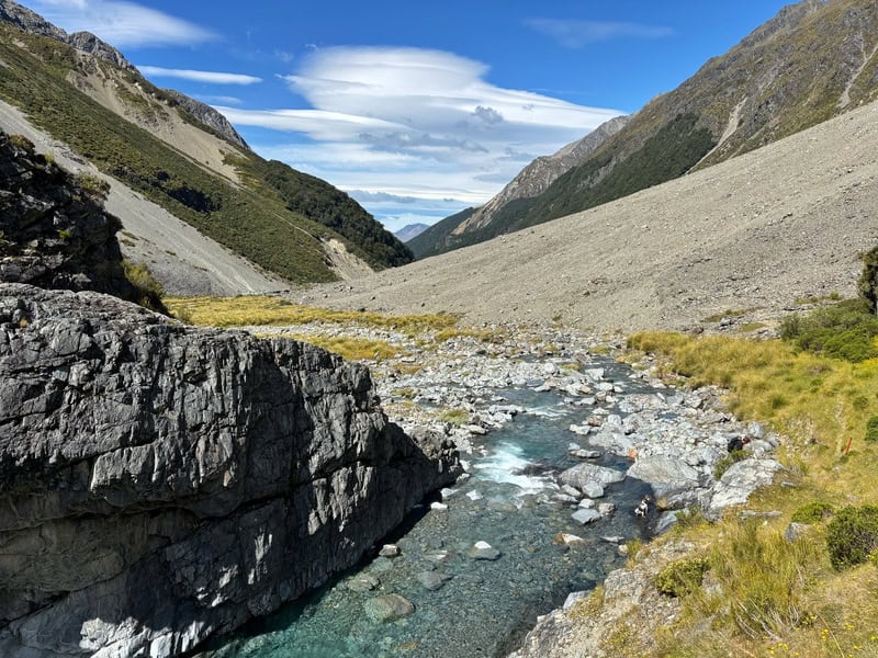
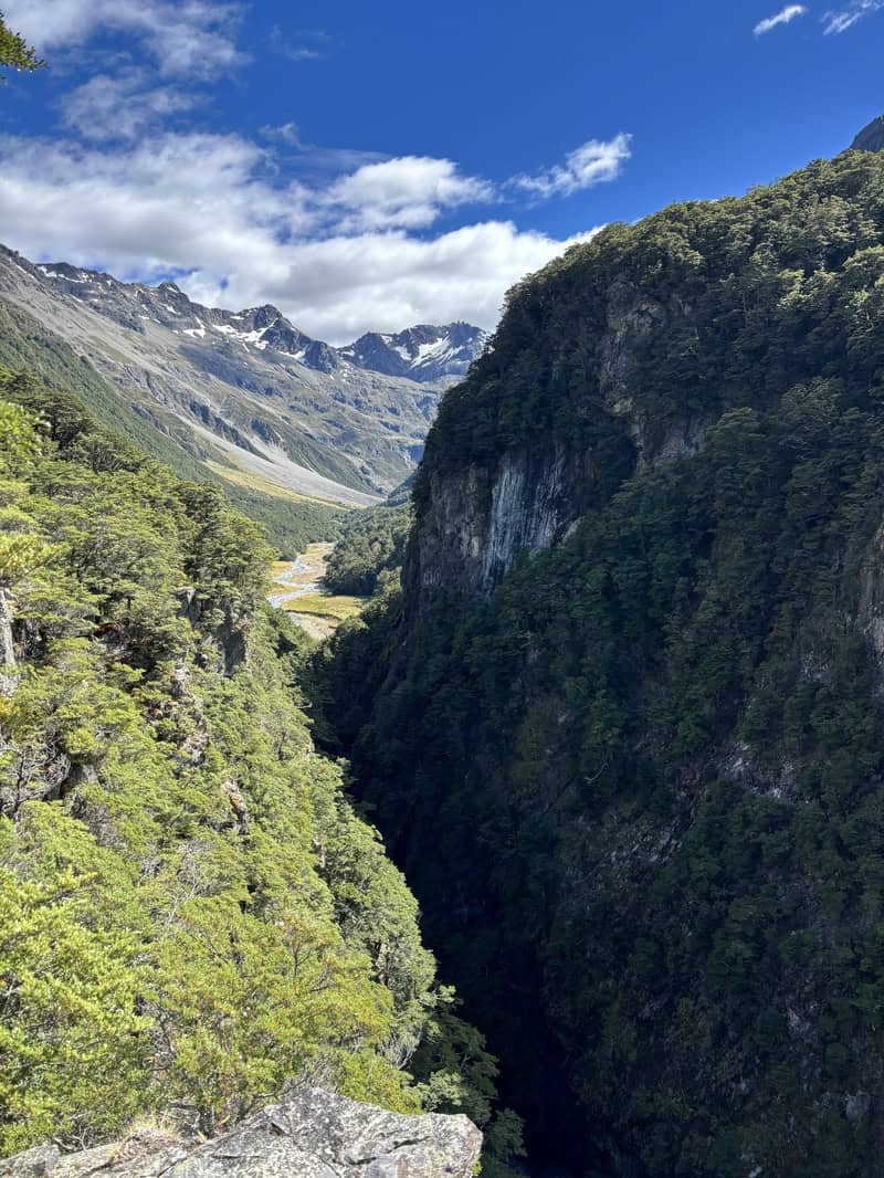
Have a look ahead, and I guess it’s apparent why it’s called Canyon Creek.
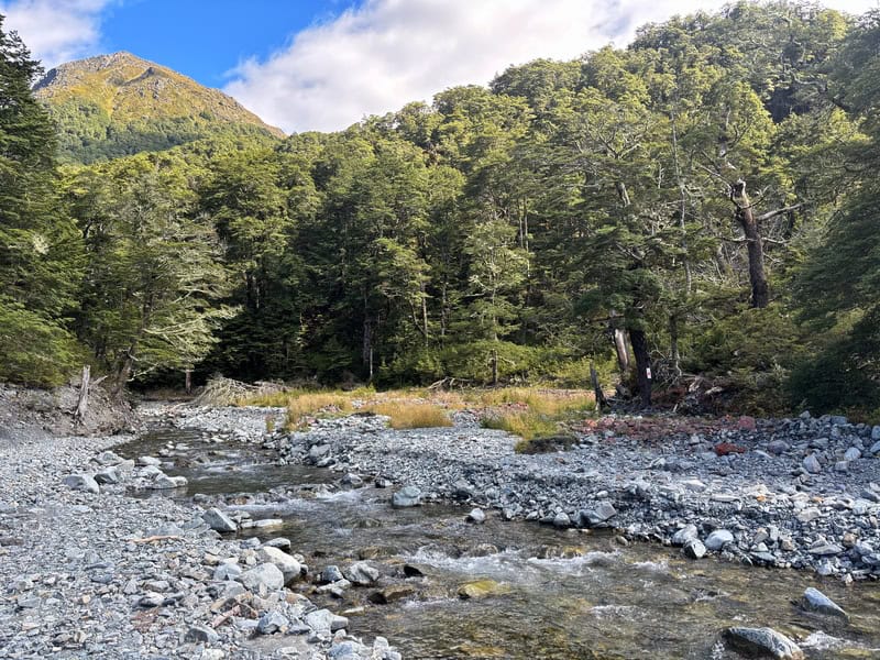
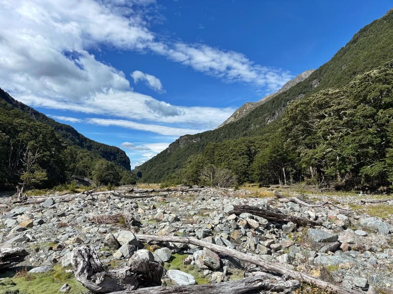
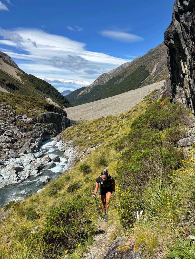
The trail then spits you out on the rock shores of the creek, with a creek crossing required to get to the otherside. You could potentially keep your feet dry if the river is low, which could be useful as you won’t get them wet again (most likely).

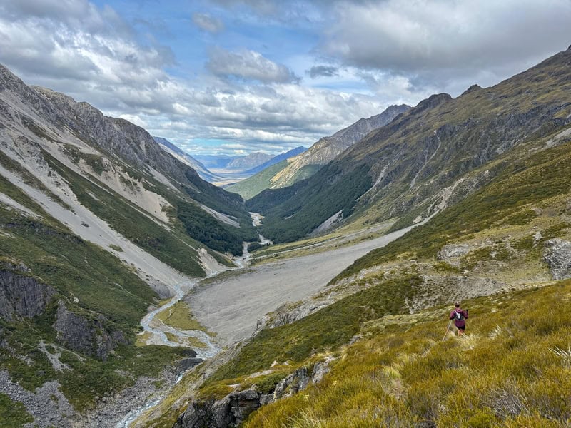
From here, you’ll be going up, up, and it’s proper steep in parts. But the waterfalls are fun! Keep an eye out for orange triangles to keep you headed in the right direction. There was various ways you could get up to avoid the shortest steep pinches where required. There’s a couple of spots where you can find cool views like the below.
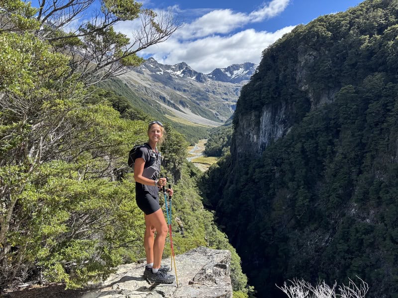
You can see this section on the elevation profile, it’s about 70 metres up before it flattens out for a bit. There’s a couple of spots where you can head towards the edge (careful, it’s a steep dropoff), to get the views you see above.
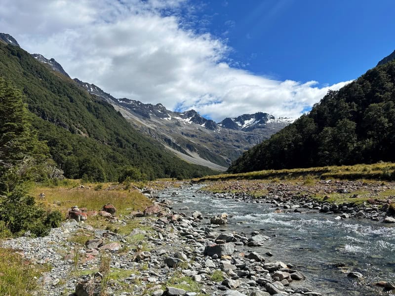
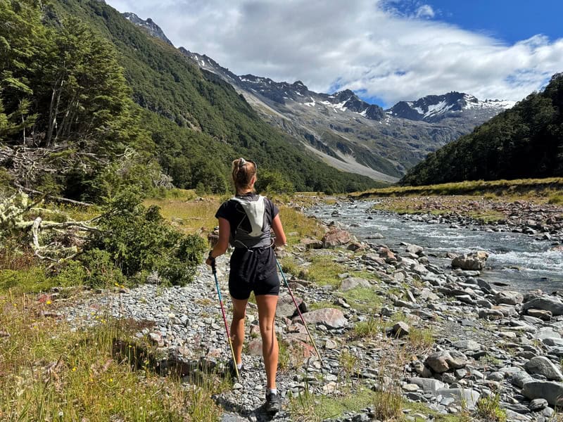
Heading down the otherside, it’s again steep and the treefall can make for some awkward moves. At the bottom of the descent, it was muddy when we were there…but that’ll vary based on recent rainfall I’d imagine. Once you are at the bottom of the descent you’ll emerge from the forest and you’ll be then following Canyon Creek for a while.
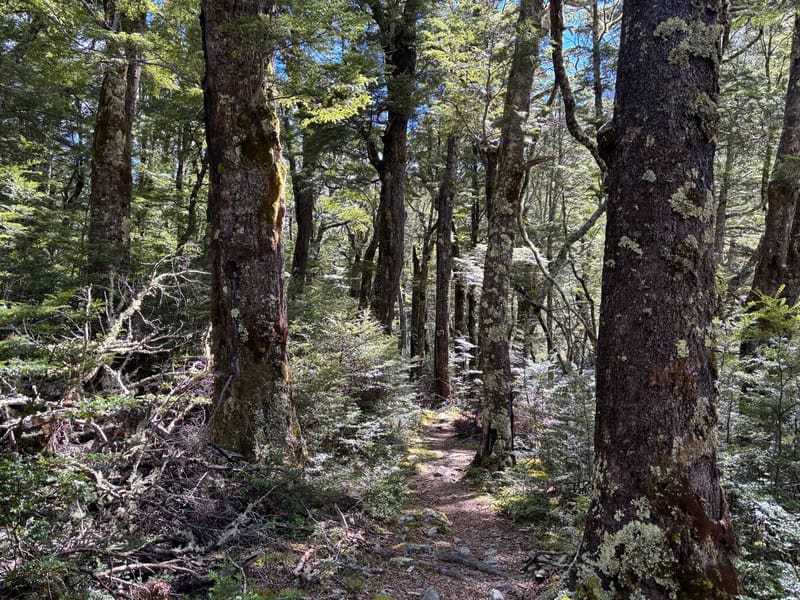
There’s not a tonne of orange markers along here…but you should see a bit of trail most of the time. Sometimes the track will be in the forest, but it’s eroded at times and you’ll be spat out on the sand/rocks near the Creek again.
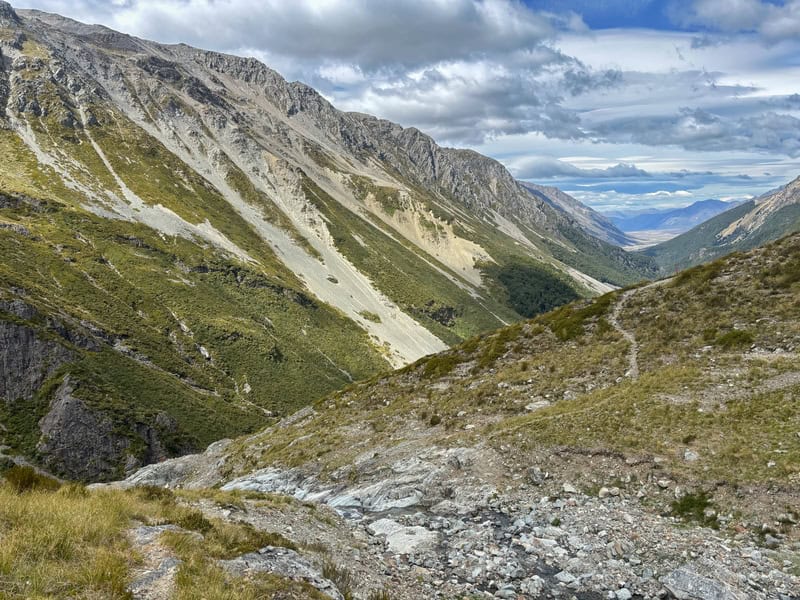
The section continues along the river for a few kilometres (it’s a gentle incline), but you’ll see awesome scenery that you’re walking towards in the distance. I’m not going to lie, I was thinking it looked intimidating…I thought we’d be scrambling up next to the main waterfall (you don’t).
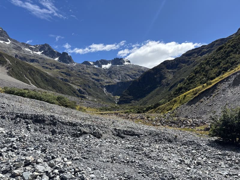
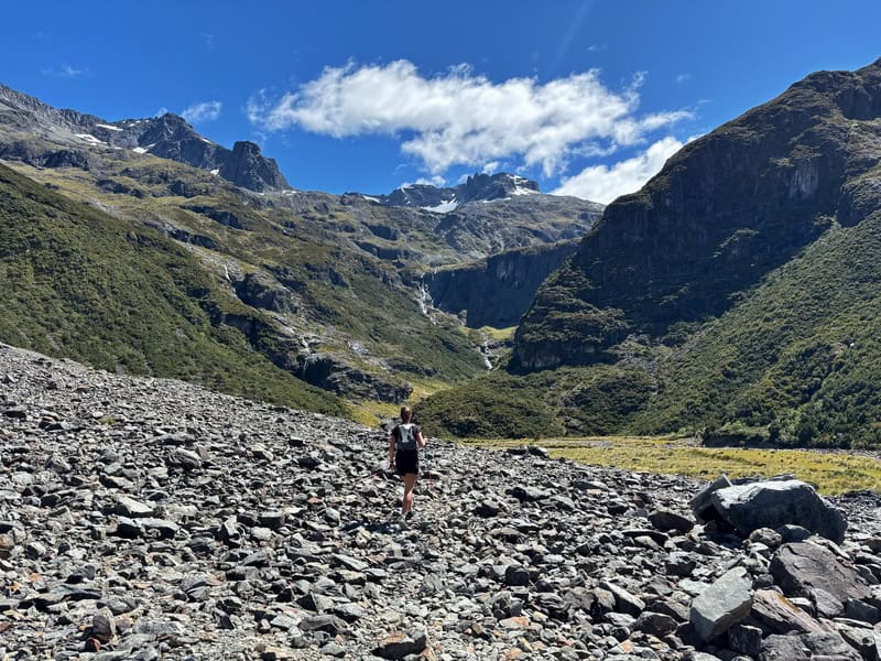
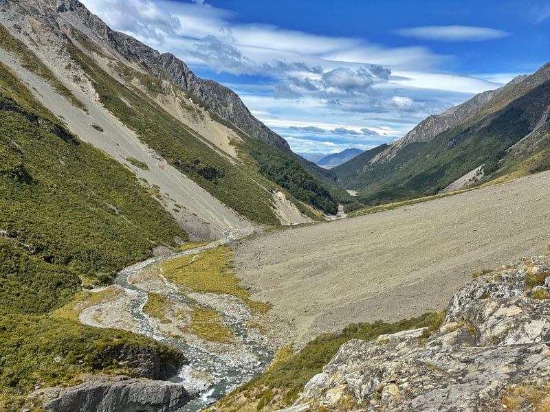
But before then, we plugged along until we entered an absolute massive scree/slip thing which was a little under 6km into the trail. For the next 800 metres or so, you’ll follow a faint path along the rocky terrain. It’s reasonable easy going, with the path just distinguished enough from the terrain.
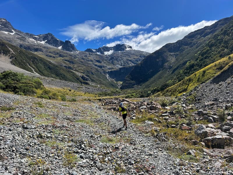
At the end of this section, it’s almost time to go up, up again. The track continues on the true right of Canyon Creek. I was expecting this to be a lot rougher than it was. The track is narrow, and it is steep at points but the path is well trodden. As you get further up, you skirt around a couple of waterfalls and the track sort of disappears. But if you look further ahead, you’ll spot the way easy enough. At worst, check the GPX on topo.
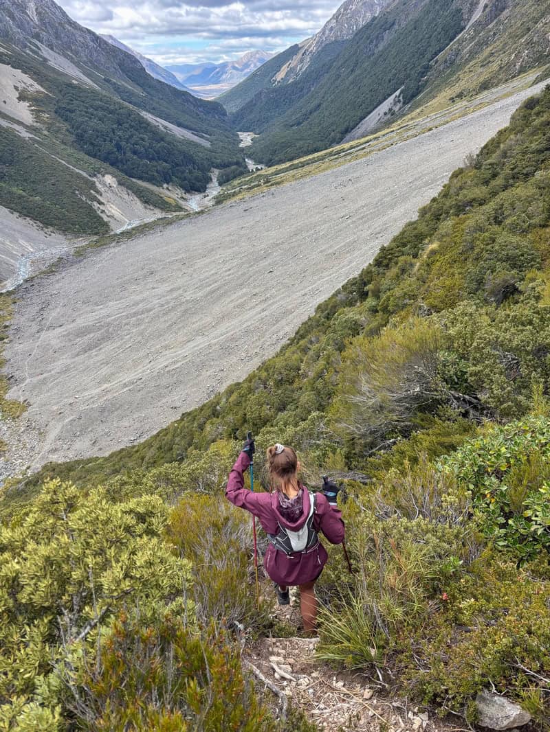
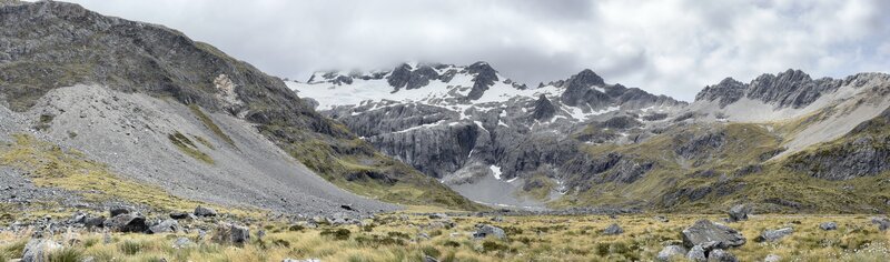
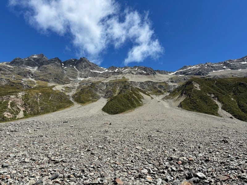
Eventually it starts to flatten out, that’s the crux of the climb done! But it’s not until you get to the spot on the topo map where it flattens out that the track becomes hard to find. It’s easy in that you’re now in the valley, and need to just keep following the valley through the boulders and tussock…but is a cairned route that is slightly easier going.
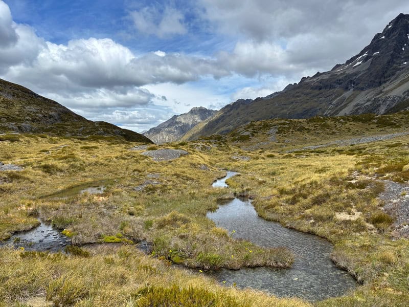
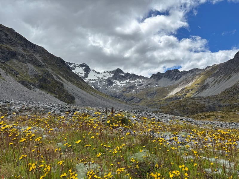
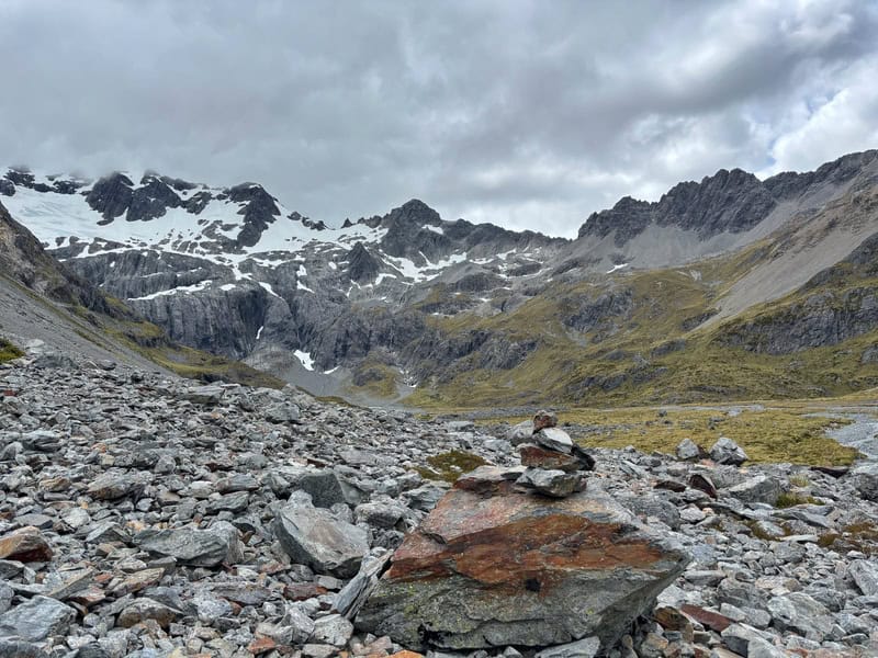
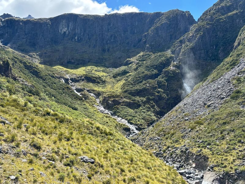
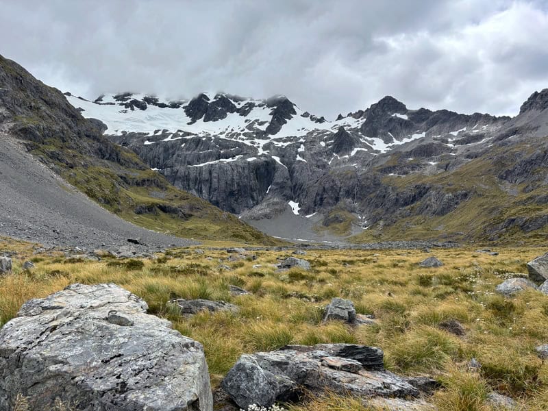
I thought we’d move quick through this section, but the terrain will prevent you from getting any momentum. But the views are epic! Love the wildflowers and tarns.
On the day I went, it was really windy, so we found a good boulder about a kilometre before the rock bivvy to have a break, enjoy the views, eat some food before turning around. It’s such a good view though….love it.
Turning back, the track was easier going. It’s not going to be much quicker on the return (in my experience) despite the net downhill.
There’s a couple of points where you can find yourself off track if you’re day dreaming, so make sure to not lose focus!
I’d rarely heard about Canyon Creek before arriving, so I was surpruised at how many cars were in the carpark. Yet, it’s a vast enough area that it doesn’t feel overcrowded…for now at least.
But yes, it’s awesome, and if you’re up for something different…give it a whirl!
Got any questions or comments about hiking the Canyon Creek Track?
Leave a message below or email jub@churnewzealand.com.
Chur.
p.s. Here’s a map of all the hikes documented on Chur New Zealand. You can click the icon to see brief details, as well as a link to read more about the hike (like this post).
p.s. here’s more photos…


Hey, it’s Jub here. I’m the guy behind Chur New Zealand, helping you have the best time hiking, trekking, walking…whatever you want to call it…in NZ. I’m based in Queenstown and am always out and about exploring trails, old & new. If you have any questions, reach out.