I’d never heard of the East Ahuriri Track until a few days before heading out to join a friend for a couple of days on the Te Araroa Trail.
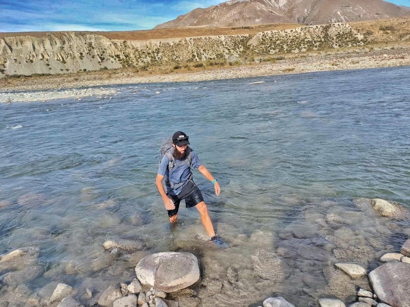
The final couple of steps out of the Ahuriri River.
If you’re looking for a big day or an overnight camping trip that takes you over a variety of terrain and want a good river crossing, then this point to point hike might be for you.
This post will give you all the details you need to know about the East Ahuriri Track.
TABLE OF CONTENTS
1. East Ahuriri Track Details
2. East Ahuriri Track Map
3. How To Get There
4. My East Ahuriri Track Experience
1. EAST AHURIRI TRACK DETAILS
QUICK DETAILS:
- Distance: 27 – 29km
- Elevation Gain:
- Difficulty: Medium to Hard.
- Time: 7 hours plus or overnight.
- GPX File here
How hard is the East Ahuriri Track?
I’m going to put this in the medium to hard bracket. If you had to complete the trip in a day it’d definitely be a hard hike, but given you can camp in the Ahuriri Conservation Park making it a 2 day hike, it takes off the pressure.
What distance is the East Ahuriri Track?
The DOC website says the hike is 27km, but my Strava came in with a little under 28.5km which did include a couple of slightly misguided sections…but not 1.5km worth. I’d be prepared to hike 30km and take anything less than that.
What is the elevation gain of the East Ahuriri Track?
The most surprising thing to me about this hike is how high above sea level you are…it really doesn’t feel like it.
How long does it take to hike the East Ahuriri Track?
This is a tough one to gauge, but strictly hiking you can do it in 7 hours if you aren’t taking extended breaks at all. But with the option to camp overnight, you can cruise this in 10 to 12 hours.
Are dogs allowed on the East Ahuriri Track?
Yes, they are allowed but do keep them under control at all times.
Can you camp on the East Ahuriri Track?
Yes, you can can anywhere within the Ahuriri Conservation Park boundaries which you can see in this brochure. In short, anytime after the rise once you cross the Ahuriri River until the start of the Freehold Creek Track/Alps 2 Ocean walkway.
As a sidenote, we were going to camp at Lake Middleton after finishing the track, but heard you can camp at Lake Ohau Lodge. This was epic, for $16 you have a nice area to pitch a tent, hot showers, and a nice hangout area with epic views over the lake. Very recommended!
Is there water available on the route?
You are following the Ahuriri River East Branch for a good chunk of the hike. We used a water filter drinking from here, but I would be pretty confident drinking straight from the water during the middle parts of the hike as there was no signs of cattle I could see.
Can you hike the East Ahuriri Track in either direction?
Yes, you can with people hiking the Te Araroa in both directions. We went from Birchwood Road to Lake Ohau as that was the way my friend was going.
What about any alternative side trips?
I have done a side trip that starts just above the bush line on the Freehold Creek Track, and it’s super cool.
You can check out the full Dumb-Bell Lake loop which takes you back to Ohau Lodge.
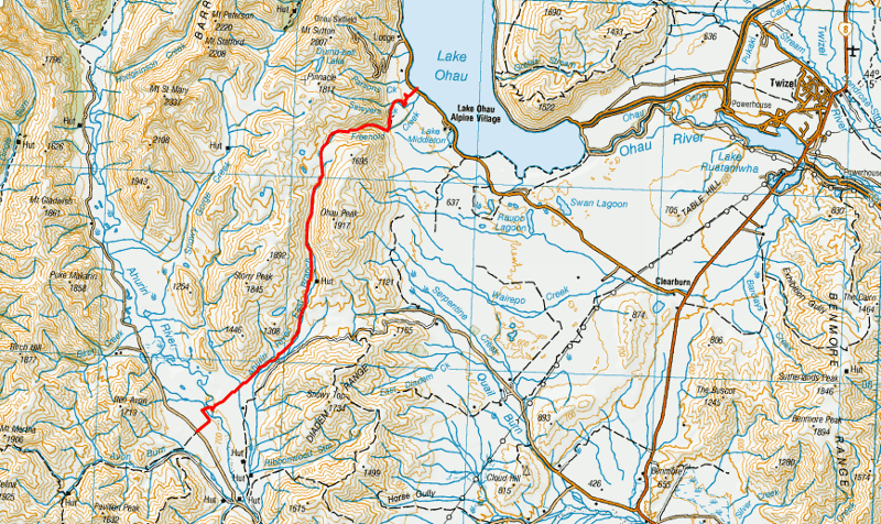
2. EAST AHURIRI TRACK MAP
The map below is the GPX file on top of map from topomap.co.nz. If you click on the image below you can scroll/zoom to explore the map in detail.
3. HOW TO GET THERE
There’s no great option to get there on this hike. If you could do a key swap, that’d be great.
The trailheads are at Avon Burn carpark on the southern end, and here at Lake Ohau at the northern end which is also the Parsons Creek Track.
Avon Burn carpark is 11km from SH8 on Birchwood Road…I was able to get lucky and hitchhike in here. And hitchhiking along Lake Oahu Road is pretty easy. In terms of shuttles, you could try some of the Mount Cook/Tekapo ones I’ve listed in this NZ hiking shuttles post.
Of course, if you’re hiking this as part of the Te Araroa Trail then there’s no issues here.
4. MY EAST AHURIRI TRACK EXPERIENCE
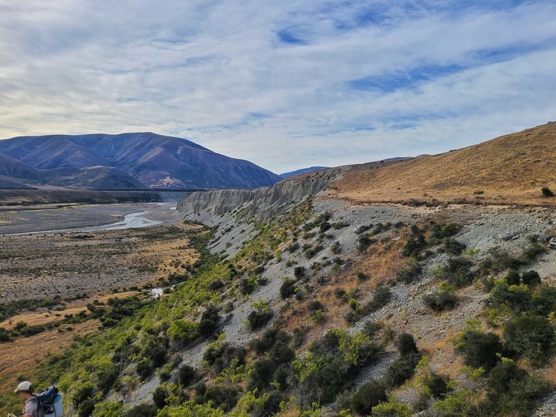
Starting from Birchwood Road, the start of the track follows some orange poles as you make your way to the Ahuriri River. Getting down to the river is no walk in the park with a short steep section with some loose ground…the path is vague, but there is a path.
Having spoken to many TA walkers, the general consensus is to cross the Ahuriri River via ‘the island’ which makes sense when you get down to the side of the river (I’m pretty sure it’s this one as seen on satelitte images on Google Maps).
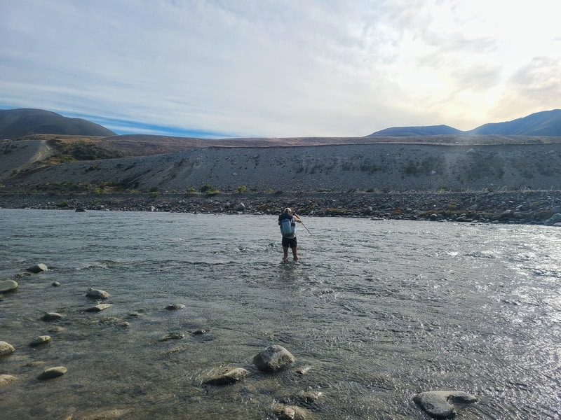
We crossed in mid-January after a few days of no rain making it close to the lowest the river gets. For reference I’m 172cm tall, and the water level was about mid-thigh at the deepest point which was on the far (northern) side of the river. If you have any hesitation in crossing the river, use the Ireland River bridge crossing 5km down the river.
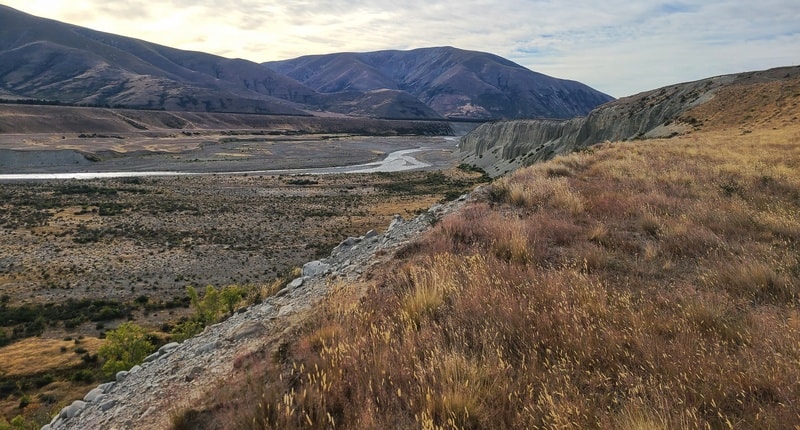
After crossing the river and making the climb back up the other side there’s a couple of flat kilometres through private land. This is a good chance to get some faster kilometres in as you’ll then be in the hills and the speed will slow right down.
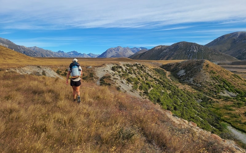
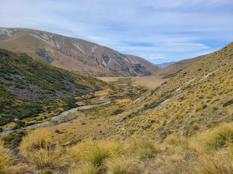
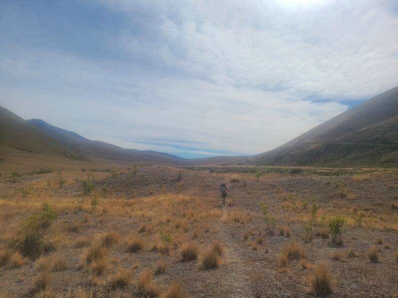
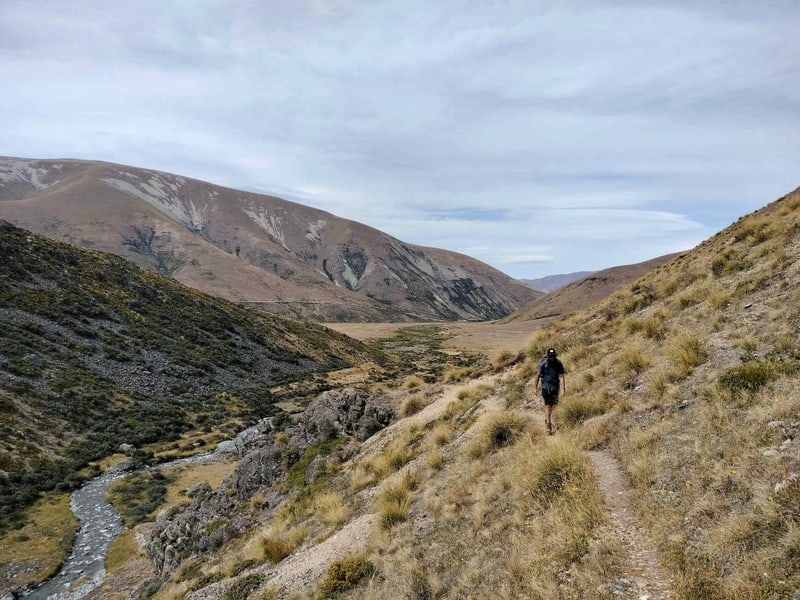
The next 15km are a gradual incline with no extended steep sections as you climb 700 metres in total over this period…my friend and I commented how we didn’t feel like we were over 1500 metres above sea level.
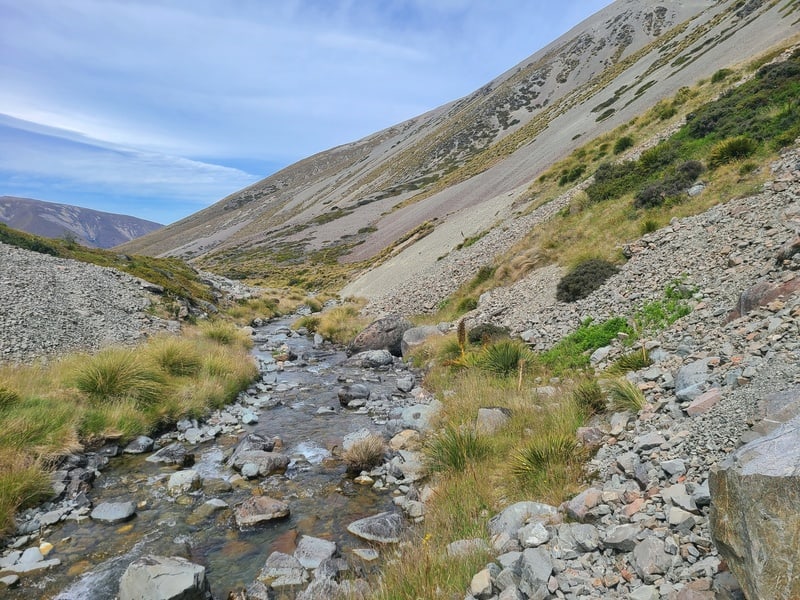
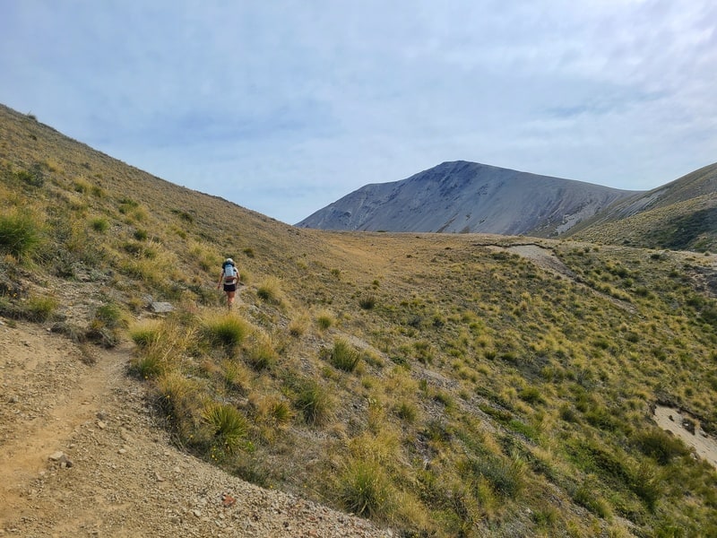
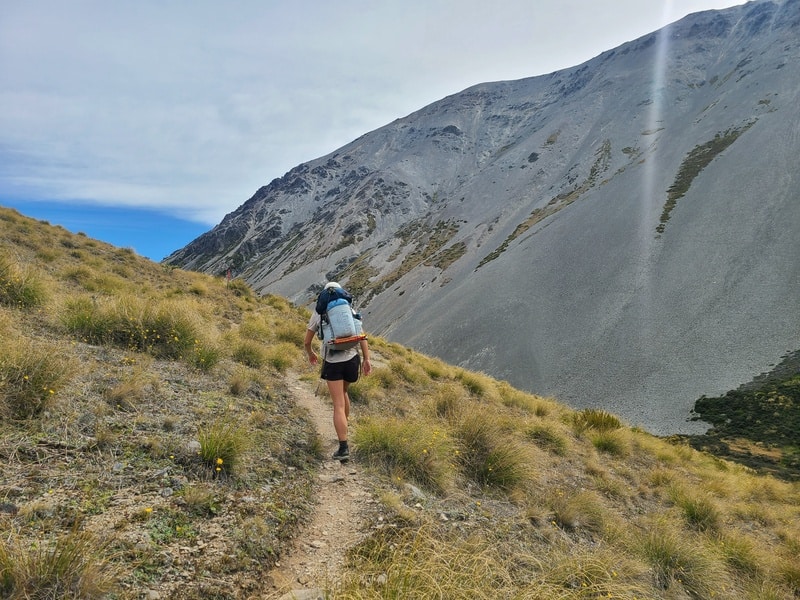
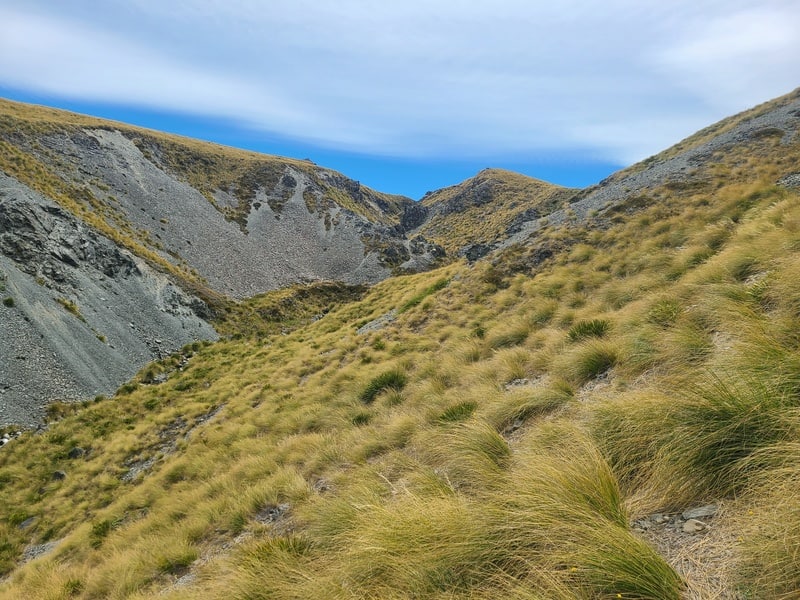
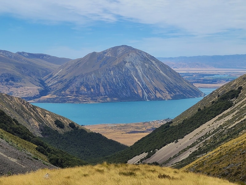
You’re walking through the valley with the Ahuriri River East Branch never far away. You’ll cross the river a couple of times, but you can more or less keep your feet dry if you really want. The ridgelines on either side of Ohau Peak look amazing, and the scree/boulder fields coming down are awesome to see.
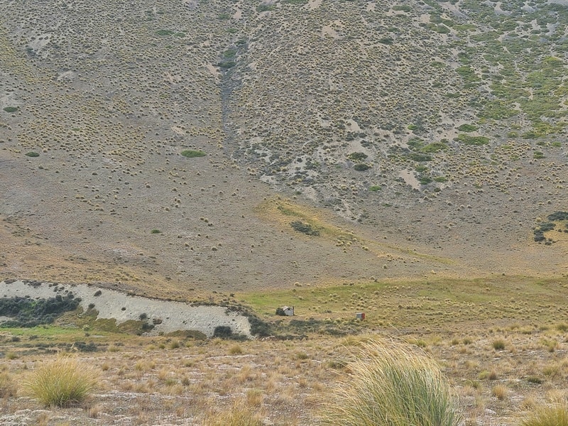
Make sure to spot the derelict East Ahuriri Hut too.
In terms of orange markers, we did lose the track a couple of times, we referenced the best topo map app a few times to make sure we were on the right path.
But there’s a track most of the time that’s easy to follow and if you keep an eye on the markers you should be good to go.
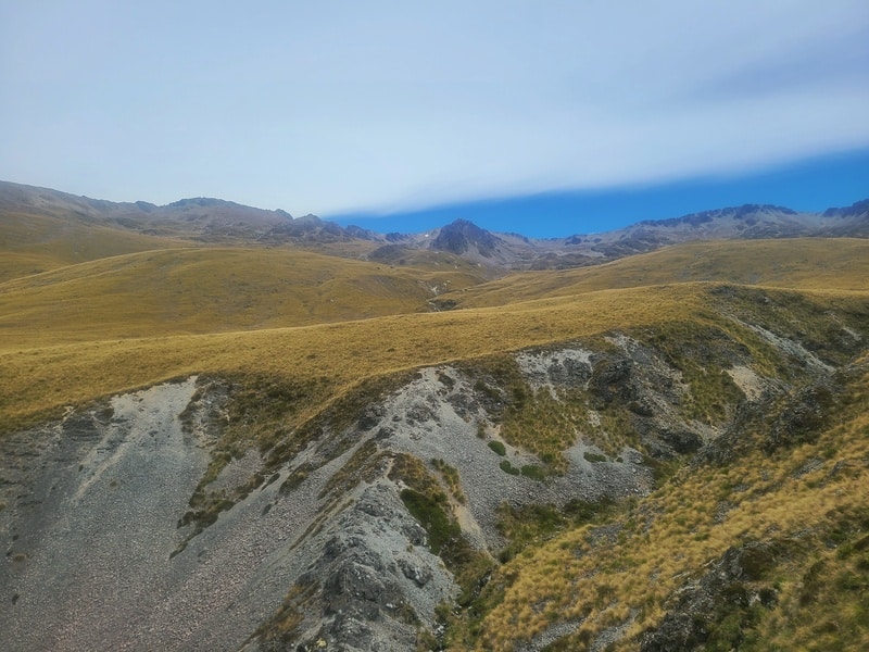
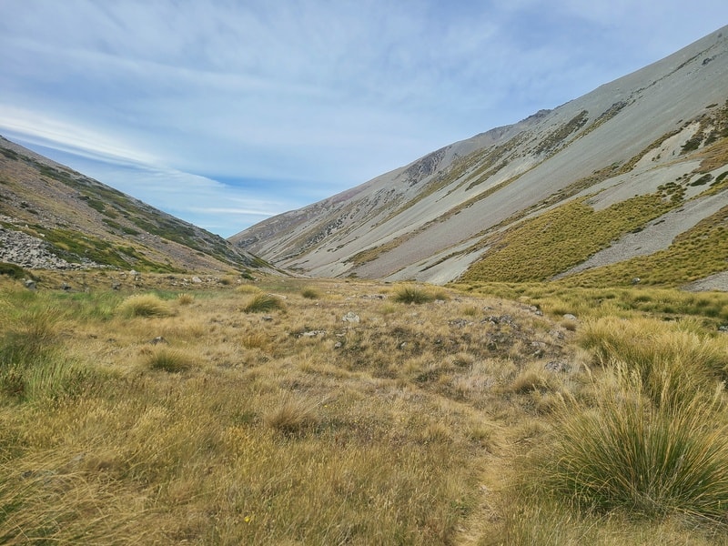
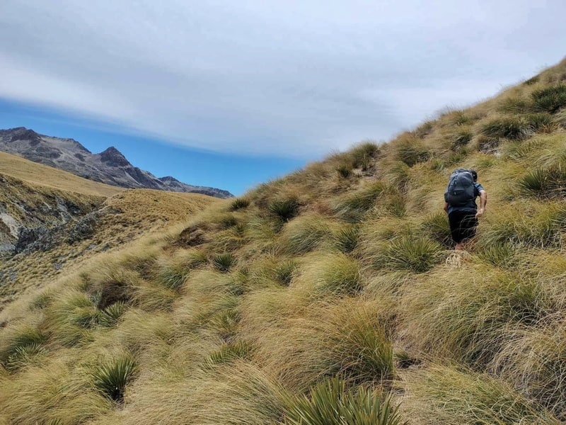
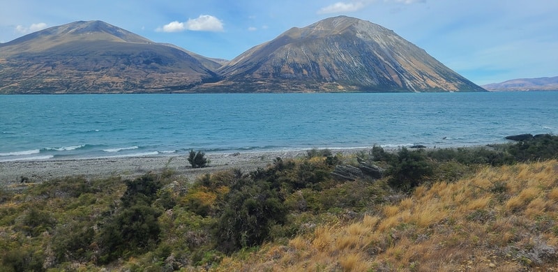
Towards the end of the 15km section the valley opens up and you’ll see some more cool ridgelines nearby. There’s no obvious highpoint, but you’ll soon find yourself frolicking down the hill and then you’ll catch a magical first glimpse of Lake Ohau.
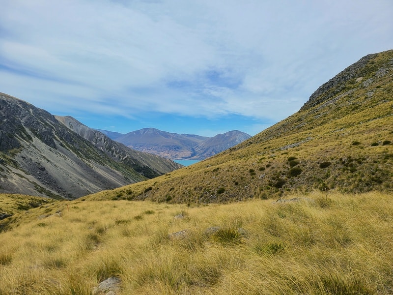
It’s still a long way to go from here though, as you begin the steady descent back down.
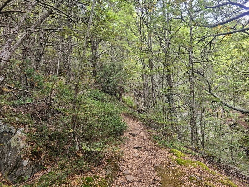
Once you get into the bush, you might appreciate the change in temperature we felt. It’s a beautiful section of track with enough rocks to keep you focused. And there’s a couple of short boulder field sections to pass through.
After a few kms of bush, you’ll emerge onto the Alps 2 Ocean Cycle Trail.
This is the final section! You’ll be out of the treeline from here on out as you weave your way down to Lake Ohau Road via the Te Araroa Trail.
But, if you decide to stay at Lake Ohau Lodge then you’ll want to stay on the Alps 2 Ocean Trail all the way through. Once you’re on the lakefront, you’ve got a couple of kilometres to go back to the village etc.
Now that I’ve completed the track, I’m keen to check out more of the Ahuriri Conservation Park!
The East Ahuriri Track might not get any recognition among locals, and even among those who do the Te Araroa Trail (there’s fierce competition), but it’s a beautiful area and provided the transport isn’t too much hassle, worthy of putting on your list.
If you have any questions/comments, leave a message below or email jub@churnewzealand.com.
Chur.
p.s. you can find all the hikes I’ve documented in this map (clicking on the icons will provide more info):

Hey, it’s Jub here. I’m the guy behind Chur New Zealand, helping you have the best time hiking, trekking, walking…whatever you want to call it…in NZ. I’m based in Queenstown and am always out and about exploring trails, old & new. If you have any questions, reach out.
Just did this from Ōhau over three days 2 nights camping. Was fab for three older women! Finished at birch wood road where we left a car. Beautiful high country scenery
Hey Lindsay!
Stoked for that. I was there over that same weekend but further up Birchwood Road. I forgot how beautiful it is. Stoked.
Chur,
Jub