
The Orokawa Bay walk is nifty. The beach can’t be accessed by car so you won’t be sharing it with many of the masses compared to the main beach. If only it was a suitable spot for swimming.
That said, it’s only a 5km out and back walk (there are options for longer), so won’t take up much time and is a great beach for a picnic and sunbathing.
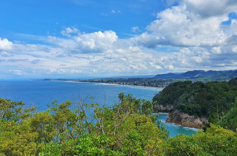
This post will give you everything you need to know about the Orokawa Bay walk, along with plenty of photos.
TABLE OF CONTENTS
1. Orokawa Bay Walk Details
2. Orokawa Bay Walk Map
3. How To Get There
4. My Orokawa Bay Track Experience
1. OROKAWA BAY WALK DETAILS
QUICK DETAILS:
- Distance: 5.2km return
- Elevation Gain: ~180 metres total
- Difficulty: Easy
- Download the GPX File
How hard is the Orokawa Bay Track?
Easy. There are some spots where there are steep drops so keep young children close. The terrain itself? Chill.
What’s the distance of the Orokawa Bay walk?
I recorded the distance at just over 5km return. Tell your friends it’s 6km to be on the safe side 😉
Is there much elevation change on the track?
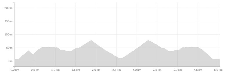
My watch had 181 metres of elevation gain for the walk. Although there’s you’re never really walking on flat terrain, you only get up to 78 metres above sea level. It’s nothing crazy.
Here’s the elevation profile:
How long does the walk take?
I walked with two friends and it took us 1 hour and 20 minutes return. That’s with maybe 5 minutes hanging out at Orokawa Bay. In terms of walking time, you could get it done in an hour if need be. On the slower walking pace, you should be there and back within 1 hour 40 minutes.
On top of this you’ll won’t to factor in the time you spend at the beach.
2. OROKAWA BAY WALK MAP
The map below has my GPX file overlaid on a topo map. If you click on the map, you’ll be able to see the route closer in a new tab.
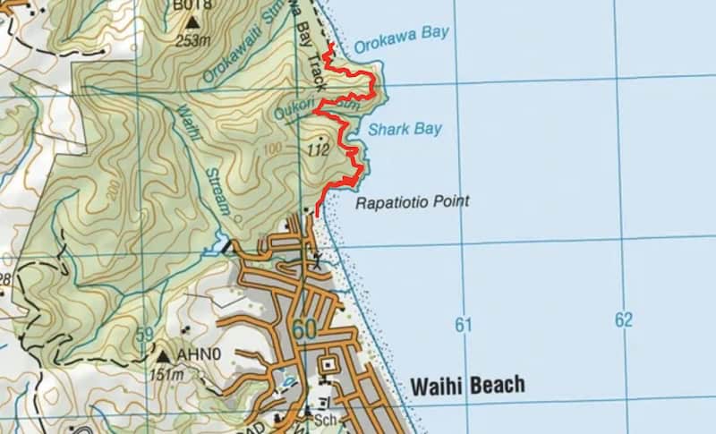
The trail is also on Maps.me and Google Maps. As long as you get to the trail head, you won’t get lost.
As always, use this topo map app for the best hiking app in NZ.
3. HOW TO GET THERE
The walk starts at the northern end of Waihi Beach where there’s free car parking on The Esplanade. If you’re staying in Waihi Beach, you’ll be a short walk away.
If you’re coming from Tauranga, you could look to catching the bus from Tauranga to Waihi Beach. Though the bus can be pretty slow going as it takes a break in Katikati before continuing on to Waihi Beach. You can see the timetables and fares here and here.
4. MY OROKAWA BAY TRACK EXPERIENCE
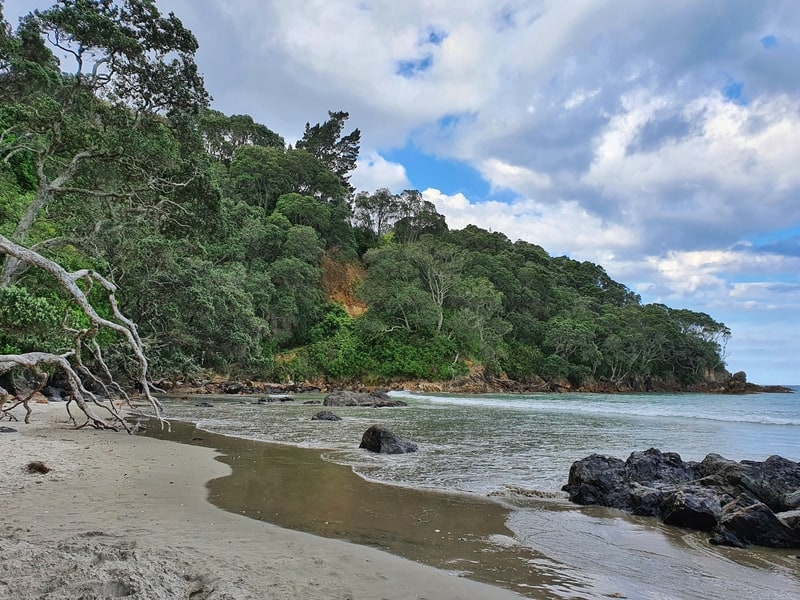
I did the Orokawa Bay walk on a whim with two friends after we drove up from Tauranga on a Tuesday afternoon. After grabbing a scoop of chips from the takeaway shop around the corner, we set off to find the trail head.
We soon learned you might not be able to safely access the trailhead if there are big waves crashing up the beach at high tide. Luckily we got through okay.
The trailhead is easy enough to find, simple walk onto the beach and head north. Keep walking on the sand towards the pohutukawas until you see the green DOC signs pointing you in the right direction.
The Orokawa Bay walk is a coastal track, so you’ll be following the coast pretty closely the whole time. The sound of the ocean ever-present. Love that.
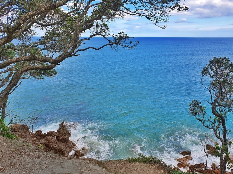
As soon as you leave the sand and get onto the packed dirt trail you’ve got a bit of an incline which leads you to a junction. Take the right-hand route, it’s only 150 metres to get to the viewpoint.
It’s not really a viewpoint thanks to the pohutukawa trees, but you’ll get a glimpse through to the ocean and back at Waihi Beach.
Turning back, to go left at the junction, you’re walking along a well-constructed track that gets a little rocky/rutty at times. Thankfully you’re under a thin coverage of trees the majority of the time on this walk, so you shouldn’t get to sunburned on the way to/from Orokawa Bay.
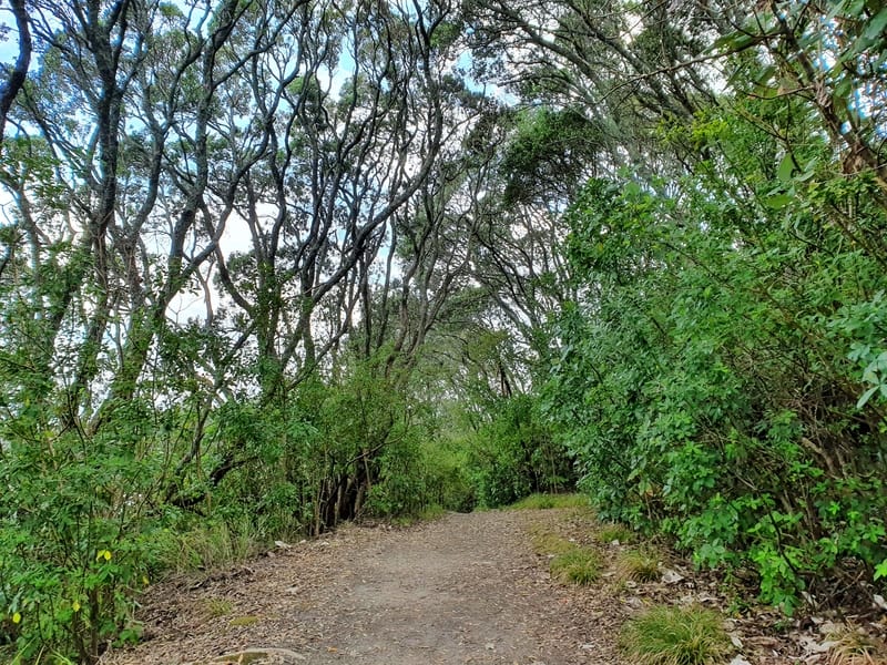
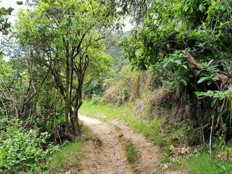
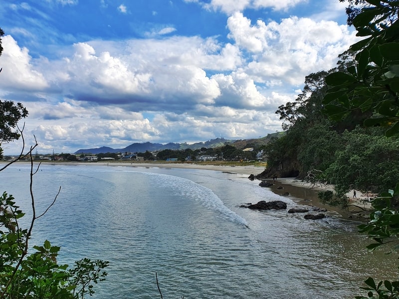
There’s not much to say about the trail as you follow the coastline and hear the occasional bird song. In less than 2km, you’ll be at the peak of the trail (78 metres above sea level) leaving you with a cruisey descent down to Orokawa Bay Beach.
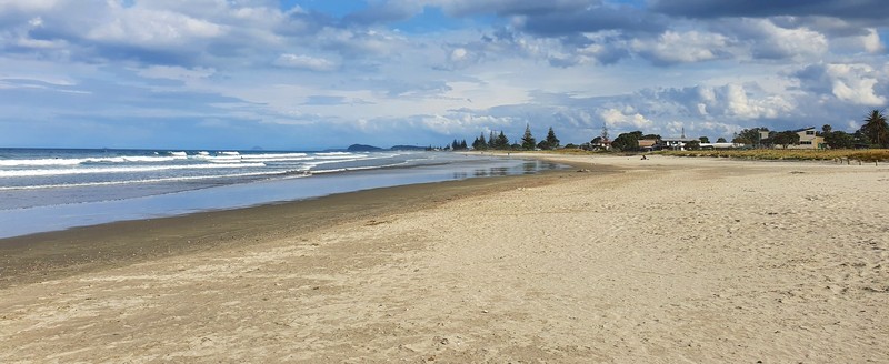
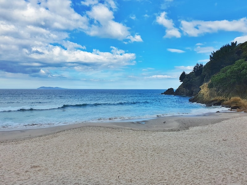
You’ll know when you get to the bay when you see more pohutukawa trees lining the beach with sand that’s softer than Waihi Beach.
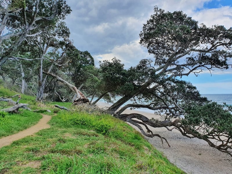
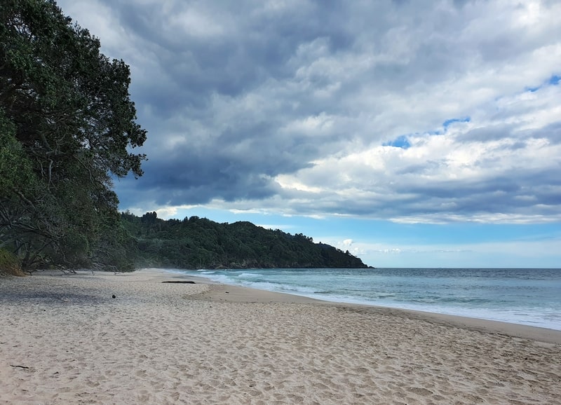
The beach is a few hundred metres long, so it’s up to you where you want to park up for a picnic. Be careful getting down on to the beach, there are some steep drops. One of our group took a nice fall 😉
As I mentioned earlier, the beach isn’t safe for swimming.
You’ll see when you arrive how the seafloor declines into the ocean quickly. You can even see the rips from the shore. BayofPlentyNZ.com mentions there’s the potential for good fishing off the rocks at the northern end of the beach so that may float your boat.
In short: practice good water safety.
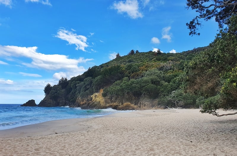
If you want, you can continue walking deeper into the scenic reserve but the majority of us are going to return to Waihi Beach. Just head back the way you came. As you don’t need to go back to the viewpoint, you’ll get back slightly quicker.
Waihi Beach is a popular seaside beach holiday vacation with its beautiful beachfront. But you can still get away from the crowds at Orokawa Bay Beach. Do the Orokawa Bay walk.
If you’ve got any questions or comments on this walk, drop a comment below or email me jub@churnewzealand.com
Chur.
p.s. Here’s a map of all the walks and hikes documented on Chur New Zealand. You can click the icon to see brief details, as well as a link to read more about the hike (like this post).

Hey, it’s Jub here. I’m the guy behind Chur New Zealand, helping you have the best time hiking, trekking, walking…whatever you want to call it…in NZ. I’m based in Queenstown and am always out and about exploring trails, old & new. If you have any questions, reach out.