The Munro Beach Track was a sneaky good surprise.
It’s not a track you’ll here people talk, but if about you’re looking to break up the drive between destinations on the West Coast (e.g. Haast and Franz Josef), a couple of hours strolling to Munro Beach works a treat.
We decided to go after spending the night at Mataketake Hut as we had time up our sleeves, and neither of us had heard about it until I was scrolling around on the topo map.
And we were there in November, so were on the lookout for Tawaki/Fiordland Crested penguins (failed).
This post will give you all the details to know about the Munro Beach Track.
TABLE OF CONTENTS
1. Munro Beach Track Details
2. Munro Beach Track Map
3. How To Get There
4. My Munro Beach Walk Experience
1. MUNRO BEACH TRACK DETAILS
QUICK DETAILS:
- Distance: ~5km return
- Elevation Gain: ~60 metres total
- Difficulty: Easy
How hard is the Munro Beach Track?
Easy. It’s short and with minimal elevation, you’re good to go.
What distance is the Munro Beach Track?
DOC has 4.7km return, I logged 4.9km. By the time you walk about the beach a little bit, consider it 5km return.
What is the elevation gain of the Munro Beach Track?
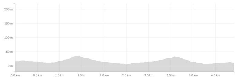
There’s minimal elevation change on this track, with my watch totalling 61 metres return. There’s a gentle rise and fall on the track…but it’s more or less flat. Here’s the elevation profile:
How long does it take to do the Lake Munro Track?
At 2.5km each way, you can comfortable walk to Munro Beach in 30 – 45 mins. Same with return. The biggest factor will be how long you spend at the beach. Expect the walking time to be in the 60 to 90 minute range.
Will I see penguins?
Don’t go in with the expecting to see them. You can see them from September to November (maybe earlier) on the beach or in the water during breeding season. There numbers have been dropping though 🙁 If you do see them, keep your distance!
You may see them occasionally after November as well.
We didn’t see any…but I wish I’d read Cat and Joe’s post giving tips about seeing them. Scroll down on that post and you’ll learn the tricks of the trade to increase your chances.
Are there sandflies at Munro Beach?
Yeap. We were there on an absolutely stunning day, and it only took a couple of minutes for the sandflies to zone in on us. It’s a West Coast beach…
Hopefully there’s a nice warm gentle breeze while you’re there to minimise their annoyance.
2. MUNRO BEACH TRACK MAP
You don’t need a map for this walk. It’s well signposted, maintained, and more or less flat. But you can see the Munro Beach Track on the topo map below anyhow.

You can always download this topo map app, it’s great.
3. HOW TO GET THERE
The only way to get there realistically is to drive. There’s a decent sized carpark which does get full on a sunny summers day. If it is, you shouldn’t need to wait long for a spot to become free given the short distance.
From Haast: 31km/~30 minutes
From Franz Josef: 111km/1 hour 40 minutes
If you’re feeling fancy, you can stay right by the trailhead at Lake Moeraki Wilderness Lodge.
4. MY MUNRO BEACH WALK EXPERIENCE
After finishing our overnight hike, my partner and I had plenty of time before we needed to be in Wanaka so decided to head to Munro Beach to check it out. We were glad we did.
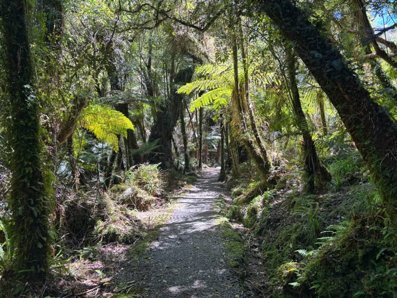
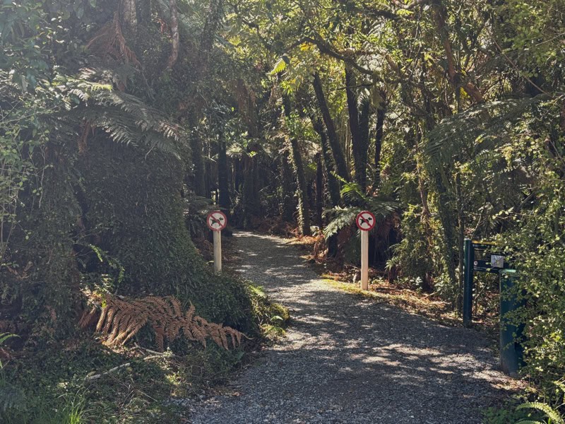
After snagging a park. We headed straight into the trail going straight into the rainforest, passing the blatant signs mentioning no dogs. Hopefully everyone follows the rules, they dogs are a risk to the native birds, especially the penguins.
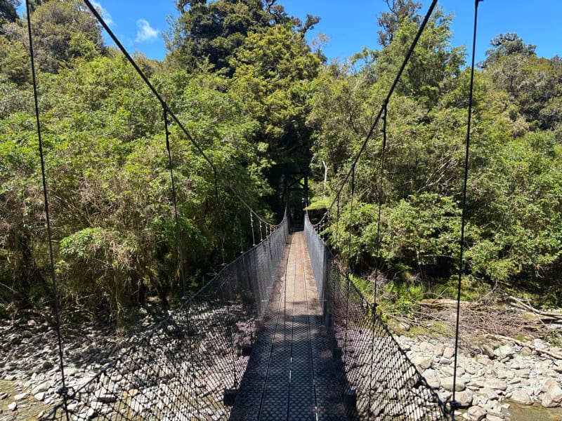
After a couple of minutes we were crossing the bridge over Munro Creek before winding through the the forest again. You’ll get spat out onto a section of road (turn right) which lasts for a few hundred metres (it’s not a drama it’s nice – and signposted).
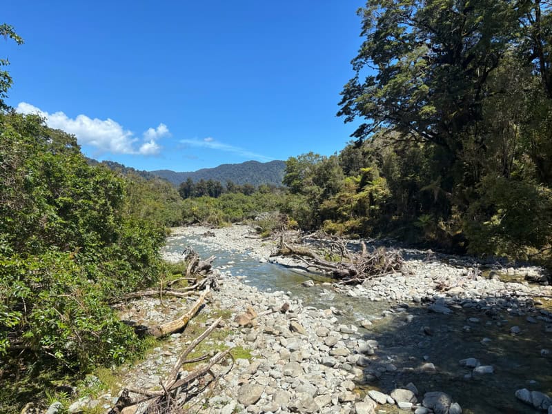
From there you have a few short sections that take you on a boardwalk…this prevents muddy feet, ideal. Shoutout DOC. The trail weaves through the forest…hopefully you’ll hear/see some birds on the way.
Then depending on the waves, you’ll start hearing them and know you’re nearly there. There’s a dinky little stream to cross…I didn’t get my feet wet getting over it. Success.
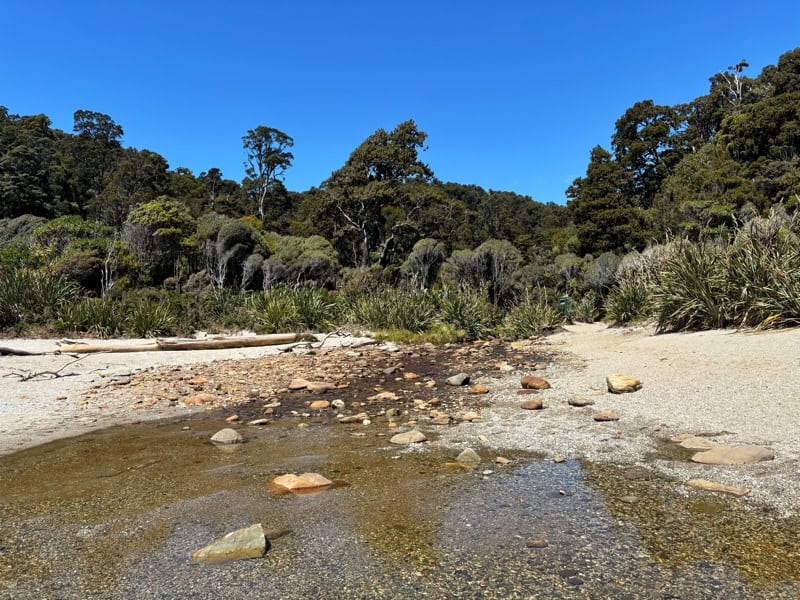
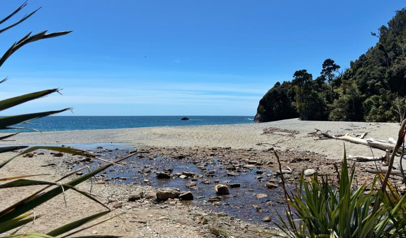
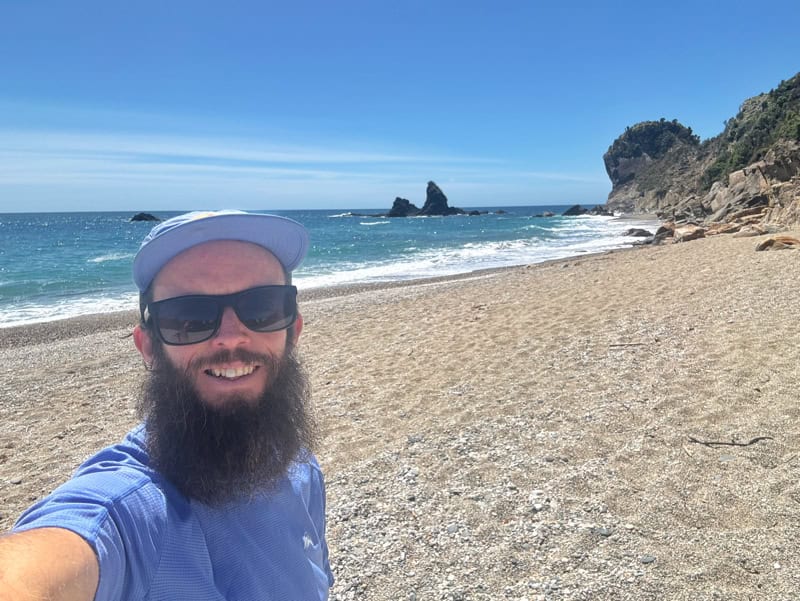
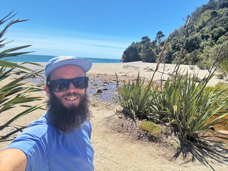
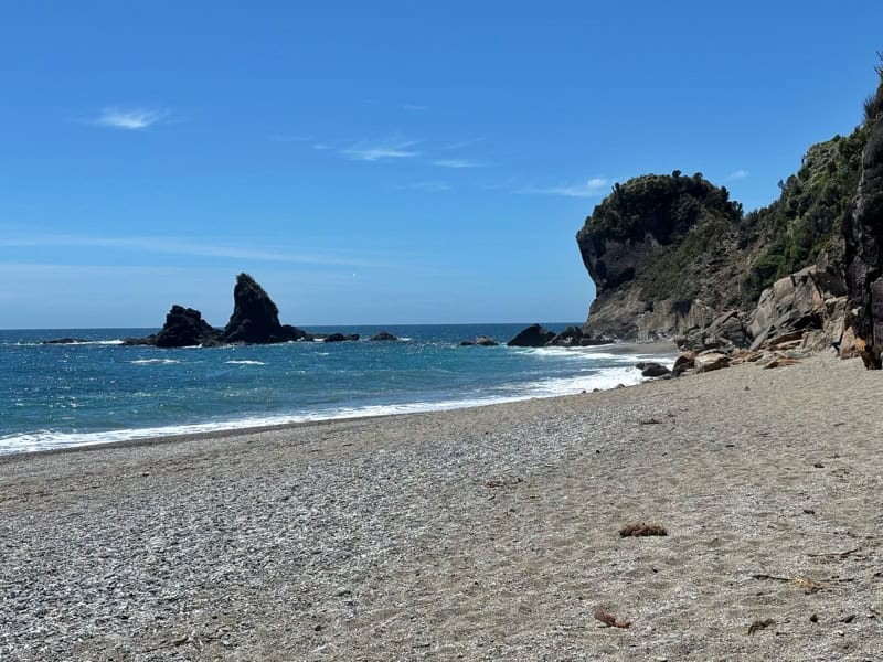
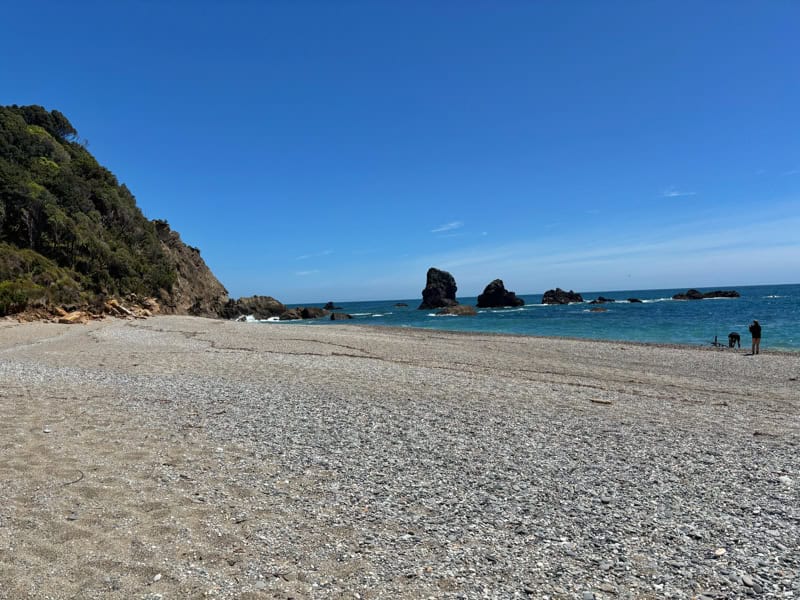
Then you’re on the beach! It’s stunning, and more than enough space for everyone…penguins included who are usually up towards the north end of beach (there are signs).
The beach is stunning, with the water looking epic and the beach nicely framed with rocks at either end. Enjoy!
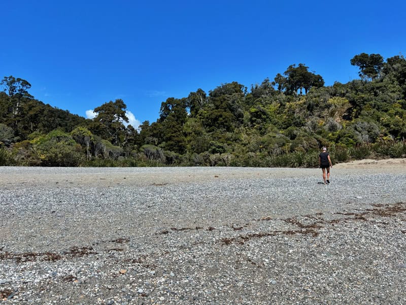
Looking back I love seeing the rainforest right up against the beach…there’s something that just makes me so happy about that.
Then you’ve got the easy return back to the carpark. Don’t forget to turn left while you’re walking along the road…there’s no drama, you’d just end up on the Lower Moeraki River Walk.
The Munro Beach Track might be a sneaky nice surprise for you, with neat rewards but not heaps of effort required. ! If you’re looking for an overnight adventure that’s only going to get more popular in the coming years, this is for you.
Got any questions or comments about walking to Munro Beach? Leave a message below or email jub@churnewzealand.com.
Chur.
p.s. Here’s a map of all the hikes and walks documented on Chur New Zealand. You can click the icon to see brief details, as well as a link to read more about the hike (like this post).

Hey, it’s Jub here. I’m the guy behind Chur New Zealand, helping you have the best time hiking, trekking, walking…whatever you want to call it…in NZ. I’m based in Queenstown and am always out and about exploring trails, old & new. If you have any questions, reach out.