Important: This post focuses on the short route to the Mount Karangahake summit hike. I’ll mention a longer route at the bottom of the post.
The Mount Karangahake walk is a loop walk under 10km that fills in a few hours. The walk starts on the gorge floor and finishes at the summit of Mount Karangahake, 500 metres above the Waitawheta River running through the Karangahake Gorge.
There are various routes you can take in the immediate area, but regardless of which track you take, it’s fair to say that this is the toughest of the Karangahake Gorge walks.

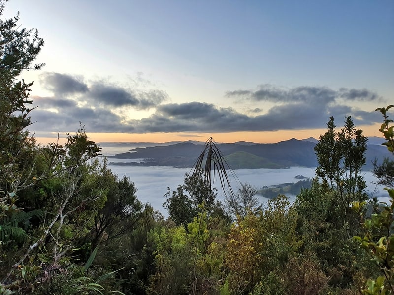
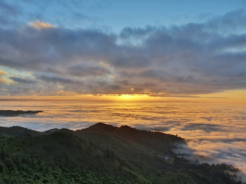
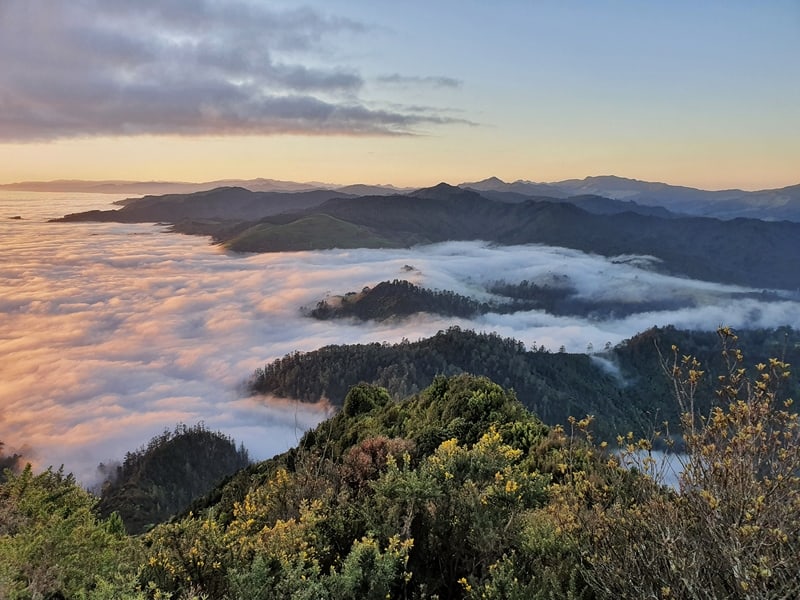
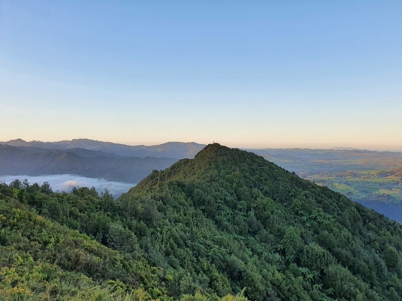
Enjoying sunset at the top of Mount Karangahake to prove I’ve been there.
TABLE OF CONTENTS
1. Mt Karangahake Summit Walk Details
2. Mt Karangahake Walk Map
3. How To Get There
4. Mt Karangahake Summit Trip Report
1. MT KARANGAHAKE SUMMIT WALK DETAILS
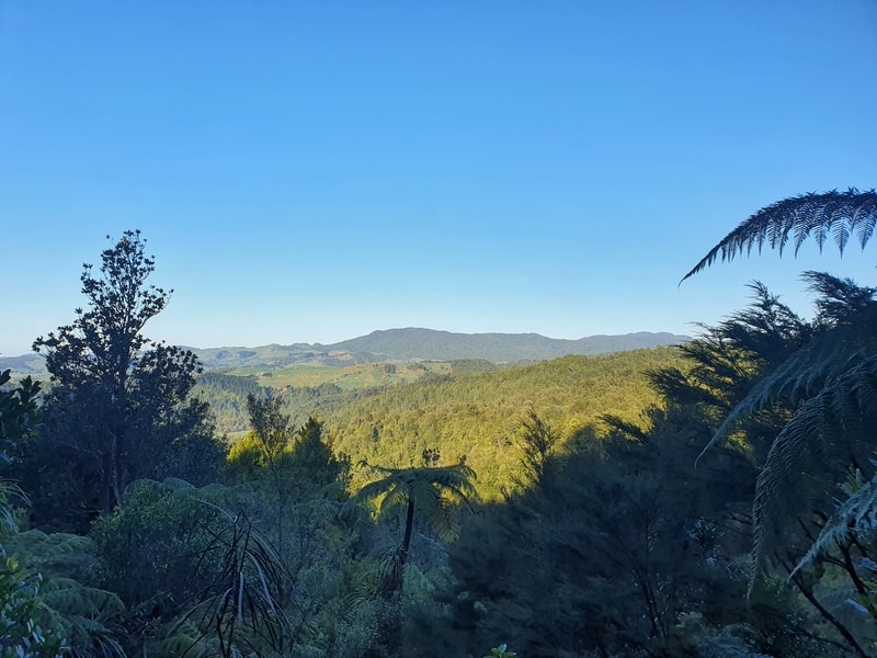
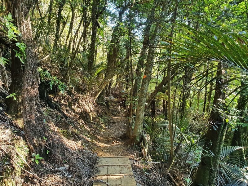
This walk is epic. The short loop doesn’t take you through the gorge at all, but you do get views on the way up. The trail is well maintained and easy to follow, but it’s not a perfect track so there is a little bit of a challenge to the hike when you add incline to the equation.
Given the climate, there’s often going to be cloud obstructing your views from the summit, so you’ll have to be flexible with your plans if you want the best views.
How long is the Mt Karangahake Mountain walk?
8.8km according to my Strava data. The majority of the track is visible on Google Maps (see below) and is 8km, but that ignores a few hundred metres that isn’t on the map. Maps.me has the route at 9km. Have 9km in your head.
How hard is this walk?
Medium. The track gets a little tight towards the summit, in addition to being a steady climb but it’s not for a long period of time.
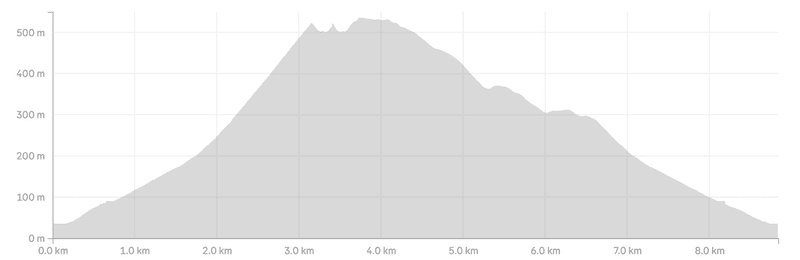
How much elevation gain is there to the Mount Karangahake Summit hike? In total, 551 metres according to my Strava data.
You can see the elevation profile for the loop here:
How long does the adventyre take?
It took me 2 hours and 14 minutes in total, with about 5 minutes spent at the siummit. If you were able to complete the walk in less than 2 hours I’d be very impressed. I’d say most people will take 2.5-3.5 hours to complete the loop, which includes lunch at the summit.
2. MOUNT KARANGAHAKE MOUNTAIN WALK MAP
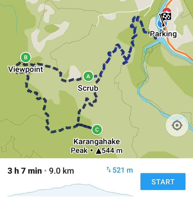
You can almost see the entire route on Google Maps, but the short offshoot to the trig is missing. That said, you can see the Mount Karangahake walking routes on Maps.me which is where the above map is taken from. Maps.me is actually great for following all the Kaimai walks.
3. HOW TO GET THERE
Driving and/or hitchhiking is the only practical way to get to the Karangahake Gorge. That’s assuming you aren’t doing the Hauraki Rail Trail cycle route.
Located on the twisty highway between Waihi and Paeroa, there are several car parks nearby but for this hike, you want to go to this car park right next to the highway.
4. MY MT KARANGAHAKE SUMMIT EXPERIENCE
Note: I’ll leave lots of photos from the track at the bottom of the post.
From the car park above, you’ll be able to see the trig at the summit you’re about to climb (if it’s a clear day). I couldn’t see it but knew the low cloud wasn’t thick.
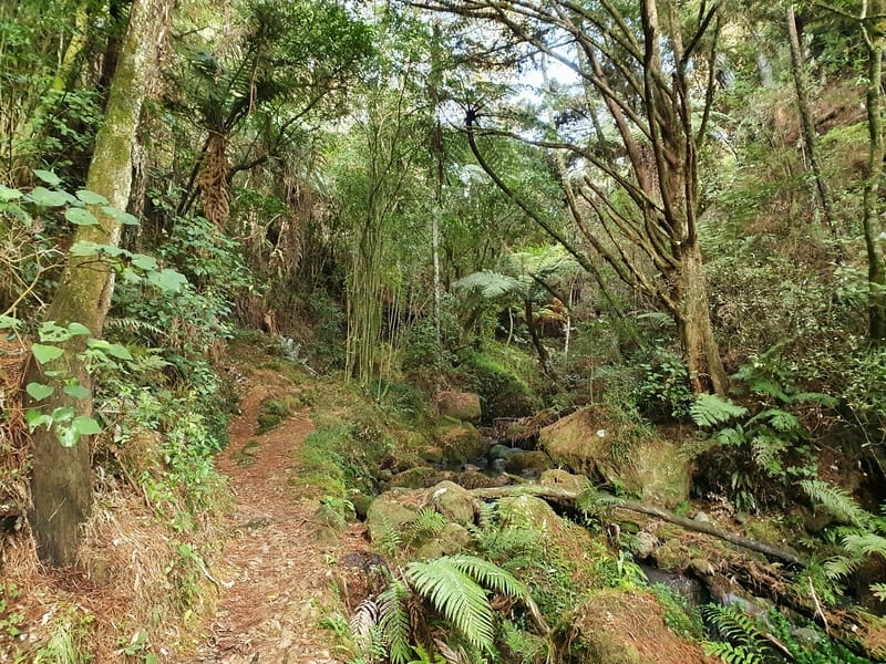
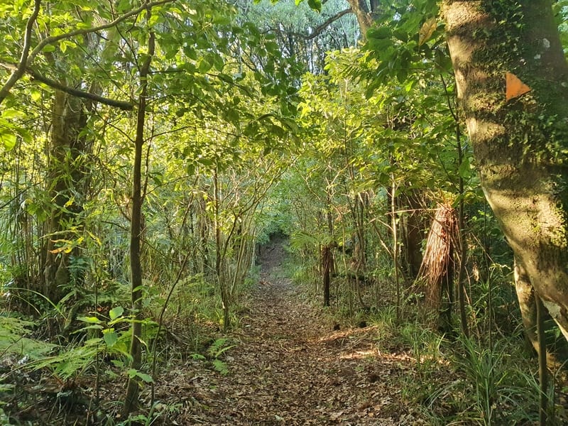
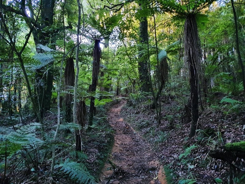
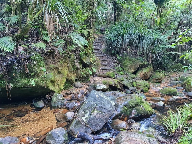
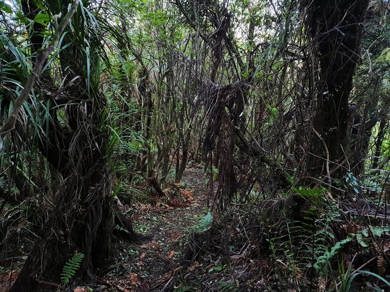
Crossing the first swing bridge, head towards the green signs where several tracks diverge. We’ll be taking the upper right-hand trail, the Scotsman Gully track (that’s the photo above). This is a short trail less than 1km long that follows a small stream which you’ll cross via some large rocks. It’s a nice intro to the walk.
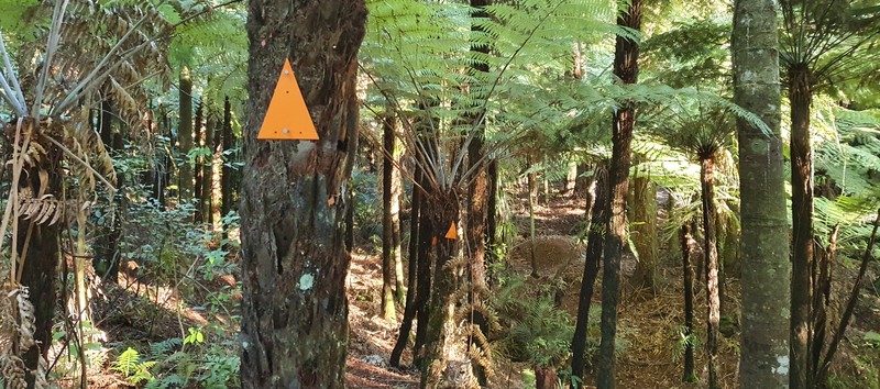
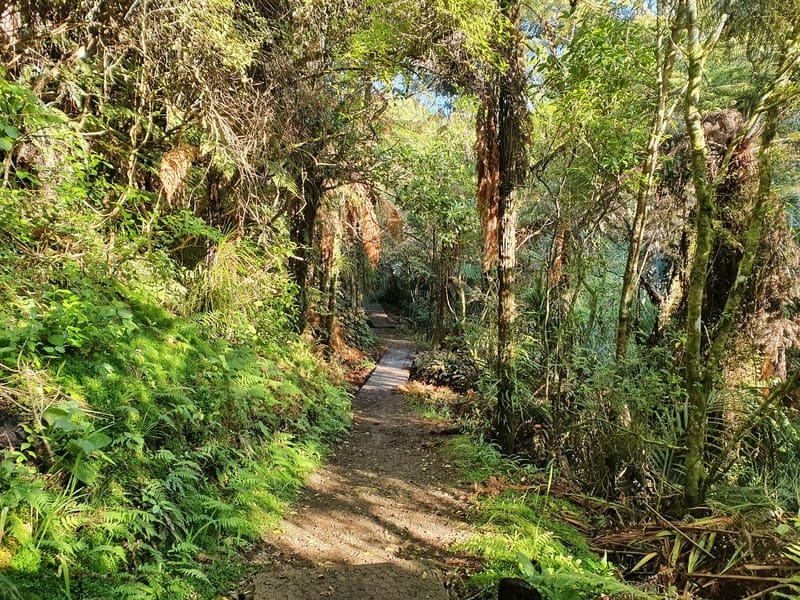
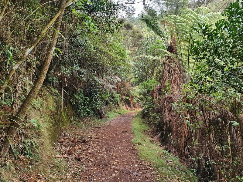
After the Scotsman Gully turn left onto the 4WD path. After 800 metres or so, you’ll see a right-hand turn which we take. This part of the trail is still in good condition, but you can feel the forest closing in around you. Depending on the day, you might be walking through fog already.
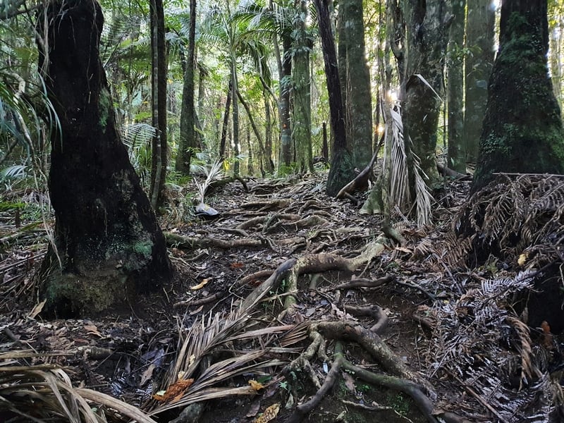
The incline is starting to get a little steeper on this section but it’s not until another 800 metres (~2.1km total) that the real incline begins. You’ll see a track splitting off to the left like in this photo:
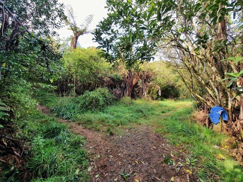
I left my blue hoody here on the fence to collect on the way back.
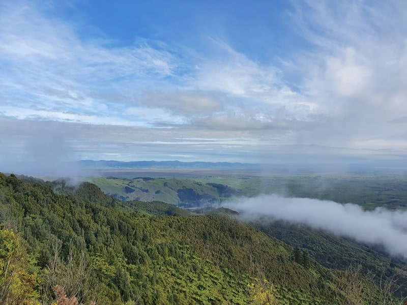
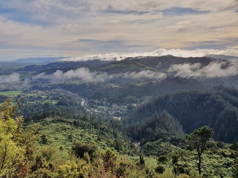
As soon as you turn left the difficulty increase. You’re now more or less down to a single trail track that can be muddy, and the further you get the more you’ll find the small shrubs and grass rubbing against your legs as you pass. There are some views poking out in between the gaps though. Again, depending on the cloud/fog situation.
I didn’t slip or fall at all on this section of the track, but you’ll want wear proper shoes (no jandals) on this walk.
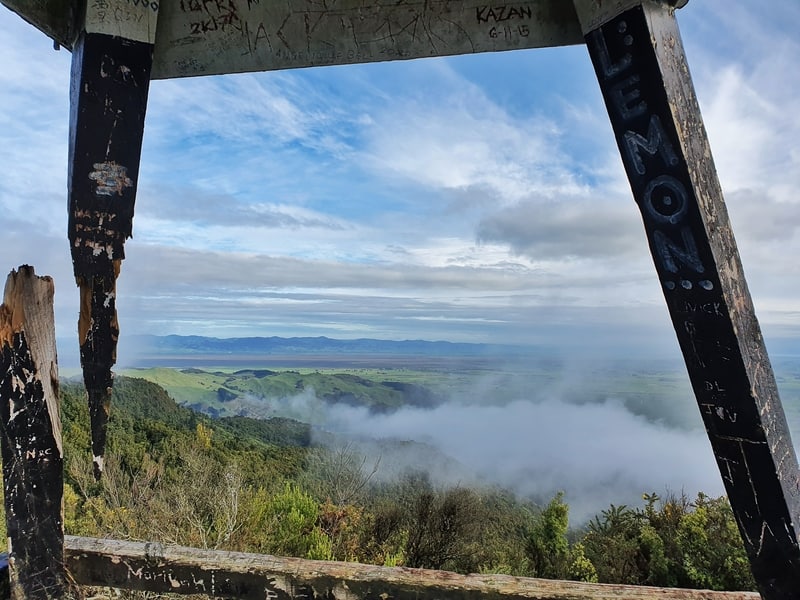
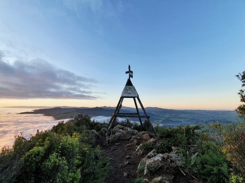
When the track starts to flatten out you’re close to the summit. On your left-hand side, you’ll see the trig, we make a left hand turn to walk the last few hundred metres to the summit. It’s an offshoot from the main track and is a little technical quite technical.
Now that you’re at the trig? ENJOY!
Once you’ve finished enjoying the summit you’ve got to return back via the offshoot then turn left to continue the loop. You could walk the way you came back down, but the full loop is easier on your knees, You’ll understand this once you’ve gone up. This part of the walk isn’t quite as exciting, but it’s still nothing to complain about.
There’s one sign you’ll come across that says there’s a viewpoint a few minutes away.
If you walk Mount Karagangahake and get to this lower viewpoint please let me know. This was my view…
Continuing on you’ll close the loop that started where I mentioned I left the blue hoody above.
From here on out it’s simply following your footsteps the rest of the way back to where you started. Yay.
There are easier walks in the Karangahake Gorge, which does mean this hike isn’t as popular. But man, this is good.
If you don’t mind a longer walk, you can incorporate the Dickey Flat Waterfalls and the Mount Karangahake by following this route. It’s just over 16km long, with 700 metres of elevation and contains some more tricky terrain in some sections.
If you have any questions and/ore about this walk/hike, leave them below or email jub@churnewzealand.com.
Chur.
p.s. annnd…here’s a few more photos.
p.p.s. Here’s a map of all the hikes documented on Chur New Zealand. You can click the icon to see brief details, as well as a link to read more about the hike (like this post).

Hey, it’s Jub here. I’m the guy behind Chur New Zealand, helping you have the best time hiking, trekking, walking…whatever you want to call it…in NZ. I’m based in Queenstown and am always out and about exploring trails, old & new. If you have any questions, reach out.
this looks great and I want to do this soon.
Hey Alison,
Awesome, I’m sure you’ll make it happen. Fingers crossed for a bluebird day!
Thanks for sharing well explained, it’s on my bucket list now
Awesome, make it happen and let me know how it goes!
Chur