Starting close to Ohau Lodge, this loop to Dumb-Bell Lake has a bit of everything, from cruisey bike trail (A2O), some of the Te Araroa, off-route hiking, and the Ohau Ski Field Road.
Views involve lakes (Dumb-Bell & Oahu), tarns, mountains, ridgelines, and pending conditions a view of Aoraki/Mount Cook.
You can make this an overnight hike, or a big day adventure. While we took the route we did, there are lots of variations possible in the area.
Let’s get into it.
TABLE OF CONTENTS
1. Details About The Dumb-Bell Lake Loop
2. Dumb-Bell Lake Loop Map
3. How To Get There
4. My Dumb-Bell Lake Loop Experience
5. More Photos
1. DUMB-BELL LAKE LOOP EXPERIENCE
- QUICK DETAILS:
- Distance of ~27km
- Elevation gain of ~1800 metres
- Hard off route hiking
- GPX file download here
How hard is the Dumb-Bell Lake Loop?
It’s hard. You’ll want to be confident hiking in the backcountry off trail. That said, if you’re making it an overnight trip…there’s plenty of time and no need to rush any part of the hike.
I had a bluebird day so navigation was easy enough. If you were in the rain/fog, this could get tricky quick.
What distance is the Dumb-Bell Lake Loop?
Based on my watch, the loop was 27.1km total. That includes the ~9km of Ohau Ski Field Road which you could avoid if you wanted to by getting a pick up at the carpark.
What is the elevation gain of Dumb-Bell Lake Loop?
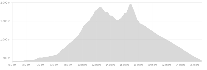
My watch has a total of 1,798 metres of elevation gain which is similar to what others get from what I can tell. There’s the one major climb, then after you drop down to Dumb-Bell Lake, you’ve got a climb back up the otherside.
Here’s the elevation profile:
How long does it take to hike the Dumb-Bell Lake Loop?
Consider this a full day hike. It’s hard to say how long it’ll take given the elevation and off track terrain. Give yourself at least 8 hours, and that’s hiking at a good speed. This does make for a great overnight hike, camping near Lake Dumb-Bell.
If you can get someone too pick you up from the top of Ohau Ski-Field, you’ll save yourself a couple of hours.
Is there much water along the route?
I drank the water from Freehold Creek above the bush line, and at the stream flowing out from Dumb-Bell Lake. If you’ve got a water filter (I didn’t have my Water 2 Go bottle), then I’d use that for the tarns.
Are the nachos at Ohau Lodge worth it?
Yes! If you get there between 4 pm and 5:45 pm, you can get a massive platter of nachos for $20. Vegan option available. It’s a big feed for two people. Good beer prices too. 10/10 would recommend.
2. DUMB-BELL LAKE MAP
Here’s the map overlaid on a map from topomap.co.nz. Clicking the image below will open it up in a new window on the website. If you missed it the first time, here’s the GPX file.
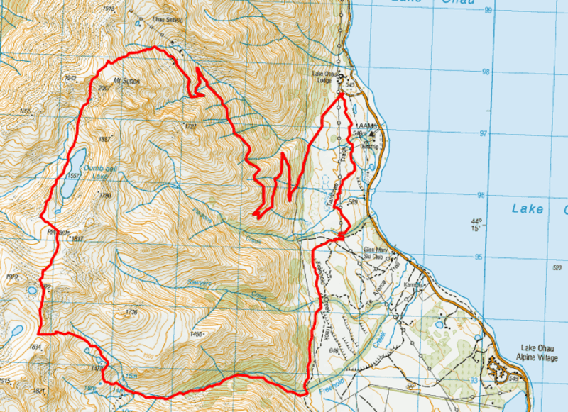
And as always, I recommend downloading the NZTopoMap app to install the GPX file on, it’s the best topo map app.
3. HOW TO GET THERE
Google Maps car park location.
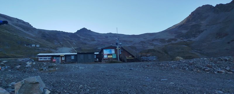
The carpark for the start of this loop is right by Ohau Lodge, at the bottom of the Ohau Ski Field Road, and the start of the Tarnbrae Track.
If you’re staying at the lodge, you can just walk a couple of hundred metres from the lodge to the trailhead.
Distance from a few nearby locations:
- Ohau Village: 8 mins/6km
- Twizel: 32 mins/37km
- Wanaka: ~1 hour 50 minutes/150km
- Lake Tekapo: 70 minutes/93km
4. MY DUMB-BELL LAKE EXPERIENCE
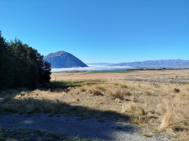
After driving through some low fog in the morning, we were stoked it was burning off as we arrived into the carpark next to Oahu Lodge. We faffed about getting ready, then started on the Tarnbrae Track, which is part of the Alps 2 Ocean Cycle Trail. It’s a cruisey start for the trail, and a good chance to cover some early ground in quick time.
After ~3km, we veered off the main trail as you can see on the GPX file, but if you wanted, you could follow the main bike trail as you’ll be back on it soon. That said, getting onto single trail is never a bad thing.
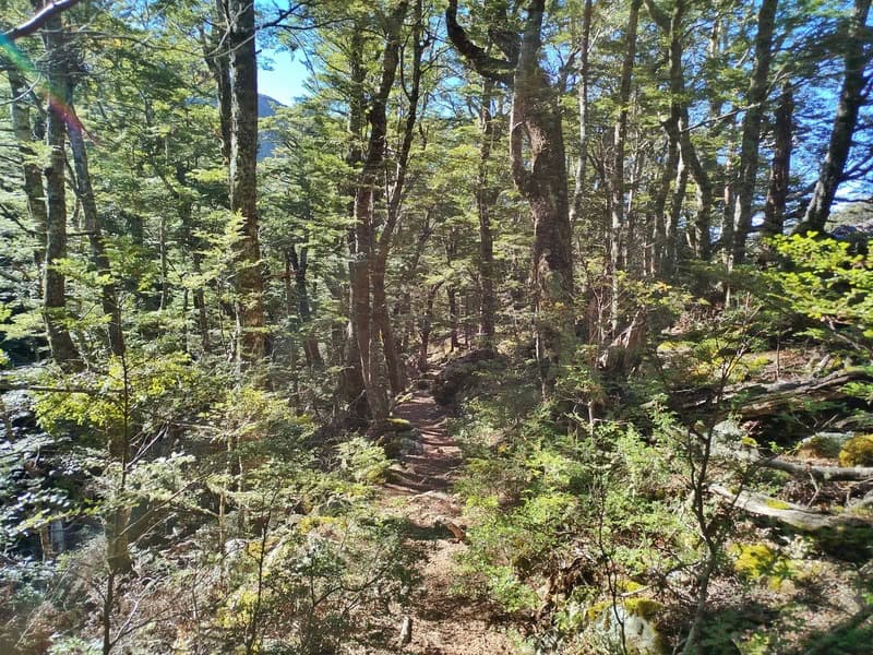
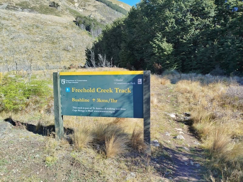
6km in, and you’ll see the big Freehold Creek Track sign which is where the real fun starts. This is a beautiful section of bush, and the only time you’ll be in shade the whole day. The trail follows Freehold Creek (true right) with the trail usually pretty easy to see, minus a little bit of tree fall which is inevitable. The couple of moraine sections you walk through are fun.
Emerging from the bush, you’ll have a couple of short boggy sections…it’s worth keeping your feet dry if you can. The track is a bit faded through here, but it’s not long until you’ll depart the Te Araroa Trail (a.k.a. East Ahuriri Track)and head towards the tarns.
I was following the GPX closely as we approached the turn off, as Freehold Creek seemed to be roaring at points. There is a track that leads towards where you cross the river, which you can keep your feet dry on if it’s running low.
From here, there’s a track you can kind of follow…but it comes and goes…just keep going up, I kept a close eye on the GPX I had.
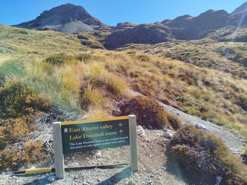
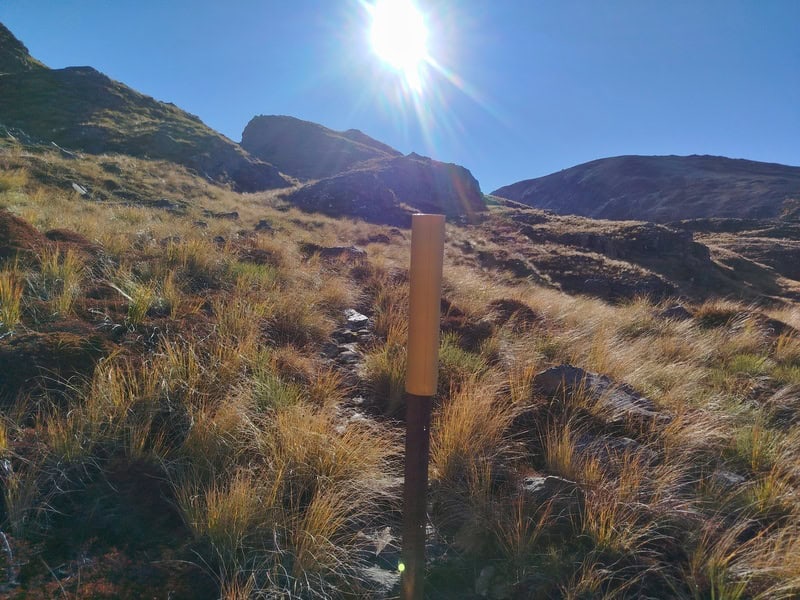
Out of nowhere is a DOC sign mentioning you’re heading onto unmarked route. Turns out, there was a definite trail formed which we were mostly able to follow with an occasional pole with a yellow marker spotted in the distance. There was also some cairns as well.
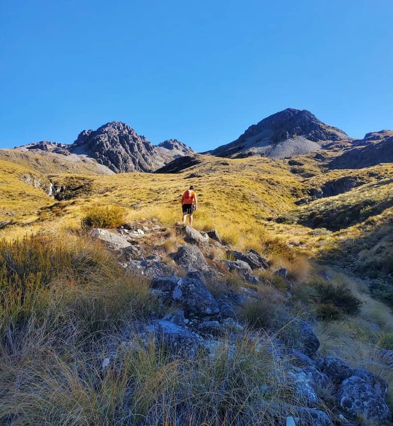
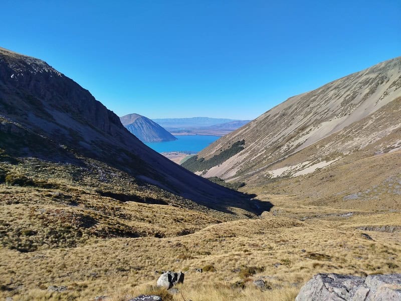
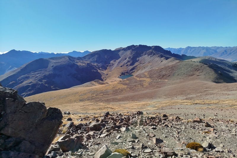
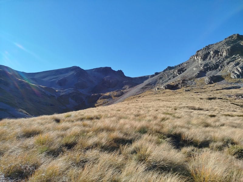
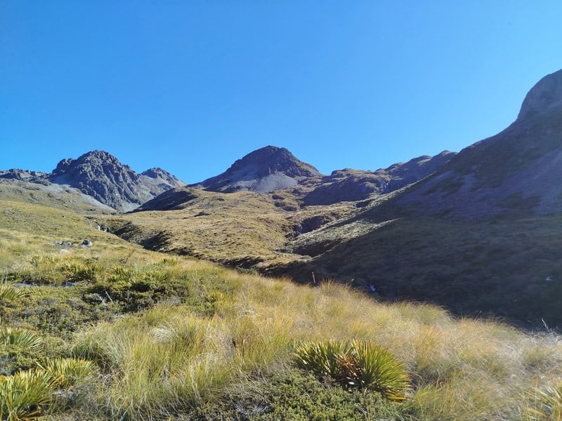
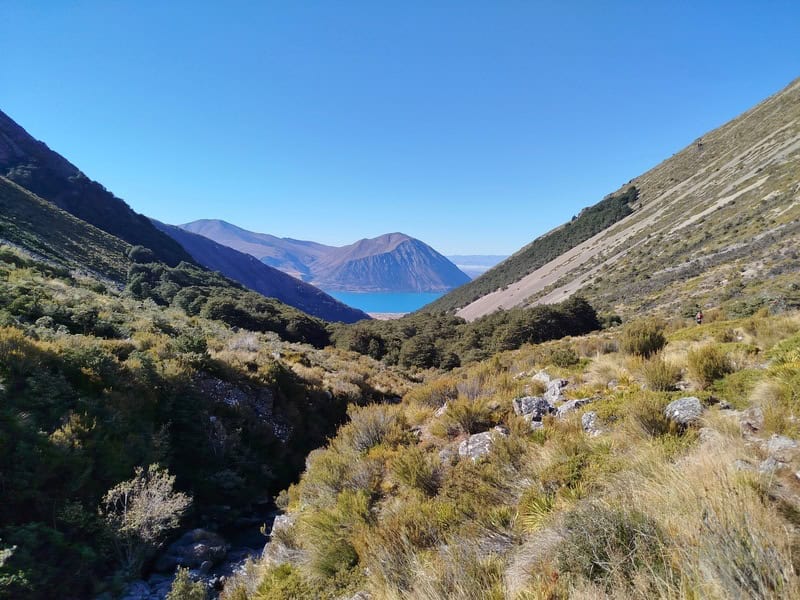
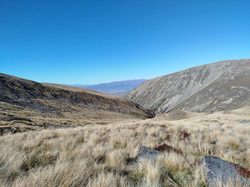
We passed by the two tarns that are prominent on the map, and our next highpoint revealed itself shortly after. Don’t forget to look behind you, the views back over Lake Ohau and the mountains are pretty spectacular.
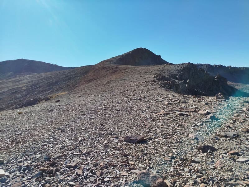
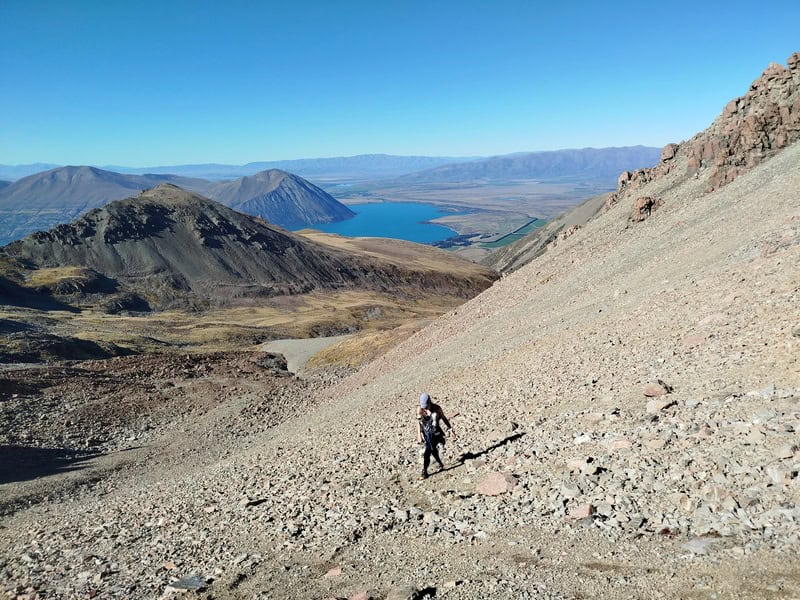
You’ll eventually leave the tussock, with the scree/rocky climb to a saddle ahead. It wasn’t nearly as long as we expected with good traction on the way up. Getting to this ridge was cool, with views in all directions. It’d be cool to spend more time up here exploring around some of the ridgelines. But we had to keep tracking, siddling towards the point between the tarn and point 1922.
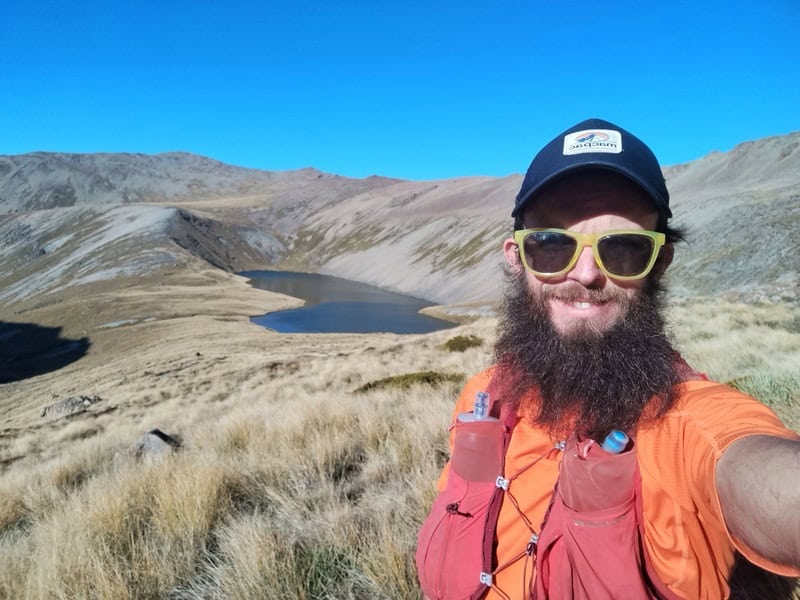
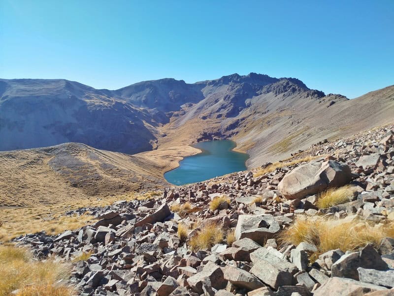
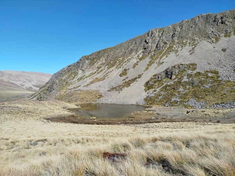
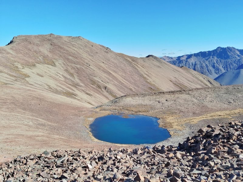
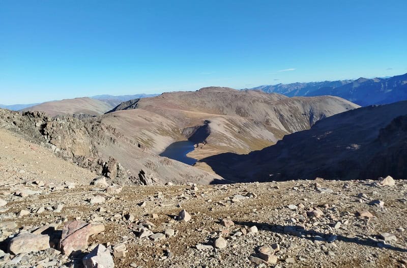
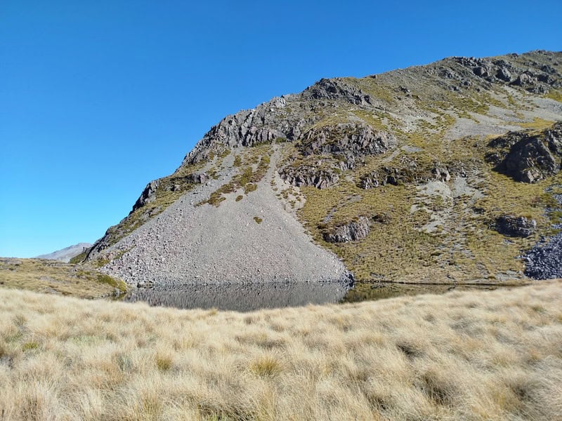
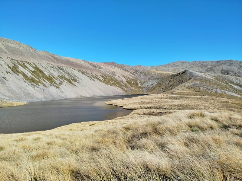
Not long after this we got a sighting of Dumb-Bell Lake for the first time. It looked like just another tarn from afar…but once closer, it’s definitely more than a tarn.
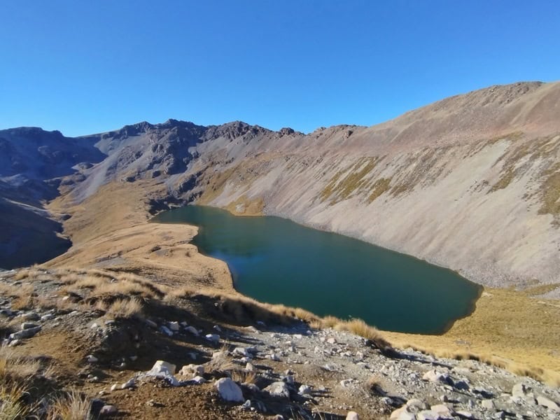
You can choose your own line here, in hindsight we went a bit too far east and crossed back to the small ridge just before dropping down to Dumb-Bell Lake. This is where I’d camp if doing this as an overnight trip…just east of point 1600 mark on the topo map. How good.
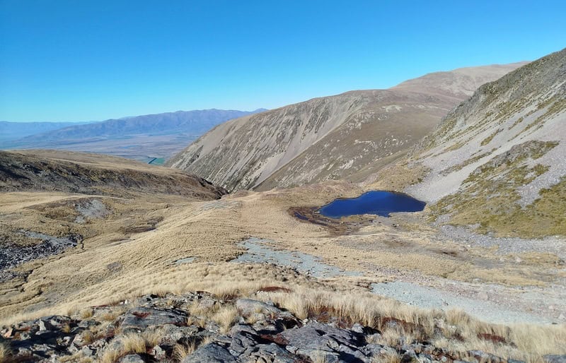
Spend as much time at Dumb-Bell Lake as you need. We didn’t spend too much time…but noted there was running water out of the lake. The climb up the other side of the basin looks intimidating! There wasn’t much in the way of tracks here…but follow the GPX more or less and you’ll be good as gold.
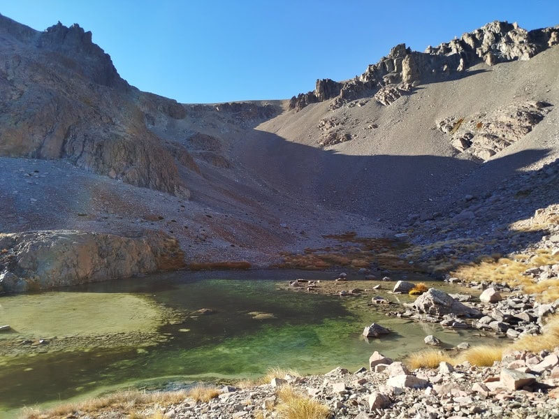
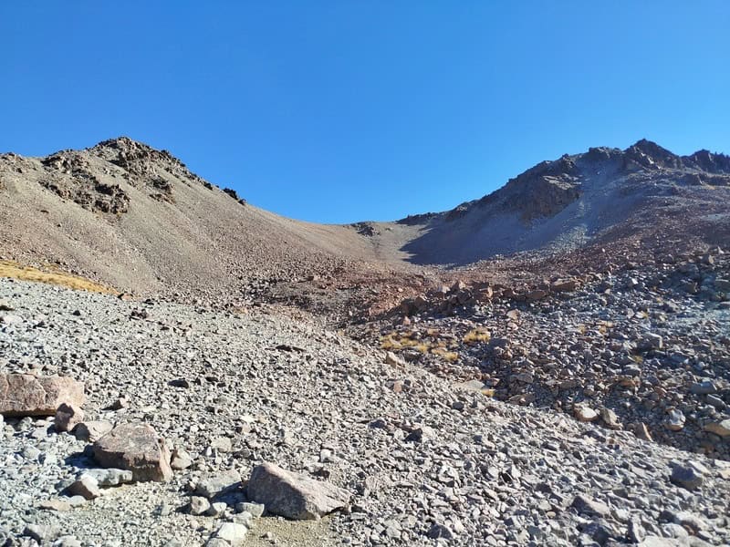
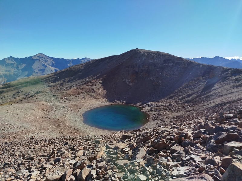
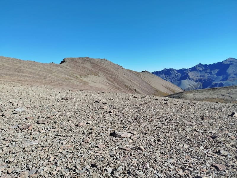
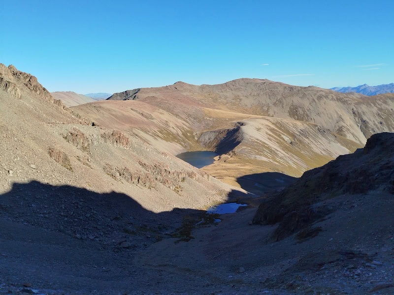
There was another surprise tarn we passed, and it wasn’t until the last 100 metres of so before reaching the top of the climb where it got super steep. If it was icy up here, that wouldn’t be fun.
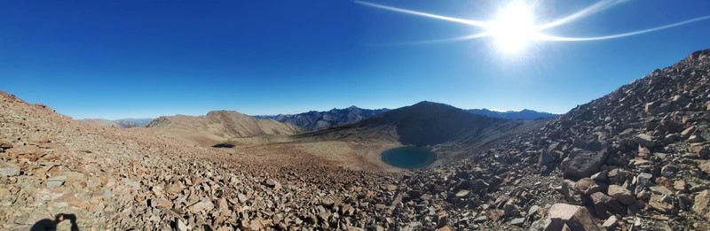
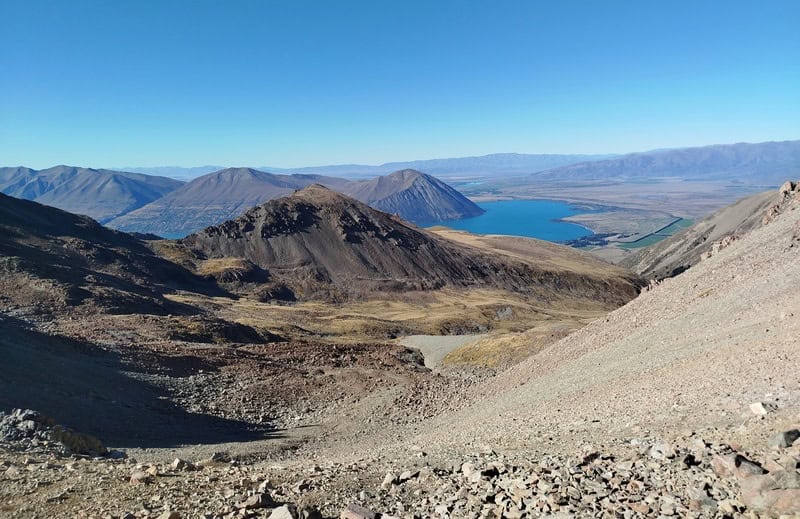
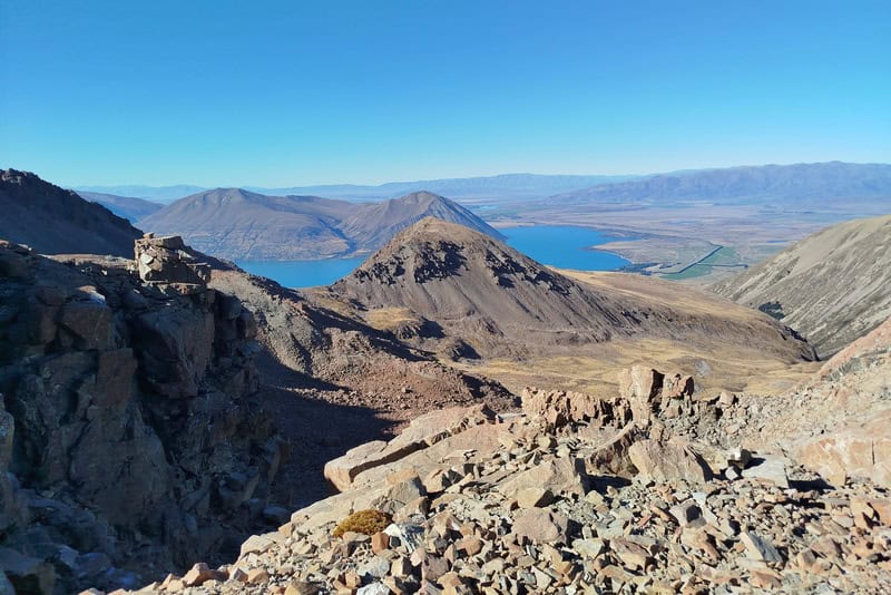
Hopefully you’ve got a beautiful blue sky with Mount Cook visible as in the photo below.
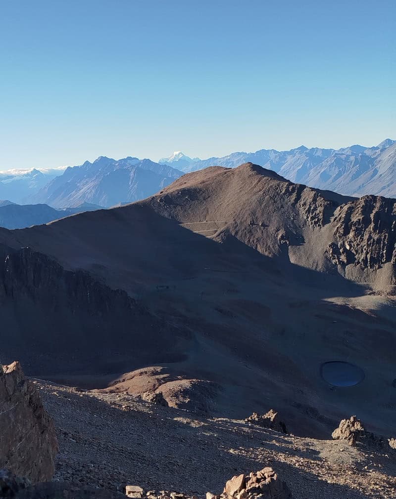
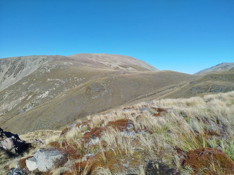
If you want, you could tick off Mount Sutton and say you got over 2000 metres of altitude.
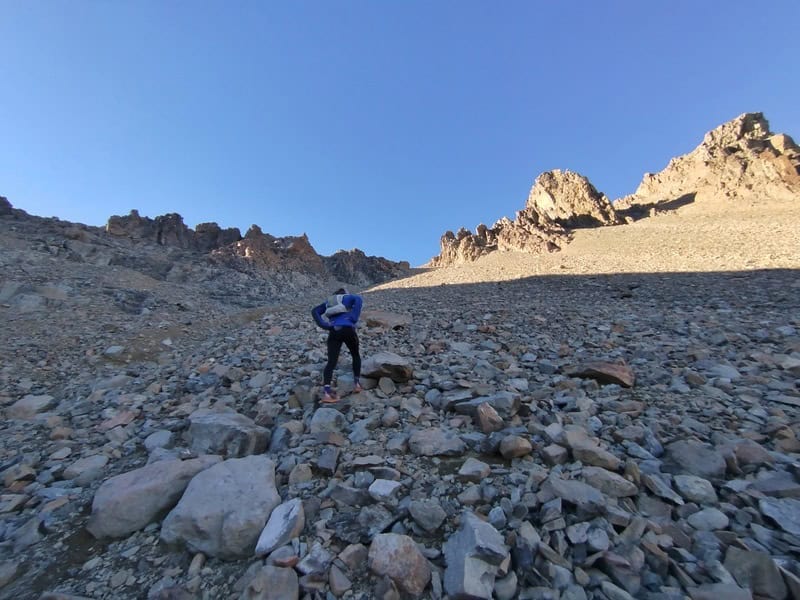
And then there’s the plunge down to Ohau SKi Field. It was quite intimidating, with about 450 metres of elevation descent in 1km on rockyish terrain. It was fine though, just no need to rush it.
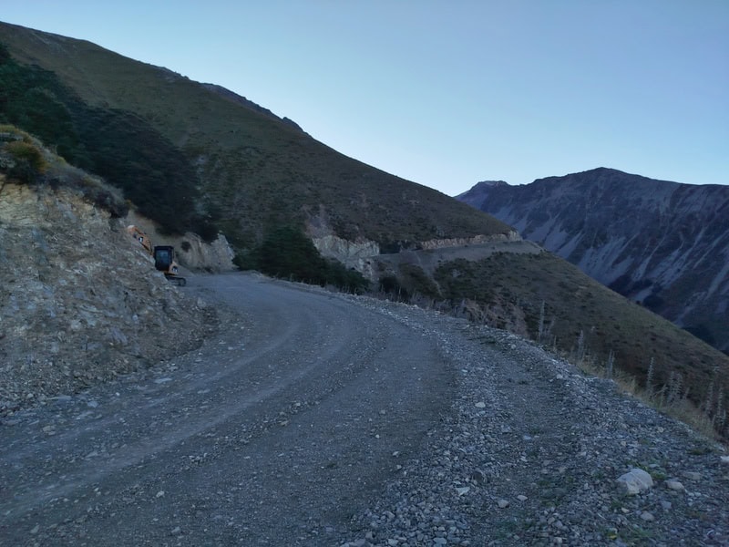
Hitting the ski field tracks, and it was all good as gold from here. In a perfect world someone would come to pick you up…or you might get super lucky with a hitch down. Otherwise it’s a 9km trundle down the hill at a nice gradient to at least make relatively quick work for the instance.
We heard there was a couple of spots where you can shortcut the trail, but we didn’t find them quickly so just followed the road all the way.
I loved the variety of the trail!
If you’ve got any questions or comments about hiking to Dumb-Bell Lake, let me know in the comments below or email jub@churnewzealand.com.
p.s. Here’s a map of all the hikes documented on Chur New Zealand. You can click the icon to see brief details, as well as a link to read more about the hike (like this post). If you’re looking for another epic nearby hike, go check out Gunsight Pass.
And if you’re still here…
5. MORE PHOTOS


Hey, it’s Jub here. I’m the guy behind Chur New Zealand, helping you have the best time hiking, trekking, walking…whatever you want to call it…in NZ. I’m based in Queenstown and am always out and about exploring trails, old & new. If you have any questions, reach out.