Daly’s Clearing Loop Track is an ~9km loop track.
It’s not a popular walk with many people doing the loop as a part of an overnight trip to Daly’d Clearing Hut.
This post will give you all you need to know about taking on this walk.
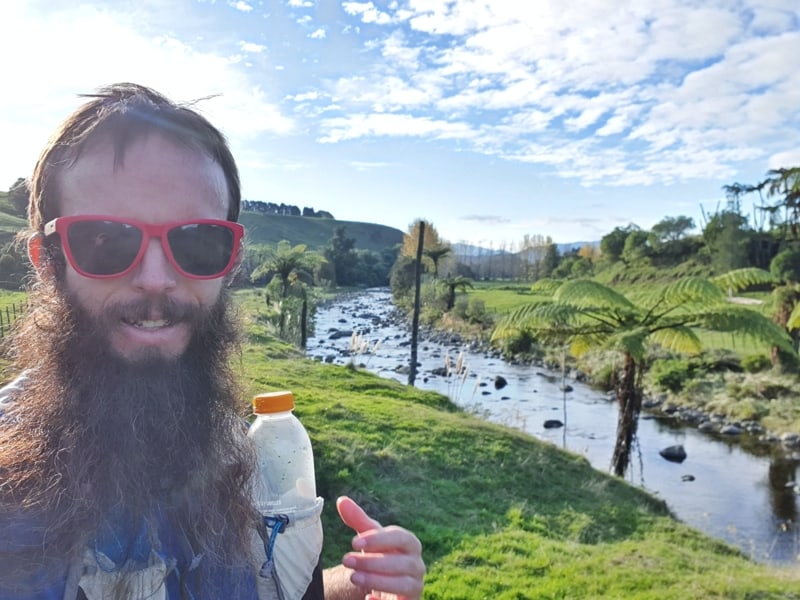
Proof that I’ve walked the track.
TABLE OF CONTENTS
1. Daly’s Clearing Loop Track Details
2. Daly’s Clearing Loop Track Map
3. How To Get There
4. Daly’s Clearing Loop Report
1. DALY’S CLEARING LOOP TRACK DETAILS
I’m struggling to rate this walk. At the time I wasn’t excited by the majority of the walk, but that’s because I had been spending all week with such epic walks in the Karangahake Gorge. But now that I think about it a couple of weeks later, it’s pretty sweet.
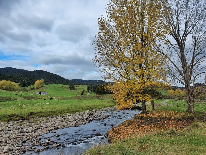
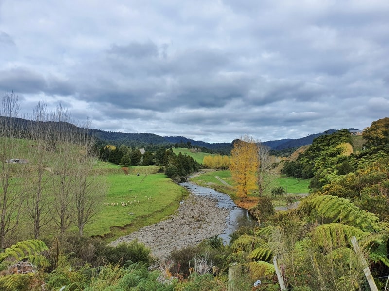
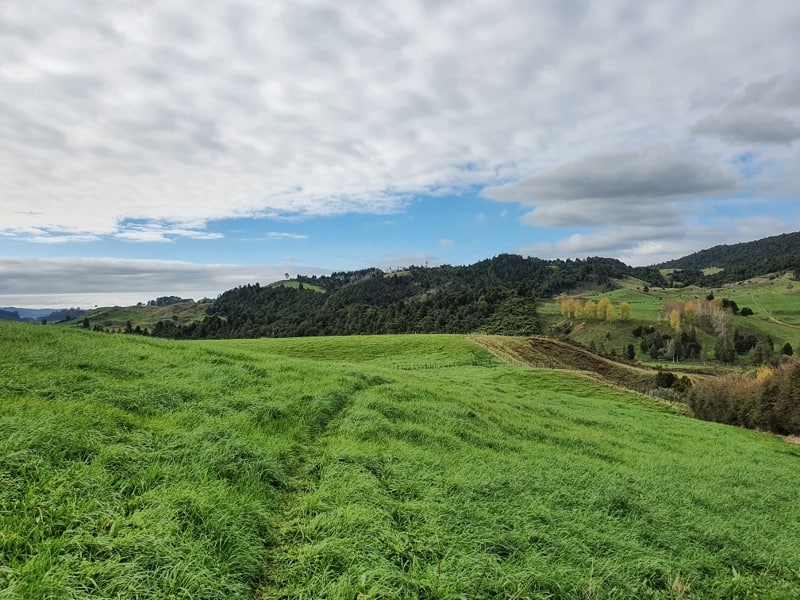
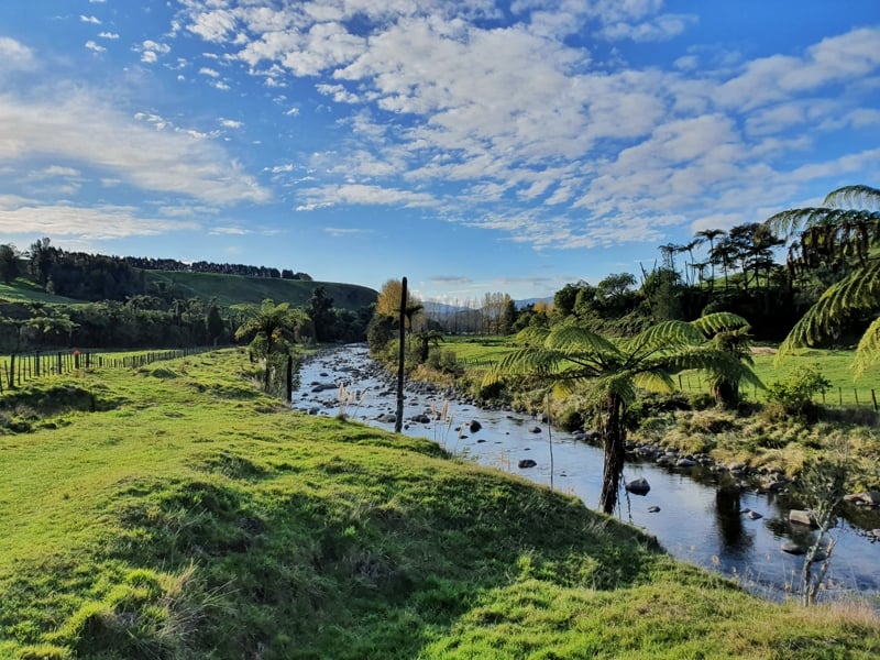
The walk across the farmland offers some nice views, and then the Nikau Palm’s are nice and the path takes you through gorgeous native forest. The hut is an old school and looked like a nice spot to spend a night, but as a day walk, you could have a nice picnic here. Then you’ve got the good looking Waitawheta River that’s a photographers dream, and worthy of a summer swim.
So yea, overall it’s a really nice walk. But it’s not amazing so I’ll stick with 3.5 stars.
How long is Daly’s Clearing Loop?
The DOC website states the track is 7.5km long, which is a lot of different to my Strava data that came in at 9.2km (I got lost for 5 minutes or so). Maps.me has the loop at 8.8km. What to believe? Let’s just say it’s definitely under 10km 🙂
How hard is the track?
Easy
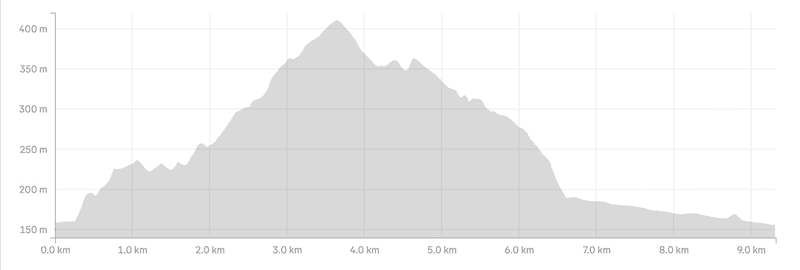
How much elevation is there on Daly’s Clearing Loop Track?
According to my Strava data, there’s 311 metres of elevation.
Here’s the elevation profile:
How long does the Daly’s Clearing Loop Track take?
It took me 2 hours 17 minutes to complete the loop which included a few minutes being lost, and a bit of time talking to people. The Department of Conservation site states 4 hours which is on the very conservative time. So I suspect most people will finish the hike within 3 hours.
Can you stay at Daly’s Clearing Hut?
Yes, you can stay at the 16-bunk hut.
Make sure you either have your Backcountry Hut Pass, or have purchased hut tickets in advance. The hut fees (as of 2025) are:
- Adult (18+ years): $10 per night
- Youth (5–17 years): $5 per night
- Child/Infant (0–4 years): free
2. DALY’S CLEARING LOOP TRACK MAP
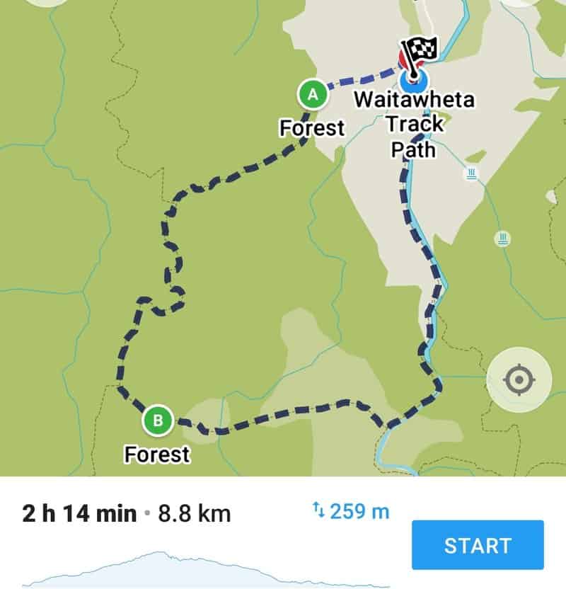
You can’t find the map on Google Maps, but as you’d expect, it’s on Maps.me which is where the screenshot above is from. It’s also on all the topo maps, make sure you download this one, it’s the best (worth the money).
3. HOW TO GET THERE
Your only option is to drive, though if you’re staying at the Dickey Flat campsite, you can walk from there and have a big day hike.
The main car park is located in front of 214 Franklin Road. You’ll see the parking spots when you arrive. From there it’s a couple of hundred metres to the Dean Track trailhead (you keep walking along Franklin Road), but this is the closest you can park.
4. MY DALY’S CLEARING LOOP TRACK EXPERIENCE
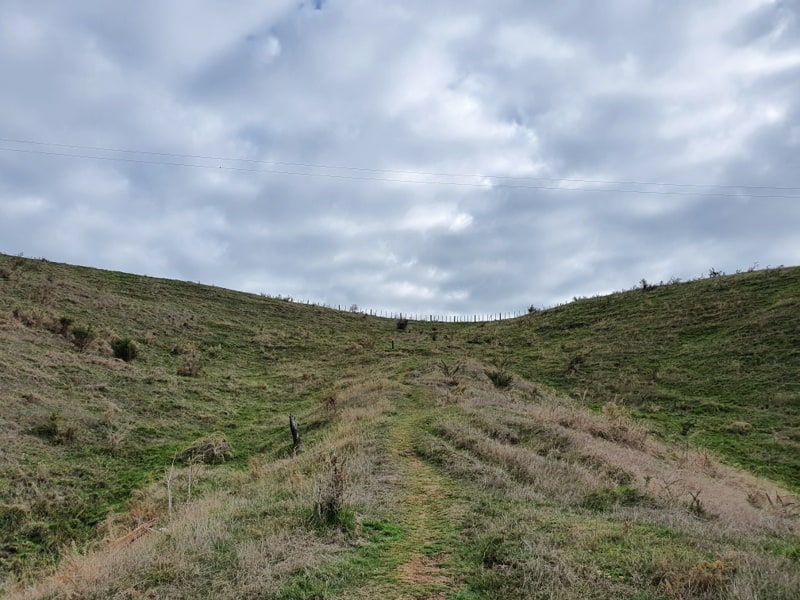
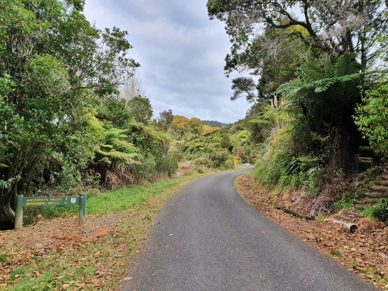
The Dean Track trailhead is lowkey. I was expecting some more details on the hike and area the hike would take me through, but you head straight up the path leaving the road. In a matter of seconds, you’re on the section of private farmland that you have permission to be on for the hike.
The trail through the paddock is super easy to follow and offers some epic views of the Waitawheta River and surrounding land.
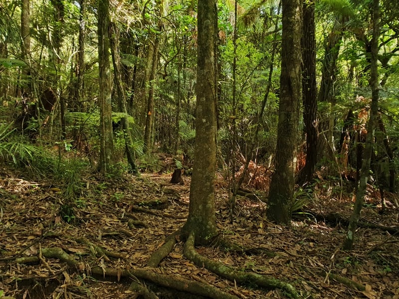
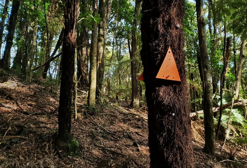
After this first kilometre is up you leave the farmland and enter straight into the forest. I did get lost early on at one point here, so make sure to keep an eye on the orange markers. The trail is visible all the way through as it continues its gentle rise. I hope you’ll appreciate the Nikau Palms as much as I do (see the photo below).
Once you hit this point, that’s the end of the DeanTrack, turn left onto the Mangakino Pack Track. There’s a small sign with directions here just in case.
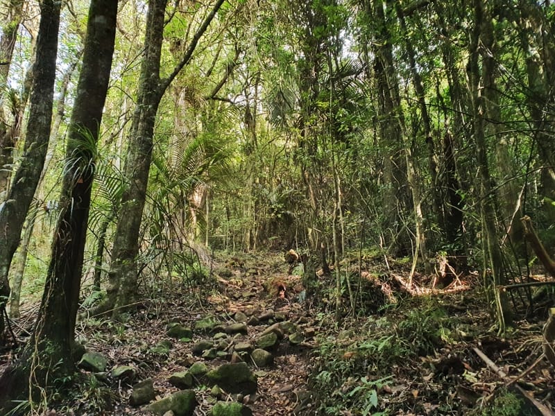
The Pack Track trail is a bit more technical and increases in steepness for the next kilometre or so. From here it’s more or less all downhill as you make your way onto the Daly’s Clearing Track with a left-hand turn after about 4.5km.
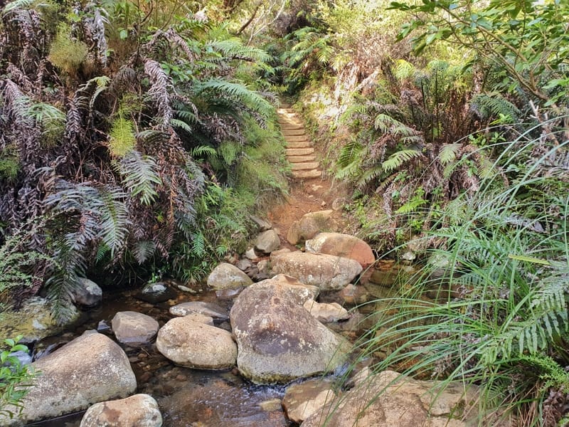
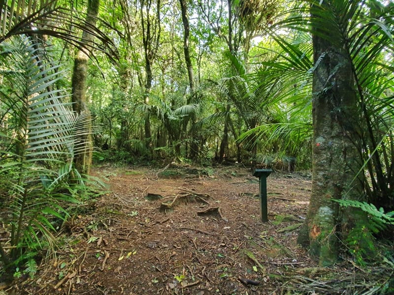
This track is well maintained and you’ll cross a stream as well as you pass Daly’s Clearing Hut (love the colours of this hut). It’s pretty steady downhill with some muddy patches as you make your way towards the Waiawheta River. DOC is aiming to fill in the muddy sections with gravel as the annoying Kauri Dieback Disease spreads via the mud.
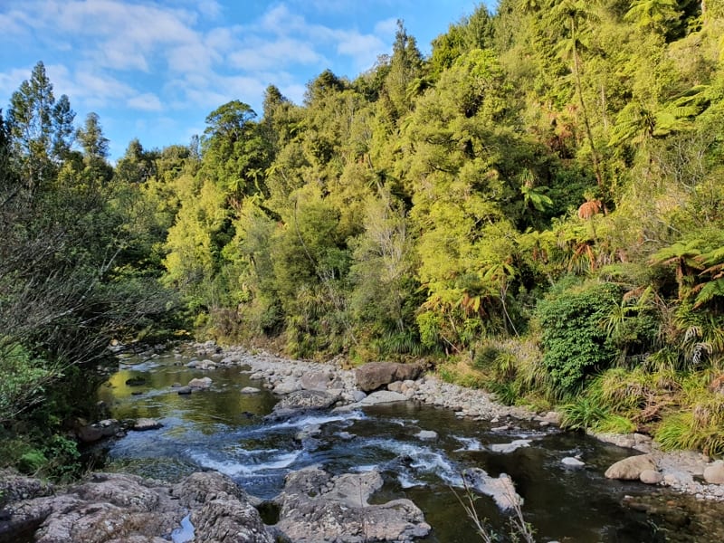
Once you hit the river, it’s another turn to the left and it’s time to enjoy the river. You hug the pretty close throughout and you can get great photos if you want. There are a few swimming spots too and don’t forget to consider the history of this section that makes up the Waitawheta Tramway which was a bush tramway operating in the early 1900s. There’s a couple of information boards as you make your way back to the starting point.
The walks in Kaimai Ranges are pretty damn awesome! And while the Daly’s Clearing track walk is nice, it was missing something for me.
If you have any questions/reports about this hike, leave them in the comments below or email jub@churnewzealand.com.
Chur.
p.s. Here’s a map of all the hikes documented on Chur New Zealand. You can click the icon to see brief details, as well as a link to read more about the hike (like this post).

Hey, it’s Jub here. I’m the guy behind Chur New Zealand, helping you have the best time hiking, trekking, walking…whatever you want to call it…in NZ. I’m based in Queenstown and am always out and about exploring trails, old & new. If you have any questions, reach out.
A group of seven of us did this walk last week. A nice easy walk for anyone of average fitness. If the weather is warm enough – over 20 degrees – the best way to enjoy this walk (and any other of the Kaimai tracks) is to ditch your clothes and any inhibitions as we did and hike it naked. It is the most liberating and almost spiritual experience – highly recommended.
Hey Andrew,
Stoked you enjoyed the track 🙂 I’ll leave you to hiking sans clothes haha.
Cheers, Jub